
Scan the QR code and open PeakVisor on your phone
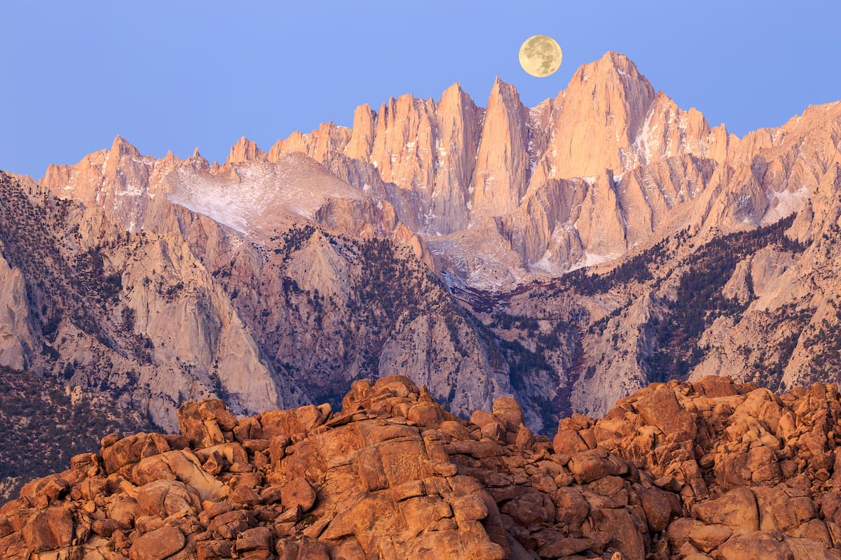
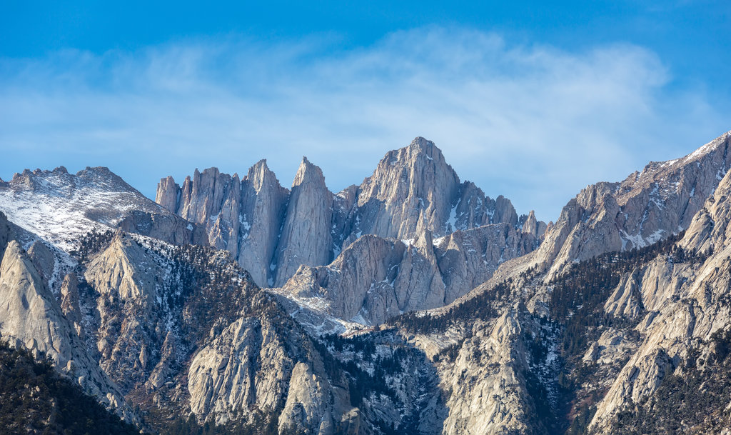
Inyo County is home to 273 named mountains, including 10 fourteeners. The highest is Mount Whitney at 4,421 m.
Located between the Sierra Nevada mountains and Nevada, Inyo county is California’s second largest county and one of the least populous counties in the state.
Formed out of the territory of Coso County in 1866, Inyo County is believed to have been named after the Paiute word for “dwelling place of the great spirit.” However, some scholars also believe that “Inyo” may actually be a mistranslation of the word “Indio,” or “Indian.” It’s possible that the Paiute used the word “Indio” to try and explain to early white settlers that the land and surrounding peaks in the Owens Valley belonged to natives.

Another theory points to the area’s name originating from a misunderstanding related to the mountains east of the Owens Valley. Historians speculate that when the first white settlers asked local Paiute for the name of the mountains, they responded that the area was ‘the land of the Inyo.’ What they meant, was that the land belonged to the Shoshone tribe and their chief, Inyo, who was the headman of the Panamint band of Paiute-Shoshone people at the time. White settlers, however, thought the mountains were the Inyo Mountains.
Inyo County has a rich indigenous history and has been the historic homeland of the Mono tribe, Coso people, Timbisha, and Kawaiisu Native Americans for thousands of years. In fact, descendants of the area’s native ancestors still live and work in the Owens River Valley and Death Valley National Park.
Cultural centers and museums, including the Shoshone Museum, Eastern Sierra Interagency Visitor Center, and Manzanar National Historic Site provide visitors with a look into the region’s incredible indigenous history, as well as its legacy in mining, ranching, farming, and pioneering.
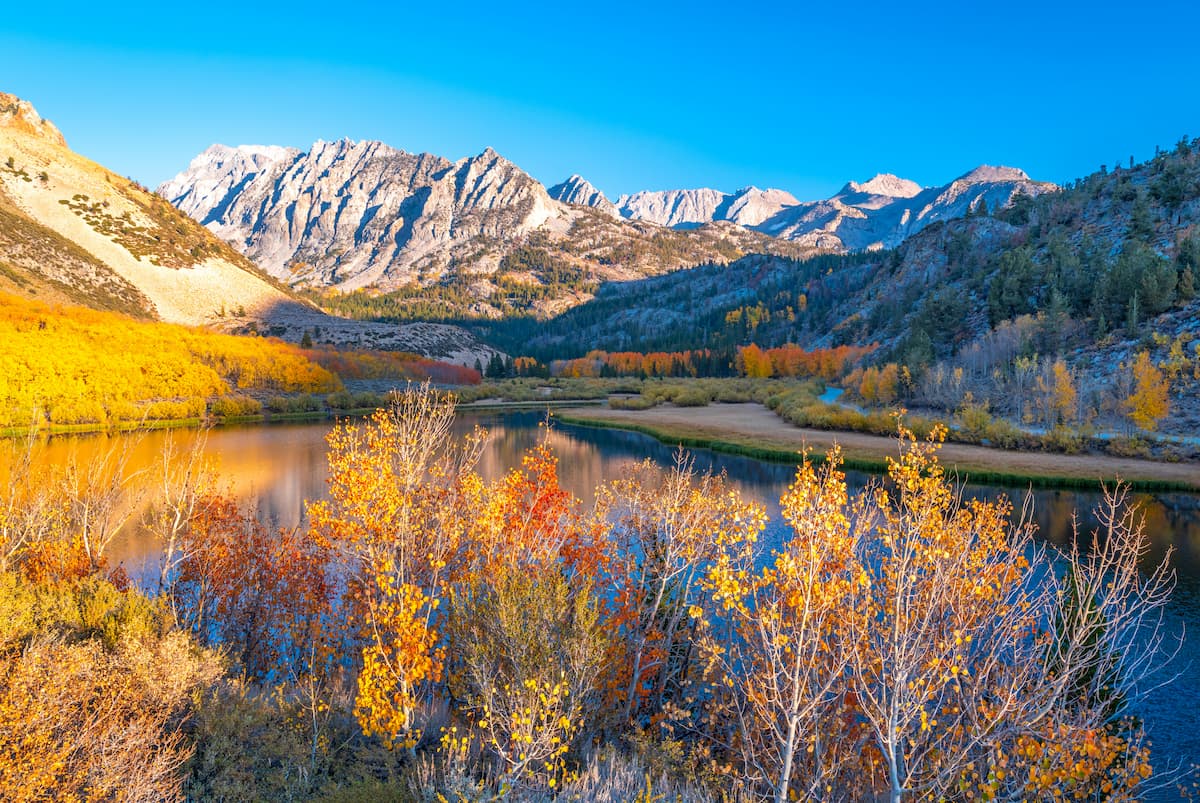
Today, Inyo County is the self-proclaimed “adventure capital of the world!” People travel from around the country to experience the grandeur of the Sierra Nevada and its wildflower-filled meadows, glacial-carved summits, dazzling alpine lakes, and beautiful vistas. Inyo County and its acres of pristine wilderness are beloved by anglers, backpackers, hikers, skiers, climbers, mountain bikers, photographers, and sightseers alike.
Bordered by the Sierra Nevada, Yosemite National Park, the White Mountains, and the Inyo Mountains, Inyo County covers roughly 10,192 square miles and encompasses parts of the Inyo National Forest and Death Valley National Park. Inyo County also contains 22 incredible wilderness areas within the National Wilderness Preservation System. Most of these wilderness areas are managed solely by the Bureau of Land Management.
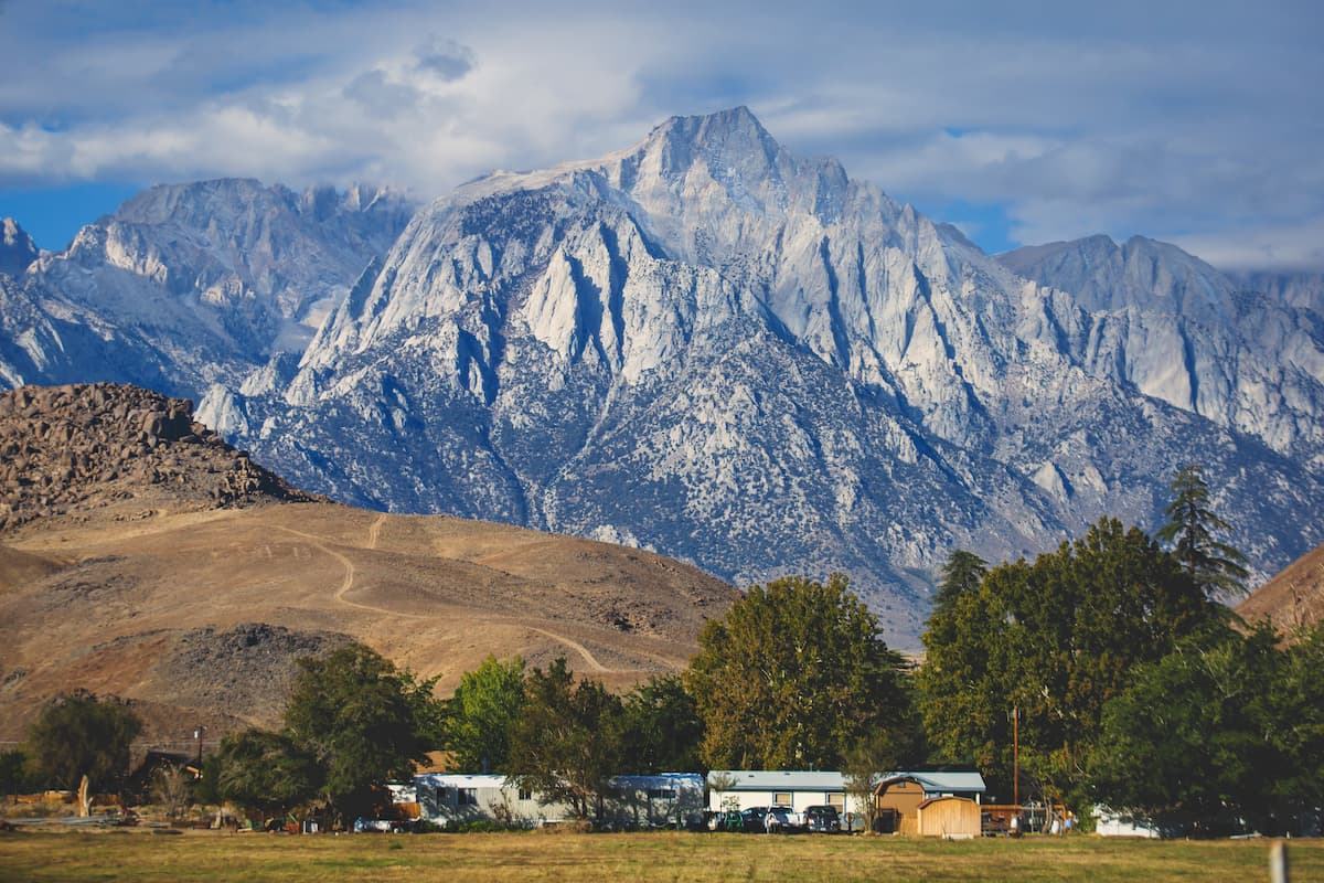
One of the county’s most impressive accolades, however, is that it contains the highest peak in the contiguous United States, Mount Whitney, and the lowest place in North America, Badwater Basin. An impressive 14,700 feet of elevation separate these two iconic landmarks.
The Inyo National Forest covers over 1.9 million acres of the eastern Sierra Nevada and White Mountains. The forest protects over 800,000 acres of designated wilderness and contains nine unique wilderness areas: Ansel Adams, Boundary Peak, Golden Trout, Hoover, Inyo Mountains, John Muir, Owens River Headwaters, South Sierra, and the White Mountains. Roughly 30 million people live within a few hours’ drive from the Inyo National Forest and explore the area’s many scenic hiking trails.
Inyo National Forest contains four ranger districts: Mount Whitney, Mammoth Lakes, Mono Lake, and White Mountains. The White Mountains and Mount Whitney districts are particularly popular among Inyo County residents.
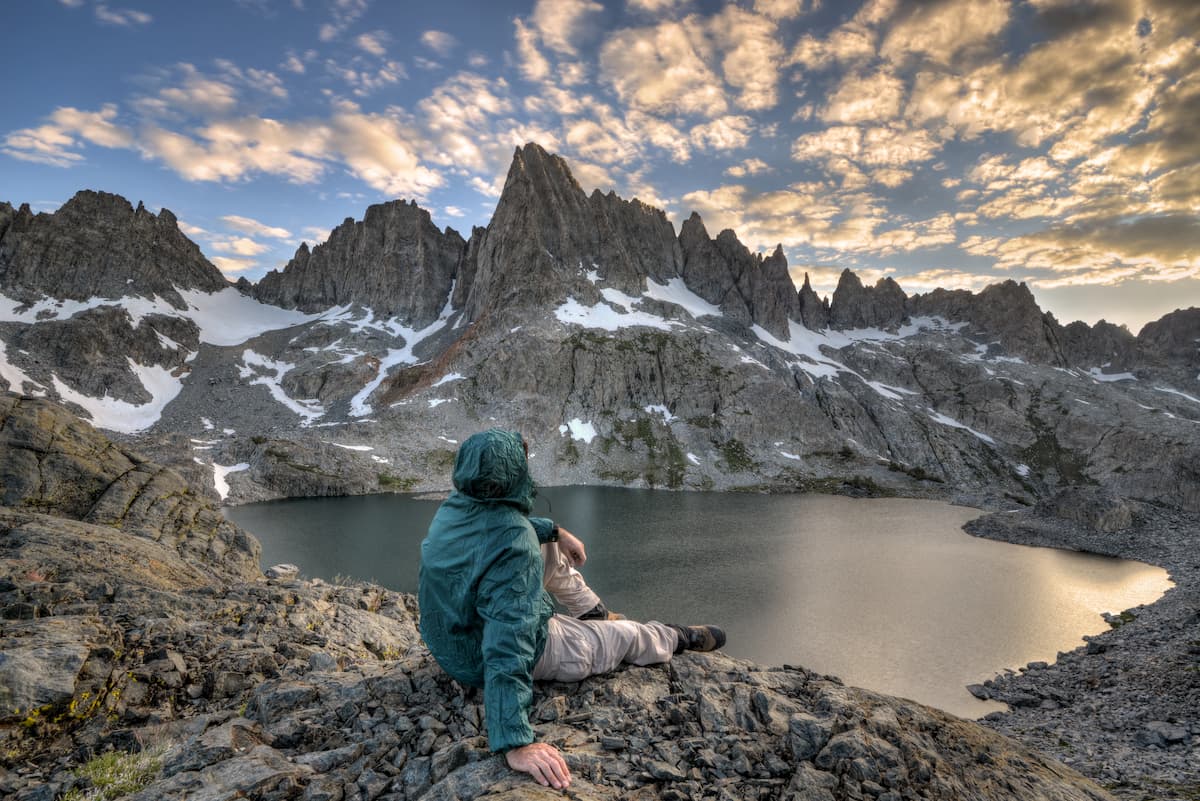
The Mount Whitney Ranger District spans the crest of the Sierra Nevada into the Inyo Mountains and contains the highest point in the lower 48, Mount Whitney. This district also provides access to the John Muir Wilderness, arguably the most popular wilderness in the area, and Sequoia National Park. Most visitors spend their time exploring Whitney Portal or Independence area and hiking popular trails like the North Fork Lone Pine Creek trail, Cottonwood lakes trail, Golden Trout Lakes trail, and Tuttle Creek trail.
The White Mountains Ranger District extends from the Sierra Nevada to the White Mountains. The John Muir Wilderness fills the west edge of the district and the White Mountains Wilderness, Boundary Peak Wilderness, and Ancient Bristlecone Pine Forest are situated to the east of the district. The White Mountains region contains hundreds of lakes, ponds, rivers, creeks, and hiking trails. Popular trails include the Baker Lakes trail, Big Pine Creek North Fork trail, Birch Lake trail, and Taboose Pass.
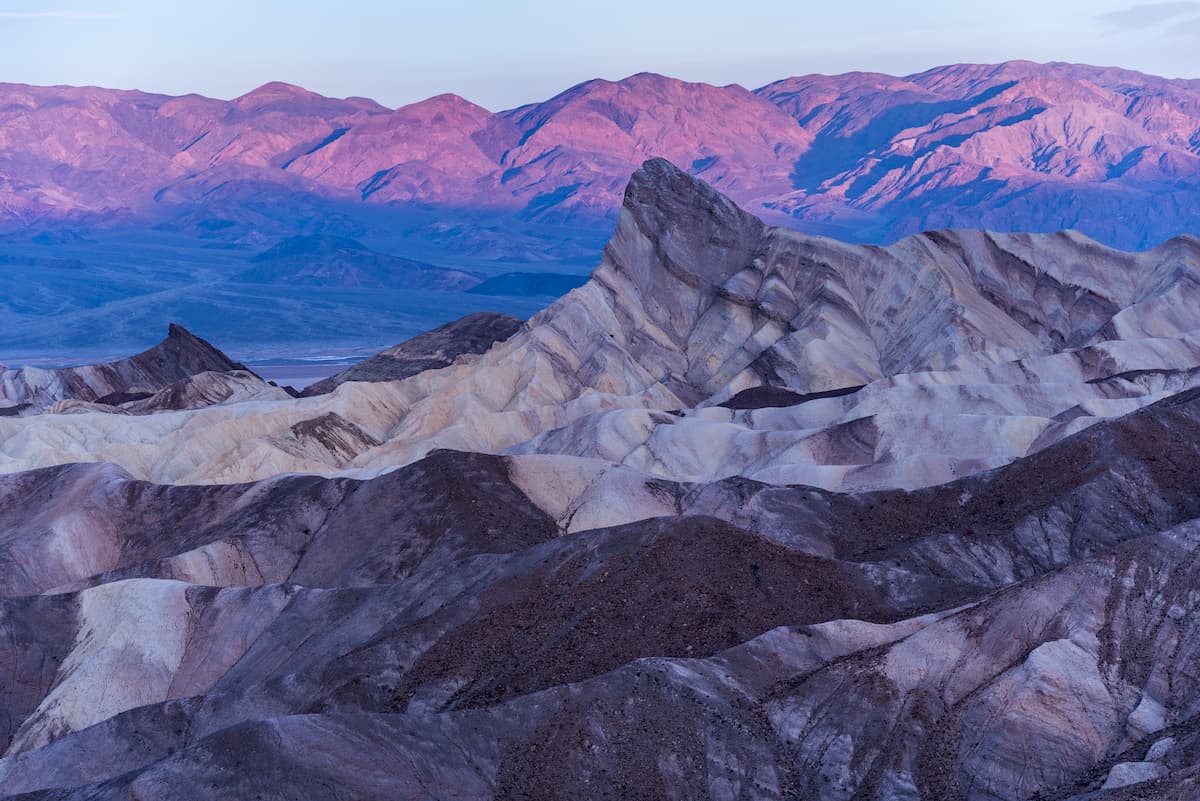
Located in southern Inyo County and northern San Bernardino County, Death Valley is the largest, hottest, and lowest national park in the contiguous United States. The park, which encompasses 3.3 million acres, lies along the California-Nevada border and protects a large portion of the Mojave Desert. Though the park contains thousands of miles of paved and dirt roads, more than 90% of the park remains a designated wilderness and is protected from future development. Popular trails and attractions in the park include: Zabriskie Point, the Mesquite Flats Sand Dunes, Badwater Basin, Desolation Canyon, Natural Bridge, and the Race Track.
Home to just 3,700 people, Bishop is the most populated city in Inyo County. Bishop is known as a ‘small town with a big backyard,’ for a reason. The town sits just outside of the Eastern High Sierra and ideal for anyone looking for an epic alpine adventure. Mt. Whitney, Bishop Creek Canyon, and Alabama Hills are all accessible from Bishop. The charming town houses dozens of hotels, cabins, and Inns, as well as a variety of restaurants, shops, and heritage sites.
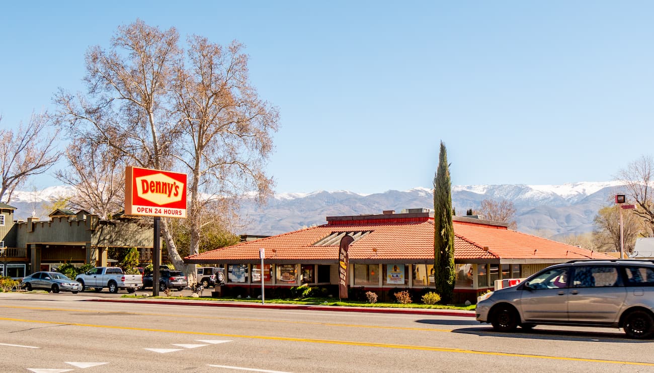
Lone Pine is a small, western-style town that stretches along US Highway 395 in the heart of the Owens Valley. The renowned Sierra Nevada rise abruptly to the west, while the Inyo Mountains ascend over the valley floor to the east. Lone Pine is best-known for its early trout season and access to the Sierra and surrounding wilderness areas. Accommodations in Lone Pine include the Mt. Whitney Motel, Dow Villa, and The Comfort Inn.


14er
ultra
california-13ers
las-vegas-mountaineers-classics
porcella-burns
western-state-climbers
western-state-climbers-star
sierra-club-sierra-peaks-section
sierra-peaks-section-emblem
sierra-sampler
vagmarken-sierra-crest
fred-beckey-great-peaks
california-ultras
14er
california-13ers
las-vegas-mountaineers-classics
porcella-burns
western-state-climbers
western-state-climbers-star
sierra-club-sierra-peaks-section
sierra-peaks-section-emblem
sierra-sampler
14er
glacier
california-13ers
porcella-burns
western-state-climbers
western-state-climbers-star
sierra-club-sierra-peaks-section
sierra-peaks-section-emblem
vagmarken-sierra-crest
fred-beckey-great-peaks
14er
california-13ers
porcella-burns
western-state-climbers
western-state-climbers-star
sierra-club-sierra-peaks-section
sierra-peaks-section-mountaineers
vagmarken-sierra-crest
california-13ers
porcella-burns
western-state-climbers
western-state-climbers-star
14er
california-13ers
porcella-burns
western-state-climbers
western-state-climbers-star
sierra-club-sierra-peaks-section
sierra-peaks-section-mountaineers
vagmarken-sierra-crest
14er
ultra
california-13ers
las-vegas-mountaineers-classics
porcella-burns
western-state-climbers
western-state-climbers-star
sierra-club-sierra-peaks-section
sierra-peaks-section-emblem
sierra-sampler
vagmarken-sierra-crest
fred-beckey-great-peaks
california-ultras
ultra
las-vegas-mountaineers-classics
western-state-climbers
western-state-climbers-star
desert-summits-book
bartells-death-valley
sierra-club-desert
desert-peaks-section-emblem
great-basin
california-ultras
western-state-climbers
western-state-climbers-star
desert-summits-book
bartells-death-valley
sierra-club-desert
western-state-climbers
western-state-climbers-emblem
desert-summits-book
sierra-club-desert
great-basin
western-state-climbers
western-state-climbers-star
desert-summits-book
bartells-death-valley
sierra-club-desert
western-state-climbers
western-state-climbers-star
desert-summits-book
bartells-death-valley
sierra-club-desert
western-state-climbers
western-state-climbers-star
sierra-club-sierra-peaks-section
sierra-peaks-section-emblem
sierra-sampler
vagmarken-sierra-crest
Yes. Inyo County has 273 named mountains. The highest is Mount Whitney at 4,421 m.
The highest mountain in Inyo County is Mount Whitney, at 4,421 m.
Inyo County has 273 named mountains.
Inyo County has 10 fourteeners — peaks above 14,000 ft (4,267 m).


