
Scan the QR code and open PeakVisor on your phone
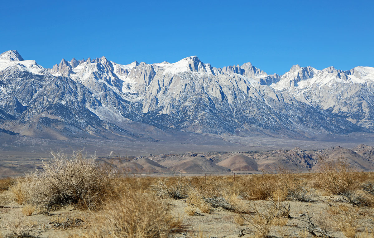
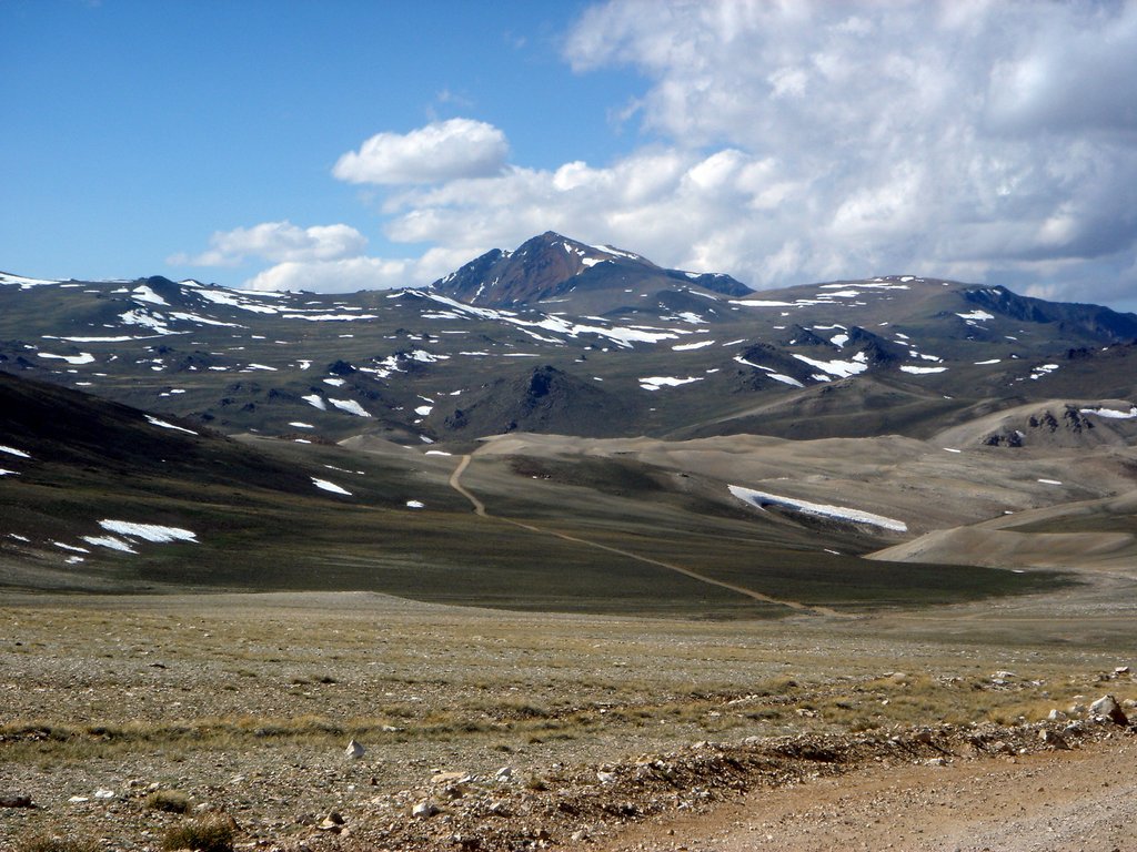
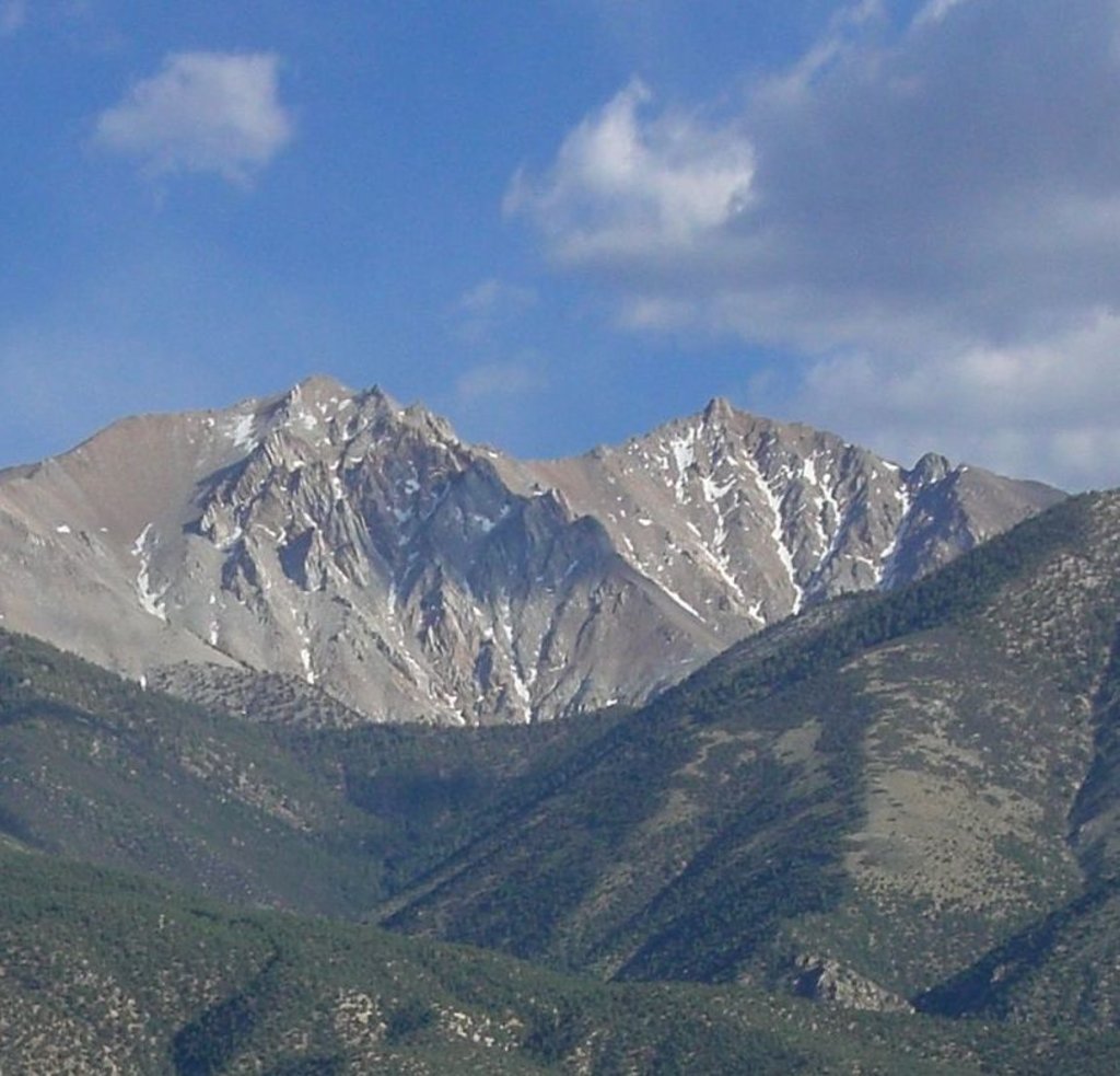
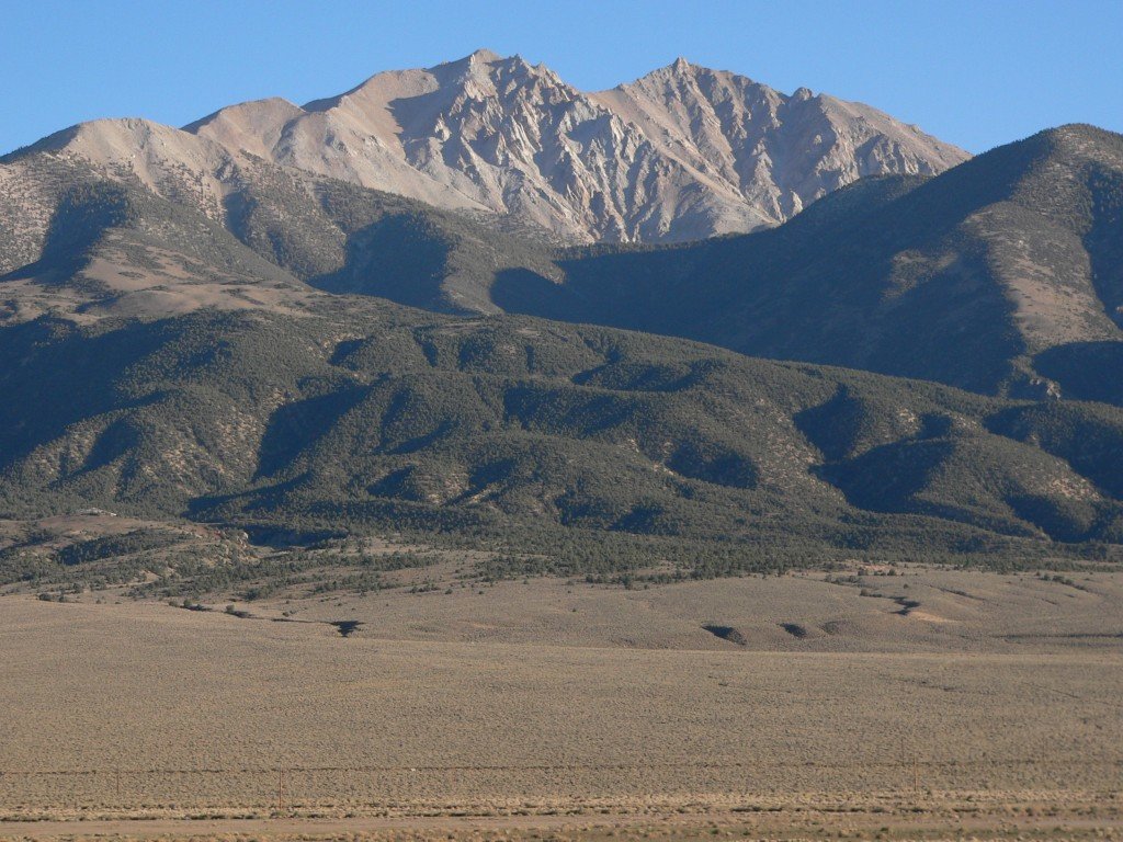
Directly to the east of the great Sierra Nevada lies the White Mountains - a chain of rugged peaks separating the Owens Valley from the Fish Lake Valley. The White Mountains are home to 27 named peaks, the tallest and most prominent of which is White Mountain Peak (14,245ft/4,342m).
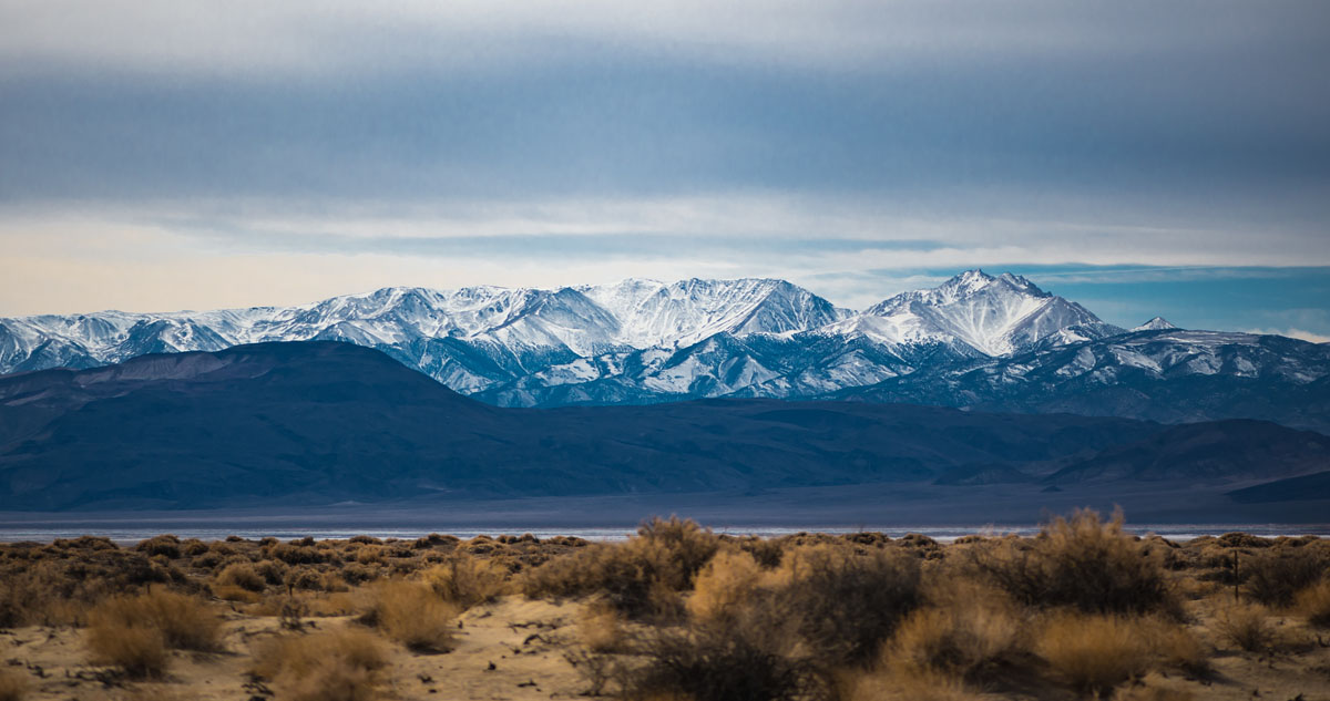
Extending for some 60 miles (97km), the White Mountains of California form an elevated plateau that’s nearly 20 miles (32 km) wide at its widest point in the South. The southern part of the White Mountain range is located near the community of Big Pine, California, where the range is separated from the neighboring Inyo Mountains by way of the Westgard Pass and Deep Springs Valley. In the north, the White Mountains are boarded by US Route 6 at Montgomery Pass while the southeastern part of the range is separated from the Silver Peak Range by the Furnace Creek Fault Zone.
Geologically, the White Mountains are part of the greater Basin and Range Province, which is characterized by a series of long, parallel mountain ranges with wide, flat valleys between them. The White Mountains, in particular, are a series of triangular fault-block mountains. Fault-block mountains form as a result of rifting - or the pulling apart of two tectonic plates. One of the most well-known rift zones in the United States is Death Valley, which is located south of the White Mountain Range.
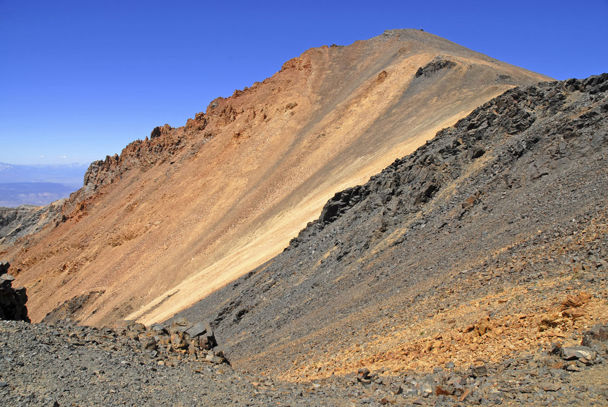
The highest point in the White Mountain Range - White Mountain Peak - is actually the remains of an old, extinct volcano that rose about 1,600ft (490m) above the plateau of the range. The summit cone of White Mountain Peak is a Mesozoic age metavolcanic rock, though the volcano is long gone. The White Mountains are actually the tallest range that is completely inside the Basin and Range Province.
Like other ranges in the Basin and Range Province of the southwestern United States, the White Mountains are fairly dry but from about 9,200 to 11,500ft (2,800 to 3,500m), they are home to relatively dense subalpine forests. These forests are mostly comprised of the Great Basin bristlecone pine when located on dolomite and granite bedrock or limber pine when the soil is made up of mostly less permeable rock. From about 6,500 to 8,5000ft (2,000 to 2,500m), the slopes of the White Mountains are dominated by piñon pine and Utah Juniper.
That being said, the slopes of the White Mountains are still home to a few remaining groves of lodgepole pine, Jeffrey pine, ponderosa pine, Sierra juniper, and aspen, all of which are more prevalent in the wetter Sierra Nevada range to the west. Perhaps the most important plant in the entirety of the White Mountains, however, is a single bristlecone pine in the southern part of the range known as the Ancient Bristlecone Pine Forest, which is the oldest known living tree in the world, standing tall at a young 5,063 years old. Not bad.
Animal life in the area includes the bighorn sheep, the mule deer, marmots, and plenty of wild horses. There are no native fish in the streams, but there are plenty of naturalized trout populations in the range’s waters, including the very rare Paiute cutthroat trout, which is a protected species. The Clark’s nutcracker is also abundant in the range and is known for eating the pine nuts front the area’s many pine trees.
The White Mountains are the ancestral home of the Owens Valley Paiute-Shoshone, who lived in summer hunting camps up to around 13,000ft (4,000m) in the range. After European colonization, sheep grazing was popular in the area, but the domesticated livestock introduced a wide number of different diseases to the area that the native bighorn sheep are still recovering from. More recently, cattle ranching became a significant part of life in the White Mountains, although the land is now managed as part of the Inyo National Forest with some permits for cattle grazing still allocated to local ranches.
Today, the White Mountains are located inside the White Mountain Wilderness of Inyo National Forest. To the east of the range is Cottonwood Creek, a National Wild and Scenic River, and the only river in the entirety of the Great Basin that is fully protected from its source in the alpine to its terminus in the desert. Just be careful not to confuse the White Mountains of California with the highly popular White Mountains of New Hampshire, or you’ll be really thrown off when you look at a map and you’ll add some 3,000 miles to your road trip.
The White Mountains are a reasonably popular outdoor recreation area amongst people in the Owens Valley and the greater California region. Here are some of the best hikes in the range:
As White Mountain Peak, the tallest mountain in the range, is above 14,000ft, it gets awarded the moniker of a “14er,” so it’s a fairly coveted summit for peak baggers and hiking enthusiasts. Although many people consider White Mountain Peak to be one of the easiest 14ers in California, it is still a substantial summit that warrants proper planning and consideration before you head out onto the trail.
To start your hike of White Mountain Peak, you’ll drive for about 16 miles down a dirt road known as the Bristlecone Pine Forest Scenic Byway, which is off of Route 168, a highway that connects the town of Big Pine and Hwy 395 with the town of Oasis, California. A high clearance vehicle and a spare tire are helpful to have for this road, which will take you about an hour to an hour and a half (one way) to drive.
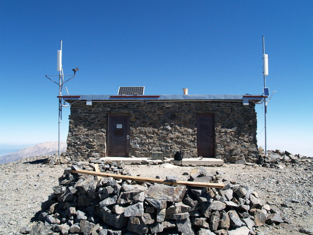
Once you reach the trailhead, the best way to hike White Mountain Peak is by the popular South Face route. In fact, this route is really more of a dirt road than a single track trail, but the views are stunning, so don’t let the state of the trail deter you from this hike.
The hike itself gains 3,360ft (1,024m) during a 15 mile (24.2km) out-and-back trail walk. The total estimated time for the hike is around 7-9 hours, but it’s a difficult hike, so don’t expect a walk in the park. Luckily, you can also camp for free at the trailhead on a first come first served basis, so you don’t have to drive an hour and a half down a dirt road at the end of your day if you don’t want to!
Perhaps the most unique feature of the White Mountains is the ancient bristlecone pine forest that calls the area home. Thankfully, the forest has been well preserved and the Forest Service allows visitors to enjoy the area during the summer months.
The forest itself is actually quite remote, but the Schulman Grove Visitor Center located at the trailhead provides plentiful information on the trees and their history, so it’s a great place to start your adventure. Parking at the visitor center is $3.00 per person, with a maximum of $6.00 per car, so be sure to bring some cash with you on your trip. There is no camping in the forest, but you can stay at the nearby Grandview campground if you need a place to sleep for the night.
Once you leave the visitor’s center, you can follow a fairly casual 4.4-mile trail that gains only 900 feet (274m) throughout the walk. The trail will take you through beautiful groves of some of the oldest trees in the world, so it’s really a wonder to behold.
If you’re not interested in camping in the White Mountains or you need a place to stock up on supplies, there are a few smaller towns in the area that make a great starting point for your adventure. Here are a few:
Big Pine is the largest of the small towns close to the White Mountains and is just an hour’s drive from the Schulman Grove Visitor Center in the Ancient Bristlecone Pine Forest. Big Pine is home to nearly 2,000 people, so it’s not a sprawling metropolis, but it will have nearly everything you need to get out on your adventure.
A bit farther away from the White Mountains is the city of Bishop, California. Bishop is the largest populated place in all of Inyo County, California and is home to about 3,700 people. It’s only an hour and a half from the Schulman Grove Visitor Center, so it’s a great place to stay before or after your trip. Plus, Bishop is a popular city among outdoor recreationalists, so it’s pretty easy to find any outdoor supplies you might need for your trip to the White Mountains.
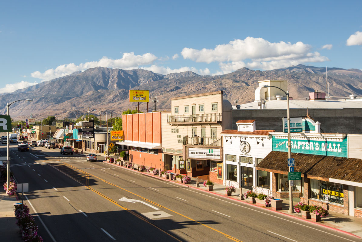
Bishop, California by Bishopvisitor - Own work, CC BY-SA 4.0


14er
ultra
california-13ers
las-vegas-mountaineers-classics
porcella-burns
western-state-climbers
western-state-climbers-star
desert-summits-book
sierra-club-desert
great-basin
great-basin-star
california-ultras
california-13ers
western-state-climbers
western-state-climbers-emblem
desert-summits-book
sierra-club-desert
13er
las-vegas-mountaineers-classics
western-state-climbers
western-state-climbers-star
desert-summits-book
sierra-club-desert
desert-peaks-section-emblem
great-basin
nevada-11ers
nevada-peaks-club
las-vegas-mountaineers-classics
nevada-peaks-club-emblem
western-state-climbers
western-state-climbers-star
desert-summits-book
sierra-club-desert
great-basin
great-basin-star
14er
ultra
california-13ers
las-vegas-mountaineers-classics
porcella-burns
western-state-climbers
western-state-climbers-star
desert-summits-book
sierra-club-desert
great-basin
great-basin-star
california-ultras
13er
las-vegas-mountaineers-classics
western-state-climbers
western-state-climbers-star
desert-summits-book
sierra-club-desert
desert-peaks-section-emblem
great-basin


