
Scan the QR code and open PeakVisor on your phone
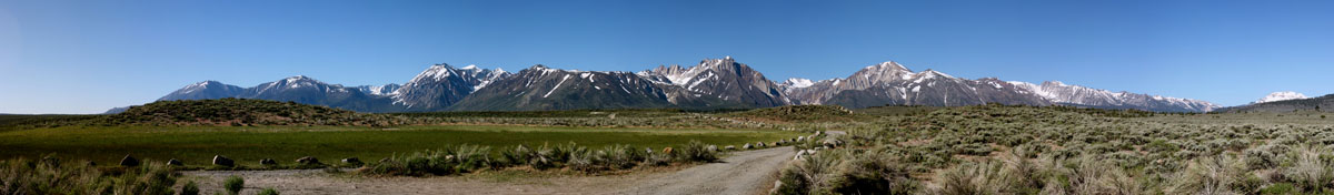
The Inyo National Forest, which covers 1,903,381-acres of the eastern Sierra Nevada and White Mountains, contains nine incredible wilderness areas and protects over 800,000 acres of beloved wilderness. Most of the forest is found in California, though 60,700 acres can also be found in western Nevada. Geographically, the Inyo National Forest is split in two. One portion of the forest is found on either side of the Long Valley Caldera and Owens Valley.
The word ‘Inyo’ comes from a Native American word that means “dwelling place of the great spirit.” The wilderness was named after this treasured word because it was once used by local Native Americans to describe the mountains in the region.
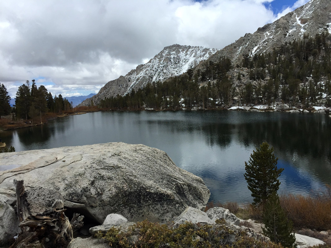
The nine wilderness areas found within the Inyo National Forest include the Ansel Adams, Boundary Peak, Golden Trout, Hoover, Inyo Mountains, John Muir, Owens River Headwaters, South Sierra, and the White Mountains Wilderness areas. However, the most popular regions for outdoor recreation are the Ansel Adams Wilderness and John Muir Wilderness, which borders three of California’s most famed national parks – Sequoia, King Canyon, and Yosemite. As a group, these nine wilderness areas are part of the much larger National Wilderness Preservation System, which aims to manage designated wilderness areas in a way that preserves them in their natural condition.
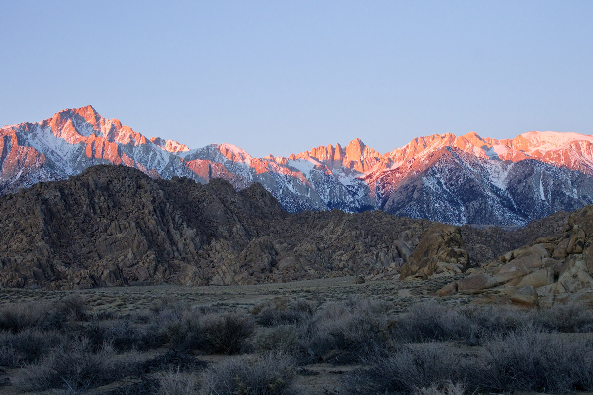
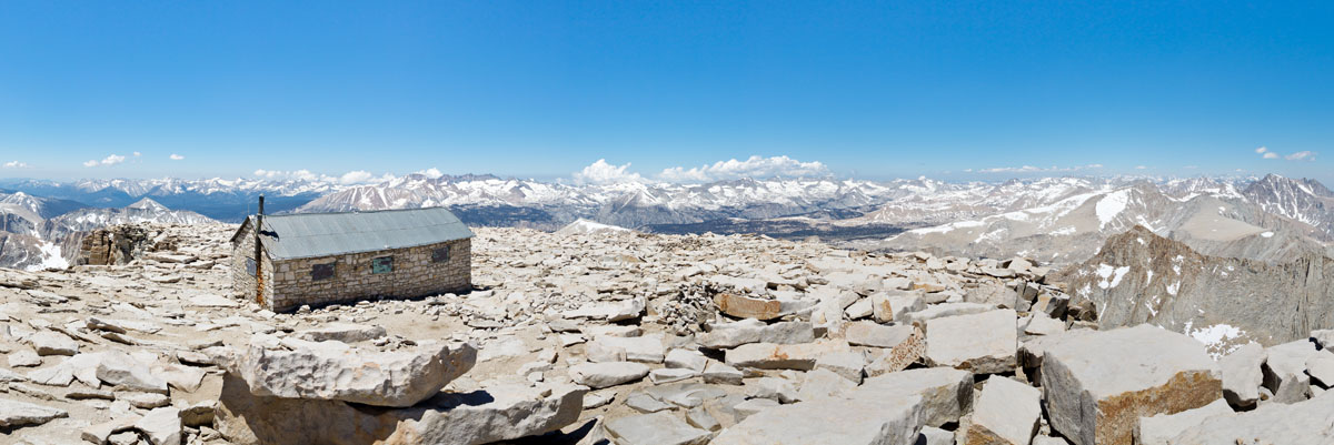
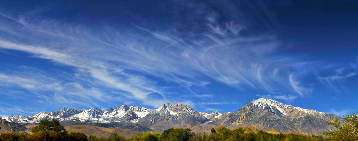
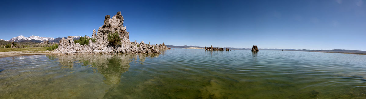
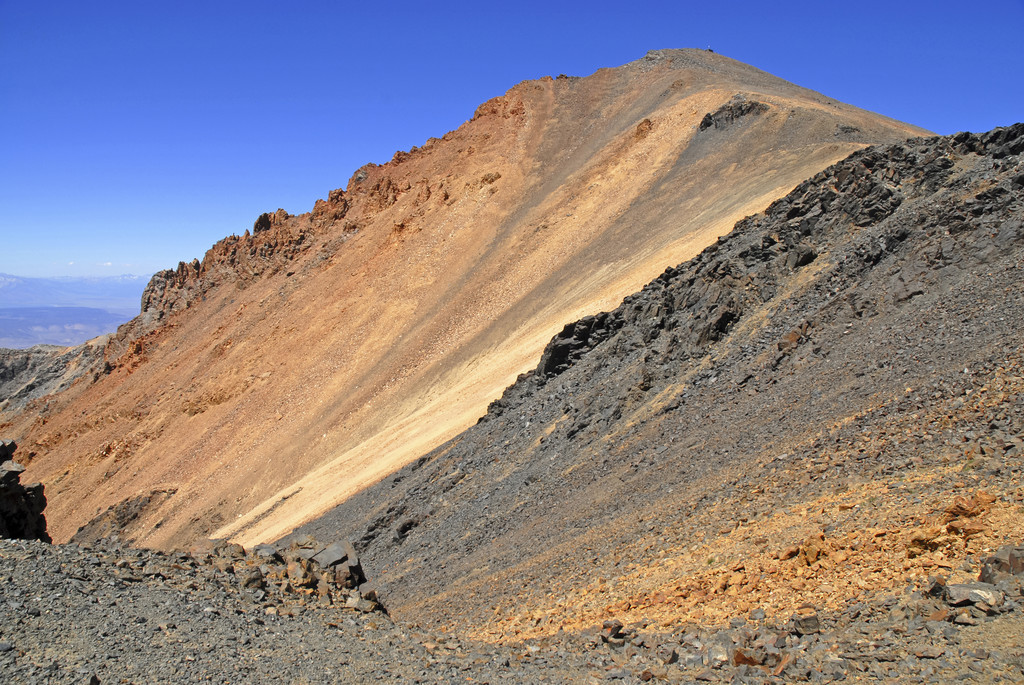
In addition to housing several wilderness areas, Inyo National Forest is home to several iconic Sierra Nevada summits, like Mount Whitney, the tallest peak in the contiguousUnited States, and Boundary Peak, the highest point in Nevada. The Forest also contains noteworthy, high-altitude summits like White Mountain Peak, Broken Finger Peak, and Mount Barcroft. Inyo also contains a variety of unique attractions like Mono Lake, a saltwater lake that is dotted with limestone towers, the Ancient Bristlecone Pine Forest, which contains the oldest living trees in the world, and Reds Meadow. Also, within the boundaries of Inyo National Forest, are two reputable ski resorts, over a thousand miles of maintained hiking and biking trails, and an abundance of lodges, resorts, and services.
Needless to say, Inyo National Forest is known for its stunning alpine lakes, valleys, and illustrious summits, making it one of the top destinations for outdoor recreation in the Eastern Sierra. In the summer, anglers flock to nearby lakes and streams while hikers and bikers shuffle from one trailhead to the next, looking for the next peak to bag or ridge to ride on. In the winter, the landscape completely transforms into a premier destination for skiing, snowboarding, snowshoeing, and snowmobiling.
The Mount Whitney Ranger District is the southernmost district in the Inyo National Forest. This district spans the crest of the Sierra Nevada into the Inyo Mountains, making it a popular destination for backpackers and hikers. Most visitors spend their time exploring Whitney Portal, which contains incredible granite cliffs, wooded canyons, and provides access to Mt. Whitney, the John Muir Wilderness, and Sequoia National Park. The most popular trails in this area include the Mt. Whitney Trail, North Fork Lone Pine Creek Trail, and Tuttle Creek Trail.
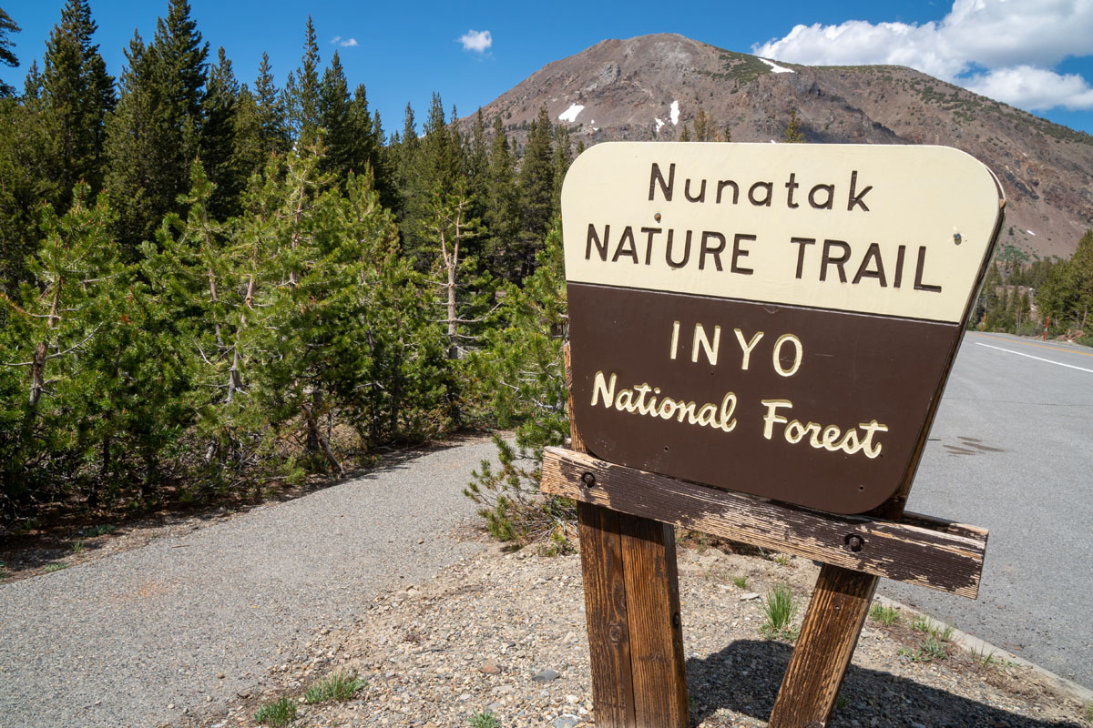
The Mammoth Lakes Ranger District is located in the northern half of the Inyo National Forest and contains one of the most popular destinations for winter recreation – Mammoth Lakes, CA. The John Muir and Ansel Adams Wilderness fill the western edge of this district and contain popular trails and attractions like the Devils Postpile National Monument, Convict Lake, the Mammoth Rock Trail, and the Crystal Lake Trail.
The Mono Lake District is the northernmost district of the Inyo National Forest and sits adjacent to Yosemite National Park. This area is known for its accessibility and incredible Sierra Nevada summits and hiking trails. Popular destinations in this region include trails along the June Lake Loop, like the Parker Lake Trail and Yost Lake Trail, and Tioga Pass or Lee Vining trails, like Twenty Lakes Basin and the Lundy Canyon Trail.
The White Mountains region extends from the Sierra Nevada to the White Mountains and contains hundreds of lakes, ponds, rivers, and creeks for fishing. This region is also popular for its varying terrain and accessibility. The most popular destinations in this region are the Big Pine area, which houses the Big Pine Creek North Fork Trail, Bishop, which is best-known for its plentiful lakes, and the White Mountains, which contain Boundary Peak and the infamous Ancient Bristlecone Pine Forest.
Mammoth Mountain is California’s tallest ski resort and boasts over 3,500 acres of skiable terrain, a 3,100-foot vertical drop, 3 gondolas, four parks, and slopes catered to both novice and expert skiers and boarders. The resort, which is located just 20 minutes from Mammoth Lakes, has 9 lodges scattered across the mountain, offers ski and snowboard lessons, and has a variety of restaurants and amenities to choose from. After hitting the slopes for the day, head down to The Village to refuel and relax or mingle with locals at a local bar.
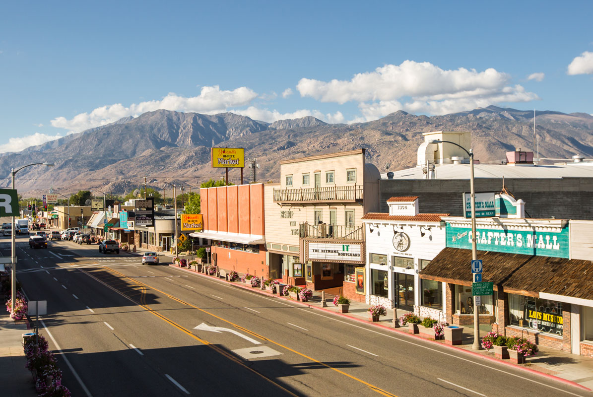
Bishop is known as the ‘small town with a big backyard,’ for a reason. The town sits just outside of the Eastern High Sierra and ideal for anyone looking for an epic alpine adventure in the Inyo National Forest. Mt. Whitney, Bishop Creek Canyon, Bishop Pass, Tungsten Peak, and Alabama Hills are all accessible from Bishop. Not to mention, this charming Sierra Nevada town houses a variety of accommodations, restaurants, and shops to choose from.
Mammoth Lakes has a reputation for being the perfect basecamp for outdoor adventure, regardless of the season. Crystal-clear alpine lakes, cascading waterfalls, expansive valleys, and towering peaks surround this charming alpine town, offering an almost endless amount of outdoor recreation potential. Lodging, shopping, and facilities are all easy to come by in Mammoth Lakes. There are plenty of mountain resorts, quaint cabins, and convenient accommodations in the area.


14er
ultra
california-13ers
las-vegas-mountaineers-classics
porcella-burns
western-state-climbers
western-state-climbers-star
desert-summits-book
sierra-club-desert
great-basin
great-basin-star
california-ultras
13er
california-13ers
western-state-climbers
western-state-climbers-emblem
sierra-club-sierra-peaks-section


