Scan the QR code and open PeakVisor on your phone
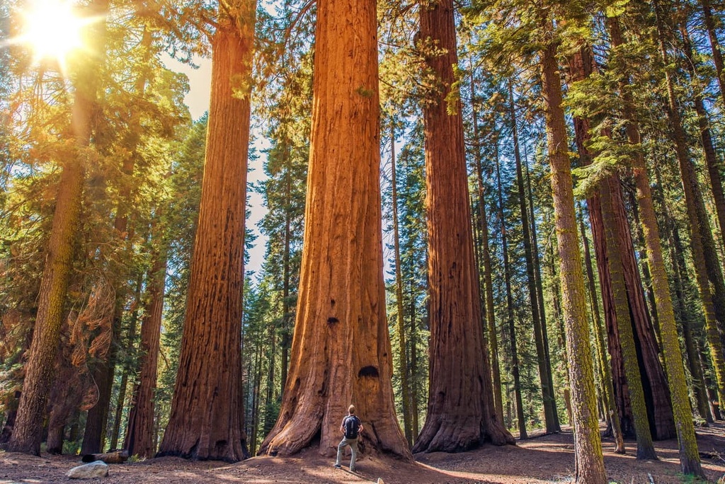
The Sequoia National Forest is situated in the east-central part of the US state of California in the southern Sierra Nevada. The forest is home to 38 groves of giant sequoias, the world’s largest tree. The tallest peak in the forest is Sirretta Peak at 9,977 ft (3,041 m) in elevation and the most prominent mountain in the forest is Piute Peak with 3,461 ft (1,055 m) of prominence.
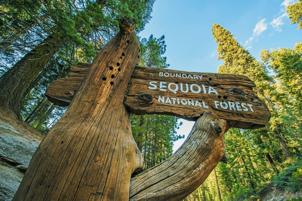
The Sequoia National Forest is situated in east-central California along the crest of the Sierra Nevada. It shares borders with Sequoia National Park and the Giant Sequoia National Monument, all of which are centered around the dozens of groves of sequoia trees that are located in the southern part of the Sierra.
The forest encompasses 1.1 million acres (482,900 ha) in Tulare, Kern, and Fresno counties. Elevations in the forest range from lows of around 1,000 ft (305 m) in the foothills, up to the summit of Sirretta Peak at 9,977 ft (3,041 m).
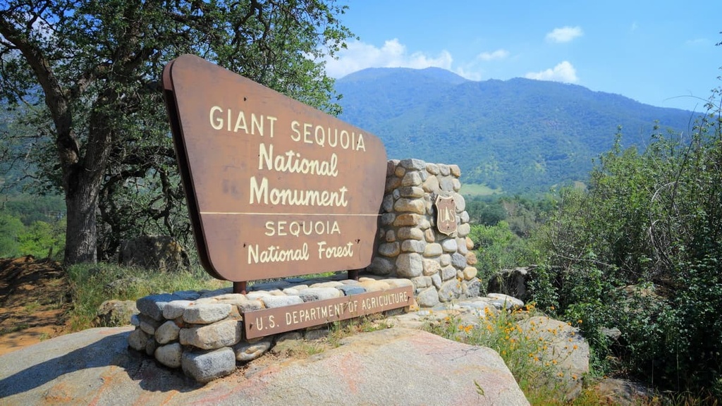
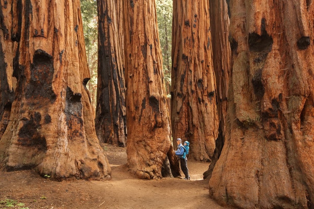
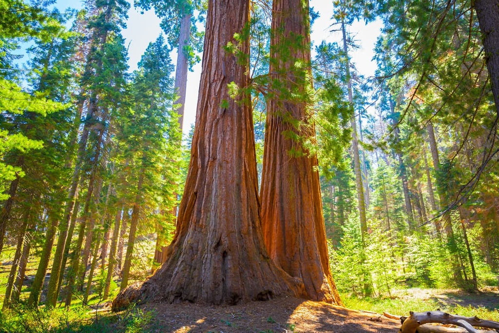
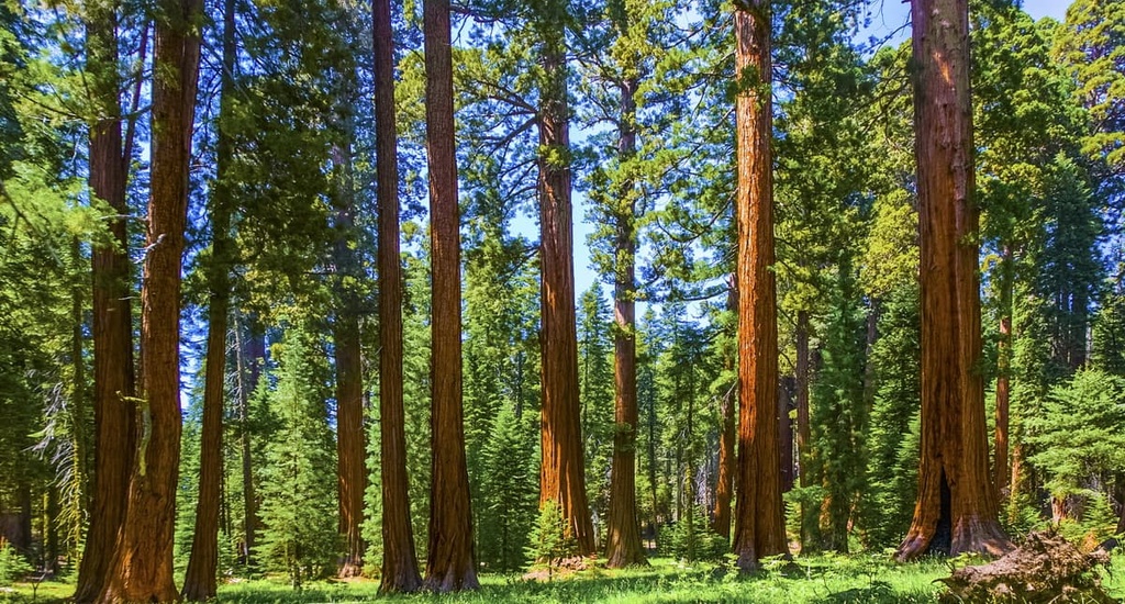
Groves of giant sequoia trees dominate the landscape within the park. In total, these groves cover 196,000 acres (793 sq. km) of old-growth forest. The Giant Sequoia National Monument covers approximately 328,000 acres (1,327 sq. km) of land within the forest, and it is home to about half of the giant sequoia groves that are still in existence.
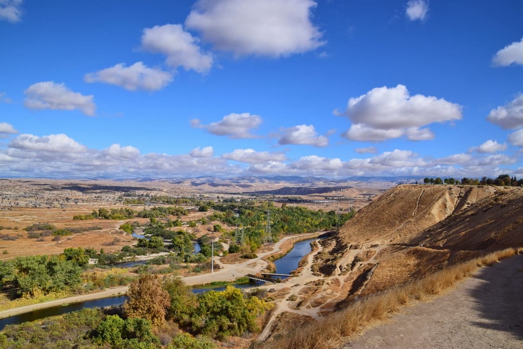
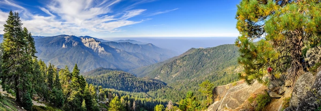
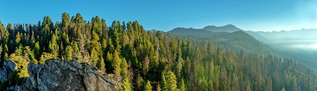
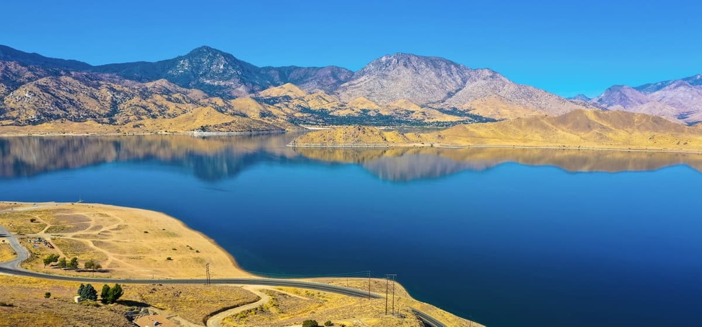
Besides the groves of giant sequoias, the forest also features vast glacier-carved cirques, granite monoliths, and roaring rivers. The Kern River runs throughout the forest while the Kings River lies in the northern stretches of the region. Lake Isabella is the largest body of water in the region, and it is situated in the southern stretches of the forest.
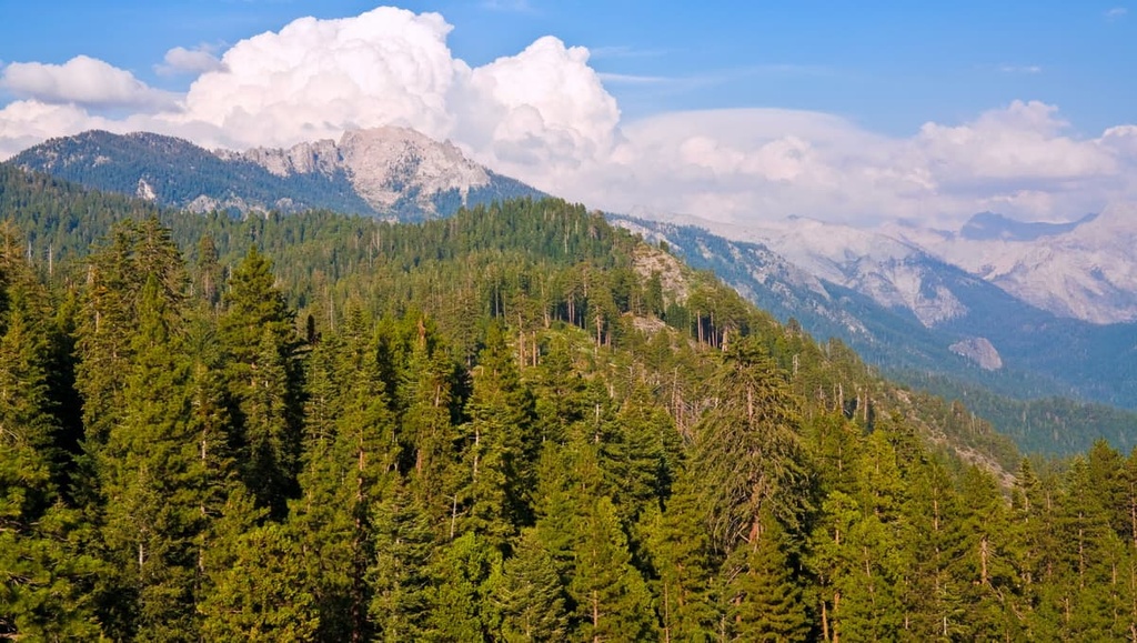
The eastern stretches of the national forest feature minimal amounts of flora as the landscape in this part of the region is often covered in low-growing shrubs and sagebrush. The forested hillsides elsewhere in the national forest typically give way to rocky ridgelines and summits at the highest elevations, as is the case in other regions of the Sierra Nevada.
There are six designated wilderness areas that are at least partially located within the forest:
The forest is located near Sequoia National Park and it encompasses the Giant Sequoia National Monument. The northern stretches of the national forest also lie adjacent to Kings Canyon National Park.
Other parks and protected areas that are located near Sequoia National Forest include César E. Chávez National Monument to the south, Death Valley National Park to the east, and Inyo National Forest to the north and east.
The peaks within the Sequoia National Forest are part of the larger Sierra Nevada, which date back over 100 million years. The range formed during the Cretaceous period as the Farallon plate subducted beneath the North American plate.
Plutons formed from the magma that made its way toward the surface as the Farallon plate subducted beneath the North American Plate. The Sierra Nevada batholith was formed by these plutons around 115 million to 90 million years ago. Younger plutons can be found in the eastern edges of the Sierra Nevada, while the older plutons are found along the western side of the range.
Some of the peaks in the forest, along with the Basin and Range Province to the east, formed by widespread crustal extension. This process resulted in volcanic activity in the region that dates back 20 million years. The Sierra Nevada were thrust upward over the course of 10 million years in between the Basin and Range Province to the east and the coastal ranges to the west.
During the subsequent millennia, rivers further carved out the landscape as lava slowly filled in some of the deep canyons. Volcanic features can still be seen throughout the forest, standing in testament to their drastic impact on the landscape over the course of the last few millions of years.
Due to the high elevations found throughout the forest, much of the region was heavily glaciated during the last glacial maximum. Glacial cirques were left behind as the glaciers began to retreat toward the end of this glacial maximum. This period of glaciation also helped to create the craggy peaks that are seen throughout the forest and the rest of the range to this day.
Major peaks within the Sequoia National Forest include Sirretta Peak, Piute Peak, Breckenridge Mountain, Sunday Peak, and Cannell Peak.
Groves of giant sequoia trees dominate the forest, especially in the Giant Sequoia National Monument. Around 196,000 acres (79,300 ha) of old-growth forest can be found within Sequoia National Forest.
Though giant sequoia trees tower above the rest of the flora in the national forest, the region is also home to a variety of other trees. Other common tree species found in the national forest include Jeffrey pine, ponderosa pine, lodgepole pine, red fir, coast Douglas fir, and white fir.
The region’s network of protected landscapes allows for a variety of fauna to thrive in the southern Sierra. One of the most common large mammals in the forest is the black bear. They inhabit much of the region and can often be spotted by hikers and campers, especially when food isn’t stored properly at campsites.
Other large mammals in the southern Sierra include coyotes, sheep, deer, and mountain lions. Populations of opossums, wolverines, beavers, badgers, muskrats, and foxes are also common in the region. A variety of songbirds and birds of prey also live in the forest.
Currently, the forest lists the Sierra Nevada bighorn sheep as endangered and local efforts are underway to support the species and encourage population growth. The red fox, wolverine, and Pacific fisher are all listed as threatened in the state of California and can be found in the forest, too.
The land that is now Sequoia National Forest has been inhabited by humans for thousands of years. The region marks the territory of numerous Indigenous peoples who have lived on the land for countless generations.
Since time immemorial, the Yokuts, who were previously referred to as the Mariposas, have lived throughout this region of the Sierra Nevada. Around sixty Yokut tribes lived in the area prior to the arrival of European settlers. Each tribe had its own dialect, cultural practices, and customs.
Following the Mexican–American War and the signing of the Treaty of Guadalupe Hidalgo in 1848, present-day California came under US control. A treaty was created to ensure that roughly seven percent of the state would be set aside for the Yokut people, yet the treaty was never ratified by the US Government.
Instead of granting land to the Yokut and other Indigenous peoples, the settlers of the region, along with the US government, forcibly removed, attacked, and killed the Yokut.
During the California Genocide, which took place throughout the latter half of the nineteenth century, the US Government and private citizens killed thousands of Indigenous peoples, including many Yokut. Many Indigenous people in what is now California were also enslaved by private citizens during this time.
These acts of violence were sanctioned and encouraged by many local officials at the time. They went mostly unrecognized by officials in the state of California until Governor Gavin Newsom made a formal apology for the genocide in 2019.
There are currently around 2,000 tribal members enrolled in the Tachi Yokut Tribe, many of whom live at Santa Rosa Rancheria. Santa Rosa Rancheria is the Tribe’s reservation and it is located near the city of Lemoore in Kings County. It represents just a fraction of the total land encompassed by the traditional territory of the Yokuts.
The Sequoia National Forest was originally established in 1908 as part of the Sierra Forest Reserve. The Giant Sequoia National Monument was established by then-President Bill Clinton in 2000. In 2020, a forest fire swept through the national forest, burning 131,087 acres (53,000 ha) of land, including 13,600 acres (5,500 ha) of giant sequoia groves.
The Sequoia National Forest is home to numerous hiking trails for outdoor enthusiasts to enjoy. Here are some of the best hiking trails in the Sequoia National Forest to check out during your next trip to the region.
The Johnsondale Bridge River Trail is the most popular hiking trail within the national forest. It is 5.2 miles (8.4 km) long round-trip and it has 561 ft (171 m) of elevation gain.
This out-and-back trail follows a portion of the Kern River in the southern region of the forest. It is relatively flat though there are some small areas of elevation gain and loss throughout the trail.
On this trail, you’ll venture to Dry Meadow Creek, though keep in mind that reaching Dry Meadow Creek does require some scrambling at the turn-around point of the trail. During the summer months, the route features wildflowers while views of waterfalls and the surrounding rugged canyon attract visitors during the late spring.
The Packsaddle Cave Trail climbs steadily along rugged hillsides before reaching a vast cave. Hikers wishing to enter the cave must exercise caution and bring proper flashlights and headlamps as the cave’s interior is quite dark.
Along this route, hikers will also need to cross three creeks, so proper footwear is needed. This out-and-back hike is 5 miles (8 km) in length and has 1,706 ft (520 m) of elevation gain.
The Mill Creek Trail is a strenuous route in the national forest that takes hikers into the alpine terrain of the region. This out-and-back trail climbs steadily as you make your way to the turn-around point.
On this hike, you’ll get to see rolling sagebrush hills and forested landscapes. You’ll also need to do a few creek crossings, so be sure to wear reliable footwear on this hike.
Overall, the Mill Creek Trail is 15.5 miles (25 km) in length and it has 4,383 ft (1,336 m) of elevation gain. Also keep in mind that this route can be used for mountain biking, too, so stay vigilant as you hike to avoid any collisions on the trail.
The route to reach Remington Hot Spring is 0.4 miles (0.6 km) long one-way and it has just 187 ft (57 m) of elevation gain. This trail can be accessed throughout the year, so it’s a great option if you’re looking for a short outing in the Sequoia National Forest.
Though short in length, this trail rewards hikers with stunning landscapes and views of the Kern River. Artificial pools have also been created along the river's edge on this trail, offering easy access to the warm water of the springs.
Looking for a place to stay near Sequoia National Forest? Here are some of the best cities and villages to check out in the region.
Situated near the southwestern shores of Lake Isabella in the heart of the Kern River Valley, the town of Lake Isabella lies in the heart of the Sequoia National Forest. This quaint town offers ample opportunities for camping, hiking, fishing, windsurfing, and skiing in the surrounding region.
Views of the Sierra Nevada abound from the town and its namesake reservoir, and there are hundreds of miles of hiking trails to enjoy in the surrounding region. The Whiskey Flat Trail is a popular route in the area that travels along the shores of the lake. Other great activities to enjoy near Lake Isabella include roaming through the Silver City Ghost Town, visiting Kern River Brewing Company, and driving along the Kern River Canyon Road.
Bakersfield is the closest major city to the Sequoia National Forest. The city is located near the southwestern edge of the national forest and is home to around 400,000 residents. This makes Bakersfield the ninth most populous city in the state of California.
The city of Bakersfield is a hub for agriculture, energy production, and general commerce in the southern part of the Central Valley. Bakersfield is also home to the Kern County Museum and the Buena Vista Museum of Natural History.
Thanks to its central location, Bakersfield provides easy access to both Sequoia National Forest and Sequoia National Park. Other popular attractions in the city include the Kern County Raceway Park, Murray Family Farms, and the Fox Theater.