
Scan the QR code and open PeakVisor on your phone
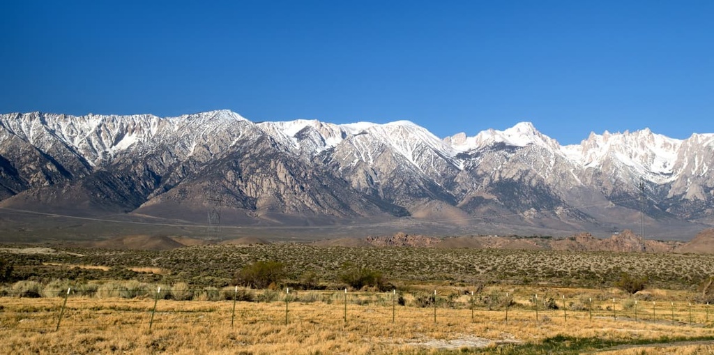
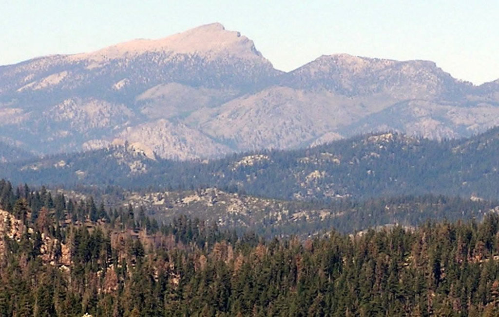
The South Sierra Wilderness is situated in the eastern part of the US state of California in the southern Sierra Nevada. The tallest and most prominent peak in the wilderness is Olancha Peak at 12,139 ft (3,700 m) in elevation and with 3,117 ft (950 m) of prominence.
The South Sierra Wilderness is situated in southeastern California along the crest of the Sierra Nevada. It is part of a continuous chain of wilderness areas that spans across the Sierra Nevada crest. Indeed, the South Sierra Wilderness marks the southernmost protected area in the region.
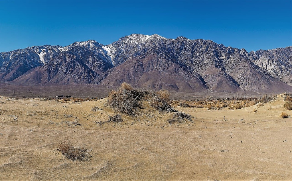
The wilderness encompasses 98 sq. miles (254 sq. km) of land. Elevations in the wilderness area range from 6,100 feet (1,900 m) in Kennedy Meadows up to the summit of Olancha Peak at 12,139 ft (3,700 m).
In the wilderness, meadows are scattered throughout the landscape, providing the ideal habitat for a wide variety of both flora and fauna. Forested rolling hillsides and rugged peaks tower above the distinct meadows of the region.
The western side of the wilderness lies within the Sequoia National Forest and is full of gentle rolling hills. The crest and eastern side of the wilderness is situated within the Inyo National Forest. Here, the landscape is marked by steep hillsides and less flora than on the western side of the wilderness area.
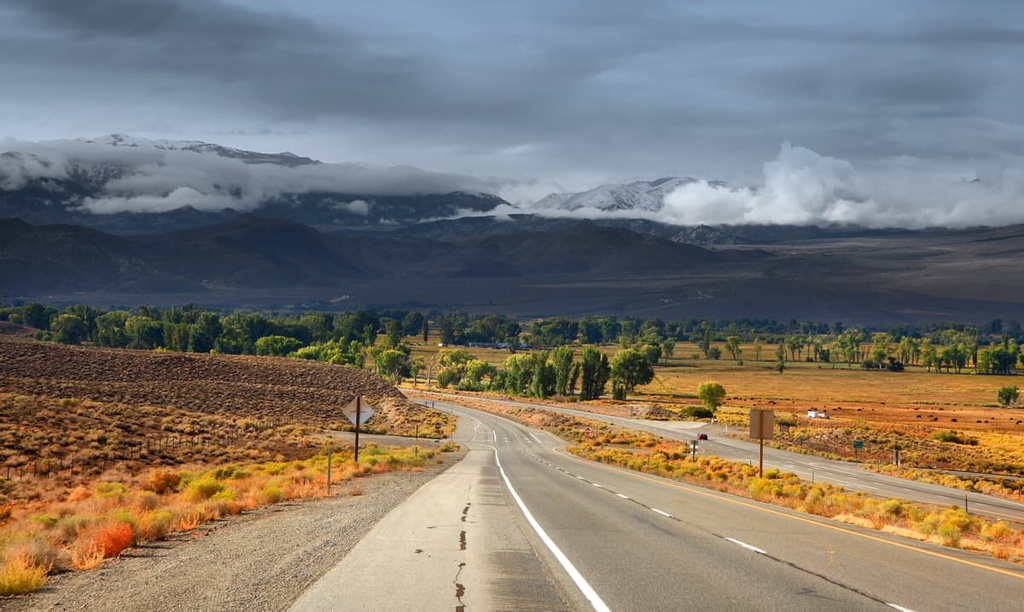
The major river within the South Sierra Wilderness is the South Fork of the Kern River, which is a federally designated Wild and Scenic River. Because the wilderness receives relatively little rainfall each year, there are very few streams throughout the area.
The wilderness lies within both the Sequoia National Forest and the Inyo National Forest. Directly to the north of the South Sierra Wilderness north lies the Golden Trout Wilderness while Death Valley National Park is situated to the east.
As part of the larger Sierra Nevada, the peaks within the South Sierra Wilderness date back over 100 million years. During the Cretaceous, an oceanic plate subducted beneath the west coast of the North American plate.
The subduction of the Farallon plate created magma beneath North America that eventually formed underground plutons. Together, these plutons created the Sierra Nevada batholith between about 115 million and 90 million years ago.
The oldest plutons in the region formed the western half of the Sierra Nevada. Meanwhile, the younger plutons formed the eastern peaks of the range.
The crustal extension that formed the Basin and Range Province also resulted in widespread volcanic activity in the Sierra Nevada around 20 million years ago. Over the course of the following 10 million years, the Sierra Nevada was uplifted between the coastal ranges and the Basin and Range Province.
In more recent millennia, rivers began further carving out the Sierra Nevada while lava began filling in some of the canyons. During the start of the last glacial maximum, around 2.5 million years ago, much of the Sierra Nevada was heavily glaciated.
As the glaciers began to retreat, they further carved out the landscape, leaving behind glacial cirques, alpine meadows, and the distinct craggy peaks that are now seen throughout the range and the South Sierra wilderness.
Today, the wilderness is home to a plethora of volcanic features that showcase the rich geological history of the southern Sierra Nevada.
Major peaks within the South Sierra Wilderness include Olancha Peak, Deer Mountain, Ball Mountain, Crag Peak, and Round Mountain.
The South Sierra Wilderness is home to a plethora of flora, including a multitude of rare native California plants. There are two distinct landscapes within the wilderness, each of which contains a diverse array of flora.
The southern portion of the wilderness is primarily home to the meadows and plateaus. Here the forests are populated by patches of Jeffrey pine, lodgepole pine, and red fir. At the same time, the mountainous northern region of the wilderness provides the ideal habitat for alpine grasses, shrubs, and wildflowers.
Some of the rare endemic plant species in the region include the Kern ceanothus shrub, Kern Canyon clarkia, and the goosefoot yellow violet. These native California plants are able to thrive in the wilderness, despite the small amounts of rainfall in the region.
The mule deer is one of the most common animals found throughout the wilderness. The harsh and dry conditions of the wilderness keep the deer population under control while natural local predators and permitted hunting also help to regulate the herd.
Other relatively large animals common in the South Sierra Wilderness are pine martens, black bears, and mountain lions. The red fox is a threatened species in the region though populations are slowly beginning to recover.
Though wolverines haven’t been spotted for many decades in the wilderness, it is believed that a small population may still be present in the region.
Humans have inhabited the land surrounding what is now the South Sierra Wilderness for thousands of years. Many different tribes lived in the surrounding region, migrating with the changing of the seasons.
The Yokuts, which were previously known as the Mariposas, have lived in the region since time immemorial. Prior to European colonization, there were about sixty Yokut tribes, each with their own unique dialects, customs, and cultural practices.
In 1848, in the aftermath of the Mexican-American War, the United States acquired present-day California from Mexico, who had recently gained independence from Spain.
Following the war, the US government created a treaty that would set aside seven percent of California’s land for the Yokut people. However, the treaty was never signed by the United States Senate.
During the mid-1800s, the Yokut people were forcibly removed from their native homelands, enslaved, and killed by European settlers who began settling much of California.
The California Genocide continued to decimate the Yokut community and that of many other tribal nations from 1850 to 1900. Many of the remaining Indigenous peoples in the region were forced into indentured servitude and displaced from their homelands. Today there are around 2,000 members enrolled in the Tachi Yokut Tribe.
Inyo National Forest was established in 1907 and Sequoia National Forest was established in 1908. The South Sierra Wilderness finally became its own protected area in 1984 after the passage of the California Wilderness Act of 1984 (Public Law 98-425)
The South Sierra Wilderness is home to numerous hiking trails. Here are some of the most popular hiking areas in the region:
The Kennedy Meadows Trail travels through the lower elevations of the wilderness. The trail is 4.1 miles (6.6 km) long with 465 (142 ft) of elevation gain.
It steadily winds its way through the rolling hills of Kennedy Meadows before crossing a small stream and turning back toward the trailhead. Along the route, hikers have views of some of the many hills, ridgelines, and small forested patches within the wilderness.
The Olancha Peak Trail takes hikers to the tallest peak within the wilderness. This route is 22 miles (35 km) long round trip with 6,663 ft (2,031 m) of elevation gain.
This trail climbs steadily throughout while the final mile is very steep up to the summit. From the top of Olancha Peak, hikers have panoramic views of the wilderness and surrounding national forests. Much of the hike is exposed to the sun, so hikers, trail runners, and backpackers should come prepared with enough water for their adventures.
The Olancha Pass and Summit Meadow Trail is 9.6 miles (15.4 km) long with 3,385 ft (1,032 m) of elevation gain.
The trail climbs up over Olancha Pass to the south of Olancha Peak before reaching Summit Creek. From the ridgeline to the creek, hikers can see Monache Mountain to the west while Death Valley extends to the east.
Looking for a place to stay near the South Sierra Wilderness? Here are some of the best cities and villages to check out in the region:
Just to the south of the South Sierra Wilderness lies the city of Ridgecrest, which has a population of around 30,000 people. The city is surrounded by national forests and wilderness, providing a multitude of options for hiking and backpacking. The Maturango Museum is also in Ridgecrest, and it offers exhibits on local culture, history, and biodiversity.
Near the city lies the Big and Little Petroglyph Canyons of the Coso People. Here, visitors can take guided tours to explore the historic landmark that showcases over 20,000 petroglyphs. Geological features in the area also include Trona Pinnacles and Red Rock Canyon State Park.
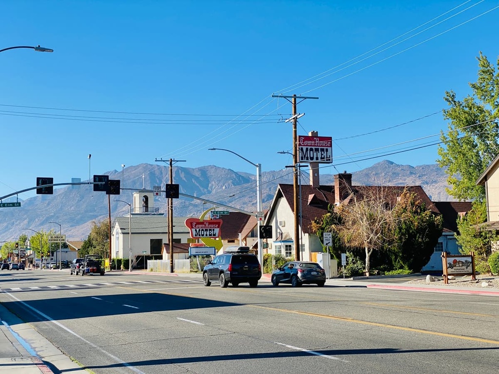
Bishop is a city located northeast of the South Sierra Wilderness. Named after Bishop Creek, the city has a population of around 4,000 people. Surrounded by the Sierra Nevada, Bishop is known for its stunning mountainous landscape.
From downtown, visitors and locals alike have ample opportunities for fishing, hiking, rock climbing, and backpacking. Bishop is also home to a quaint downtown full of local shops, bakeries, and restaurants. Every year the city also hosts a parade called “Mule Days,” which is one of the largest non-motorized parades in the world.


western-state-climbers
western-state-climbers-star
sierra-club-sierra-peaks-section
sierra-peaks-section-emblem
sierra-sampler
vagmarken-sierra-crest
western-state-climbers
western-state-climbers-star
sierra-club-sierra-peaks-section
sierra-peaks-section-emblem
sierra-sampler
vagmarken-sierra-crest


