
Scan the QR code and open PeakVisor on your phone
The largest, hottest, and lowest National Park in the contiguous United States, Death Valley National Park, encompasses over 3.3 million acres along the California-Nevada border. The park occupies an interface zone between the arid Great Basin and Mojave deserts, protecting a large portion of the Mojave Desert.
Death Valley has a long history of inhabitants, including Native Americans, gold prospectors, including slaves, Chinese immigrants mining for silver and borax, Basque immigrants, and Japanese Americans.
The Timbisha Shoshone Tribe has lived in Death Valley for over 1,000 years, well before white settlers traveled to the area. The Timbisha people not only adapted to the valley’s harsh climate but thrived on the limited available resources.
It wasn’t until the late 1800s that Death Valley would earn its daunting name and reputation. In 1849, a group of emigrants destined for California’s gold fields accidentally wandered into the valley. Met with “hunger and thirst,” the men firmly believed that they wouldn’t make it out of the desert alive. Though only one pioneer perished, as the survivors climbed over the Panamint Mountains, one of the men turned and said “Goodbye, Death Valley,” inadvertently giving the valley its name.
Despite the park’s forbidding name and sweltering temperatures, however, it’s more than just a sprawling, arid desert. Death Valley is truly a land of extremes and remarkable diversity. Though the park does protect acres of sand dunes, salt-flats, and badlands, it also encompasses lofty snow-capped peaks and rugged canyons.
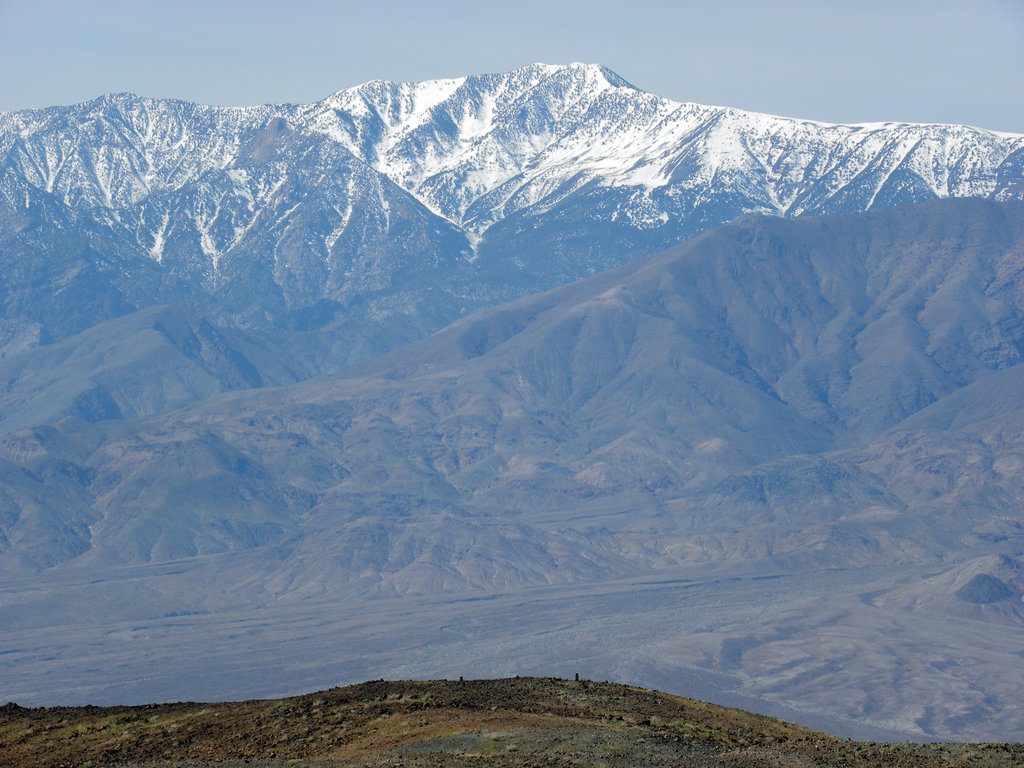
In fact, the tallest peak in the park, Telescope Peak, reaches over 11,000 feet in elevation and several others, including Bennet Peak, Rogers Peak, and Sentinel Peak, surpass 9,000 feet. The Death Valley region consists of several different mountain ranges, including the Sierra Nevada, the Argus Range, the Panamint Range. These lofty summits create a significant rain shadow effect, making the park North America’s driest destination.
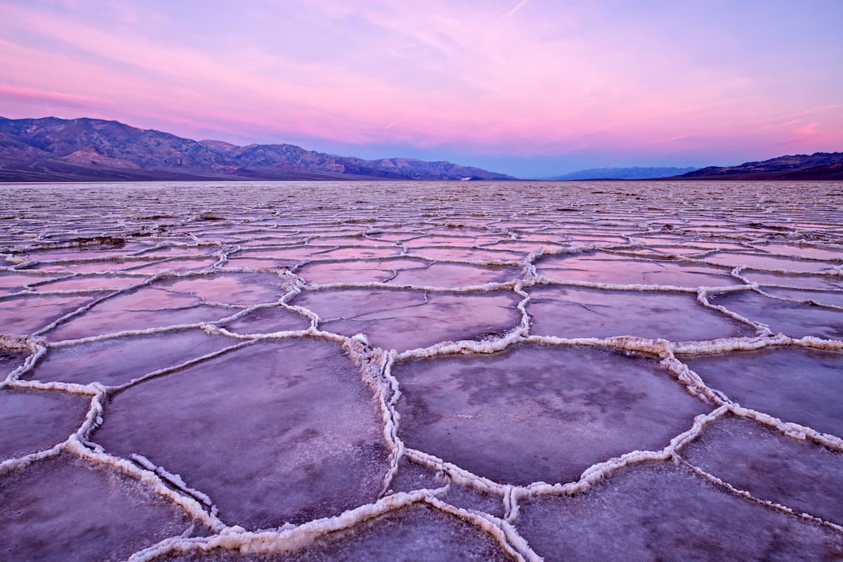
Beneath the shadow of Telescope Peak, for example, lies the lowest point in North America, Badwater Basin. The vertical drop from the summit of Telescope Peak to Badwater Basin is twice the depth of the Grand Canyon. This below-sea-level basin has recorded some of the hottest temperatures in North America.
When rain does arrive, however, incredible ephemeral lakes and spectacular spring wildflowers are on full display. Wildflower ‘super blooms’ are considered an anomaly and require near-perfect weather conditions, but witnessing one is truly a once-in-a-lifetime opportunity.
Though thousands of miles of paved and dirt roads dissect Death Valley, roughly 93% of the park remains a designated wilderness area. This wilderness designation further protects the park’s natural condition and prevents additional development. Visitors are free to hike, bike, or ride horses throughout this wilderness area.
Despite being one of the driest places on earth, Death Valley is also home to a great diversity of wildlife. Many of the park’s inhabitants have adapted and evolved to endure the elements. Bighorn Sheep, for example, are able to go without water for several days and drink several gallons when they locate a water source. There are roughly 50 species of native mammals in the park, including bighorn sheep, coyotes, bobcats, kit foxes, and cougars.
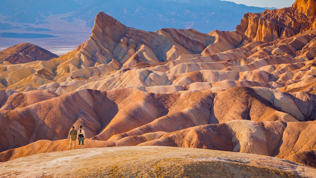
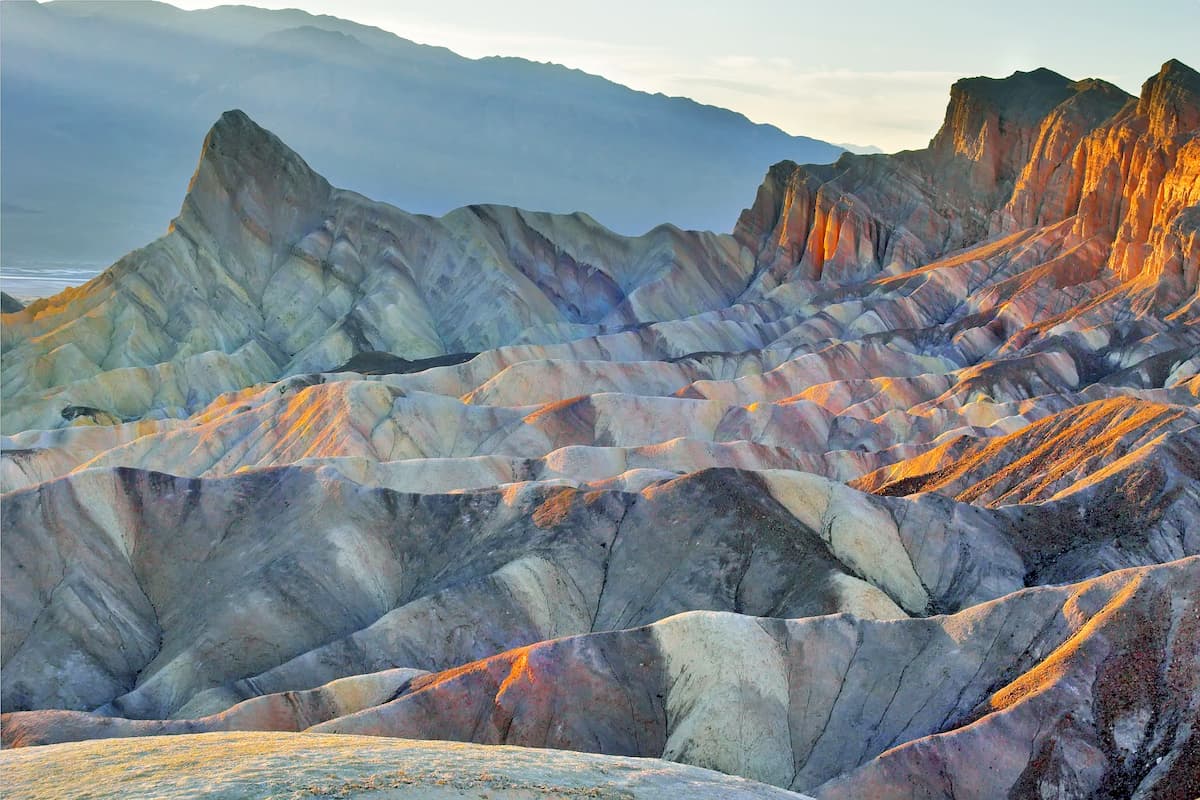
A trip to Death Valley wouldn’t be complete without visiting Zabriskie Point. This short footpath leads to incredible views of the badlands near Furnace Creek. The overlook features extraordinary views of Manly Beacon and Red Cathedral, two impressive rock formations surrounded by colorful canyons and hills.
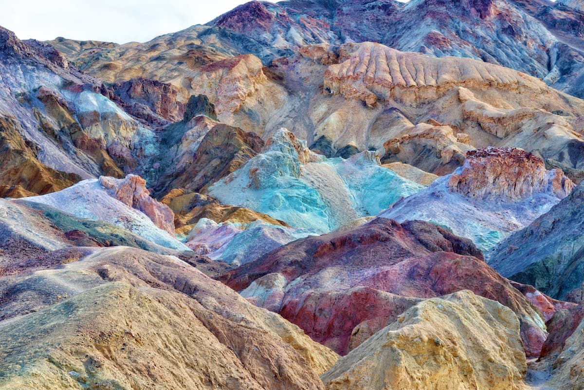
The Golden Canyon to Red Rock Cathedral trail features stunning colorful rock formations and a network of small slot canyons waiting to be discovered. Along this footpath, hikers can explore amidst golden sandstone rock walls, vibrant painted hills, and towering red rocks. After reaching the 400-foot fluted walls of Red Cathedral, hikers can either opt to head back to the car or venture on toward Zabriskie Point or Gower Gulch
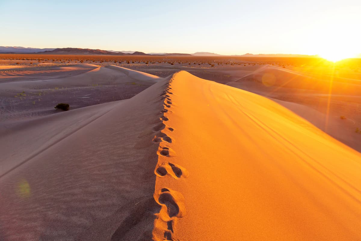
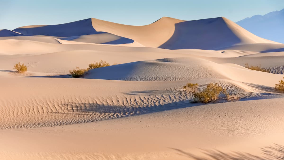
Arguably the park’s most notorious feature, the Mesquite Flats are Death Valley’s most accessible sand dunes. Located in central Death Valley, the highest dunes in this area rise to roughly 100 feet and offer sweeping views of the park. This dune field includes three different types of dunes: crescent, linear, and star shaped.
Pack extra water and head to the lowest point in North America. The 6.5-mile Badwater Basin Crossing traverses the heart of the Badwater Basin. Though the trail isn’t particularly difficult, it may require some navigating. Most visitors will opt to hang out at the boardwalk or look down at Badwater Basin from above at Dante’s View. However, the Badwater Basin Crossing trail is an excellent way to experience Death Valley’s rugged wilderness.
Spanning 3.4 million acres, Death Valley is remarkably remote. Driving distances between popular trailheads and attractions and local accommodations can be relatively long. Visitors are advised to pick accommodations in the park based on what they are hoping to see in the park.
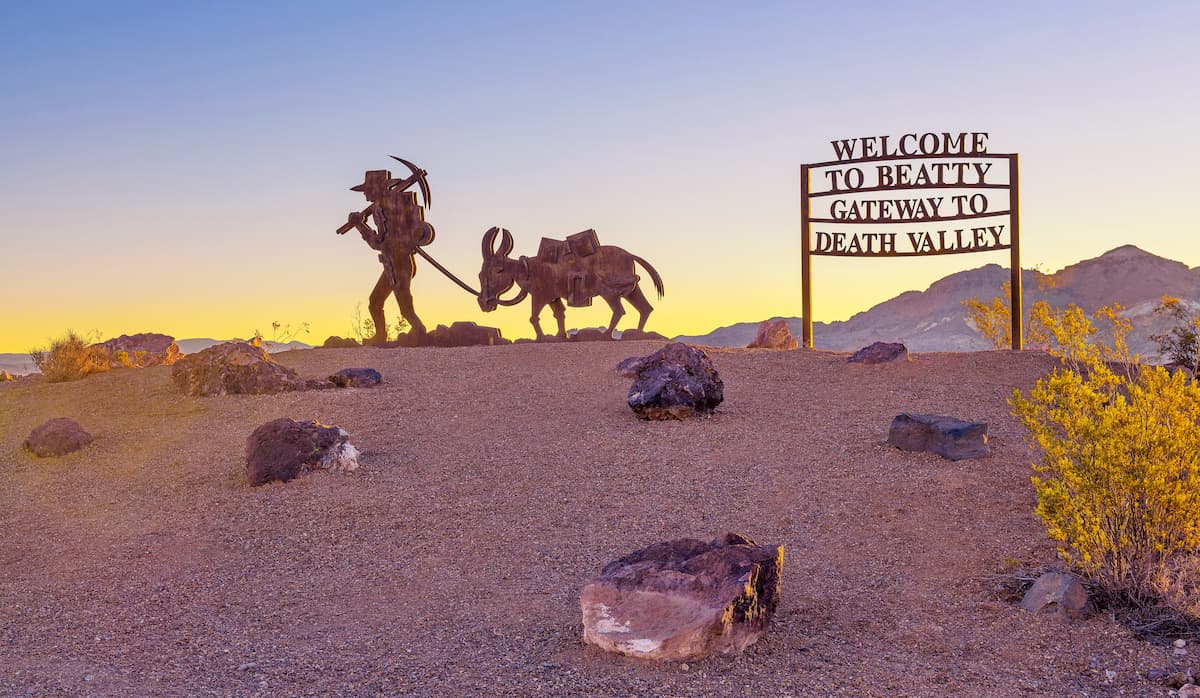
Accommodations in the park include: Stovepipe Wells, The Oasis, The Ranch, and Panamint Springs. Outside of the park, the nearest cities include Beatty, Pahrump, and Shoshone.


ultra
las-vegas-mountaineers-classics
western-state-climbers
western-state-climbers-star
desert-summits-book
bartells-death-valley
sierra-club-desert
desert-peaks-section-emblem
great-basin
california-ultras
western-state-climbers
western-state-climbers-star
desert-summits-book
bartells-death-valley
sierra-club-desert
nevada-peaks-club
desert-summits-book
bartells-death-valley
sierra-club-desert
great-basin
western-state-climbers
western-state-climbers-star
desert-summits-book
bartells-death-valley
sierra-club-desert
ultra
las-vegas-mountaineers-classics
western-state-climbers
western-state-climbers-star
desert-summits-book
bartells-death-valley
sierra-club-desert
desert-peaks-section-emblem
great-basin
california-ultras
nevada-peaks-club
desert-summits-book
bartells-death-valley
sierra-club-desert
great-basin
western-state-climbers
western-state-climbers-star
desert-summits-book
bartells-death-valley
sierra-club-desert
western-state-climbers
western-state-climbers-star
desert-summits-book
bartells-death-valley
sierra-club-desert
western-state-climbers
western-state-climbers-star
desert-summits-book
bartells-death-valley
sierra-club-desert


