Scan the QR code and open PeakVisor on your phone
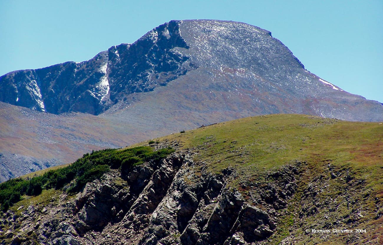
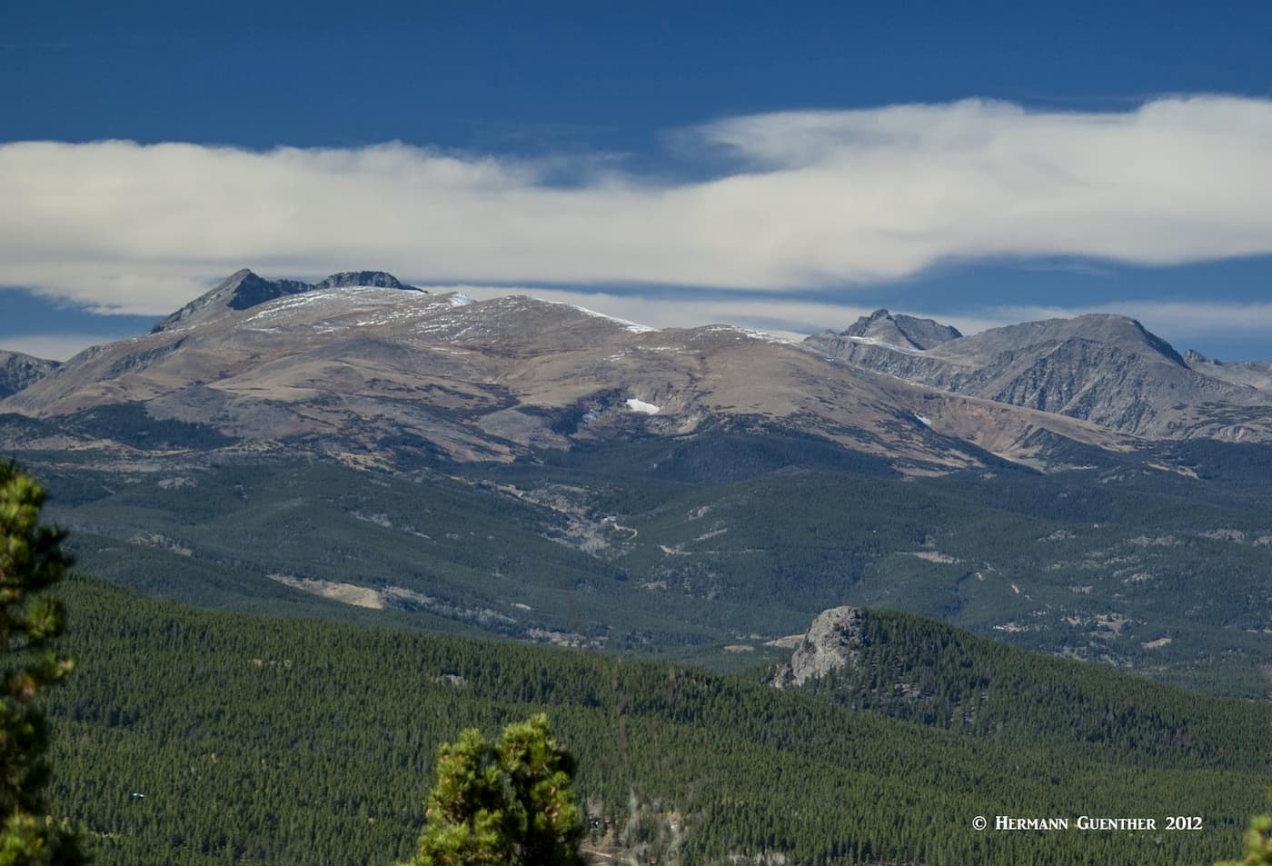
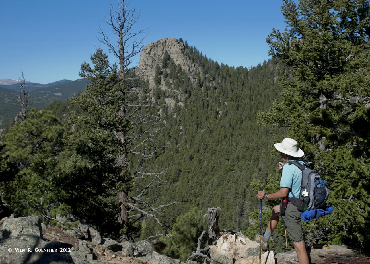
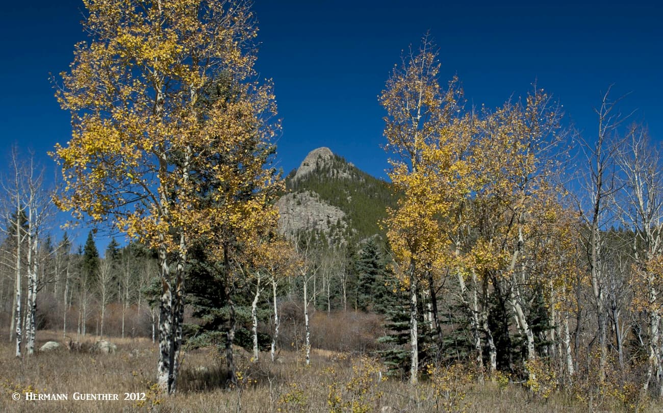
Gilpin County in north central Colorado is one of 64 counties in the state. It is the second smallest county in the state, at only 150 square miles, located just west of the northern half of Jefferson County; it shares its northern boundary with Boulder County while its meandering southern boundary is common with Clear Creek County. On the west, it shares a boundary with Grand County which is the Continental Divide. The highest mountain in the county is James Peak and the most prominent is Starr Peak, which is the highest summit of Thorodin Mountain, located in the northeastern corner of the county. It is not a popular place to hike.
While Gilpin County is technically part of the urban metropolitan area of Denver, it is entirely rural in character with perhaps one exception – the Central City/Black Hawk Historic District. Central City is the county seat. The total estimated 2019 population of the county is just over 6,200. The population density is only 36 inhabitants per square mile. The county was first formed in 1861 when Colorado was still a territory – it was named after Colonel William Gilpin, the first territorial governor. Aside from gambling, which attracts lots of people from the greater Denver area (more about that later), this county is scenically gorgeous. It offers some of the finest hiking in the Front Range.
As small as Gilpin County is, there are other administrative entities that occupy parts of it, thus sharing in the “ownership” of some of the named mountains listed for the county. In fact, the highest mountain in the county, James Peak, is shared by no less than five other entities – Clear Creek County, Grand County, Arapaho National Forest, Roosevelt National Forest and the James Peak Wilderness. I wonder how many people that climb this peak realize that, as they are standing on the true summit, they are actually in three counties, two national forests and one wilderness area. I never realized that the times I climbed it. Let’s take a quick look at how these entities relate to the county as it pertains to mountains.
Arapaho National Forest – A very small part of this expansive national forest occupies the southern part of Gilpin County, east of the Continental Divide. Although this area is interspersed with lots of private tracts of land, there are a number of named mountains ranging in elevations from 9,000 to over 11,000 feet – many of these are the so-called “state” mountains, since they are named after several of the United States. While most of these are not popular hiking destinations, some designated routes exist.
Roosevelt National Forest – A somewhat greater portion of the county is comprised of Roosevelt National Forest. This is where most of the best hiking trails are located.
James Peak Wilderness – This small but beautiful wilderness area is a popular and scenic area that occupies parts of both Gilpin and Clear Creek County Counties. It is entirely confined to the eastern side of the Continental Divide. We hike in the area often for it affords excellent trail access to high terrain – all very close to home.
Grand County – Gilpin County and Grand County share a common boundary which is defined by the Continental Divide. James Peak is the only named mountain on this boundary.
Clear Creek County – While the southern boundary of Gilpin County is shared with Clear Creek County, there are not many important named mountains that are common to both counties.
Front Range – This is the longest sub-range of the Rocky Mountains located entirely within Colorado, the northern section of which encompasses the entirety of Gilpin County. Therefore, all of the named mountains in the county are also contained within this range.
Much of Gilpin County, although entirely mountainous terrain extending from foothills to alpine peaks and ridges, is not widely recognized as prime hiking territory. That is in part due to the many large parcels of private property interspersed with national forest land. Some of the named mountains are virtually inaccessible without encroaching onto private land; those that are, likely do not have maintained trails, thus making them unattractive to all but local residents who know the back ways to reach them. But the real attractions for hiking in this county, though they may be few in number, are worthy of serious attention by serious hikers.
One of the major attractions in Gilpin County is Golden Gate Canyon State Park, most of which lies within the county although a large part of it extends into adjacent Jefferson County. Long considered the showpiece of the Colorado State Parks system, although I think that the much newer Staunton State Park offers it some major competition in that regard, this park is truly worth considering for hiking and even climbing. Of course, it being a state park, admission is not free, but that should be no deterrent, since there is a large network of trails for all levels of fitness. There is even off-trail climbing possible here. But this park has plenty of other exciting activities to offer, including fishing and camping, and seasonally, hunting. We often drive through this park on our way to hiking in the much higher mountains in the western end of the county.
Elevations in the park vary from around 7,500 feet to 10,387 at the top of Tremont Mountain, the highest point in the park. With 12 trails having a combined length of 35 miles, it is likely that you will encounter few other hikers except at peak times. Elevations along these trails lie between 8,000 feet and about 9,500 feet. Please note that there is no official trail to the summit of Tremont Mountain, although many people do attempt this somewhat strenuous climb just for the fine views from the top, where on a clear day you can see the high mountains from Pikes Peak to Longs Peak, and everything between. With several main roads in the park, the many trailheads and parking lots are easily accessible. Some trails are for hikers only while most also allow biking and horseback riding.
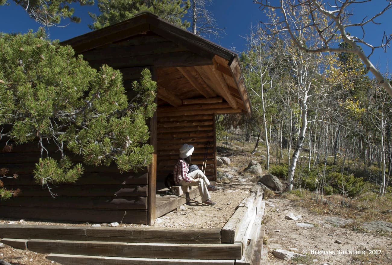
The park has many picnic areas and two campgrounds (one for tent camping only). There are also four backcountry shelters in the “Appalachian Trail Hut” tradition as well as 20 backcountry tent sites. The shelters are three-sided structures with a roof and wooden floors that can accompany up to six hikers each without a need for a tent. The one open side does not guarantee to keep bears from snooping around your sleeping quarters, so be bear-aware.
We will not describe individual trails here, but be assured that the park’s brochure and map provide you with plenty of useful information. Much of the park is pine-covered hills between green meadows and lush aspen groves. This makes autumn a particularly pleasant time to go hiking here. Warm days and cool nights offer relief from the hotter summer months and mosquitoes. This wonderful park is to be recommended for those not seeking high alpine adventures.
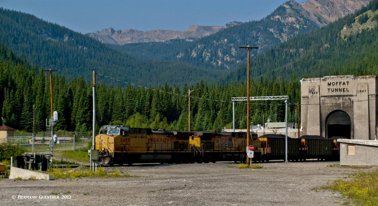
While not all of the splendid James Peak Wilderness is in Gilpin County, the part that is has not gone unnoticed by any means. There is really only one trailhead in Gilpin County for hiking in this wilderness – it is the so-called East Portal Trailhead. It is so named because it is located right at the eastern portal of the famous Moffat Railroad Tunnel. The tunnel, constructed between 1923 and 1927, is six miles long and contains a mainline track from Denver to the west coast, serving both passenger and freight traffic. The west end of the tunnel is in the resort of Winter Park after passing under the Continental Divide. Adjacent to the track is a huge parking area for the trailhead.
The trailhead is the beginning of the South Boulder Creek Trail. This is the main trail into the wilderness, at least from Gilpin County. It ends 5.5 miles away on top of the Continental Divide. Along the way, there are several trail junctions from which branching trails can be taken to some wonderful alpine lakes. It is well worth discussing all of these since each choice will result in a wonderful day hike. Backpacking and spending one or more nights in the wilderness will simply enhance the experience by allowing you to explore more of this beautiful area.
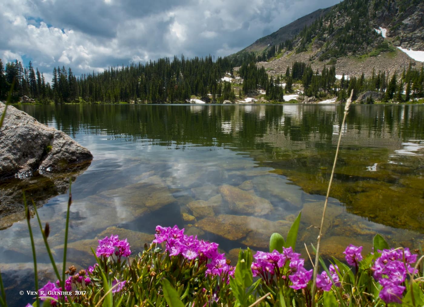
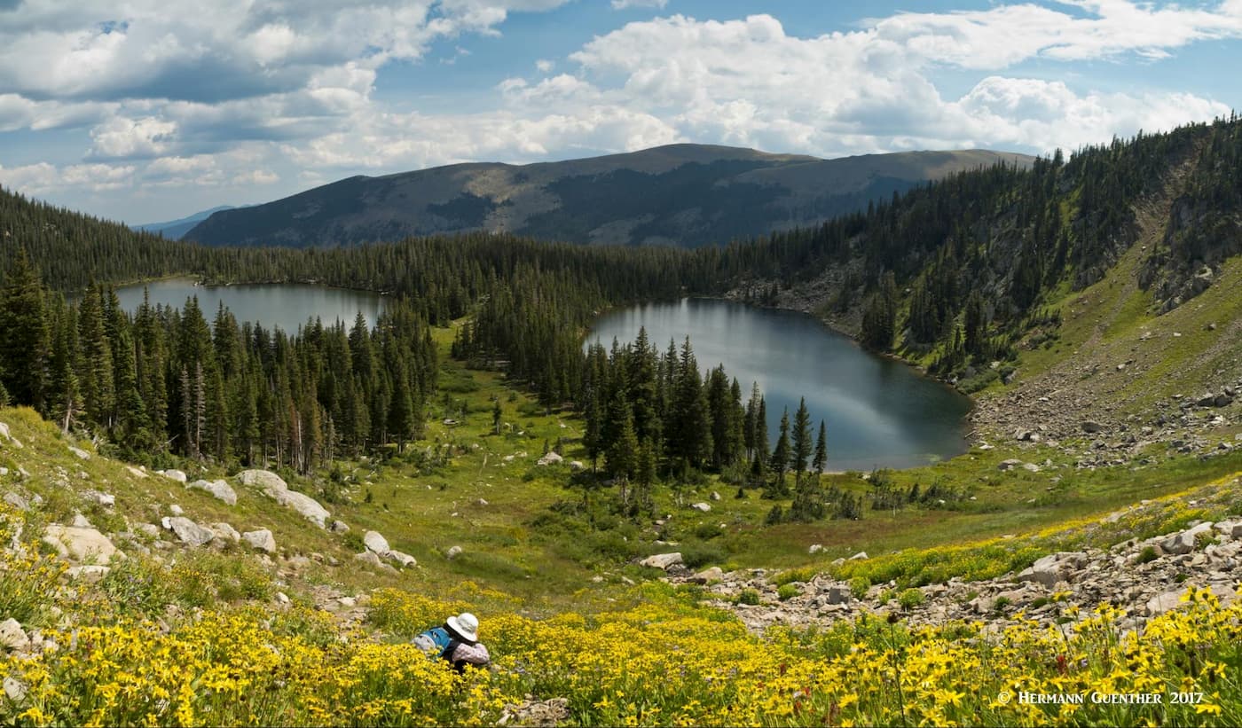
Forest Lakes Trail – The first trail junction along the South Boulder Creek Trail is about 1.25 miles in from the trailhead. Up to here, the South Boulder Creek Trail mostly follows the creek at a relatively flat grade with only minor elevation gain. The trail to the two Forest Lakes then climbs more aggressively, though never excessively steep, as it arrives at the lower of the two lakes, where it levels out and follows the lake’s western shore. While this lake has its charm, don’t linger here too long – if you made it this far, you must continue the extra mile to the upper lake, which is the real gem in this part of the wilderness. As the trail emerges from the trees, you will be slightly above the lake and if you are here at the right time of summer, you will be greeted by an abundance of colorful wildflowers. This is a great place to stop for a lunch break.
Then, if the weather looks good and you have more time on your hands, by all means take the half-mile walk around the lake so that you can be sure to see the scenery from all parts of the trail. Unlike many high alpine lakes, this one is easy to get around. Then, on your way back down, you could opt to also walk around the other side of the lower lake, although this is not on a developed trail. The only reason to do this would be to get the fine view across this lake to the high ridges of the Continental Divide above the upper lake. We have only done this once in all of the times we have made this hike.
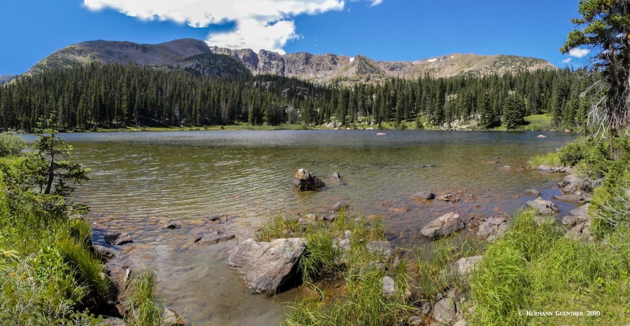
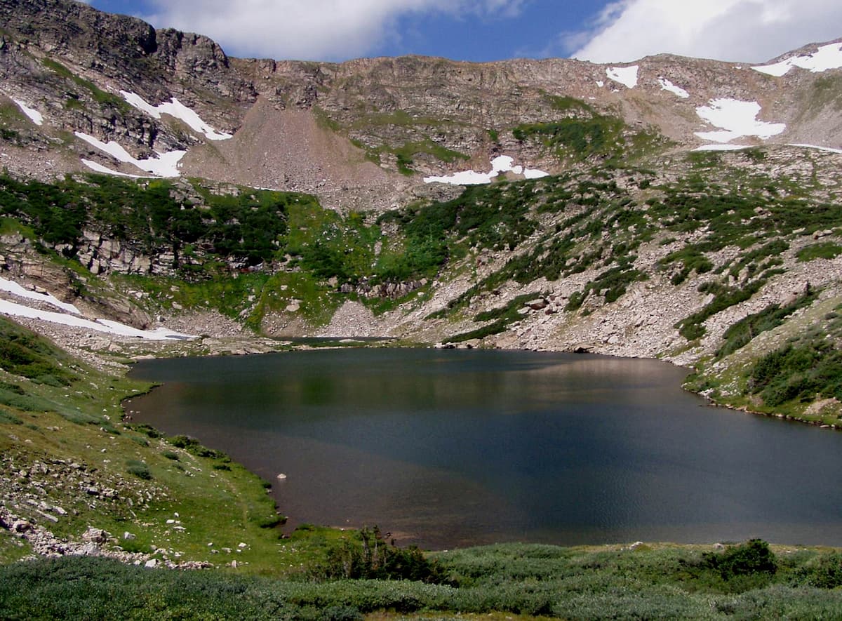
Crater Lakes Trail – If you follow the South Boulder Creek Trail for two miles from the trailhead, you will arrive at the junction of the Crater Lakes Trail. Your hike to this point will have gotten considerably steeper after the Forest Lakes junction. From this junction it is only one mile to the two lower Crater Lakes, but that is a really steep mile, at least in some places. Once you get to the twin lakes, which are side-by-side separated by a narrow isthmus of only 150 feet wide, you will be rewarded with a fine place to celebrate your accomplishment. If you go no further, your total hike will be only six miles, but you will have a decent workout. You can easily walk around the south lake but I would not recommend trying to walk around the north one – it is not pleasant. Better to just enjoy them both from their western shores. Maybe even try fishing – it’s not bad here.
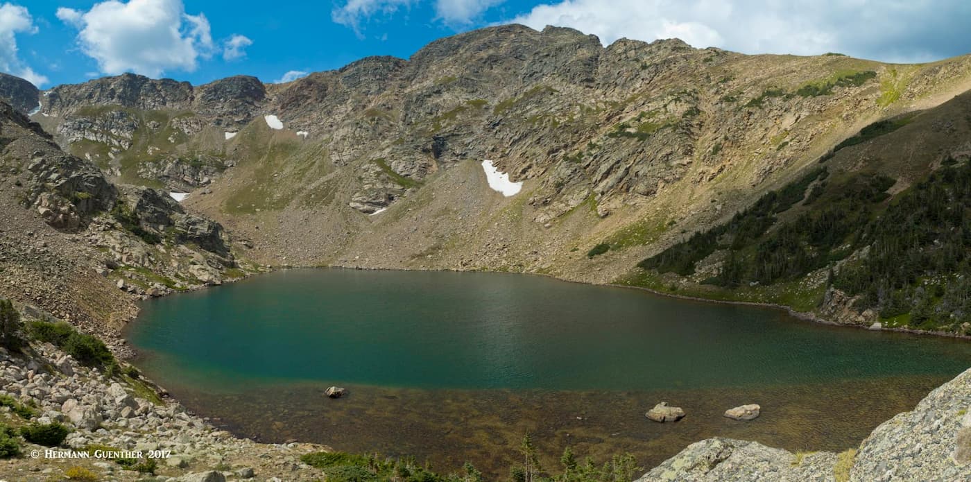
If you haven’t had enough yet (after all, what is a mere six miles?), you can make your hike far more interesting. Go to the upper Crater Lake. This will turn your hike from moderately easy to moderately difficult. There are two ways to get there, which means that you can do it as a loop hike from the lower lakes. Neither approach is well-developed and some route finding is necessary. You can go counter clockwise by following the western shore of the north Lower Crater Lake from where you will ascend very steeply to the upper lake, passing a scenic little tarn just before you get to the lake.
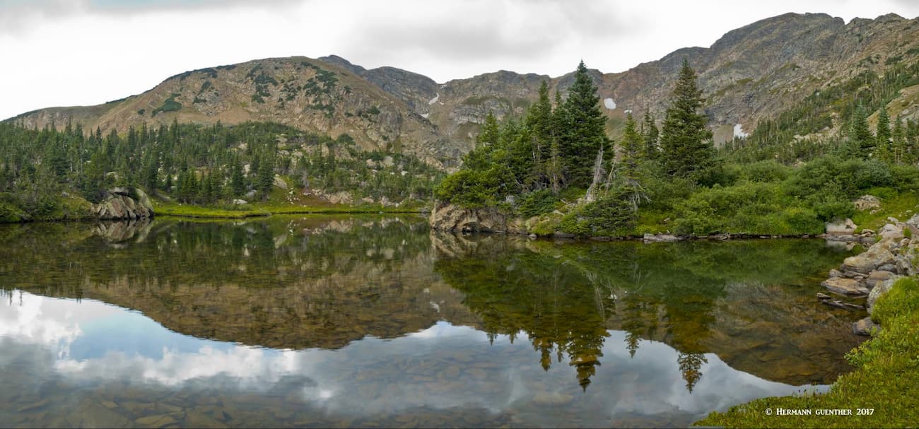
Or you can take the clockwise approach from the area between the two lower lakes. This takes you up a really steep, lung-busting scree slope that is overgrown with a wonderful display of wildflowers. But to give your lungs a rest, stop often along this section and look back. This is just about the only view you can get of both of the lower Crater Lakes (north on the left and south on the right). To get this wide-angle view, you need an appropriate lens or you will need to shoot a panorama series, which is what I had to do for the photo below.
Once you are at the top of this monster, you will have to do some route-finding since you are now on a boulder field in a saddle above the upper Crater Lake. You don’t see the lake below you yet, but intuitively you should know where the lake is likely to be. If you don’t have that sense of “where am I”, you should probably not be up there. Now you start to do some boulder-hopping to get down to the best of the three lakes. I prefer going this way, because you can see the lake on the way down. If you try to do this going the opposite way, the upper lake is behind you while you are concentrating on finding your way up to and over the saddle and boulder field. I’ve done it that way and, trust me, that’s not the way to do it.
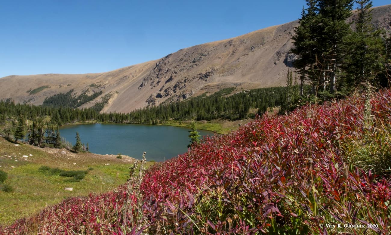
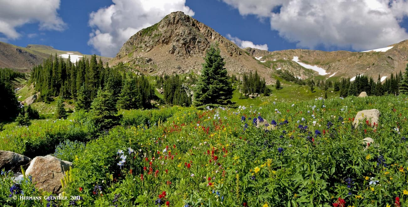
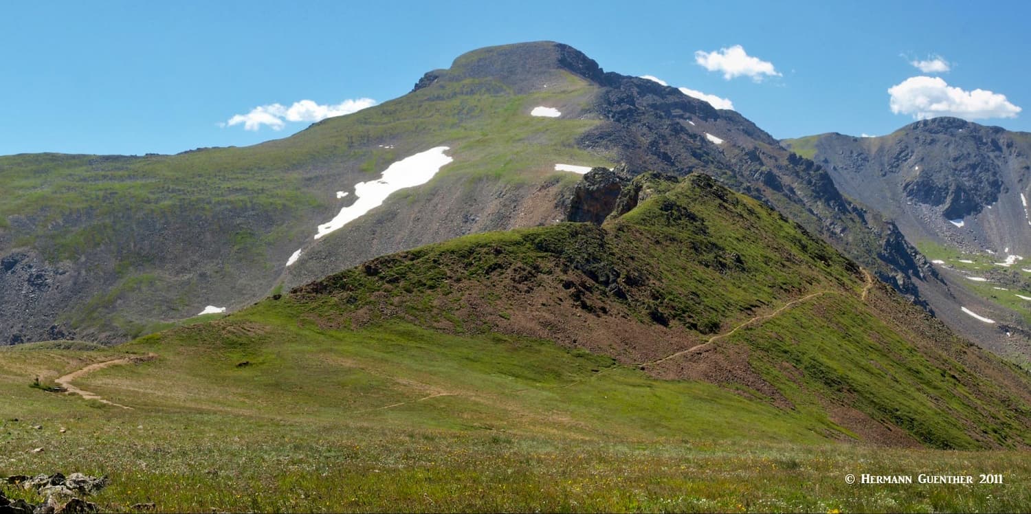
Upper South Boulder Creek – Once you have passed the turnoff to Crater Lakes, the South Boulder Creek Trail gets steeper but progressively more interesting and scenic. After almost two more miles, it emerges near the tree line where you start to get the feel of the beautiful alpine basin that awaits you. In my humble opinion, this is the best part of the James Peak Wilderness. We have been up here many times, as recently as early September 2020, and we never get tired of it. In mid-summer, the wildflowers up there can be spectacular, while in autumn the changing colors are equally dramatic.
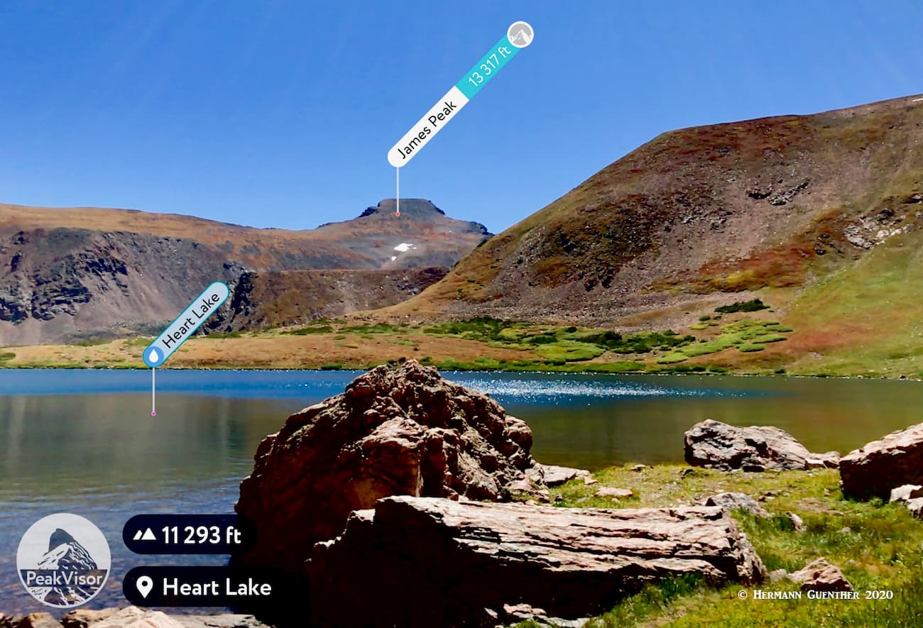
There are two wonderful alpine lakes in this basin – Rogers Pass Lake (incorrectly labeled as Rogers Peak Lake in Google Earth and Google Maps) and Heart Lake slightly higher. The namesake of the latter is obvious if you climb high above it. Before you arrive at the first of the two lakes, a short diversion off the trail will take you to a fine meadow of wildflowers in the middle of which is a scenic pond, which is fed by South Boulder Creek. A nice place to take photos, with the imposing Haystack Mountain as a backdrop. Just try not to trample the flowers so that others can enjoy them as well.
Just above this meadow is Roger Pass Lake – for first-time visitors the initial view of the lake with Haystack Mountain behind it is breathtaking. Actually it is even for those like us who have been here many times. If you are fortunate enough to have the time, this is a great place to camp for a few nights. There are many fine campsites nearby that afford great views. But it is important to obey the rules regarding proximity to the lake, fire prohibitions, etc. For those who have the time, this is one of the best places to base an assault on James Peak itself. You can either attack it head-on by hiking behind Haystack Mountain, as I did, and then up the steep north slope of the mountain, or you can take the trail to Rogers Pass from where you simply follow the Continental Divide National Scenic Trail (CDNST).
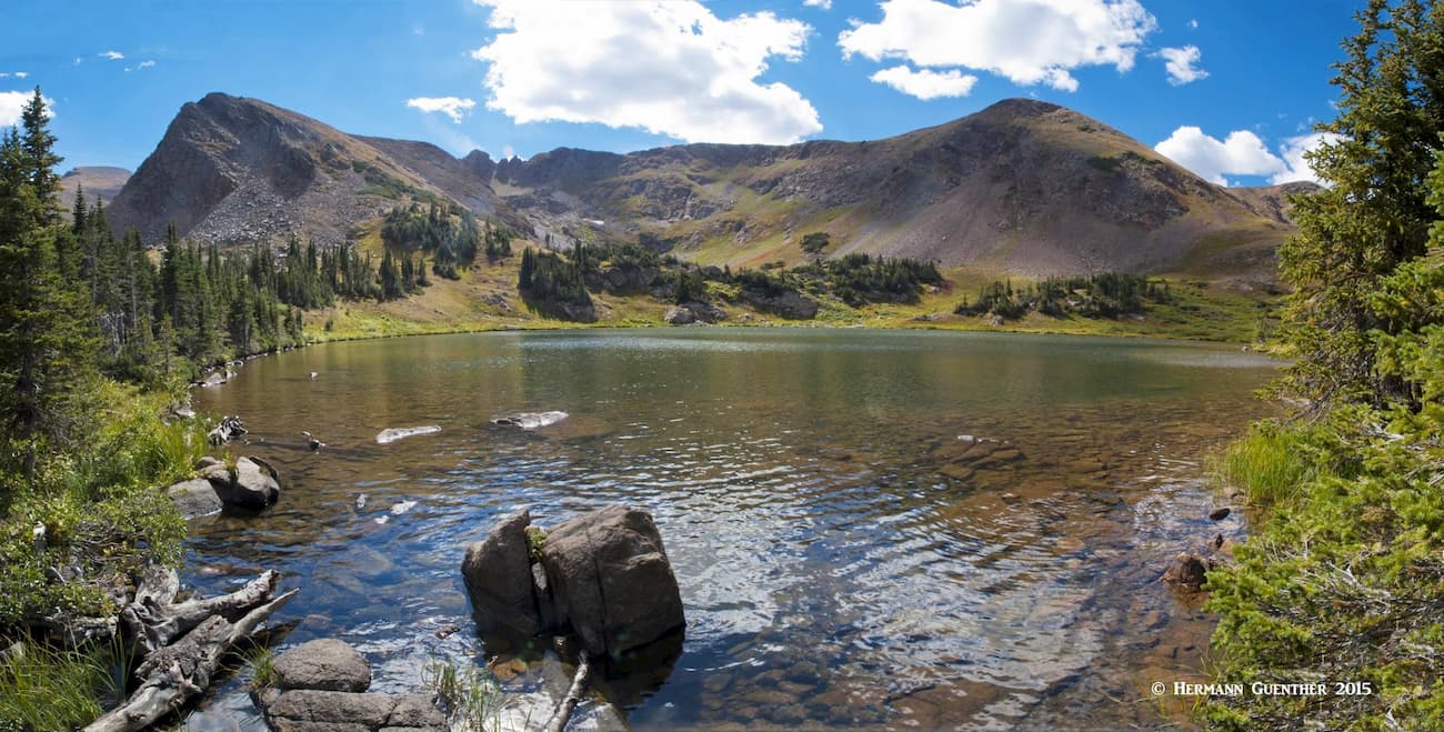
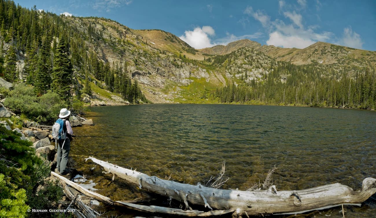
After you have taken several dozen photos at Rogers Pass Lake, head up the short but somewhat steep trail to Heart Lake, which is much larger than its lower neighbor. While the latter is positioned just about at the tree line, Heart Lake is mostly surrounded by open terrain, though the east side has some low-level timber where you can find some sheltered spots for setting up camp. If you are into fishing, this lake is stuffed with large native cutthroat trout. Just walk all the way around the lake and you will see them cruising along the shore in the super clear water. In fact, we usually do walk around it – about one mile of additional hiking – since the best views are from the far side. This diversion requires a bit of boulder hopping so it is necessary to make every step count. If you do this, you will be amply rewarded.
If, at this point you still have reserves of energy, you can take the final half-mile of the South Boulder Creek Trail to the top at Rogers Pass. This part is steep, trust me, rising another 700 feet over a series of switchbacks. From this point you can look down to the Winter Park Resort as well as follow the CDNST either south to the summit of James Peak, or north as far as your feet can take you. As a minimum, it is worth trekking north a little over one mile to a high point from which you can look down onto the Iceberg Lakes which are accessible only via a very steep and primitive trail from the South Boulder Creek Trail Trail. I have never done that since very few people go there and to do it alone is not wise, at least at my age.
Arapaho Lakes Trail – This trail, which used to take off from the Forest Lakes Trail, exists no more. But when it did, it was difficult to follow. It provided an interesting loop hike in which you could visit the scenic Arapaho Lakes as well as all three Crater Lakes. This involved climbing over a high ridge separating the lakes. I have done that a couple of times, but when I tried to find the trail a few years later, there was no longer a trail sign at the junction. I subsequently called the U.S. Forest Service ranger station to inquire about this. They told me that they had to eliminate all references to the trail because too many people got lost up there, as a result of which they caused significant damage to a sensitive wetland area. So, although I still know where the original trail junction was, I have refrained from going there anymore.
The fact that all of the hiking venues in Gilpin County are so close to the population center of the greater Denver area, most of the fine hiking trails can easily be done as day hikes from much of the metropolitan area. The fact that we can get to the major trailhead at East Portal in just over an hour, and Golden Gate Canyon State Park in less than an hour, there is no need to find a place to stay when recreating here. Of course, the pleasant town of Boulder is quite nearby and should be considered as a fine accommodation option for out-of-state visitors.
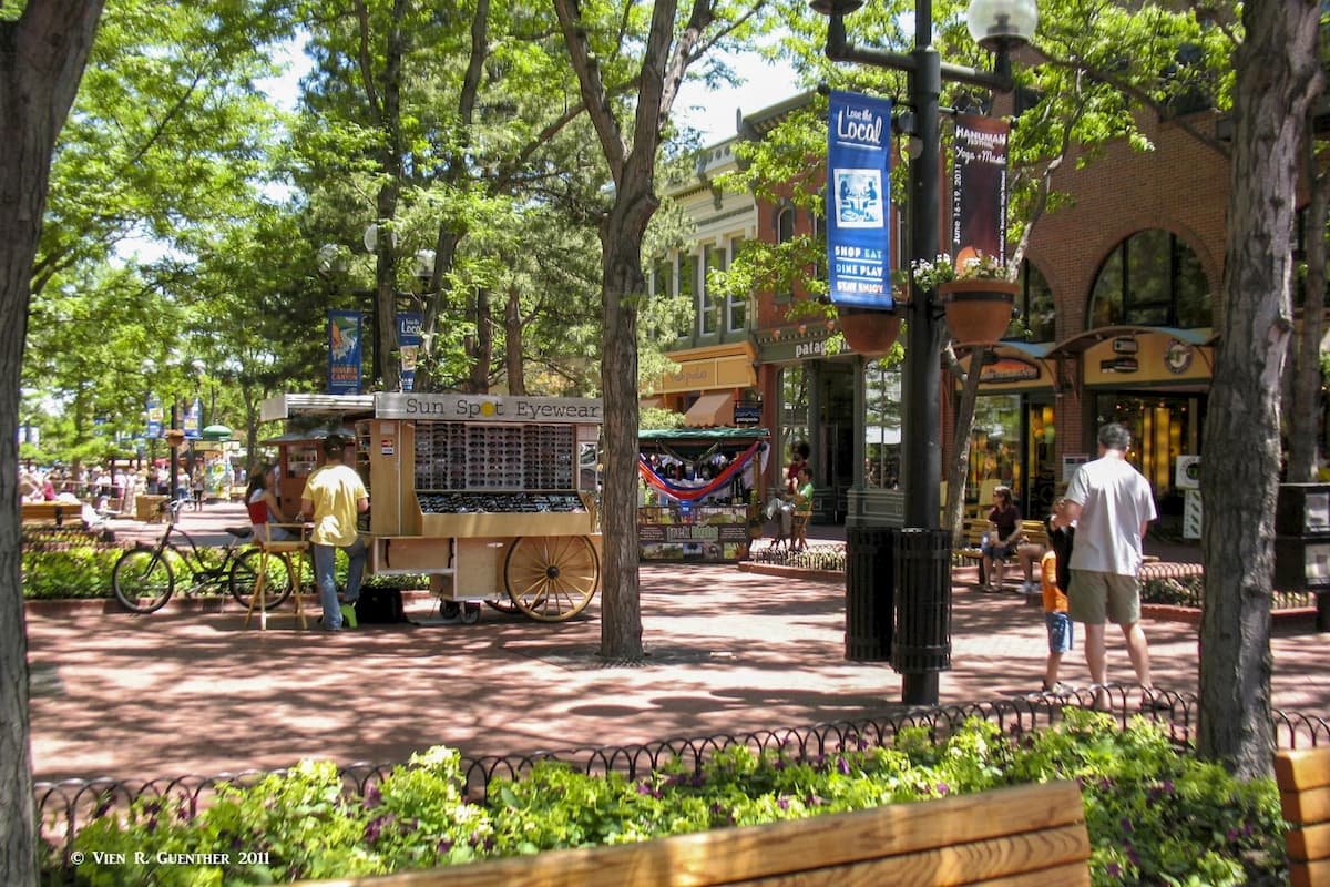
This beautiful city (population 107,353, per 2018 estimate) about 25 miles northwest of Denver is a mountain-lover's nirvana. Many famous climbers and mountain explorers call (or have called) Boulder home. Nestled right at the base of the foothills of the Rocky Mountains, Boulder is so well positioned as to make it the perfect base from which to explore the main hiking areas in Gilpin County. Even the high foothills looming over the city afford some impressive hiking and climbing opportunities. Just above Chautauqua Park are the famous Flatirons - not too many cities have this kind of climbing venue right within city limits. Of course, the highly outdoor-oriented population of this town contributes significantly to the hordes of people that often use this part of the Front Range as their playground. But irrespective of that, Boulder is a fun and vibrant town and should be considered an important base for staging explorations into the wilderness. Visitors to the Front Range urban corridor should not pass up a visit to Boulder.
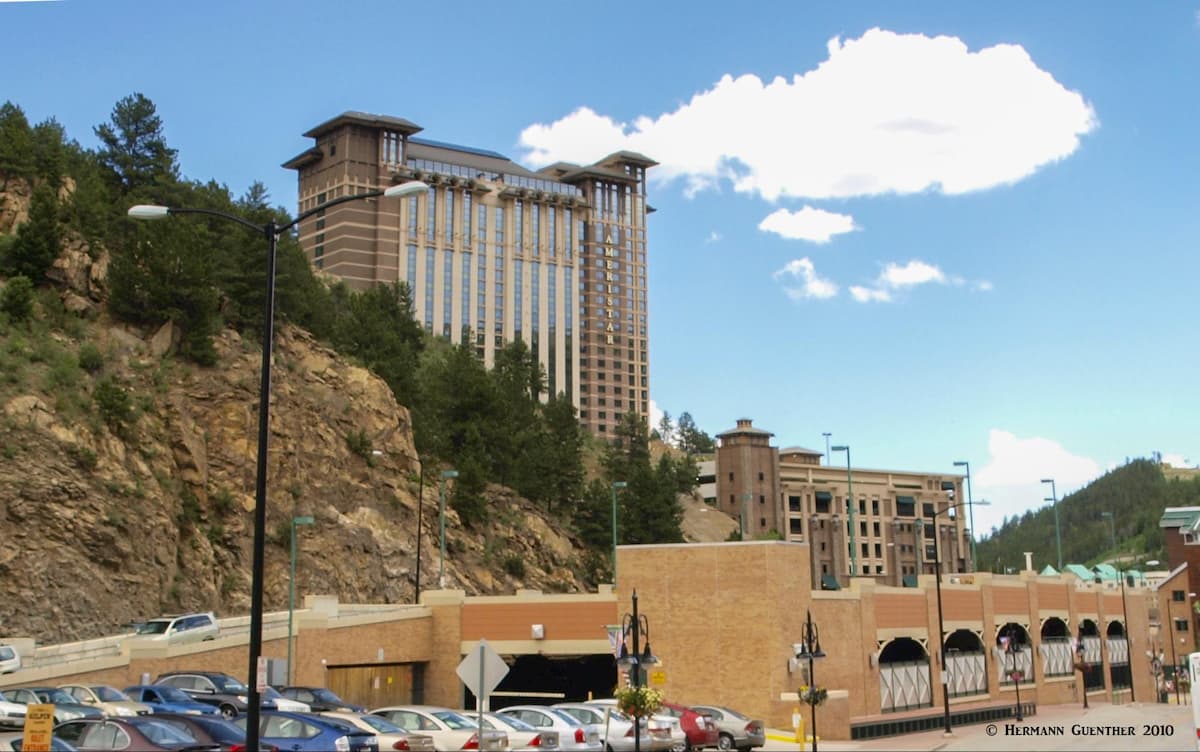
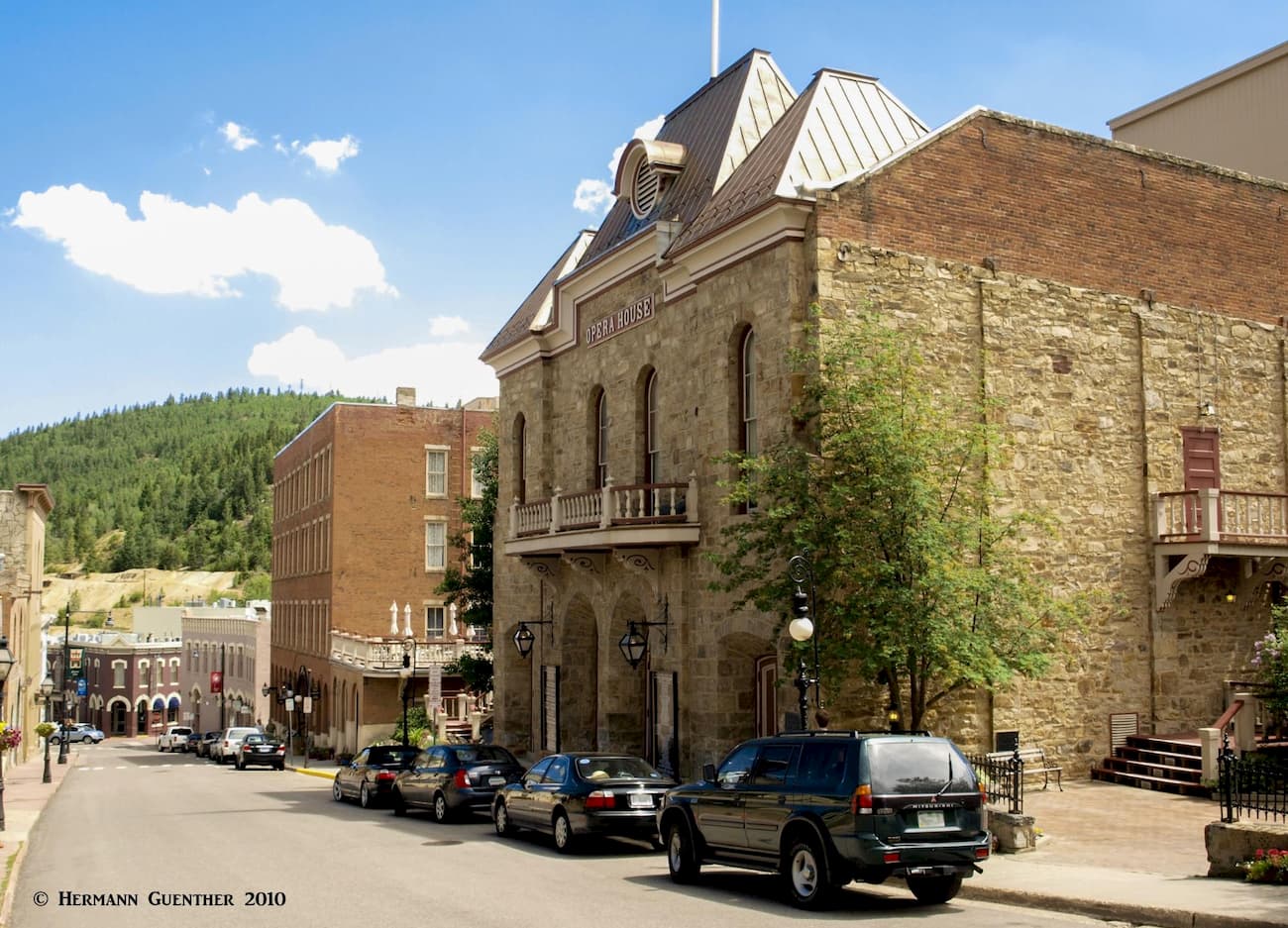
Visitors from faraway places are well advised to visit this fascinating duo of historic mining towns. For a time in the late 19th century, this area was known as the “Richest Square Mile on Earth”. When a rich deposit of gold in hard rock was discovered here on May 5, 1859, it started the famous Pike’s Peak Gold Rush and several mining camps quickly materialized. Two years later, Central City, the seat of Gilpin County, was already the largest city in the Colorado Territory, although Denver became the state capital. The various mining camps eventually became the two adjacent towns of Central City and Black Hawk, which now have a well-preserved early mining community architecture and history. When I first moved to Colorado, Central City was perhaps best known for hosting the annual summer Central City Opera in its historic Opera House. They are still performed today – with all operas sung in English.
Fast-forward to November 1990 when voters supported the legalization of casino gambling in Colorado. That’s what put these two quiet towns on the map. Although Central City had already been well established for its historic value, nearby Black Hawk (only one mile away) was not much more than a wide spot along the road. Now it has high-rise casinos, hotels and parking garages. While the gaming laws in Colorado are not as liberal as in Las Vegas for example, these two towns have become a major tourist attraction, not to mention a real source of revenue. People who may not have had any prior interest in the mountains, are now flocking to these towns. So, next time you go hiking in Gilpin County, you might just follow up your daytime adventures with trying your luck at the slot machines. Of course, you might go home with lighter pockets as well.