Scan the QR code and open PeakVisor on your phone
Jefferson County is located in central Colorado just to the west of the Greater Denver area. In fact, about one fourth of the total area of the county is entirely urban and is positioned on the flatlands to the east of the foothills of the Rocky Mountains. The whole rest of the county is mountainous with elevations ranging from around 6,000 feet to about 11,600 feet. But even the mountainous parts of the county have pockets of suburban population. It is the fourth most populous county in the state. Its western boundary is shared with Gilpin, Clear Creek and Park Counties, all of which extend much further west, all the way to the high mountains of the Continental Divide. Though Jefferson County has 73 named mountains, only two exceed 10,000 feet in elevation with all the rest confined to the elevations of the foothills zone.
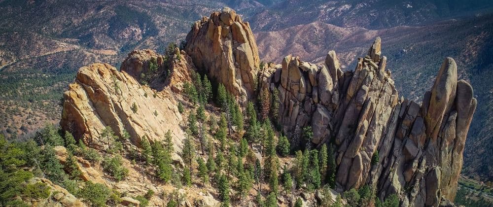
The highest mountain is Buffalo Peak, which barely reaches the treeline, and the most prominent is Green Mountain, which is tree-covered over almost its entirety. Please note that there are several other mountains in Colorado sharing the same names as these two. Interestingly, neither of these peaks is generally used for hiking – there are no formal trails on or up to either of them. But having lived in Jefferson County for the past 40 years, I can assure you that there are plenty of places to go hiking here. While none of that will be in alpine terrain and most of it is not in any national forest, small tracts of Arapaho and Pike National Forests encroach within county boundaries. For those who want some serious climbing, that can be found at several locations in the county, most especially in the Cathedral Spires (more about that following).
Given the scarcity of high alpine peaks with windswept crags and ridges, just “how can you do some decent hiking in Jefferson County?” you might ask. Well, I’ll help you out. Now, keep in mind that the only summits above 10,000 feet in the entire county don’t even have any trails (as far as I’ve been able to ascertain), which means that all your hiking will be at elevations below that, sometimes far below, as low as 6,000 feet. I suppose many people living on the two coasts of the United States will say “that’s pretty high as far as I’m concerned.” Yes it is, but here we live at that elevation. But fear not, there are some wonderful hikes to be found here, miles of wonderful trails and plenty of elevation gain to be negotiated if that’s what you want.
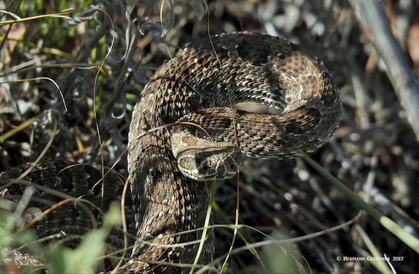
Just beware of two things – it gets pretty hot in the summer, so if you are sensitive to hiking in hot conditions, as we are, do what we do. Hike from late October to late April. That’s when the high country is usually pretty snowed in anyway. And that’s when the rattlesnakes in the foothills are in hibernation. Yes, we have them here and I’ve encountered them – four times in several thousand miles of hiking in these hills. So your chances of seeing them are fairly remote, but you really need to be aware of their presence and know how to avoid encounters. They are not aggressive, but they fiercely protect their domain. So, let’s have a look at what exciting hiking experiences await you in Jefferson County.
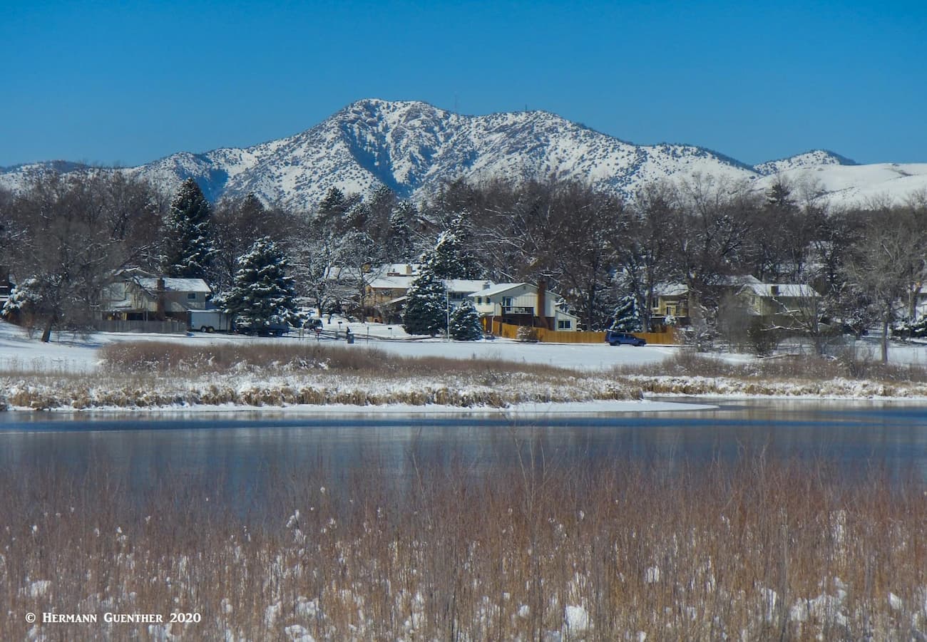
There are two state parks that are partially within Jefferson County boundaries – Staunton State and Golden Gate Canyon. They are both real gems in the overall system of 41 state parks spread over all geographic areas of the state. Staunton is the newest, having been opened to the public in 2013. Both have miles of hiking trails and feature some spectacular terrain which even supports rock climbing.
Staunton State Park has only one entrance and two trailheads. These are in the Jefferson County portion of the park, which also contains about half of the total trail mileage, the rest being in adjacent Park County. Most of the scenic overlooks in the park are also in the Jefferson County segment, but that does not mean that you should limit your hiking to only this area. All the trails here offer simply wonderful hiking opportunities, but be prepared for some long hikes to get to some of the more remote areas. Staunton even features a fine waterfall and several small lakes (ponds actually). The park can be easily reached from all parts of the greater Denver area – about 40 miles and 45 minutes from the center of downtown Denver.
Golden Gate Canyon State Park, long considered one of the showpieces of the state park system, is also very easily reached from anywhere in greater Denver. From downtown to the center of the park is 30 miles and less than one hour on scenic roads. Though the visitor center and campgrounds are physically located in adjacent Gilpin County, many miles of trails can be found in the Jefferson County segment of the park, with convenient parking at various trailheads. Here you will fond several ponds where fishing is permitted; there are a number of backcountry hiking shelters and camping sites. There are also possibilities to do some climbing in the park, which is crossed by several good roads suitable for all kinds of vehicles (though one road is so steep and meandering that vehicles towing trailers are not permitted).
When it comes to outdoor recreation in Jefferson County, there is little that can surpass the system of Open Space Parks in terms of variability, scenery, choice of venues and variety of trails. There is something for everybody within this network of 27 parks, most of which are in the foothills although a few spill out onto the plains. They comprise a combined area of 56,000 acres of preserved land, and contain 244 miles of trails. A dedicated county sales tax provides funding for the creation and maintenance of these parks, to which admission is free to all visitors, county residents or not. The quality of maintenance, whether it is the trails or ancillary facilities such as picnic areas, shelters and restrooms, is exemplary. Needless to say, therefore, these parks likely provide the best opportunities to the most people for hiking in Jefferson County. But recreation here is not limited to hiking – mountain biking, horseback riding and camping is also possible.
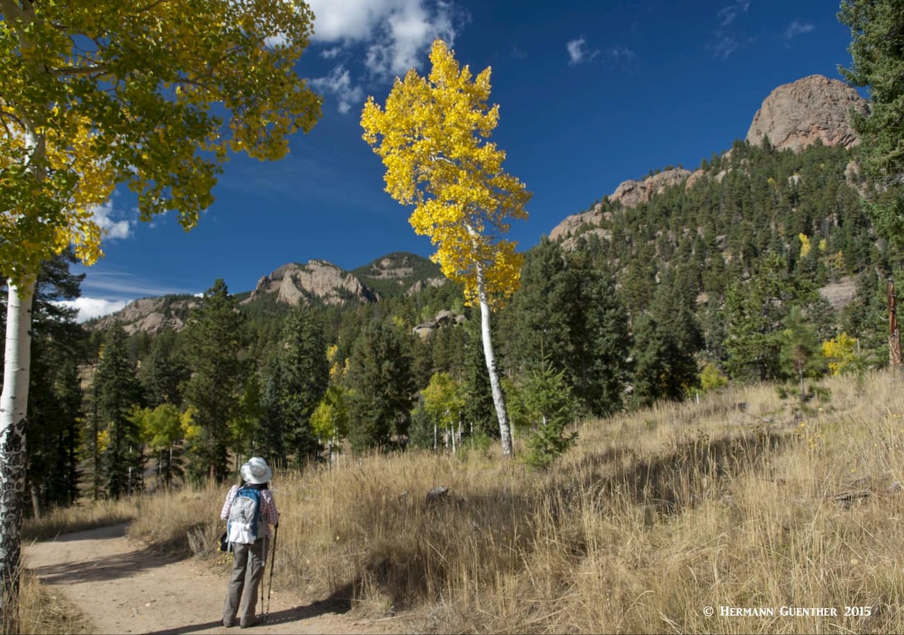
Let’s talk about a few of these parks. The PeakVisor library has articles about some of them, so we will refer you to those articles instead of revisiting them here. Those include: Mount Falcon Park, Deer Creek Canyon Park and Alderfer/Three Sisters Park. Instead, we will focus on some that may not even have a named mountain within their boundaries. This does certainly not mean that they don’t have rugged, and even mountainous, terrain. Some can really test your endurance and stamina as my wife and I have experienced over the years and many miles of hiking in them. Since we live in Jefferson County, most of our off-season (meaning late fall, winter and early spring) takes place in these Open Space Parks. As a result, we know them intimately, having hiked all the trails in most of them – many times. There are just a few where we have never hiked – mostly those in the flatlands east of the mountains. Since we live practically right in the center of the county, we can reach almost all of them within a 30-minute drive.
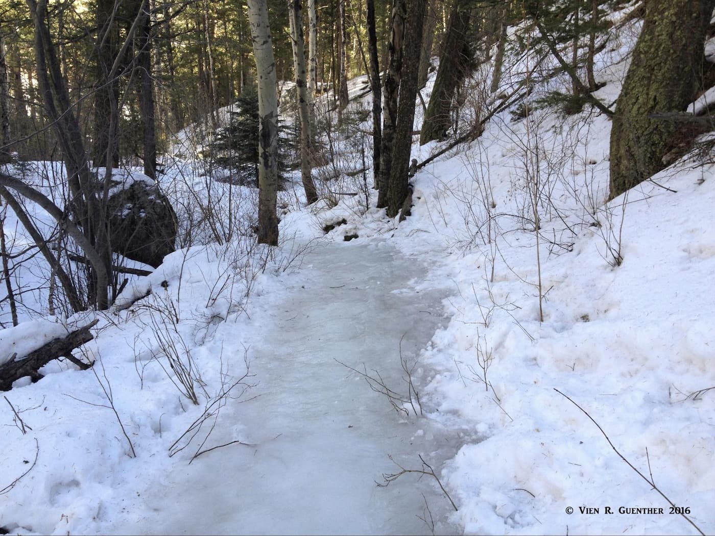
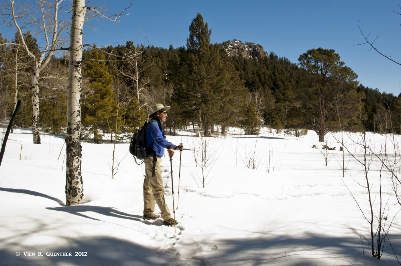
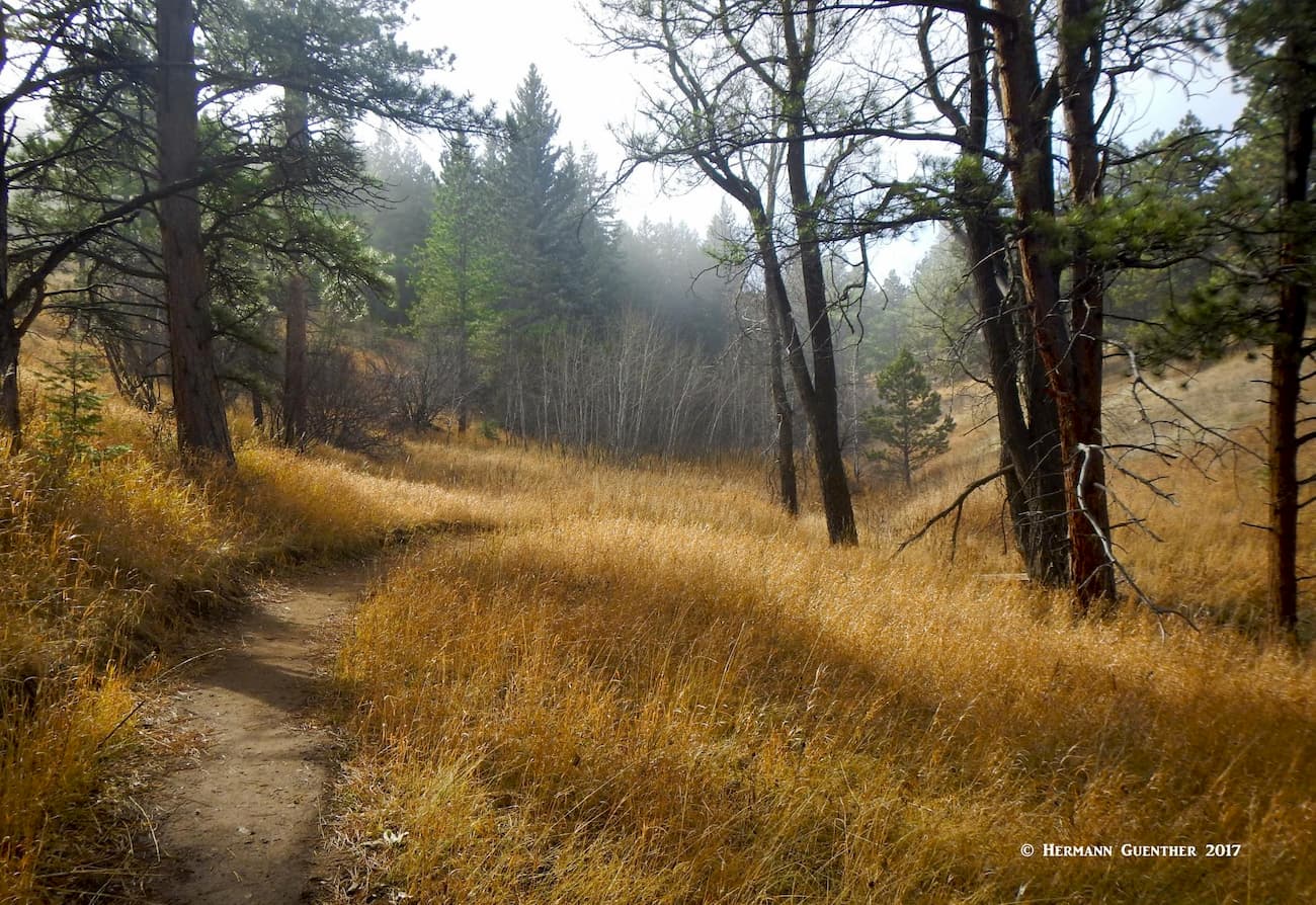
Reynolds Park – This relatively small park is one of the three southernmost parks in the county. It is one of our favorites, especially in the winter. Many times, when we arrive in the main parking lot, there will be no other cars there – this park clearly gets a lot less visitors than some of the others, including the three referenced above. Just south of the town of Conifer along a good paved road, this park has trails on both sides of the highway, those on the east side being multi-use whereas the trails on the west side, the main part of the park, are for hikers and equestrians only. We have hiked the trails on both sides, always starting on the east side and then finishing on the west. In the winter, the Oxen Draw Trail can be a real challenge since it is often completely covered with ice. It is virtually impossible to get through this part without traction devices (spikes).
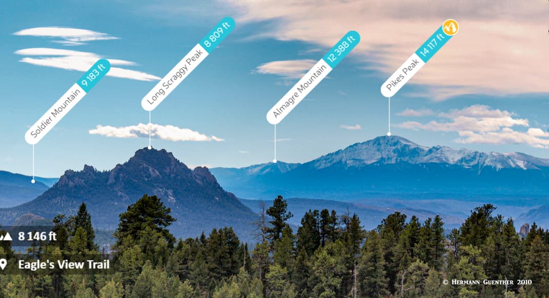
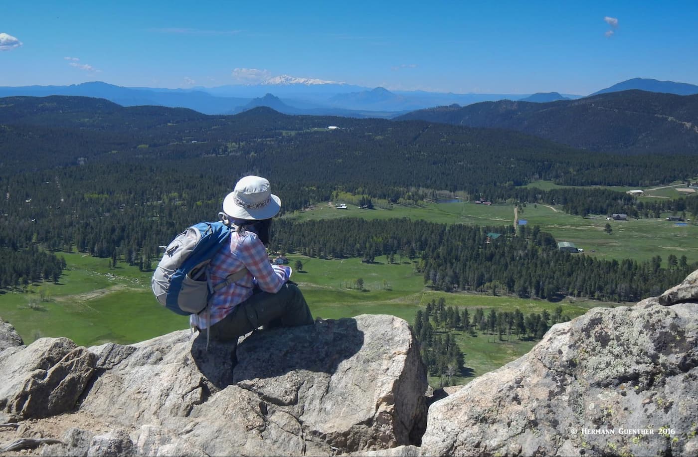
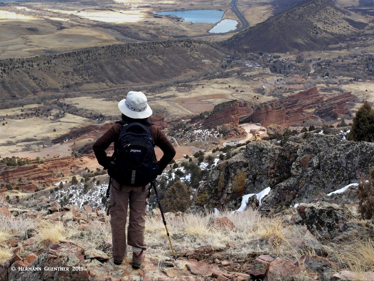
Our favorite trail is the Eagle’s View Trail. As the name implies, the upper part of this trail offers the best views in the entire park. From here you will see a 180-degree panorama to the south, with a commanding view of the Cathedral Spires, another Open Space Park that is almost exclusively used by climbers. It offers probably the best climbing in the county. But aside from that, the fantastic view extends all the way to Long Scraggly Peak and to Pikes Peak beyond, which dominates the southern horizon. This is one of only two Open Space parks that allows camping, though we have never tried that here.
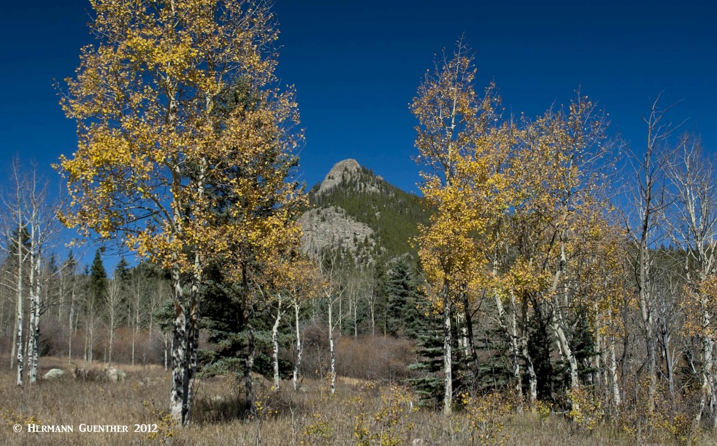
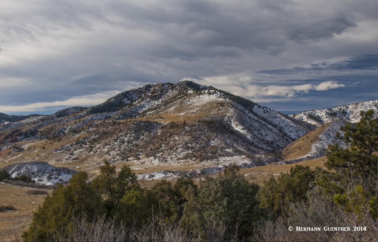
Meyer Ranch Park – This small park situated right beside U.S. Highway 285 outside the town of Conifer may have only 4 miles of trails, but we hike there often. The main attraction in this park is the 9,075-foot Legault Mountain. Located inside the park near its southeastern corner, this delightful summit has no designated trail by which to reach it, but the common route to the top is fairly obvious. I have been told that the county has plans to build an official trail to the summit, but until they do, we continue to climb this peak while enjoying the almost total absence of other hikers. As of this writing, I have climbed it 34 times. Easy to do when it is only a 15-minute drive from home.
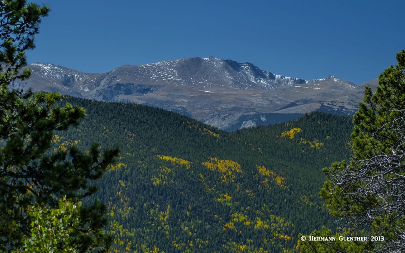
Most times we go up there, we are the only ones there, something that is sure to change if the trail ever gets built. We are in no hurry to see that done. The views from up there are stunning – you can see all the way from Pikes Peak in the south to Longs Peak in the north. In between, the western sky is dominated by Mount Evans and almost the entire northern Front Range, including the Indian Peaks, are readily visible from here. This hike can easily be done in a half day, since the total trail distance is about 6.5 miles. We usually take our time and have our lunch at the top.
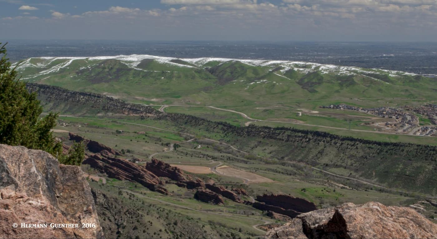
Matthews/Winters Park – The 2,461-acre park has some unique characteristics. Technically located within the boundaries of the city of Golden, this park lies between the huge mass of Mount Morrison and the well-defined ridge known as the “Hogback” or Dakota Ridge. In this area this long ridge is also known as Dinosaur Ridge, so-called because of the dinosaur tracks imprinted on the eastern slope of this ridge. This alone is a popular tourist attraction in its own right with its visitor center. One of the park’s trails, the Dakota Ridge Trail, runs along the top of this ridge, the southern half of which is reserved for bikes only. The view from this trail toward Mount Morrison is impressive.
Another attribute which makes this park attractive is that its trails connect with the trails of Red Rocks Park and the famous amphitheater. So it is possible to do some very enjoyable hikes of varying lengths. One trail even connects the Dakota Ridge Trail to the trails of nearby William F. Hayden Green Mountain Park, which is owned by the city of Lakewood. This park is the closest hiking venue to our house. We can actually walk to the trailhead – but we don’t.
Elk Meadow Park and Bergen Peak – In the mountain town of Evergreen, you will find aptly-named Elk Meadow Park, the most likely place in the Open Space System where you can view large herds of elk (Wapiti) at certain times, but probably not when you are hiking in the middle of the day. The park has 14 miles of trails, but the ultimate trail experience here is the 5-mile somewhat strenuous hike to the 9,708-foot Bergen Peak. The latter is outside of the Open Space park in the adjoining Denver Mountain Parks property. The views from the top are mostly toward the east and south, although a fine view of Mount Evans in the west can be had if you know where to find it.
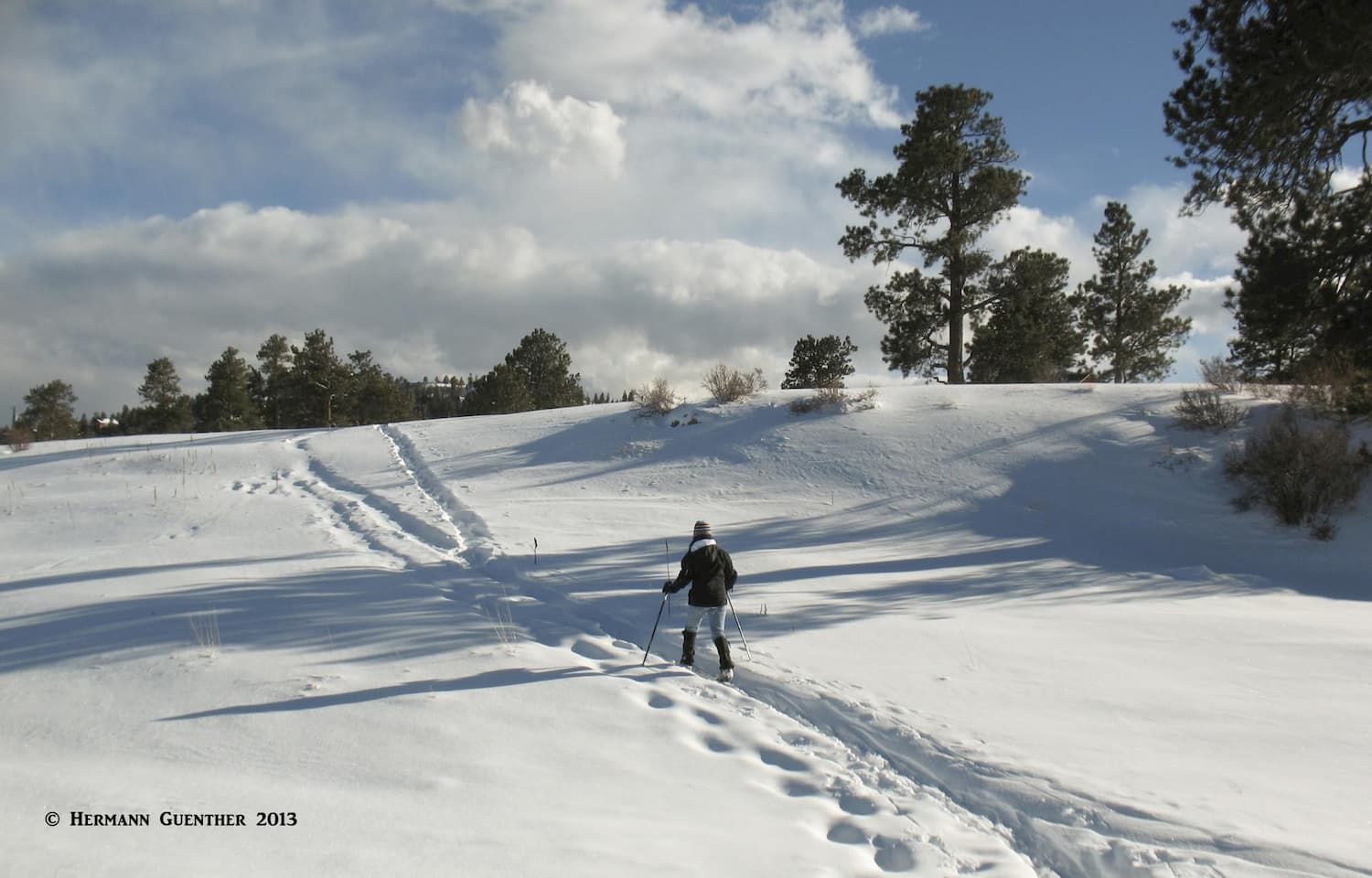
The trails leading to the mountain are jointly managed by Jefferson County, Denver Mountain Parks and the Colorado Parks and Wildlife Division (since hunting is allowed here). A round-trip hike to the summit can vary from less than 10 miles to more than 12 miles depending on which trailhead and trails you choose to use. I have hiked to the top dozens of times. A common trail combination is to go up via the Bergen Peak Trail, then on the way down, divert via the Too Long Trail (it is long and has too many switchbacks!) and finally return to the trailhead by the Meadow-View Trail, which follows along the edge of the forest on gentle grades. The lower part of this park offers some fine cross-country skiing after a fresh snowfall, but before the sun turns the snow into slush.
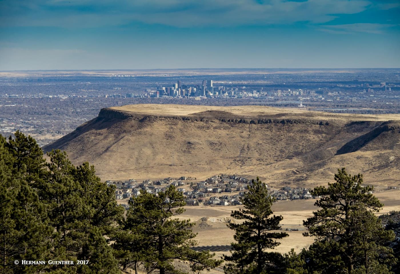
White Ranch Park – This northernmost park in the Open Space System is also the largest and has more than 20 miles of trails. I have hiked over 600 miles in this park alone. The park, located at the edge of the city of Golden, is very popular, especially on weekends, although on a winter weekday you can have the place almost to yourself. There is a huge selection of trails and combinations from which to choose, but on most of my hikes there, I will one way or another end up at the highest point, which is called Belcher Hill. It is simply a flat, wooded summit with no views in any direction. But the park does offer some fine views toward the east including the Denver skyline and the two expansive mesas right in Golden, especially from the Belcher Hill Trail.
The park’s trails cross both gentle as well as rugged terrain, and are as widely used by bikers as by hikers. There are two campgrounds in the park as well as several large picnic areas. The park has two trailheads – one in Golden which is the lowest point in the park, and one near the summit of Belcher Hill, which can be reached via a good road from the Golden Gate Canyon Road. Both trailheads have ample parking. By the upper trailhead, there is an interesting collection of old farm implements – this park was after all a cattle ranch at one time. All trails except one are multi-use designated, with the one being restricted to bikers only. The first 1.3 miles of trail from the lower trailhead passes through private property, so users are expected to exercise appropriate respect.
This rugged mountain can be seen from much of the southwestern Denver area. It stands as a huge sentinel overlooking the towns of Morrison and Lakewood. When I sit at my desk writing these articles, I just have to turn my head to look out of the window and there it is. On clear days, looking through my binoculars, I can see climbers on its summit. I say climbers, because this monster is a climb indeed. My wife and I have climbed it (me several times) and we can vouch for the fact that this is a tough hike. There is no designated trail on this mountain, but there are several known routes. The summit has several communications towers, which are serviced via a road that climbs to the top from the west. But that is not how we want to climb this mountain.
Needless to say, the view from the top extends in all directions of the compass. That may be why a certain John Brisben Walker conceived a coup to build an incline railway, or funicular, to the top for tourists to enjoy what is considered to be one of the most spectacular views in the Front Range. (This was the same guy that also had visions of a summer “White House” for the presidents of the United States (see Mount Falcon Park). The railway was completed in 1909, but as it competed with the new novelty of the automobile, tourist interest waned and the railway was hauled away as scrap metal in the late 1920s. Visitors today can still see the scar on the side of the mountain left by the tracks and there are a few artifacts and pieces of equipment found at the top. But the view is still awesome. One even gets a birds' eye view down into the famous Red Rocks Amphitheater from part of the trail.
OK, let’s be up front about this one. You can drive to the top of this one on an interesting paved road, park at the top in a large parking lot, visit a museum about Buffalo Bill, spend a few dollars in a typical gift shop – and enjoy one of the finest views in the entire Denver area. You can also hike to the top from the town of Golden down below, right at the foot of Lookout Mountain. I have never had the urge to make that hike – there are many better hikes around, and it is so much easier to drive up. And we only do that when we want to impress our out-of-state visitors. And those that come from the flatlands are duly impressed. Not only do you see most of the Denver area, you can even see the largest single brewery in the world – tucked in between two big flat-topped mountains.
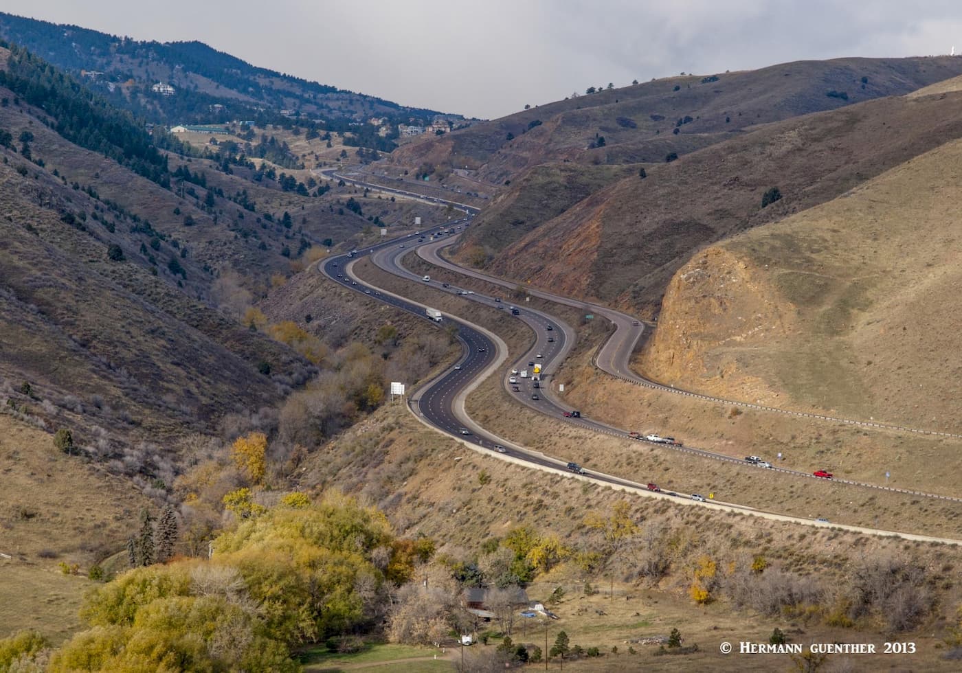
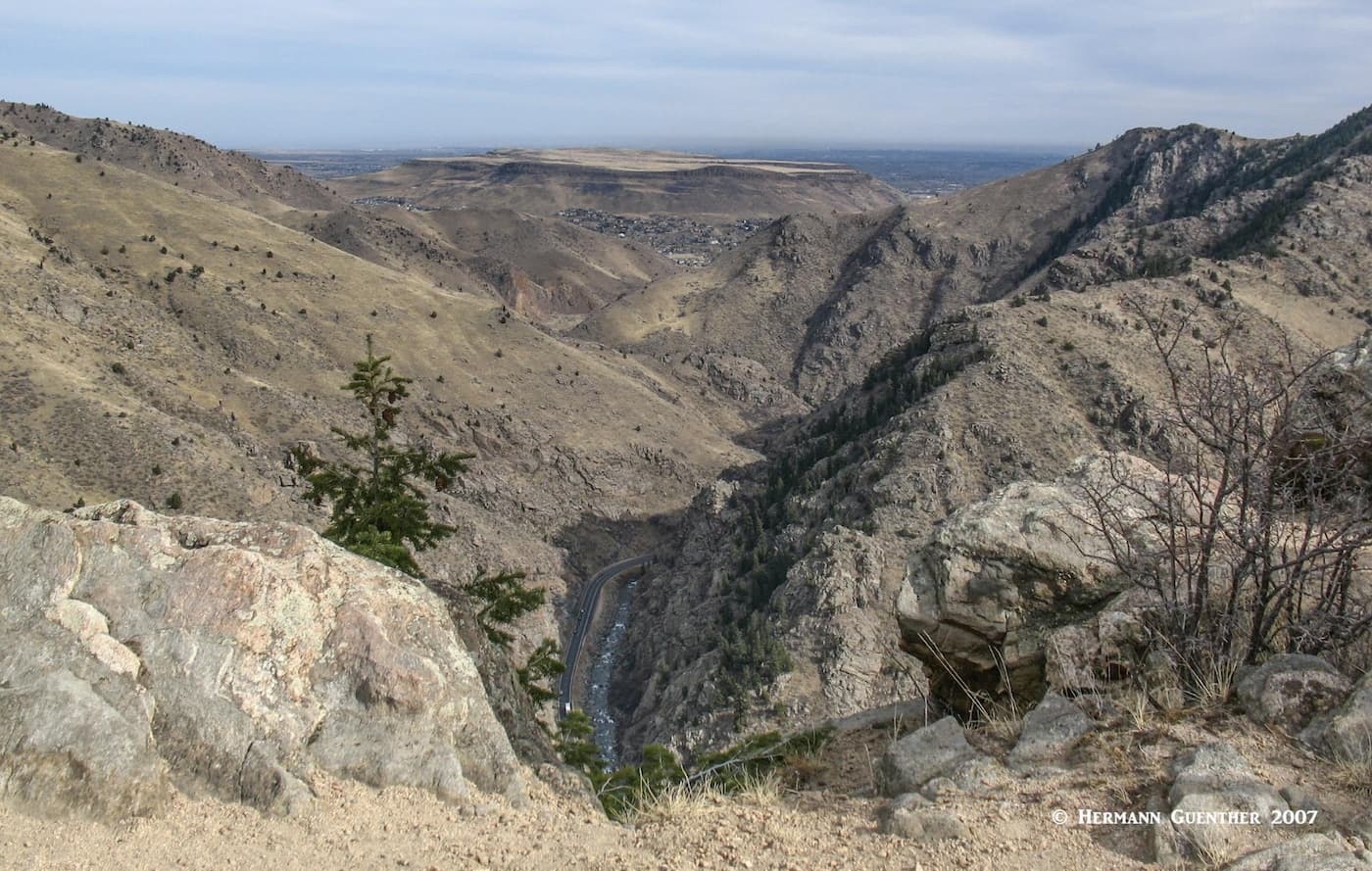
There are some good hiking trails though. The Beaverbrook Trail, which starts at the Windy Saddle Trailhead partway up the mountain, is almost seven miles long – one way. If you want to hike this entire trail – and back again – expect a tough hike involving 3,300 feet of total elevation gain, even though the net elevation difference between the high and low points is only about 1,100 feet. Lots of up and down. We have hiked part of this trail, which affords some fine views down into Clear Creek Canyon.
With much of Jefferson County encompassing part of the greater Denver metropolitan area, it is logical to assume that all of the amenities a visitor could possibly want are available here. We will not elaborate on that since there are unlimited resources from which to get all the information a visitor could ever want. Instead, we want to point out those towns that are more relevant to the feeling of Jefferson County and some of what makes it unique.
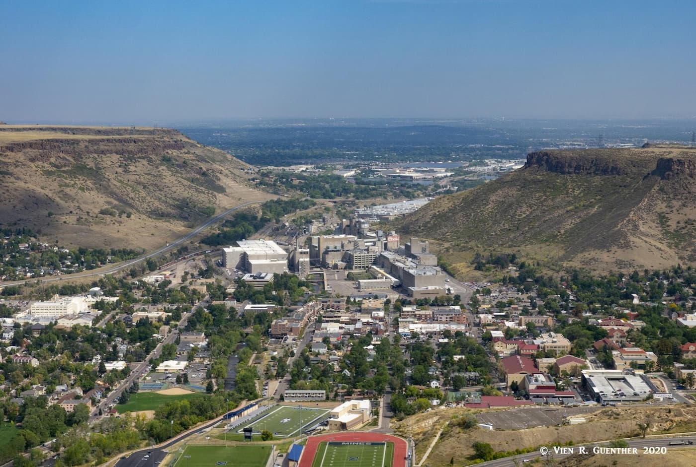
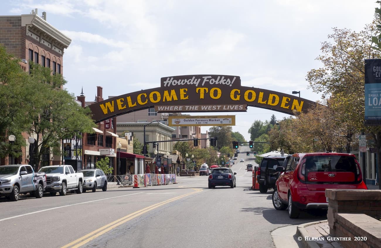
This historic town is the county seat and has an interesting and colorful history. Situated on Clear Creek at the foot of the Front Range, Golden was founded during the Pike’s Peak Gold Rush on June 16, 1859. The town is home to the excellent Colorado School of Mines which offers programs in engineering and science. If one wants to become a mining engineer, this would not be a bad place to undertake your studies. The famous western showman, William F. Cody (better known as Buffalo Bill) is buried on nearby Lookout Mountain. The Coors Brewery, located in the Clear Creek Valley between North Table Mountain and South Table Mountain, is the largest single-site brewery in the world. Visitors must take a tour – and sample some of the goods as well.
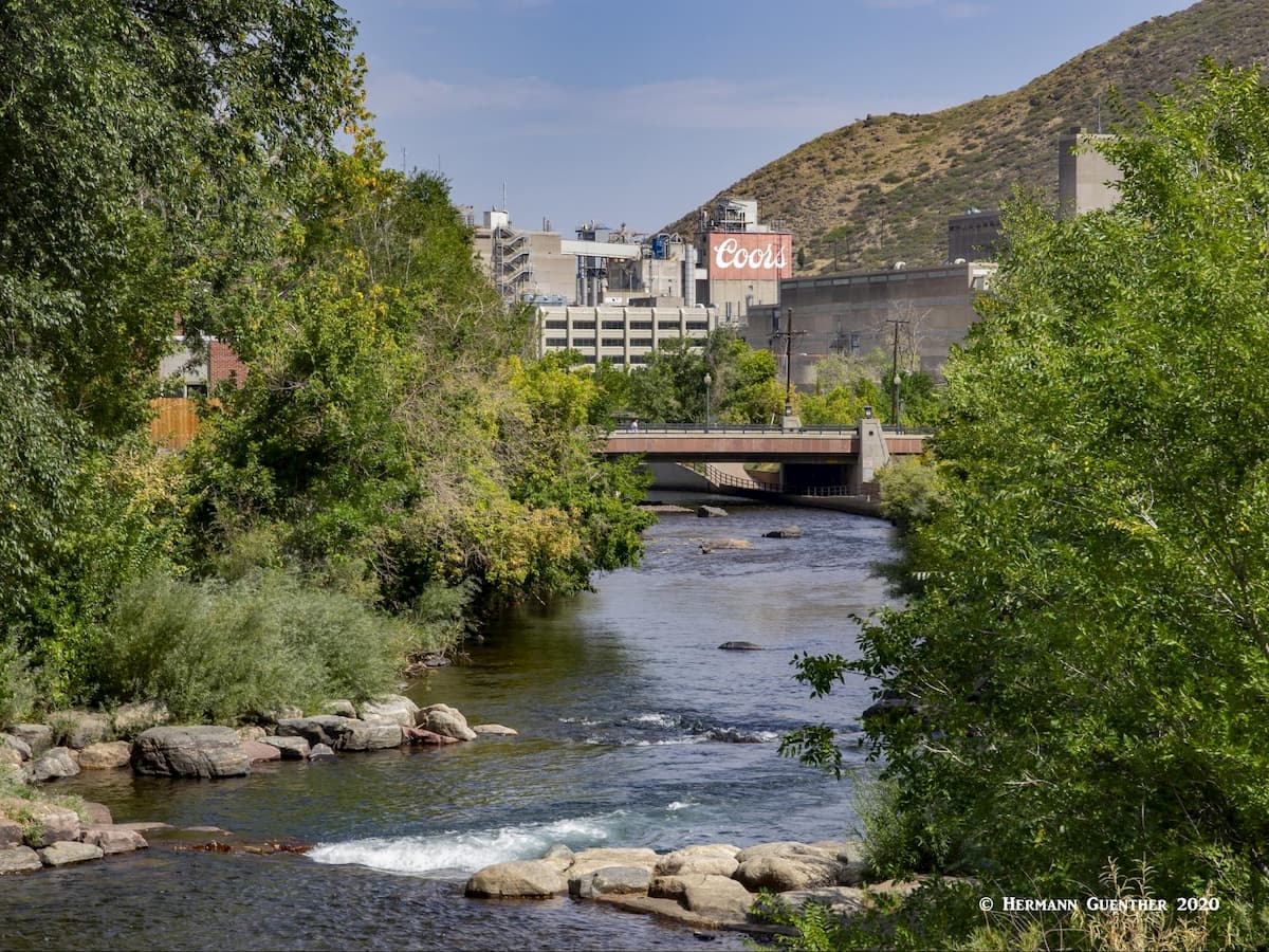
The historic center of Golden is a charming place to spend a couple of hours. Its setting at the foot of South Table Mountain, with Lookout Mountain on the opposite side of downtown, is one of the finest in the entire Front Range, just minutes from downtown Denver. Walk along the waterfront park developed around the sparkling Clear Creek and you will be transported to another world that seems far from the bustling metropolis of which it is a part. And appropriately, the American Mountaineering Center is located here. Its museum is the first and only one in the nation dedicated to mountaineering history. The town has no shortage of places to eat and drink, but accommodations are better found in nearby Lakewood.
What you might want to do, if you are new to the area, is to visit the quaint, small town of Morrison – the old historic part. It has really only two streets – Highway 74 (Morrison Road) and Highway 8. Morrison Road has a number of shops, boutiques, restaurants and bars. The latter are popular hangouts for the locals – especially the historic Morrison Inn, a Mexican restaurant that prides itself on its award-winning margaritas. Make sure you have a designated driver if you plan to indulge. The small Morrison Police Department are always on the prowl for perpetrators. And sober or not, don’t ever let yourself creep even remotely above the speed limit. You will be caught. For a small town, they sure have a lot of cops.
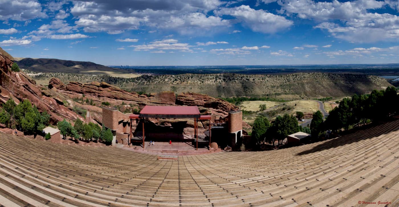
Morrison is also the home of Red Rocks Park and Amphitheater, which are entirely owned by the City of Denver despite their location in Morrison. This park has many hiking trails of its own, but climbing any of the rock formations is strictly prohibited. The amphitheater is worth visiting not just for concerts, which are usually at night, but also for simply gawking at this magnificent facility. It is usually open to the public free of charge when there is no event going on. The view from the upper back rows across the city toward downtown Denver is dramatic – day or night.
In addition, under the upper plaza is a museum, restaurant, gift shop (naturally!) and a lecture hall/theater which presents a film about the history of Red Rocks. The museum has a unique display that lists all of the celebrities that have performed here, by year, since the very beginning of the amphitheater – 1906. The Beatles performed here on August 26, 1964, and seats were $6.60. It was not sold out! Ringo Starr later recalled that they had to have occasional hits from oxygen canisters because of the thin air in Morrison. But it’s not just pop and rock stars that have performed here – this is also a venue for classical performances and other more benign music. We saw Yanni perform live here – that was a treat!