Scan the QR code and open PeakVisor on your phone
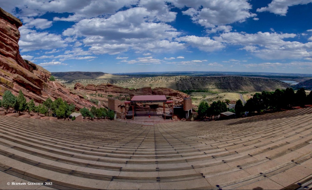
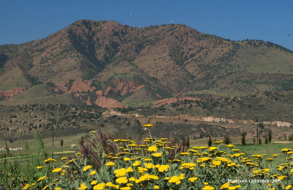
Red Rocks Park is a suburban park located in the foothills of the Rocky Mountains just west of Denver, Colorado. The park is owned by the City and County of Denver but is actually located in unincorporated Jefferson County. It is perhaps best known for the natural amphitheater carved into the side of Mount Morrison, the highest and most prominent mountain in the park. In addition, there are two other named mountains, but these are tall rock formations on either side of the amphitheater and climbing on them is prohibited.
The majority of visitors to Red Rocks Park come here for sightseeing, specifically the magnificent red sandstone rock formations, and to attend one or more of the many concerts that are performed in the world-famous amphitheater. The natural acoustic characteristics of this amphitheater have attracted untold numbers of famous performers – if you have heard of them, they have probably performed here sometime in their careers since the opening of the modern amphitheater in 1941. But even prior to the construction of the facility we see today, there have been musical performances since the earliest years of the 20th century. The acoustics were provided by nature, but the stage and seating amenities were Spartan in those early days.
It was these natural acoustics that prompted city officials to authorize construction of the amphitheater. With a seating capacity of 9,525, you would think that there would always be seats available, but that’s not so. Major performers will sell out weeks and months in advance. If the seats were stretched out in a straight line, they would reach 2.5 miles. But if you are not going to a concert, the entire park is open to the public free of charge (but only until 2:00 p.m. for non-ticket-holders on days when events are scheduled in the evening). That includes visiting the amphitheater, the attached Red Rocks Visitor Center and Hall of Fame, and of course hiking the many trails or using the picnic sites. There is a restaurant in the visitor center (where you do, however, pay for your food) as well as a gift shop (of course). Separate from the amphitheater is a trading post (just another gift shop).
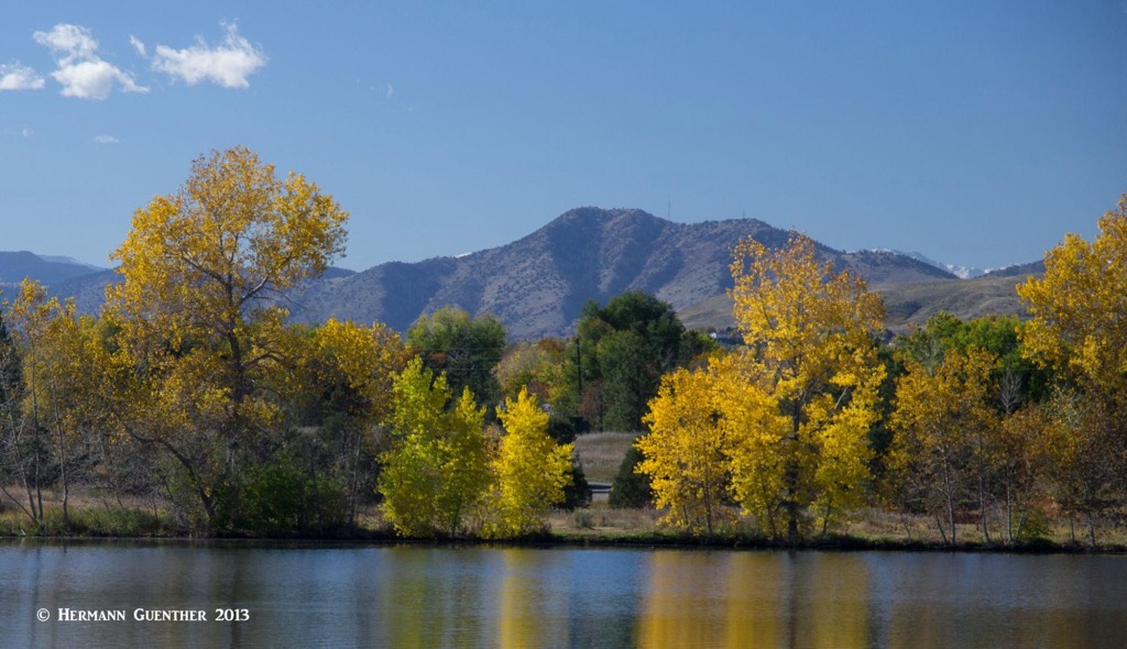
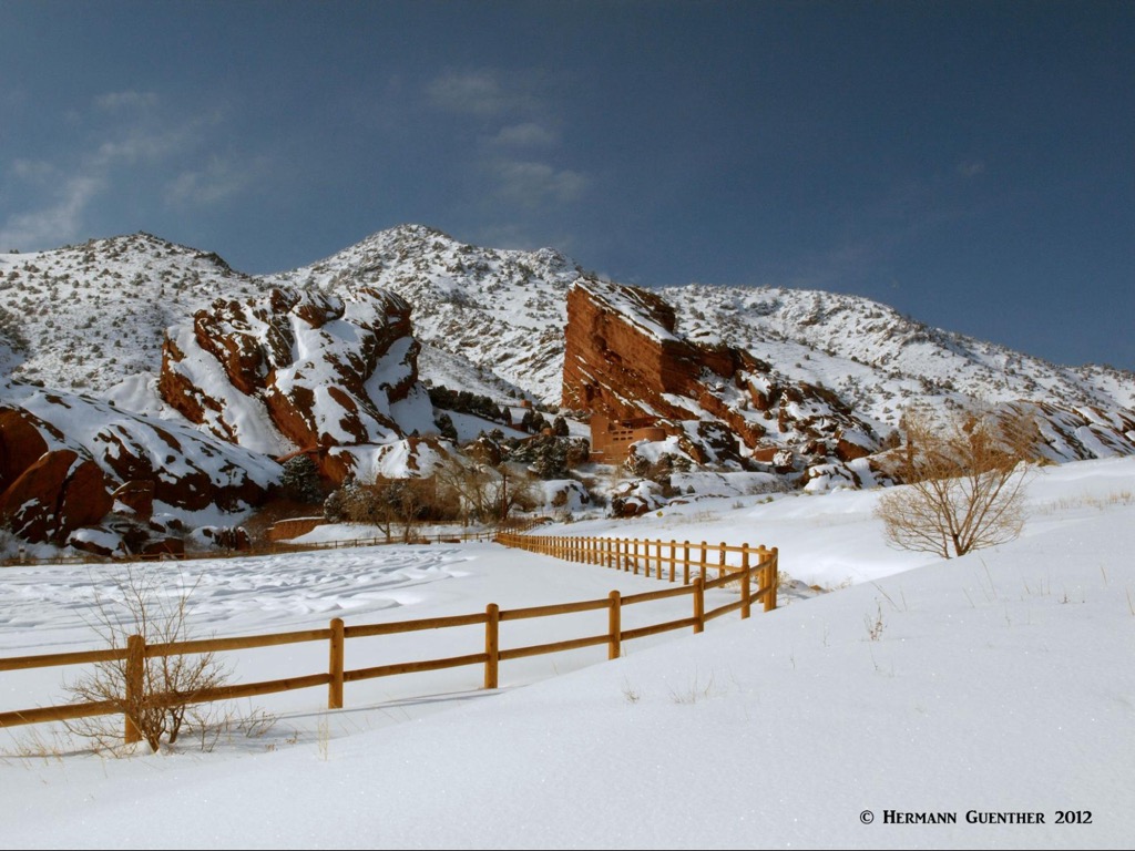
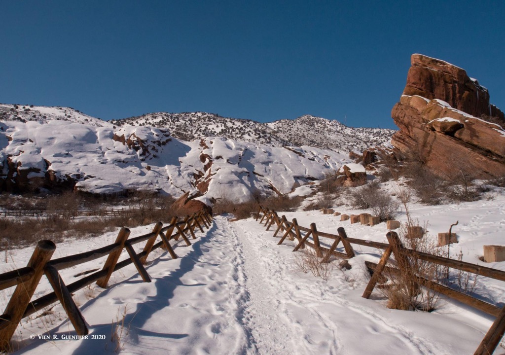
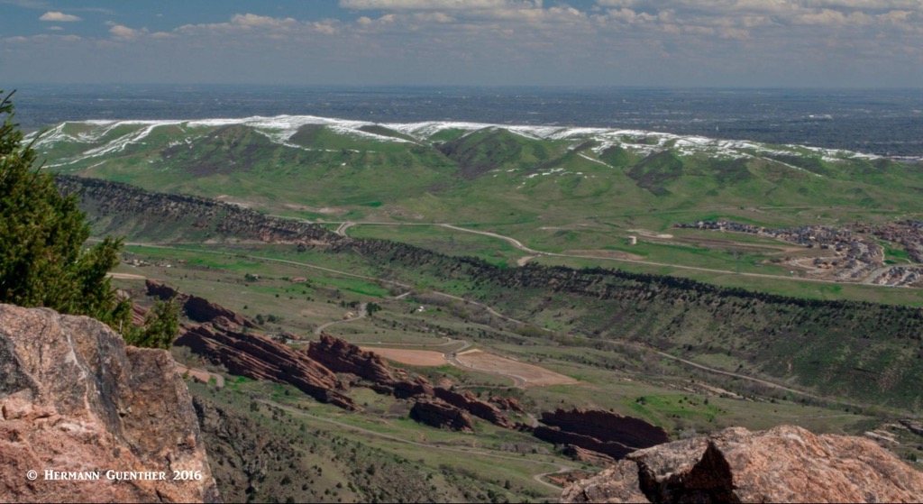
Having lived for many years just three miles from the park (on particularly loud or noisy concerts, we could hear them from our house), we have been there often, sometimes just to walk around and enjoy the quiet beauty of the place. Just after a big snowstorm, this place becomes a winter wonderland. We have hiked in and through the park many times over the years. And it seems that whenever we had visitors from out of state or from abroad even, this was always a place to take them. Everyone we have introduced to Red Rocks was especially impressed with standing behind the uppermost row of seats and just looking out across the amphitheater to the Great Plains to the east, even seeing the skyscrapers of Denver in the distance.
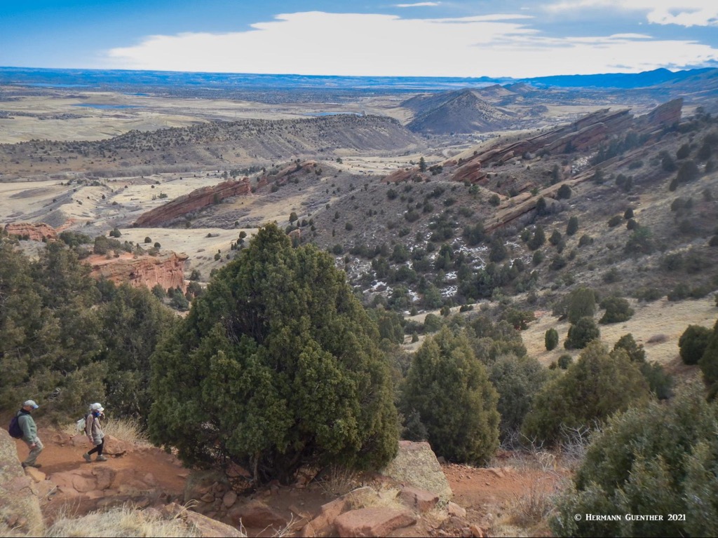
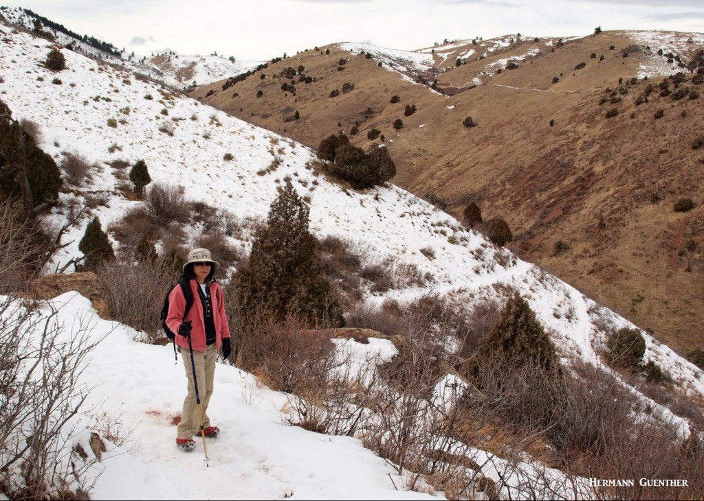
There are a number of trails in Red Rocks Park, some suitable for the entire family and others a bit more challenging. Several of these trails connect with the trail system of adjacent Matthews-Winters Park, which is part of the Jefferson County Open Space parks network. So, while the trails entirely within the park are generally short and easy, it is possible to create your own hike of considerable length and difficulty. Here we look at a few of the best hiking tours that can be accomplished in and across this wonderful park. These are all hikes that I and my wife have done while we lived in the area. We love hiking here in winter especially, though finding the exact locations of some of the trails can be a little challenging right after a heavy snow, while others are pretty obvious. But that’s all part of the fun.
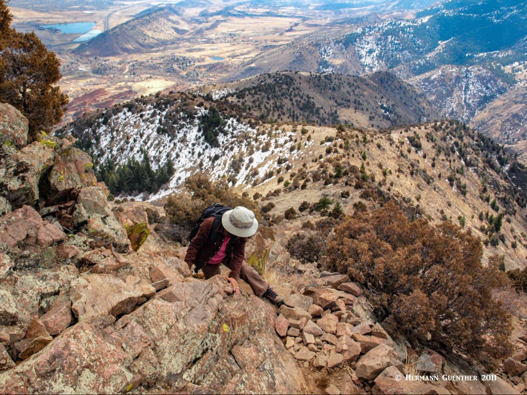
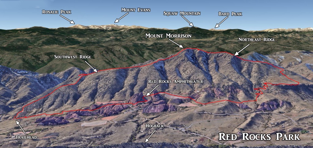
Let’s start with the most difficult, Mount Morrison, the monarch of Red Rocks Park (at least that is what I call it). This one deserves lots of attention. Interestingly, this very prominent mountain, especially as it is viewed from the east, has no official designated trails. But there are several known, and well-used, routes to the top, some of which can be combined to turn a hike into an interesting and challenging loop. The most popular route starts right at the beginning of the Red Rocks Entrance No. 4 in Morrison, just off State Highway 74. There is limited parking here and if there is an event scheduled in the amphitheater, the gate might be closed. But I have seen people park outside the gate and just walk a few yards to the “trailhead” which is within the park, as is the summit of Mount Morrison. Whether the closure of the park during events means that this hike is off-limits is questionable since almost the entire length of the trail is in Jefferson County Open Space.
The trail follows the southeast ridge of the mountain all the way to the top. The first part is exceedingly steep and not very pleasant due to deep ruts and loose gravel. It is no fun to go up this part, and even less fun to come down. But as you gain elevation, the trail becomes more enjoyable and has some segments that are a relief for the legs and lungs. The views to the east improve with each step, and eventually open up to glimpses to the west. As the trail follows the ridgeline, you will soon see your goal, the summit. But the best part of the trail is still to come – the summit cone. Here the hike becomes a real scramble such that sure-footedness is essential. You will need to use your hands here – just make sure you don’t reach for something you can’t see. There are rattlesnakes up here from spring until autumn.
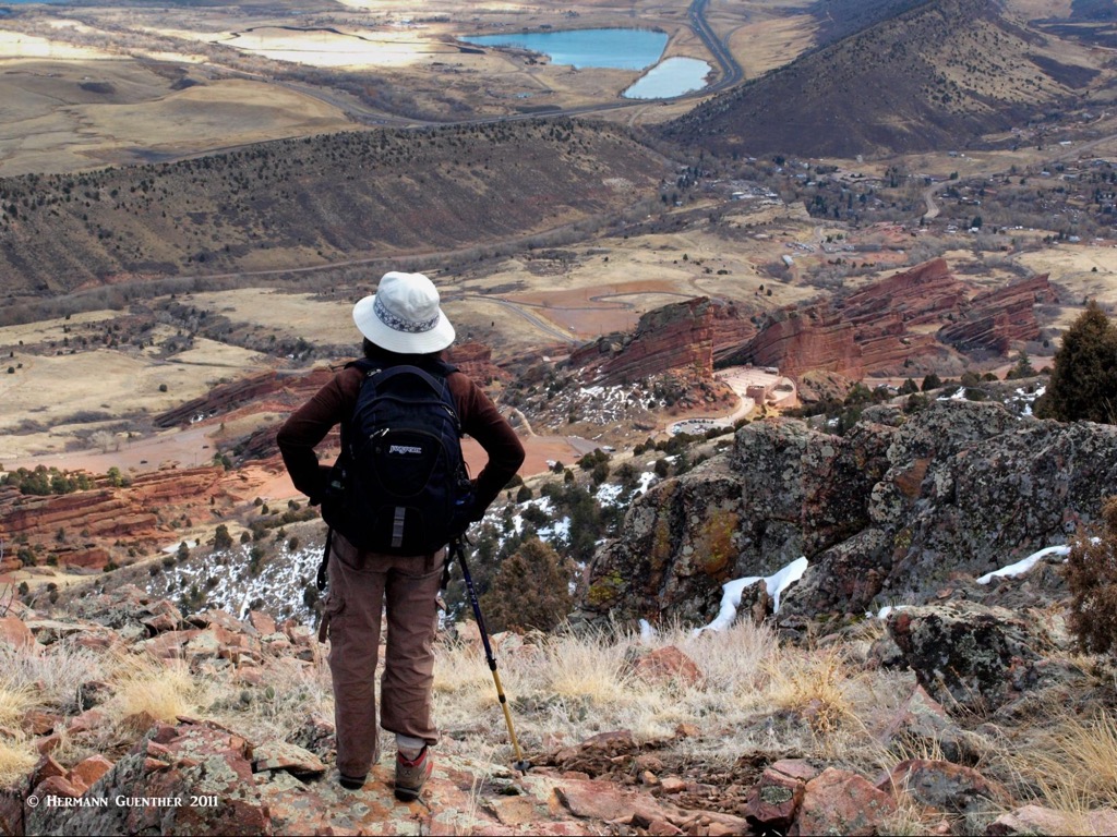
When you get to the top, enjoy the 360-degree views. Almost 2,000 below, you will be looking right at the amphitheater, an impressive sight from up here. To the east, the entire metropolitan area of Denver is spread out before you. To the north, south and west, you will see nothing but mountains, including at least three fourteeners. When you look around your surroundings on the top you may find some relics of an old funicular railroad that had been built to the summit back in 1909. It was not a success so it was hauled away as scrap metal in the 1920s. So, find a rock to sit on and have your snack or sandwich, and realize that you have just hiked only two miles for all that effort. Now you have to decide if you want to go back the way you came (I have done that a few times) or take a longer and more pleasant descent route, which I have also done (as has my wife). I’ll tell you a way you can turn this into a nice six-mile loop.
Look toward the north and you will see a second, but lower, summit that has some communication towers on it. These are not the overwhelming ones you can see on some mountains, but they are here for a function. So when you are ready to go onward, head for the second, lower summit and then continue more or less along the northeast ridge of the mountain. Your route will be fairly obvious although you may have to deviate around some obstructive boulders or cliffs that you should avoid. As the ridge peters out and the eastern slope of the mountain becomes less steep, just head down toward a large plateau or mesa, at the far edge of which you should see an obvious hiking trail. Go for it and when you get there turn right and follow that trail (the Morrison Slide Trail) toward the south. Fine views along the edge of the escarpment. You are not in Red Rocks Park here. The trail then loses a bit of elevation over several long switchbacks after which it once again enters the park, at which point its name changes to Red Rocks Trail (what else, you ask). From here, you simply follow various park trails (even hike through the amphitheater if you like) until you get back to your car. The most punishing part of this hike is the first half-mile. (See my actual GPS track overlain on Google Earth below.)
This classic hike will take you through a variety of interesting terrain including Red Rocks Park, Jefferson County Open Space parks and along a unique geologic feature called the Hogback. Let’s talk about the last one first. Viewed from the air (or in the PeakVisor app in 3-D view), this formation, also called the Dakota Hogback, is a long, narrow sharp-edged ridge running for many miles along the Front Range. It runs straight north to south from southern Wyoming to northern New Mexico. The Hogback is most prominently seen as the first line of foothills along the edge of the Great Plains, which it separates from the eastern fringe of the Rocky Mountains. It is particularly well-defined in the southwestern part of the Denver metropolitan area, which includes the areas adjacent to Red Rocks Park, where it is often referred to as Dinosaur Ridge since it contains a significant collection of dinosaur tracks imprinted on the eastern face of the ridge, visible to anyone that can take a short walk on a paved path.
There are a number of places where this hike can be started and ended, several within Red Rocks Park. Since it involves several ups and downs along the way, I prefer to start this hike at its lowest elevation so that I get most of the climbing out of the way in the earlier stages of the hike, although I have started it at some of the other trailheads. I will describe the hike from this trailhead, which is just inside Red Rocks Park at the Entrance No. 2. Just off County Road 93 (also known as the Hog Back Road). At the side of the entrance road, appropriately named Red Rocks Park Road, is a small parking lot for just 12 cars – it is not heavily used. I like to do this hike in the counterclockwise direction because it just seems easier – you reach the high point of the hike by following intermittent ups and downs instead of one continuous uphill slog going clockwise.
From the parking lot, you start by gradually climbing to the crest of the Hogback, from which point you follow it (the Dakota Ridge Trail) to the north for over two miles. This part of the hike is in South and North Dinosaur Park, which is technically part of Matthews-Winters Open Space Park. After descending the ridge and crossing the Hog Back Road, the trail continues into the main trailhead in the park, where there is a large parking lot (which frequently overflows on peak days. This is where the Red Rocks Trail begins; it meanders over open grasslands for a mile to a junction. You can continue on the left branch, or opt to take the right branch, which becomes the amazing Morrison Slide Trail. This ascends steeply over a number of switchbacks until it reaches a mesa which it follows the edge of for a half mile. This is a nice place to stop and enjoy the view, although it can get quite windy here at times. The trail then descends in a series of switchbacks, at the bottom of which it merges with the Red Rocks Trail again. This you then follow the rest of the way back to your starting point. This is a moderate 7-mile hike that will take you over some amazing terrain. Expect to see mountain bikers on this loop.
There are several other trails entirely within Red Rocks Park and these can be combined into hikes of variable lengths. In the middle of the park is a trading post (i.e. gift shop) from where it is possible to make several loop hikes, which can be combined into longer ones. These would all be considered easy walks over gentle rolling terrain – suitable for families with children. The Trading Post Trail is a loop only 1.5 miles long; it can be combined with the Mount Vernon Creek Trail, another loop of equal length for a hike of between three and five miles depending on which trailhead you plan to start from. Still an easy hike.
It is possible to climb Mount Morrison from this main trailhead. This involves taking the Red Rocks Trail to the Morrison Slide Trail junction. From this point you take the latter up through the switchbacks onto the mesa mentioned earlier. At that point you have to leave the trail and head for the northeast ridge of Mount Morrison, which you then follow the best way you can until you reach the summit. You then return the same way – more or less. The difficult part of this hike involves off-trail hiking. Whether or not this is allowed is open to debate; I have done it and did not get into trouble. Nevertheless, this is one of the recognized routes to climb this tough chunk of rock. As an aside, please note that parking and entry to Matthews-Winters Park, as for all Jefferson County Open Space parks, is free to all visitors. No residency requirements.
Being strategically situated at the western end of metropolitan Denver means that tourist infrastructure is abundant and available in the city as well as in most suburban towns. Visitors will have no problems finding places to stay or eat – the choices, even fairly close to Red Rocks Park, are endless and prices will be all over the map. In other words, there is something for everybody. So we will not talk about Denver here, it is adequately discussed in many of our other articles in the PeakVisor library. But there are two towns near the park that deserve attention since they can easily be visited in conjunction with a visit to the park. They are charming, historic and situated in scenic mountain settings.
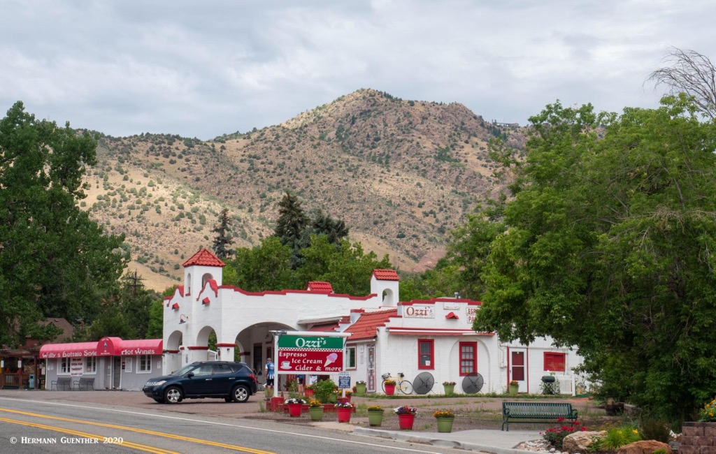
I strongly recommend, if you are new to the area, to visit this quaint, small town – the old historic part. It has really only two streets – Highway 74 (Morrison Road) and Highway 8. Morrison Road has a number of shops, boutiques, restaurants and bars. The latter are popular hangouts for the locals – especially the historic Morrison Inn, a Mexican restaurant that prides itself on its award-winning margaritas. Make sure you have a designated driver if you plan to indulge. The small Morrison Police Department are always on the prowl for perpetrators. And sober or not, don’t ever let yourself creep even remotely above the speed limit. You will be caught. For a small town, they sure have a lot of cops. The entrances into Red Rocks Park are basically either right in town or just outside the town limits – no more than a two-minute drive. If you are going to Red Rocks, you would have to try very hard to avoid seeing Morrison. No matter where you are in town, Mount Morrison will likely dominate the view.
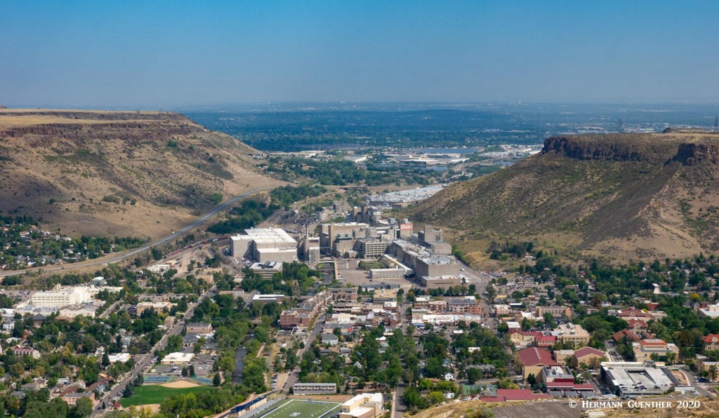
Just a few miles to the north of Red Rocks Park, six mile or 10 minutes, is the delightful town of Golden, the seat of Jefferson County. It is a charming place to spend a couple of hours. Its setting at the foot of South Table Mountain, with Lookout Mountain on the opposite side of downtown, is one of the finest in the entire Front Range, just minutes from downtown Denver. Walk along the waterfront park developed around the sparkling Clear Creek and you will be transported to another world that seems far from the bustling metropolis of which it is a part. And appropriately, the American Mountaineering Center is located here. Its museum is the first and only one in the nation dedicated to mountaineering history. While there is no shortage of places to eat or drink, accommodations are somewhat scarce here – better to find a place to stay in Denver or its western suburbs.
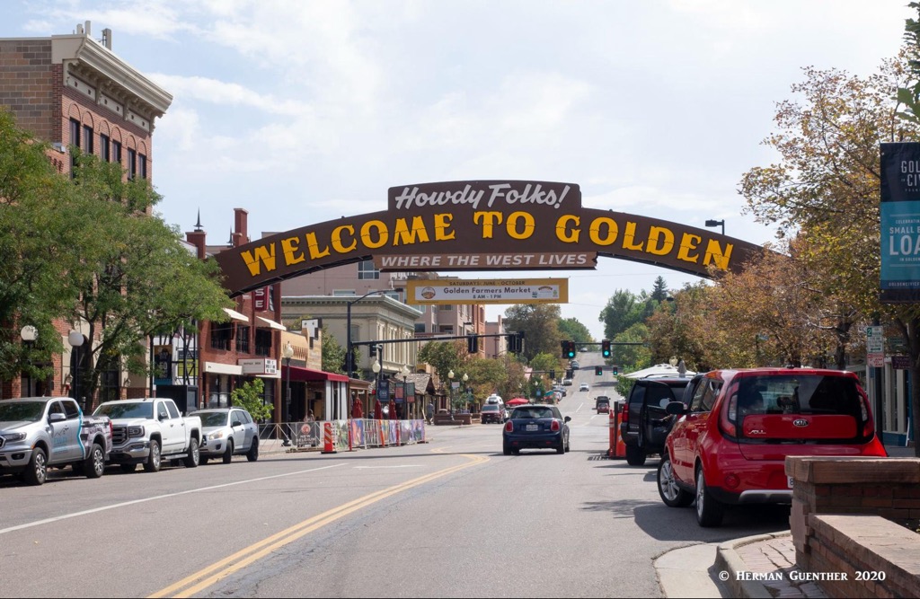
Situated on Clear Creek at the foot of the Front Range, Golden was founded during the Pike’s Peak Gold Rush on June 16, 1859. The town is home to the excellent Colorado School of Mines which offers programs in engineering and science. If one wants to become a mining engineer, this would not be a bad place to undertake your studies. The famous western showman, William F. Cody (better known as Buffalo Bill) is buried on nearby Lookout Mountain. The Coors Brewery, located in the Clear Creek Valley between North Table Mountain and South Table Mountain, is the largest single-site brewery in the world. Visitors must take a tour – and sample some of the goods as well.