
Scan the QR code and open PeakVisor on your phone
One of 64 counties in the state of Colorado, Park County is about as close to the geographical center of the state as it is possible to get. In fact, the state’s official geographical center is in Park County, about 30 miles northwest of Pikes Peak. The county has an area of 2,211 square miles and a population of 18,845 as of the 2019 estimate and is included in the Denver-Aurora-Lakewood Metropolitan Statistical Area. It is one of the original 17 counties created in the Territory of Colorado and is named after the large geographical region known as South Park – an immense flat area at an elevation of just above 9,000 feet average. The county seat is the small town of Fairplay, which has a population of only 787 inhabitants. The only other town is the even smaller Alma with a grand total of 313 souls. So where are all the people? Well, there are a number of small unincorporated communities scattered around the county as well as ranches and farms where people make their homes.
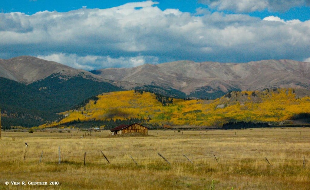
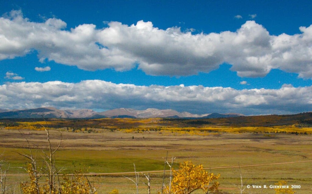
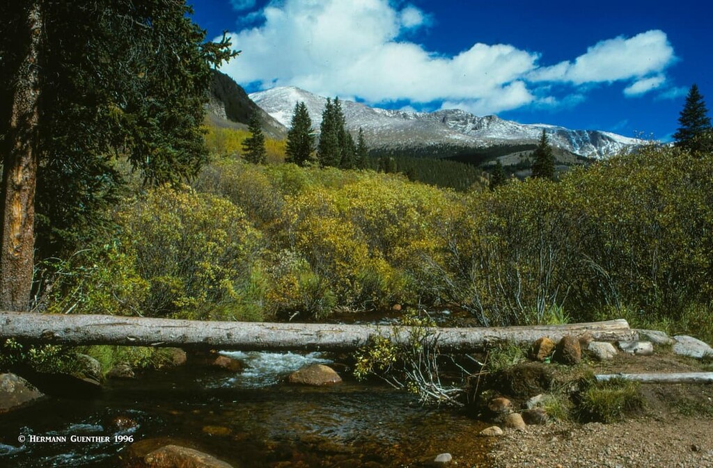
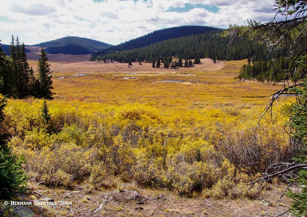
The South Park area is essentially a large valley surrounded by mountains, the highest ones located at the western boundary of the county. In Colorado, there are several such valleys, which are called “parks”. These are mostly treeless expanses of grasslands that are typically used for grazing and limited farming. An interesting way to see this place for the first time is to drive south from the Denver area on U.S Highway 285 - as you emerge on the top of Kenosha Pass, you will get an amazing view of much of this valley with the stunning backdrop of the Mosquito Range on its western edge, which includes five fourteeners. The county has 136 named mountains, with Mount Lincoln the highest and most prominent.
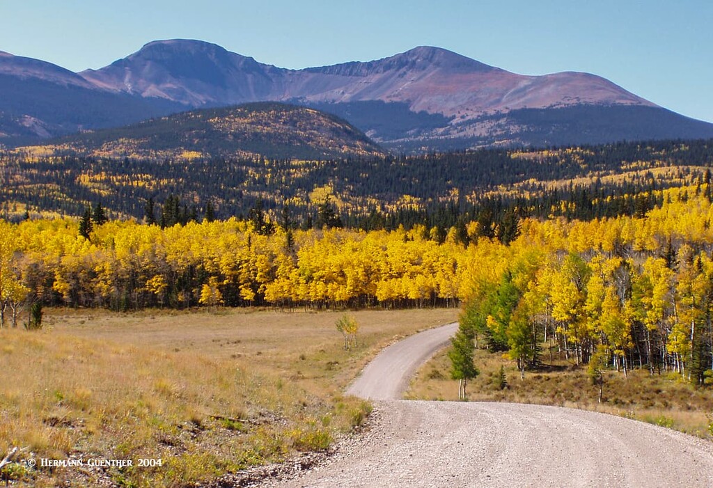
With a mean elevation of 9,572 feet, Park County is the ninth-highest county in the United States. This means mountains, despite the fact that South Park – the huge flat valley in the center of the county – is anything but mountainous. But the surrounding peaks beckon with their many opportunities for hiking and climbing. But there is more to this beautiful county than mountains. There are parts of two national forests (Pike National Forest and San Isabel National Forest) and three designated wilderness areas (Mount Evans, Buffalo Peaks and Lost Creek). Visitors will also find three state parks (Eleven Mile, Spinney Mountain and Staunton) and a number of scenic byways and long-distance trails, including parts of the Colorado Trail and the Continental Divide National Scenic Trail.
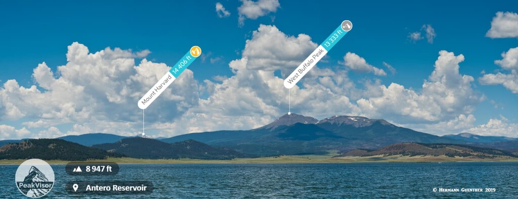
For those who are fishing addicts, Park County offers perhaps some of the finest fishing venues in the Colorado Rockies. Three large reservoirs (Antero, Spinney Mountain and Eleven Mile), all in South Park, are perennial favorites for catching large trout. Avid anglers even brave the winter cold here just to catch trophy trout. Yes, this place gets frightfully cold when the wind whips across the treeless terrain – yet they are out there ice-fishing. Of course many of them have small huts or tent shelters on the ice, which gets mighty thick here in winter. Then there is some fine river fishing to be found here – the South Platte River is renowned for its Gold Medal waters.
But for those of us that come here for hiking, there is plenty from which to choose. The western boundary of the county is framed by a high wall of mountains known as the Mosquito Range. This is where you will find five fourteeners as well as many other high peaks exceeding 13,000 feet in elevation. Most of the Mosquito Range is not in a wilderness area since there is lots of private property along with active mining claims. But that doesn’t detract from the appeal of these mountains – they are among the most popular in Colorado. At the southern end of the range is the pristine Buffalo Peaks Wilderness, which extends into adjacent Chaffee County and the San Isabel National Forest. This is one of my favorite places to hike in Park County since it is so rarely visited.
The northwestern boundary of the county is defined by the Continental Divide and features a few high peaks over 13,000 feet, but they are not high on the list of popular summits. The northeastern segment is defined by the Kenosha Mountains, the spine of which is largely above the tree line but does not rise much above 12,000 feet in elevation, the highest being the Twin Cones Peaks. Hiking trails are far and few between and this is generally not a very popular hiking area. In my opinion, the long hike to Twin Cones is not very exciting and not worth the effort to make the hike which is mostly in the trees. I have hiked here several times and have rarely seen other hikers. Meanwhile, the southern portion of the county, while very scenic, is defined more by lower forested mountains which are not of major consequence in terms of hiking destinations. So we will confine the following discussion mostly to the north and west sides.
While much of this fine wilderness is in Clear Creek County to the north, some of our favorite hiking places can best be reached from trailheads that are located in Park County, so we want to include them here. The trailheads for two of these hikes are along or just a short distance from the scenic Guanella Pass Road (one of Colorado’s Scenic Byways).
Shelf Lake Trailhead – This moderately strenuous hike to a beautiful lake starts on the Geneva Creek Road just two miles off the Guanella Pass Road. You would be well-advised to have a high-clearance vehicle to drive this short stretch, although I have seen people drive regular passenger cars here. I don’t recommend that – you don’t want to tear the oil pan off the bottom of your engine. The seven-mile round-trip hike to the lake is just awesome – in the summer you will find some of the best displays of wildflowers in the basin below the lake. And once you arrive at the lake, you will be tempted to explore even higher. The view across to Square Top Mountain is stunning.
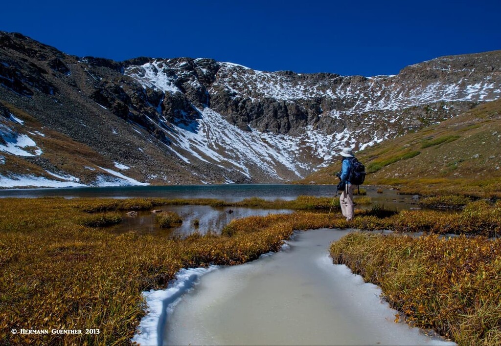
Abyss-Burning Bear Trailhead – The Scott Gomer Trail starts at this trailhead which is right at the side of the Guanella Pass Road about five miles north of the settlement of Grant at U.S. Highway 285. This fine trail goes to Abyss Lake, which lies in a high cirque between Mount Evans and Mount Bierstadt, two popular fourteeners. Be warned, this is a long hike if you want to do it all in one day – almost 18 miles round-trip and 3,300 feet of elevation gain, though it is not a very steep hike. I have chosen to do it that way twice and have learned that making a three-day backpacking trip instead is far more enjoyable and relaxing. There are nice camping spots along the way. About halfway along the trail there is a junction from which you can take a spur up to the summit of Guanella Pass, which lies in Clear Creek County to the north. It is common to see moose along this trail.
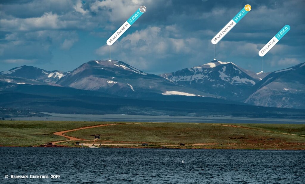
For those who love acronyms or compound names, here is what this means: It refers to a combination hike taking in four of the five fourteeners in Park County – Democrat, Cameron, Lincoln and Bross. Back when I climbed these peaks it wasn’t called that, but then, designations like these had not yet been invented. Well, this place is so popular because it is perhaps the best place in the state to bag four fourteeners in a single hike of only eight miles and a total elevation gain of only 3,267 feet. It is this popularity (and being only two hours from Denver) that has turned this place somewhat controversial. Most of this trail is on private property, including the trailheads. The entire summit of Mount Bross is on private property.
With so many people attempting to attain bragging rights for having done these peaks in one go, confrontations with property owners have become common. Too many hikers feel that it is their right to violate, vandalize and deface the area despite numerous signs indicating private property boundaries. This was not a problem back when I did these hikes in the 1980s – but the population of Colorado has doubled since then, and peak-bagging has boomed, making such conflicts inevitable. If hikers continue to disrespect the landowners’ rights, it is possible that this hike could become permanently off limits. Let’s hope not. It is a great hike regardless of where you start. One note of caution – this entire hike is above the tree line so that exposure to the elements is a major concern. Very high winds are common here and hikers need to be prepared accordingly.
East Access – An old trailhead off County Road 6 (which is a frontage road to State Highway 9) provides the shortest route to the summit of Mount Lincoln. But as of March 31, 2021, the trail has been closed indefinitely since it is private. We just mention this in case you can get permission from the owner(s) to park here, in which case you might be able to use this trail, which is nothing more than an old mining road. This was not a problem in the 1980s and may hopefully be resolved to the benefit of all concerned parties. We don’t recommend trying this unless you have succeeded in gaining permission.
West Access – Because of the access limitation on the east side, and the increased popularity of this hike, this trailhead has become even more overused. The main parking, about six miles from the center of the town of Alma on a rough gravel road, is at Kite Lake (elevation 12,000 feet) where you will have to pay a parking fee – if you can find a spot. Some people park along the road to the lake. Most hikers, if they are planning to do the entire loop, will start with the steep ascent to Mount Democrat, from where they will drop down to the Democrat-Cameron saddle. A steep ascent up the west ridge will put you on top of Cameron (not a ranked fourteener since it does not meet prominence criteria – but it is over 14,000 feet), from where the hike to Mount Lincoln, and the ridge walk to Mount Bross, is very gentle. This hike is then completed with a steep and rocky descent from Mount Bross along its southwest ridge. You don’t want to go up this way, although some people do.
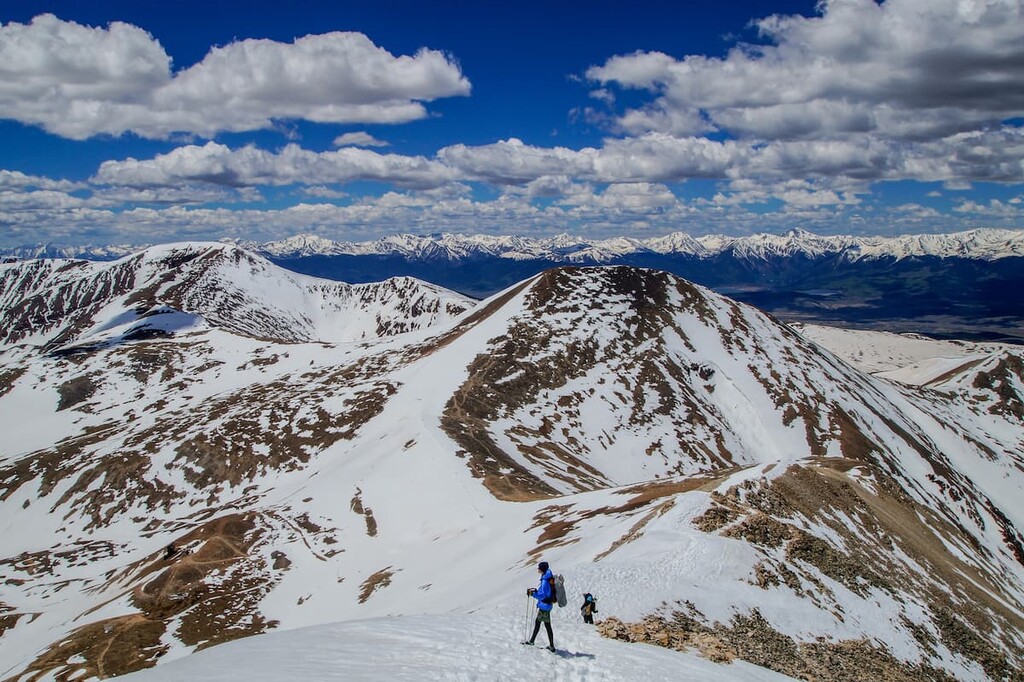
An alternative hike from this same trailhead is to climb to the ridge connecting Loveland Mountain and Mount Buckskin. You can then walk the ridge to each peak with a total elevation gain of about 2,400 feet and a length of less than five miles. The views will be comparable to the other hike since you will reach an elevation of almost 13,900 feet. While you may be on this hike without encountering other hikers, you must be aware of the weather due to extreme exposure.
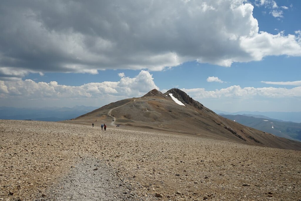
Mount Sherman – Four Mile Creek Trailhead – It is said that Mount Sherman is the easiest fourteener in Colorado. That may be so, but it is still a fourteener. Most people will climb it from the east side from this trailhead, to which you can drive a regular passenger car. If you have a 4WD vehicle with high clearance, you can drive to the actual Mount Sherman Trailhead which is three miles further up the road at an elevation of 12,300 feet. This would leave you with one of the shortest hikes up any fourteener. But it is not only Mount Sherman that you can climb from here, the nearby Mount Sheridan or Horseshoe Mountain are viable destinations as well, with lots less traffic and an opportunity to bag two high thirteeners – either individually or in combination with Mount Sherman. The view from any of these summits is extraordinary, especially toward the Sawatch Range in the west.
Rich Creek Trailhead – If you are looking for a wonderful wilderness hike without encountering hordes of people, here is where you need to be. The Buffalo Peaks Loop, in the wilderness area of the same name, is a 12-mile hike through pristine terrain offering high meadows, beaver ponds, several tumbling creeks and stunning views. This hike is different from many high-country hikes in that you will not be climbing any mountain. Total elevation gain for the entire loop is only a little over 2,000 feet. But the opportunity to see wildlife, fields of wildflowers and very few people is what has made this my favorite hike in Park County. You will not get close to the two Buffalo Peaks, but you will get fine views of them. Autumn is particularly nice here since most of the trail is below tree line, which means you will be hiking through some fine stands of aspen trees whose fall colors will astound you. If you want to climb one or both of the Buffalo Peaks, you will have to go further afield and be prepared to test your skills at route-finding since neither of these two or the other named mountains in this wilderness can be reached by official trails. Either way, you will be rewarded with solitude and great views.
Buffalo Peaks Trailhead – This trailhead is one of the best spots from which to attempt climbing both Buffalo Peaks. It can be reached by driving on Forest Service Road 431, also known as the Buffalo Peaks Road (of course). The road can be reached by driving 15 miles south of Fairplay on US-285. From the intersection it is only eight miles to the unmarked trailhead, which is somewhat obvious since it is at a high point on a small saddle. From here the road continues downhill into the Rough-and-Tumbling Creek drainage. Start your hike here, following old logging roads and doing some old-fashioned bushwhacking. A recommended way to combine both peaks is to aim for the east peak first, then make the traverse to the west peak from which you can follow the gentle north ridge back down to your starting point. Depending on how much you deviate from the most direct path, you should be able to complete this loop hike in less than nine miles with a total elevation gain of around 4,000 feet. Since there are no designated trails here, and given the fact that you will most likely be alone, be sure you are prepared with GPS, maps, etc. and know how to read them. Route-finding skills are advisable and hiking with a companion is a good idea in this remote place.
Fourmile Creek Trailhead– This trailhead is just outside of the Park County boundary just at the edge of the Buffalo Peaks Wilderness. For approaching the wilderness from the south (i.e. from Buena Vista) you need to drive on County Road 371 from Main Street until you get to County Road 375 which you follow for seven miles to the trailhead. This lovely trail follows Fourmile Creek while passing below the southwest slopes of West Buffalo Peak. Once it reaches a drainage divide, the trail enters the Buffalo Meadows area and then continues into the Rough-and-Tumble Creek drainage where it intersects the Buffalo Meadows Loop (see above). For those wanting to climb only the West Buffalo Peak, this would be a viable approach, though the hike would be longer than the alternative approaches from the east. To combine both peaks, which straddle the boundary between Park and Chaffee Counties, from this trail would be a more difficult undertaking.
Let’s be realistic. I mentioned earlier that there are only two towns in Park County and they are very small. Here you can’t expect to find any stylish resorts or even upscale accommodations. For that you will have to venture outside of the county, although we are not talking about great distances, especially by Colorado standards. After all, people who live here often commute to jobs in adjacent counties and think nothing of driving an hour or even lots more in order to get to work. Places such as Breckenridge or Buena Vista are very convenient for those wanting to explore the mountains of Park County though they are just a little bit outside of the county. But let’s be a little more realistic and just focus on a couple of towns that can provide a measure of amenities to those who are not going to be camping, though there are plenty of campgrounds in close proximity to some of the hiking venues we discussed above.
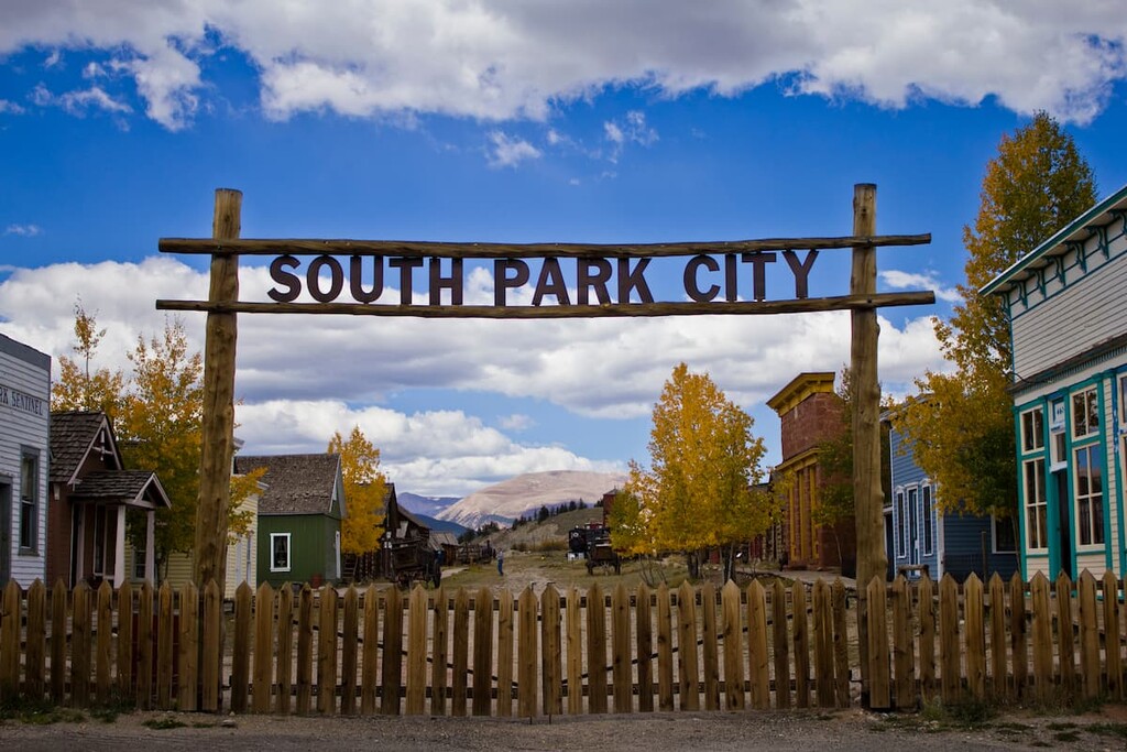
The historic town of Fairplay is the largest town in Park County of which it is also the county seat. Its population in 2019 was 787 and its elevation is 9,953 feet which makes it the fifth-highest incorporated place in Colorado. If exploring the east side of the Buffalo Peaks Wilderness as well as most of the Mosquito Range, this is the closest town where you might want to settle in for a few nights (unless you plan on camping, which is very popular in this area). So if the town is so small, why is it a major town at all? Well, it sits at the crossroads of two major highways (SH-9 and US-285) which makes it very centrally positioned for serving as a base to explore the mountains in this county. The only tourist attraction in the town is the open-air museum called South Park City – a collection of relocated historic structures. Be advised though – tourist amenities are scarce in this tiny town. For that, you need to go to Breckenridge, only 22 miles to the north on SH-9 over Hoosier Pass, or Buena Vista, 38 miles to the south on US-285. When leaving town on US-285, you will get a terrific view of the Buffalo Peaks.
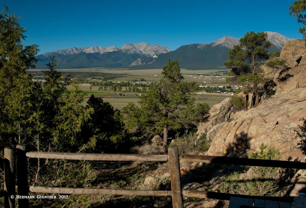
While Buena Vista sits at the southern end of the Mosquito Range, its role in mountain recreation is more oriented toward the Sawatch Range, especially the Collegiate Peaks sub range, than it is toward the Mosquito Range. Yet visitors who prefer to stay in this town can easily access some of the southern expanses of the latter and in fact most of the recreation destinations in Park County. It is located at the junction of two major highways in central Colorado - US-285 and US-24. Therefore, Buena Vista is likely to capture many visitors destined for the southern Mosquito Range, especially the Buffalo Peaks Wilderness. It is a more low-key resort than Breckenridge, for example, yet it offers a range of accommodations and eating establishments. The town can be reached on good roads in just over two hours from Denver.
Park County has no shortage of maintained campgrounds. One might say that they are everywhere. That might be due in part to the fact that there is very little in the way of alternative accommodations in the county except in Fairplay, and even there the availability is marginal. But one must keep in mind that many of these campgrounds close after the peak summer season – sometimes in early September, when you can find some of the finest hiking conditions.


