
Scan the QR code and open PeakVisor on your phone
The City of Lakewood is one of the major suburbs of the greater Denver metropolitan area in Colorado. It is the most populous city in Jefferson County and the 167th most populous city in the United States. The latter statistic might come across as somewhat meaningless in the greater context of what Lakewood has to offer. I lived in Lakewood from 1980 until 2021, so I am somewhat familiar with the place. As of the 2020 census this town had a population of 155,984 inhabitants out of a total of almost 3 million in the entire metro area. The city lies at an average elevation of 5,518 feet and is located entirely in the flatlands east of the foothills of the Rocky Mountains. So one might ask what kind of hiking venues are there in this town. Read on and I shall tell you.
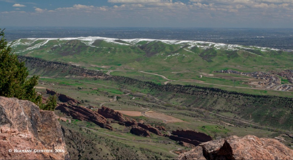
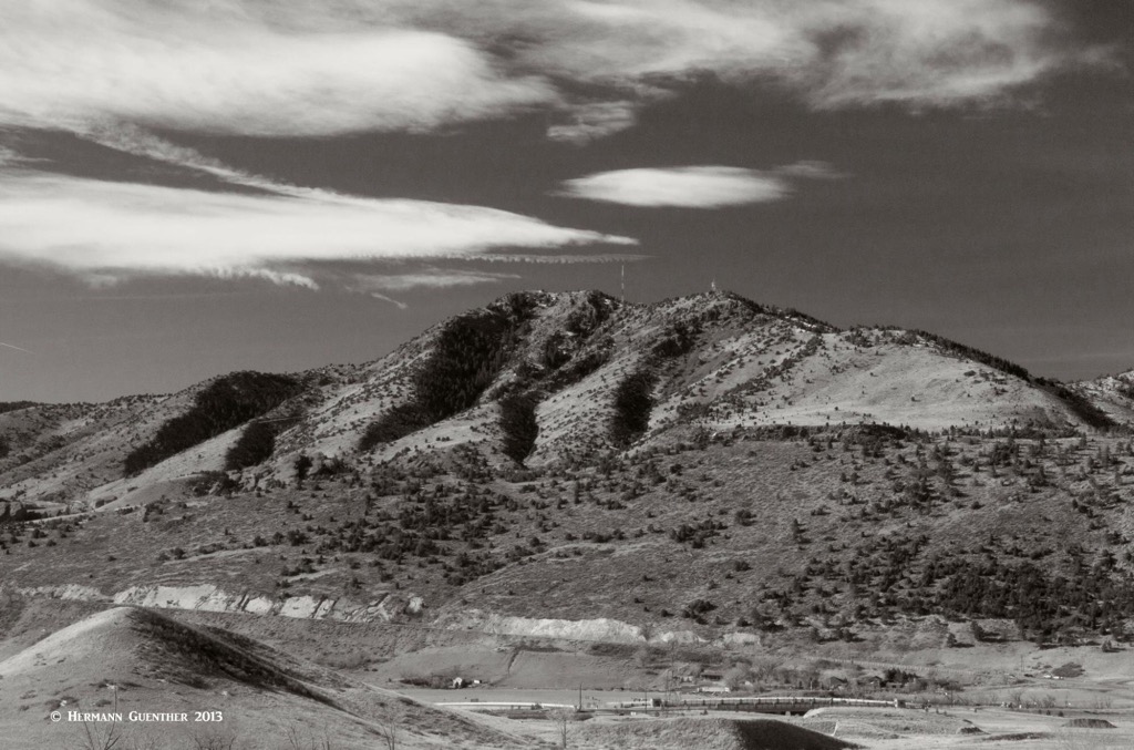
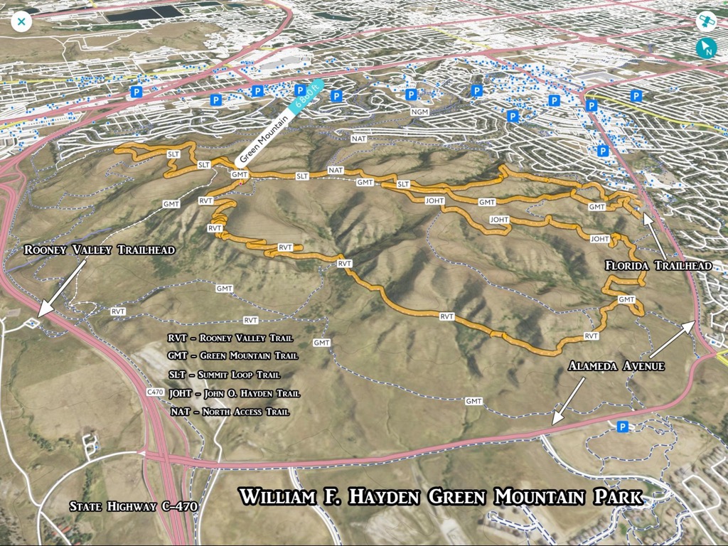
As in any city of significant size, Lakewood has its share of parks – 113 of them totaling 7,200 acres and with a total of 240 miles of trails for hiking, biking, walking and horseback riding. One of the most popular of these parks is the 2,400-acre William Frederick Hayden Green Mountain Park. Now that’s quite a mouthful, so here I will simply call it Green Mountain Park. Only one park in the city is larger (Bear Creek Lake Park – more about that one at another time). The park is dominated by Green Mountain (by no means the only mountain so named in Colorado), which at 6,860 feet is naturally the highest and most prominent point not only in the park but in all of Lakewood as well.
Green Mountain Park came into being in 1972 when a majority of the land was donated by or purchased from the Hayden Family. The land was once part of an open range roamed by native buffalo, but even today the park is home to a diverse array of wildlife, including coyotes, hawks, rattlesnakes, bluebirds, rabbits, mule deer and an occasional mountain lion. Though I have never seen one of the latter, a neighbor of ours has encountered one recently on our street, just two doors from our house, which is only about a half mile from the park. We have however seen a large mule deer trotting along our street - undoubtedly from the park and somehow got lost in the neighborhood streets. Vegetation in Green Mountain Park consists mostly of grasslands and various kinds of dense brush. The mountain itself has several deep ravines, in which can be found some sizable trees. This provides great habitat for wildlife and means that much of the terrain off-trail is inaccessible - I can’t think of any reason one would want to try hiking there. Wildflowers abound here in the spring.
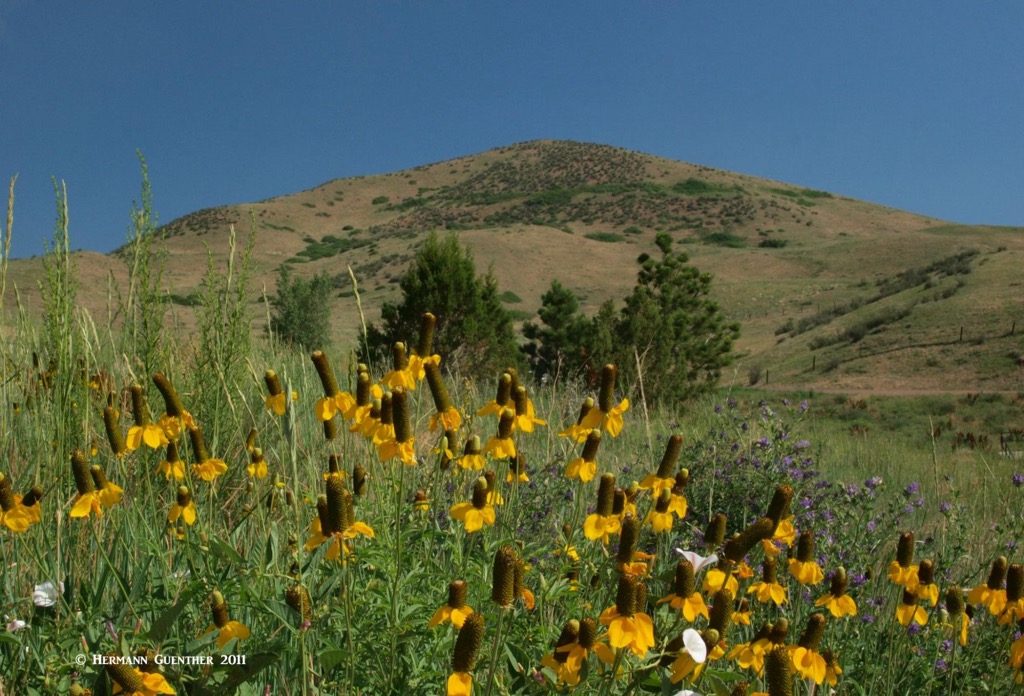
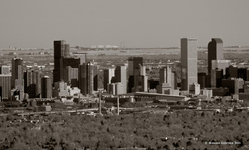
This general lack of trees over most of Green Mountain means that you will not find any shade on any of the trails. Midday in the summers is usually not the best time to go hiking here. And if there are afternoon thunderstorms, which are common, this is definitely not the place to be. And I would not advise wandering off the trail – rattlesnakes love to hang out in the deep grass away from the trails. I know, I had my very first encounter with one here many years ago. But the upside is that the landscape in the park affords excellent views from all parts of all trails. To the east are sprawling views of the metropolitan area while the view toward the west offers a stunning panorama of mountains from the foothills to the Continental Divide. There are at least 50 named mountains that can be seen from here, including three fourteeners. Check it out on PeakVisor. But the one mountain that dominates the view to the west is the impressive Mount Morrison, only three miles away.
There are two major trailheads serving Green Mountain with large parking lots and restroom facilities. A couple of minor trailheads provide very limited parking for a handful of cars, plus there are many neighborhood access points – more than two-thirds of the park is surrounded by residential development. This means that the locals can simply hike from their homes, thus making more parking spaces available for those who have to drive to hike here. On peak days, it is not unusual for the parking lots to run out of available spaces. The primary trailhead is on the west side of the park just beside Rooney Road - the Rooney Valley Trailhead. Several of the major trails converge at this spot, which is easily reached from the State Highway C-470 freeway that runs between Green Mountain and the foothills. The other significant trailhead is the Florida Trailhead on Alameda Avenue on the southeast side of the park, just one mile from where we used to live. All this easy access provides hikers with a wide range of loops and other trail combinations from which to choose. In addition, the western trailhead also provides access to the Matthews-Winters Open Space Park and the Dakota Ridge via the Zorro Trail.
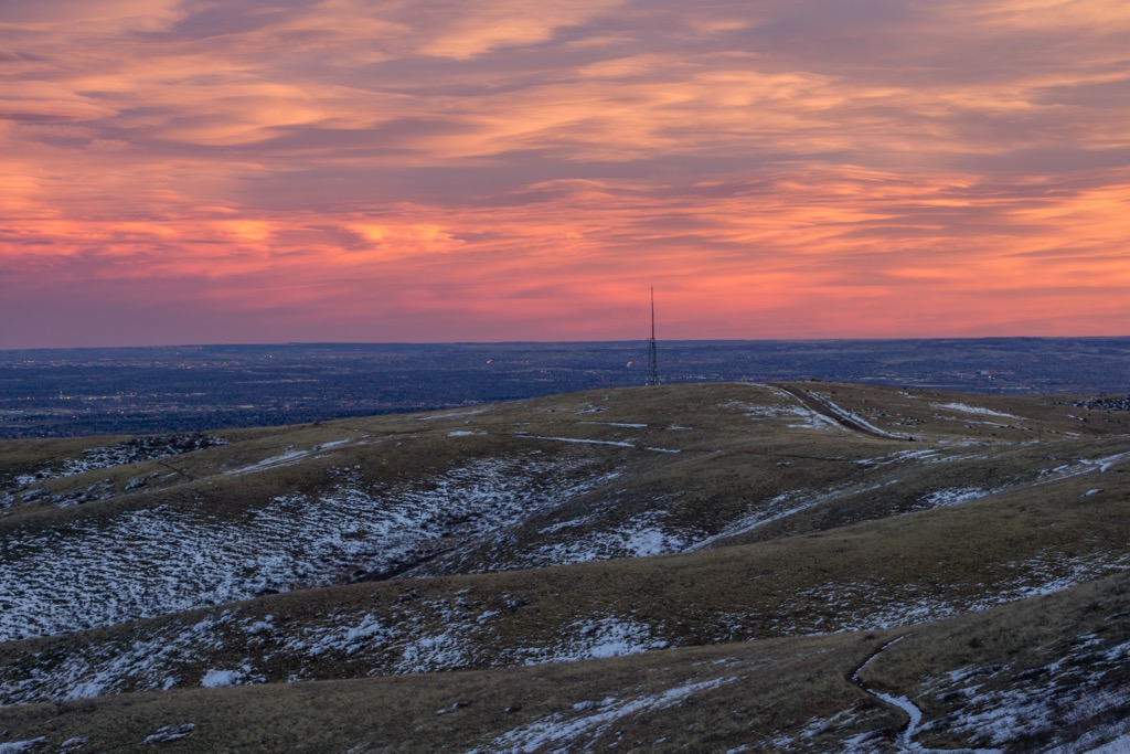
Green Mountain Trail – At 6.6 miles long, this is the longest trail in the park. This loop has access points at both major trailheads – the northern half climbs over the top of Green Mountain and can be challenging for some hikers and especially bikers, while the southern half meanders gently along the base of the park, which is popular with beginner hikers and runners. A portion of this trail follows a steep gravel park service road which is used to access a radio tower on the gentle ridge connection to the summit. This is also the trail that connects to most of the other trails, either directly or via spur connectors. So it goes without saying that there is a large variety of choices one has here to put together a hike of any length without repeating any segment of trail. Having lived nearby, I have hiked all of the trails in different combinations many times, totaling hundreds of miles. The place was after all practically in our front yard.
Rooney Valley Trail – This is perhaps one of my favorite trails in the park. Now be advised, you cannot just hike this trail without combining it with several others in order to experience a complete hike. One end of the trail is at a junction just below the summit of Green Mountain. To get to this end, you have to get to the top first by the Green Mountain Trail (starting at either east or west trailhead) and then the Rooney Valley Connector. The trail then descends the south side of Green Mountain through a number of switchbacks until it reaches a junction. Strangely, it splits into two branches here – one branch goes to the Rooney Valley Trailhead and the other heads in a southeasterly direction until it ends at the Green Mountain Trail. So in effect, the Rooney Valley Trail has three branches that meet at a single point. Assuming you start and end this hike at the Florida Trailhead, this makes a delightful six-mile hike with an elevation gain of only about 1,000 feet.
“A Really Long Loop Hike” – This 11-mile hike involves hiking to the summit of Green Mountain twice and combining six trails. I have done this a number of times because it provides lots of solitude in places and entails all of the views that Green Mountain has to offer. Plus it provides a significant workout. Starting at the east (Florida) trailhead, I first followed an unnamed (although maintained) trail to its junction with the Summit Loop Trail, which I then took until it intersects the Box-o-Rocks Trail. This rugged trail, a favorite for bikers since it is very technical for them, descends to near the west (Rooney Valley) trailhead and its end at the Green Mountain Trail. The reason the Box-o-Rocks is so technical for bikers is that it is covered with lots of loose rocks – not big boulders but little rocks that make good ankle-twisters for hikers. When I reached the Green Mountain Trail, I took it back up to the top, from where I descended again on the Rooney Valley Trail (my favorite) until it again met the Green Mountain Trail, which I took back to my starting point. This is a hike that has over 2,000 feet of elevation gain. The illustration below shows my GPS track of this hike uploaded into PeakVisor 3-D view.
“An Even Longer Hike” – Once, and only once, I completed a hike here of 14 miles with about 2,700 feet of elevation gain. This one encompassed the longest route on Green Mountain and then left the park to ascend from the western trailhead to the Dakota Ridge (also known as the Hogback) which I then followed to both its ends before I returned to my starting point. This hike also required that I hike to the Green Mountain summit twice. Actually, that was not required – I chose to do that and could have easily taken a simpler route back to the trailhead. But I was a lot younger and more adventurous back then. I bring this up simply to illustrate that Green Mountain Park offers the possibility to make some really challenging hikes, within and outside of the park, even though none of the trails here are by themselves difficult.
Green Mountain Park is not what I would call a significant destination on its own merits. It is after all a local city park that is most likely best known by the locals and is not a place that people would drive long distances to visit. I would say that the overwhelming majority of hikers and bikers that come here to recreate are those that live nearby and want easy access to a place where they can get in a quick ride or hike – in many cases even before or after work. I have often seen families with children hiking here on weekends. Certainly, these are all either local residents or perhaps their visitors. But for visitors from out of the area, the proximity to the entire greater Denver area means that all amenities and attractions of a large city are readily available, often only a very short drive away.
I would say that the best local nearby attraction is Red Rocks Park with its towering rock formations and the world-famous amphitheater. This park has its own hiking trails which are interconnected with those of Green Mountain Park via the trails of Matthews-Winters Park. If more strenuous hiking is your preference, the majestic Mount Morrison in Red Rocks Park will not disappoint. So there is no shortage of fun things to do in or immediately adjacent to Green Mountain Park.
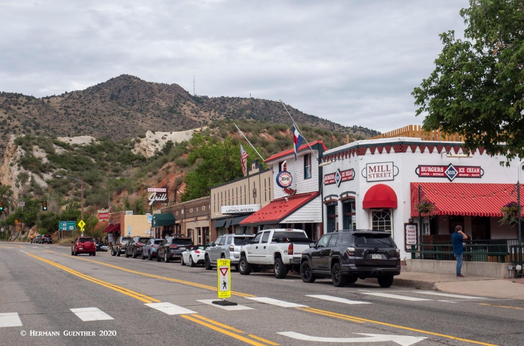
This historic town practically within walking distance of Green Mountain Park is a local hangout as well as a tourist attraction. Its beautiful mountain setting and all of the restaurants, bars and shops, a museum and great climate make this a wonderful place to spend a few hours after a good hike. Morrison is also famous for being the home of the Bandimere Speedway - a drag-racing venue that attracts motor aficionados from all over and features the well-known Mile High Nationals where some of the best drivers in the business come to compete. The noise they make is an “attraction” by itself! Just don’t expect to find much in the way of accommodations here. For that you need to venture into the city.


.jpg)


