Scan the QR code and open PeakVisor on your phone
Jefferson County is the fourth most populous county in the state of Colorado. It lies just to the west of Denver and includes some of the city’s western suburbs. But most of the county is mountainous and encompasses a significant number of the foothills of the Rocky Mountains. The county’s Open Space system has 27 parks comprising 56,000 acres of preserved land with 251 miles of trails. A dedicated county sales tax provides funding for the creation and maintenance of these parks, and admission is free to all parks and to all visitors, county residents or not. Most of the parks are in the county’s mountain areas. They are very popular, especially on weekends.
Deer Creek Canyon Park is located in the southwestern part of the Denver metropolitan area about 27 miles from downtown Denver. It is a foothills park with the entrance and trailhead parking at the edge of an upscale suburban subdivision. The park varies in elevation from 5,744 to 7,484 feet and has seven trails with a total length of 11 miles. (There is another trail called the Black Bear Trail which leaves the park from one of the other trails and is only seasonally open. For our purposes we do not include it in this discussion since it is not frequently used by most park visitors.) To hike all the trails in a single hike will require doing some repeat segments which will result in an overall hiking distance of between 13 and 14 miles.
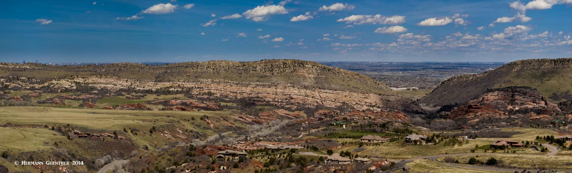
Most of the park is covered by evergreen forests interspersed with a few open areas. There are several viewpoints that offer good views that extend mostly to the eastern side – the populated urban area and the eastern prairie. There is one viewpoint that affords a reasonable view toward the west, although the high mountains of the Front Range cannot be seen from this park since they are almost totally blocked by higher foothills. Yet this park is a pleasant place for hiking and mountain biking. There are three trails on which bikes are prohibited which gives some relief to hikers who want to be left alone.
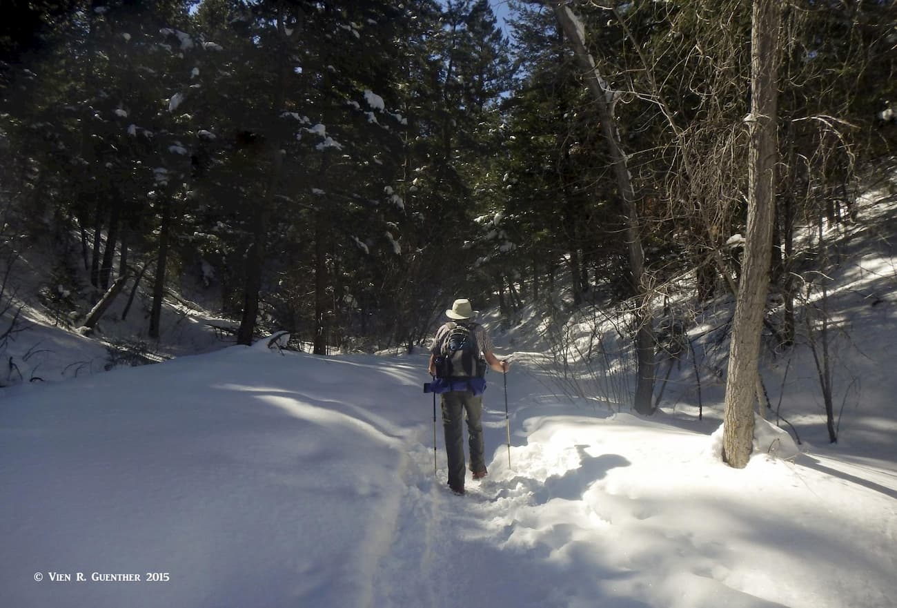
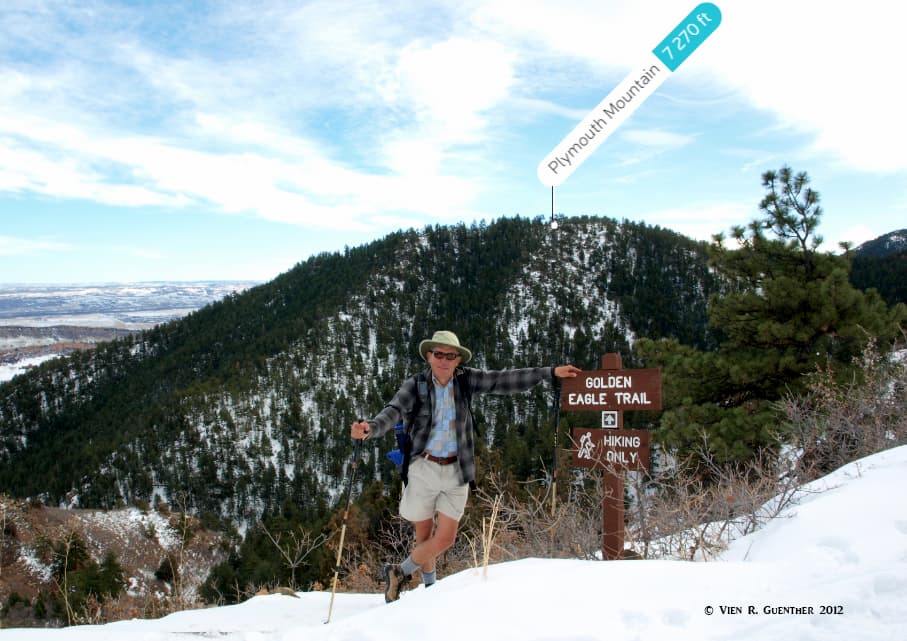
Deer Creek Canyon Park has three named mountains. The highest is Wilds Peak and the most prominent is Plymouth Mountain. While there are trails to two of the peaks, there is no trail to, or even near, Wilds Peak, thus making it officially inaccessible, although there might be unofficial “social” trails up there. It’s highly unlikely that the average park visitor would consider bushwhacking their way to the top. The best times to hike in this park are from autumn through early spring when lots of wildflowers show their best. From late spring onward through the summer and into early autumn, it can be very hot here, and there is also the ever-present risk of encountering rattlesnakes. Winter is a wonderful time to hike here – far less hikers and virtually no bikers due to icy conditions. But the autumn can be especially enjoyable since that is when the many stands of Gambel Oak (a.k.a. oak brush, scrub oak) turn a vibrant reddish-brown color. The hiker-only trail to Bill Couch Mountain really shows off these colors.
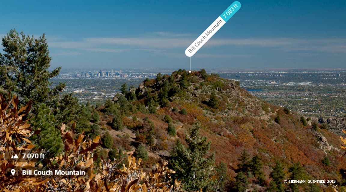
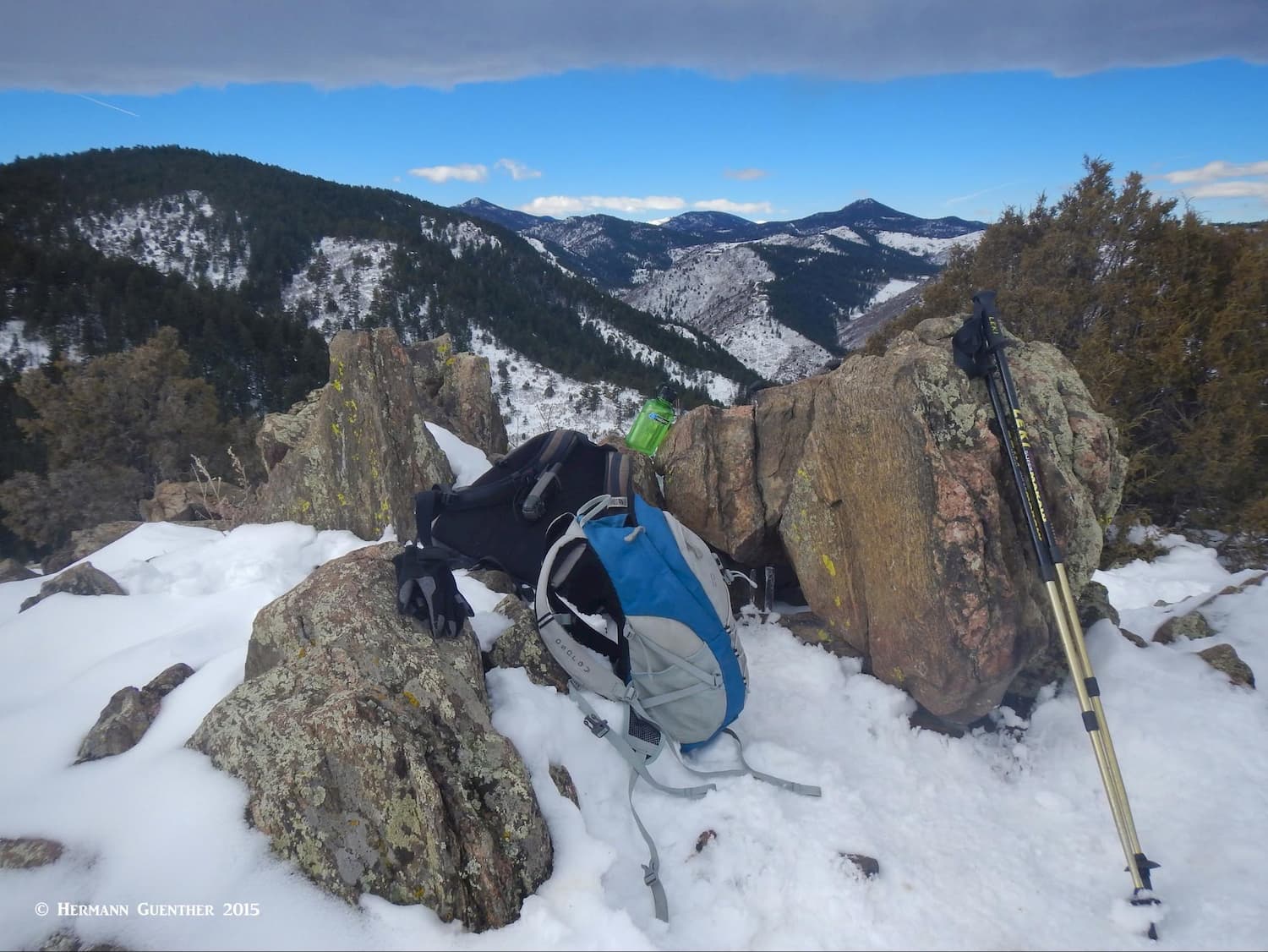
Deer Creek Canyon Park, unlike other parks in the Jefferson County Open Space system, has been left conspicuously “wild” throughout its trail network. Except at the base area, where there are several covered picnic shelters and a large toilet facility, the park has no other amenities – not even intermittent benches. If you want to take a snack break or rest stop, you will need to sit on the ground or find a rock or downed tree log. By far the best places to sit, have something to eat, or simply enjoy the views are at the tops of Bill Couch or Plymouth Mountains. So we plan our hikes accordingly. Let’s take a look at hiking in this pleasant park.
Plymouth Creek Trail – Although two trails (the other one is the Meadowlark Trail which is for hikers only) leave the trailhead on different headings, they both converge again less than two miles up, where only one continues. That one is the Plymouth Creek Trail, which I call the “main” trail since it is the only one that penetrates deeper into the park. While the two lower trails can be combined into a short loop hike, you can only get to the remaining trails by continuing on the Plymouth Creek Trail, which does indeed follow a creek that flows at different rates most of the year.
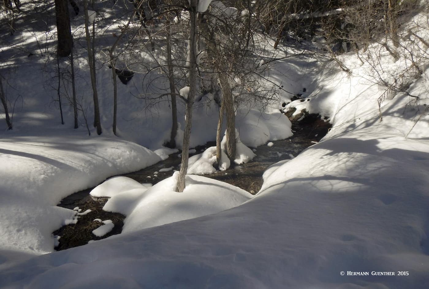
Shortly after its junction with the Meadowlark Trail, the Plymouth Creek Trail it gets very steep as it passes through a canyon, which the biker crowd call “The Wall”. It becomes very rocky through the middle section, where there is an adjacent set of constructed steps. Most bikers carry their bikes over this section, though some die-hards try hard to prove their mettle - by attempting to ride it – up and down. I have seen them persistently trying to ride it uphill only to be stopped – and then going back and trying again. In the winter, and sometimes early spring, this section is almost impossible to get through without some kind of traction devices (spikes) on your boots. Because of the presence of the creek and groundwater seeping out, the entire width of this segment can be a solid sheet of ice. Not too many bikers or hikers then. That means you can have most of the park above here to yourself and the few others who are properly equipped. It was this condition that convinced me to buy a good set of spikes for both me and my wife. We have used them in many other places as well.
Shortly after “The Wall”, the Plymouth Creek Trail passes three trail junctions before it ends at a fourth junction with the Red Mesa Loop. The total length to this point is 2.4 miles. But most hikers don’t simply do this and then go back down. This means that at several points along the trail, you will have to decide where else you want to go. I’ll give you some ideas.

Plymouth Mountain Trail – At the first junction along the Plymouth Creek Trail you have the option of taking the Plymouth Mountain Trail, which completely encircles – you guessed it – Plymouth Mountain, in a distance of 2.4 miles. When you reach the highest point on this trail (about two miles in, assuming you chose to go clockwise), you will arrive at the junction with a short half-mile spur (Scenic View Trail) that will take you to a couple of scenic viewpoints. If you have made it this far, you just must take this diversion. This spur passes right over the summit of Plymouth Mountain and then descends just slightly to a couple of nice views. After that, you can just return to the main trail and continue the loop around the mountain to where the trail reconnects to the Plymouth Creek Trail, which you can then take back down. You will then have completed a 6.4-mile hike. A small variation of this is to take the Meadowlark Trail both ways from the bottom, instead of the Plymouth Creek Trail. This adds about one mile to the hike, affords better views and avoids bikers for better than three miles of the entire hike.
Red Mesa Loop – This hike will take you to the farthest reaches of the park, where you will encounter fewer people. But you may be more likely to encounter a bear – this has been known to happen, although not to me – yet. For this option, you must take the Plymouth Creek Trail (or use the Meadowlark Trail alternative at the bottom) all the way to its junction with the Red Mesa Loop. Then you walk the entire 2.3-mile loop, in either direction, after which you can go back down the way you came. That will be a 7-mile hike (eight miles if you take the Meadowlark option both ways at the bottom).

But as long as you are up here, you might as well take the half mile spur known as the Golden Eagle Trail, to Bill Couch Mountain – one of the three named mountains in the park. This summit provides the best viewpoint in the entire park in my humble opinion. So this hiking adventure can be anything from seven miles to nine miles depending on which options you want to take.
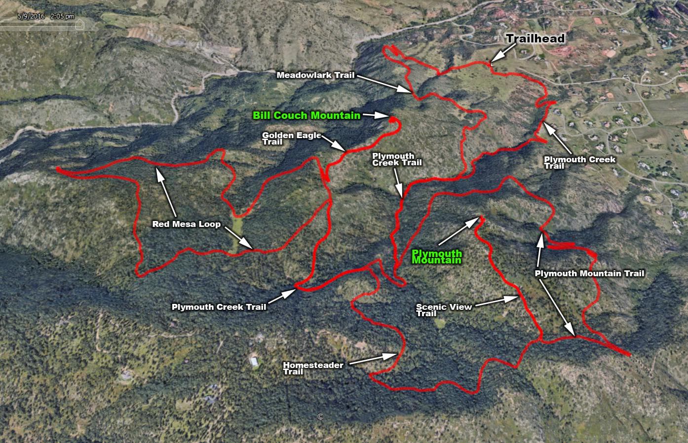
The Total Hike – For this hike you will take in everything we have discussed above – with the exception of two trails. You will start at the trailhead and proceed up the Meadowlark Trail until it intersects with the Plymouth Creek Trail, which you then take to its end. That will put you onto the Red Mesa Loop, which, after completing it in either direction, returns you to the Plymouth Creek Trail. Take this one back down until you get to the Junction with the Plymouth Mountain Trail. Hike the loop around the mountain (include the short spur to the viewpoints, as above) and then continue to the end of your hike by going down the Plymouth Creek Trail all the way to the trailhead. This is a 10-mile hike, but you can do some variations that will increase the length to 12 miles. The simulation below shows the 12-mile route that I have done many times. I created it by importing my actual GPS track into Google Earth, taking a screenshot and then manually adding labels in Photoshop.
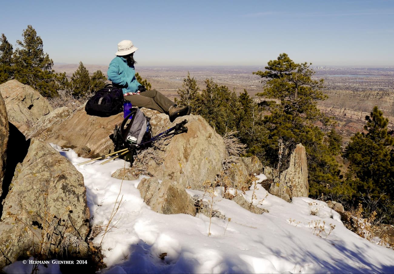
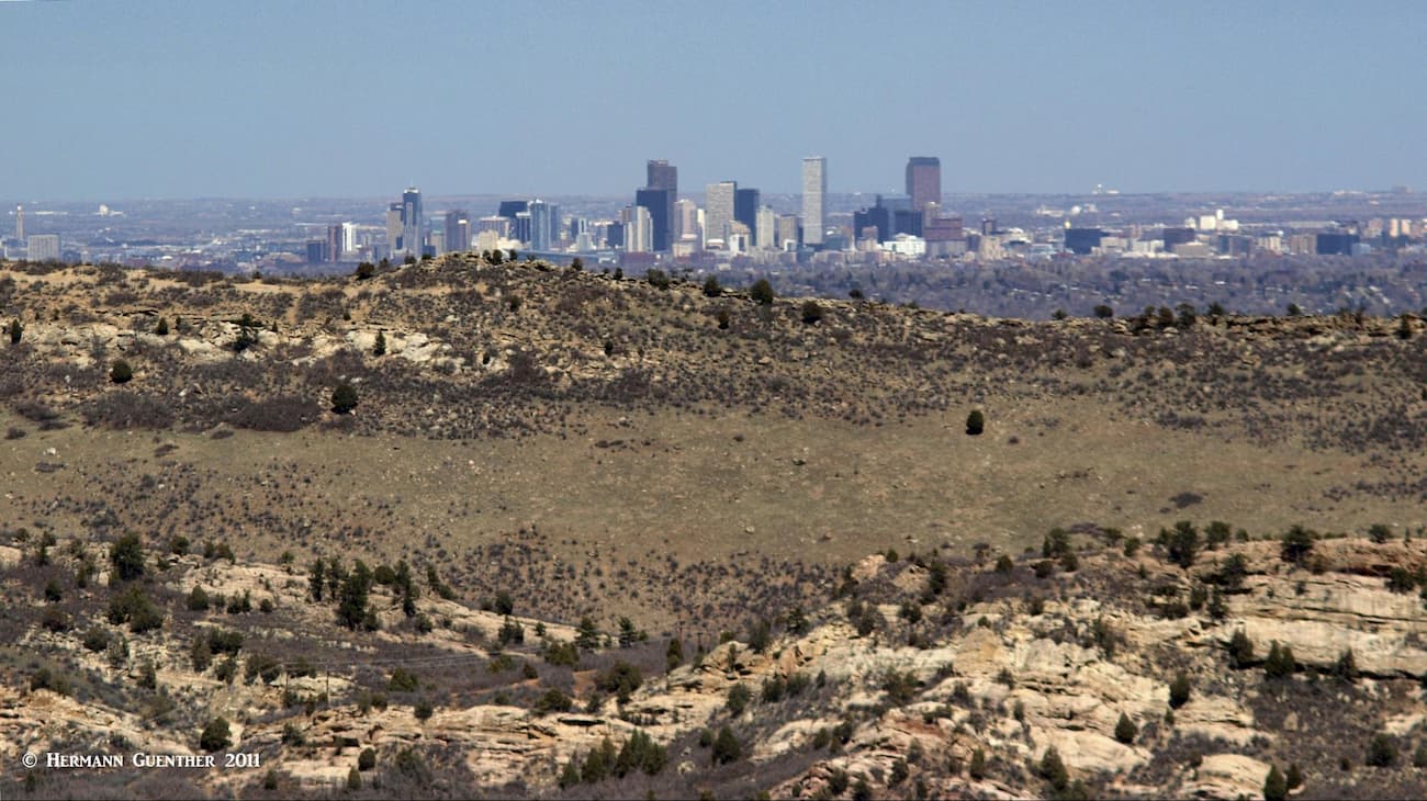
The fact that this park is right at the doorstep of the entire Denver Metropolitan area, means it can be reached by almost anyone in a short time. The park is mostly used by locals (and perhaps guests of nearby residents). The Denver area has everything that visitors from elsewhere could want. From parts of the park you might even see where you live or where you are staying if from out of town. Certainly, on a clear day (which is most of the time) you can see the skyscrapers of downtown, as in the photo below which was taken from the lower part of the Plymouth Creek Trail. For a photo like the one below, you would need an extra long lens.
Virtually all of the nearby communities within short striking distance of Deer Creek Canyon Park are the southwestern “bedroom” suburbs of greater Denver. While they have enough dining, lodging and shopping to serve the local needs, they have no other remarkable attributes that would make one stand out from the others. These are the communities that would likely feed the greatest number of visitors to the park. The most notable ones nearby would include Ken Caryl, Columbine, Highlands Ranch and Littleton.
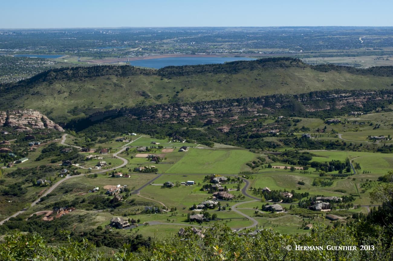
For additional nearby recreation venues it would be remiss to exclude Chatfield State Park, technically in Littleton. The park basically surrounds Chatfield Lake (or Reservoir) and came into being after the construction of the dam of the same name. The dam was built as a result of a disastrous flood in 1965 which inundated downtown Denver. Consequently, the lake that was formed became one of the many water supply reservoirs for the city, though its primary purpose was for flood control. The park and lake are now a major suburban recreation area providing boating, fishing, horseback riding and camping. Up to 212 bird species can be found in the park. The reservoir is very visible from the higher elevations in Deer Creek Canyon Park.
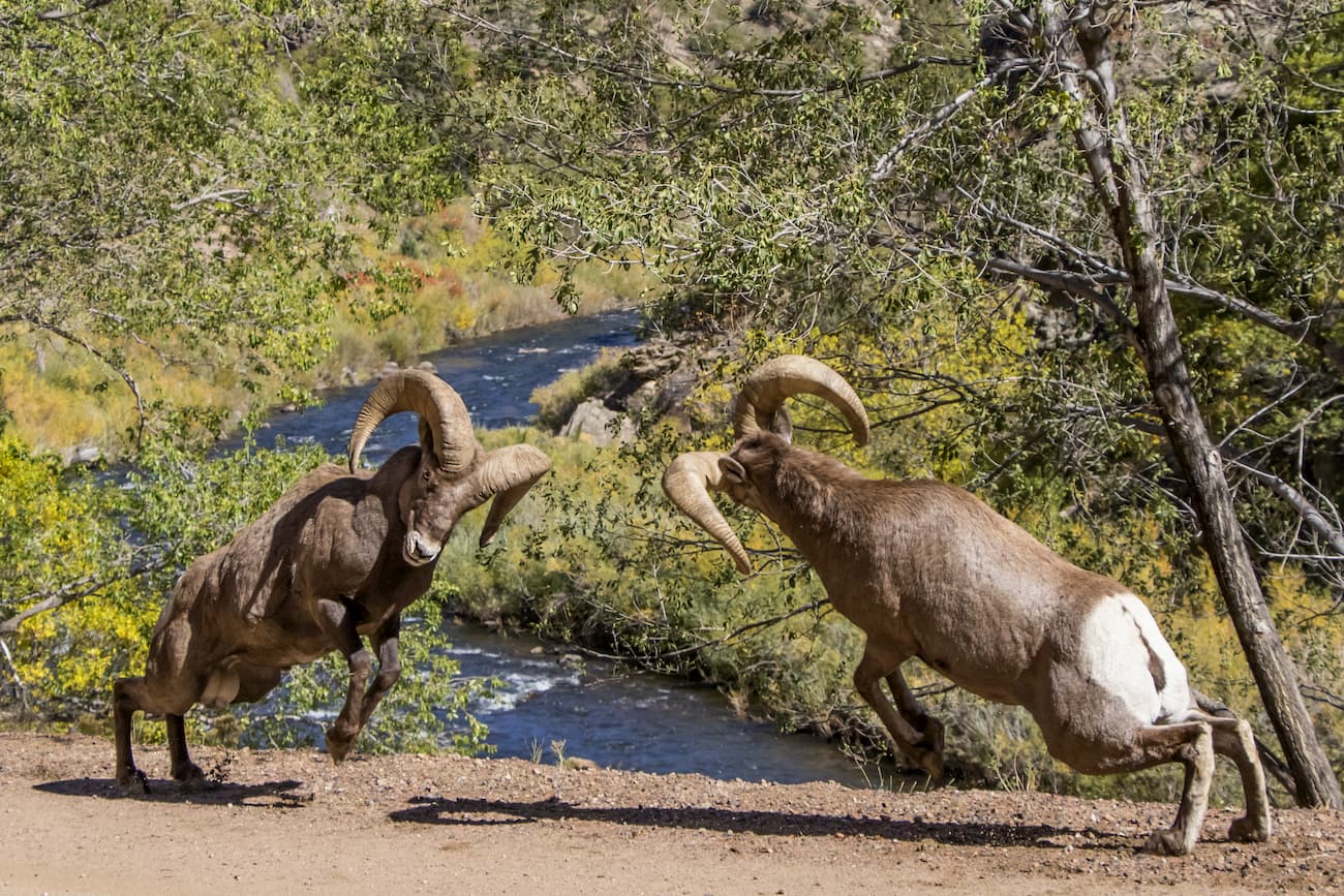
Also nearby is the Waterton Canyon Recreation Area. This spectacular canyon was formed by the South Platte River, which is also the main perennial water source feeding the Chatfield Lake. This is a prime area for biking and fishing as there is a fairly level road/trail following the river for 6.5 miles to the massive Strontia Springs Dam, which is used to store water that is then diverted through a tunnel to the Foothills Water Treatment Plant. Of course much of the water that is not diverted goes over the spillway and ends up in the river, thus turning it into a favorite trout fishing stream. The canyon is also home to many different types of wildlife including the popular Rocky Mountain Bighorn Sheep, black bears, mountain lions, elk and plenty of reptiles including rattlesnakes. This popular recreation area connects to the trail system in Chatfield State Park. The famous Colorado Trail begins here on its486-mile journey across the mountains of Colorado ending in the town of Durango.