Scan the QR code and open PeakVisor on your phone
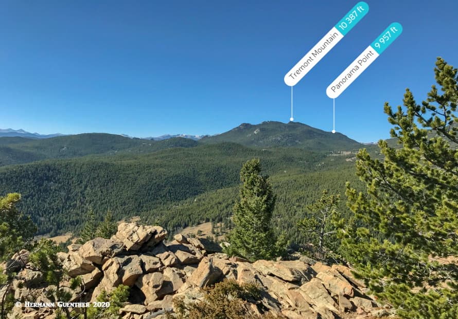
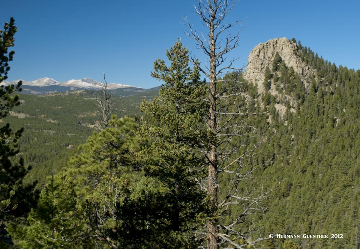
Of the 41 state parks in Colorado, Golden Gate Canyon State Park (GGCSP) is one of the flagship parks when it comes to scenery, mountain setting and hiking opportunities. Only about 30 miles west of central Denver, this gem of a park offers plenty of things to do for the entire family. Confined mostly to the foothills eco-zone, this park lacks any semblance to alpine terrain (or even subalpine conditions) with elevations in the park ranging from around 7,500 to 10,387 feet at the top of Tremont Mountain, the highest (and most prominent) point in the park. In fact, there are only five named mountains in the park, two of which are merely named features that are not really independent mountains at all.
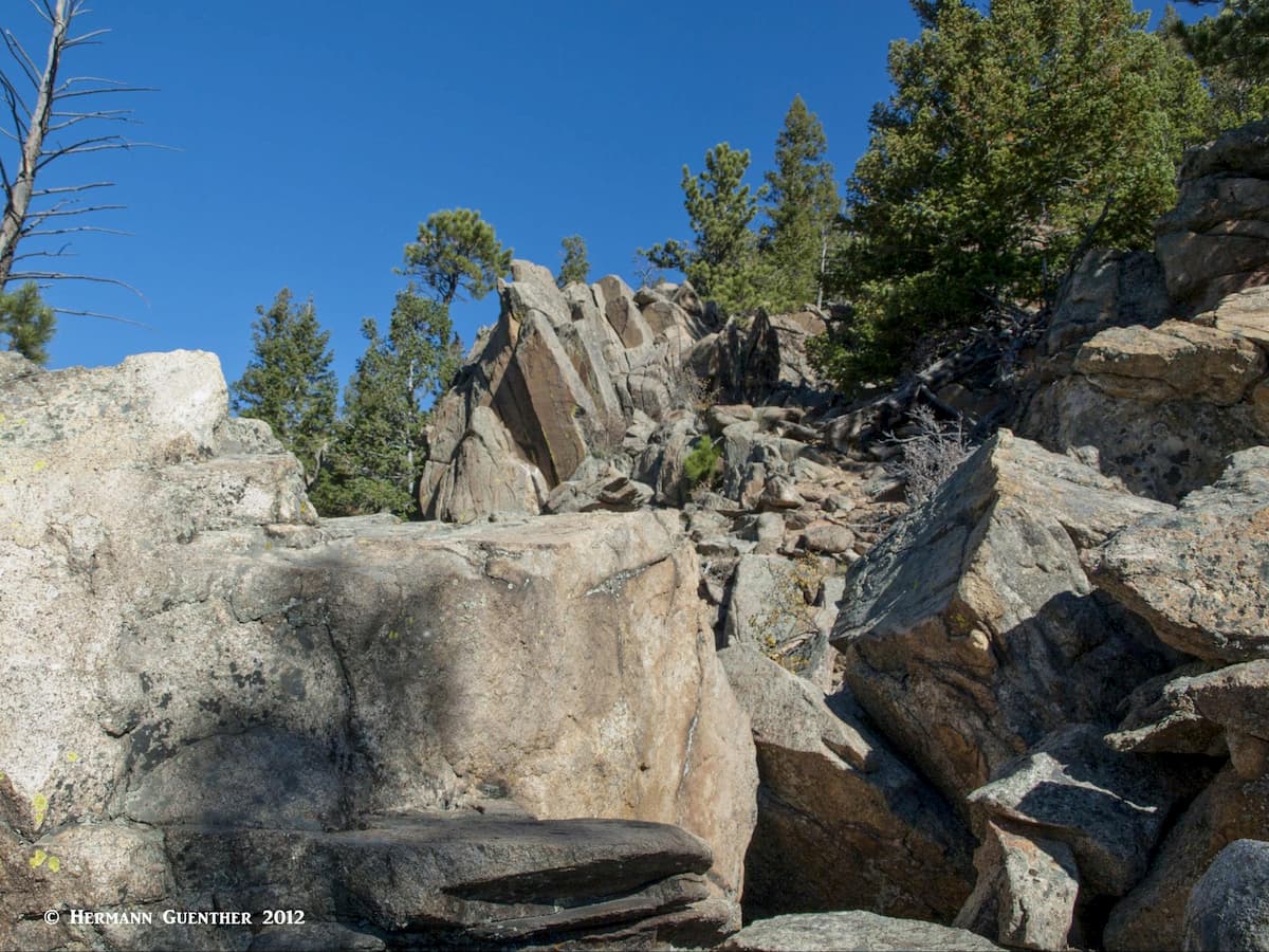
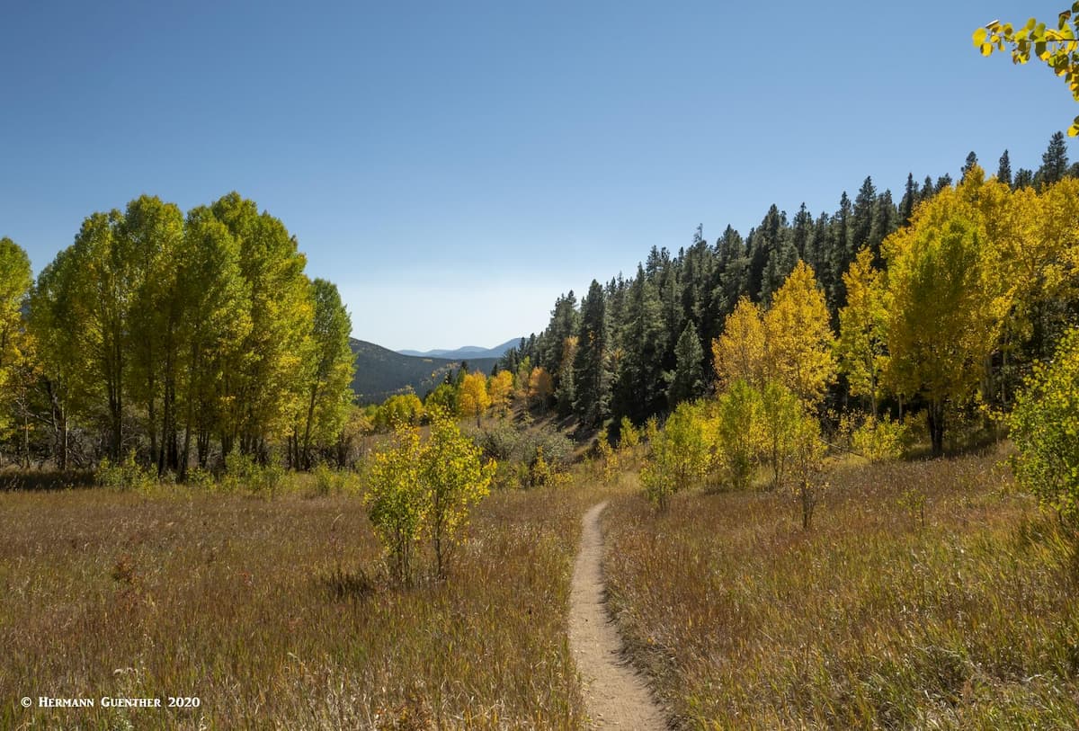
But don’t let these attributes mislead you into thinking that there is no good hiking to be found here. There are 35 miles of hiking trails in the park that offer pleasures and challenges for everyone. Some trails are definitely not for families with little kids, I can assure you, having hiked the most difficult ones with my wife. You have to be prepared for some strenuous activity and challenging scrambles. Don’t underestimate some of these trails – they are not a simple “walk in the park” and if you get into trouble you will be on your own for a while. Remember, this place is so remote that there is no cell phone or internet service in the park. If you are using your PeakVisor app, you had better have your offline maps downloaded in advance.
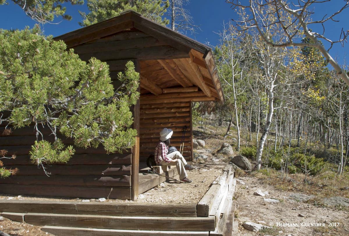
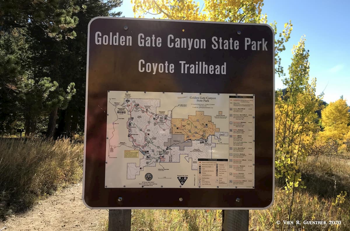
There are two distinct sections of the park with only one trail that connects the two segments. The eastern segment is in Jefferson County while the slightly larger western segment is in Gilpin County. Both are accessible from good roads and have a number of trailheads with excellent parking areas and are covered under a single entry permit. Each segment has numerous picnic sites (125 overall) and ponds where fishing is permitted (license required). There are two campgrounds, one of which is for tent camping only, that have a combined total 132 sites. The one full-service campground is open year-round. In addition, there are 20 backcountry tent sites and four backcountry shelters, all about one to two miles from the nearest parking. These are provided with bear boxes for food storage. Note that the shelters have a roof, three walls and a wooden floor – they can sleep six hikers each – but the open side does not guarantee to keep bears from snooping around your sleeping quarters.
For non-hikers and non-campers, there are still fun things to do for the entire family. One of the ponds even has fishing access for wheelchairs. There is a fine visitor center which also has a gift shop for those in need of lightening their wallets. Beside the center is a “Show Pond” in which fishing is not permitted. Wildlife viewing is a popular activity given the large variety of animals that make the park their home. Even large animals such as elk, moose, bighorn sheep, black bears and deer are to be found here. Mountain biking is permitted on 19 miles of the total 35 miles of trails. The park even offers opportunities for rock climbing, though such areas are not very obviously promoted by the management.
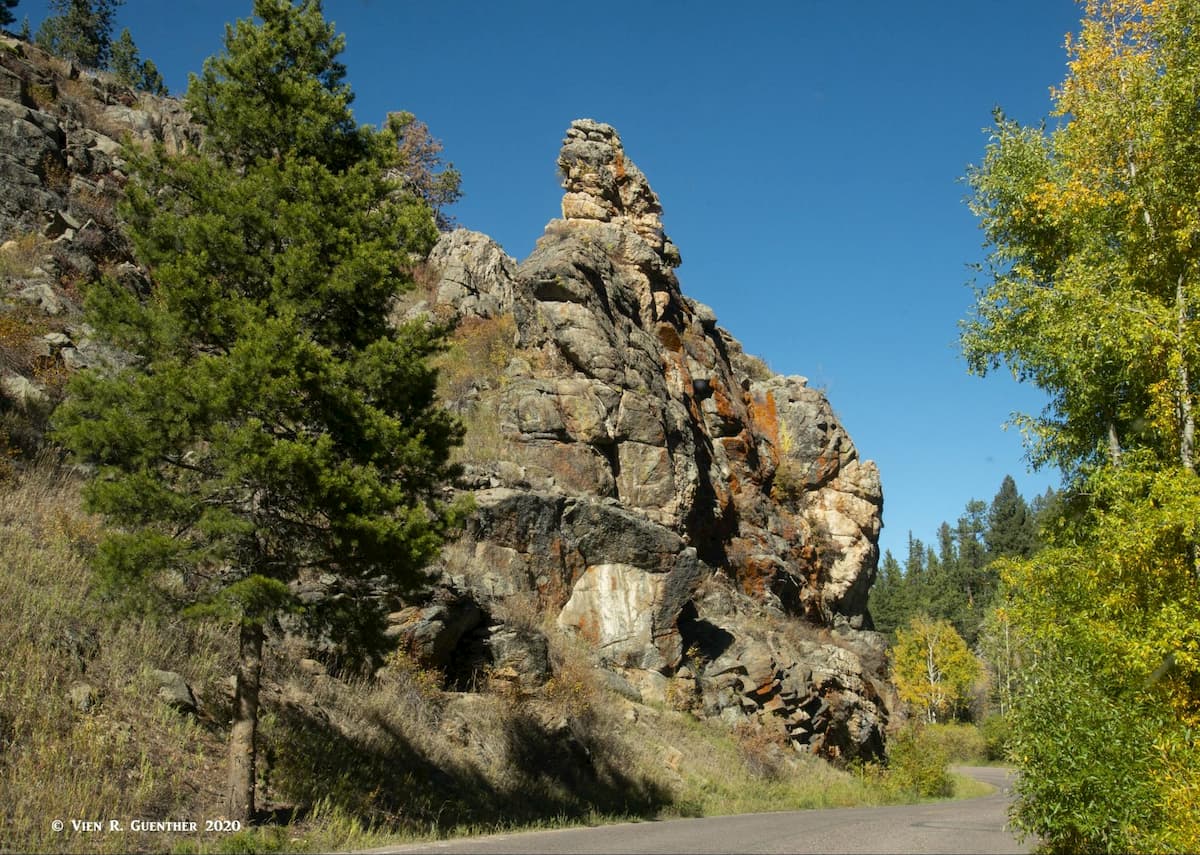
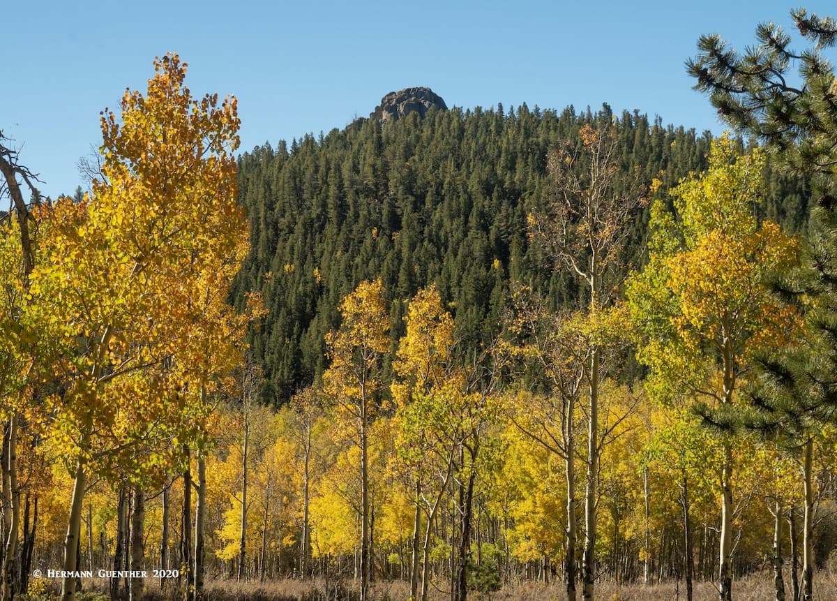
With several well-constructed roads in the park, there is no shortage of beautiful scenery for the casual visitor. Every turn in these roads provides new vistas – near and far, especially the Mountain Base Road, which is so steep and dominated by tight curves that RVs (campers) and oversized vehicles are not permitted. At the northernmost section of the park is the amazing Panorama Point, so named for obvious reasons, where the visitor gets a mind-blowing view of much of Colorado’s Front Range, especially the high mountains from James Peak all the way to Longs Peak in Rocky Mountain National Park. While this fine overlook is well developed for tourists, it is equally favored by hikers who might just be passing through on a longer hike. On peak days, parking can be a challenge here.
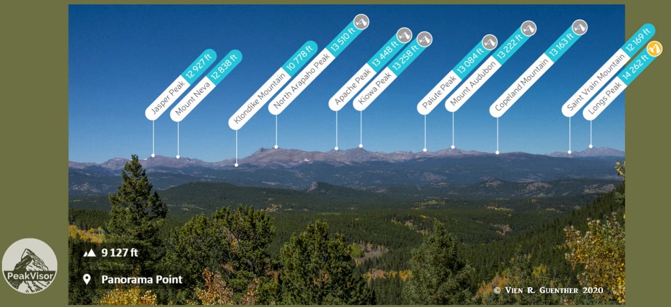
Elevations of most of the hiking trails lie between 8,000 feet and about 9,500 feet. Please note that there is no official trail to the summit of Tremont Mountain, although many people do attempt this somewhat strenuous climb just for the fine views from the top, where on a clear day you can see the high mountains from Pikes Peak to Longs Peak, and everything between. The major trailheads are found along the Mountain Base Road along the western side of the park, the Ralston Creek Road (also called Crawford Gulch Road and Drew Hill Road), which also is the main road connection between the east and west segments of the park. There are also two trailheads on the Gap Road which passes through the northern part.
One of the nice features I find in this park is that none of the trails are of the exclusively “out-and-back” type, although you can certainly go to a destination and return to your starting point the same way you came. But all trails are connected to other trails such that you can always turn your hike into a loop so you don’t have to do much (or any) backtracking, and thereby can vary the scenery through which you travel. You can make your hike as long or short as you like. You can even do multi-day hikes, given that there are multiple camping sites scattered all over the park.
The park brochure is a good place to start planning your hikes here. But I would caution that you don’t fully rely on that map alone. It is not a precise map – instead, I would regard it as more of a schematic representation of the trail network. I have found it somewhat confusing, as have other people, when arriving at a trail junction and not seeing exactly what is represented on the map. In addition, trail signs leave something to be desired - I have even found one that is incorrect. A cell phone app or a true trail map is far more accurate (but only if you have the downloaded offline maps, there being little to no cellphone coverage in the park). But the park map does help in the overall planning of your routes and it also gives information about the level of difficulty of the trails, which ranges from moderate to most difficult and is not necessarily consistent with the ratings offered by other sources. So some judgment should be exercised. Based on my experience, the trails that are designated as most difficult are appropriately so named for visitors with little experience, since they have some very challenging sections that could intimidate some people. Therefore, parts of the Black Bear Trail or the Coyote Trail, for example, are best left to sure-footed hikers.
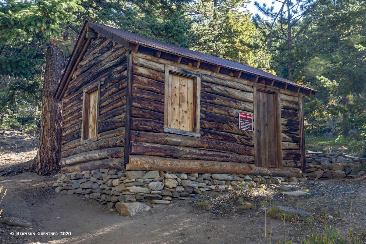
Let’s just touch on a little bit of history surrounding this beautiful part of the park. In 1918, the 19th amendment to the United States Constitution imposed prohibition, which made it illegal to make, import and drink alcoholic beverages including beer, wine and spirits. Nationwide. What a sobering thought! So Golden Gate became an excellent place for “moonshiners” to set up secret stills for making whiskey. They could hide them in remote valleys of the park wherever there were springs or streams, and then illegally transport the distilled “bootleg” whiskey to Denver, where there was great demand for such liquid gold. The picnic area and trailhead are now located in the bottom of one of these remote valleys, hence the name “Bootleg Bottom”. Thankfully, the 21st amendment repealed the 18th in 1932. I guess the government officials realized that there was plenty of revenue to be generated through liquor taxes, and it put the criminal element associated with bootlegging out of business. A bootlegger’s cabin still stands partway up the Coyote Trail.
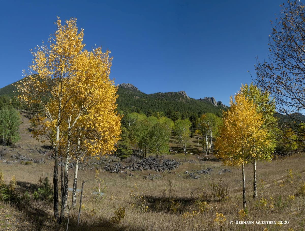
This wonderful trail (hikers only) starts with a beautiful view of the lower end of the valley, which is especially scenic in the autumn when the aspen trees change color. The Coyote Trail ascends the west side of Promontory Ridge through forest with occasional openings affording fine views toward the Continental Divide to the west. It is a good idea to do this hike in the morning when most of the trail is still in shadow, since it could be quite hot later in the day. The final scramble to the top of the ridge can be fun, or terrifying if it were icy, after which the trail descends gently toward its end at the lovely Fraser Meadow. You can return the way you came, but that would entail just a short round trip hike of four miles.
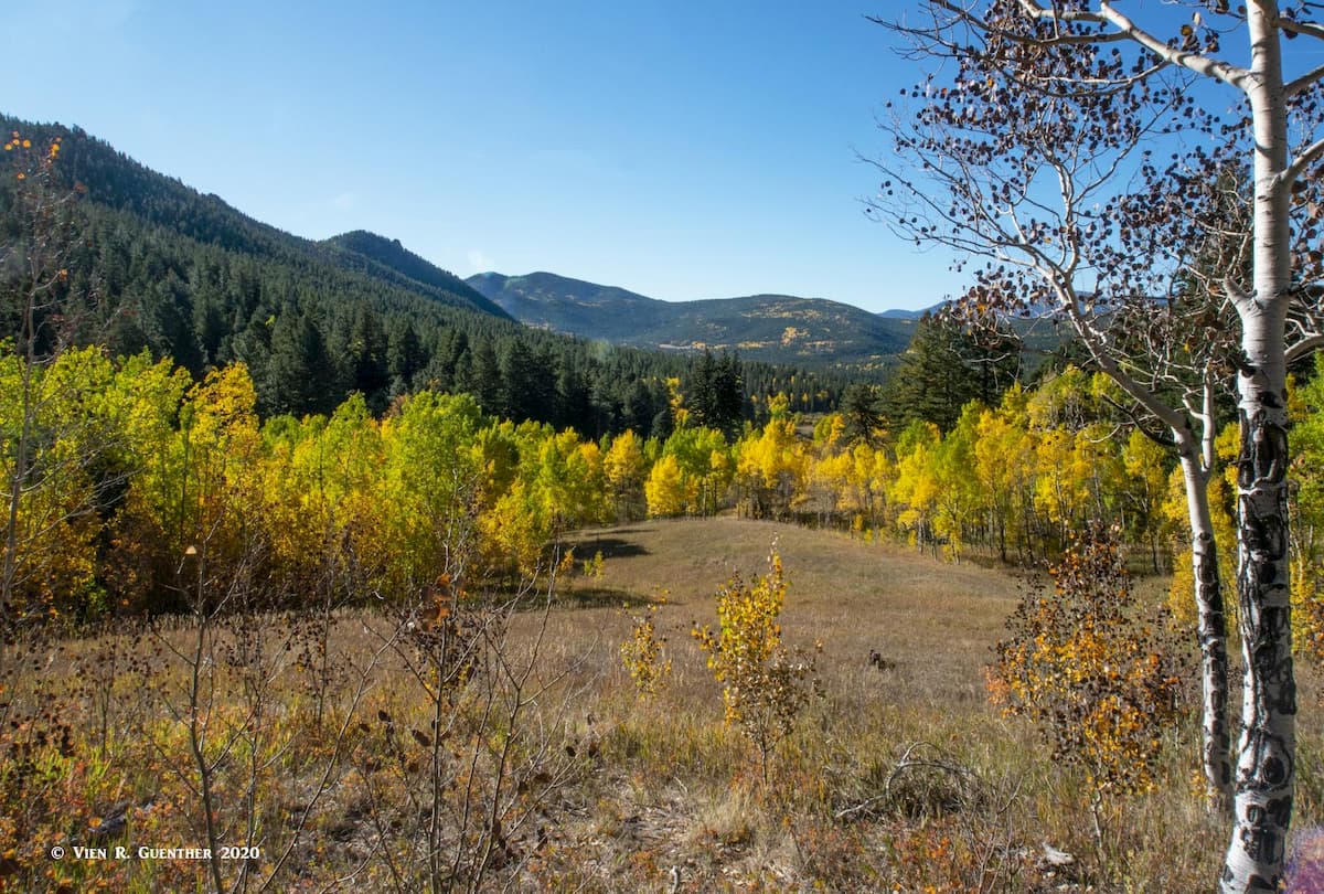
But a really nice option just before the Fraser Meadow is to take the Mule Deer Trail to the north and follow it through the trees all the way to the Panorama Point. You will pass some scenic meadows covered in wildflowers during summer and surrounded by colorful aspen groves in autumn. This trail will eventually take you completely around Tremont Mountain and after several more miles get you back to where you started the hike, a total distance of about eight miles. Be sure to stop at the edge of an unnamed meadow where you will be treated to a beautiful autumn spectacle.

After you have stopped at Panorama Point to admire the scenery, and have impressed a few tourists how amazing your PeakVisor app works at a spot like this (yes this really happened), you will basically follow the western boundary of the park back to the trailhead while passing through such beautiful scenery that you will think that you are miles from civilization. If you look up to the east, you will clearly see the Promontory Ridge that you crossed early in your hike.
Just 200 yards up the Ralston Creek Road from the visitor center is the Ralston Roost Trailhead, which has its own parking area though you can just park at the visitor center and take the short foot path to the trailhead. From here, you can make a nice short (hikers only) loop hike by combining the Black Bear Trail with the Horseshoe Trail. The Black Bear Trail will take you to Ralston Roost, the third highest named “mountain” in the park. From here you can descend down to the Horseshoe Trail, pass the Rim Meadow Campground and return to your starting point. This hike is only about four miles, but it does entail the “most difficult” Black Bear Trail (by the park’s definition).
When my wife and I did this hike, we extended it by two miles by hiking a segment of the Mule Deer Trail to the Fraser Meadow backcountry campground and returning via the Horseshoe Trail. Here we took a snack break at one of the backcountry shelters and saw one of the many bear poles – specifically erected so that campers can hang their food bags out of the reach of hungry bears. However, since that hike, the park has now provided bear boxes for food storage, so these bear poles have become somewhat redundant. This very pleasant hike will get you well into the interior of the park. As you return to the trailhead, make sure you take the connector from the Horseshoe Trail back to the Black Bear Trail or you will end up at a different trailhead about a half mile from the visitor center.
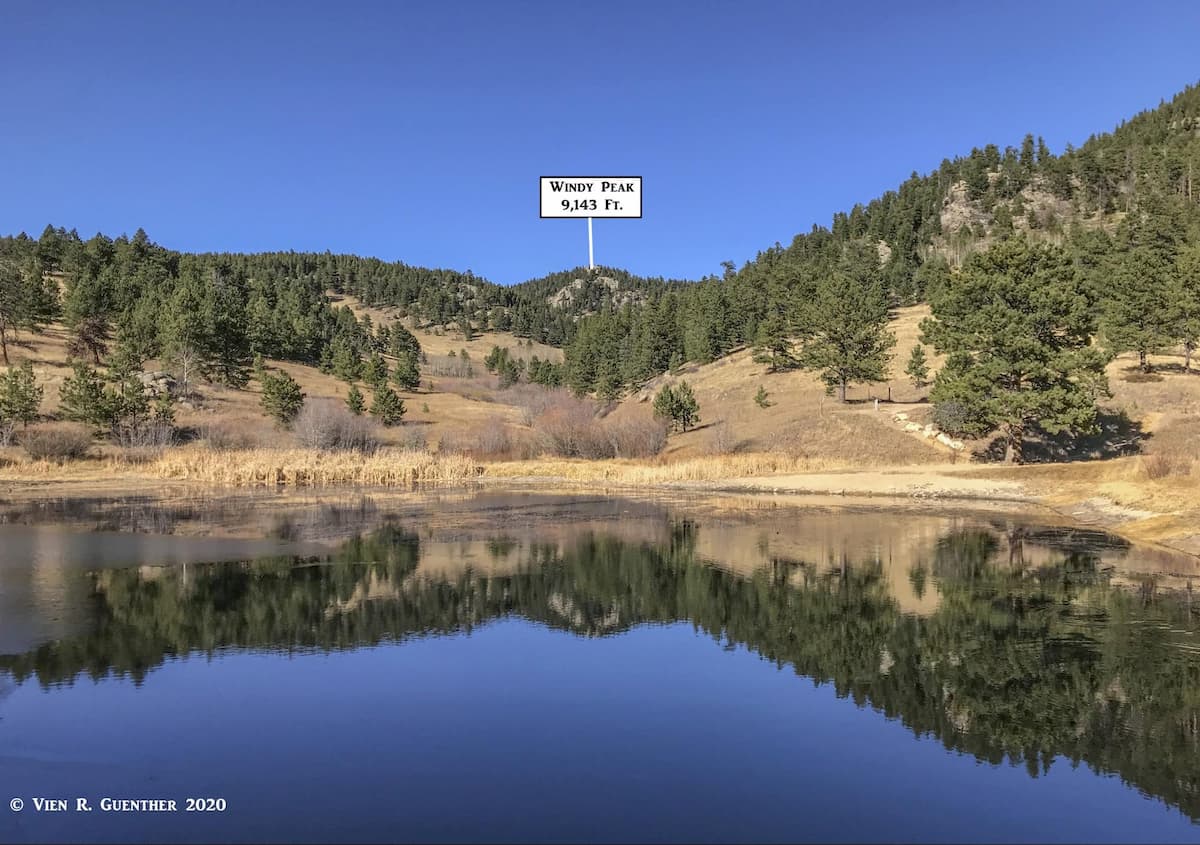
This trailhead, a little over two miles from the visitor center along Ralston Creek Road, provides perhaps the best access into the trail network in the Jefferson County segment of the park, although there is one more trailhead even further east along this road. Here is where the Burro trail starts. There are several different loop options available here that can get you into some interesting terrain and even to the summit of Windy Peak from which some spectacular views can be had. The Burro Trail is basically a loop with an extension to Windy Peak’s summit, that would make about a six-mile round trip hike. We chose to take the left leg of the trail going up to the peak. This is definitely a strenuous hike a little over three miles to the top. While the distance is not long, this trail is very steep in places and has been variably labelled as hard or difficult. It was indeed a workout, but “difficult” might be a stretch. Nevertheless, horses and bikes are prohibited from using this trail. The view from the top of Windy Peak is very fine, mostly towards the south and west.
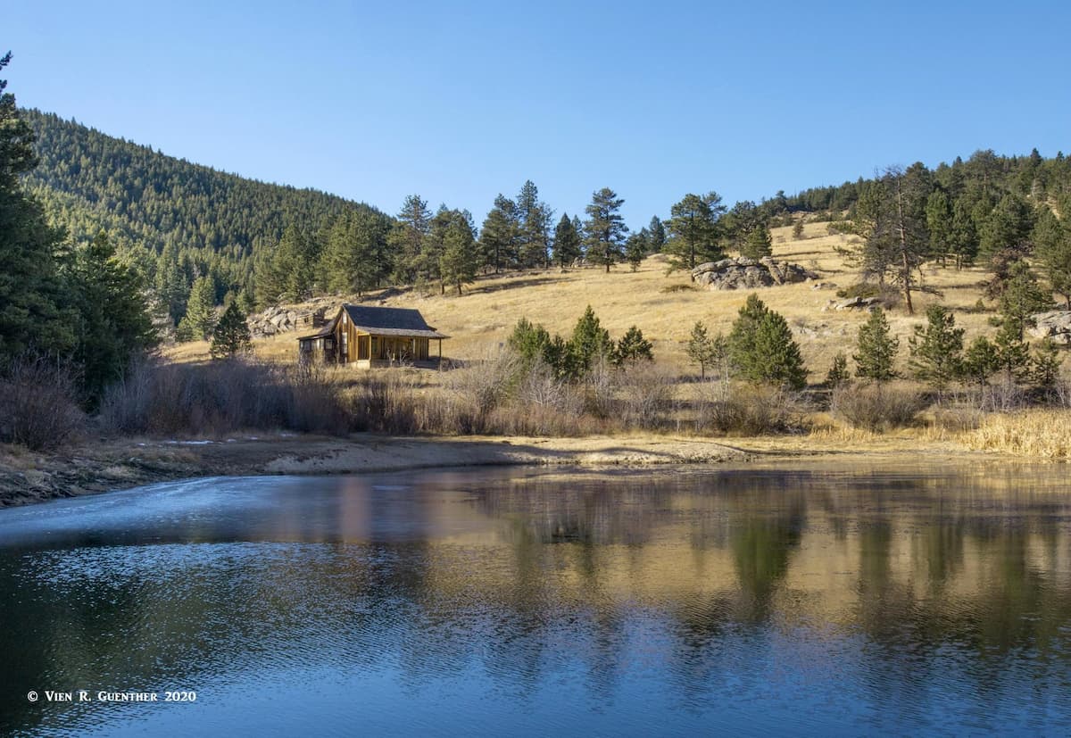
We chose to continue our hike on a different trail - the Mountain Lion Trail, which can also be hiked as a complete loop around most of the eastern segment of the park. After leaving the summit area, this trail can be taken back down in either direction. We opted to descend in a westerly direction which eventually took us down to a beautiful secluded glen known as Forgotten Valley. Since we had never been here, we were pleasantly surprised. Perched in the middle of the valley is the site of a well-preserved historic homestead established in 1876 by Swedish immigrants. The ranch in this valley was farmed until 1955 and eventually sold to the State of Colorado which has preserved it for all time as part of this park. The scenic pond on the property is stuffed with trout that are eager to be caught - and hopefully not eaten, though anglers are allowed to keep a small number.
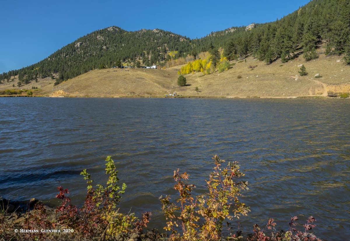
Located just off the southern end of the Mountain Base Road at the western side of the park is the beginning of the Blue Grouse Trail. From here it is possible to take some very easy family hikes as well as some long loop hikes and even a recommended multi-day hike of 25 miles or more. The parking area for this trailhead is right above Kriley Pond which sits adjacent to State Highway 46. It should be noted that this is the only road within the park that can be driven without the need for a parks pass – as long as you don’t stop and use park facilities. All hikes beginning from this trailhead will use the Blue Grouse Trail for about the first mile.
One option from here is to do the entire Mule Deer Trail Loop. Including the Blue Grouse Trail segment at the beginning and end of the hike, this will be a hike of just over ten miles and will entail a combined elevation gain of 2,000 feet. This is definitely not an easy hike, especially if you are doing it on a hot day. Another hike that I have read about is the so-called “Golden Gate Canyon Full Pull Trail”. It is only about 24 miles long and encompasses over 4,800 feet of total elevation gain. There is actually no trail by this name - this is more like a designated route. Perhaps a seasoned trail-runner can do this in one go, but more likely, hikers will want to do this over three or four days, spending the nights in one of many backcountry campsites. The problem with this would be the availability of water in some locations, especially in late summer or autumn. Since this route can be done entirely on multi-use trails, mountain bikers might find this an attractive one-day outing. The variety of scenery would be stunning, but who could enjoy it when racing along on a bike? This one is not for “couch potatoes”.
Since Golden Gate Canyon State Park straddles the Gilpin/Jefferson County line, it is perched in the middle of a rural area. But in terms of park users’ origin, it can safely be assumed that it attracts the majority of its visitors from the greater Denver metropolitan area. Therefore all the amenities visitors from outside of the Front Range might need are readily available in this urban area. But most park visitors generally come here from their homes. Instead of focusing on Denver and its many scattered suburbs, it might be more interesting to point out what is closer to the park and has more unique characteristics and points of interest for visitors from out of town.
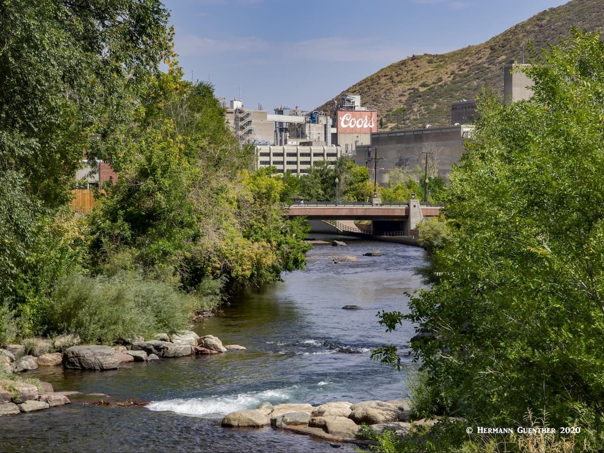
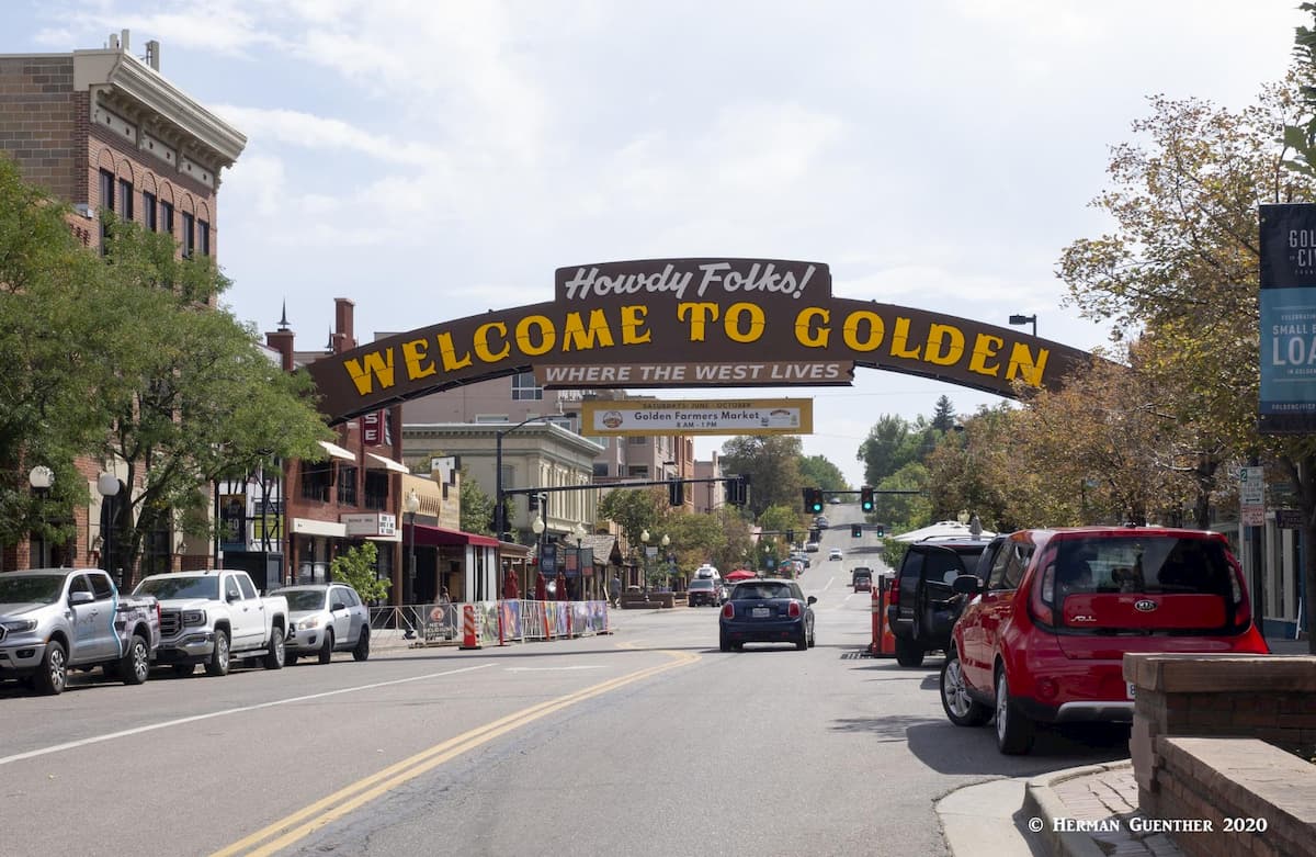
The closest town to the park, and literally minutes way, is Golden, the county seat of Jefferson County. It is only 14 miles from the center of Golden to the park’s visitor center. All other attractions in the park are then just a short drive from there. Golden is a fascinating and historic town with a colorful history. Situated on Clear Creek at the foot of Colorado’s Front Range, Golden was founded during the Pike’s Peak Gold Rush on June 16, 1859. The town is home to the excellent Colorado School of Mines, which offers programs in engineering and science. If one wants to become a mining engineer, this would not be a bad place to undertake your studies. The famous western showman, William F. Cody (better known as Buffalo Bill) is buried on nearby Lookout Mountain. The Coors Brewery, located in the Clear Creek Valley between North Table Mountain and South Table Mountain, is the largest single-site brewery in the world. Visitors must take a tour – and sample some of the goods as well.
The historic center of Golden is a charming place to spend a couple of hours. Its setting at the foot of South Table Mountain, with Lookout Mountain on the opposite side of downtown, is one of the finest in the entire Front Range, just minutes from downtown Denver. Walk along the waterfront park developed around the sparkling Clear Creek and you will be transported to another world that seems far from the bustling metropolis of which it is a part. And appropriately, the American Mountaineering Center is located here. Its museum is the first and only one in the nation dedicated to mountaineering history. The town has no shortage of places to eat and drink, but accommodations are better found in nearby Lakewood.
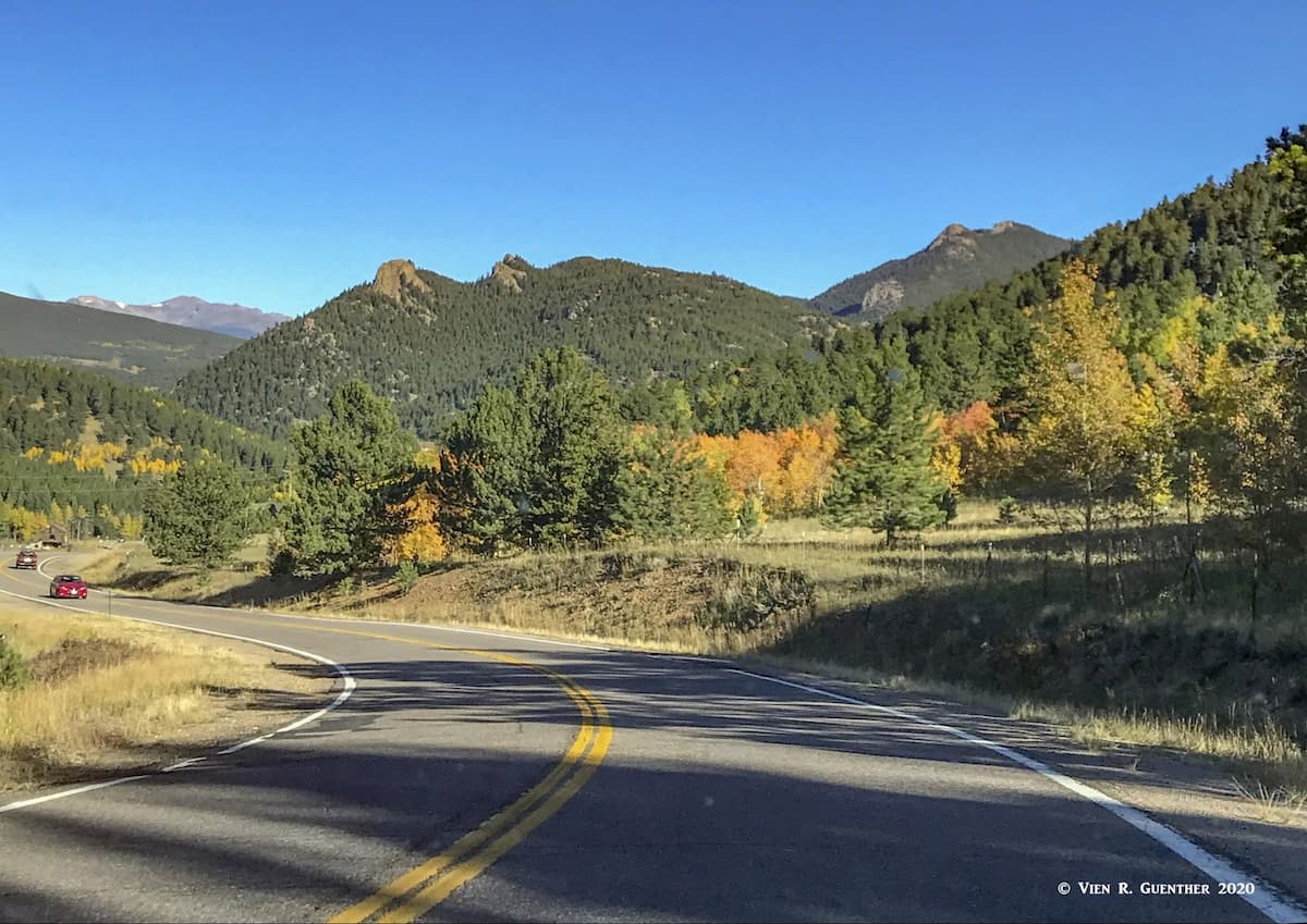
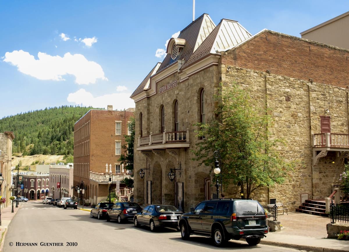
The greater proportion of GGCSP is in Gilpin County, where the only real towns of interest are these two that make up the Historic District. From the midpoint between Central City (the Gilpin County seat) and Black Hawk to the park’s visitor center it is only ten miles, taking not much longer than 15 minutes along the southern end of the Peak-to-Peak Highway, a very scenic drive indeed. Visitors from faraway places are well advised to visit this fascinating duo of historic mining towns. For a time in the late 19th century, this area was known as the “Richest Square Mile on Earth”. When a rich deposit of gold in hard rock was discovered here on May 5, 1859, it started the famous Pike’s Peak Gold Rush and several mining camps quickly materialized. Two years later, Central City was already the largest city in the Colorado Territory, although Denver became the state capital. The various mining camps eventually became the two adjacent towns of Central City and Black Hawk, which now have a well-preserved early mining community architecture and history. When I first moved to Colorado, Central City was perhaps best known for hosting the annual summer Central City Opera in its historic Opera House. They are still performed today – with all operas sung in English.
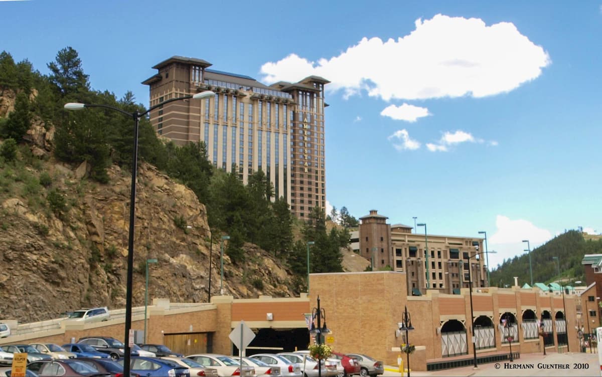
Fast-forward to November 1990, when voters supported the legalization of casino gambling in Colorado. That’s what put these two quiet towns on the map. Although Central City had already been well established for its historic value, nearby Black Hawk (only one mile away) was not much more than a wide spot along the road. Now it has high-rise casinos, hotels and parking garages. While the gaming laws in Colorado are not as liberal as in Las Vegas for example, these two towns have become a major tourist attraction, not to mention a real source of revenue. People who may not have had any prior interest in the mountains, are now flocking to these towns. So, next time you go hiking in GGCSP, you might just follow up your daytime adventures with trying your luck at the slot machines and gaming tables. Of course, you might go home with lighter pockets as well. That happened to me only once - when some gambling friends visiting me from out of state wanted to try their luck in this place. I quickly recovered from that minor loss – and learned my lessons. Now I only go hiking and lose a few pounds – and keep my dollars!