Scan the QR code and open PeakVisor on your phone
Cibola National Forest – Magdalena Ranger District (South) is located in the US state of New Mexico. It is one of four ranger districts managed by Cibola National Forest. There are 42 named peaks within the district, the tallest and most prominent of which is West Blue Mountain at 10,331 ft (3,149 m) in elevation and with a prominence of 3,146 ft (959 m).
The Magdalena Ranger District (South) of Cibola National Forest covers approximately 800,000 acres (323,749 ha) of terrain in the south-central part of the US state of New Mexico.
It encompasses parts of four mountain ranges: Datils, Bears, San Mateos, and Magdalena Mountains. These mountain ranges surround the Plains of San Agustin, although the plains mainly fall outside the jurisdiction of the Magdalena Ranger District.
Two wilderness areas, the Apache Kid Wilderness and the Withington Wilderness, were designated in 1980 and they protect parts of the San Mateo Mountains. Thompson Canyon and the Enchanted Tower are popular destinations for rock climbers within the district.
The district contains 190 mi (306 km) of trails, the majority of which are located in the Magdalena and San Mateo Mountains. There are also 500 mi (805 km) of maintained roads and 600 mi (966 km) of unimproved roads in the Magdalena Ranger District.
Due to its location in south-central New Mexico, the Magdalena Ranger District is surrounded by other areas of public land. This includes the Aldo Leopold Wilderness and the Gila National Forest to the south and west as well as other parts of the Cibola National Forest, like the Magdalena Ranger District (East) and the Magdalena Ranger District (North) to the north.
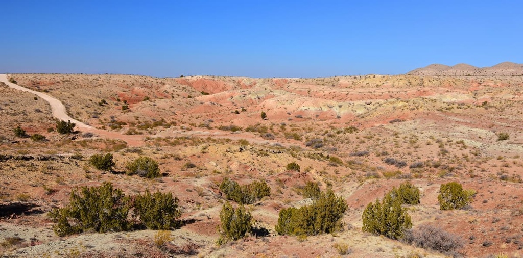
The Magdalena Ranger District consists of four distinct mountain ranges and the grassy plains that are located between them. In the eastern section of the district, volcanic rocks such as basalt, andesite, and rhyolite are common and date as far back as 65 million years.
The Magdalena Mountains formed as a fault-block range superimposed over calderas that were created 65 million years ago. Approximately, 28 to 23 million years ago the faults rotated and tilted like falling dominos. These mountains are surrounded to the east, north, and west by grasslands and to the south by creosote desert.
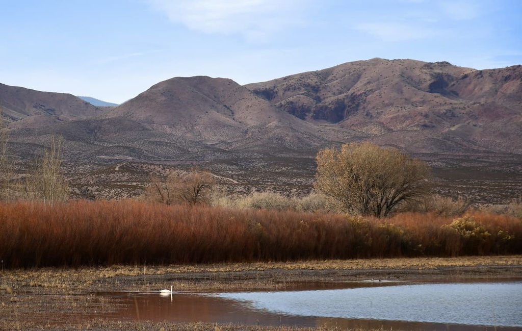
The San Mateo Mountains are made up of volcanic rock from the Mogollon-Datil Volcanic Field and they form the western edge of the Rio Grande Rift Valley. The Bear and Gallinas Mountains, which are often grouped into one unit, have lower elevations and more natural springs than their neighboring mountains. Meanwhile, the Datil Mountains lie just on the edge of the Colorado Plateau.
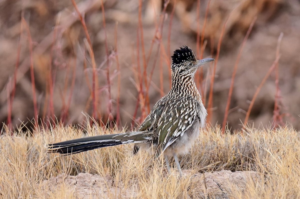
Mule deer, elk, black bears, mountain lions, bobcats, coyotes, foxes, pronghorn, and prairie dogs are common throughout the mountain ranges in the Magdalena Ranger District. Frequently seen birds in the region include turkeys, turkey vultures, red-tailed hawks, northern goshawks, kestrels, bald eagles, golden eagles, peregrine falcons, and Mexican spotted owls.
The Magdalena and San Mateo Mountains have fairly similar forest compositions. Above 8,000 ft (2,440 m) in elevation, the forest is composed of douglas fir, white fir, southwestern white pine, and ponderosa pine. The San Mateo Mountains also have stands of Engelmann spruce.
Between 6,500 ft (1,980 m) and 8,000 ft (2,440 m) in elevation, ponderosa pine, mountain mahogany, and Gambel oak are common. The pinyon-juniper forests in the region also begin at elevations around 6,500 ft (1,980 m). These forests feature one-seed juniper, rocky mountain juniper, alligator juniper, and two-needle pinyon.
The understory across the district consists of grasses, shrubs, forbs, and cacti. The most commonly seen grasses include blue grama grass, black grama grass, poverty three-awn grass, purple three-awn, sideoats grama, ring muhly, mountain muhly, pine dropseed, sand dropseed, Indian ricegrass, and wolf’s tail.
Common shrubs, forbs, and cacti that are found in the ranger district include four-winged saltbush, bud sagebrush, creosote bush, greasewood, broom snakeweed, soapweed yucca, Navajo yucca, Mormon tea, prickly pear cactus, and cholla cactus.
The Magdalena Ranger District runs a small timber program. The main goals of this program are forest restoration and improving wildlife habitat. There are limited permits available in the forest to harvest house logs, posts, and poles.
The district also uses prescribed fire to help maintain ecosystems and prevent wildfires. Currently, there are prescribed fire management plans in place for Apache Kid Wilderness and Withington Wilderness with future plans to expand this to include all of the San Mateo Mountain Range. The district receives 11.5 in (29 cm) to 12.5 in (32 cm) of precipitation annually.
Archaeological studies in the area have turned up numerous spearheads from the Paleoindian period about 11,500 to 8,500 years ago, a time when humans in the area typically lived in mobile hunting groups and followed now-extinct megafauna such as mammoths, mastodons, and prehistoric bison.
The region also has evidence of peoples from the Archaic period who lived in the area about 8,500 to 1,700 years ago as the shifting climate began to encourage early humans to hunt smaller game and gather more plants. This ultimately led to stronger seasonal migration patterns and less mobility among communities.
The Ancestral Puebloans lived on and around the Colorado Plateau for 4,000 years until about 1540 CE when the Europeans first arrived. Indigenous people in the region first made contact with Europeans when a group of Spaniards passed near Socorro. Spain eventually claimed the region as part of the territory of New Spain. In 1821, Mexico gained its independence from Spain and began to establish land claims in what is now New Mexico.
The land that is now the Magdalena Ranger District is part of the traditional territory of the Apache, which includes bands such as the Jicarilla Apache, Mescalero Apache, Western Apache, and the Chiricahua Apache, though the traditional territory of the Chiricahua most closely aligns with that of the Magdalena Ranger District.
The Apache lived throughout the region from at least the 1600s until their defeat in the Apache Wars in the late 1800s. In the aftermath of the wars, most Apache bands in the region were forced onto reservations, both within what is now New Mexico and as far away as Oklahoma.
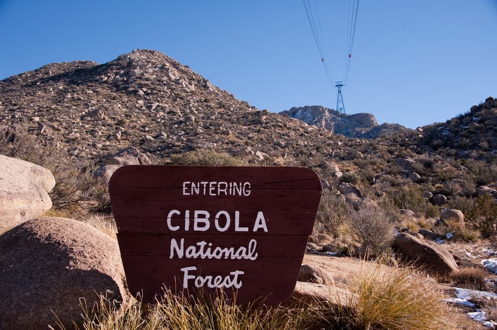
In 1932, the Cibola National Forest was formally established by combining a collection of forest reserves in the area. Both the Withington Wilderness and the Apache Kid Wilderness were created in 1980 as part of the New Mexico Wilderness Act.
Today, the area is mainly used for recreational purposes, such as hiking, camping, horseback riding, mountain biking, rock climbing, and hunting.
The district administers an extensive grazing program. There are 40 grazing allotments in the district and ranchers run approximately 8,000 cattle in the district annually. Furthermore, approximately 31,000 acres (12,545 ha) of the district are set aside for the Langmuir Laboratory for Atmospheric Research and the Magdalena Ridge Observatory.
The Magdalena Ranger District oversees 190 mi (306 km) of trails, most of which run through the Magdalena and San Mateo Mountains. In addition to hiking, biking, and horseback riding trails, the area also hosts some impressive rock climbing opportunities, most notably at Thompson Canyon and the Enchanted Tower.
With that in mind, here are some of the best hikes in the Magdalena Ranger District of the Cibola National Forest to check out during your next trip to the region.
Part of the Grand Enchantment Trail, a 770 mi (1,239 km) route that runs from Arizona to New Mexico, the Apache Kid Trail is a challenging 21 mi (34 km) long out-and-back hike. It begins at the Springtime Campground and passes San Mateo Peak, Apache Kid Peak, and Blue Mountain Peak before reaching West Blue Mountain.
This trail gains around 6,750 ft (2,057 m) in elevation and takes an estimated 12 hours to complete. Water sources along the route are unreliable, so hikers should bring enough water for their hike when they set off from the trailhead.
A 6.2 mi (10 km) one-way trail, Potato Canyon Trail begins off Forest Road 56 at an elevation of 6,720 ft (2,048 m). The trail ends along Forest Road 138 at an elevation of 9,760 ft (2,975 m). Early on, the trail crosses into Withington Wilderness. It is considered a challenging trail because much of the footing along the canyon is loose and gravelly.
The route winds its way through pinyon-juniper and mixed conifer forest and provides good vantage points over Potato Canyon, Mount Withington (the trail ends in a saddle just south of the Mount Withington lookout), and Potato Rock.
A 4.5 mi (7 km) long loop, the Mesa Trail begins at the Mesa Trailhead on Forest Road 235. It gains around 1,500 ft (457 m) in elevation and is open for hiking, mountain biking, and horseback riding.
It’s recommended that you hike this loop counterclockwise to avoid the steep, uphill climb. Hikers should also pay close attention to trail markers on this hike as there are only a few along this route and they’re all easily missed.
There are five developed campgrounds located within the Magdalena Ranger District: Water Canyon, Springtime, Luna Park, Bear Trap, and Hughes Mill. Socorro is a small town that’s located nearby, and the larger cities of Albuquerque and Santa Fe are just under four and five hours away from the Magdalena Ranger District, respectively.
Here are some of the best cities and towns to visit during your next trip to the Magdalena Ranger District of Cibola National Forest.
With a population of around 8,500 people, the small New Mexican town of Socorro celebrates its heritage and southwestern roots through art, historical walks, museums, and abundant opportunities to enjoy the local flora and fauna. Local events include farmer's markets, art exhibitions, and performances of Mexican folk and Tex-Mex music.
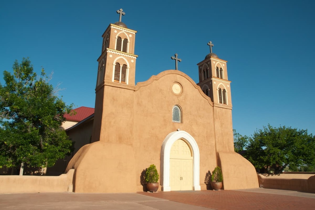
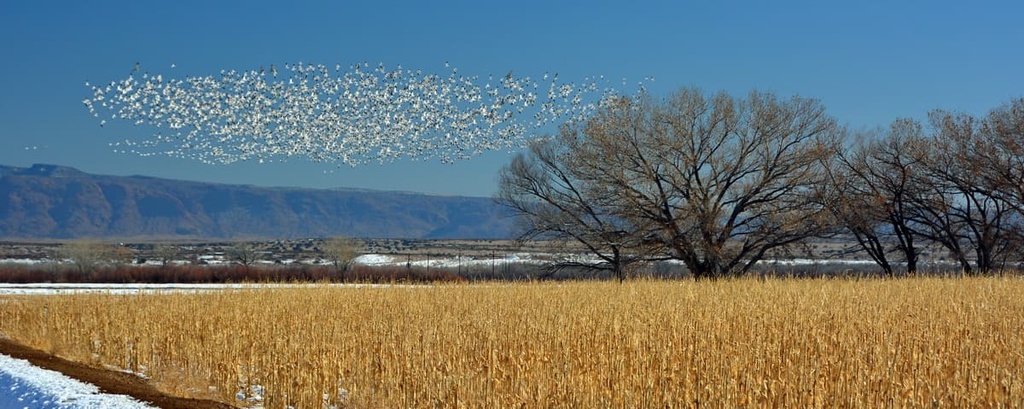
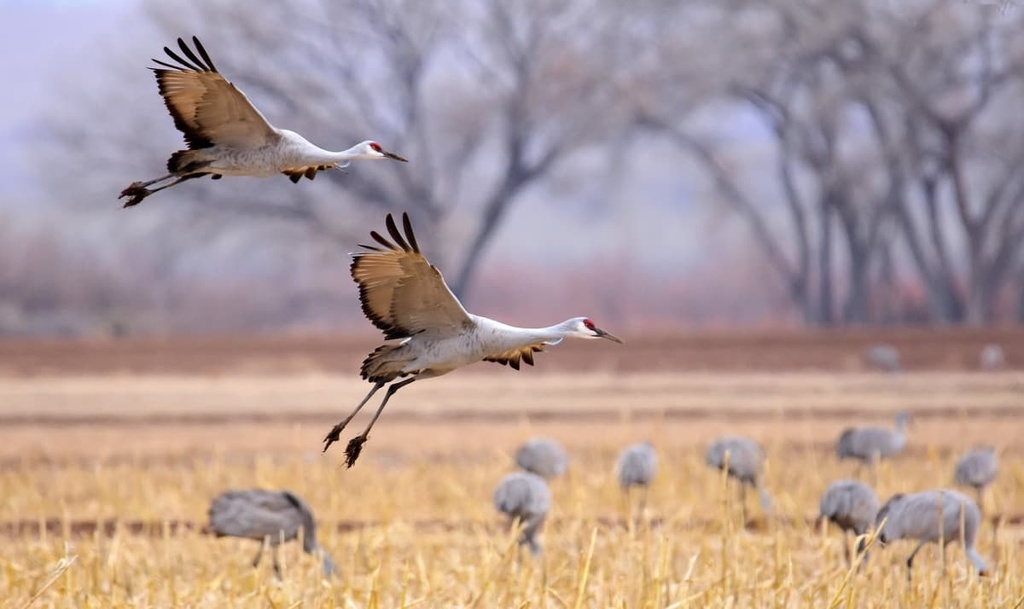
Those interested in a deep dive into the local ecology can look to the Native Plant Society of New Mexico for a guide as they explore the refuges and hikes that are situated around Socorro. Bosque del Apache National Wildlife Refuge is a prime spot in the area around Socorro for nature enthusiasts as it hosts a Festival of the Cranes in late November when the sandhill cranes pass through the region on their southbound migration.
For local cuisine, look out for the iconic green chile cheeseburgers at in-town favorites like the Owl Bar and Cafe or Socorro Springs Brewing Company. There are budget motels and chain hotels available in town if you’re in need of lodging, as well as B&Bs, RV parks, and campgrounds.
Home to just over half a million people, Albuquerque is a city that can be experienced in a plethora of ways, from tasting your way through southwestern flavors to visiting galleries and museums that celebrate the community’s rich artistic and cultural traditions or exploring the landscape on foot and via hot air balloon.
Looking for an outdoor adventure while in Albuquerque? The Sandia Mountains border the city to the east and trails in the mountains range from easy strolls in the foothills to strenuous climbs to the summit of Sandia Peak. The Sandia Peak Aerial Tramway offers a shortcut to the top of the 10,378 ft (3,163 m) peak, too, if you’d prefer not to hike. Another worthwhile stop while in the city is the incredible Petroglyph National Monument.
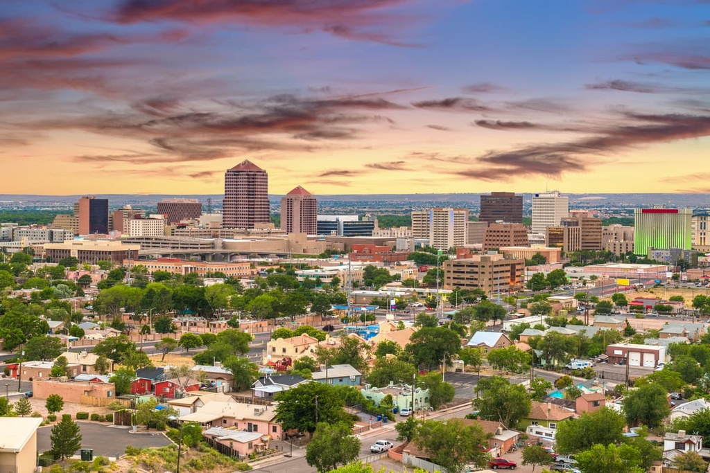
Alternatively, dive into the city’s rich cultural scene by visiting the Indian Pueblo Cultural Center, the National Hispanic Cultural Center, or the Albuquerque Museum of Art and History. While exploring the downtown area of Albuquerque, pop into the numerous galleries that display local art, pottery, and jewelry, and enjoy the colorful street art that adorns the walls of the city.
Albuquerque is lauded as a foodie destination, so one can easily eat their way through the city. In Albuquerque, you can enjoy everything from classic New Mexican dishes to cuisines from all around the world. The city also boasts a rich nightlife with bars, breweries, dance clubs, and multiple casinos.
Beyond the standard hotels and motels, some of the many charming local accommodations in Albuquerque include the Los Poblanos Historic Inn and Organic Farm as well as the region’s numerous B&Bs, which boast cozy, southwestern vibes. There are also resorts, vacation rentals, and plenty of RV parks and campgrounds located nearby for those looking to stay near the city.
Sitting at an elevation of 7,200 ft (2,195 m), Santa Fe is a city of 84,000 inhabitants that boasts a rich history and a plethora of scenic landscapes.
You can explore the city with a guided tram or walking tour, or you can independently walk through Santa Fe on a curated self-guided stroll that hits up chocolate stores, coffee shops, tea houses, famous historical landmarks, and some hot spots on the local art scene.
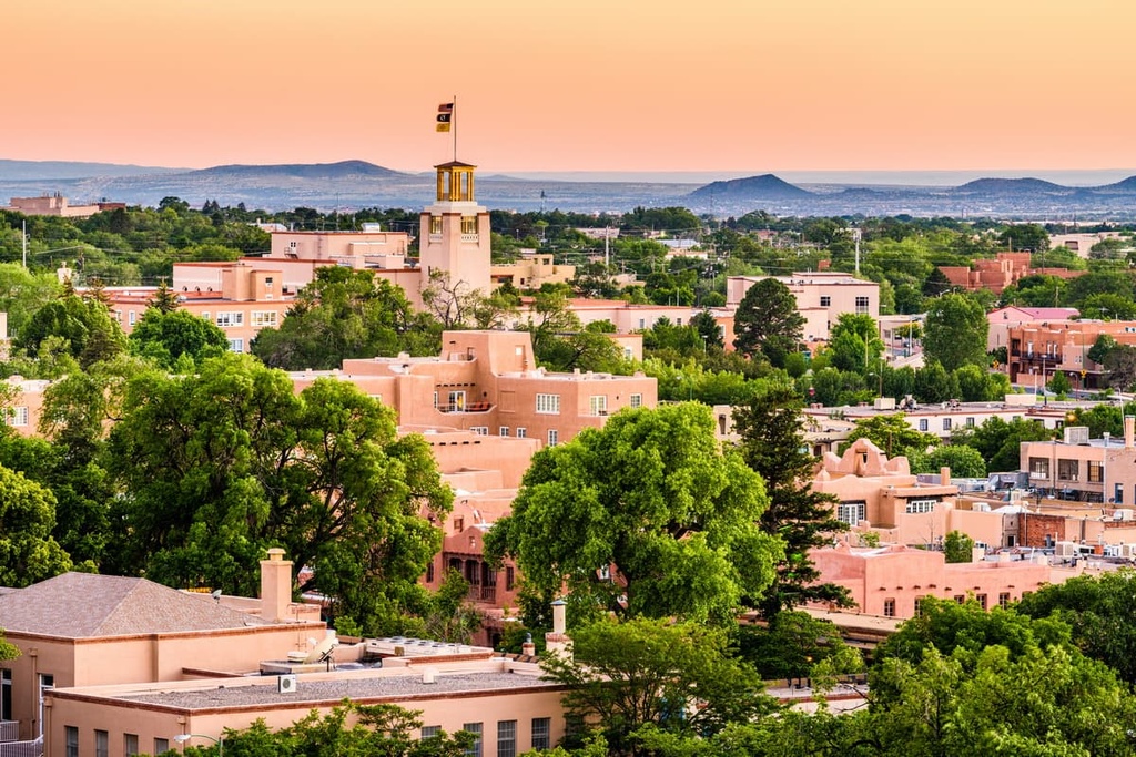
Plus, just a short distance from Santa Fe, one can hike, golf, go white water rafting, or fly fish in the mountains. The Georgia O’Keeffe Museum, New Mexico Museum of Art, and New Mexico History Museum are all worthwhile stops in Santa Fe, too.
New Mexican foods abound and chiles tend to accompany many of the classic dishes in Santa Fe. As far as accommodation options go, you can find everything from luxury spas and resorts to cozy B&Bs, rustic RV parks, and campgrounds in stunning Santa Fe.