Scan the QR code and open PeakVisor on your phone
The San Mateo Mountains in Socorro County in southwestern New Mexico in the United States are approximately 32 mi (50 km) long and overlapped by the Cibola National Forest, the Apache Kid Wilderness, and the Withington Wilderness. There are 49 mountains in the range. At 10,331 ft (3,149 m), West Blue Mountain is the tallest and most prominent (3,146 ft/959 m). However, it lies in a remote part of the range far from paved roads and is rarely visited.
The roughly 32 mi (50 km) long San Mateo Mountains in southwestern New Mexico rise from desert plains between 5,000 and 6,000 ft (1,525 and 1,830 m) to a handful of peaks over 10,000 ft (3,050 m). The Cibola National Forest – Magdalena Ranger District covers a large portion of the range.
The Apache Kid Wilderness encompasses 44,678 acres (18,081 ha) in the south. From canyons to rugged peaks, the wilderness area includes ocotillo at low elevations, pinyon-juniper woodlands, ponderosa pine forests, and spruce-fir forests and aspen groves at higher elevations.
This wilderness area is historically notable for containing the site where local ranchers caught and killed the Apache Kid in retaliation for his many raids. The ranchers burned and hacked a tree to mark the site of the murder in 1894 and this spot can still be seen today.
The Withington Wilderness is one of the state’s least visited wilderness areas and occupies a little under 19,000 acres (7,690 ha) in the furthest north section of the mountains, mainly along the eastern slopes. Elevations here range from 6,800 ft (2,070 m) to 10,098 ft (3,078 m) on Mount Withington – the range’s second most prominent peak.
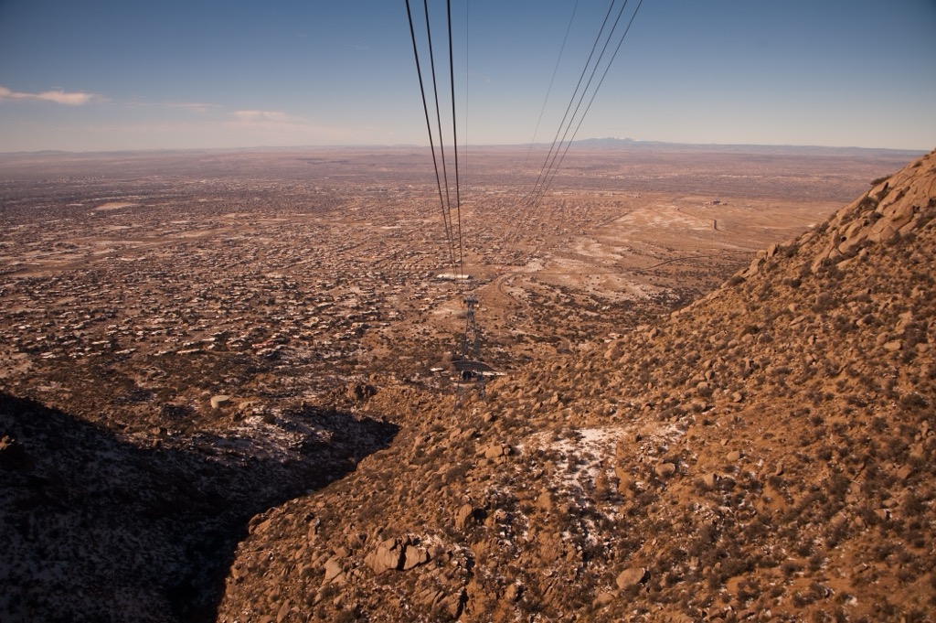
This remote area has three trails, although even these can be primitive at best in some areas. The Very Large Array radio telescope observatory is located near the base of Mount Withington on the Plains of San Agustin.
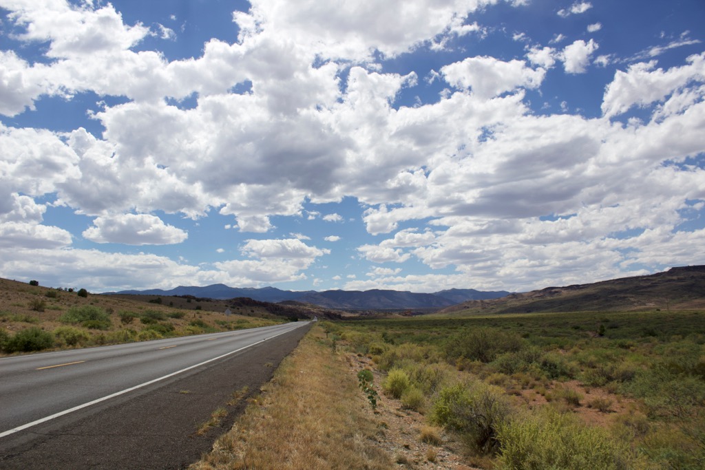
For those planning a visit to the San Mateo Mountains, south of Grassy Lookout (9,662 ft/2,945 m), including the Apache Kid Wilderness, has few roads and more than 150 mi (240 km) of trails through rugged scenery making it a good spot for multi-day loops. North of Grassy Lookout has gentler hikes and less water along the trails making it well-suited for day hikes.
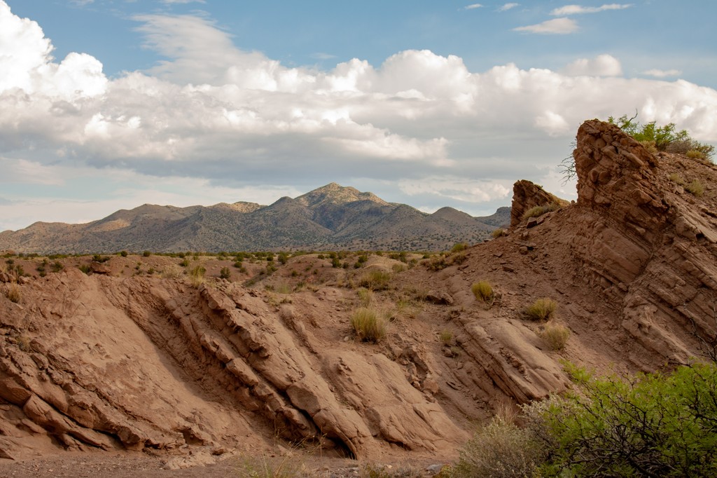
The San Mateo Mountains are part of the Mogollon-Datil volcanic field – a volcanic province from the late Eocene-Oligocene that reaches from New Mexico into Chihuahua, Mexico. The range is bordered by Monticello graben to the west, and by Mulligen Gulch and the San Marcial basin to the east. Nogal Canyon caldera is exposed in the southern part of the range. Vicks Peak tuff, rhyolite, and quartz latite erupted from the caldera and was later intruded by granite stocks.
Tertiary volcanism started between 40 and 36 million years ago, leaving behind andesitic lavas and breccias. Periods of volcanism were accompanied by faulting and hydrothermal alterations that reshaped the range. The range contains mainly volcanic rocks with some shallow intrusions. Paleozoic and Proterozoic rocks are exposed in some areas.
The oldest exposed rocks in the south consist of granite with occurrences of feldspar, quartz, and magnetite. Some gneiss is present, along with small quartz, feldspar, and muscovite intrusions. This is overlaid in places by sedimentary rocks including sandstones and limestones.
Rising from high desert between 5,000 and 6,000 ft (1,525 and 1,830 m), desert vegetation such as ocotillo can be found at the lower elevations around the San Mateo Mountains. Climbing above the rocky canyons, pinyon pine and juniper woodland dominate. As elevation increases, the trees transition to ponderosa pine. Spruce, Douglas fir, white fir, and aspen occur at higher elevations.
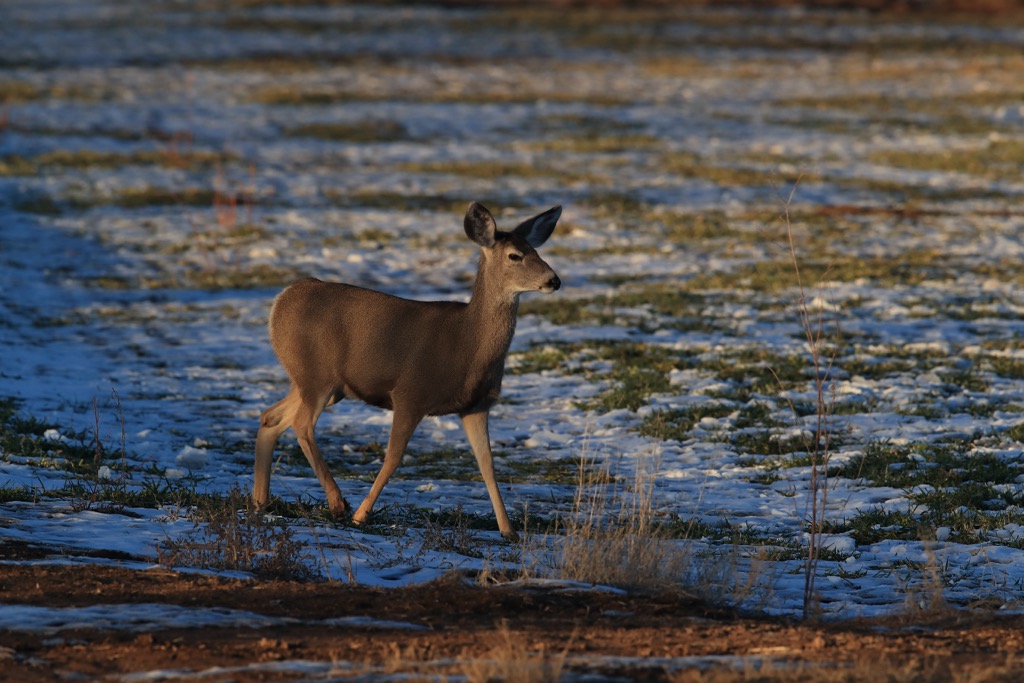
The area typically experiences cold winters and hot summers. Rain in July and August can keep streams flowing but also brings the risk of flooding narrow canyons. Common wildlife in the area include Coues white-tailed deer, mule deer, elk, black bears, bobcats, cougars, antelope, javelina, coyotes, rabbits, squirrels, quail, and a variety of birds of prey.
The Piros were some of the earliest inhabitants in recent history around Socorro County, arriving in the region around 1200. A few centuries later, the Navajo and Apache moved in. For some time, the area’s rugged landscape helped keep populations and conflict between groups relatively low. The community of Socorro was established and named after a Spanish explorer in 1598. Spanish missionaries continued to arrive in the following decades.
In 1680, Native Americans revolted against the Spanish, pushing them south towards what is now Mexico. The territory shifted ownership several times. In 1692, the Spanish reclaimed much of New Mexico although the area around the San Mateo Mountains remained sparsely populated. By the 1800s, Spanish settlements increased, including ranches and trading stops along the Camino Real. In 1821, Socorro County became part of Mexico.
A couple decades later following the war with Mexico, the United States claimed the land as their own. The area saw some action during the Civil War with the most notable battle occurring at Valverde with a Confederate victory.
Mining and ranching in the region increased from the late 1800s to early 1900s during which the area embodied the “wild west” feel with events like the Apache Kids’s murder and the famous Sheriff Elfego Baca shoot out.
The Apache Kid, after whom the wilderness area is named, was a White Mountain Apache who was taken captive by the Yuma as a youth. As an adult in the 1890s, he spent several years raiding ranches and hiding out in the San Mateo Mountains before his capture and murder in 1894.
The region’s “wild west” became more tranquil by the mid-1900s. Today, ranching and farming are the main drivers of the local economy. The Civilian Conservation Corps developed campsites and roads in the mountains in the 1930s. The Apache Kid and Withington Wildernesses were established in 1980 and are maintained by the Forest Service.
From Grassy Lookout southwards, there are more than 150 mi (240 km) of trails, including 68 mi (109 km) of trails in the Apache Kid Wilderness. There are a handful of semi-dependable streams in this part of the range, with rains in July and August helping to keep them flowing. Many enter the wilderness at Springtime campground.
To the north in the Withington Wilderness, there are only three trails that are very loosely maintained. The Magdalena Ranger District of Cibola National Forest has a complete list of all trails in the San Mateo Mountains that can be found here.
The Apache Kid Trail #43 is one of the longest and best maintained trails in the Apache Kid Wilderness. It measures about 21 mi (34 km) and runs from Springtime campground to Grassy Lookout. Although it is not completely reliable, water is typically available at San Mateo spring, Twenty Five Yard Spring, Water Canyon, Pothole Spring, Tool Box, and Indian Springs.
The trail begins in a canyon with ponderosa pine and scenic rock formations. The first mile (1.6 km) follows the upper part of Nogal Canyon and passes through white and Douglas fir. It then climbs a series of switchbacks to reach higher in the range. Many other trails intersect this route along the way.
The trail to summit San Mateo Peak (10,135 ft/3,089 m) is 7.6 mi (12.2 km) out and back with about 2,700 ft (825 m) elevation gain. The route begins on the Apache Kid Trail but diverges onto Cowboy Trail for the final 0.8 mi (1.3 km) to the summit. There is an old fire tower and cabin at the summit.
The Apache Kid Trail can also be used to reach Blue Mountain (10,299 ft/3,139 m) – one of seven peaks along the Grand Enchantment Trail.
The Potato Canyon Trail #38 is a 6 mi (9.7 km) trail in Withington Wilderness. It is a primitive trail that mainly follows a wash. At times the trail can be hard to follow or nonexistent. The area in general is rarely visited. However, those who are confident navigating in the wilderness can branch off to explore the Potato and Cooney Canyon with the place to themselves.
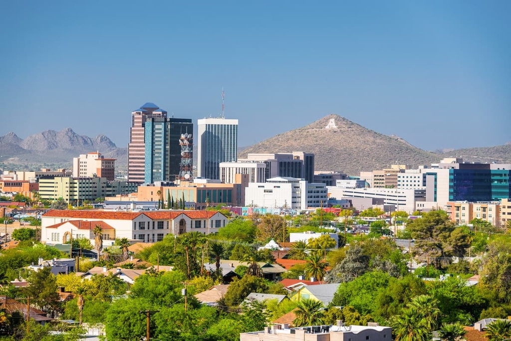
The towns of Socorro and Truth or Consequences both have populations of several thousand people and basic amenities and accommodation. Albuquerque is under four hours drive away to the north and El Paso, Texas is just over four hours away to the south.
Albuquerque is home to 565,000 people and holds the distinction of being the hot air ballooning capital of the world. Native American and Hispanic and Latino culture strongly influences the city and can be explored at one of the many cultural centers, museums, performing art centers, or via local restaurants.
The city sits around one mile (1.6 km) above sea level. There is easy access to the Sandia and Manzano Mountains for epic hiking and mountain biking. The Paseo del Bosque trail runs 16 mi (26 km) through town and the city is well situated to make a day trip to the Valles Caldera National Preserve.
New Mexican cuisine features corn, beans, squash, chiles (red, green, or ‘Christmas’ for both) with distinct indigenous and Hispanic influences. The dining scene is diverse, ranging from sushi to taquerias to fine dining, and with a good selection of wine bars and breweries. Lodging around the city includes hotels, motels, B&Bs, resorts, campgrounds, and RV parks.
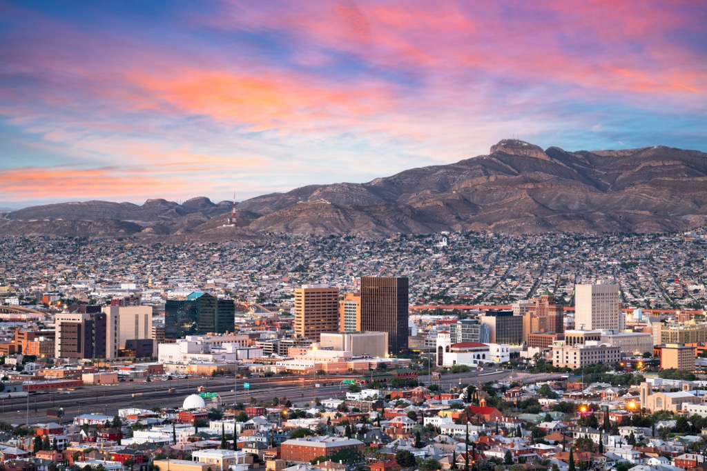
El Paso, Texas, has a population of 680,000 on the border with Mexico. Popular outdoor excursions include a short hike through lechuguillas, ocotillos, yuccas, and prickly pear to see the Aztec Caves, a visit to the pictographs at Hueco Tanks State Park & Historic Site, or a hike in the Franklin Mountains.
The city offers a zoo, waterpark, and live music and performances. Some of the best restaurants include steakhouses, excellent Mexican food, and barbecue. In addition to standard hotels and motels, the city also has glamorous and historic hotels. A more rustic option is staying over at a campsite or RV park outside the city.