
Scan the QR code and open PeakVisor on your phone
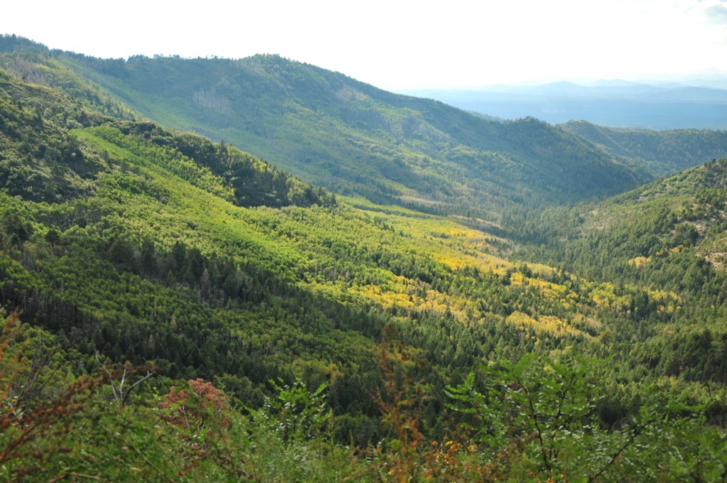
Considered New Mexico’s “wildest wilderness”, the Aldo Leopold Wilderness spans a portion of the Black Range ridges in the United States’ southwest and is part of Gila National Forest. Although impressive with peaks over 10,000 ft (3,000 m), pine, oak, and fir forests, and deep canyons, the wilderness has unfortunately experienced numerous wildfires in recent years. McKnight Mountain is the tallest (10,167 ft/3,099 m) and most prominent (2,526 ft/770 m) of the 23 mountains in the area.
The Aldo Leopold Wilderness is one of three wilderness areas within Gila National Forest in New Mexico. It lies adjacent to Gila Wilderness, which it was formerly part of, in the state’s southwest. Gila Wilderness was established in 1924. Over time, with modifications and added acreage, the Aldo Leopold Wilderness was carved out in 1980 and is separated from Gila Wilderness by Forest Service Road 150.
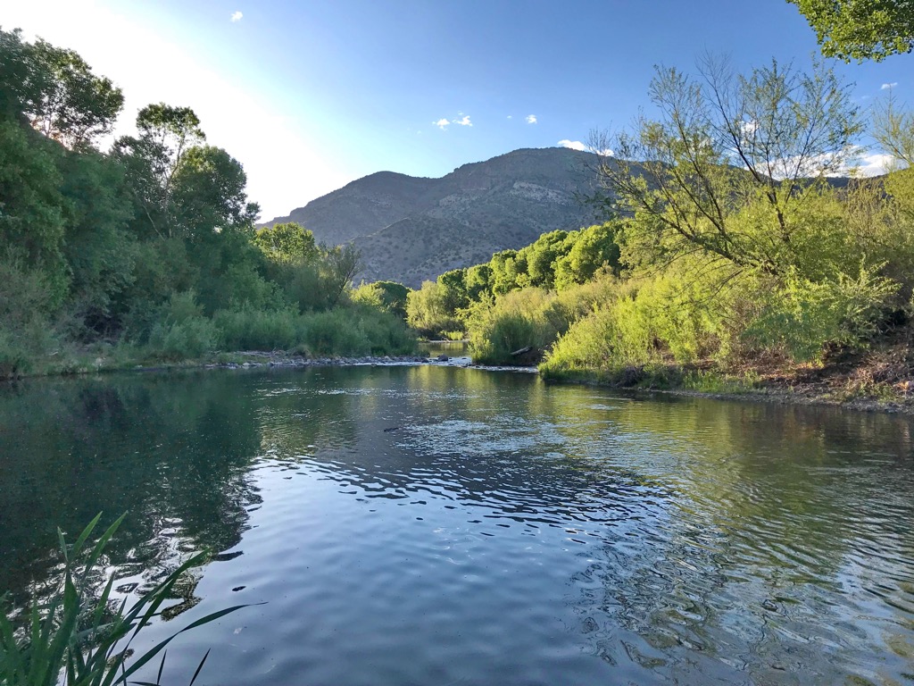
The wilderness covers 202,016 acres (81,753 hectares) along the southern crest and subsidiary ridges of the Black Range. It is a wild landscape marked by sharp ridges with elevations between 6,000 and 10,167 ft (1,800 and 3,099 m) and deep canyons. A section of the Continental Divide Trail follows the Black Range to Reeds Peak (10,013 ft/3,052 m) where it then diverges to the southwest out of the wilderness.
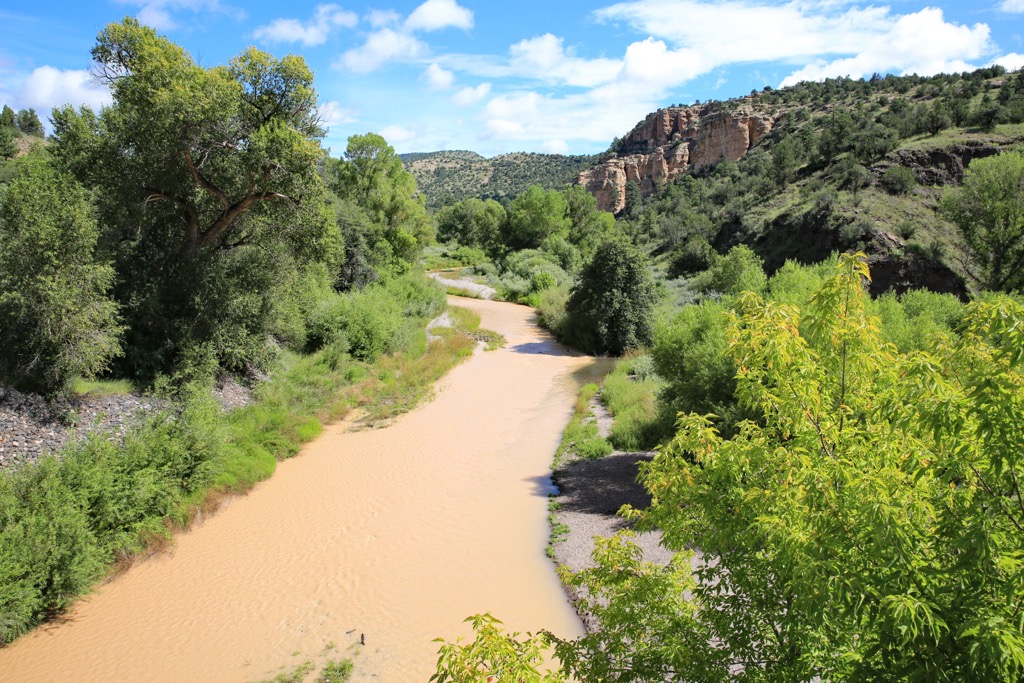
The tallest peaks are McKnight Mountain (10,167 ft/3,099 m), Hillsboro Peak (10,020 ft/3,054 m), Reeds Peak (10,013 ft/3,052 m), Sheep Mountain (9,885 ft/3,013 m), and Diamond Peak (9,852 ft/3,003 m). The Mimbres River, Diamond Creek, and headwater streams of Seco Creek flow through the wilderness.
It is named after Aldo Leopold, one of the United States’ most influential conservationists from the 20th century.
During the Cenozoic era 35 to 25 million years ago, New Mexico experienced a wave of volcanism. This period of volcanic activity is responsible for the formation of not only the Black Range, but also the Mogollon Mountains, Datil Mountains, Sierra Blanca, and Shiprock in New Mexico.
The region surrounding the Gila Cliff Dwellings was also formed by volcanic events that left behind the Bursum and Cliff Dweller calderas. Several layers of rocks are present including igneous rhyolitic rocks, petrified ash, and Gila conglomerates – a mix of rocks welded together by a naturally occurring sandstone mortar.
The conglomerates are prone to a process called exfoliation where they break and flake off in small pieces. It is exactly these conditions that enabled the cliff dwellings of the ancient Mogollon culture to be carved into the rocky walls and constructed beneath overhangs.
The Aldo Leopold Wilderness supports riparian ecosystems along its canyon floors with willows, cottonwoods, boxelders, and Arizona sycamores thriving along the creek beds. Juniper, pinyon pine, ponderosa pine, and oak climb the slopes up to 7,000 ft (2,130 m). Above this, Engelmann spruce, blue spruce, white fir, subalpine fir, and quaking aspen fill the higher montane and subalpine forests.
The rocky terrain is home to a number of lizards, snakes, rodents, and bats. Larger mammals that roam here include gray foxes, bobcats, ringtails, coyotes, black bears, mountain lions, mule deer, and elk. The area is also part of the U.S. Fish and Wildlife Service’s recovery area for Mexican gray wolves which were reintroduced into the region in 1998.
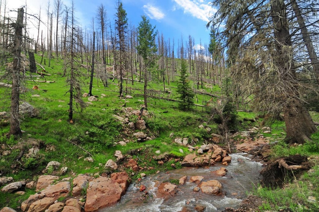
The Silver Fire of 2013 and Black Fire of 2022 ravaged portions of the wilderness. Due to changing conditions, visitors should check Forest Service updates on trail conditions and closures before planning a trip here.
Archeological finds offer a few indications of hunting by PaleoIndians in the region between 9,000 and 6,500 BC. Much more widespread evidence exists of Archaic culture, part of the Cochise culture, from 6,000 BC to 300 AD. By the end of this period, ancient people were growing corn and squash and building small houses for seasonal inhabitation.
The Mogollon culture followed, likely a direct evolution of the Cochise culture. This marked a shift in lifestyle as people became more sedentary with their focus on cultivating food and constructing pit houses, pueblos, and cliff dwellings. They created pottery, a tradition that peaked with the black and white pottery of the Mimbres people.
Around the 13th century, the Mogollon culture disappeared, perhaps due to climatic conditions, depletion of resources, and conflict. During the 16th and 17th century, the Apache moved into the region from the northwest. A nomadic, hunting-gathering peoples, they entered the area at a time when grizzly bears, wolves, and the now extinct Merriam's elk still lived in the mountains. The ruggedness of the landscape likely helped prevent overpopulation and thereby minimized conflict for some time.
However, by the 1800s, the Spanish began occupying the area for copper mines they used to make coins. In 1821, Gila became part of Mexico following the revolution against Spain. In 1848 with the termination of the War with Mexico and the Gadsden Purchase, Gila was claimed by the United States. This ushered in a new era of settlers, ranchers, and miners. By the late 1800s, most Native Americans had been killed or forced to resettle on reservations. This was also a time of increased environmental degradation as settlers cut forests and altered rivers to fuel their mining and mill operations.
The Gila Wilderness was established in 1924, with the US conservationist Aldo Leopold playing a pivotal role in protecting it. Over time, alterations were made to the acreage, and the Aldo Leopold Wilderness was officially created in 1980.
33 mi (53 km) of the Continental Divide Trail pass through the wilderness. The Silver Fire in 2013 and Black Fire in spring of 2022 damaged sections of the wilderness. Before visiting, check the Forest Service site to see if the area is open.
Water levels in the creeks can vary depending on droughts and rainfall so it’s best to check recent reports if you are planning an extended trip in the wilderness.
This is a great backpacking trail. It is divided into two sections but both begin at Emory Pass on NM 152. Going north, the trail heads towards Hillsboro Peak (10,020 ft/3,054 m), the second tallest peak in the wilderness. The landscape it traverses is almost entirely wilderness and accessible only on foot or horseback.
As it runs along the ridge, it takes in some of the range’s tallest peaks and crosses through ponderosa pine, mixed conifer, and aspen forests. The trail is about 27.7 mi (44.6 km) from trailhead to Reeds Peak (10,013 ft/3,052 m) where it runs into Continental Divide Trail #74.
The trail south from Emory Pass goes towards Sawyers Peak (9,646 ft/2,940 m) and ends at Forest Road 886, passing through dense forest along the way. It is 8.3 mi (13.4 km) one way and often done as an out and back trail.
The trail departs from Diamond Creek Trailhead off of Forest Road 150 and runs approximately 20 mi (32 mi) to its end at Continental Divide Trail #74 near Diamond Peak (9,852 ft/3,003 m). The first part of the trail doesn’t have much shade so it’s nice to get an early start. It goes from meadow through canyons and ponderosa and oak forest. The creek running along the canyon typically has water, but it can vary depending on rainfall.
The trail begins at the Railroad Canyon Campground and extends 6 mi (9.7 km) until it terminates at the intersection of Black Range Crest Trail #79. There are several stream crossings along the way.
Sections of the trail are not well marked where it was damaged by the Silver Fire in 2013, but if one continues to follow the Gallinas Creek upstream, the trail sticks close to the stream so you’ll likely spot the trail again.
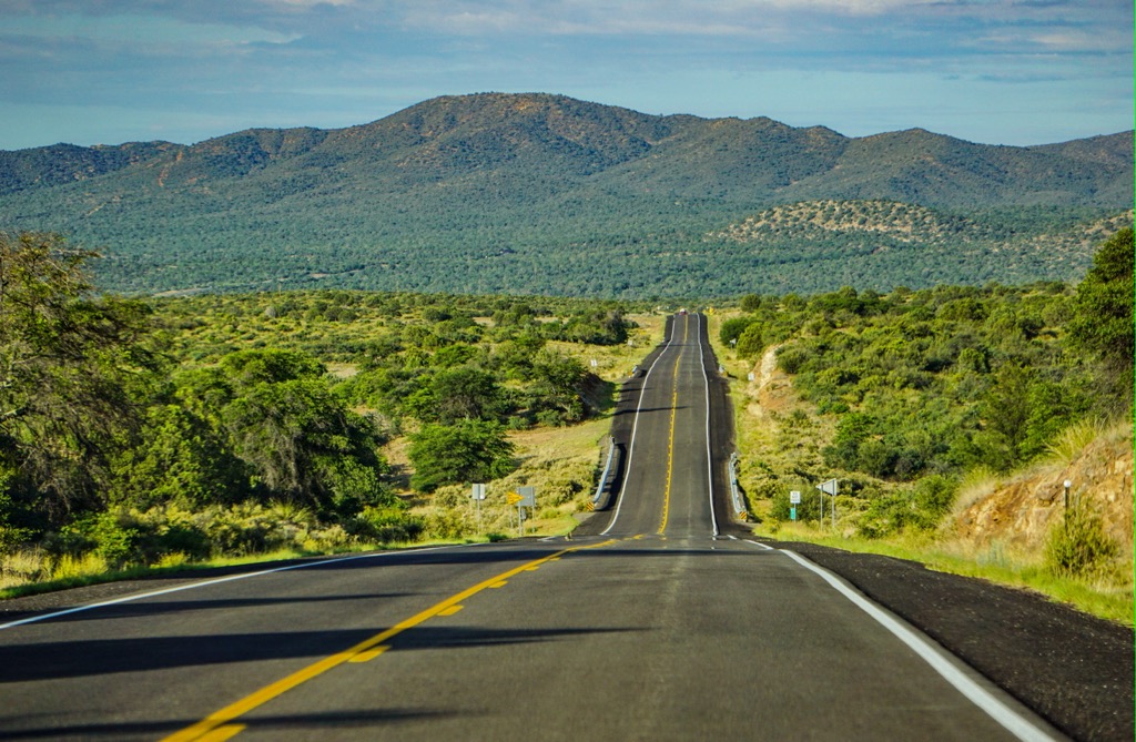
There are a handful of designated campsites surrounding the wilderness and within Gila National Forest. Backcountry camping is also allowed. Several small towns and communities punctuate the surrounding area. The bigger cities of Albuquerque and Tucson, AZ are a three and fours hours drive away, respectively.
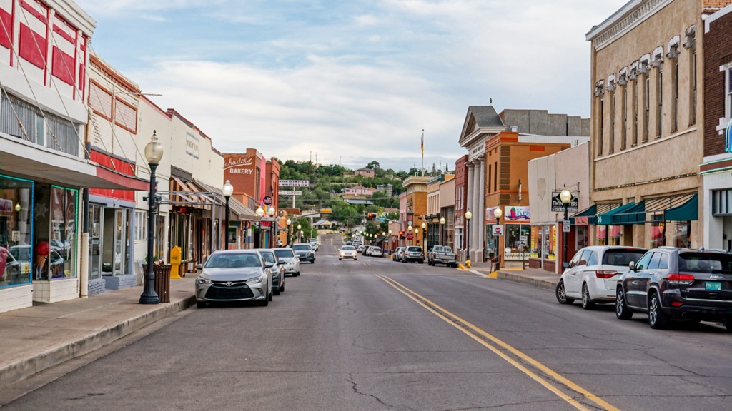
Silver City is a gateway community for the Continental Divide Trail about one hour’s drive from the Aldo Leopold Wilderness. The high desert town of 9,500 people welcomes thru-hikers to its robust downtown.
Located on the ancestral lands of the Chiricahua Apache, founded by Spaniards, and with its close proximity to Mexico, the town celebrates its cultural heritage and diversity via a vibrant art scene.
It also lies in close proximity to extraordinary ecological diversity, nestled between the Mogollon Range, Black Range, and the arroyos and the isolated sky island mountains of the Chiricahua Desert. It is not far to visit the Gila Cliff Dwellings and Gila Hot Springs.
There are plenty of restaurants in town, most with a Mexican or New Mexican flare. You’ll notice lots of locally inspired and sourced flavors on the menus. Accommodation options run the gamut from camping to B&Bs to hotels.
A three hour drive from the wilderness, Albuquerque is New Mexico’s largest city with a population of 560,000 people. The city can be enjoyed from above in a hot air balloon, biking along the Sandia foothills, kayaking the Rio Grande, or relaxing on a golf course.
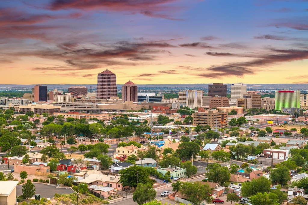
In addition to a rich arts scene inspired by the landscape and the state’s diverse cultural history, one can also learn more about this heritage at the National Hispanic Cultural Center and the Indian Pueblo Cultural Center, or visit one of the city’s museums.
The downtown celebrates its distinct culinary traditions so be sure to look for New Mexican classics with local ingredients thrown in. From hotels and resorts to B&Bs and farm-based inns like Los Poblanos, there is a wide selection of places to stay.
Four hours by car from the Aldo Leopold Wilderness in the middle of the Sonoran Desert, Tucson, Arizona is a lively city with easy access to culture and the outdoors. It has a population of 545,000 people and multiple museums and historic sites recognizing the diverse influence of Native American, Mexican settlers, and Spanish missionaries on the area.
The city sits close to Saguaro National Park and the waterfalls of the Sabino Canyon Recreation Area. There are galleries, shops, casinos, and spas for those looking to spend more time in the city itself.
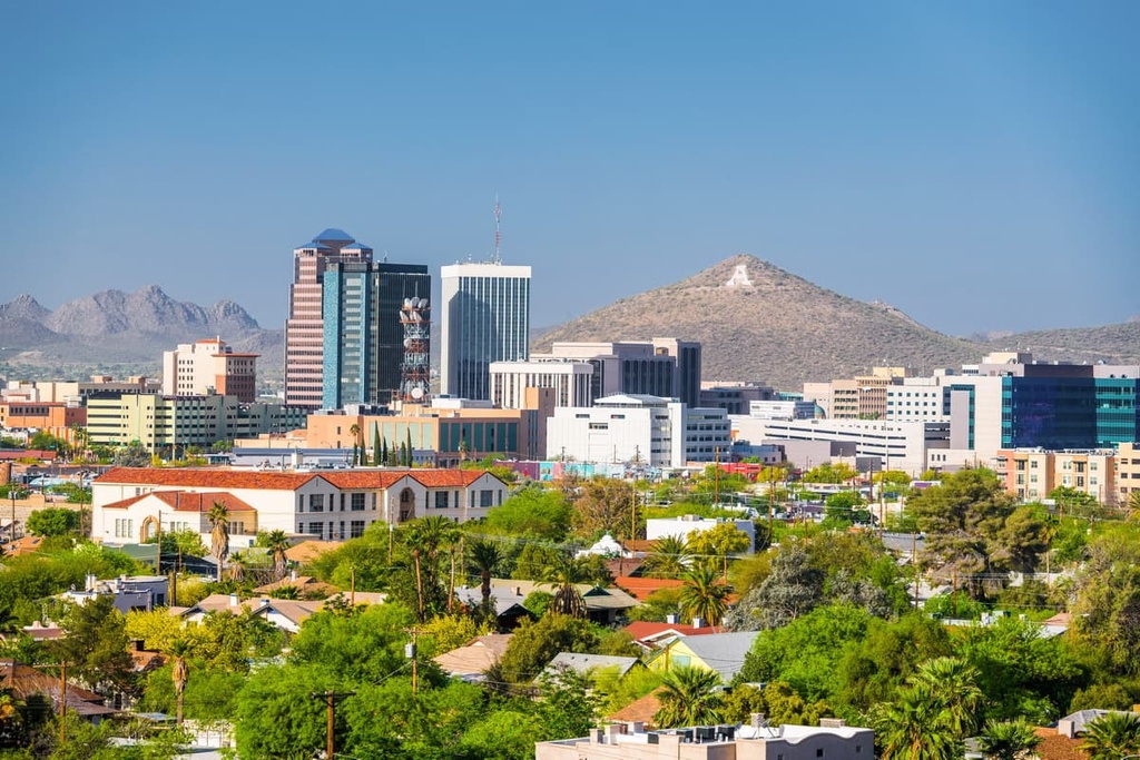
Tucson is the United States’ first designated UNESCO City of Gastronomy. With a big Mexican influence, the local dining scene also prides itself on using native and local ingredients. Try a mesquite-smoked whiskey, chile-spiced coffee, or prickly pear glazed ribs. Booking a stay here is easy with options including resorts, hotels, campsites, and guest ranches all within or close to the city.


