Scan the QR code and open PeakVisor on your phone
The Gila Wilderness is a large federally protected wilderness area situated in the southwestern part of the US state of New Mexico. The wilderness lies within Gila National Forest and is one of the oldest designated wilderness areas in the world. The Gila Wilderness contains 55 named peaks, the highest and most prominent of which is Whitewater Baldy (10,892 ft/ 3,320 m).
The Gila Wilderness lies in southwestern New Mexico within Gila National Forest, and it encompasses 558,014 acres (225,820 ha) of terrain. Situated in Grant and Catron counties, the wilderness roughly extends for roughly 27 miles (43 km) from north to south and 39 miles (63 km) from east to west.
As it was established in 1924, the Gila Wilderness is the oldest designated wilderness area in the US. The protected region features a diversity of landscapes, and it contains the highest peak in the entire Gila National Forest.
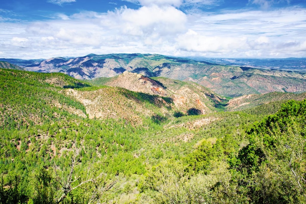
The eastern region of the wilderness features rolling hills, deep canyons, and towering mesas. This area is home to both grasslands and woodlands that contain a mix of pinon and juniper trees. The central portion of the wilderness features a vast ponderosa pine forest.
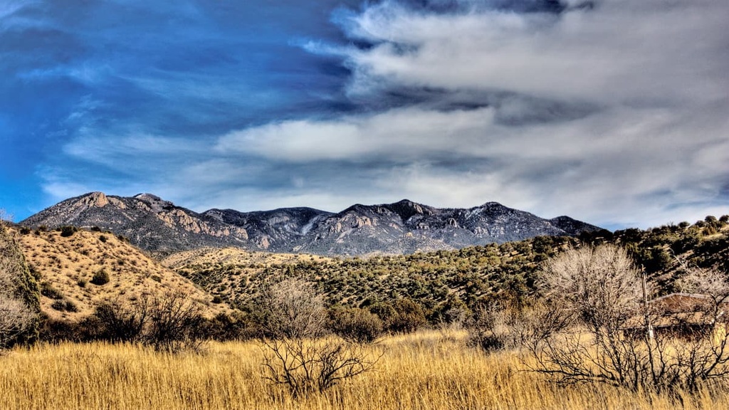
Furthermore, the western portion of the Gila Wilderness is home to the tallest peaks in the region. The Mogollon Mountains, which are also called the Gila Mountains, dominate the western part of the wilderness and they run approximately from north to south. The range is around 30 miles (48 km) long though the main crest of the range is only 15 miles (24 km) in length.
Deep canyons cut through the Gila Mountains, and they were mostly carved out from the drainages of both Turkey Creek and Mogollon Creek. The main three forks of the Gila River run through the wilderness and flow throughout the year.
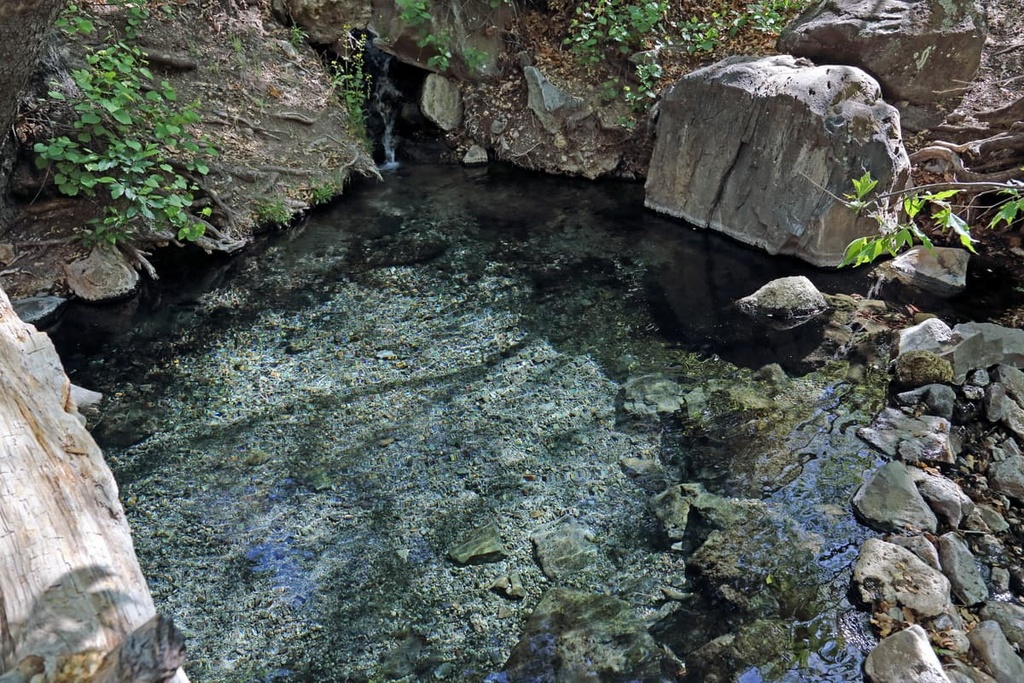
Heavy rains in these deep canyons tend to produce flash floods throughout the wilderness and the surrounding national forest. Hot springs are common in the wilderness, too, and they can be found in various places in the region.
Additionally, the Gila Wilderness is surrounded by other popular outdoor recreation areas. Other wilderness areas in the forest include the Aldo Leopold Wilderness and the Blue Range Wilderness.
Cibola National Forest and El Malpais National Conservation Area both lie to the north of the Gila Wilderness while the Apache Kid Wilderness, Apache-Sitgreaves National Forests, and Lincoln National Forest sit to the east and the Organ Mountains–Desert Peaks National Monument lies to the southeast.
The peaks within the Gila Wilderness are part of the Mogollon Mountains, which are also known as the Gila Mountains. This range sits upon the Mogollon Plateau, which is part of the larger Colorado Plateau.
The peaks in the region were formed by the Mogollon-Datil volcanic field, which experienced regular eruptions between 40 and 25 million years ago. Remnants of this volcanic past can be seen to this day in the multitude of hot springs that exist throughout the wilderness. Major hot springs in the region include the Jorden, Middle Fork, and Turkey hot springs.
As this volcanic activity occurred, the Mogollon Mountains began to take form. Over the course of millions of years, three successive phases of volcanism left behind a sheet of ash that covered the region that is now the Gila Wilderness.
The waterways of the region further carved out the deep valleys in the region, and they are still eroding away at the landscape to this day. However, the deep basins that you can currently see in the region were formed by basin and range extension along with thrust faulting.
Major peaks within the wilderness are Whitewater Baldy, Black Mountain, Holt Mountain, Sacaton Mountain, and Mogollon Baldy Peak.
The varying landscape and abrupt changes in elevation in the Gila Wilderness allow for a variety of both flora and fauna to thrive in the region. In fact, the region marks an ecological transition zone between the Chihuahuan Desert and the flora commonly found in the Rocky Mountains.
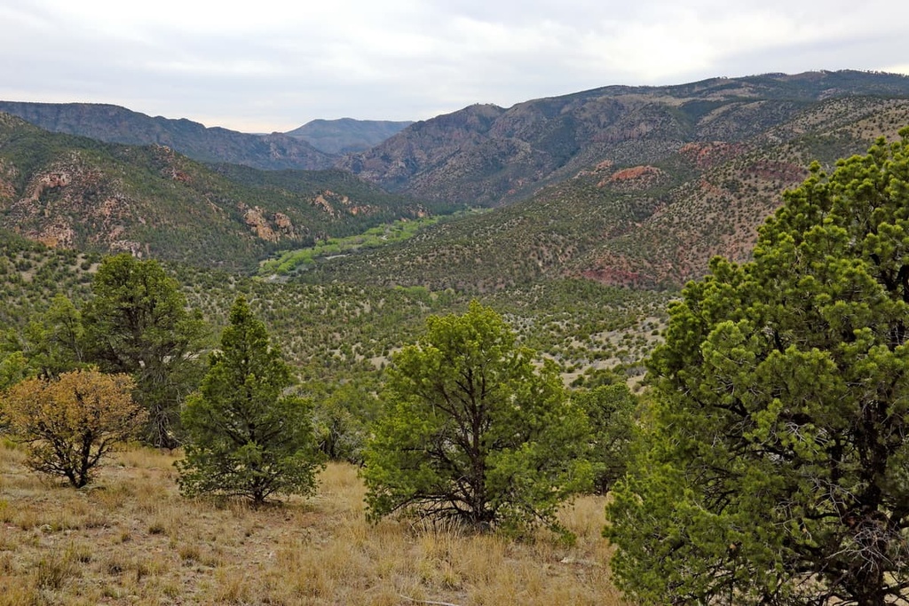
At elevations above 9,000 ft (2,743 m), the forested landscape consists primarily of quaking aspen and spruce-fir trees. From 6,500 ft (1,981 m) up to 9,000 ft (2,743 m), the forest is dominated by ponderosa pine, which is very common in this region. At lower elevations, common tree species include Apache pine, mesquite, and Chihuahua pine.
Below 6,500 ft (1,981 m) in elevation, the primary vegetation in the region includes pinyon-juniper woodlands along with desert succulents and other drought-tolerant species. The canyons in the wilderness feature willow, alder, ash, maple, walnut, cottonwood, and Arizona sycamore.
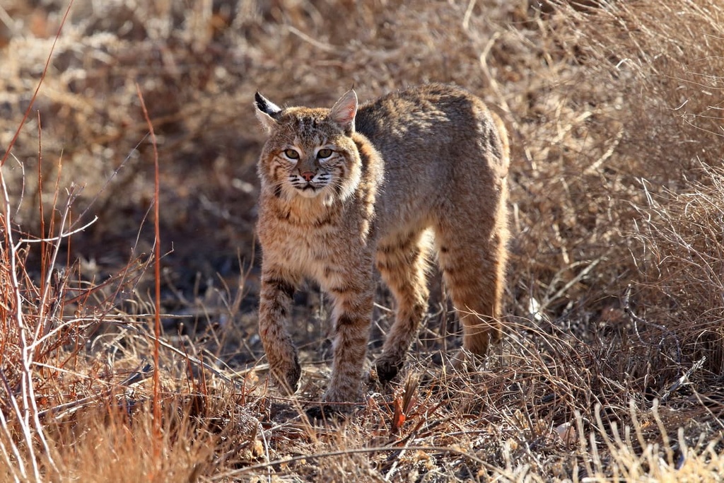
Large mammals that live throughout the wilderness include black bears, bobcats, cougars, white-tailed deer, pronghorns, and collared peccary. The wilderness is also an important region for the critically endangered Mexican wolf. After being reintroduced to the wilderness in the 1980s, the Mexican wolf population in the region has grown to include at least four distinct packs.
Game birds and birds of prey are both common in the wilderness. The region is home to sizable populations of dusky grouse, wild turkey, goshawk, bald eagle, common black hawk, and zone-tailed hawk.
The McKenna and Spruce creeks both also provide a safe habitat for the threatened Gila trout. Other fish species found in the wilderness include catfish, bass, brown trout, and rainbow trout.
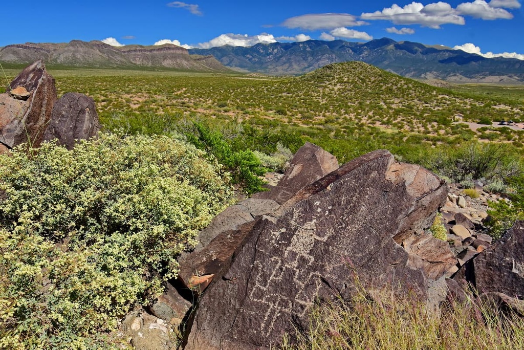
The land within the Gila Wilderness has been inhabited by humans for thousands of years. The surrounding land marks the traditional territory of the people of the Mogollon culture and their descendants. The Mogollon people were an Indigenous community that lived throughout the region, including in what is now Arizona, New Mexico, and northern Mexico.
The Mimbres people were part of the Mogollon culture and they lived in the region until around 1150 CE. Traces of their culture can still be spotted to this day in the cliff dwellings that are located within the Gila Wilderness.
The land that is part of the Gila National Forest also marks the ancestral homelands and traditional territory of the Chiricahua people. Descendents of the Chiricahua tribes are part of multiple tribes in the US, including the Fort Sill Apache Tribe, the San Carlos Apache, and the Mescalero Apache Tribe. The reservations that many of these tribes maintain today represent just a fraction of the size of the traditional territory of the Chiricahua people.
The first contact between the Indigenous peoples and people of European descent in the region occurred during the seventeenth century. Throughout both the seventeenth and eighteenth centuries, the Spanish colonized much of what is now New Mexico. They established multiple ranches, missions, and copper mines in their effort to drive out Indigenous peoples from the region.
Following the Mexican War of Independence, the land that is now part of the Gila Wilderness was ceded to Mexico. A few decades later, in the 1840s, the land was then ceded to the US. Many of the towns that are present today were originally established during the late nineteenth century by settlers from both the US and Mexico.
Extensive logging throughout the region nearly decimated the natural resources of the forest. The Gila River Forest Reserve was established in 1899 in an attempt to protect the region and prevent further ecological harm.
In 1905, the reserve was renamed the Gila Forest Reserve, though it later became Gila National Forest in 1907. The Gila Wilderness was established in 1924, making it the first designated wilderness area within the National Forest System.
The Gila Wilderness is home to numerous trails and hiking opportunities. Here are some of the top hiking areas to visit during your next trip to the Gila.
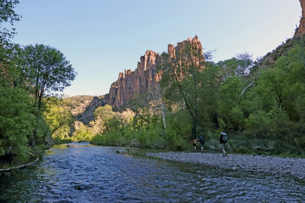
The San Francisco Hot Springs Trail begins between Black Mountain and Sundial Mountain. The trail then drops in elevation before reaching the San Francisco River. Once at the river, hikers are greeted with a stunning forested landscape that provides shade from the extreme heat.
However, do note that in order to access the hot springs, hikers must cross the San Francisco River. This route is 3.1 miles (5 km) long and it has 521 ft (159 m) of elevation gain.
To access the Jordan Hot Springs, hikers must follow a 15 mile (24 km) long trail that has 1,561 ft (476 m) of elevation gain. From the trailhead, the trail climbs steadily along exposed switchbacks before reaching the fork of Little Bear Canyon and Middle Fork.
Prior to reaching the hot springs, the trail boasts over a dozen river and creek crossings. Rugged rock formations tower above the forested landscape throughout this route, adding to the splendor of the adventure.
The Catwalk National Recreation Trail is a more accessible hike within the wilderness. This out-and-back route is just 2 miles (3.2 km) long and it has 351 ft (107 m) of elevation gain.
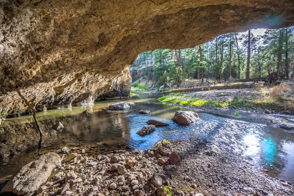
This pathway gets its name from the elevated catwalk-like bridges found along the route. The trail follows the banks of Whitewater Creek, and it features views of rock slabs and cliffs throughout. Hikers on this route can also view rock arches, forested areas, and a diversity of other landscapes despite the relatively short distance of the trail.
Looking for a place to stay near the Gila Wilderness? Here are some of the best cities and villages to check out in the region.
Situated just to the south of the Gila Wilderness, Silver City is a community of around 10,000 residents. Despite its name, this small city was actually originally a copper mining town (not a silver mining town) that was established by the Spanish during the seventeenth century.
Despite its small size, each year, the city hosts dozens of festivals and events. This includes the Silver City Blues Festival, Gila River Festival, Rolling Stones Gem & Mineral Show, and Tour of the Gila.
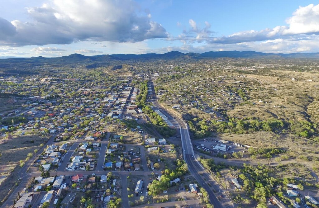
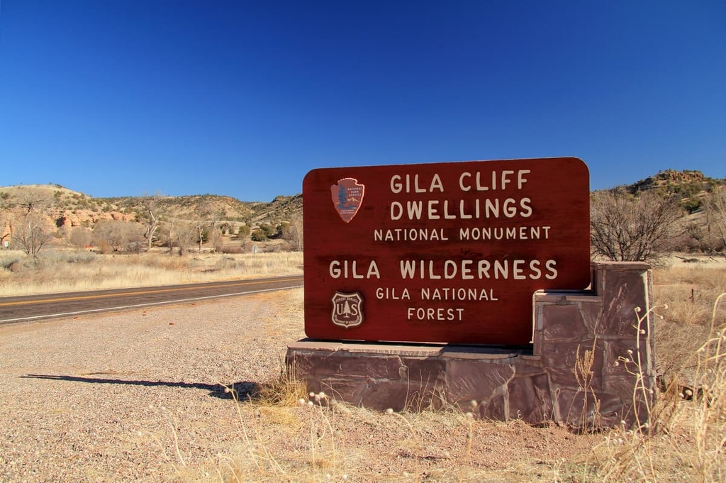
Silver City is also the closest city to the Gila Cliff Dwellings National Monument, which is located along NM State Route 15. The city’s close proximity to Gila National Forest has also allowed it to blossom into a popular tourist destination for anyone looking to explore southwestern New Mexico.
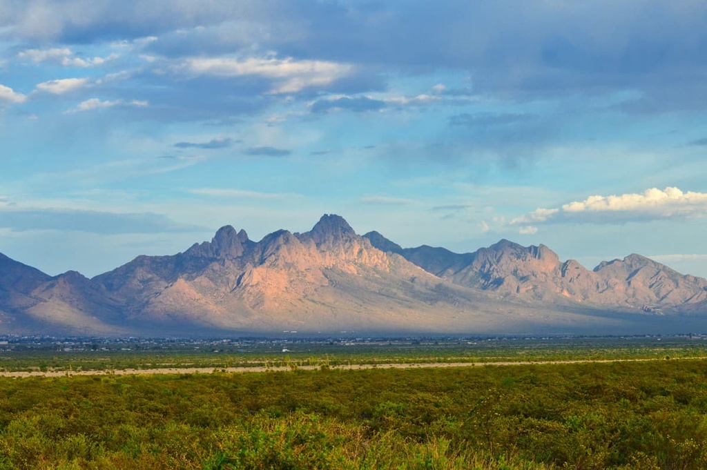
Las Cruces lies to the southeast of the Gila Wilderness and is home to around 111,000 residents, making it the largest city in southern New Mexico. The city acts as both an economic and geographic hub for the Mesilla Valley. Each year, the city hosts the Harvest Wine Festival and Southern New Mexico Wine Festival along with an annual Day of the Dead celebration.
Besides its easy access to the Gila Wilderness, the city is also a good starting point for trips to White Sands National Park, Organ Mountains–Desert Peaks National Monument, and Prehistoric Trackways National Monument. Visitors can learn more about the region by visiting the Branigan Cultural Center, Gadsden Museum, and Las Cruces Museum of Art.