Scan the QR code and open PeakVisor on your phone
The Gila Mountains, also known as the Mogollon Mountains, are located in Gila National Forest in southwestern New Mexico, USA. The range contains 211 mountains. Whitewater Baldy is the tallest peak in the range at 10,892 ft (3,320 m), as well as the most prominent (3,547 ft/1,081 m).
The Gila Mountains stretch across southwestern New Mexico. The Gila National Forest encompasses the range. The 558,065 acres (225,841 ha) Gila Wilderness also covers a portion of the range. It was the first wilderness area in the United States, established in 1924 thanks in large part to the efforts of Aldo Leopold.
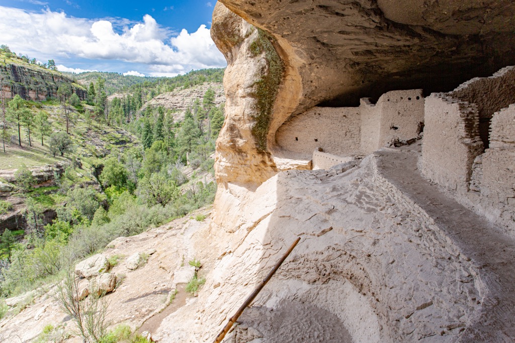
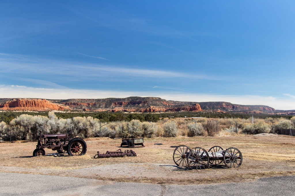
Located within the range is the Gila Cliff Dwellings National Monument – a series of cave dwellings left behind by people of the Mogollon culture. Whitewater Baldy is the tallest peak in the range at 10,892 ft (3,320 m), followed by Mogollon Baldy Peak (10,778 ft/3,285 m), Willow Mountain (10,774 ft/3,284 m), Sacaton Mountain (10,663 ft/3,250 m), and Black Mountain (10,643 ft/3,244 m).
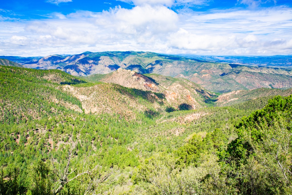
Also known as the Mogollon Mountains, the Gila Mountains are part of the Southwest Basins and Ranges, and more specifically, the Mogollon-Datil volcanic field. It formed between 50 and 25 million years ago, beginning with two eruptions from a super-volcano that resulted in the creation of the Bursum and Cliff Dweller calderas. The range is made up of layers of igneous rhyolite, petrified ash, and Gila conglomerate – a blend of rocks sealed together by a naturally occuring sandstone mortar.
Erosion has led to a process called exfoliation where pieces of rock break off. Rocks that had fallen due to exfoliation were used by Mogollons to build walls of their dwellings.
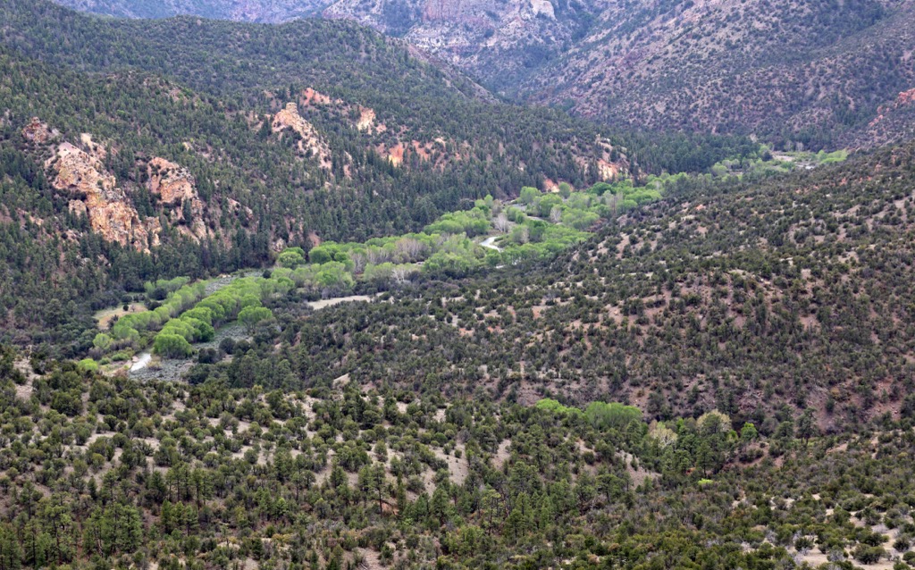
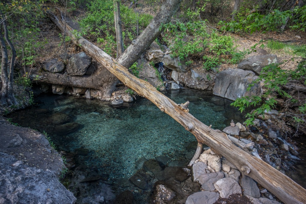
Because of the volcanic activity in the area, there are a number of hot springs around. Jordan Hot Spring and Lightfeather Hot Spring are two of the more popular ones. Both have high mineral content but no salt and sulfur.
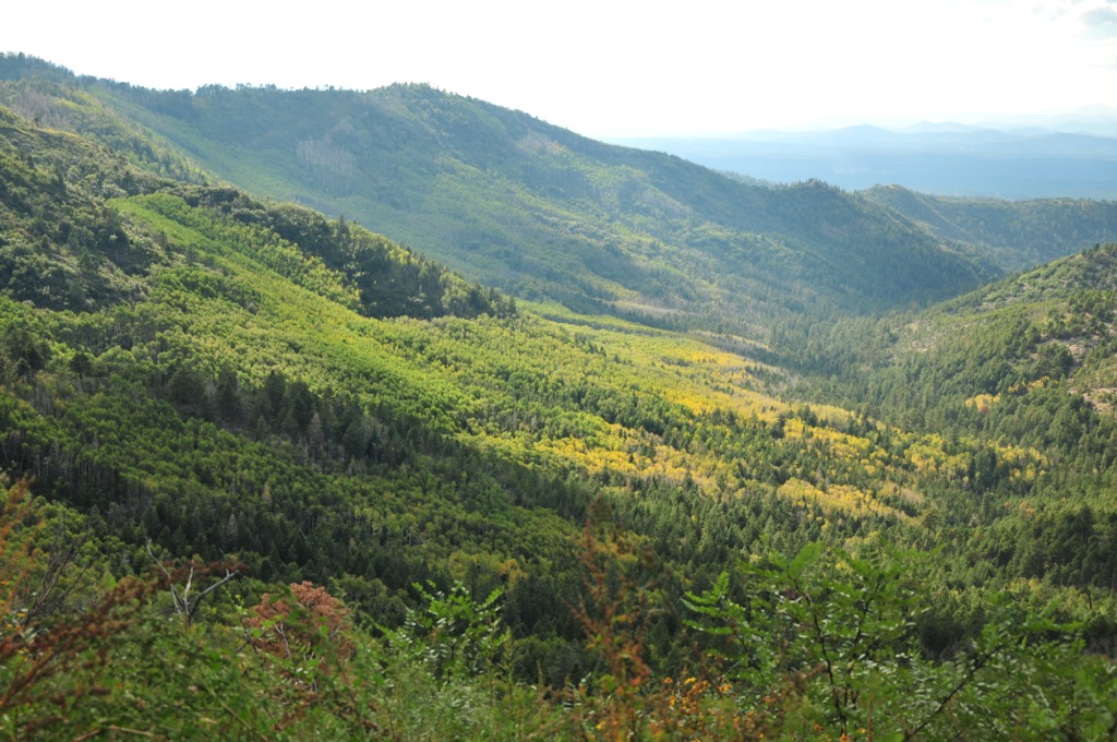
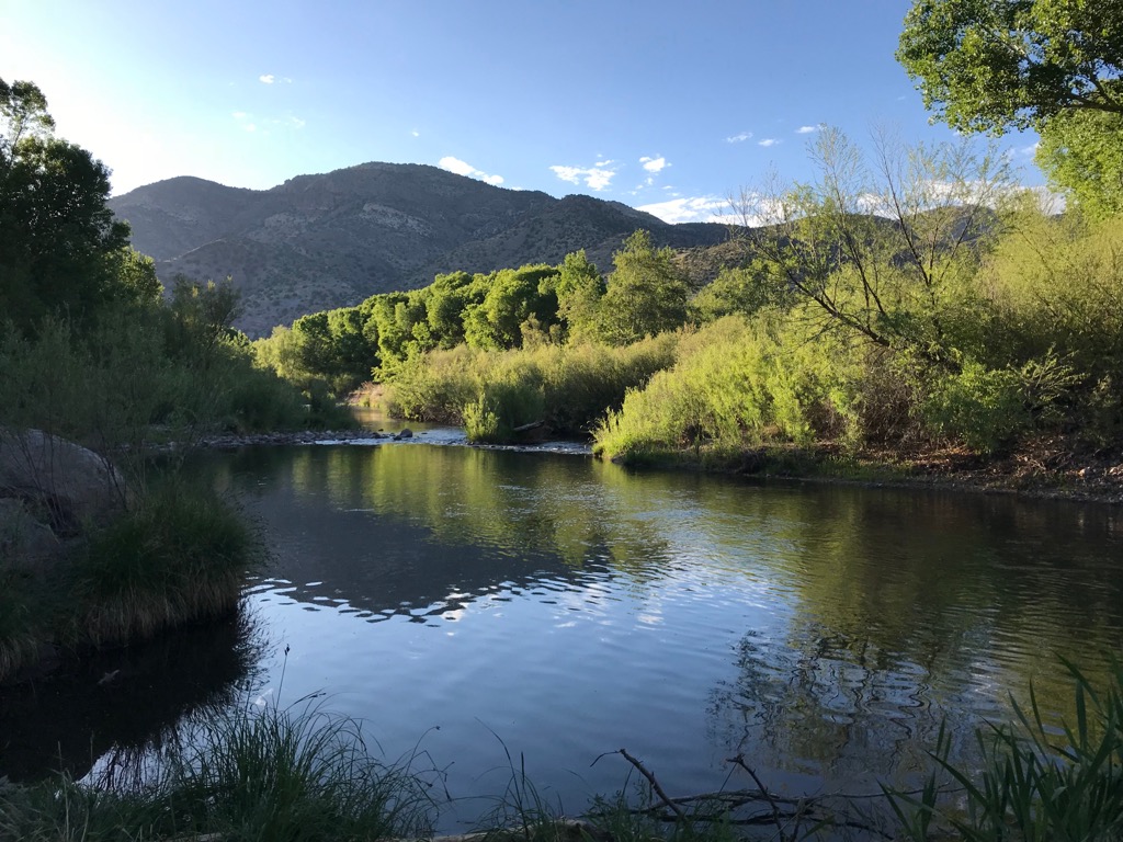
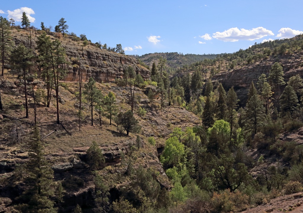
The range typically experiences cool summers and mild winters. Common forest types include pinyon pine, juniper, ponderosa pine, aspen groves, and spruce-fir. Lower elevations have mesquite, cacti, and ocotillo. There are a number of streams, rivers, and creeks flowing through the wilderness, and several hot springs that are popular hiking destinations.
Mexican gray wolves were reintroduced into the Gila Wilderness in 1999. There are also black bears, mountain lions, mule deer, coyotes, foxes, and a number of small rodents.
Parts of the range have been affected by forest fires over the years. One example can be seen on Whitewater Baldy, with the damage still showing from the Whitewater Baldy Complex fire from 2012.
The region has evidence of human occupation in the mountains dating back to the Cochise Culture from around 8,000 years ago and lasting until approximately 300 AD. Towards the later end of this period, people began to cultivate corn and squash, as well as build pit houses.
The Mogollon Culture followed. Their lifestyle tended to be more sedentary, taking the time to construct pit houses and cliff dwellings. They produced pottery, a craft that peaked with the black and white pottery of the Mimbres people. This culture faded off around 1300.
The Gila Cliff Dwellings date back to this time. The caves were used for thousands of years as temporary housing. But between the late 1200s and about 1300, the Southern Ancestral Pueblo people (part of the Mogollon Culture), took the time to create more permanent structures. They built rooms and produced pottery in the cliff dwellings for one or two generations.
The Apache moved into the region during the 1500s and 1600s. Due to the area’s rugged conditions, populations remained relatively low and thus meant there was less conflict between human groups for a few centuries. Around 1800, Spanish explorers began arriving, establishing copper mines to make coins. Gila became part of Mexico in 1821 after the revolution against Spain, and then part of the United States in 1848 after the war with Mexico.
A section of the range is covered by the Gila Wilderness – the first official wilderness area in the United States. It was founded in 1924 thanks to the efforts of Aldo Leopold to prevent the area being developed.
Within the Gila Wilderness, the eastern sections have mesas, hills, canyons, and pinyon and juniper forested areas. The central region has ponderosa pine and the mountains lie to the west and southwest. A number of rivers, streams, creeks, and hot springs exist within the mountains. However, do not put your head underwater in the hot springs because there is risk of a microorganism that can enter the brain and be deadly.
The range’s higher elevations typically have snow December through February. Heavy summer rains can cause flash floods and late summer can be quite hot.
Contrary to its name, the summit of Whitewater Baldy (10,892 ft/3,320 m) is forested. It can be reach along the Crest Trail #182 from the west, or from the east from the Gila Wilderness. The mountain is not dramatic, rather a prominent rounded summit rising higher than any other peak in the range.
The trail to Jordan Hot Spring is about 7 mi (11.3 km) one way along Little Bear Canyon Trail #729 and Middle Fork Trail #157. There are numerous stream crossings along the way so waterproof shoes or a change of shoes are recommended.
This trail can be completed as a long day hike but many prefer to overnight. Water is available between miles 4 and 5 (kilometers 6.4 and 8).
Section 7 of the Continental Divide Trail runs through the southern portion of the Gila Mountains north of Silver City. The CDT runs a total of 3,100 mi (4,990 km) between the US border with Mexico and Canada. Sections of this trail can be made as long or short as one likes. A popular trailhead for connecting to the route near Silver City is the Burro Peak Trailhead.
There are several small towns located around the Gila Mountains. The larger cities of Albuquerque, New Mexico, Phoenix, Arizona, and El Paso, Texas are located to the northeast, west, and south respectively.
Albuquerque, New Mexico has a population of just over 560,000 people. The city captures the rich diversity and heritages of the southwest with heavy influences from Native American, Hispanic, and Latino cultures. The city’s vibrant culture can be explored at the Indian Pueblo Cultural Center or the National Hispanic Cultural Center.
A few top attractions while visiting Albuquerque include taking a hot air balloon ride or visiting the Balloon Museum, visiting some of the city’s art galleries, or exploring the Sandia Mountains either by foot or by the Sandia Peak Aerial Tramway.
Naturally, the city offers amazing options of New Mexican cuisine, always accompanied by red or green chiles, or “Christmas” if you want both. The Indian Pueblo Cultural Center is a great spot to try frybread, posole, and other traditional foods. You’ll also find a good selection of other options such as pizzerias, BBQ, and Mediterranean. The city has hotels, motels, resorts, B&Bs, campgrounds, and RV parks for those looking to stay over.
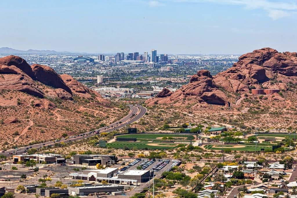
With a population of 1.625 million people, Arizona’s capital has a number of cultural and outdoor excursions that make it worth spending a day or two around the city. A hike up Camelback Mountain, or within the Phoenix Mountains Preserve or Papago Park are great ways to take in the desert scenery. The Desert Botanical Garden houses hundreds of native species and explains some of the plants’ unique desert adaptations.
A few top cultural stops include a visit to Taliesin West, Frank Lloyd Wright’s winter home; the Heard Museum with its exhibits of indigenous art; and the Phoenix Art Museum.
Southwestern and Mexican restaurants abound in the city, flavored by local ingredients like peppers, pomegranates, and citrus. There are also diverse cuisines offered such as Thai, Middle Eastern, and Chinese. Accommodation can be a hotel or motel located downtown, a boutique B&B, or a peaceful guest ranch or resort.
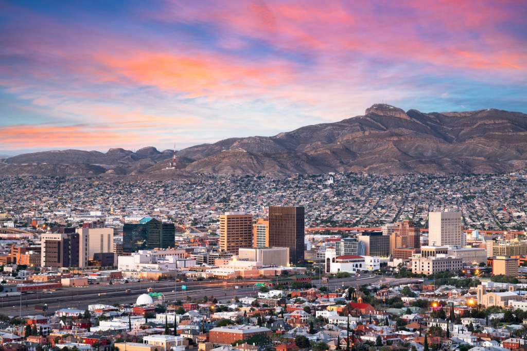
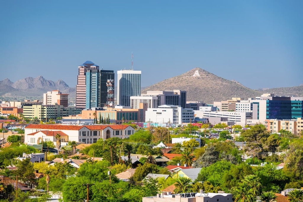
El Paso, Texas has a population of 678,000 people and sits on the border with Mexico. Popular outdoor activities include a trip to the Franklin Mountains and the cultural site of the Aztec Caves. Tour the region’s vineyards and wineries or stop by the El Paso Museum of Art.
Given its proximity to the Mexican border, El Paso offers top notch Mexican and TexMex cuisine. The city has many historic hotels with old western class and charm, as well as standard hotels, B&Bs, and campgrounds and RV parks nearby.