
Scan the QR code and open PeakVisor on your phone
The Black Range include 82 named peaks. The highest is McKnight Mountain at 3,099 m. Other notable peaks include Hillsboro Peak, Reeds Peak and Sheep Mountain.
The Black Range is a rugged mountain range in the southwestern portion of the US state of New Mexico. The range contains 82 named peaks and lies almost entirely within the Gila National Forest. McKnight Mountain marks the tallest and most prominent peak at 10,167 ft (3,099 m) with 2,526 ft (770 m) of prominence.
The Black Range is in southwestern New Mexico. This rugged range lies within Gila National Forest, covering land within Grant, Sierra, and Catron counties.
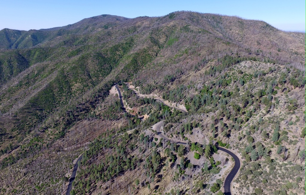
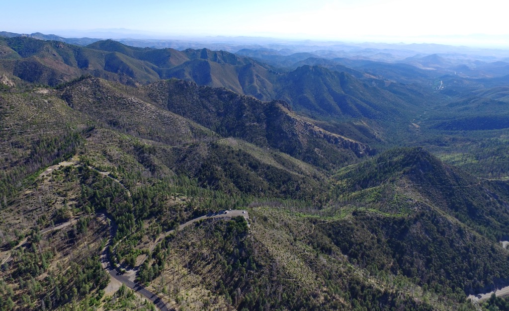
A prominent ridgeline separates the range into distinct western and eastern portions. The range spans approximately 55 miles (88 km) north to south and 18 miles (29 km) east to west.
The Mimbres River originates in the range, fed by the annual snowpack, while the Rio Grande is situated to the east, traveling roughly north to south. A few small towns are scattered amidst the eastern foothills.
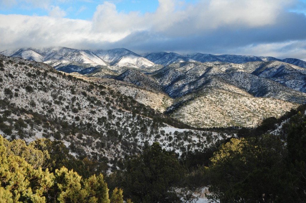
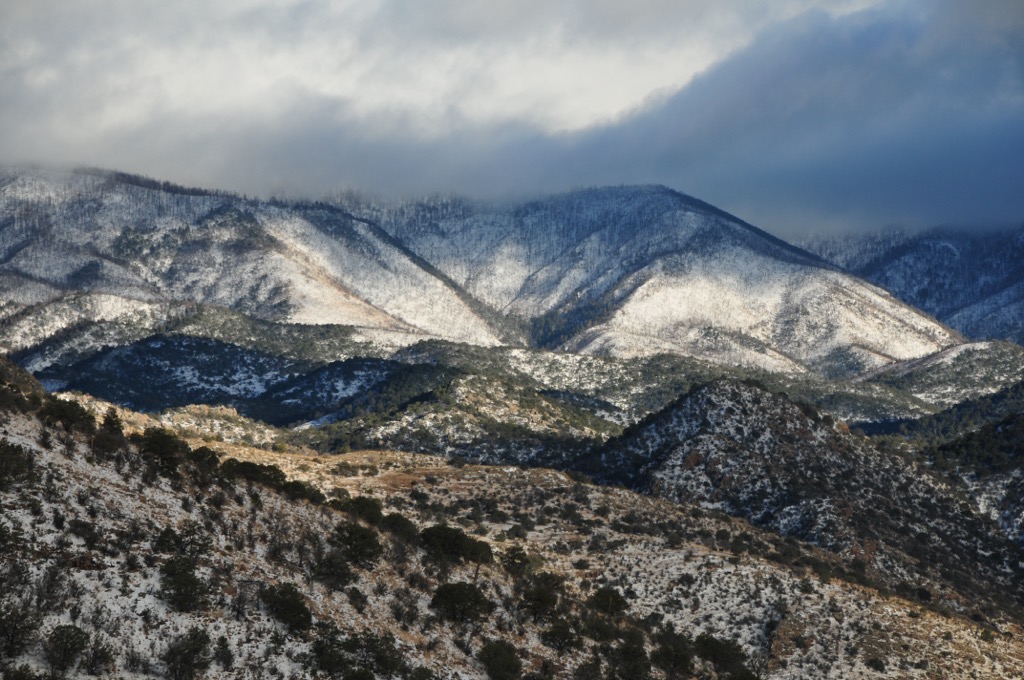
The terrain varies greatly depending on elevation. The foothills feature numerous steep and narrow stream valleys, with some measuring up to 1,000 feet (305 m) deep. Elevation varies from 4,200 ft (1,280 m) up to the summit of McKnight Mountain at 10,167 ft (3,099 m).
The lowest elevations feature arid grasslands and desert landscapes, giving way to forested mountainsides. Densely forested woodlands define much of the higher elevations, along with rocky ridge lines and outcroppings.
Outdoor recreation areas surround the Black Range. The range lies within Gila National Forest and the Aldo Leopold Wilderness. To the west is the Gila Wilderness, while the Continental Divide Wilderness Study Area is to the north. A portion of the Cibola National Forest and the Apache Kid Wilderness spread to the northeast.
The Black Range and a vast majority of Gila National Forest lie within the Mogollon Plateau section of the Colorado Plateau, on the Mogollon-Datil volcanic field. Widespread volcanism in the region began around 40 million years ago.
This volcanic field experienced three phases of volcanism over the course of millions of years. These eruptions covered much of the landscape in an ash sheet. The ash sheet spread across the mountains and valleys. A series of eruptions on the Mogollon plateau led to the formation of the Black Range and other nearby ranges, such as the Mogollon Mountains (also called the Gila Mountains).
The Black Range and the surrounding region formed around 25 million years ago. The rivers and streams further carved out the landscape, leaving behind the distinct deep valleys that mark the foothills range.
Significant peaks include McKnight Mountain, Sawyers Peak, Hillsboro Peak, Brushy Mountain, and Sheep Mountain.
The Black Range is home to a wide range of flora and fauna throughout its varying elevations.
The surrounding network of national forests and wilderness areas allows many species to thrive. Gila National Forest, including a portion in the Black Range, is home to one of the world’s most extensive stretches of healthy ponderosa pine forest.
Lower elevations along the eastern foothills feature a desert landscape and arid grassland. Pinyon-juniper woodlands and oak trees are prominent at elevations up to 7,000 ft. At elevations above 7,000 ft (2,134 m), a mix of fir, aspen, ponderosa pine, and spruce dominate the forests.
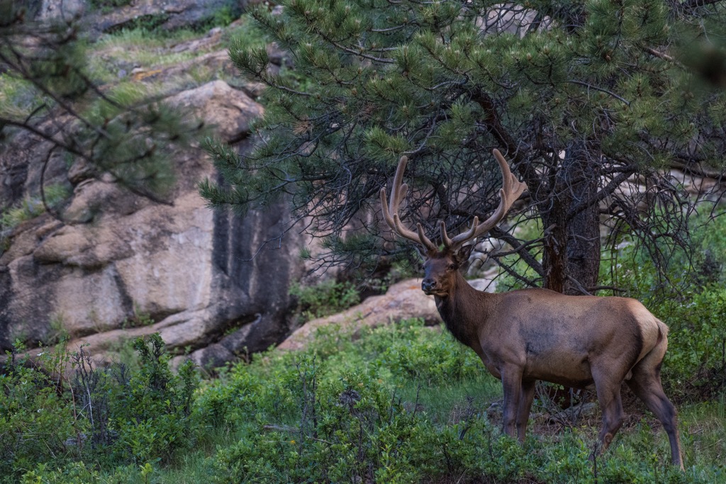
Large mammals include elk, black bears, mule deer, white-tailed deer, and coyotes. Smaller mammals include bobcats, foxes, ringtail cats, and raccoons. Common bird species include the wild turkey, peregrine falcon, and the threatened Mexican spotted owl.
Sections of the range are home to multiple species of reptiles; some of the most common include the rock rattlesnake and black-tailed rattlesnake. The rivers are populated by brown trout, rainbow trout, Gila trout, and bass.
Humans have inhabited the land within and surrounding the Black Range for thousands of years. This land is part of the traditional territory of Mongollon culture, representing the Indigenous peoples that lived throughout present-day Arizona, New Mexico, and northern Mexico.
The modern-day Gila National Forest's boundaries are part of the ancestral homelands of the Mimbres people, who lived in the region until around 1150 CE. Multiple Mimbres cliff dwellings lie within the nearby Gila Wilderness, just west of the range.
The land surrounding the Black Range marks part of the traditional territory of the Chiricahua people. Today there are multiple Chiricahua tribes in the US, including the Fort Sill Apache Tribe, the San Carlos Apache, and the Mescalero Apache Tribe. These tribes maintain reservations that comprise a small fraction of their traditional territory.
The first people of European descent arrived during the seventeenth and eighteenth centuries. The Spanish colonized large swaths of land in present-day New Mexico and established numerous ranches and missions.
During the eighteenth century, the Spanish also established multiple copper mines in the mountains of southwestern New Mexico. Following the Mexican War of Independence, Spain ceded the land to the newly-formed nation of Mexico.
The Mexican-American War ended in 1848, and the United States annexed the territory. Over the following decades, the region became a popular destination for settlers heading west. Many of the contemporary towns and villages were initially established during the end of the 1800s.
Indigenous peoples and white settlers clashed. War, disease, famine, and a complete loss of livelihood took its toll on the Native population, with those who remained being forced onto reservations as settlers continued to pour in.
Like many mountain locales in the Western US, widespread logging and mining had destroyed much of the natural beauty and threatened the region’s ecosystems. The Gila Forest Reserve was established in 1899 in an effort to protect and rehabilitate natural resources.
The federal government designated the Gila National Forest in 1907, the Gila Wilderness in 1924, and the Aldo Leopold Wilderness in 1980.
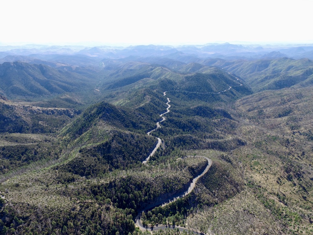
The Black Range is home to numerous trails and hiking opportunities. Here are some of the top hiking areas:
True to its name, the Black Range Crest Trail follows along the central ridgeline within the Black Range. The out-and-back hike climbs steeply in the first few miles, with the route's middle portion featuring minimal elevation changes.
Hikers pass through various landscapes, including creeks and forests, with viewpoints throughout. This out-and-back trail is 18.4 miles (30 km) long and features 3,661 ft (1,116 m) of total elevation gain.
The Railroad Canyon Trail is situated in the southern portion of the Black Range. The route climbs steadily throughout, following along the canyon, and features numerous seasonal creeks and streams.
Much of the route is forested with open patches throughout. This out-and-back trail marks the beginning of the Black Range Crest Trail and offers a shorter hiking route. The trail is 7.8 miles (12.5 km) round trip with 1,154 ft (352 m) of total elevation gain.
The McKnight Canyon Trail begins by dropping in elevation down into the canyon itself. The trail follows the canyon along with the East Fork of the Mimbres River. The forest starts to thin at higher elevations, giving way to sweeping views.
Hikers also pass through a section of land previously burned in a wildfire. The trail's turnaround point is marked by a small waterfall cascading down the smooth rocks. This out-and-back route is 11.5 miles (18.5 km) long and features 1,669 ft (509 m) of total elevation gain.
Looking for a place to stay near the Black Range? Here are some of the best cities and villages to check out in the region:
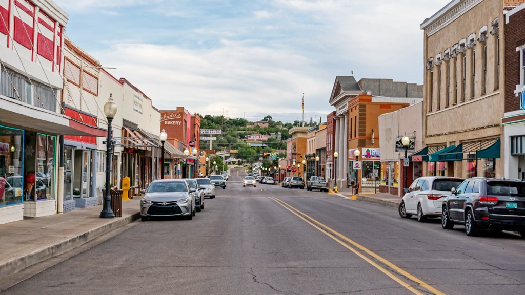
The small community of Silver City lies just southwest of the Black Range, along the edge of Gila National Forest. Home to around 10,000 residents, the city has a long history of copper mining, dating back to the arrival of the Spanish conquistadors.
Despite its relatively small size, Silver City hosts numerous festivals and events each year, including Pickamania, Silver City Blues Festival, and the Southwest Festival of the Written Word.
Situated along the edge of the 3.3 million acres of Gila National Forest, Silver City has become a hub for outdoor recreation. Close by lie the Gila Cliff Dwellings and numerous other historical sites. The downtown streets are lined with local shops, restaurants, and art galleries.
Las Cruces
Las Cruces lies to the southeast of the Black Range. Home to around 111,000 residents, it marks the closest major city to the range and the largest city in southern New Mexico.
An economic and geographic hub for Mesilla Valley, Las Cruces is home to numerous festivals each year. Some popular events include the Harvest Wine Festival, Southern New Mexico Wine Festival, and an annual Day of the Dead celebration.
Besides its proximity to Gila National Forest, the city is also near White Sands National Park, Organ Mountains–Desert Peaks National Monument, and Prehistoric Trackways National Monument. Those interested in learning more about the region can visit the Branigan Cultural Center, Gadsden Museum, and Las Cruces Museum of Art.


The highest peak in the Black Range is McKnight Mountain, at 3,099 m.
The Black Range have 82 named peaks.


