Scan the QR code and open PeakVisor on your phone
Containing some of the most stunning desert landscapes in the country, Glen Canyon National Recreation Area is a major outdoor recreation destination located in the southeastern part of the US state of Utah and the north-central part of the state of Arizona.
Although it’s best known for its rugged canyons, the recreation area does contain 68 named mountains, the highest of which is Navajo Point (7,382ft/2,250m), and the most prominent of which is Lands End (7,133ft/2,174m).
Located in southeastern Utah and north-central Arizona, the Glen Canyon National Recreation Area is a major parcel of federally-managed land that’s renowned for its scenic beauty. The recreation area encompasses over 1.2 million acres (485,000 ha) of land within Utah’s Kane, Garfield, San Juan, and Wayne counties as well as Arizona’s Coconino County.
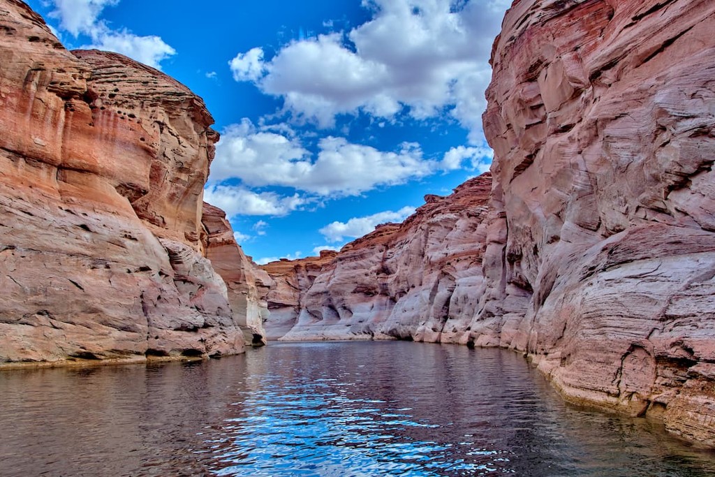
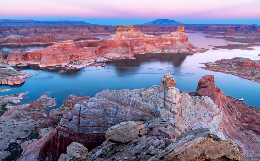
Initially designated back in 1972, the recreation area protects the vast majority of Glen Canyon, which is now filled by Lake Powell, one of the country’s largest reservoirs with a total volume capacity of about 8 cubic miles (33 cubic kilometers).
However, Lake Powell is not a natural lake; rather, it is a man-made lake that was formed by the damming of the Colorado River with the Glen Canyon Dam in the mid-twentieth century. The dam itself is 710 feet (220m) tall, so it rivals the nearby Hoover Dam in terms of size.
These days, Glen Canyon National Recreation Area is located amongst a major parcel of nearly contiguous public land which stretches from near the city of Moab, Utah to the northeast, all the way through northern Arizona and into Nevada, where it terminates just to the north of the state’s border with California. The recreation area also technically administers Rainbow Bridge National Monument.
In particular the recreation area is located to the south and west of Canyonlands National Park (Island in the Sky, Maze, and Needles districts), Bears Ears National Monument, Manti-La Sal National Forest, Dark Canyon ISA Complex, and the Grand Gulch ISA Complex.
Glen Canyon is also located to the west of Capitol Reef National Park, Goblin Valley State Park, and the massive Grand Staircase-Escalante National Monument, as well as to the north of the Vermilion Cliffs National Monument and the Paria Canyon-Vermilion Cliffs Wilderness.
Furthermore, Glen Canyon National Recreation Area is located within a major complex of federal land that extends far to the south of its borders, which includes parks such as Grand Canyon National Park, Grand Canyon-Parashant National Monument, and Lake Mead National Recreation Area.
Additionally, the recreation area borders the Navajo Nation to the south and it is within driving distance of the Ute Mountain Ute Reservation of the Ute Mountain Ute Tribe, the Hopi Reservation of the Hopi Tribe, the Kaibab Indian Reservation of the Kaibab Paiute Tribe, and the Hualapai Indian Reservation of the Hualapai Tribe, among others.
Geologically, Glen Canyon National Recreation Area is part of the Colorado Plateau, which is a massive physiographic province that spans much of Arizona, New Mexico, Colorado, and Utah, as well as a small chunk of Nevada.
Although the Colorado Plateau can be defined in many different ways, the region itself is primarily drained by the Colorado River, which cuts through Glen Canyon, while a very small section of it is drained by the Rio Grande.
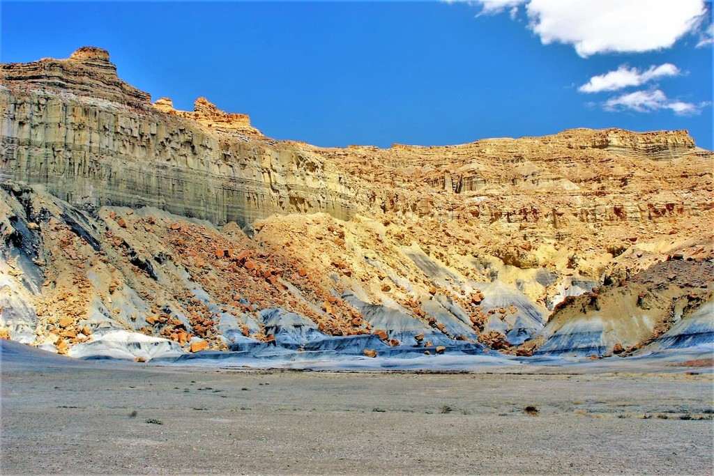
The plateau itself is primarily sedimentary in origin and the rocks within Glen Canyon National Recreation Area are mostly part of the Glen Canyon Group, which contains a number of notable layers, such as Wingate sandstone, Kayenta Formation, Navajo Sandstone, and Moenave Formation. Moreover, the Glen Canyon Group is known to be rich in fossils and a number of paleontological remains have been found, including dinosaur bones and tracks.
Furthermore, the Glen Canyon is the result of millions of years of erosion at the hands of the Colorado River. The canyon, which is 169.9 miles (272.9km) long starts at the confluence of the Dirty Devil River and the Colorado River.
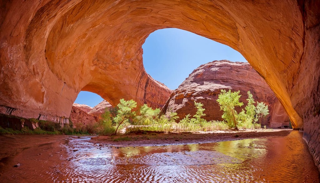
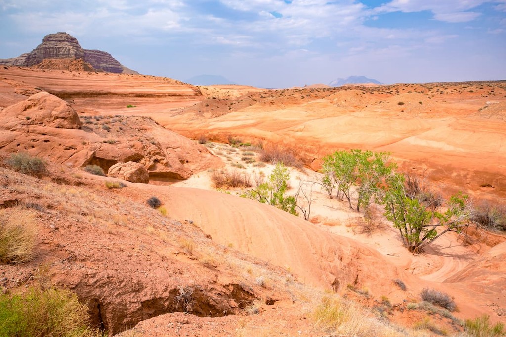
These days, the canyon and the recreation area are known for its truly stunning cliffs, natural arches, and other geologic features. High points in the park include Navajo Point, Lands End, Cataract Point, Gunsight Butte, Observation Rock, Bagpipe Butte, and Cleopatra's Chair.
Although much of the Glen Canyon National Recreation Area is slickrock and desert, the region is teeming with life and rich ecosystems. Indeed, life can be found even in the most inconspicuous places within the recreation area, including in its incredibly fragile cryptobiotic soil crusts.
Moreover, like other parts of the Colorado Plateau, Glen Canyon National Recreation Area is located within an ecoregion known as the Colorado Plateau Shrublands. This ecoregion is home to a number of different ecosystems, which vary based on elevation.
Within the lowest elevation parts of the region, one can find grassland communities, which are mostly shrubs, sagebrushes, and grasses. Meanwhile, the mid-elevations are predominantly woodlands, with species such as pinyon pine and juniper.
Finally, higher elevation regions are home to some montae communities with ponderosa pine forests and the occasional stands of lodgepole pine and quaking aspen, though these are found only at the highest elevations of the Colorado Plateau below the treeline.
As far as wildlife goes, there are quite a few species that can be found in the region. These include pronghorns, bobcats, mule deer, coyotes, mountain lions, elk, and black bears. There are also venomous snakes in the region, so care is necessary if you see any snakes on the trail.
The land in and around Glen Canyon National Monument has long been home to humans. In fact, the land is part of the ancestral homelands and traditional territories of many peoples, including the Southern Paiute, the Ute, the Hopi, the Navajo, and the Pueblo people, who are currently represented by a number of different nations and tribes.
The earliest people of European descent to visit the region were likely members of the Spanish Domínguez-Escalante expedition, which traveled extensively through what is now the southwestern United States in 1776. Indeed, the expedition extensively documented the canyon and it is believed that they crossed it near what is now called the Crossing of the Fathers.
Over the next few decades, a handful of trappers, such as the French-Canadian Denis Julien, are believed to have visited the canyon, perhaps on boat. However, the most famous expedition to the region undertaken by the US Government was that of John Wesley Powell who floated the Colorado River through the canyon in 1869 and 1871.
By the 1890s, miners had descended upon Glen Canyon in search for gold and many of them set up mining camps at Hite, which is now a flooded ghost town under Lake Powell.
The first discussions of building a dam in the region started in the early part of the 1900s after the catastrophic and accidental flooding of the Salton Sea in California’s Imperial Valley after an engineering mishap with a Colorado River canal gate in 1904.
After the incident, a number of states signed a compact that set out to allocate the flow of the Colorado River and its water rights to various states. During the 1920s, there was a push to create a dam that could help control floods and store water for periods of extended drought.
In the aftermath of a number of studies in potential dam sites, the Bureau of Reclamation decided that the Black Canyon of the Colorado in Nevada was the more suitable location for a dam. As a result, the Hoover Dam was built, which formed Lake Mead.
Nevertheless, since the Hoover Dam only controlled the southern part of the river, some in the region thought there was still a need to control the river’s flow to the north. Thus, after the Bureau of Reclamation dropped a proposal to build the Echo Park dam to the north in Dinosaur National Monument, they chose to build a dam at Flaming Gorge in the 1950s and 1960s as well as a dam at the Glen Canyon during the same time.
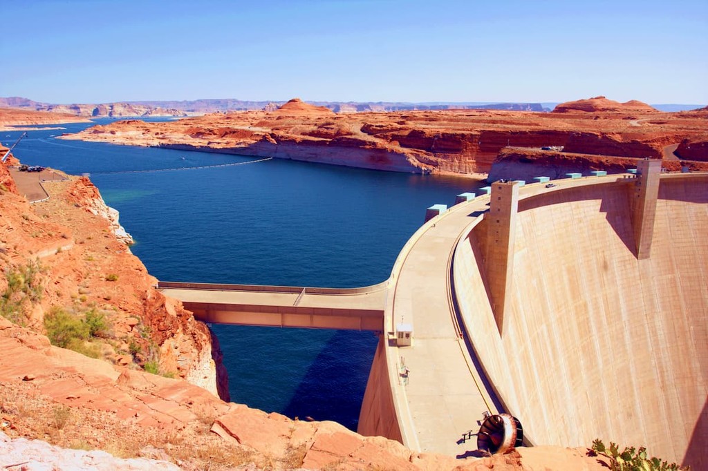
These days, the dam itself is quite contentious as it has caused a number of major environmental issues. In particular, the muddiness of the Colorado River has caused the accumulation of an incredible amount of sediment within Lake Powell. Moreover, the heating of the water in Lake Powell due to the high ambient air temperature and the stagnant nature of the water has had grave consequences for native fish species.
Moreover, the dam has impacted the Colorado River downstream. In fact, the sheer amount of water that’s taken from the river at the dam means that the Colorado River no longer reaches its natural delta in the Gulf of California. These many environmental impacts have led to calls from major environmental groups to dismantle the dam and drain the lake, though these have not proved to be successful movements.
Although the Glen Canyon Dam was completed in the 1960s, the recreation area wasn’t established until 1972. Nevertheless, the recreation area is now one of the premier watersports destinations in the southwestern United States as well as one of its most popular hiking areas.
The recreation area now offers a number of public campgrounds, marinas, and trailheads. Visitors to the recreation area who wish to hike into the backcountry must come prepared, however, as trails tend to disappear and reappear in the park’s many slot canyons.
Glen Canyon National Recreation is the perfect place to hike and enjoy the beautiful desert landscape of the Colorado Plateau. Here are some of the most popular hikes in the park:
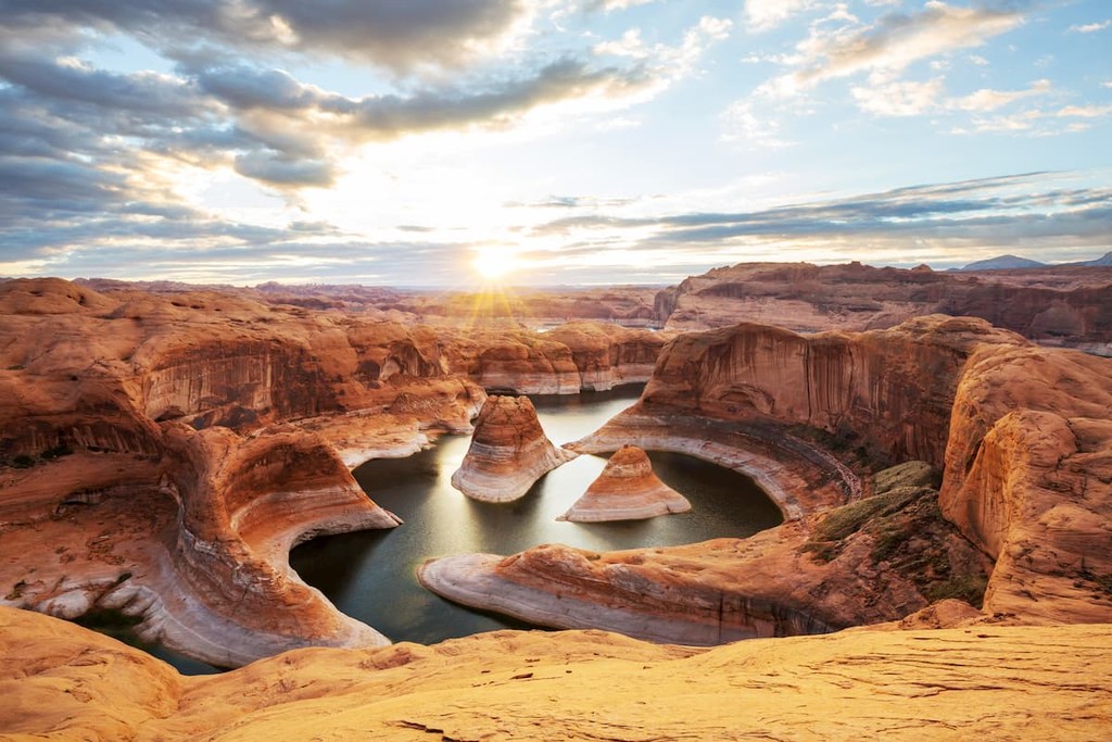
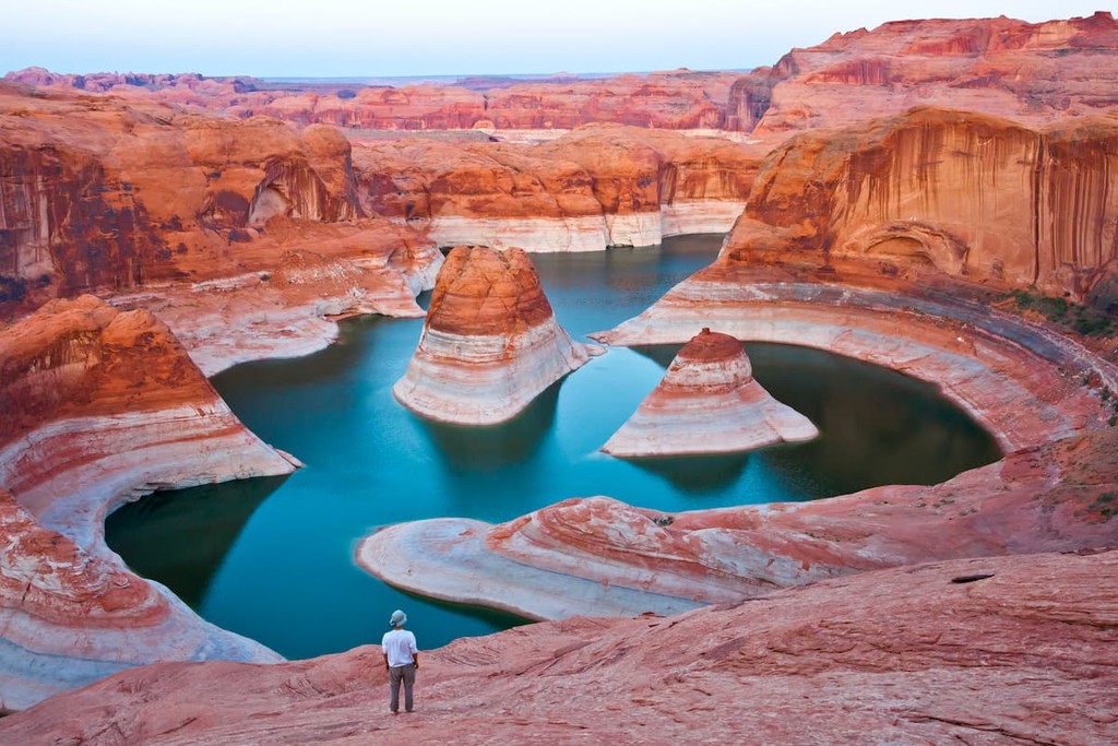
One of the most stunning hikes in the region, the 18 mile (29km) hike to Reflection Canyon is a must-do for avid backpackers. Featuring exceptional views and great chances for solitude, the off-trail trek to Reflection Canyon is a remote adventure in Glen Canyon National Recreation Area.
Due to the exposure of the hike to the midday sun and the desert heat, the trek to Reflection Canyon is best in the spring or fall. However, it’s important to note that there is no water on the hike, so you’ll have to pack in everything you need for the trip.
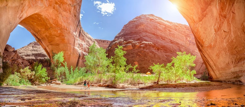
Located in the famous Coyote Gulch, the single most popular destination of the entire hike is easily the Jacob Hamblin Arch. Depending on where you start, this hike is between 7 and 8.5 miles (11.3 to 13.7km) one-way, so many do this hike as an overnight trip.
Once you’re at the arch, however, you’ll get fantastic views of one of the most beautiful natural spans in southern Utah, as well as a chance to link up to many other nearby destinations.
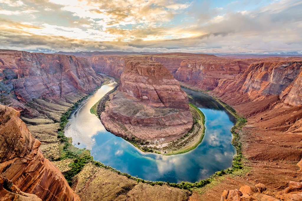
Among the most popular hikes in the park, the trail to Horseshoe Bend is a casual 1.4 mile (2.3km) hike to see the 180º bend in the Colorado River. The trail itself is short and sweet with little elevation change as you make your way to great vistas of the mighty Colorado. However, it can get quite hot on the hike, so it’s best avoided at midday in the summer months.
Looking for a place to stay during your visit to Glen Canyon National Recreation Area? Here are some of the best places to check out:
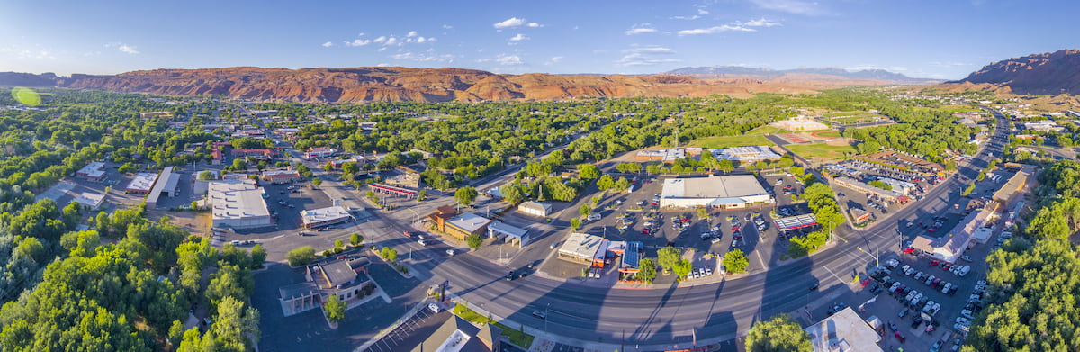
One of the most popular outdoor recreation destinations in south-eastern Utah, the city of Moab is located to the northeast of Glen Canyon, right outside Arches and Canyonlands National Park. With over 5,000 residents, Moab is a world-famous hiking, mountain biking, and rock climbing destination, so it’s a must-visit if you’re in the area.
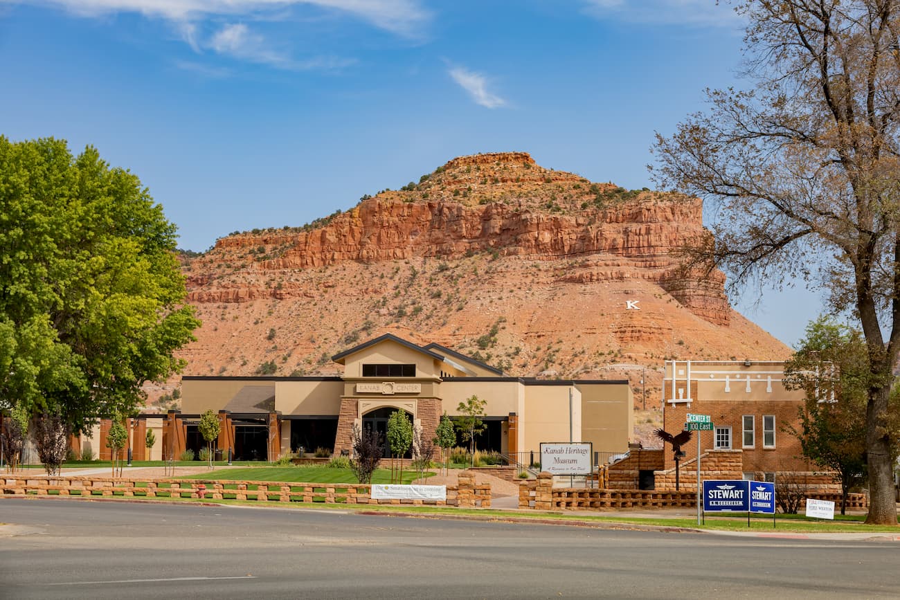
Located just to the west of the Glen Canyon National Recreation Area, the city of Kanab is home to about 4,800 residents who live outside some of the most beautiful desert landscapes in southern Utah. In fact, the city has been used as a filming location for a number of famous western films and it is a popular starting point for ventures into Grand Staircase-Escalante National Monument and into Glen Canyon.
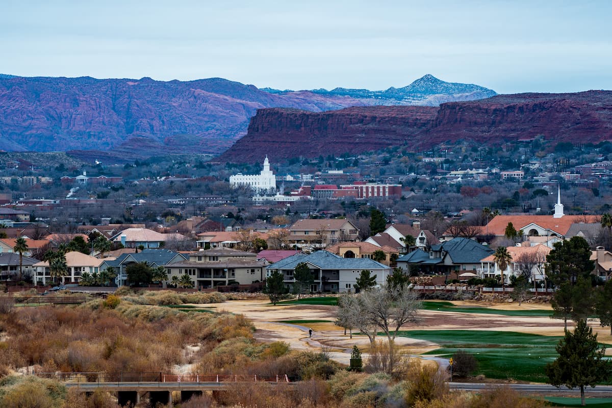
One of the largest cities in Utah outside of the Wasatch Front, St. George is located to the west of Glen Canyon near the state’s border with both Arizona and Nevada. St. George has about 90,000 residents and it is a major destination for outdoor recreationalists who venture to the city to take advantage of its excellent rock climbing, hiking, and mountain biking opportunities, as well as its proximity to Zion National Park.
St. George is also located along I-15 with quick connections to Las Vegas and it has a regional airport that offers flights to major cities in the vicinity.
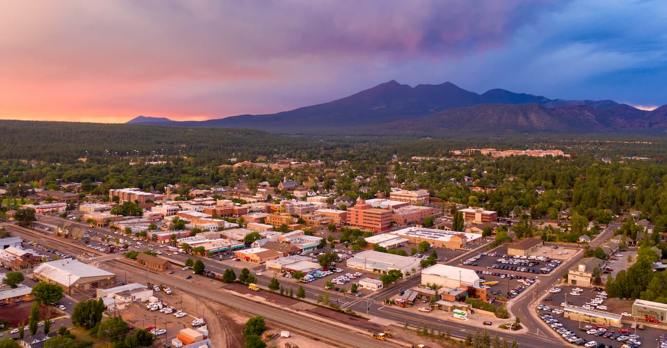
Situated to the south of the Glen Canyon National Recreation Area, the city of Flagstaff is one of the most populous communities in northern Arizona. The city is home to about 75,000 residents and is located at the base of the state high point, Humphreys Peak.
While Flagstaff is far from the largest city in the state, its proximity to major outdoor recreation areas such as Grand Canyon National Park to the north and both Kaibab National Forest and Coconino National Forest to the west and east, respectively, make it a popular destination for outdoor enthusiasts.