Scan the QR code and open PeakVisor on your phone
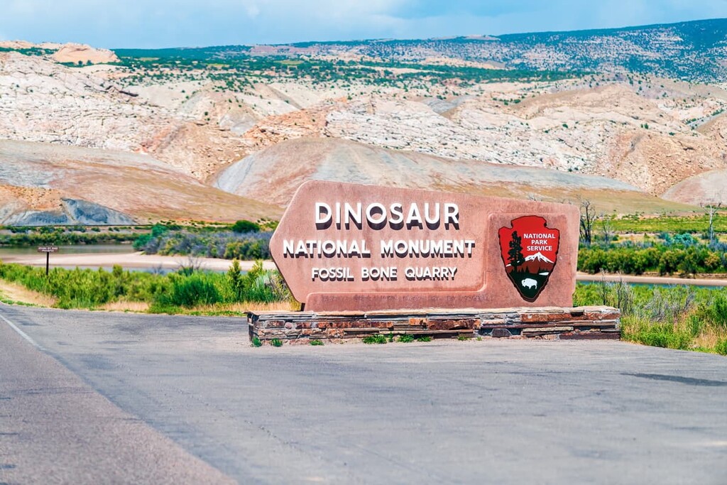
The aptly named Dinosaur National Monument is a federally protected area located along the borders of the US states of Colorado and Utah. It is particularly well known for its plethora of paleontological sites that contain hundreds of dinosaur fossils. It also features superb natural landscapes and it preserves many important cultural sites. The monument contains 32 named high points, the highest and most prominent of which is Zenobia Peak.
Dinosaur National Monument is located along the northern border of the US states of Colorado and Utah, not far from the states’ mutual border with Wyoming. It contains 210,844 acres (85,325 ha) of land and it is situated within both Uintah County, Utah and Moffat County, Colorado.
The monument is best known for its abundance of dinosaur fossils, however, its many landscapes offer something for everyone, regardless of your personal fascination with dinosaurs. For example, the monument is situated along the confluence of the Yampa and Green Rivers, so it offers superb river rafting opportunities.
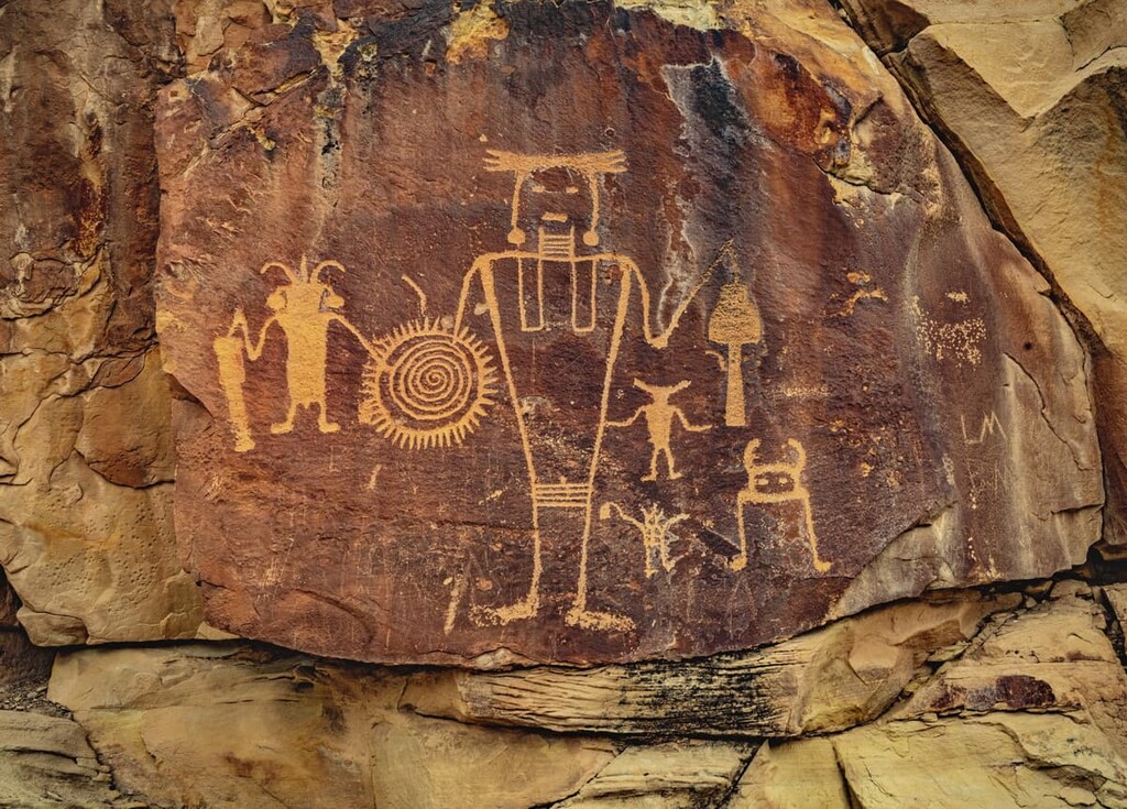
Furthermore, Dinosaur National Monument is located on the ancestral lands of the Ute Nation (Núu-agha-tʉvʉ-pʉ̱), particularly the Ute Indian Tribe of the Uintah and Ouray Reservation. The monument contains dozens of cultural sites dating back to the people of the Fremont culture, such as very well-preserved petroglyphs. Visitors should note that these sites are both culturally important and federally protected, so touching or disturbing the sites is prohibited.
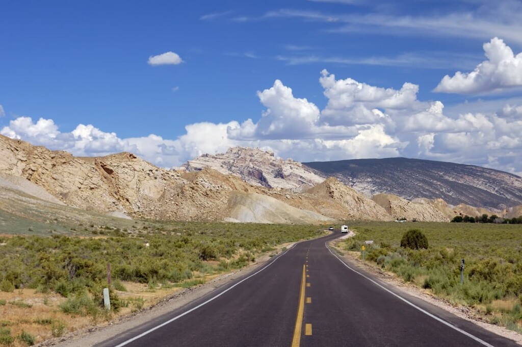
Additionally, Dinosaur National Monument is located in a fairly remote part of Utah and Colorado. It is situated just to the north of US Route 40 and just east of US Route 191. However no major roads of other interstate highways cross through the monument. The monument is also located a considerable distance from any cities with more than 20,000 residents.
As such, it boasts some of the best night skies in the region. It was actually designated as an International Dark Sky Park by the International Dark Sky Association in 2019.
Dinosaur National Monument, despite its remoteness, is located within driving distance of a number of other areas of public land. This includes the Diamond Breaks Wilderness Study Area to the north, the Ashley National Forest to the west, the Cross Mountain Wilderness Study Area to the east, and both the Willow Creek and Skull Creek wilderness study areas to the south.
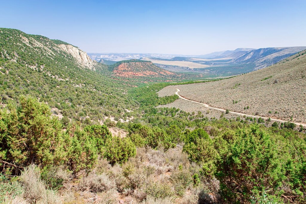
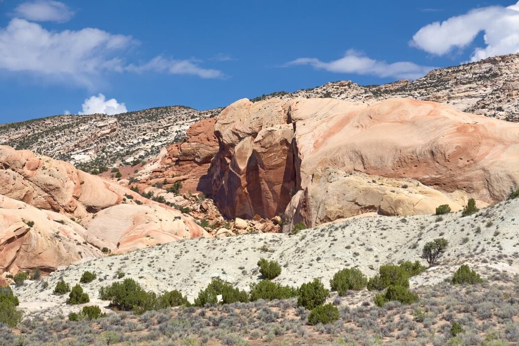
Dinosaur National Monument is a true geologist’s paradise. The monument is located along the edge of the Uinta Mountains of the Western Rocky Mountains, which transition into the Colorado Plateau not too far to the south.
The Uinta Mountains, like much of the rest of the Rockies, formed during the Laramide orogeny, which started approximately 80 to 70 million years ago. However, the rocks in the monument are substantially older.
The primary rock layer of interest in the monument, at least for paleontologists, is the Morrison Formation. The Morrison Formation is approximately 150 to 140 years old, so it formed during the Late Jurassic. Much of the formation is sedimentary in origin with rocks such as sandstones, limestones, mudstones, and siltstones comprising much of the region.
It is widely considered to be one of the best formations in the US to find dinosaur fossils. The formation covers an area that’s approximately 600,000 square miles (1.5 million sq. kilometers) in size across the United States, including in areas as far away as North Dakota and Montana.
The other notable rock layer in the monument is the Cedar Mountain Formation, which dates between 140 and 95 million years ago. It overlies the Morrison Formation in areas and it is overlied itself by the Naturia Formation.
Although the bulk of the fossils in Dinosaur National Monument are found in the Morrison Formation, the Cedar Mountain Formation also contains some fossils of note. Some paleontologists argue that the records from this formation suggest that North America and Europe were still connected by a land bridge during this time.
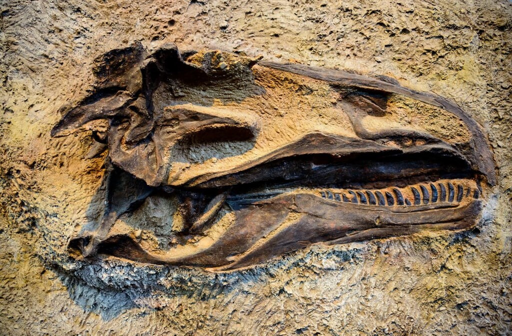
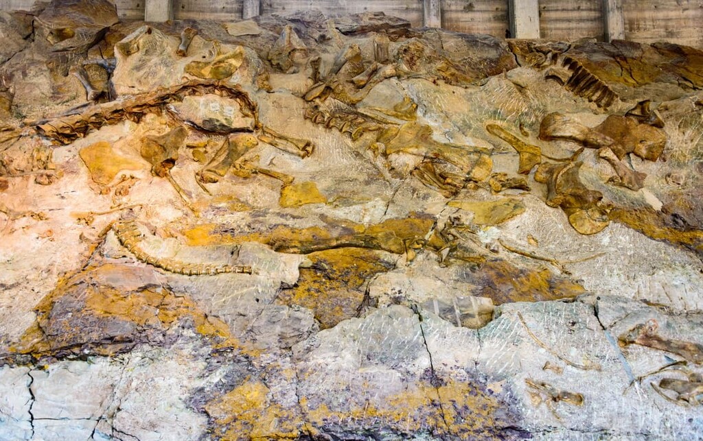
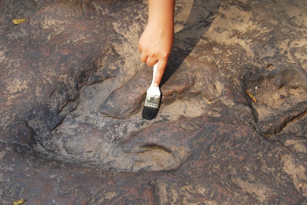
Within the monument, the most notable dinosaur fossil site is called the Carnegie Dinosaur Quarry. This area contained eleven different dinosaur species, including stegosaurus, allosaurus, and diplodocus. A much more recent dinosaur fossil discovery was made in the Cedar Mountain Formation where researchers found a skull of the Abydosaurus mcintoshi.
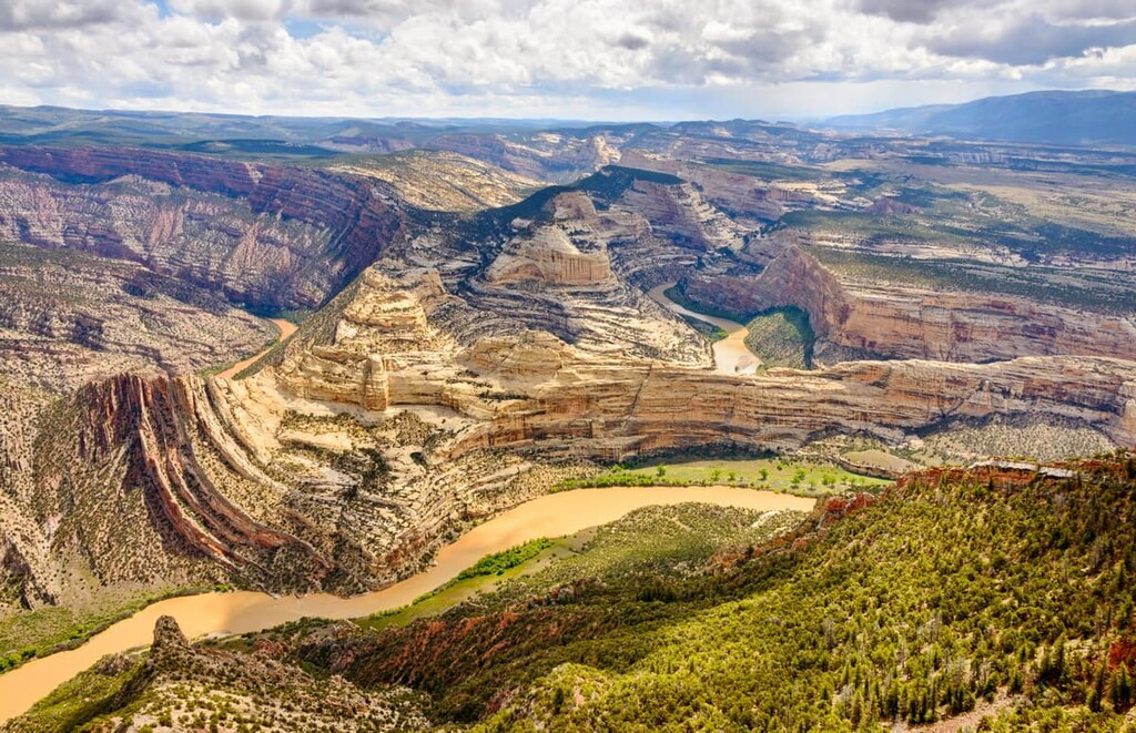
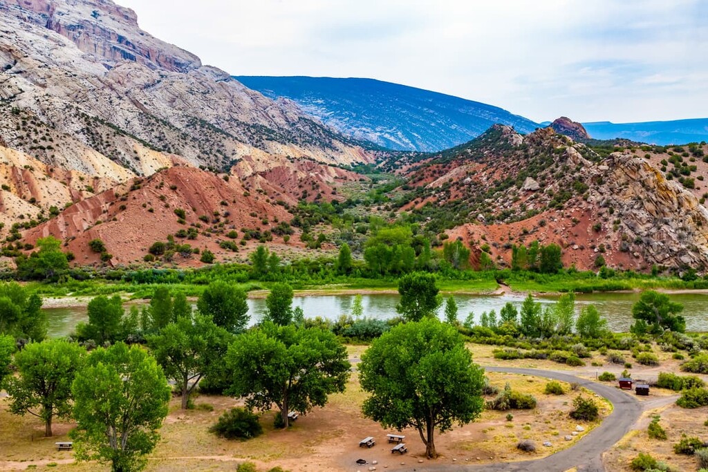
While Dinosaur National Monument might be best known for its dinosaur fossils (and rightly so), the monument also contains the confluence of two of the most important rivers in the region: the Yampa and the Green.
The Yampa is approximately 250 miles (400 km) long and it is considered to be a tributary of the Green. Its headwaters are located in Routt County, Colorado near the town of Yampa. It remains one of the last few rivers in the western United States that is almost entirely free-flowing as it has no major dams along its course.
Meanwhile, the Green River (Seeds-kee-dee-Agie) is a waterway of approximately 730 miles (1,170 km) in length that originates in Wyoming’s mighty Wind River Range. It flows through the town of Green River and into the Flaming Gorge National Recreation Area before skirting around the Uinta Mountains and meeting the Yampa in Colorado.
The Green River is itself a tributary of the Colorado River and it is actually only slightly smaller in size than the Colorado when the two rivers converge in the heart of Canyonlands National Park.
Combined the Yampa and Green rivers have carved out some of the most spectacular landscapes in the monument. Rafting is a particularly popular activity in the region as both rivers are premier whitewater rafting destinations.
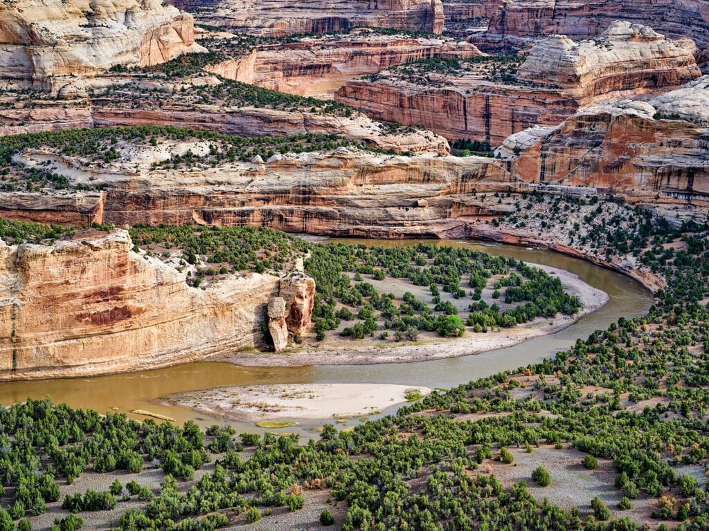
In particular, Dinosaur National Monument is home to the Canyon of Lodore, which is an 18 mile (29 km) section of the Green River that meanders its way through the Uinta Mountains. The canyon starts at the scenic Gates of Lodore in the northern part of the monument and travels downriver toward Echo Park in the central part of the monument.
Paddlers can raft the Gates of Lodore over the course of a 4 day trip that involves Class II to Class III rapids. Note that advanced planning and permits are required in order to take a river trip in Dinosaur National Monument.
Dinosaur National Monument is home to a wide array of different plant communities. The monument contains a range of elevations, soil types, and terrains, so it is the perfect place to support an abundance of ecosystems. In particular, there are six major plant communities in the monument, including:
The many plant ecosystems in Dinosaur National Monument support a wide variety of wildlife.
Here, mammals like the Ord’s kangaroo rat and the white-tailed prairie dog, both of which thrive in arid climates, are abundant. However, visitors can also see coyotes, bighorn sheep, elk, yellow-bellied marmots, river otters, mule deer, black bears, and mountain lions also call this area home.
Birdlife is also plentiful in the monument with over 200 bird species nesting or migrating through the region each year. Some of the most notable species include great blue herons, bald eagles, peregrine falcons, turkey vultures, Clark’s nutcrackers, northern goshawks, burrowing owls, and golden eagles.
Finally, in a monument that’s dominated by two of the western US’ greatest rivers, we couldn’t possibly overlook the fish species that call this place home. The monument’s waterways are currently home to more than 50 fish species, however, all but 14 have been introduced to the region.
Out of those 14 fish, 4 are considered to be endangered. These include the bonytail, humpback chub, razorback sucker, and Colorado pikeminnow.
Humans have lived in the area in and around what is now Dinosaur National Monument for at least the last 10,000 years. Many of the petroglyphs found within the monument today are from the people of the Fremont culture who lived in this region approximately 1,200 to 800 years ago.
The land in and around what is now Dinosaur National Monument is the ancestral homelands of many Indigenous communities, including the tribes of the Ute Nation (Núu-agha-tʉvʉ-pʉ̱) and, in particular, the Ute Indian Tribe of the Uintah and Ouray Reservation.
Peoples of European descent first started arriving in the region during the eighteenth century. Some of the most prominent early European visitors to the area include Spaniards Francisco Domínguez and Silvestre Vélez de Escalante, who visited the area in 1776 on the so-called Domínguez–Escalante expedition.
Not long afterward, fur trappers from what is now Canada and the eastern United States began arriving in the area. However, many European and European-American settlements in the region were located further to the south, thanks to the establishment of the Old Spanish Trail, which passed through what is now the community of Green River, Utah.
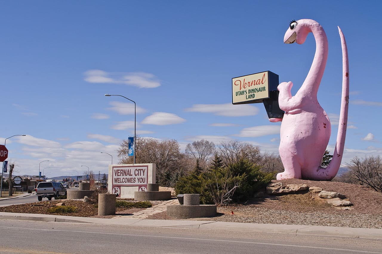
The nearby community of Vernal was established in the late nineteenth century after a number of families established homesteads in the Ashley Valley. The Mormon Church helped draw more settlers to the region during the latter part of the century and Vernal was incorporated in 1897.
Over the last century, the bulk of the economy around Dinosaur National Monument has been ranching and mining-based. In 1909, a paleontologist by the name of Earl Douglass discovered dinosaur fossils in what is now the monument. He was working for the Carnegie Museum of Natural History in Pennsylvania at the time and he and his crew excavated thousands of fossils in the process.
The dinosaur beds around Douglass’s original excavation were protected as Dinosaur National Monument in 1915. The monument was expanded in 1938 to its current size.
However, Dinosaur National Monument hasn’t been without its controversies. One of the most notable controversies occurred in the 1950s when the US Bureau of Reclamation made a proposal to build a dam at Echo Park, which is located in the middle of the monument just downstream from the confluence of the Green and Yampa rivers.
The proposed dam was part of the Colorado River Storage Project Act which purported to create dams along the Colorado and its tributaries to provide hydro power and water storage. Congress eventually passed the act, but, thankfully, with the provision that no dam could be built at Echo Park. However, the act did result in the creation of multiple dams in the region including the massive Glen Canyon Dam at what is now Glen Canyon National Recreation Area.
These days, Dinosaur National Monument is one of the most popular national monuments in the area. It draws hundreds of thousands of hikers and rafters each year as well as plenty of dinosaur enthusiasts.
Dinosaur National Monument is a fantastic place to visit if you’re looking to get outside and hike along the canyons of the Green and Yampa rivers. Here are some of the best hikes to check out during your trip to the monument:
The Fossil Discovery Trail is a 2.4 mile (3.9 km) round-trip hike from the Quarry Visitor Center. It is a moderately difficult trail that offers a chance so see some of the monument’s unique geological structures.
On this trail, you’ll travel past outcroppings of the Morrison Formation and you’ll get to see a number of fossil fragments. There are a handful of dinosaur bones still in the rock, so you can experience precisely what it was like for Earl Douglass to see these fossils for the first time in 1909.
The 1.5 mile (2.4 km) Gates of Lodore Trail is a remote adventure that starts from the Gates of Lodore Campground in the northern end of the monument. It is a mostly flat trail that takes you to a viewpoint that overlooks the Gates of Lodore, so it’s a great option for folks that want to see this famous section of the Green River.
Do note that there is no foot access to the Green River or through Lodore Canyon. The canyon is only passable by boat.

The Plug Hat Trail is a 0.5 mile (800 m) accessible loop trail that starts on Harpers Corner Road. It is an interpretive trail that follows a paved path along the top of a butte where you can get super views of the region. There is also a wheelchair-accessible picnic area near the trailhead for all to enjoy.
The 3.2 mile (5.1 km) Sound of Silence Trail is a loop path that takes you deep into the monument’s desert environment. On this trail, you get a chance to see some of the most unique rock outcroppings in the monument, and you get great vistas of Split Mountain.
Looking for a place to stay or refuel during your next trip to Dinosaur National Park? Here are some of the best cities and towns to check out:
Although Dinosaur National Monument is fairly far from a major city or town, the monument is home to six campgrounds that boast over 120 different campsites for visitors to choose from. Half of the campgrounds are located in Utah and the other half are situated in Colorado.
The campgrounds in Dinosaur National Monument include:
Many of the campgrounds in the monument are open year-round, but please note that some of the campgrounds are impossible to reach in wet or snowy conditions. You may also want to consider bringing a high clearance vehicle as some campgrounds, such as Echo Park, require a long drive on dirt roads in order to reach.
With the exception of group campsites, most sites in Dinosaur National Monument are available on a first come, first served basis. Additionally, take note of the water availability at your chosen campground as some only have water available during certain months of the year.
Backcountry camping is also allowed within Dinosaur National Monument. A permit is required for all overnight backcountry visitors. Permits are free for backpackers and they can be picked up at a visitor’s center. Most backpackers stay in dispersed campsites, though there are designated sites available at Ely Creek. Note that you will need a bear-proof storage system for all food while backpacking in Dinosaur National Monument.
The city of Vernal is situated to the west of Dinosaur National Monument along US Route 40. It is approximately 30 minutes by car to the western edge of the monument, but about 1 hour to the Colorado side of the park.
Vernal is home to approximately 10,000 people, many of whom work in the natural gas and petroleum industries. However, Vernal’s proximity to Dinosaur National Monument and its location near the Green River have made it a popular destination for outdoor recreation.
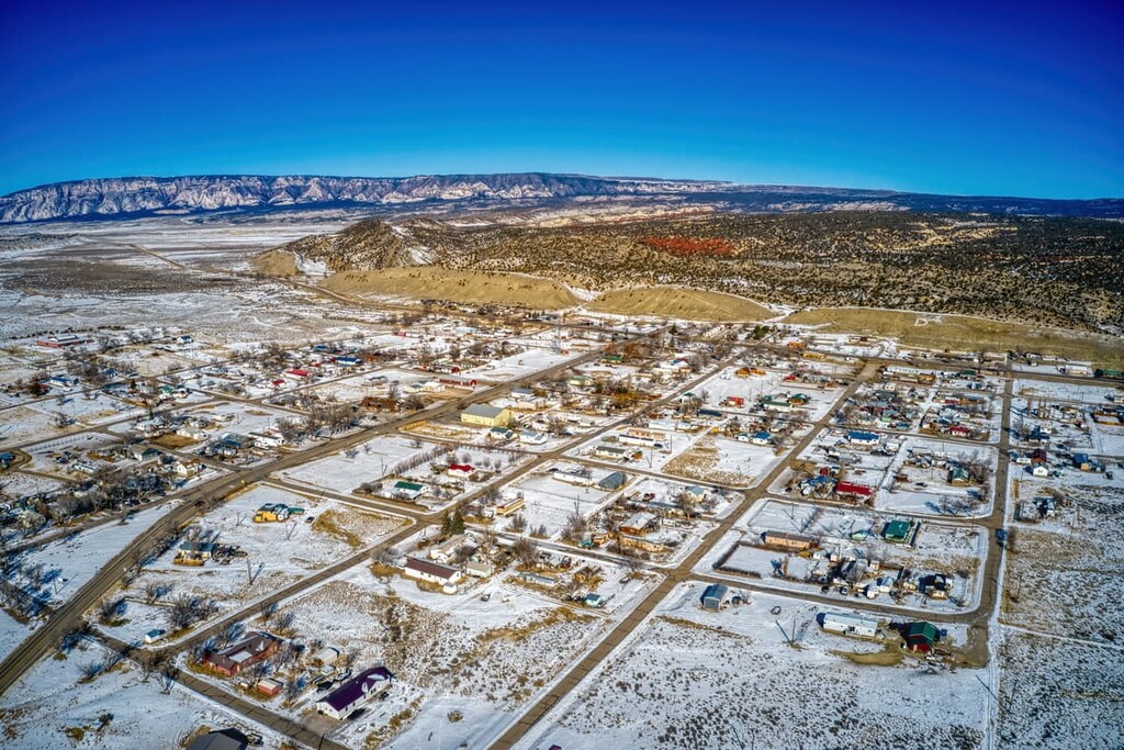
The small town of Dinosaur, Colorado is home to approximately 400 people who live just south of Dinosaur National Monument. Its name was actually originally Baxter Springs, and it was later named Artesia in the 1940s. However, the town’s name changed again in the 1960s to highlight its proximity to the monument.
While Dinosaur isn’t the largest town in the region, it is a nice place to stay if you’re looking to have a roof over your head for the night. Dinosaur has a growing tourism industry and it has since become popular for cannabis tourism due to the legality of the substance in Colorado, but not in neighboring Utah.
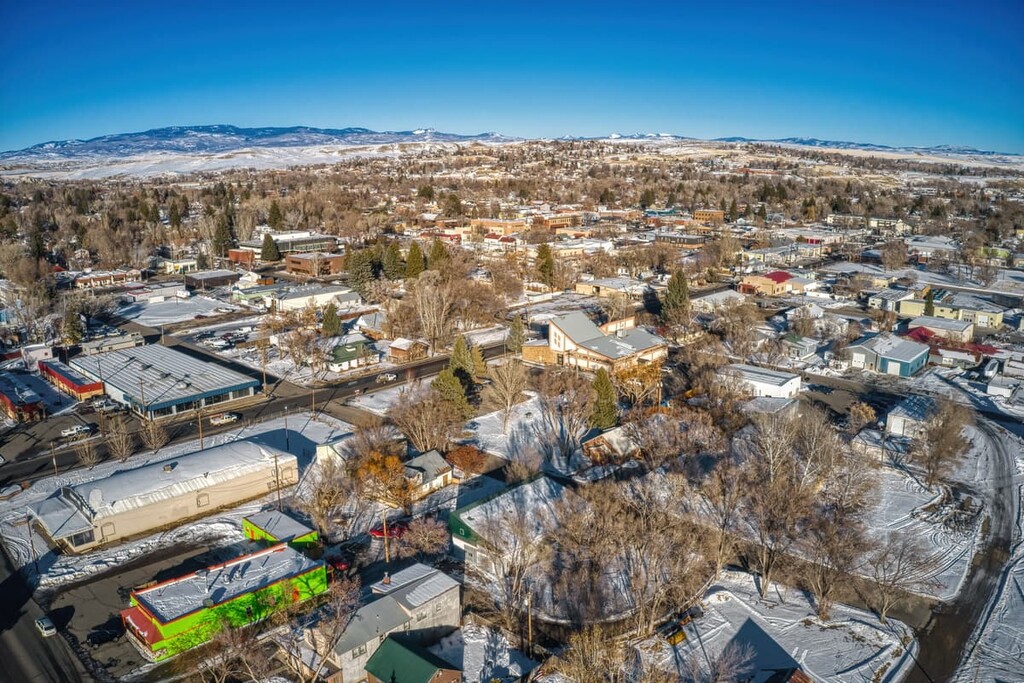
Home to approximately 9,500 residents, the city of Craig is located at the intersection of US Route 40 and Colorado State Highway 13. It is about 2 hours by car to the central part of Dinosaur National Monument.
Craig is particularly well known for its elk hunting opportunities as well as its plethora of historic sites. The city is home to the Museum of Northwest Colorado as well as the Wyman Museum. It’s also just a short drive from Routt National Forest, so it’s a great place to start any adventure.
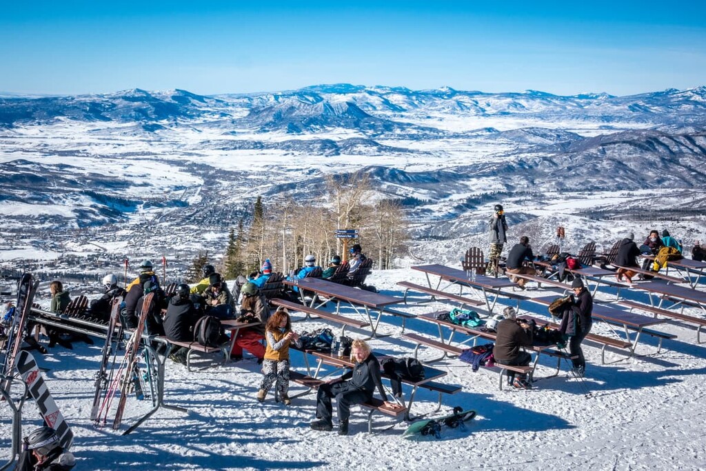
Lovingly known as Ski Town USA, Steamboat Springs, Colorado is a community of some 13,000 people located to the east of Dinosaur National Monument. Although it is a fairly far distance from the monument, Steamboat has a large collection of hotels, restaurants, and shops that cater to tourists. So, it’s a perfect basecamp for your northwestern Colorado travels.
Steamboat has a world-class ski resort, Steamboat Ski Resort on Mount Werner, and it’s located near some of the ebay paddling on the Yampa River. The town is also just a short distance from the Yampa Valley Regional Airport, which offers scheduled flights to major cities around the United States.