
Scan the QR code and open PeakVisor on your phone
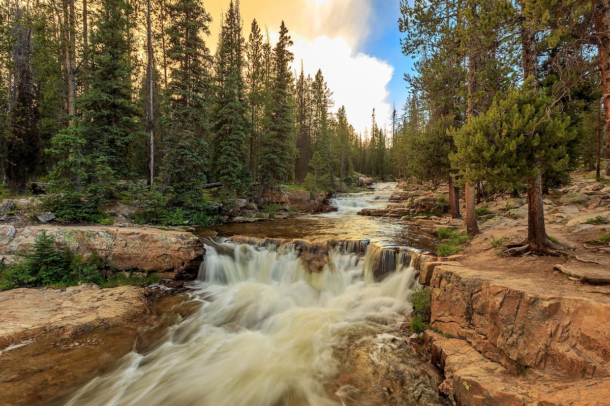
With rugged mountains, dense forests, and raging rivers filled with trout, the Ashley National Forest is a true outdoor recreationalist’s paradise. The forest is situated in the northeastern part of the state of Utah and in the southwestern part of the state of Wyoming in the United States. It contains 51 named mountains, the highest and most prominent of which is Kings Peak (13,527ft/4,123m), the highest in the state of Utah.
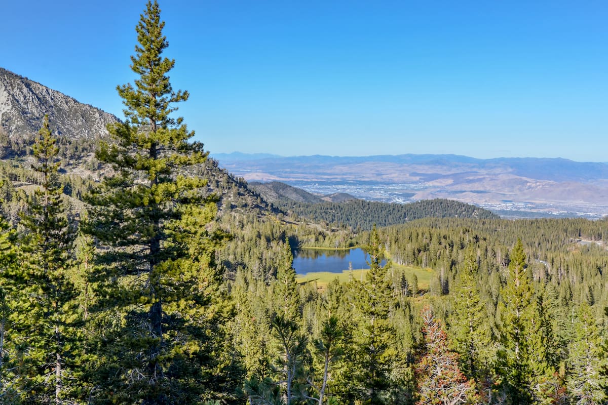
The Ashley National Forest is a large federally-managed area located in the northeastern part of Utah and the southwestern part of Wyoming. It covers about 1,382,346 acres (559,415 ha) of land in the 2 states, which is split between Daggett, Summit, Uintah, Duchesne, and Utah counties within Utah and Sweetwater County in Wyoming.
For the most part, the Ashley National Forest is situated around the Uinta Mountains, which is a collection of peaks that runs from the Wasatch Range in the west into Dinosaur National Monument in Colorado to the east. However, the Ashley National Forest includes just the southern part of the range, while the rest of the Uinta Mountains are actually included within the Uinta-Wasatch-Cache National Forest to the north and west.
Within the state of Utah, the Ashley National Forest is also located to the west of the Dinosaur National Monument and to the north of Steinaker State Park, Red Fleet State Park, Starvation State Park, and the Ouray National Wildlife Refuge.
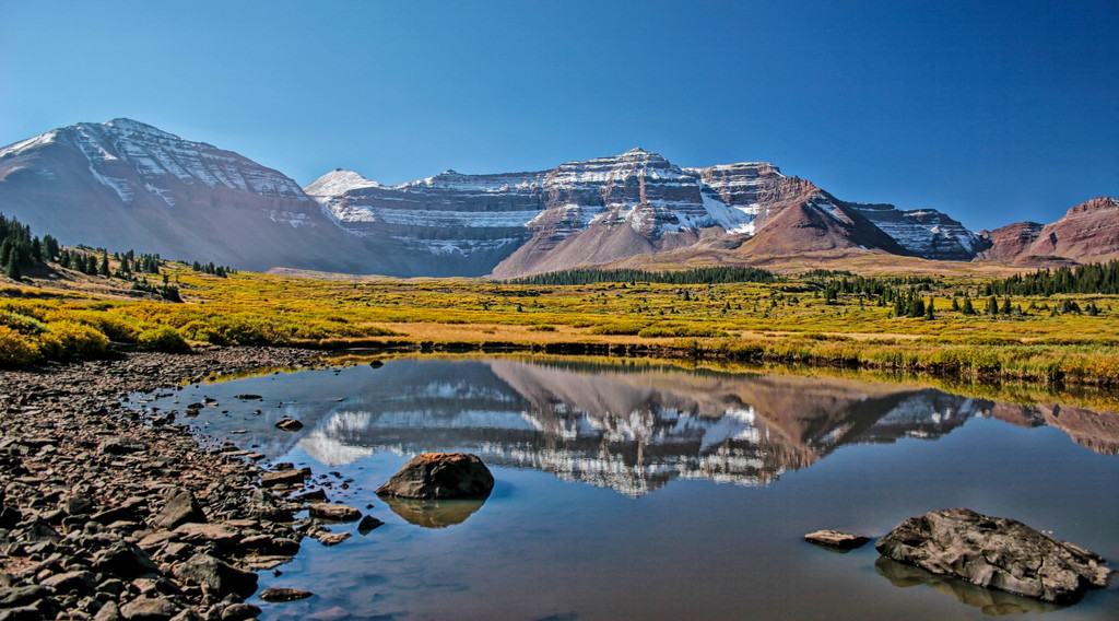
Despite being one of the larger national forests in Utah, Ashley National Forest contains just 1 wilderness: the High Uintas Wilderness. Part of the High Uintas Wilderness is located within the Uinta-Wasatch-Cache National Forest, though the most rugged parts of the wilderness, including the area around Kings Peak, is within the Ashley National Forest.
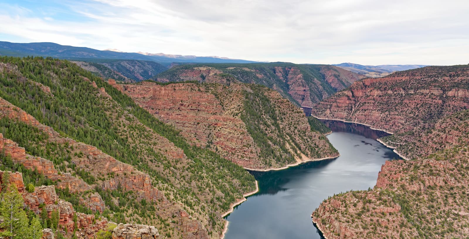
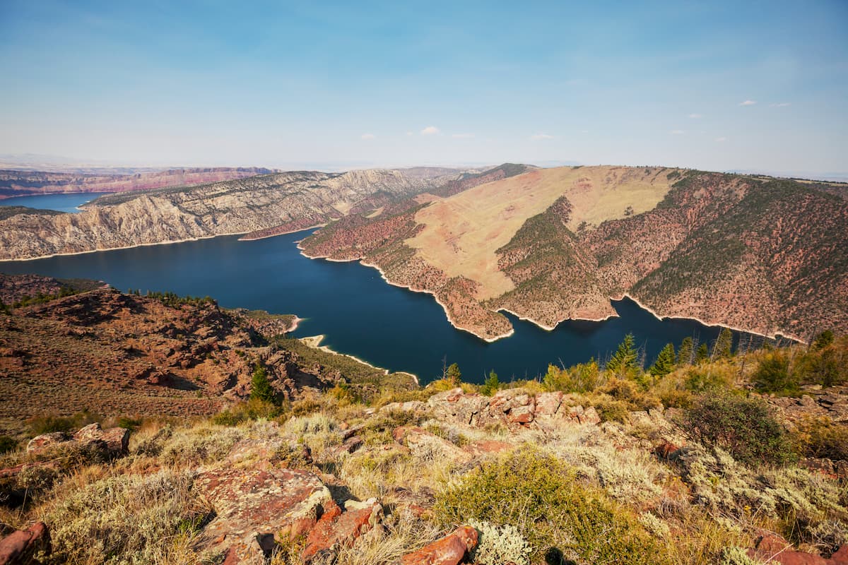
Also located within the Ashley National Forest is the Flaming Gorge National Recreation Area. The recreation area is situated around the Flaming Gorge Reservoir, which is a 91 mile (146km) long man-made lake created by the Flaming Gorge Dam on the Green River. It is a highly popular hiking, climbing, paddling, boating, and biking area that straddles the border between Wyoming and Utah.

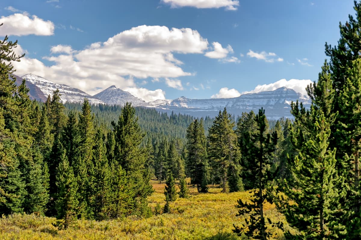
Geologically, the mountains within the Ashley National Forest are part of the Uinta Mountains. The Uinta Mountains are a subrange of the Western Rocky Mountains that cuts across the northeastern part of Utah from west to east.
Here the bedrock is mostly metasedimentary in origin, having been uplifted during the Laramide orogeny, which also formed the majority of the Rocky Mountains. In later years, the Uinta Mountains were also heavily glaciated. This glaciation also helped to sculpt the mountains into the landforms that we see today.
Interestingly, the east-west oriented Uinta Mountains form a bit of a natural barrier between the Greater Yellowstone Rockies to the north and the Colorado Plateau to the south. They also separate the Western Rocky Mountains to the west and the Southern Rocky Mountains to the east.
Major peaks within the Ashley National Forest include Kings Peak, Gilbert Peak, Mount Emmons, Mount Lovenia, Wilson Peak, and Strawberry Peak.
Like the nearby Uinta-Wasatch-Cache National Forest, much of the Ashley National Forest is part of the Wasatch and Uinta Montane Forest ecoregion. This ecoregion is found only within the Uinta and Wasatch ranges in Utah, Wyoming, and Idaho, so it’s fairly unique within the Rocky Mountains.
Due to the forest’s location to the east of the Sierra Nevada, the Great Basin Ranges, and the Wasatch Range, it’s actually one of the driest places in the Rocky Mountains.
However, at higher elevations, the Ashley National Forest is able to support fairly sizable stands of conifers, including subalpine fir, lodgepole pine, Rocky Mountain Douglas fir, ponderosa pine, and Engelmann spruce. There are also some large areas of quaking aspen, though, unlike many other parts of the Rocky Mountains, Gambel oak isn’t commonly found in the Ashley National Forest.
Wildlife is also particularly abundant in the Ashley National Forest. Although hundreds of animal species call the region home, some of the most notable include mule deer, pronghorns, elk, moose, mountain goats, and bighorn sheep. There are also quite a few badgers, coyotes, foxes, weasels, black bears, mountain lions, and even the occasional grey wolf.
The land in and around what is now called Ashley National Forest has been home to humans for millennia. Many Indigenous peoples consider the region to be sacred and part of their ancestral homelands, including the Ute Indian Tribe, among others.
Indeed, the Uintah and Ouray Indian Reservation of the Ute Indian Tribe covers approximately 6.7 million square miles (17.5 million sq. km) of land to the south of the Ashley National Forest. It is the second largest reservation in the United States by land area after the Navajo Nation in Arizona, Utah, and New Mexico.
The first Europeans to travel through the region in and around the Ashley National Forest were likely part of the Spanish Domínguez-Escalante expedition in the late 18th century, which visited large swaths of what is now the southwestern United States in order to find a route between Santa Fe, New Mexico and Monterey, California.
Some half century later, William Henry Ashley, the forest’s namesake and a prominent fur trader, visited the region in the 1820s. During his expedition, Ashely traveled along the Green River, through the Flaming Gorge, and entered the Uinta Mountains in his search to find a waterway outlet to the Gulf of Mexico.
The next famous US-sponsored expedition to visit the region was John Wesley Powell’s 1869 expedition, which rafted the Green River through the Uinta Mountains and to its confluence with the Colorado River in what is now Canyonlands National Park, before heading south toward the Grand Canyon.
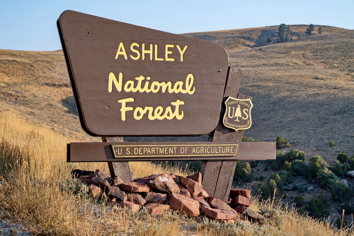
Although the various parts of the nearby Uinta-Wasatch-Cache National Forest were established in the late 19th century by President Grover Cleveland, however, the Ashley National Forest wasn’t created until the 20th century. In 1908, President Theodore Roosevelt officially designated the Ashley National Forest, which was later expanded in 1968 with the creation of the Flaming Gorge Recreation Area.
Finally, the High Uintas Wilderness was formally established in 1984 with the passage of the Utah Wilderness Act. This wilderness was established alongside many of the other major wildernesses in the state, including the Mount Naomi Wilderness, the Wellsville Mountain Wilderness, the Mount Olympus Wilderness, the Mount Timpanogos Wilderness, and the Twin Peaks Wilderness in the nearby Uinta-Wasatch-Cache National Forest.
To this day, the Ashley National Forest remains a popular hiking and outdoor recreation location in the state of Utah.
Ashely National Forest is one of the premier hiking destinations in northeastern Utah. There are plenty of great hikes and outdoor opportunities to check out if you’re in the area. Here are some of the most popular places to visit:
The 101 mile (162.5km) Highline Trail travels through both the High Uintas Wilderness of the Ashley National Forest. It begins at Mirror Lake in the west and then continues eastward toward its terminus near the town of Vernal.
Along the way, the trail stays almost entirely about 10,000 feet (3,048m) in elevation, though due to the ruggedness of the terrain, hikers can expect to gain around 18,000 feet (5,486m) of elevation during this point-to-point hike.
The Highline Trail passes through some of the most remote parts of the Ashley National Forest, so it’s an excellent place to check out if you’re looking to venture deep into the backcountry. Most hikers take about a week to complete the trail, making it a great choice for longer adventures.
The Dark Fork Flume Interpretive Trail near Vernal, Utah boasts beautiful rivers, scenic forests, and steep cliffs for visitors to enjoy. At just 9 miles (14.5km) long, the trail makes for a great day hike for anyone staying in or near Vernal during their trip.
Boasting the largest lake in the Sheep and Carter Creek drainage system, the Tamarack and Jessen Lake Trail is a short, but sweet 3.8 mile (6.1km) hike that starts at the Spirit Lake Campground. After leaving the campground, the trail continues onward to Tamarack Lake, where you can head on a walk around the lake, go for a swim, or cast lines in the hopes of snagging some trout.
Here are some of the best places to stay if you’re planning a trip to the Ashley National Forest:
The capital and largest city in the state of Utah, Salt Lake City is situated to the west of the Ashley National Forest at the base of the Wasatch Range. It is home to about 200,000 people and it has the largest airport in the state, which makes it a good place to fly into if you’re visiting from further afield.
Moreover, Salt Lake City is within driving distance of most of the state’s major outdoor recreation destinations, including the Uinta-Wasatch-Cache National Forest. It is close to most of Utah’s top ski resorts and it even hosted the Winter Olympics back in 2002.
The small city of Vernal, Utah has a population of just over 10,000 people. It is located to the east of the Ashley National Forest, near the end of the Highline Trail and it is known for its excellent outdoor recreation opportunities.
Vernal is also home to the annual Dinosaur Roundup Rodeo, one of the largest rodeos in the region. The city is also accessible by both road and air, so it’s fairly easy to get to from other major nearby destinations.


13er
ultra
utah-13ers
utah-ultras
13er
ultra
utah-13ers
utah-ultras


