
Scan the QR code and open PeakVisor on your phone
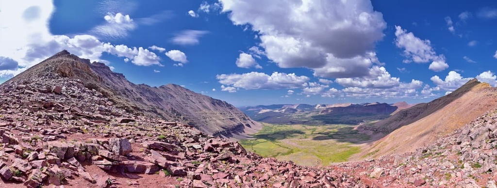
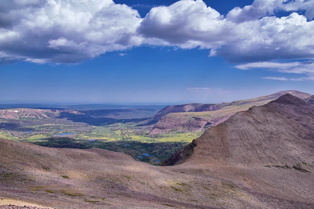
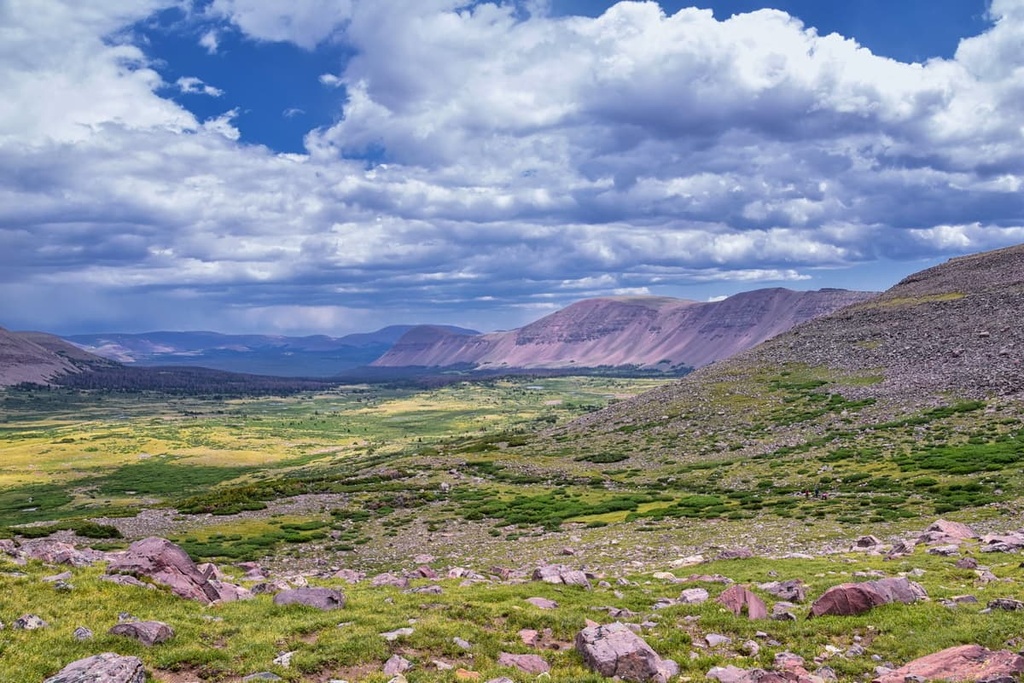
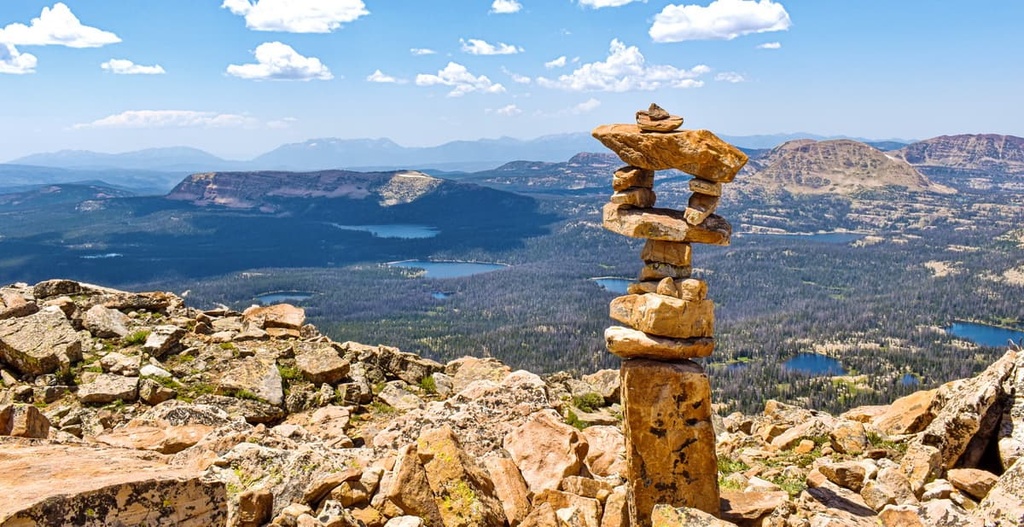
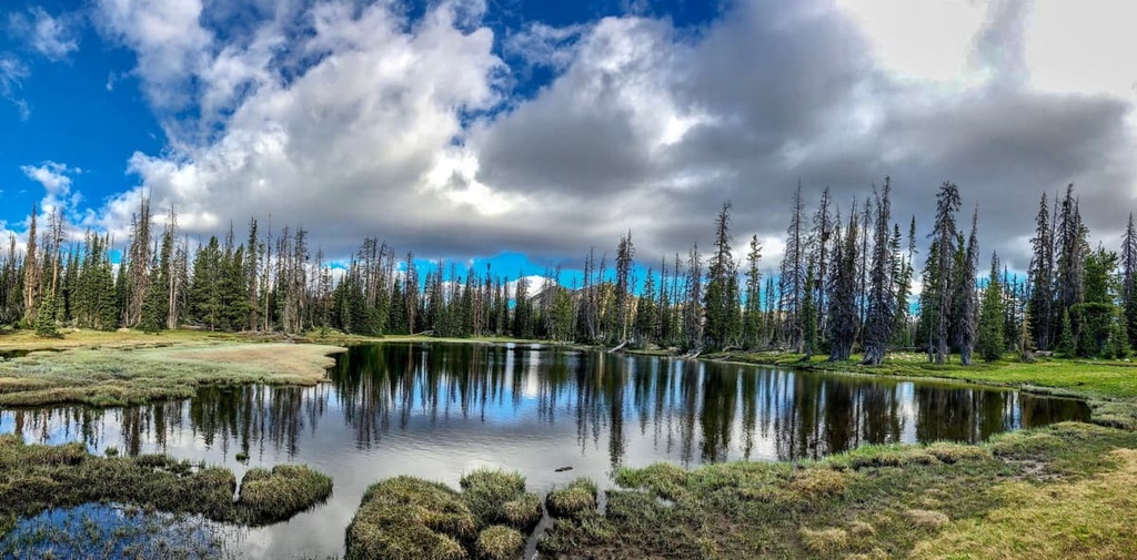
Home to towering peaks, rocky crags, and glistening alpine lakes, the High Uintas Wilderness is a federally protected area located in the northeastern part of the US state of Utah. The wilderness encompasses a swath of the tallest peaks in the Uinta Mountains. There are 56 named peaks in the wilderness, the highest and most prominent of which is Utah’s high point, Kings Peak (13,528 ft/4,123 m).
The High Uintas Wilderness is a federally protected wilderness area located in northeastern Utah. It encompasses some 456,705 acres (184,821 acres) of land in Summit and Duchesne counties.
Aptly named, the High Uintas Wilderness includes some of the loftiest parts of the Uinta Mountains, the tallest mountain range in Utah. The Uinta Mountains stretch across the northeastern part of the state from the eastern edge of the Wasatch Range all the way into the northwestern part of Colorado near Dinosaur National Monument.
The High Uintas Wilderness protects a small section of the west-central part of the Uinta Mountains. It is managed by the US Forest Service as part of both the Ashley National Forest and the Uinta-Wasatch-Cache National Forest.
Additionally, the wilderness is situated just to the north of the Uintah and Ouray Reservation, which is managed by the Ute Indian Tribe. The wilderness is located on the ancestral homelands of the Ute Indian Tribe and on the traditional territory of a number of other tribal nations, including the Eastern Shoshone Tribe.
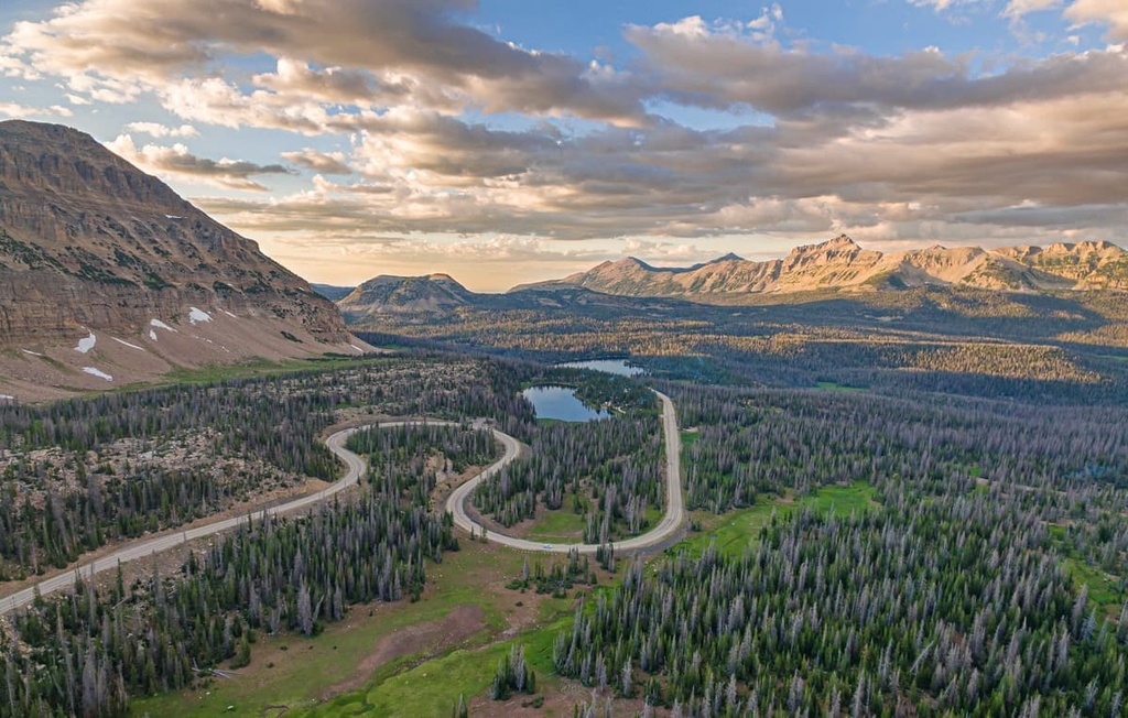
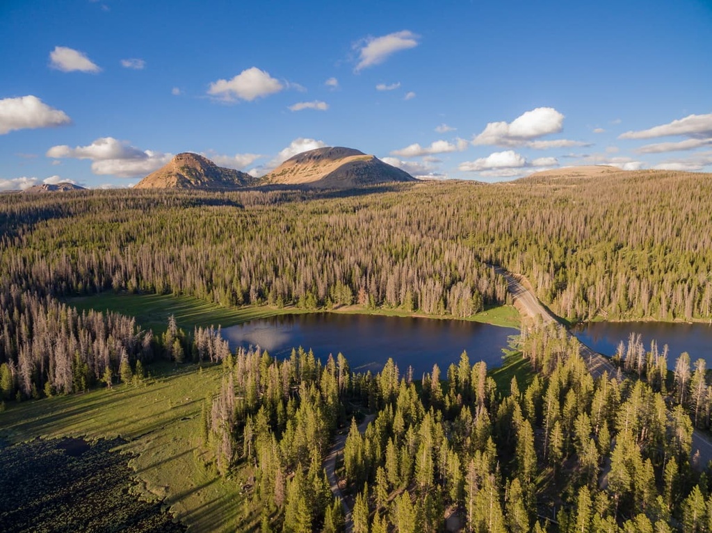
Within the wilderness, the landscape is dominated by rugged peaks, dense forests, beautiful lakes, and deep canyons. The wilderness area is completely surrounded by both the Ashley and Uinta-Wasatch-Cache national forests, making it one of the most remote areas within a half day’s drive of Salt Lake City.
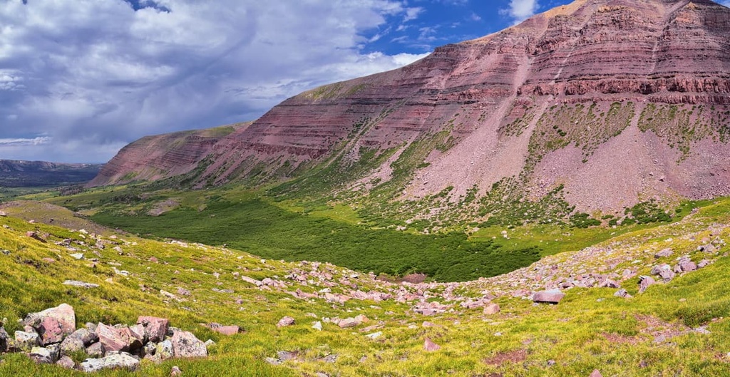
Geologically, the peaks within the High Uintas Wilderness are part of the Uinta Mountains. Unlike many other major mountain ranges in the United States, the Uintas run in an east-west direction (rather than the more typical north-south direction).
The bedrock in the range is mostly metasedimentary in origin. Most of the range was uplifted as part of the Laramide orogeny, which was also responsible for creating much of the rest of the Western Rocky Mountains. During the Laramide orogeny, the land between the Green River Basin and the Uinta River Basin buckled and folded, creating the mountains that we see today.
In the years that followed, the Uinta Mountains were heavily eroded by natural forces like wind and water. Around the Tertiary period, the region experienced a period of heightened tectonic activity, which led to even more uplift of the range.
Since that time, the range has experienced more erosion that’s helped carve out the landscape that’s now visible in the region. Much of this erosion happened as a result of wind and water, however, the region was also heavily glaciated throughout the Pleistocene.
Researchers believe that about 1,000 square miles (2,590 sq. km) of the Uinta Mountains were covered in ice during the last glacial maximum. These glaciers further eroded the landscape and created many of the deep valleys that the range is known for.
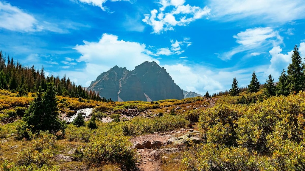
Major peaks in the High Uintas Wilderness include the state high point, Kings Peak, as well as Gilbert Peak, Mount Emmons, Mount Lovenia, Tokewanna Peak, Mount Powell, Wasatch Mountain, and Wilson Peak.
For the most part, the High Uintas Wilderness is dominated by the Wasatch and Uinta montane forest ecoregion. This ecoregion is found primarily in Utah, though it also exists in small parts of Wyoming and Idaho.
The Wasatch and Uinta montane forest ecoregion is one of the driest ecoregions in the Western Rocky Mountains because it is located in the rain shadow of the Sierra Nevada and the Great Basin Ranges.
Here, the landscape is dominated by coniferous forests that include species such as ponderosa pine, lodgepole pine, Rocky Mountain Douglas fir, Engelmann spruce, subalpine fir, and quaking aspen. That said, Gambel oak, which is found throughout many other parts of the southern Rockies, isn’t very common in the Uinta Mountains.
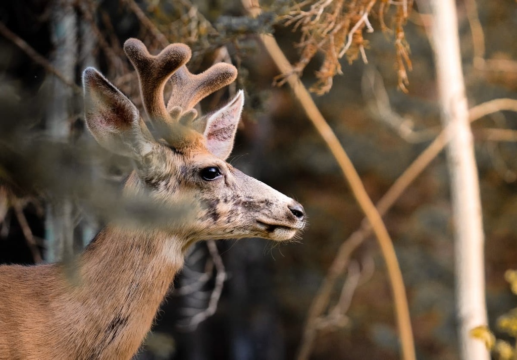
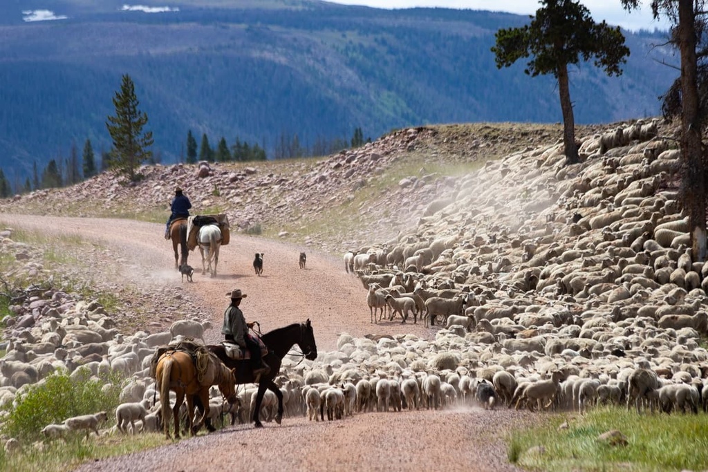
With regards to wildlife, the High Uintas Wilderness is home to pronghorns, moose, elk, mule deer, bighorn sheep, and mountain goats. Other wildlife species found in the region include badgers, foxes, weasels, coyotes, mountain lions, black bears, and gray wolves.
The land that is now part of the High Uintas Wilderness has been home to humans for countless generations. It is located on the ancestral homelands and traditional territory of the Ute Indian Tribe and the Eastern Shoshone Tribe, among other tribal nations.
People of European descent first visited the region as early as the Domínguez-Escalante expedition in the 1770s, however the expedition likely didn’t venture into the heart of the Uinta Mountains.
Fur trappers, including William Henry Ashley, began traveling into the Uinta Mountains in search of pelts and other economic opportunities in the 1820s. Ashley, in particular, traveled extensively throughout the range as part of his search for a river that led to the Gulf of Mexico. He eventually made it as far as what is now Flaming Gorge National Recreation Area.
The Uinta Forest Reserve was established in 1897 by President Grover Cleavland. This reserve eventually became the Uinta National Forest after the establishment of the US Forest Service. It was later administratively combined with two other nearby forests to create the Uinta-Wasatch-Cache National Forest.
In 1908, President Theodore Roosevelt also created the Ashley National Forest, which encompasses a large part of the southern Uinta Mountains. The High Uintas Wilderness was officially designated as a federally protected wilderness in 1984 as part of the Utah Wilderness Act.
Even though the wilderness is quite remote, there are 16 developed trailheads with over 545 miles (877 km) of trails that lead into the High Uintas Wilderness. As a result, the wilderness is a fantastic place to hike and enjoy the splendor of the alpine regions of Uinta Mountains.
Here’s a quick look at some of the most popular trails in the wilderness area:
One of the best hikes in the High Uintas Wilderness, this trail to the summit of Kings Peak is a popular choice for anyone that wants to stand on the summit of Utah’s high point. This trail begins at the Henrys Fork Trailhead and it runs for about 26.8 miles (43.1 km) to the summit of Kings Peak.
Since the trail is so long, most people opt to spend at least one or two nights in the backcountry when summiting Kings Peak. There are campsites along the lakes of the West Side Loop and at Dollar Lake. If possible, it’s best to do this as a 2 night trip so you can dedicate an entire day to summiting the tallest mountain in Utah.
The range’s premier backpacking route, the Uinta Highline Trail is a 104 mile (167 km) long thru-hike that follows the main crest of the Uinta Mountains. It traverses the wilderness area from east to west from McKee Draw to Hayden Pass, giving hikers a chance to see the best that the range has to offer.
If you just want to thru-hike the trail without any side trips, most hikers budget about 5 to 6 days for the adventure. However, if you want to do some peak bagging of the more than 23 peaks over 13,000 feet (3,962 m) near the trail, you may want to give yourself a week or two for this hike.
As of the time of writing, permits aren’t required to thru-hike the Uinta Highline Trail. But, be sure to check in with the Forest Service for information on the most up-to-date regulations for hiking in the range.
For a shorter backpacking trip in the High Uintas, consider the trek to Amethyst Basin. This 13 mile (21 km) round-trip hike takes most people about 2 to 4 days to complete and it brings you to see a stunning alpine lake in the heart of the wilderness.
This backpacking trail is rated as moderately challenging as it requires about 2,050 ft (625 m) of elevation gain. Due to the high elevation of this hike, it’s best completed between July and October when snow on the trail is less likely. That said, this is one of the most popular hikes in the region, so it may be a bit busy on a summer weekend.
It might not be the highest peak in the High Uintas, but Bald Mountain is one of the most enjoyable summit ascents in the wilderness. The trail begins at the Bald Mountain Trailhead near the Moosehorn Campground and immediately starts climbing uphill.
Thankfully, the trail is only about 5 miles (8 km) long (round-trip), so the uphill climb to the summit isn’t too long. Once you’re at the summit, you'll be treated to excellent views of the High Uintas. Keep in mind that this trail is steep and that there are some exposed sections, so it’s not ideal for people who aren’t comfortable around heights.
The Fehr Lake Trail is a suitable option for hikers looking for a shorter adventure in the High Uintas Wilderness. It begins at the Moosehorn Campground near Bald Mountain Pass on the Mirror Lake Highway and ventures to a series of three alpine lakes.
If you hike the whole trail, your mileage will be about 4 miles (6.4 km) round-trip. However, there are options to make this a shorter trail by turning around at one of the first two lakes.
Backcountry dispersed tent camping is allowed throughout the High Uintas Wilderness so long as you camp at least 200 feet (60 m) from trails and bodies of water. You must also follow all other Forest Service and Leave No Trace regulations when camping in the wilderness. If you have any questions about camping regulations, be sure to contact a ranger station for more information.
Besides dispersed backcountry camping, there are few other accommodation options in the wilderness area itself. There are a number of developed campgrounds located around the wilderness including:
Most of these campgrounds offer sites on a first-come first-served basis, though some also allow campsite reservations that can be made on Recreation.gov. Be sure to research what amenities are available at a given campsite before you leave home because some campgrounds don’t have potable water available on-site.
Since the High Uintas Wilderness is a federally protected area of land, there are a number of important regulations that all visitors ought to know about before traveling to the region. Some key rules to note include:
If you have any other questions about travel in the wilderness area, contact a ranger station in either the Ashley or Uinta-Wasatch-Cache national forests.
Looking for a place to stay near the High Uintas Wilderness? Here are some of the best cities, towns, and lodges in the region:
The city of Kamas is a community of about 1,800 people located just to the west of the High Uintas Wilderness. It is the closest major developed area to the wilderness and it is home to ranger offices for the Uinta-Wasatch-Cache National Forest.
Kamas is locally known as the “Gateway to the Uintas” due to its proximity to the range. The major industries in the community are lumber and cattle ranching, but it’s also a popular starting point for outdoor recreation activities in the nearby national forest.
Even though Kamas is a fairly small city, it has everything you need for an adventure, including groceries, fuel, and multiple outdoor gear stores. There are also plenty of restaurants and hotels in the city for visitors to enjoy.
Bear River Lodge is a hotel and outdoor recreation resort situated just to the north of the High Uintas Wilderness. The lodge offers accommodations for a wide range of guests in its beautiful refurbished cabins that can house anywhere from 2 to 16 people.
Additionally, the lodge has a restaurant on-site as well as ample access to rental snowmobiles and ATVs to use in the area around the lodge. Bear River Lodge alo has a private fishing pond, a swimming pool, a general store, and plenty of other amenities for visitors to the Uinta Mountains.
Located a 2 to 3 hour drive to the west of the High Uintas Wilderness, Salt Lake City is the largest city in Utah with around 200,000 residents in the city proper. Salt Lake City is the economic and cultural hub for all of Utah and it’s a must-visit destination for all tourists to the region.
In addition to a bustling city life, Salt Lake City is also well-situated for adventures into the nearby Wasatch Range and Uinta Mountains. Salt Lake is also home to the state’s largest airport, which offers excellent connections to a variety of domestic and international locations.


13er
ultra
utah-13ers
utah-ultras
13er
ultra
utah-13ers
utah-ultras


