
Scan the QR code and open PeakVisor on your phone
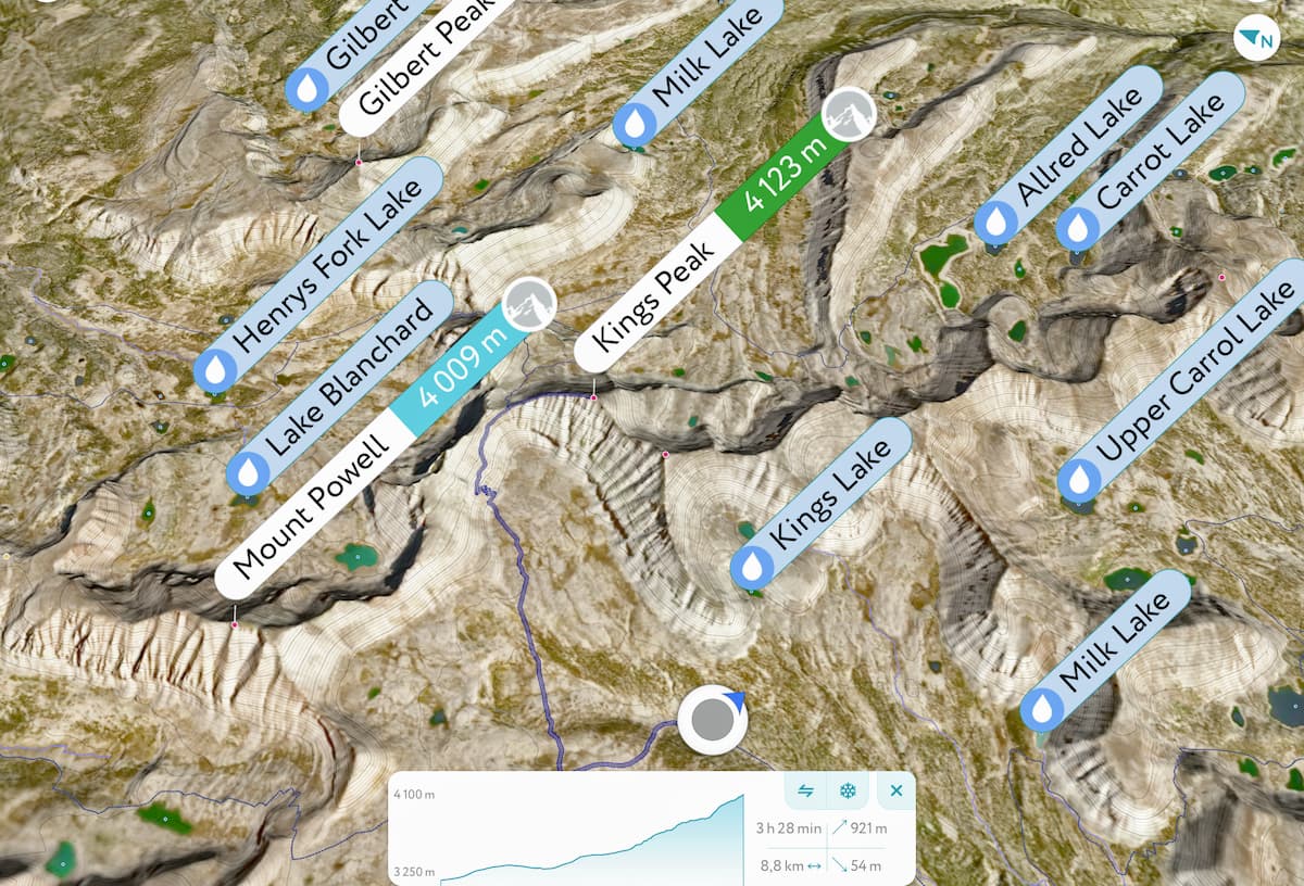
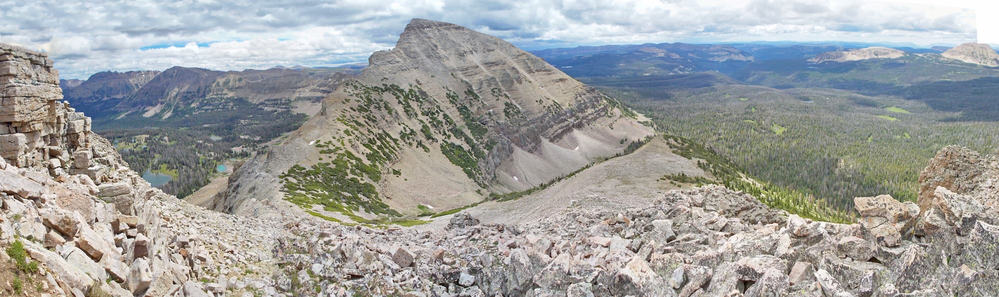
The Uinta Mountains include 200 named peaks. The highest is Kings Peak at 4,123 m. Other notable peaks include South Kings Peak, Gilbert Peak and Mount Emmons.
The highest mountain range in the US states of Utah and Wyoming, the Uinta Mountains are a collection of peaks that are known for their stunning alpine terrain and remote wilderness. Within the range, there are 136 named mountains, the highest and most prominent of which is Kings Peak (13,527ft/4,123m).
Located just to the east of Salt Lake City, the Uinta Mountains extend from the edge of the Salt Lake Valley for some 100 miles (160km) toward Utah’s border with Colorado. The range just barely crosses the border into Wyoming’s Sweetwater County, though the vast majority is contained within Utah’s Summit, Wasatch, Duchesne, Dagget, and Uintah counties.
Parts of the northern Uinta Mountains are located within the Uinta-Wasatch-Cache National Forest, which also covers a substantial portion of the Wasatch Range to the west. In the southern part of the Uintas, the land is managed as part of the Ashley National Forest.
Additionally, some of the easternmost sections of the Uinta Mountains are included within the borders of Dinosaur National Monument, which extends into Colorado. Other notable public lands within the range include the Flaming Gorge National Recreation Area and the High Uintas Wilderness Area, which are both managed by Ashley National Forest, though the latter of which is also included in the Uinta-Wasatch-Cache National Forest.
With the exception of the Wasatch Range to the west, the Uinta Mountains are fairly isolated from other mountain ranges. To the north of the Uintas, the landscape becomes substantially less mountainous as it enters Wyoming’s Sweetwater County.
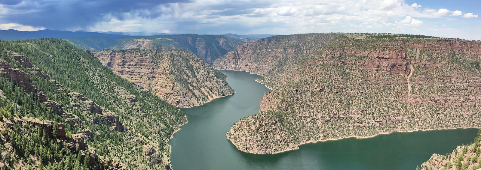
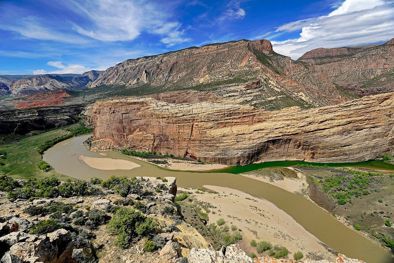
Here, the Green River, which flows all the way from its headwaters in the Wind River Range, skirts around the eastern edge of the Uintas and into Dinosaur National Monument, where it joins the Yampa River and the end of the Gates of Lodore.
To the south of the range, the landscape leaves the Western Rocky Mountains behind and transitions into the Uinta Basin of the Colorado Plateau as the Green River moves southward and reaches its confluence with the Colorado River at Canyonlands National Park. Thus, the Uintas form a stark geographical barrier between the rolling sagebrush covered plains to the north and the canyon-filled country to the south.
The Uinta Mountains are fairly unique within North America because they run in an east-west direction rather than a north-south direction. Within the range, the bedrock is predominantly metasedimentary rock, which was uplift during the Laramide orogeny some 80 to 55 million years ago.
This mountain building event was responsible for the creation of a large majority of the Western Rocky Mountains. As a result, of the Laramide orogeny, the land between the Uinta River Basin and the Green River Basin buckled and folded, creating the original Uinta Mountains.
During the years after the Laramide orogeny, the Uintas experienced a significant amount of erosion, until the late Tertiary period. At this time, the region experienced more tectonic activity, which led to more folding and uplift. Afterward, the mountains underwent a second period of erosion, which continues to this day.
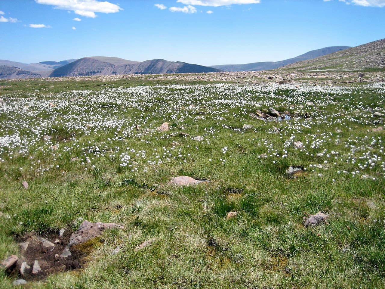
Throughout the Uintas, there is widespread evidence of glaciation. During the Pleistocene, a significant portion of the range was covered by ice, which helped to carve out many of the U-shaped valleys seen today.
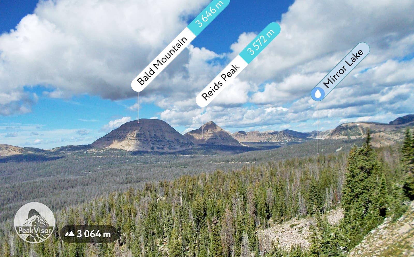
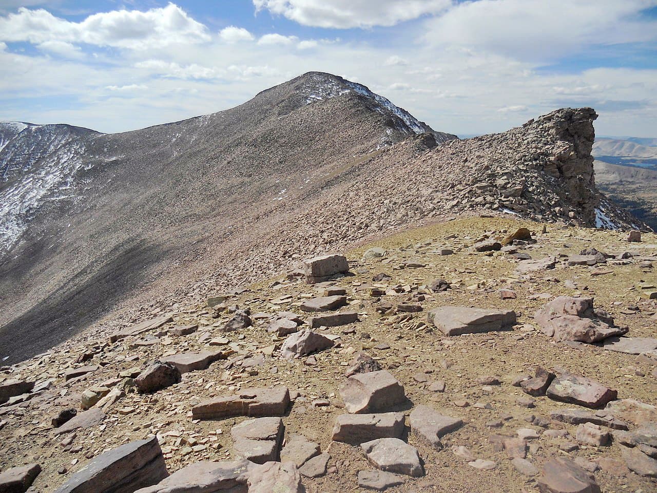
Besides Kings Peak, which happens to be not only the highest mountain in the Uintas, but the tallest peak in Utah, the range contains a number of notable summits, including Gilbert Peak, Mount Emmons, Mount Lovenia, Mount Powell, Tokewanna Peak, Wasatch Mountain, and Wilson Peak.
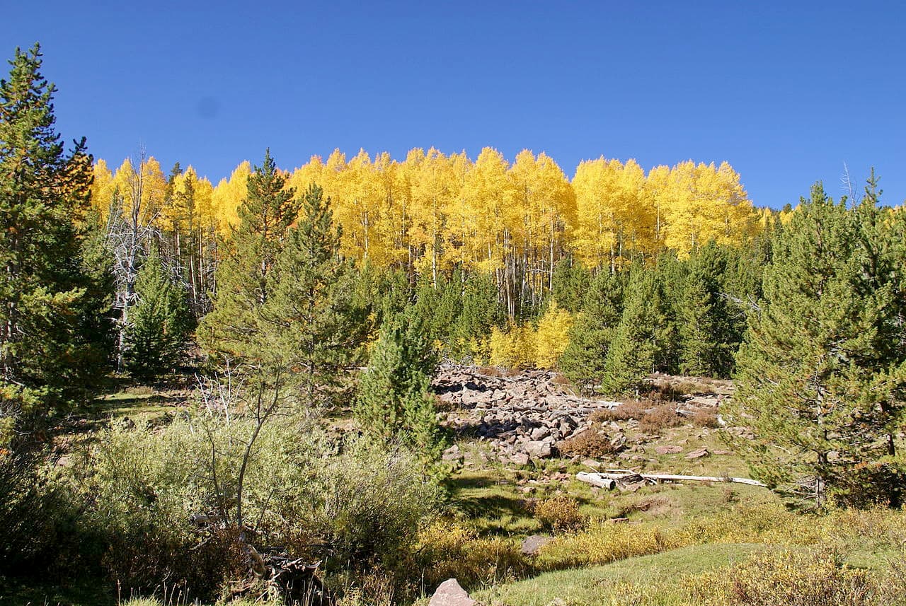
The majority of the Uinta Mountains is covered by the Wasatch and Uinta montane forest ecoregion, which exists mostly in Utah and in small parts of Wyoming and Idaho. This ecoregion is one of the driest parts of the Rocky Mountains, as it sits in the rain shadow of the Sierra Nevada and the many smaller chains in the Great Basin Ranges.
Throughout this ecoregion, the landscape is dominated by coniferous forests, which are mostly Rocky Mountain Douglas fir, ponderosa pine, Engelmann spruce, lodgepole pine, subalpine fir, and quaking aspen. Unlike many other parts of the Rockies, the Gambel oak is less commonly found in the Uintas and the surrounding ecoregion.
As far as wildlife goes, the Uinta Mountains are home to many of the typical species found throughout Utah’s Rocky Mountains. These include moose, mule deer, elk, pronghorns, mountain goats, and bighorn sheep. Other species include coyotes, badgers, weasels, foxes, black bears, mountain lions, and, less commonly, grey wolves.
Much of Utah, including the Uinta Mountains, has been home to humans for thousands of years. The most recent inhabitants of the land include the Eastern Shoshone and the Ute, among others, who lived in the region long before the arrival of Europeans and European Americans.

Perhaps the first Europeans to visit the region were part of the Domínguez-Escalante expedition, which was a Spanish-sponsored endeavor led by two Franciscan priests in an attempt to find an overland route between Santa Fe, New Mexico and Monterey, California.
In the 1820s, William Henry Ashley, the owner of a large fur company, traveled along the Green River and into the Uinta Mountains as he searched for a river that led to the Gulf of Mexico. His travels eventually took him toward what is now the Flaming Gorge Reservoir in Flaming Gorge National Recreation Area.
During his 1869 expedition, John Wesley Powell traveled down the Green River, through its gorge in the northern part of the Uintas, and even gave it the English-language name of “Flaming Gorge,” which exists to this day.
In 1897, President Grover Cleveland created the Uinta Forest Reserve in the northern part of the Uinta Mountains. This later became the Uinta National Forest, which was administratively merged with two other forests and is now the Uinta-Wasatch-Cache National Forest.
However, due to various boundary changes over the years, the northern part of the Uinta Mountains actually became part of the Wasatch-Cache National Forest, though all three forests are now managed as a single unit.
A few years later, in 1908, President Theodore Rosevelt created the Ashley National Forest, which includes a substantial portion of the southern part of the Uinta Mountains. The forest was later expanded with the establishment of the Flaming Gorge National Recreation Area in 1968.
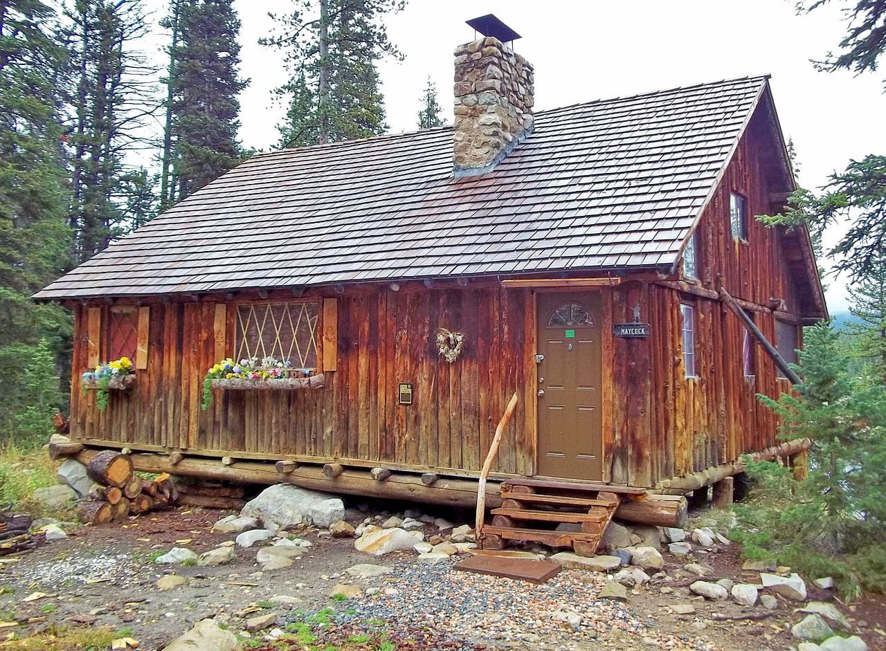
To this day, the Uinta Mountains remain a popular outdoor recreation area, both for local residents and out-of-state visitors. There are thousands of miles of hiking trails within the region and ample opportunities for camping, climbing, skiing, and watersports throughout the year.
With thousands of miles of hiking trails to enjoy, the Uinta Mountains are a veritable outdoor paradise. Here are some great places to check out:
The Ashley National Forest contains some 2,159.9 square miles (5,594 sq. km) of land, the vast majority of which is in the southern part of the Uinta Mountains. The forest contains 46 named mountains, the highest and most prominent of which is Kings Peak.
It is home to hundreds of different lakes to enjoy as well as 16 designated trails that are perfect for long hiking trips. The Uinta Highline Trail (known as Trail 025 in the region) travels through Ashley National Forest along the crest of the range for some 96 miles (154km) until it enters the Uinta-Wasatch-Cache National Forest.
The Uinta-Wasatch-Cache National Forest covers a substantial portion of the northwestern part of the Uinta Mountains, as well as the Wasatch Range and the Stansbury Mountains to the west. It includes 337 named peaks (most of which are outside the Uinta Mountains), the tallest of which is Gilbert Peak.
A substantial portion of the forest within the Uinta Mountains is included as part of the High Uintas Wilderness, which is shared with Ashley National Forest. Throughout the forest, there are plenty of great hiking areas to explore, including 8 miles (13km) of the Uinta Highline Trail.
The High Uinta Wilderness Area is located in the central part of the Uinta Mountains, within both Uinta-Wasatch-Cache National Forest and Ashley National Forest. It contains 34 named mountains, the highest and most prominent of which is Kings Peak.
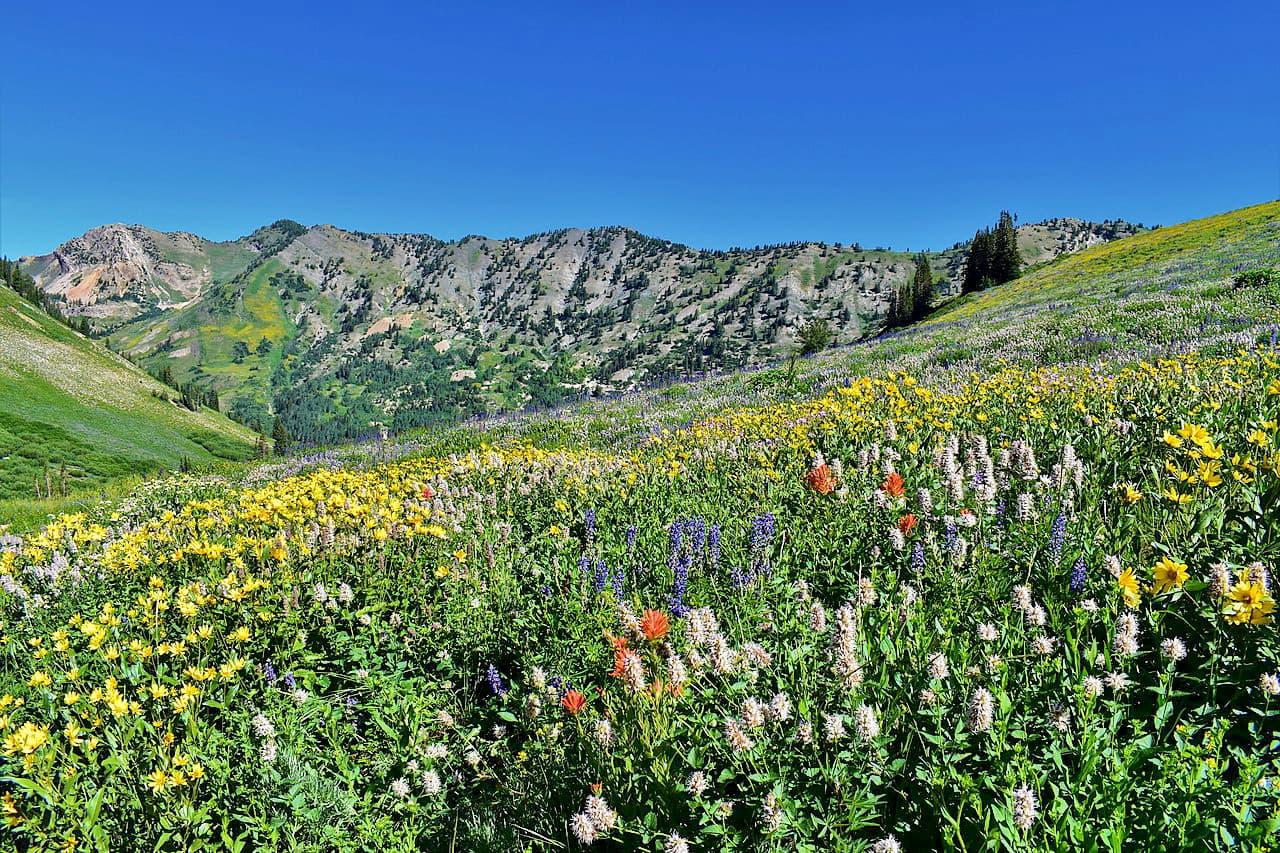
Visitors to the wilderness can enjoy dozens of lakes, alpine ecosystems, and stunning views of the surrounding region. The High Uinta Wilderness is rugged and offers great access to some of the highest peaks in the range.
Situated in the northernmost part of the Uinta Mountains, the Flaming Gorge National Recreation Area is a small protected area of some 324 square miles (839 sq. km) that’s managed by Ashley National Forest.
Flaming Gorge National Recreation Area includes 3 named peaks, the highest of which is Dowd Mountain and the most prominent of which is Bare Top Mountain.
As the name suggests, the region is popular among outdoor recreationalists, thanks to its abundance of hiking, camping, biking, climbing, paddling, and fishing opportunities.
Situated on the easternmost portion of the Uinta Mountains, Dinosaur National Monument contains 20 named mountains, the highest and most prominent of which is Zenobia Peak.
Aptly named, Dinosaur National Monument is best known for its over 800 paleontological sites, which include fossils of dozens of different dinosaur species. The monument is also the site of the confluence of the Green and Yampa rivers and is an International Dark Sky Park.
Here are some of the best places to stay when planning a trip into the Uinta Mountains:
Salt Lake City is located just to the west of the Uinta Mountains. It is the capital and largest city in Utah, with some 200,000 residents. The city is easy to get to by road along I-80 and I-15. Salt Lake is also home to Utah’s largest airport, which offers great connections to major cities around the world.

The city of Rock Springs is situated to the north of the Uinta Mountains in Wyoming’s Sweetwater County. It is home to some 23,000 people and is located near I-80, which offers good road access. The city also has a small airport, which offers scheduled flights to Denver.
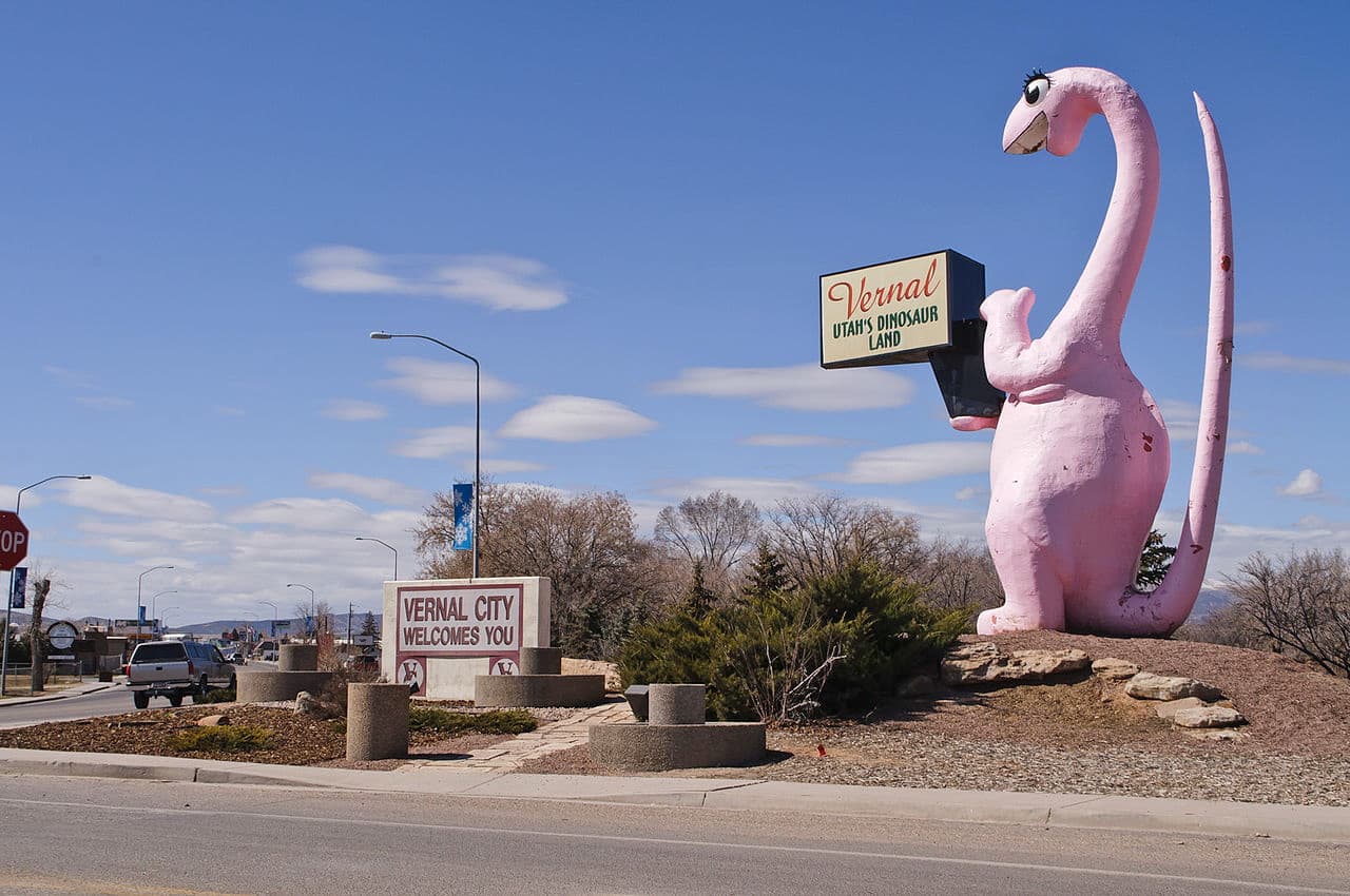
The city of Vernal is located just south of the Uinta Mountains near the Green River. It has a population of some 10,000 people and is a popular destination for outdoor activities, particularly rafting, paddling, and fly fishing. Vernal is located along US Route 40 and US Route 191. It also has a small airport with service to Denver.


13er
ultra
utah-13ers
utah-ultras
13er
ultra
utah-13ers
utah-ultras
The highest peak in the Uinta Mountains is Kings Peak, at 4,123 m.
The Uinta Mountains have 200 named peaks.


.jpg)
.jpg)
.jpg)