
Scan the QR code and open PeakVisor on your phone
The first designated National Recreation Area in the US, the Lake Mead National Recreation Area, encompasses roughly 1.5 million acres (607,028 ha) of southeastern Nevada and northwestern Arizona. There are 86 named mountains in the Lake Mead National Recreation Area. The highest point in the park is Mount Dellenbaugh (7,064 ft/2,153 m) and the most prominent is Spirit Mountain (5,614 ft/1,711 m).
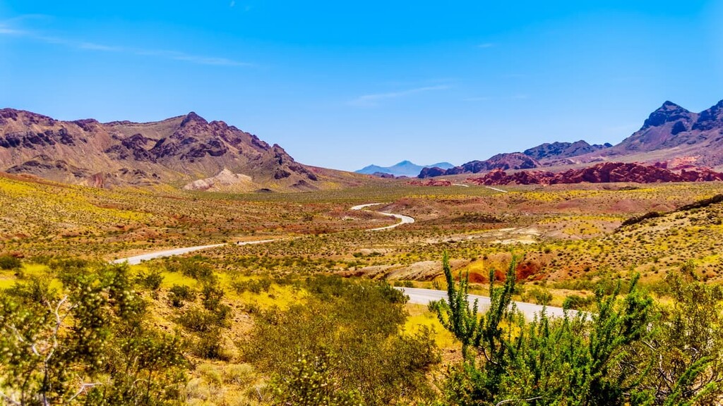
The Lake Mead National Recreation Area spans over 140 miles (225 km) of the Colorado River corridor in northwestern Arizona (Mohave County) and southern Nevada (Clark County). To the east, the recreation area borders the Grand Canyon-Parashant National Monument and Grand Canyon National Park. Valley of Fire State Park lies north of the Overton Arm of Lake Mead.
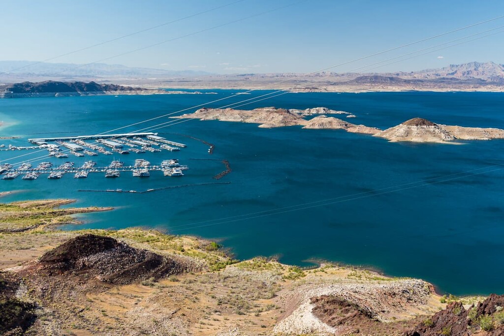
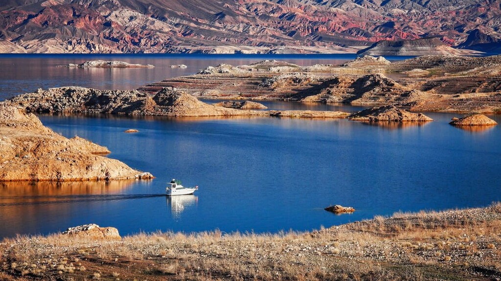
The recreation area is home to two major reservoirs, Lake Mead and Lake Mohave. It also contains many miles of scenic shoreline, rugged canyons, sheer cliffs, and impressive summits.
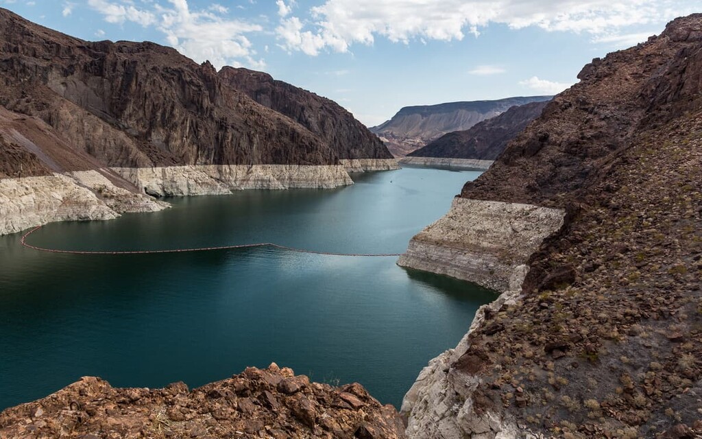
The park’s central feature, Lake Mead, lies along the eastern edge of the Basin and Range province. At full pool, Lake Mead extends 65 miles (105 km) from Black Canyon to Pearce Ferry, which forms the boundary between Lake Mead and the Grand Canyon. Lake Mead’s greatest width is over 9 miles (14 km), and its irregular shoreline spans roughly 550 miles (885 km) in length.
Four large, ecologically diverse basins lie within the historic Colorado River channel on Lake Mead: Boulder, Virgin, Temple, and Gregg. Four narrow canyons lie between these basins: Black, Boulder, Virgin, and Iceberg. To the north of the Virgin Basin, the 32 mile (51 km) long Overton Arm extends south from the Virgin and Muddy Rivers to the Virgin Basin.
The Gregg Basin and Temple Basin are fed by the Colorado River, which enters Lake Mead at the northern end of the Gregg Basin. The Virgin and Muddy Rivers flow into the Overton Arm, eventually merging with the Colorado River in the Virgin Basin. The water then flows into the east end of the Boulder Basin at Boulder Canyon.
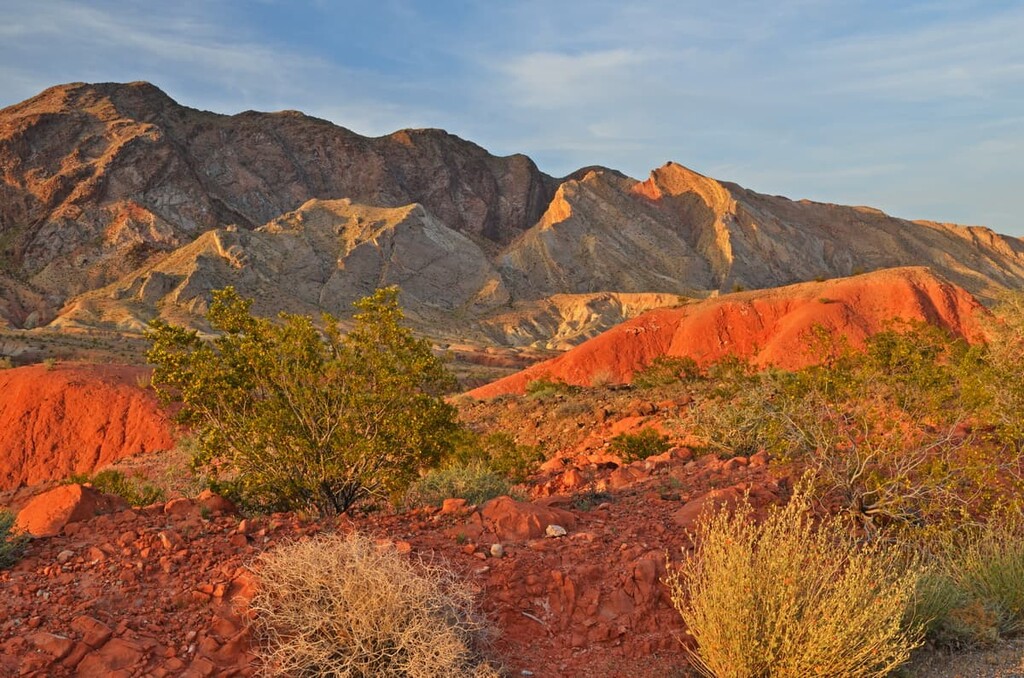
Several rugged mountain ranges border Lake Mead, including the Muddy Mountains, Black Mountains, River Mountains, and South Virgin Mountains.
The Muddy Mountains and Black Mountains lie along the north shore of Lake Mead, to the west of the Overton Arm. Meanwhile, the South Virgin Mountains sit east of the Overton Arm, just to the south of the Gold Butte National Monument.
The Muddy Mountains and Black Mountains contain some of the tallest peaks in the Lake Mead National Recreation Area, including Muddy Peak, Mount Wilson, and Arch Mountain. The River Mountains, which sit west of the Hoover Dam, also contain several noteworthy summits, including Red Mountain, River Mountain, and Black Mountain.
To the south of Lake Mead, a smaller reservoir, Lake Mohave, extends roughly 67 miles (108 km) over the Cottonwood Valley from the Hoover Dam to Davis Dam, straddling the southern Nevada and northwestern Arizona border.
Formed by the Davis Dam, Lake Mohave lies between the Black Mountains in Arizona and the Eldorado and Newberry Mountains in southern Nevada. Nevada’s southernmost named mountain range, the Newberry Mountains, contains the most prominent peak in the Lake Mead National Recreation Area, Spirit Mountain.
There are nine designated wilderness areas in the Lake Mead National Recreation Area. These include:
The Lake Mead National Recreation Area contains an impressive collection of geological features, some of which span more than 1.4 billion years of the Earth’s history. Remnants of the region’s unique geological past, which include granite plutons, lava flows, fault lines, boulder fields, petrified wood, and fossils, are well-exposed due to the erosion caused by the Colorado River and its tributaries.
The Grand Wash Cliffs near Pierce Ferry, for example, showcase layers of limestone and shale deposits from ancient Paleozoic seas. Over 500 million years ago, southern Nevada was covered by a shallow sea. But as the sea retreated, limestone and shale formations were created from the remnants of plants and animals that had been combined with sediments eroded from older rock.
Approximately 18 million years ago, the area surrounding present-day Lake Mead was profoundly influenced by tectonic activity. The thinning of the earth’s crust was complemented by a series of earthquakes, resulting in dip-slip and strike-slip faulting in the area.
The thinning of the earth’s crust also allowed magnesium-rich magma and basalt to cover the landscape. Today, evidence of the region’s volcanic past can be observed at Fortification Hill, Black Canyon, and Callville Mesa.
An ancient stratovolcano, the Hamblin-Cleopatra Volcano, also lies along Lake Mead’s northern shore. Cleopatra-Hamblin formed in the late Miocene epoch along the Hamblin Bay Fault. Though the now-dormant volcano once reached over 3,000 feet (914 m) high, extensive faulting in the region has since split the stratovolcano into three parts.
The region’s extensive volcanic and tectonic activity eventually subsided, allowing water to travel through the fractured landscape and shape the region’s incredible waterways and canyons.
The Lake Mead National Recreation Area protects three desert ecosystems: the Mojave, the Great Basin, and the Sonoran. As a result, the area is rich in ecological diversity and protects several rare and endangered species.
Despite the region’s formidable climate, approximately 900 plant species and 700 flower species thrive in the Lake Mead National Recreation Area, including the Las Vegas bear poppy, devil’s cove, monkey flower, desert trumpets, desert star, indigo bush, and globe mallow.
The Lake Mead National Recreation Area also protects a wide variety of animal species, including desert bighorn sheep, coyote, rabbit, beaver, and mule deer. Due to its location along a north to south migration route, the Lake Mead area has recorded roughly 240 different kinds of bird species, including the peregrine falcon, burrowing owl, and bald eagle.
The desert tortoise, an endangered resident of the Lake Mead area, thrives in Lake Mead’s desert valleys and spends much of their time in burrows, emerging infrequently to feed and mate. Other endangered species in the area include the bonytail chub and razorback suckers.
Long before the completion of the Hoover Dam in 1936, the present-day Lake Mead National Recreation Area was occupied by numerous Indigenous communities, including Ancestral Puebloans, the Patayan, the Basketmaker-Pueblo, as well as the contemporary Hualapai Tribe, and Southern Paiute nations.
Archaeological evidence in the area suggests that despite the region’s taxing climate and limited natural resources, Indigenous communities flourished by employing advanced hunting, gathering, and building techniques. Dozens of structures and ancient artifacts, including pit houses, pueblos, cliff-side dwellings, weapons, pottery, and skeletal remains have been unearthed in the Lake Mead area.
European Americans first reached the area surrounding present-day Lake Mead in the 1820s. However, the region’s challenging climate and limited natural resources deterred early travelers from permanently settling in the area.
In the mid and late 1800s, however, gold and silver were discovered in the southern Nevada mountains, which prompted a surge in white settlement. In the late 1800s, Mormon settlers, who mistakenly thought they were in Utah and Arizona, established a settlement along the confluence of the Muddy and Virgin Rivers that’s now known as St. Thomas.
The community was abandoned by Mormon settlers in 1871, when the state of Nevada attempted to collect taxes from residents. However, the fertile land and abundance of salt mining opportunities in the area, immediately enticed more to the area.
In 1928, President Calvin Coolidge signed legislation to erect a dam on the Arizona-Nevada border to divert irrigation water to the growing southwest. The Hoover Dam was finalized in 1936 and flooded St. Thomas, burying it beneath Lake Mead. Decades of drought, however, eventually exposed the ruins of St. Thomas and they are now protected as a national historic site.
In 1964, the 1.5-million-acre (607,028 ha) Lake Mead National Recreation Area was established to preserve the region’s incredible natural features and allow visitors to explore the area’s many recreational opportunities.
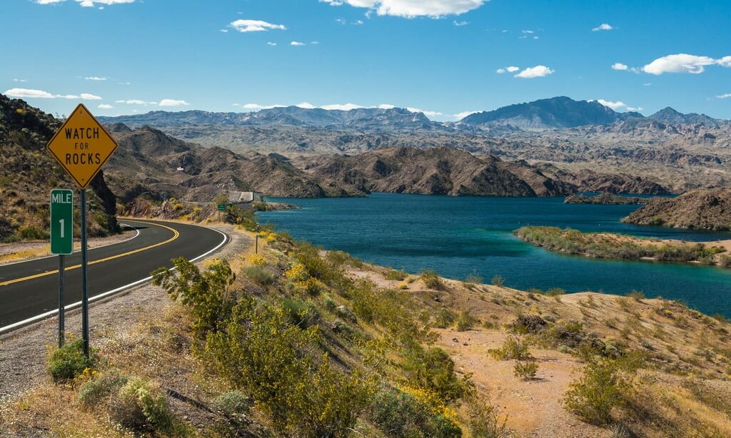
The Lake Mead National Recreation Area best-known for its water-based recreation. However, there are several historic and scenic hiking trails to explore. These are some of the most popular trails in the area:
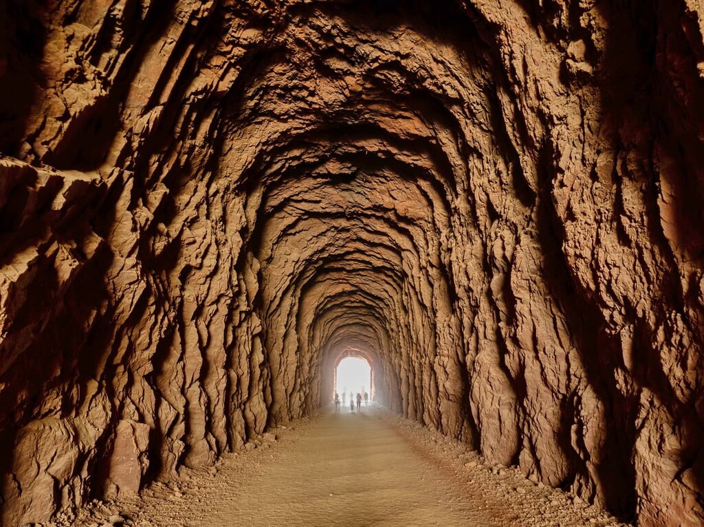
The Historic Railroad Trail is a wide and flat gravel trail that features beautiful vistas of the Boulder Basin and the Hoover Dam. The trail follows a historic 1930s railroad that was built to haul equipment and materials to the construction site of the Hoover Dam.
Though the tracks were dismantled in the 1960s, the present-day, multi-use trail allows visitors to learn about the historic railroad and walk through several impressive tunnels carved from volcanic rock.
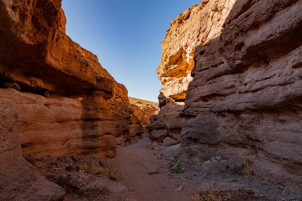
Nestled at the edge of Lake Mead, Owl Canyon gets its name from barn owls that occasionally roost in the slot canyon. Owl Canyon is a short slot canyon cut through conglomerate rock. The trail begins with a descent along an unmaintained path.
From there, the footpath climbs toward the mouth of the canyon. Visitors are encouraged to keep an eye out for evidence of owl activity by looking scouring the canyon walls for ‘white wash.’
Located along the upper reaches of Black Canyon, the Gold Strike Hot Springs trail winds through a rugged, weathered canyon to a cluster of stunning aquamarine hot springs.
Though popular, the trek to Gold Strike isn’t easy. Hikers have to descend several challenging obstacles, many of which require scrambling or navigating fixed ropes. It’s important to note that due to dangerous temperatures, the springs are closed from May to September.
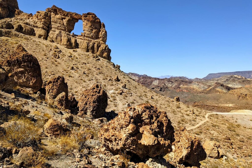
Named for its resemblance to the famous Liberty Bell at Independence National Historic Park in Pennsylvania, Liberty Bell Arch is one of the most popular natural features in the Lake Mead National Recreation Area.
The trail begins by following a sandy wash before dropping into White Rock Canyon. From there, the trail steadily climbs away from the canyon, passing abandoned mining equipment, before reaching a scenic overlook.
From the overlook, the trail quickly descends, and hikers are rewarded with their first glimpse of Liberty Bell Arch. Due to extreme temperatures, the Liberty Bell Arch is inaccessible from May 15 to Sept 30.
Callville Summit boasts expansive views of Lake Mead, Fortification Hill, Boulder Basin, and Hemenway Valley, as well as the River Mountains, Black Mountains, Hamblin Mountain, Rainbow Mountains, and Callville Mesa. The most direct route leaves from the trash collection area of the Callville Bay campground.
Looking for a place to stay during your visit to Lake Mead National Recreation Area? Here are some of the nearby cities and towns to check out:
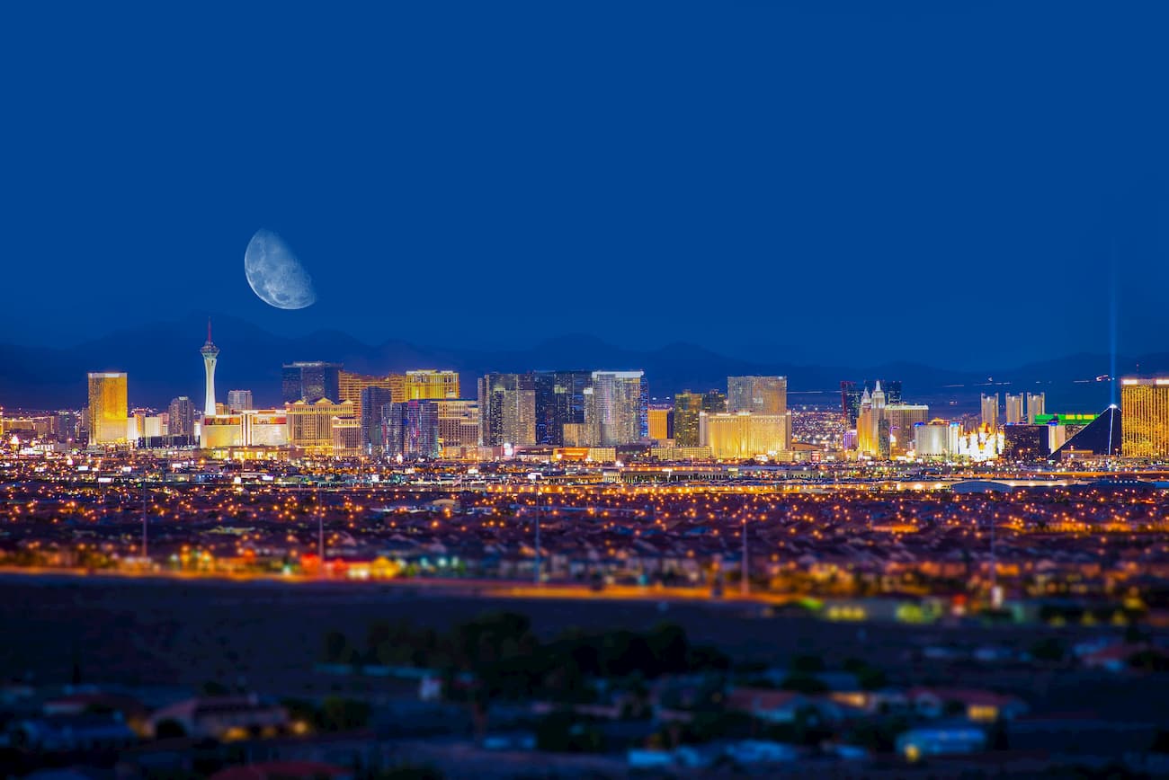
Las Vegas is best-known for dazzling lights and extravagant entertainment. However, the city’s abundant amenities and lodging options also make it an excellent destination for exploring nearby parks and wilderness areas.
Nearby outdoor recreation areas include Lake Mead National Recreation Area, Red Rock Canyon Conservation Area, Spring Mountains National Recreation Area, Death Valley National Park, and Valley of Fire State Park.
Located just 26 miles (42 km) southeast of Las Vegas and a few miles from the Lake
Mead National Recreation Area, Boulder City is a charming, family-friendly community that
offers a variety of amenities to travelers. Boulder City is a popular destination for visitors looking to learn about the fascinating history of the Hoover Dam.
Established by Mormon pioneers, Overton lies near the Moapa Valley at the northern end of
Lake Mead. Overton is a great option for visitors looking to explore Valley of Fire State Park and or the Lost City, a cultural site of the Ancestral Puebloans.
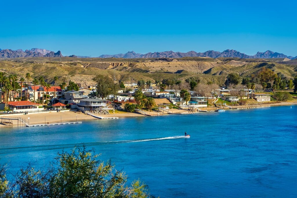
Located on the Colorado River, in Mohave County, Arizona, Bullhead City is a popular destination for visitors to Lake Mohave. Bullhead City boasts a variety of water recreation options, including boating, canoeing, fishing, kayaking, paddle boarding, tubing, and wakeboarding.
Visitors to Bullhead City can easily access Lake Mohave and Lake Mead, or travel to nearby Dead Horse Ranch State Park to explore dozens of hiking trails and scenic overlooks.


nevada-peaks-club
las-vegas-mountaineers-classics
desert-summits-book
sierra-club-desert
great-basin
nevada-peaks-club
las-vegas-mountaineers-classics
desert-summits-book
sierra-club-desert
great-basin


