
Scan the QR code and open PeakVisor on your phone
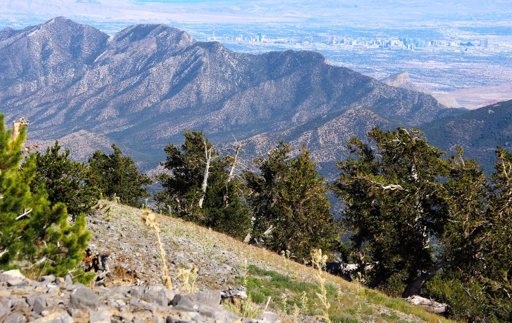
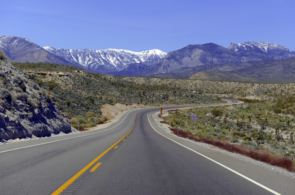
The Spring Mountains National Recreation Area is a 316,000-acre (1,280 sq. km) swathe of mountains and high desert administered by the U.S. Forest Service in southern Nevada. The area primarily comprises the Spring Mountains range, which stretches northwest-southeast from the Las Vegas Valley through the Ivanpah Valley near the California border. The recreation area is only a dozen miles northwest of Las Vegas, adjacent to Red Rock Canyon National Conservation Area. It is a popular destination for hiking, biking, skiing, and camping. The high point of the Spring Mountains and its most prominent summit is Charleston Peak (11,916 ft/3,632 m). Charleston is the most topographically prominent mountain in Nevada and the eighth-most-prominent in the contiguous United States, with over 8,000 feet (2,500 m) of prominence. There are over 30 named summits in the range.
The Spring Mountains National Recreation Area is a subsidiary of the Humboldt–Toiyabe National Forest. Humboldt–Toiyabe is Nevada’s principal National Forest and—outside of Alaska—it is the largest in the United States, with a total area of 6,289,821 acres (25,454 sq. km), consisting of many non-contiguous forest regions.
The range was named for the surprising number of springs in the area (given the high desert climate), particularly on its eastern slopes near Red Rock Canyon. Its climate ranges from arid desert shrublands at lower elevations to dense alpine forests in the higher ramparts.
In addition to Charleston, notable peaks in the Spring Mountains include Bonanza Peak (10,381 ft/3,164 m), The Sisters (10,171 ft/3,100 m), McFarland Peak (10,738 ft/3,274 m), Mummy Mountain (11,522 ft/3,521 m), Harris Mountain (10,013 ft/3,051 m), Fletcher Peak (10,246 ft/3,123 m), and Griffith Peak (11,053 ft/3,369 m). At its southern terminus, it is anchored by Potosi Mountain (8,497 ft/2,590 m).
The range separates the Pahrump Valley and Amargosa River basins (to the west) from the Las Vegas Valley watershed (to the east). The latter drains into the Colorado River and, ultimately, Lake Mead. As a result, the Spring Mountains are significant as the southwestern boundary of the Great Basin.
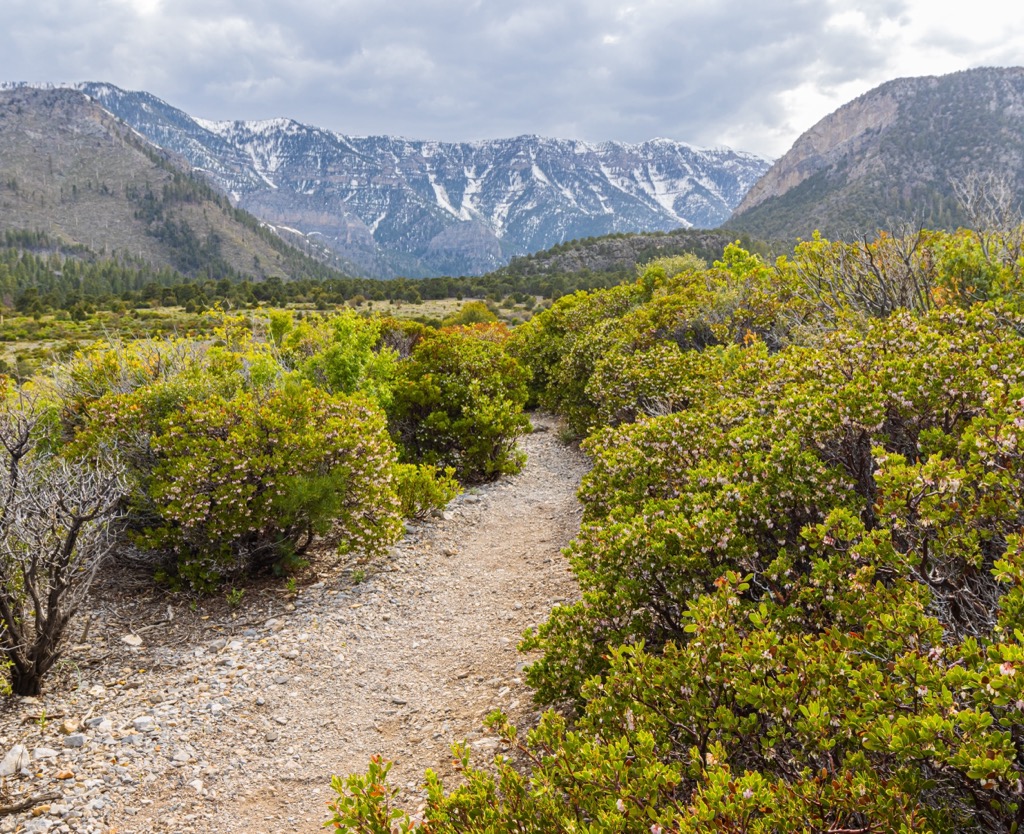
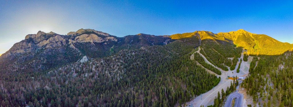
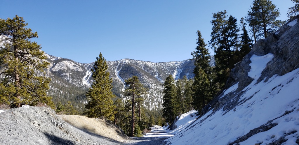
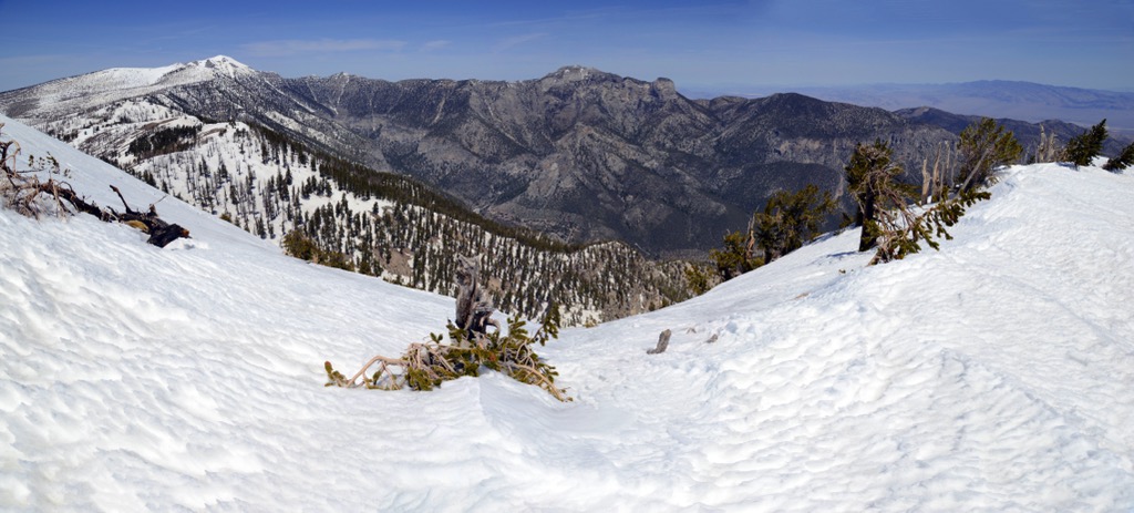
The Spring Mountains receive heavy snowfall in the winter (130 in/330 cm on average). They are a popular location for skiing, snowshoeing, and mountaineering, particularly given their proximity to the already popular destination of Las Vegas.
Compared to the deserts of surrounding valleys—in which temps can soar above 115 °F (46°C) in the summer months—temperatures in the Spring Mountains are 30-40°F (17-22°C) cooler, making the range a familiar summer retreat for Vegas locals. Snow regularly lingers at higher elevations well into June.
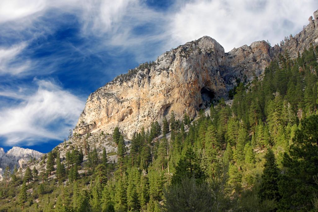
The Spring Mountains are composed of a dense layer of limestone, which accumulated while the region was still underwater between 520 million and 280 million years ago. Fossils of marine ancestors like brachiopods, gastropods, sponges, corals, crinoids, and aquatic organisms are visible in the limestone throughout the range, even near the summit of Griffith Peak (11,053 ft/3,369 m).
During the Triassic period, after water levels had dropped, rivers deposited mud and sand atop the existing limestone, as well as gypsum beds left by evaporating seawater. As the climate dried during the late Jurassic period, further sand was deposited, forming vast dunes.
Time and pressure compacted these dunes into the striking red Aztec sandstone found in the lower elevations of the Spring Mountains, particularly in Red Rock Canyon National Conservation Area and even in the Valley of Fire State Park to the northeast.
Due to the Keystone Thrust Fault (which formed around 65 million years ago, near the end of the Mesozoic era), the older gray limestone was pushed up and over the red Aztec sandstone. Limestone now constitutes the modern high points of the Spring Mountains range, creating the stark visual contrast that makes Red Rock Canyon and other regional sites so famous.
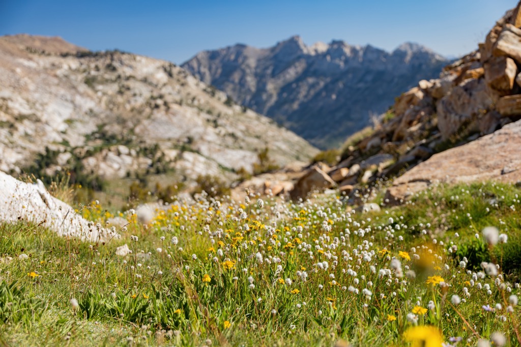
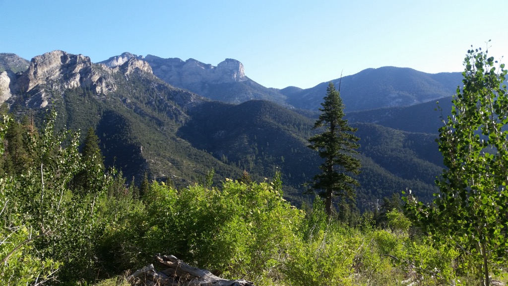
Due to the Spring Mountains’ significant elevation variance (over 2 miles/3.2 km), and temperate climes, it is the most biologically diverse mountain range in all of Nevada. The Spring Mountains National Recreation Area is home to nearly 33% of Nevada’s flora, over 1,000 total species, including 37 species of tree and over 600 species of vascular plants.
Prickly pear cacti, white bursage (burro weed), and creosote bushes are found in the low desert valley floors. Higher up are blackbush scrub zones, followed by pygmy conifer with juniper, mountain mahogany, and pinyon pine. Alpine slopes with large swathes of ponderosa pine cap the range’s highest elevations.
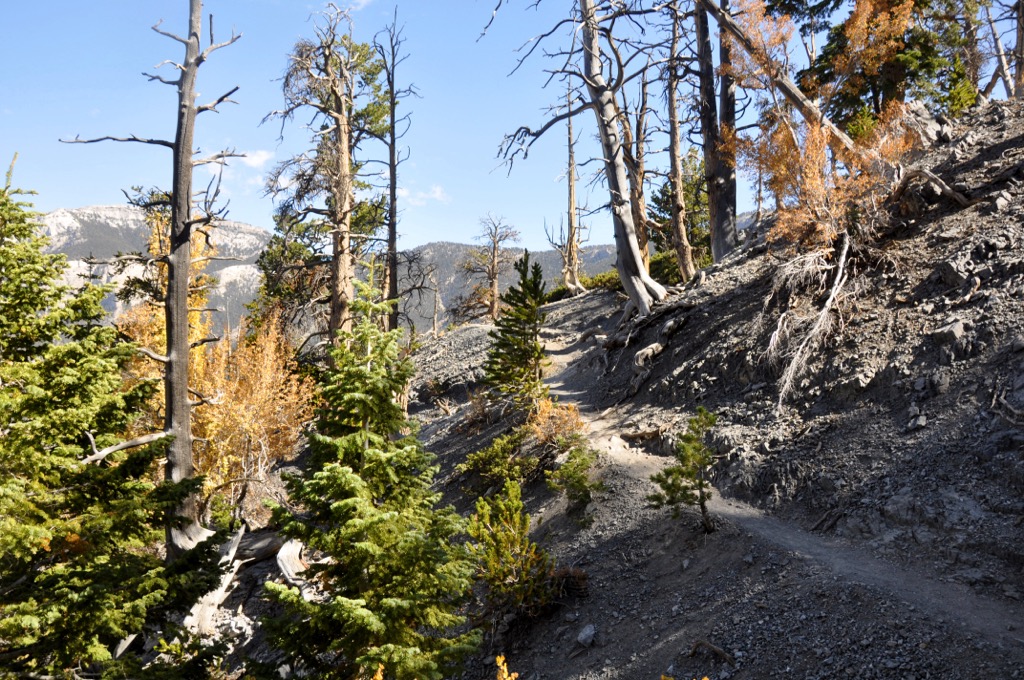
Of particular note, the Mount Charleston Wilderness Area, in the center of the range, has many bristlecone pine stands. “Raintree” is the oldest-known bristlecone in the Spring Mountains range and likely the oldest living organism in Nevada. Raintree is estimated to be over 3,000 years old.
Animals in the Spring Mountains include mule deer, desert bighorn sheep, pronghorn, and elk, as well as numerous species of lizards and snakes, antelope ground squirrels, jackrabbits, coyotes, cotton tails, kit fox, mountain lions, and wild burros.
The National Recreation Area is home to 25 plant and animal species found nowhere else in the world. These endemic species include the rare and endangered Palmer’s chipmunk, a small rodent with a habitat niche between 7,000 to 10,000 feet (2,100 to 3,000 m).
The region around the Spring Mountains has likely been inhabited in some form or another for over 12,000 years, as spear points have been discovered in the Las Vegas Valley dating to this era.
Over the millennia, the range has served as a home for the Ancestral Puebloan people, Southern Paiute, Chemehuevi, Western Shoshone, and Colorado River Yuman tribes, among other indigenous peoples. The mountains were of great cultural and spiritual significance to these tribes. For example, to the Southern Paiute, Charleston Peak was known as Nuvagantu (“where snow sits”) and is traditionally considered the center of creation.
European settlers arrived in the area by the 1700s, and the region was officially designated as Mexican territory for much of the early 1800s. By this point, the Southern Paiute were almost entirely displaced from their ancestral lands, partly due to the construction of the Old Spanish Trail, which connected Salt Lake City with Los Angeles.
By the mid-1800s, the trail became heavily trafficked, with numerous miners heading west to stake claims in the Las Vegas, Pahrump, Mesquite, and Amargosa Valleys. In 1869, the Army Corp of Engineers designated Charleston Peak as the range's high point.
Today's Spring Mountains National Recreation Area was initially named the Charleston Forest Reserve in 1906, comprising 149,165 acres (604 sq. km). The Vegas National Forest was created a year later, preserving the northern peaks of the Spring Mountains and the neighboring Sheep Range to the northeast.
The two zones were eventually combined, and more land was added in 1989, bringing the total area to today’s 316,000 acres (1,280 sq. km). The land was officially named the Spring Mountains National Recreation Area by Congress on August 4, 1993.
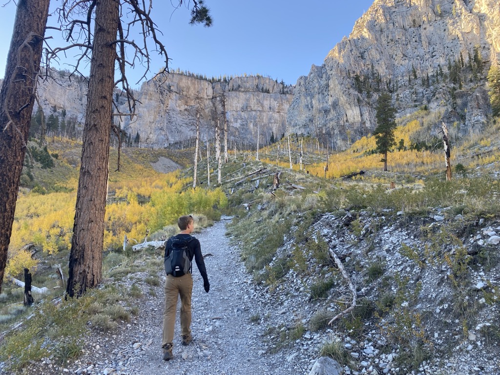
There are dozens of hiking trails in the Spring Mountains National Recreation Area. In addition to following basic wilderness safety and courtesy principles and Leave No Trace practices, keep in mind that snow remains well into late spring and early summer.
Depending on snowfall and pack, many of the trails in the Spring Mountains are inaccessible from November to as late as June (at least without snowshoes, crampons, and/or other snow trekking gear).
This 10.2-mile (16.4 km) route takes you to the eponymous summit (Griffith Peak [11,053 ft/3,369 m]), one of the highest in the Spring Mountains Range. The trail has an elevation gain of 3,500 feet (1,066 m). Once you reach the connecting ridgeline, Griffith can be linked with Charleston Peak (below) as part of a loop trail.
Charleston Peak, at nearly 12,000 feet (3,657 m), is the high point of the Spring Mountains, and hiking to its summit is far and away the best hike in the range. Hikers can access the peak via a southern or northern trail or create a loop by ascending one and descending the other.
Regardless, the out-and-back or loop trail is around 21 miles (33.8 km) and entails 5,600 feet (1,706 m) of elevation gain (slightly less if ascending and descending only via the southern trail).
This 5.3-mile (8.5 km) out-and-back trail takes hikers to Raintree, the oldest living organism in Nevada, with a gain of 1,800 feet (548 m). Raintree is a 3,000-year-old bristlecone pine. The trail, along with Charleston’s North Loop, begins from the North Loop trailhead.
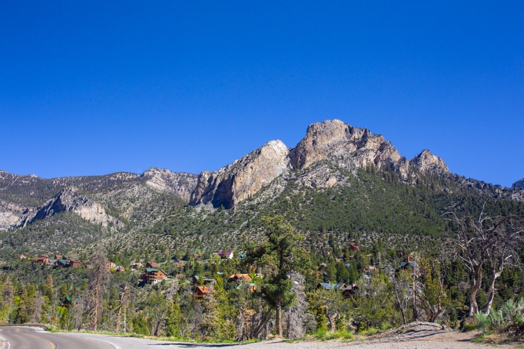
Mount Charleston is a small town nestled just below the ramparts of Charleston Peak. The town is small, with only a few hundred residents, but has several restaurants, venues, and hotels, notably The Retreat on Charleston Peak, a high-end lodge focusing on sustainability and offering weekly live music. For a visit to the Spring Mountains National Recreation Area, Mount Charleston is the best destination to base a stay. There are dozens of hiking trails around the community and many places to camp and picnic.
Las Vegas is approximately 45 minutes by car from Spring Mountains National Recreation Area and is the closest major city to the range. The city is a major international tourist destination, with a vast array of cuisine, lodging, and entertainment options. Experience the famous Las Vegas Strip, the vibrant Fremont Street downtown, and the surrounding communities, such as Spring Valley’s Chinatown.
Red Rock Canyon National Conservation Area, one of the world’s leading destinations for traditional rock climbing, is also a short drive from Las Vegas (30 minutes). The city is an excellent jumping-off point for trips to many other parks and recreation areas, including the Desert National Wildlife Refuge, Lake Mead National Recreation Area, and Valley of Fire State Park.

Several established campgrounds exist within the Spring Mountains National Recreation Area, although not all campgrounds are open year-round due to heavy snowfall in the winter months.
These campgrounds include Fletcher View, Hilltop, and McWilliams Campground. All have vault or flush toilets; some provide showers, grills, and electrical hookups. The Mahogany Grove Group Campground offers two sites for large groups. Visit Recreation.gov to reserve campsites—a few are first-come, first-serve, but most require a reservation.


ultra
nevada-11ers
nevada-peaks-club
las-vegas-mountaineers-classics
nevada-peaks-club-emblem
western-state-climbers
western-state-climbers-star
desert-summits-book
sierra-club-desert
desert-peaks-section-emblem
great-basin
great-basin-star
nevada-ultras
nevada-11ers
nevada-peaks-club
las-vegas-mountaineers-classics
desert-summits-book
sierra-club-desert
great-basin
nevada-11ers
las-vegas-mountaineers-classics
desert-summits-book
great-basin
ultra
nevada-11ers
nevada-peaks-club
las-vegas-mountaineers-classics
nevada-peaks-club-emblem
western-state-climbers
western-state-climbers-star
desert-summits-book
sierra-club-desert
desert-peaks-section-emblem
great-basin
great-basin-star
nevada-ultras
nevada-peaks-club
las-vegas-mountaineers-classics
desert-summits-book
sierra-club-desert
great-basin
nevada-11ers
nevada-peaks-club
las-vegas-mountaineers-classics
desert-summits-book
sierra-club-desert
great-basin


