
Scan the QR code and open PeakVisor on your phone
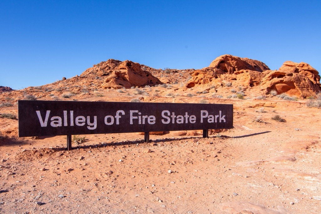
Valley of Fire State Park is a 46,000-acre (185 sq. km) state park in the Mojave Desert of southern Nevada. Open since 1934, it is the oldest state park in the state. Valley of Fire is famous for its red Aztec sandstone rock formations, which often appear “on fire” under the harsh desert sun, giving the park its name. Valley of Fire is also notable for housing several petroglyphs carved by indigenous peoples, some of which date back over 2,000 years. The park is approximately 50 miles northeast of Las Vegas, bordering Lake Mead National Recreation Area. The park has 9 named peaks, all members of the Muddy Mountains range. The highest and most prominent summit is Weisner Ridge (2,900 ft/884 m).
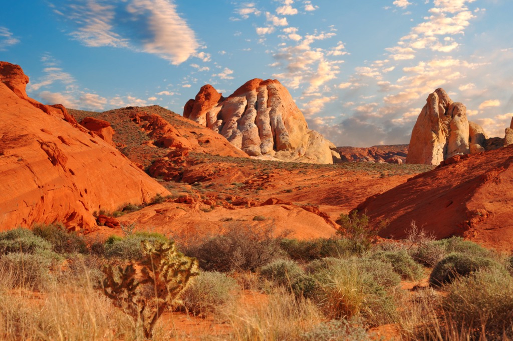
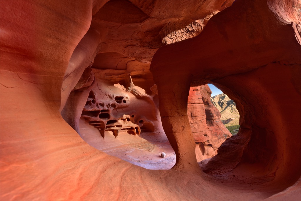
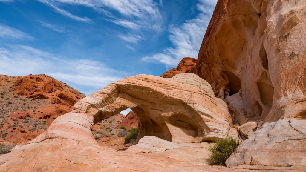
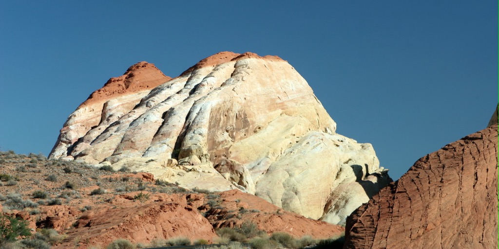
Valley of Fire is known for its vibrant red sandstone formations—arches, domes, towers, and canyons—which can appear to be “on fire,” particularly during sunrise and sunset. The deep red Aztec sandstone is married with contrasting tan, pink, orange, and white hues, resulting from various uplifted limestones, shales, and conglomerates. The result is a surreal landscape that has inspired photographers, painters, and filmmakers for decades.
In addition to the rock, the park features petrified wood dating back over 225 million years ago, as well as sprawling sand dunes. Valley of Fire sits at elevations ranging from 1,300 feet (395 m) to just under 3,000 feet (915 m) and is near the confluence of the Virgin River.
The park has a warm, arid climate, typical of North America’s desert southwest. The park’s average annual precipitation is a mere 6.5 inches (165 mm). Winters are relatively mild, with daytime temperatures between 55°F (12°C) and 75°F (24°C), and nighttime lows rarely below 30°F (3°C). However, the park is sweltering in the summer, like much of southern Nevada. Daytime temperatures regularly reach 115 °F (46°C).
Valley of Fire’s colorful formations were shaped by 150 million years of uplifting, faulting, and erosion. The result is the array of sculpted arches, towering cliffs, and intricate, flowing rock patterns that define the park.
The park’s present-day appearance dates back to 150 million years ago, when a combination of wind and water erosion deposited large amounts of sediment, including sand and other debris, creating vast dune fields. Over time, these dunes were buried and compacted, forming the distinctive red sandstone visible today.
The other notable development in the park’s geologic history is the Keystone Thrust Fault. This fault—estimated to have formed around 65 million years ago—pushed older gray limestone above the younger red Aztec sandstone, creating much of the red/tan/gray visual contrast we see today. The same fault is responsible for similar formations at the nearby Red Rock Canyon National Conservation Area.
Valley of Fire is home to a diverse array of flora and fauna. Plants include creosote bush, burro bush, and brittlebush, and several cactus species, such as beaver tail and cholla. During spring, visitors are treated to beautiful blooms of desert marigolds, desert mallow, and indigo bushes along many of the park’s roads.
Animals in the park include a plethora of lizards and snakes, such as desert iguanas and chuckwallas, zebra-tailed, horned, and spiny lizards, coachwhips, speckled rattlesnakes, and sidewinders. Birds such as ravens, house finches, roadrunners, and sage sparrows dot the skies. Mammals include coyotes, kit foxes, spotted skunks, black-tailed jackrabbits, and antelope ground squirrels.
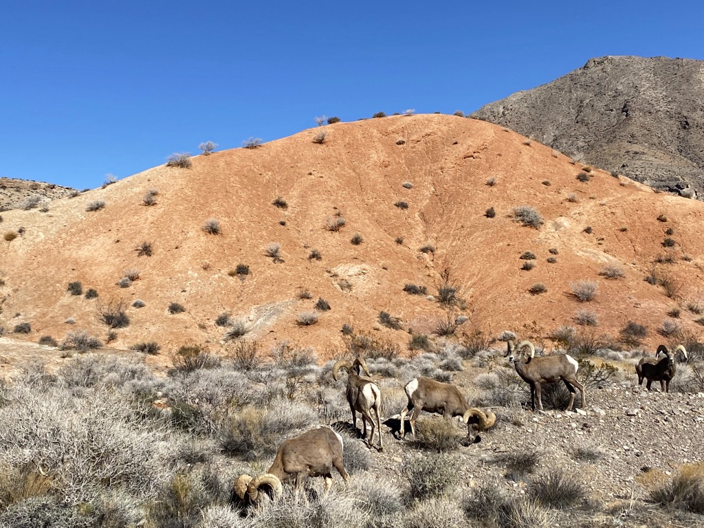
Two of the most notable animals in the park are bighorn sheep—commonly seen along park roads and trails—and desert tortoises, a rare protected species native to the Mojave and Sonoran deserts.
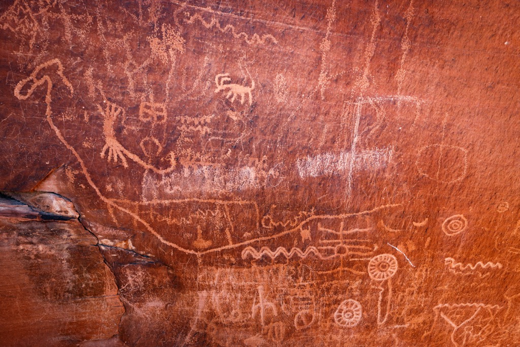
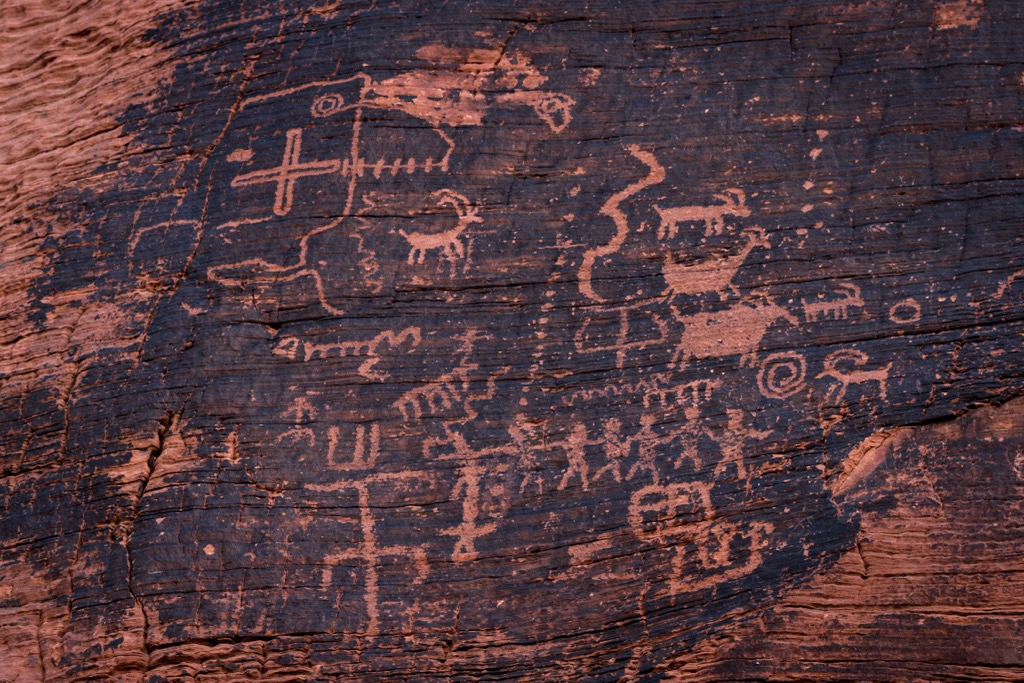
The Valley of Fire was visited by humans beginning as early as 4,000 years ago. Evidence suggests that the Ancestral Puebloan people entered the park as early as 300 BC. Because there was little to no water in the vicinity, their presence in the park was never permanent. Nevertheless, they lived and farmed in the Moapa Valley nearby and ventured to the Valley of Fire for hunting, gathering, and religious ceremonies.
Evidence of their activities is seen at several easily-accessible petroglyph sites in the park, including Atlatl Rock (2,431 ft/731 m) and Mouse Tanks. After a harsh drought sometime in mid-1100 AD, these tribes migrated away from the region. They were later replaced by the Nuwuvi (Southern Paiute).
A road connecting Salt Lake City with Los Angeles was built through the area in 1912, which resulted in many visitors traveling through the park. One of these, an American Automobile Association (AAA) official, coined the park’s name in the 1920s while driving through the area at sunset. Around the same time, archeologists recognized the area's significance, and around 8,500 acres (34 sq. km) of federal land was given to the State of Nevada for preservation. This was the beginning of the modern-day park.
The Civilian Conservation Corps (CCC) constructed the park’s initial facilities and campgrounds in the early 1930s, and cabins from that period remain today. The park’s gates opened to visitors on Easter Sunday in 1934, and it received its legal designation from the state legislature in 1935—becoming the first state park in Nevada.
In addition to regular tourism, Valley of Fire has developed a reputation as a popular location for artists, photographers, and filmmakers. It is a common site for TV shows, films, and commercials, particularly car commercials.
Films shot at the Valley of Fire include the 1964 Elvis Presley picture Viva Las Vegas, The Professionals with Burt Lancaster (1966), Arnold Schwarzenegger’s Total Recall (1990), as well as many scenes from the popular television show Star Trek Generations. The park’s Silica Dome (2,336 ft/(712 m) is the site of a pivotal scene in the series: Captain James T. Kirk’s death and burial. Some pieces of various historic film and TV sets remain in the park today.
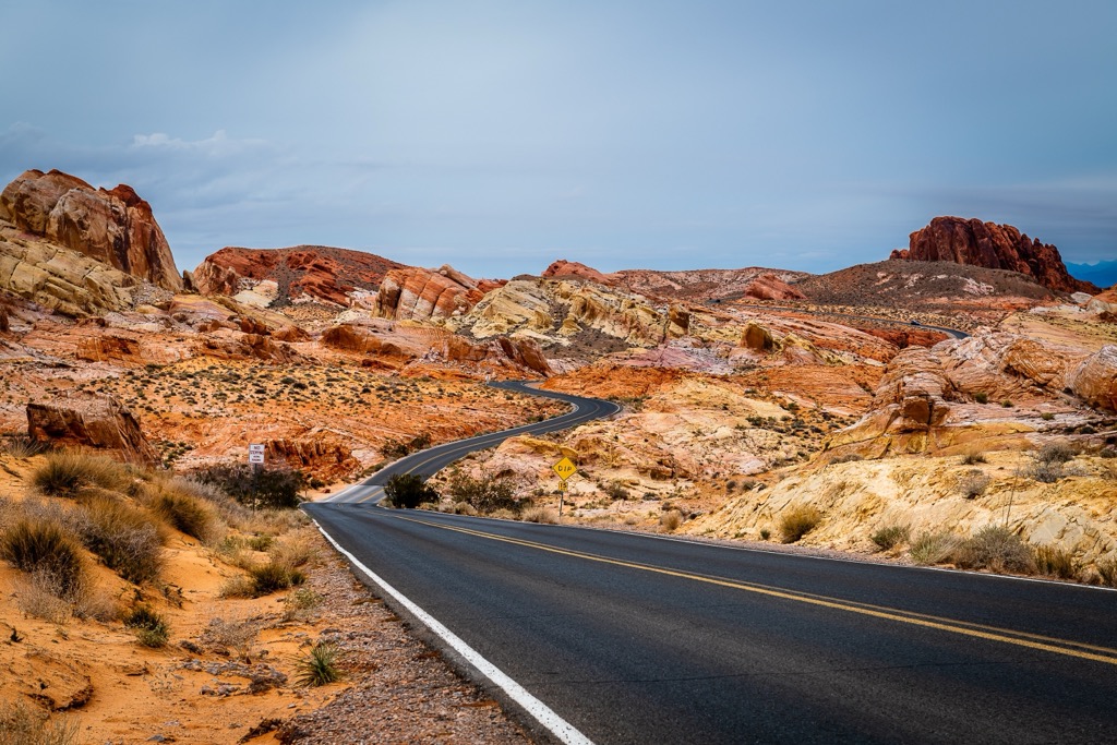
Valley of Fire State Park has around a dozen trails, but most are relatively short, ranging between one and two miles. A moderately fit group could easily hike most (or all) of the park’s trails in a single day. In addition, almost all of the most famous formations are easily accessible from the 10.5-mile (16.9 km) scenic road running between the park’s east and west entrances.
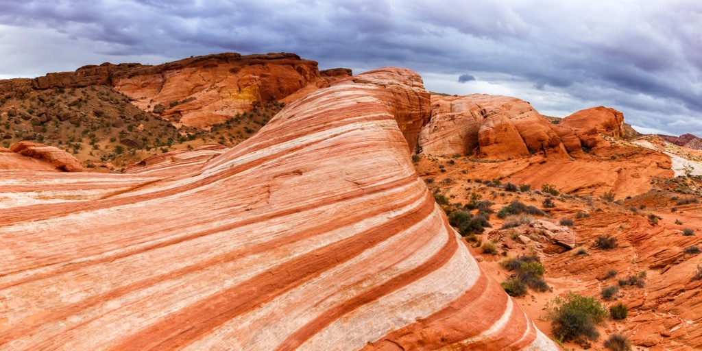
This 1.8-mile (2.9 km) loop takes hikers to the famous “Fire Wave” formation, tracking over loose sand and rough terrain through colorful canyons and past various characteristic red sandstone formations. Due to dangerously high temperatures, the trail closes due between June 1 and September 30.
This mellow 0.75-mile (1.2 km) route travels over loose sand to a petroglyph site, and is an excellent choice for families with younger children. The nearby Rainbow Vista hike (1 mile/1.6 km) is another good choice, taking hikers to a viewpoint.
This 1.1-mile (1.8 km) hike travels over loose sand and rough terrain to the eponymous White Domes (2,231 ft/680 m), traveling through a slot canyon and past the remains of an old movie set.
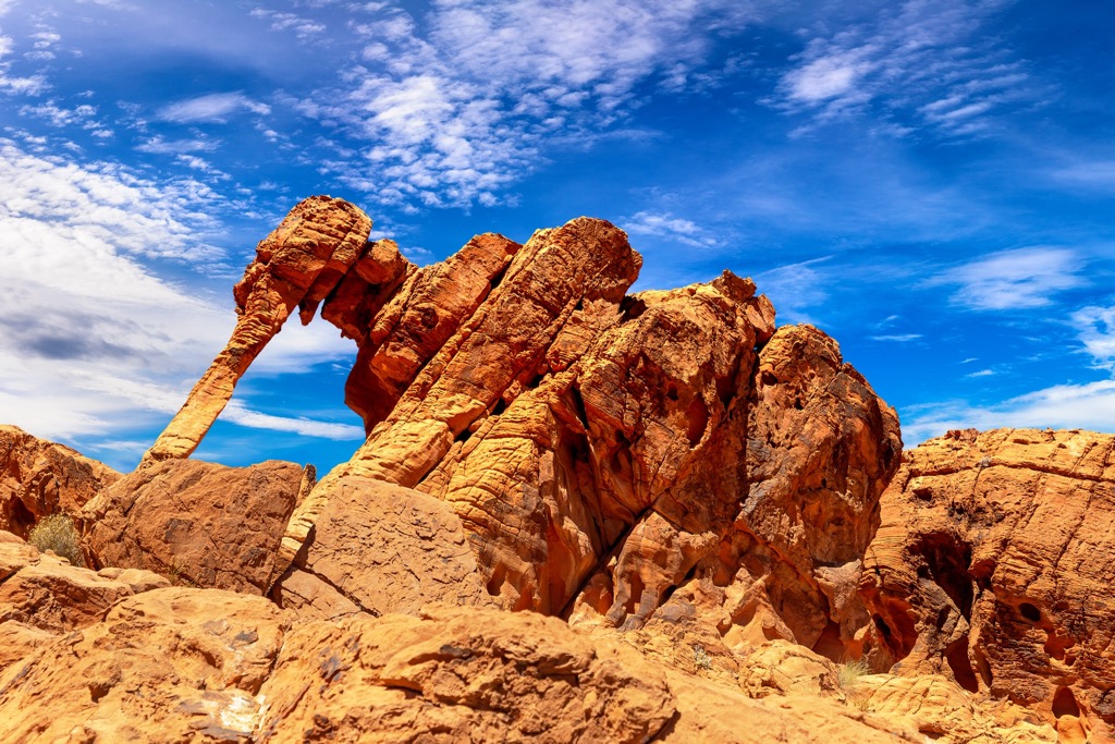
Elephant Rock (1,926 ft/587 m), near the park’s eastern boundary, is another of Valley of Fire’s most well-known formations. Visitors can access the rock via a 0.2-mile (0.3 km) out-and-back stroll or a 1.25-mile (2 km) loop.
Valley of Fire State Park is approximately 50 minutes by car from the Las Vegas Strip. Vegas is the closest major city to Valley of Fire and has endless options for lodging, food, and entertainment, with a particularly energetic nightlife scene and excellent cuisine. (Check out the city’s Chinatown for world-class Asian food.)
In addition to Valley of Fire, there are many other natural recreation options near Las Vegas, making it an excellent hub for visiting outdoor enthusiasts.
To the east, Lake Mead National Recreation Area offers camping, boating, paddling, and swimming. To the southwest, you’ll find the Spring Mountains (home to Charleston Peak [11,916 ft/3,632 m], the most topographically prominent peak in Nevada). This densely-forested mountain range is an excellent spot for hiking and camping, as well as skiing and snowshoeing in the winter months. Nearby Red Rock Canyon National Conservation Area is one of the best rock climbing destinations in the United States.

There are two campgrounds in Valley of Fire, with a combined total of 72 units, as well as RV slots with hookups. Campsites have access to tables, grills, water, showers, and restrooms. However, all sites are first-come, first-serve, and given Valley of Fire’s proximity to Las Vegas, the park’s camping is frequently booked out on weekends. There are also three large group sites, each accommodating 45 people. These are reservation-only.
Instead of camping within the park, we recommend camping for free in one of the many established dispersed campsites in Lake Mead National Recreation Area, just outside the park’s eastern border.


