Scan the QR code and open PeakVisor on your phone
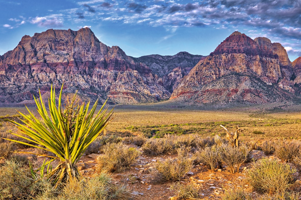
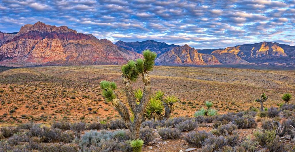
Red Rock Canyon National Conservation Area is a system of canyons, rock formations, and high desert plains in southern Nevada’s Mojave Desert managed by the U.S. Bureau of Land Management. Red Rock, approximately 15 miles (24 km) west of the Las Vegas Strip, is a popular destination for hiking, rock climbing, horseback riding, and cycling, among other outdoor attractions. It sees over three million visitors annually. The highest peak in Red Rock Canyon is Mount Wilson (7,070 ft/2,155 m), a member of the nearby Spring Mountains range, which is crowned by the ultra-prominent Charleston Peak (11,916 ft/3,632 m), which sits 15 miles (24 km) northwest of Red Rock. Charleston is both the most topographically prominent peak in Nevada and the eighth-most-prominent in the contiguous United States, with over 8,000 feet (2,500 m) of prominence.
NOTE: Although Mount Wilson is almost unanimously considered the highest peak in Red Rock Canyon, its summit sits approximately 100 feet outside the conservation area boundaries—the same is true for many of the high points rimming the canyon mentioned below. Technically, the highest point in Red Rock Canyon Conservation Area proper is Black Velvet Peak (6,145 ft/1,872 m).
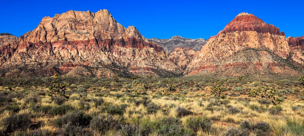
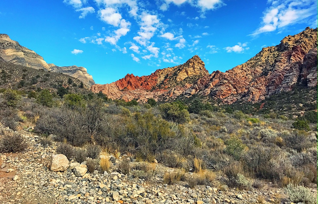
Red Rock Canyon National Conservation Area spans over 200,000 acres (809 sq. km) adjacent to southern Nevada's Spring Mountains National Recreation Area. Its red sandstone walls are considered one of the premier rock climbing destinations in the United States, with many faces, like the well-known Black Velvet Wall on Black Velvet Peak (6,145 ft/1,872 m), soaring over 3,000 continuous feet (900 m).
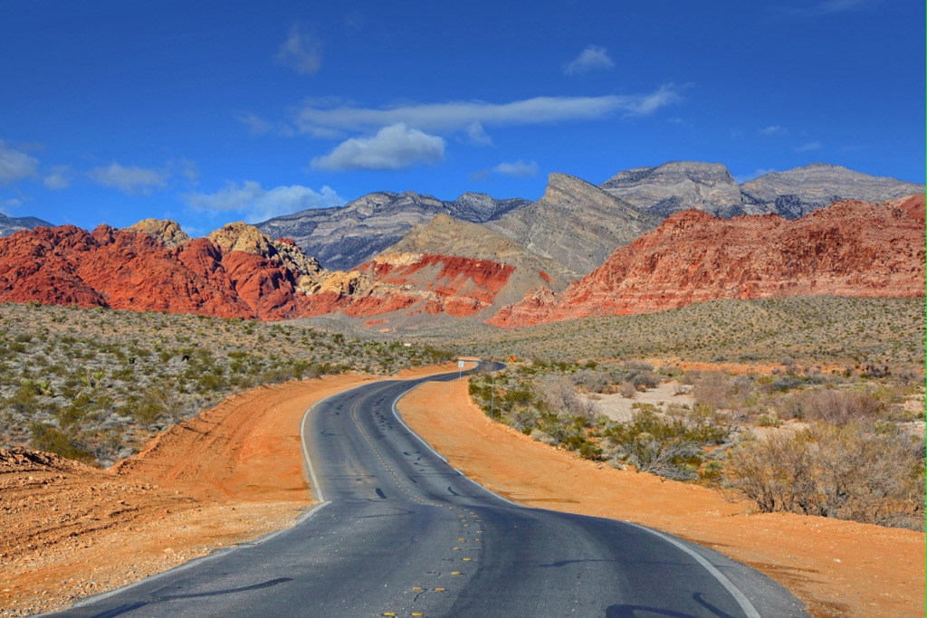
The conservation area is accessed from the east, on Highway 159, and rimmed by high canyon walls, peaks, and lower-elevation boulder piles to the north, west, and south. Running counterclockwise from north to south, some of the more famous formations include Kraft Mountain (4,715 ft/437 m), Calico Hills (4,938 ft/505 m), Turtlehead Peak (6,323 ft/1,950 m), White Rock Hills (6,453 ft/1,967 m), North Peak (7,047 ft/2148 m), Bridge Mountain (6,457 ft/1,968 m), Pine Creek Canyon, and Oak Creek Canyon.
The climate in Red Rock is typical of the high Mojave Desert, with brutally hot summers and cool winters. On average, the conservation area receives around four inches of annual precipitation, primarily between November and March. During the summer months, temperatures regularly exceed 100℉ (38℃), and in winter can drop to below freezing. Snowfall is quite common, particularly on the higher canyon walls and peaks.
Several small springs within Red Rock Canyon National Conservation Area provide a hub for the park’s diverse flora and fauna (see below). Easily accessible springs include Ash Springs, a stone’s throw from Calico Basin to the north of the scenic loop entrance, and Willow Spring and La Madre Spring, near the northwest corner of the scenic loop road. The latter sits near the base of La Madre Mountain (8,140 ft/2,481 m),
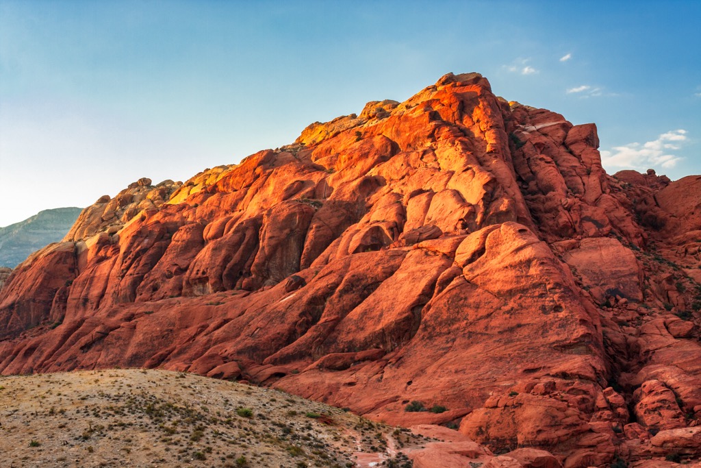
The soft, porous red Aztec sandstone of Red Rock was created by millions of years of geological activity. Its rock formations are the cores of ancient dunes from the early Jurassic Period (180-190 million years ago), cemented into sandstone as subsurface water trickled through it, depositing minerals like calcium carbonate and iron oxide between the grains. High concentrations of iron oxide are responsible for much of the red spotting seen in the sandstone.
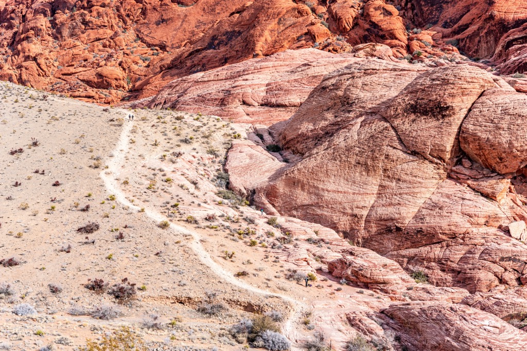
The Keystone Thrust Fault later affected the region, which formed an estimated 65 million years ago at the close of the Mesozoic era. Here, older gray limestone (500 million years old) has been pushed up and over the younger red sandstone from the Jurassic Period. This phenomenon is largely responsible for Red Rock’s diverse rock colors and elevations.
Evidence of the Keystone Thrust Fault is particularly noticeable in the easily-identifiable Turtlehead Peak, a striking gray hue compared to the surrounding red sandstone. The Thrust is exposed for over 13 miles (21 km) throughout the Red Rock area.
Despite inhospitable desert temperatures, the conservation area's wide range of elevations provides diverse habitats for both flora and fauna. A plethora of plants are found in the springs, including the alkali mariposa lily, stream orchid, velvet ash, yerba mansa, and Nevada blue-eyed grass. Mojave yucca and prickly pear live throughout the park, and the rare Joshua tree, a yucca endemic to the Mojave, is also found here.
The conservation area is home to almost 200 species of birds, including red-tailed hawk, canyon wren, turkey vulture, great horned owl, Gambel quail, black-tailed gnatcatcher, nighthawk, and golden eagle. It is also a habitat for canyon bats (Western pipistrelle), the smallest bat species in the United States.
Desert bighorn sheep are a common sight on many Red Rock trails. The area is also home to coyotes, black-tailed jackrabbits, desert cottontail, ringtail, white-tailed antelope ground squirrel, burro, desert cicada, desert tortoise, damselfly, deer, and numerous species of snakes and lizards—such as chuckwalla—as well as the tiny Spring Mountains Springsnail, found in small pools throughout the Spring Mountains range and Red Rock.
Just as the springs and catch basins found in Red Rock Canyon have attracted an abundance of plants and animals, so too have humans gathered in the area for thousands of years. From indigenous tribes like the Southern Paiute to colonial scouts, missionaries, explorers, miners, and settlers, Red Rock has seen human activity for approximately 13 millennia.
It is estimated that six different Native American cultures have lived at Red Rock, beginning with Paleo Indians in 11,000 BC and later the San Dieguito, Pinto or Gypsum, Ancestral Puebloan, and Patayan people. In pre-colonial times, Red Rock was a home for the Southern Paiute, who inhabited the area from around 900 CE.
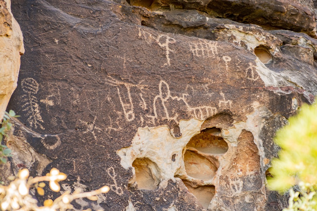
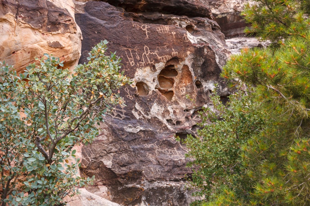
Evidence of these early human inhabitants can be found throughout the park, from petroglyphs to pottery to roasting pits. One popular trail takes visitors to the Petroglyph Wall, featuring indigenous rock art estimated to be at least 800 years old.
In the 1800s, Red Rock was a prominent stop on the Old Spanish Trail, a 1,200-mile (1,930 km) route stretching from Sante Fe to modern-day Los Angeles (then known as El Pueblo de Nuestra Señora la Reina de los Ángeles).
The park was founded in 1967 when the Bureau of Land Management designated 10,000 acres (40 sq. km) as the “Red Rock Recreation Lands.” The recreation land was briefly given state ownership in the early 1970s. However, legislation in 1990 changed the park’s status to a National Conservation Area, transferring ownership back to the federal government and establishing the framework for Red Rock today.
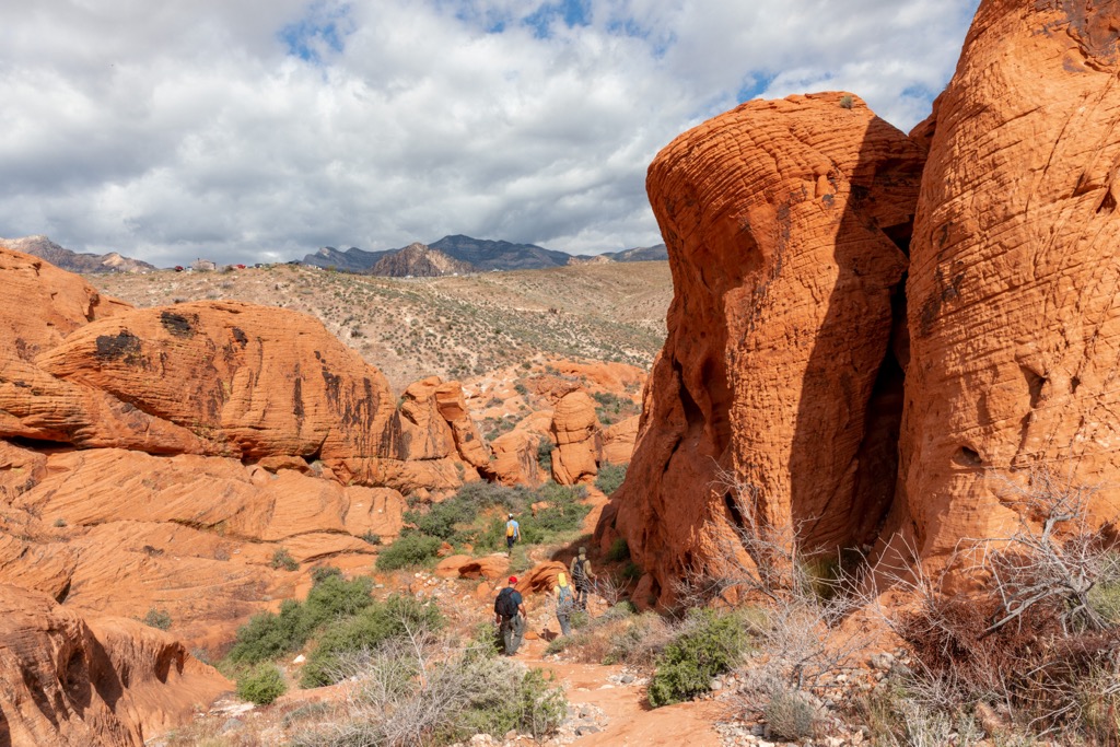
Above all else, today Red Rock Canyon is best known for its superb rock climbing. Many consider it one of the best climbing destinations in the entire world. This is belied by the conservation area’s accessibility, being only a few miles outside the major metropolitan area of Las Vegas.
The soaring sandstone walls here are home to some of America’s best traditional routes, such as the legendary 13-pitch, Epinephrine (5.9). Several world-class bouldering sites in the conservation area include Kraft Mountain (4,715 ft/1,437 m) and Black Velvet Canyon. In fact, one of the world’s two proposed V17 problems, Daniel Woods’ Return of the Sleepwalker, is located in Black Velvet.
While there are plenty of opportunities for bouldering, sport, and top roping, trad climbing is the name of the game at Red Rock, and there are over 1,600 established trad climbs in the conservation area.
In addition to the mighty Epinephrine—which some may tout as the best traditional route in the United States—classic moderates include Frogland (5.8) on the North Face of Whiskey Peak (5,161 ft/1,573 m), Dark Shadows (5.8), Birdland (5.7+), Olive Oil (5.7), and Crimson Chrysalis (5.8+). Big Bad Wolf (5.9) is the must-see sport line for bolt-clippers.
However, the bouldering options are nearly as vast, with almost 1,000 named problems. Friendly highlights are the off-width chimney Plumber’s Crack (V2 R), Natasha’s Highball (V2), Monkey Bar (V2), and The Pearl (V5). The Cube, a massive freestanding highball at Kraft with a dozen lines ranging from V0 to V12, is another must-see for climbers of all skill levels.
NOTE: Red Rock’s sandstone is extremely fragile after rain. Climbing on wet rock can cause holds to rip off, permanently scarring a route. (It’s also a safety hazard). After a heavy storm, the routes can remain wet for several days. During this period, climbers and scramblers should never venture off-trail onto the sandstone. Only climb in Red Rock when the rock is completely dry.
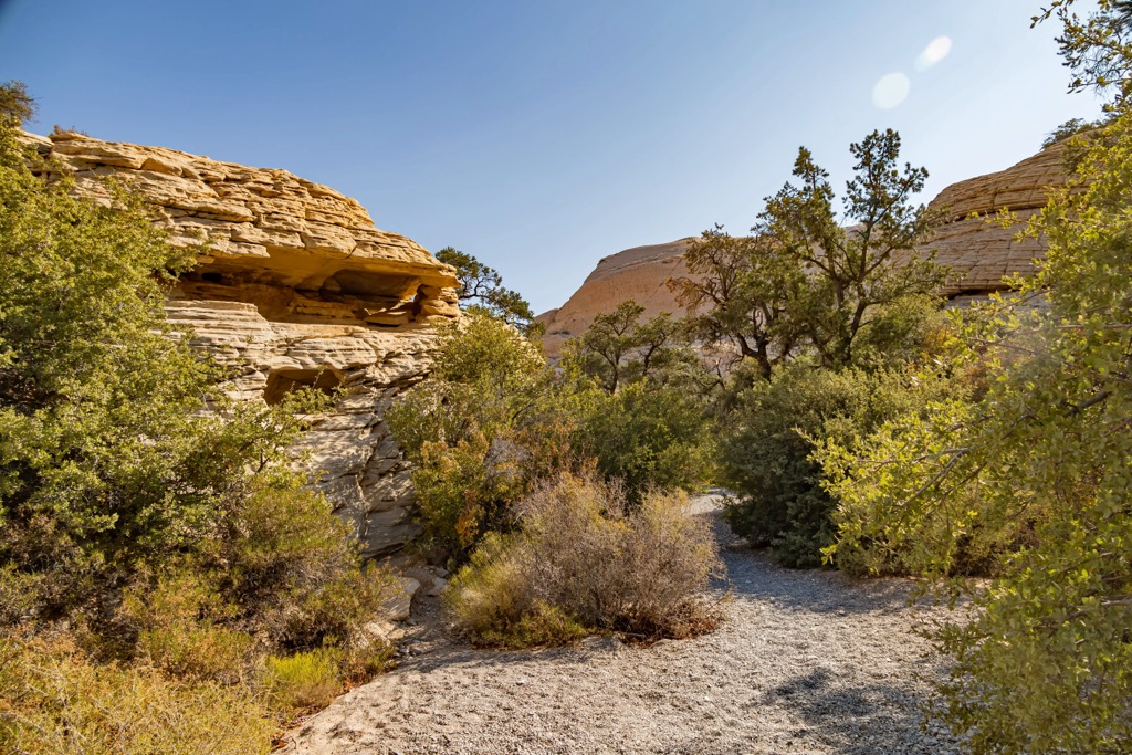
There are nearly 30 trails within the park boundaries and dozens of miles of hiking. Scrambling is also quite popular when the sandstone is dry, particularly on the easily accessible, lower-elevation portions of the Calico Hills. For more information, see the Red Rock Canyon official visitor’s guide.
This six-mile (9.6 km) loop can begin at Upper White Rock, Willow Spring Picnic Area, or Lost Creek and takes about 3.5 hrs, with an elevation gain of 890 feet (270 m). It takes hikers along to the remote north side of White Rock, one of the best areas in the park to see bighorn sheep. A short connection onto the La Madre Spring Trail allows visitors to spy a year-round high desert spring.
Accessible at the third pullout along the scenic road (Sandstone Quarry), this trail takes intrepid hikers as far as you’d like to go into the rugged boulder piles of the Calico Hills and is an excellent choice for a DIY scramble. Similar trails are accessible from Calico I and II parking lots.
Beginning from the Willow Spring Picnic Area, this short trail (0.15 mi/0.25 km) will take hikers to an 800-year-old petroglyph system in approximately 30 minutes.
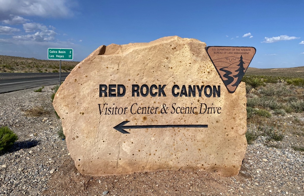
Red Rock Canyon is approximately 30 minutes by car from the Las Vegas Strip, due east along Charleston Boulevard. Vegas, the largest city in Nevada, is the closest major city to Red Rock and the Spring Mountains, also has a wide variety of lodging, cuisine, and other entertainment choices—from sprawling casinos to mind-bending concerts and shows, decadent nightclubs, and no-holds-barred pool parties.
Vegas is famous for the strip, but it's the incredible dining scene that will interest hungry climbers visiting town for the night. Like New York City and LA, Vegas offers authentic, affordable cuisine from all corners of the earth.
In addition to Red Rock and the Spring Mountains range—which offers a variety of outdoor sports as well as sublime skiing and snowshoeing in the winter months—the Lake Mead National Recreation Area, the world-famous Hoover Dam, and Valley of Fire State Park are all within an hour’s drive from Las Vegas. Further afield, visitors can get to the California national parks of Joshua Tree and Death Valley in a couple of hours.