Scan the QR code and open PeakVisor on your phone
Known for its craggy rock formations, vast desert landscapes, and its namesake Joshua trees, Joshua Tree National Park is a federally protected area located in the southern part of the US state of California. The park contains 44 named mountains, the highest and most prominent of which is Quail Mountain (5,817 ft/1,773 m).

Joshua Tree National Park contains 1,235 square miles (3,199.6 sq. km) of land, which makes it slightly bigger than the state of Rhode Island. It is located within both Riverside and San Bernardino counties near the town of Twenty Nine Palms and the cities of Palm Springs and San Bernardino.
The park is a short drive from the borders of the states of Nevada and Arizona. Additionally, the park is within driving distance of San Diego and Los Angeles and the northernmost part of Mexico.
Joshua Tree National Park is located in an area with a significant amount of public land. It is just to the west of the San Gorgonio Wilderness and the Santa Rosa and San Jacinto Mountains National Monument. It is situated to the north of the Santa Rosa Wilderness, Anza-Borrego Desert State Park, and Chuckwalla Mountains Wilderness Area.
Palen-McCoy Wilderness Area forms the park’s eastern border. Meanwhile, the Sheephole Valley Wilderness Area, Bighorn Mountain Wilderness, and the Twentynine Palms Marine Corps Base are located just north of Joshua Tree. Mojave National Preserve is also within driving distance of the park and is a good secondary destination for keen desert hikers in the area.
The Coachella Valley is another close neighbor to Joshua Tree National Park. It stretches 50 miles (80.5 km) beneath the western Little San Bernardino and Cottonwood Mountains and travels through the Colorado Desert.
Unfortunately, when visitors look out onto the Coachella Valley from the park they are met more with visions of smog and development than wildlife. However, a great view of the San Bernardino Mountains and the San Bernardino National Forest rises above the valley.
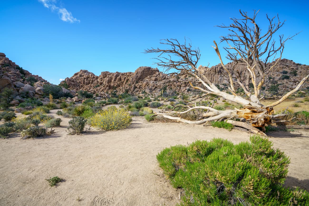
Joshua Tree National Park also highlights a number of geographic wonders. The three major topographical regions present in the park are desert scrub, sand dunes, and mountains. One geographic highlight is the Turkey Flats area, which is a popular stop as visitors explore the Piute Mountains region in the southern reaches of the park.
In fact, the Turkey Flats, though they seem expansively flat, are actually a low-grade extension of the Piute Mountains above them and are composed of rock, sand, and soil alluvium. This rock and soil flowed down from the slopes and canyons above, spreading gradually over the basin to form both the alluvial fans and the bajadas above them.
Piute Mountain sits at an elevation of 3,983 feet (1214 meters). The flats below the peak support a number of different plants and animals like creosote bush, bunchgrass, and a variety of seasonal wildflowers, as well as animals like the sidewinders and road runners.
The alluvium that filled the flats originally consisted of a mantle of soil on top of the mountain and which was anchored by grasses, junipers, and pinyon pines. However, when the last glacial maximum ended 10,000 years ago, arid conditions killed the plants and erosion ensued. No longer anchored to the ground, the soil flowed into the valley as a result of periodic floods.
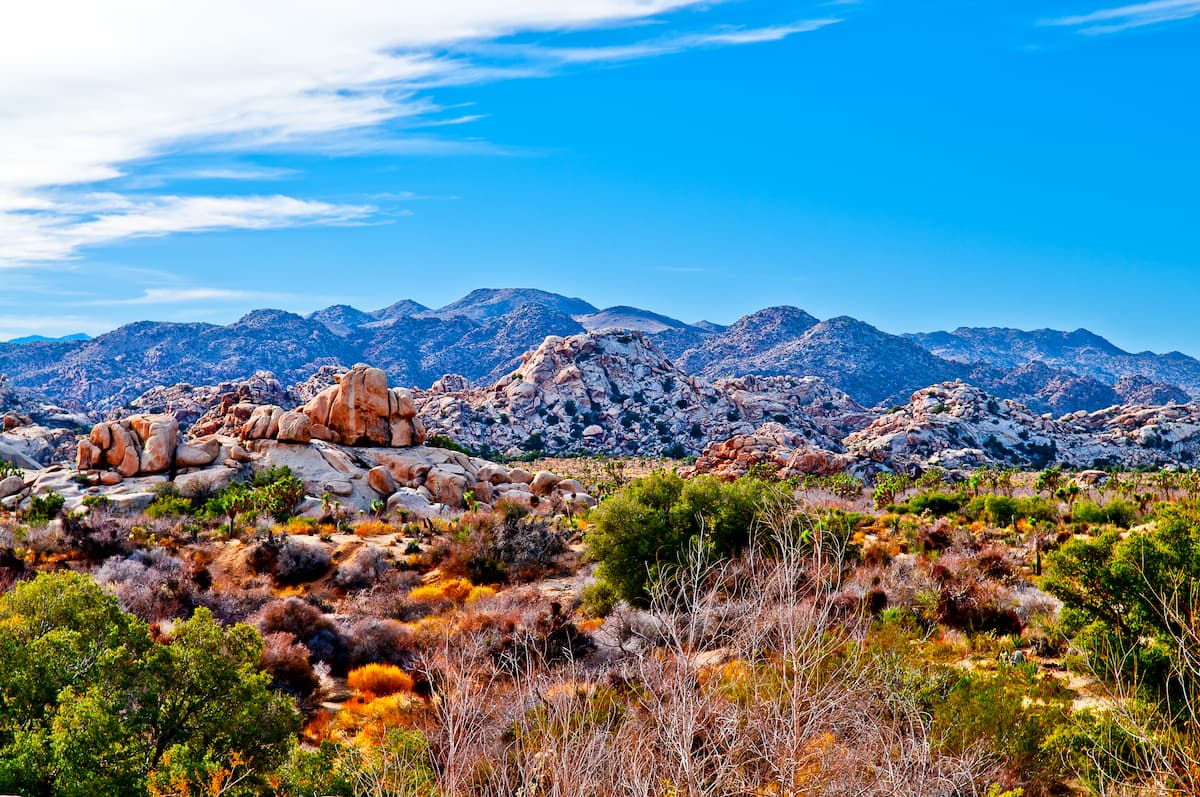
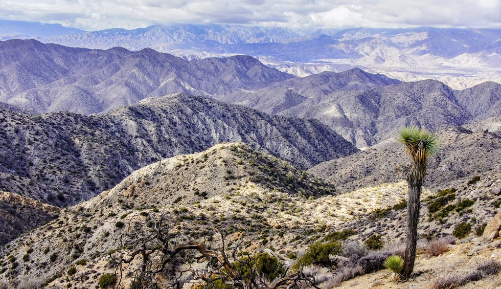
Joshua Tree National Park is a geologist’s paradise. The mountains within the park are part of the greater California Ranges. The California Ranges extend throughout the southern and central parts of the state, along its western edge and parallel to the Sierra Nevada.
The park hosts a number of contorted metamorphic rock formations that point to the region’s history of colossal heat and pressure. Visitors can see crystalline structures within the park’s majestic boulders, especially in the northernmost portions of the park. These boulders reveal how quickly molten rocks cooled once they were exposed to the surface millions of years ago.
Geologically, the oldest rocks in the park date back about 1.7 billion years and they are best exposed at the top of Ryan Mountain. However, most geologists believe that the park’s current landscape was largely created around 100 million years ago as magma cooled just below the surface of the Earth’s crust, creating large plutonic intrusions of monzogranite.
The monzogranite rocks that make up a great deal of the park formed a wide network of rectangular joints that were then layered with gneiss and then fractured into the shapes we see today.
Over millennia, these rectangular joints eroded away to create the rounded structures found all over the park. Millenia of flash floods then eroded away the bedrock, leaving these huge boulders piled up on top of each other and sculpting out some truly fantastic geologic features, which make for great climbing and sightseeing today.
Some geologic highlights in the park include Cottonwood Pass monzogranite, which can be found around Mastodon Peak and the Lost Palms Oasis Trail.
The rocks in this area are igneous in origin and they formed during the Cretaceous and Jurassic periods some 75 to 200 million years ago. These rocks cooled and solidified far below the surface of the Earth and were later exposed by uplifts and erosion.
White Tank monzogranite can be found at the areas around Jumbo Rocks, White Tanks, and the Belle Campground. These are igneous intrusions that formed and solidified 15–20 miles below the surface during the Cretaceous and Jurassic Periods. These rock formations are famous for their crystalline structure that is a result of slow cooling.
Phyllite rocks can be found in the McCroy Mountain formations around the southern Coxcomb Mountains off of Highway 177. These metamorphic rocks also formed during the Cretaceous and Jurassic periods and have a sparkly appearance due to the presence of mica, graphite, and other mineral grains.
Visitors can also find characteristically black basalt rocks at Malapai Hill on Geology Tour Road. These igneous rocks formed 3–7 million years ago during the late Miocene epoch by intrusive magma. The lava flows and cinder cones that formed these rocks have since eroded away.
Pinto gneiss rocks can be found at the top of Ryan Mountain. These rocks formed 1.7 billion years ago during the Proterozoic eon. They are characterized by light and dark mineral bands formed during the metamorphic process.
Additionally, skarn deposits can be found at the Desert Queen Mine. They formed in fractures of existing igneous intrusions. Gold and other precious metals can be found in these deposits. These, and many other regionally specific rock formations, make the Joshua Tree wilderness a real treat for the geology enthusiast.
Joshua Tree National Park has a hot desert climate (BWh in the Köppen climate system), with average high temperatures in the summer months generally exceeding 90ºF (32ºC) and a highest-ever recorded verified temperature of 118ºF (47.8ºC) as of 2021. Additionally, the park receives very little precipitation, with an average annual rain total of just 5.45in (138mm).

This harsh climate, in addition to the region’s varying elevation, created two distinct ecosystems within Joshua Tree National Park: the Mojave and Colorado Desert ecosystems.
The Colorado Desert section of the Sonoran Desert is located at the lowest elevations in the park below 3,000 feet (910 m).
The majority of this ecoregion is located in the eastern edge of Joshua Tree and is known for its collection of ocotillo, desert saltbush, cholla cactus, yucca, and creosote bush scrub. There are even some patches of cacti that are naturally dense enough to look like natural succulent gardens in the middle of an otherwise sandy landscape.
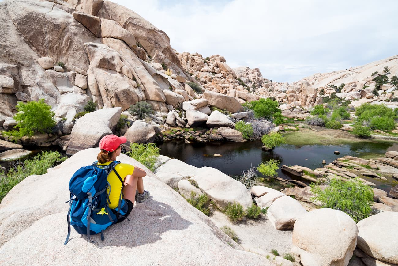
Additionally, at these lower elevations, visitors can see the California fan palm (Washingtonia filifera), which is the only naturally occurring palm tree in the state. These palms occur naturally within the park’s five oases, which are very rare areas with year-round water that can sustain fertile soil and an abundance of wildlife.
Above 3,000 feet (910 m), the park is dominated by the ecosystems of the Mojave Desert, which are slightly cooler than those found in the Colorado Desert due to their higher elevation. Here, the Joshua tree (Yucca brevifolia) occurs in both dense forests and in interspersed individuals around the desert landscape.

Although Joshua trees are the dominant species in this area, there are also piñon pine, desert scrub oak, Muller’s oak, Tucker’s oak, and California juniper. However, fairly extensive cattle grazing in the region removed much of the natural scrub that once covered the landscape.
After this period of intense cattle grazing, invasive species moved in, and have started to dominate the area. When these invasive species, such as cheatgrass, die, they help fuel massive wildfires that now burn hotter and for longer than those that occurred before their arrival.
Despite its harsh aridity, Joshua Tree National Park is home to a surprising array of wildlife. There are actually more than 250 species of birds that either nest in or migrate through the park.
These birds include the Gambel’s quail, golden eagles, greater roadrunner, northern mockingbird, and the cactus wren. The park’s oases are particularly good places to spot birds if you’re an amateur ornithologist.
One notable bird species in the park is the rock wren. Though widespread throughout the park, this bird favors the rocky desert slopes and hillside of the Pinto Mountains.
Other wildlife in the park includes lizards and ground squirrels, which are the most common sightings in the region.
Joshua Tree is also home to the desert tortoise, a threatened species that is well-adapted to the desert and rarely drinks water because it gets most of its hydration from the plants it eats. The desert tortoise is also known to burrow its dens into the soil, typically near shady spots where they can wait out the intense heat of the day.

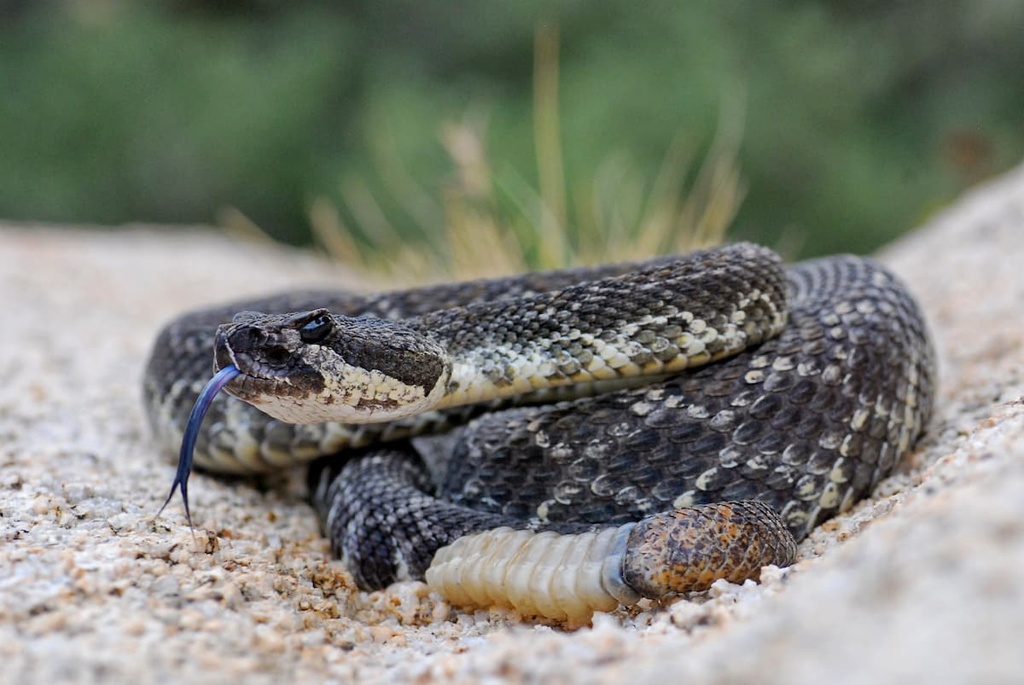
There are also plenty of snakes, kangaroo rats, jackrabbits, coyotes, lynxes, and bighorn sheep that roam the park. Bobcats are an apex predator within the region, but you’re lucky if you’re able to spot one.
The desert sidewinder is a famous rattlesnake that inhabits Joshua Tree. It is an ambush predator that hides under bushes or buries itself in the sand to wait for passing prey. These snakes are aptly named for their sidewinding style of movement that leaves a distinct pattern on the sand. This method of movement reduces the amount of contact between the snake and the hot ground and reduces overheating as a result.
The Mojave fringe toed lizard also called Joshua Tree home and is found in the sand dune regions of the park near Piute Wells. The lizard’s scaly fringe toes allow the lizard to run quickly over the hot sand.
Another lizard found in the park is the collared lizard, which can be found in the mountainous regions of the park. The Pinto mountains are home to a number of collared lizards who use the area's distinctive rock formations to either bask in the sun or hide from the day's heat and to look out for nearby prey and predators.
Desert kangaroo rats can also be found in the sand dune regions of the park and are well adapted for the dry area. These industrious rodents are able to conserve water to an amazing degree and often get all of the hydration they need from the seeds they eat.
Interestingly, there are also a few amphibians within this desert landscape, including the red-spotted toad (Bufo punctatus) and the California tree frog (Pseudacris cadaverina).
While the toad spends much of its life underground, it does come to the surface, especially after it rains. The frog, on the other hand, is most likely found around the permanent water sources in the Pinto Fault area in the northern section of the park.
People of the Pinto culture are the earliest known inhabitants of the region that would later become Joshua Tree National Park, having lived in the area between 10,000 and 6,000 years ago.
Based on archaeological evidence, they likely hunted game and gathered some of the region’s seasonal plans, but there is little else known about them beyond the stone tools and spear points that were uncovered in the 1930s.

More recent inhabitants of the region include the Cahuilla, Serrano, Mojave, and the Chemehuevi people, among countless others. Descendants of the Chemehuevi are part of the Twenty-Nine Palms Band of Mission Indians of California and now manage a small reservation near Joshua Tree National Park.
The first Europeans to visit the region and encounter the Joshua trees were led by Pedro Fages, a Spanish soldier and later the first Lieutenant Governor of Spanish California, in 1772. They came to the region in search of Indigenous people who had run away from a mission in San Diego that they had been forced to relocate to.
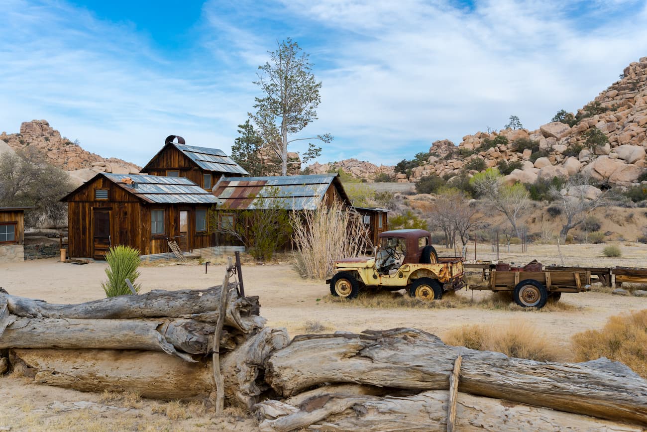
One hundred years later, more White settlers, who arrived after Mexico ceded California to the United States following the Mexican-American War, started to extensively graze cattle in the region. This grazing took place around the park and led to the construction of various wells and rainwater catchment tanks that supported a cattle industry in the region until 1945.
There is also one popular legend in the Turkey Flats area that claims the name came from an entrepreneurial turkey farmer who was convinced that the area would be perfect for a turkey farm. However, the harsh conditions proved otherwise.
Additionally, prospectors began staking claims in the region in 1865. There was a flood of activity during the California gold rush. Between the 1860s and 1940s, there were about 300 pit mines in the park. Mines in park include Fore Aces, Big Bozo Claim, Lucky Turkey #2, and Hard Digging, among others. The most successful mine in the park was the Lost Horse Mine.
The Lone Horse mine produced about $5 million (current currency equivalent) of both gold and silver during its time in production. The nearby Desert Queen Mine also produced a substantial amount of gold, while others in the park produced iron, zinc, and copper.
Remains of the Silver Bell Mine can still be seen on the slopes of Hexie Mountains in the very center of the park. It’s tipples are even still intact. The ore in these mountains was mined and sent to a stamp battery that crushed the ore into a sandy, watery pulp and then pushed it onto an amalgamation table where precious metals were extracted.
The mine operated for 40 years, though its ownership and the exact details of just how much the mine produced is a bit sketchy. Regardless, the mine was known for its versatility. In the 1930s the mine produced gold, then lead in the 1940s, and finally copper in the 1950s.
However, the values of both the gold and the silver out of the Silver Belle Mine were considered quite low. That said, the value of the copper that the mine produced was conversely considered quite high and was valued at $90 a ton at the time.
Mining in the region reached its peak in 1917 and gradually tapered off by the 1960s.
By the 1930s, though, protecting the region was a focal point for a number of local activists. Minerva Hoyt, in particular, was instrumental in persuading President Franklin D. Roosevelt to establish Joshua Tree National Monument in 1936 using his powers under the 1906 Antiquities Act. Mount Minerva Hoyt was later named in her honor for the work that she did in protecting the park.
However, in 1950, the monument was reduced in size to provide more opportunities for local mining interests. In 1994, conservationists finally got what they wanted when Joshua Tree was expanded and then designated as a national park under the Desert Protection Act. The park was expanded once again in the 2019 John D. Dingell J. Conservation, Management, and Recreation Act.
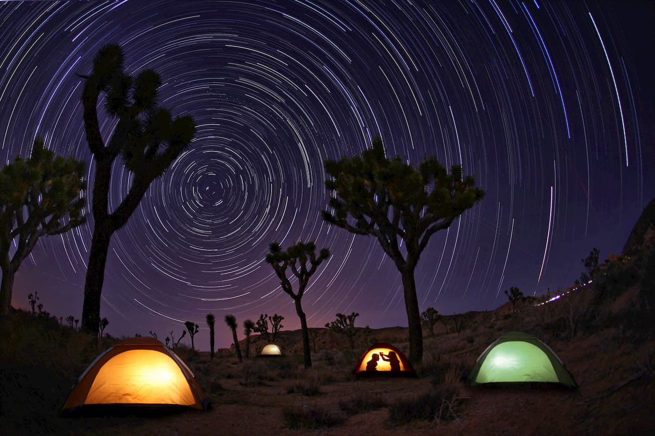
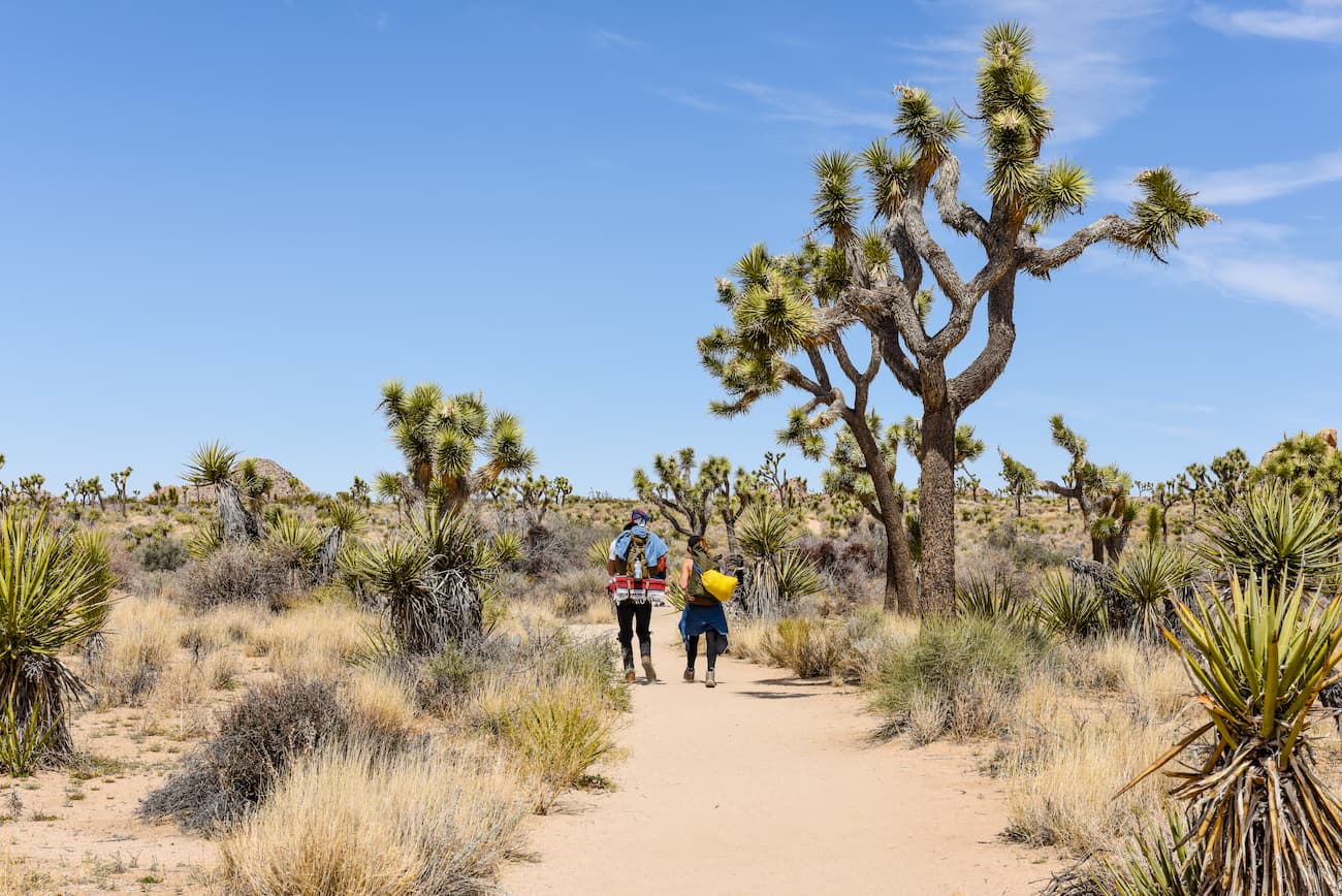
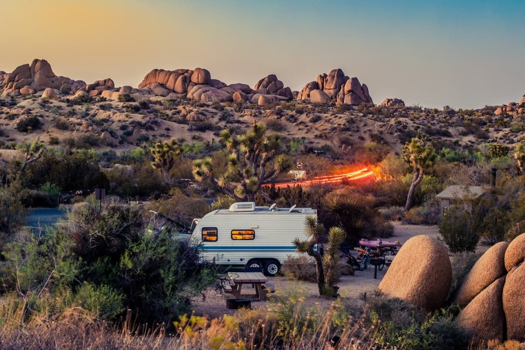
These days, the park is a very popular destination for outdoor recreationists. Joshua Tree has nine established campgrounds, two of which have year-round running water. There are also plenty of hiking trails and backcountry campsites for people that want to venture further from the road.
Additionally, the park is a world-renowned climbing location, having originally been used as a winter training ground for bigger objectives in Yosemite National Park. Some of the most popular climbing areas include Chimney Rock, Locomotion Rock, Jumbo Rocks, Turtle Rock, and Cap Rock.
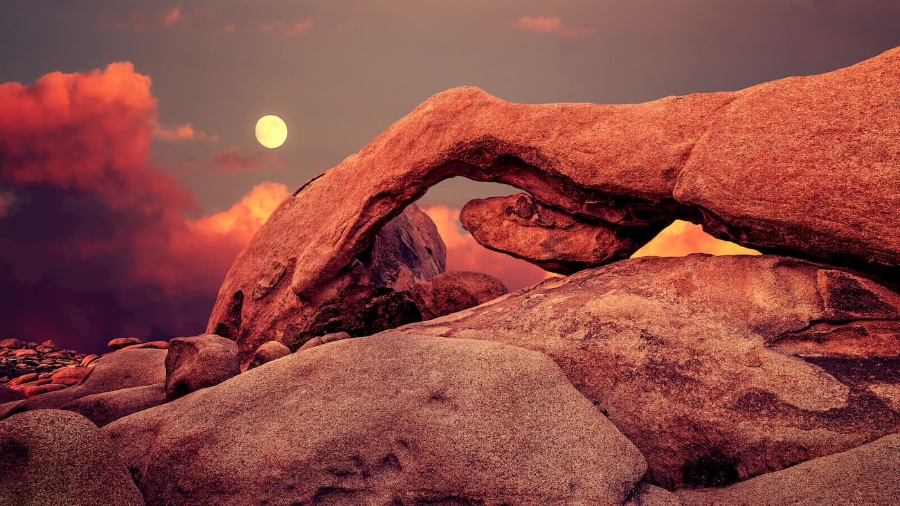
Finally, Joshua Tree National Park is a great destination for amateur astronomy and star observations because of its dark, light-pollution free skies. In the westernmost parts of the park, visitors can see the Andromeda Galaxy as well as the Galactic Center of the Milky Way.
As with any desert hiking destination, safety should be a top priority during trips to Joshua Tree National Park. Visitors have been seriously injured or killed in the park from preventable causes, so a bit of extra care and attention should be taken before heading out on a hike.
The National Park Services (NPS) asks that all hikers familiarize themselves with the details of their hike before they head out. All visitors should also bring basic navigating equipment like a compass. Luckily, much of Joshua Tree is wide open and flat, making desert navigation somewhat more straightforward than its forest counterpart.
Dehydration is the biggest risk in the desert ,so be sure to bring more water than you anticipate needing. Also, start your hikes early in the day to beat the heat of mid-day.
The NPS recommends hikers carry 1 gallon (4.5 L) of water per person per day and that hikers make it a point to make periodic stops to hydrate—even when they do not feel thirsty. It is also recommended to keep electrolyte packets to maintain salt and electrolyte balance, which can be lost more rapidly in the desert.
The weather in the desert can also be highly fickle and the temperature can fluctuate rapidly in a short period of time, especially at night. As such, hypothermia can be just as big of a risk factor as hyperthermia. If you are hiking into the evening, add warm clothes to your pack, as well as a headlamp and extra food, in case you end up hiking later than you planned.
Hikers also need to be aware of the risks of lightning and flash floods. If there is a storm in the desert, it is not a good idea to hit the trail. There is little coverage in the desert so lightning is a real hazard. Be sure to stay off of ridgelines and mountain peaks, away from exposed rock faces, and out from shallow overhangs and guilles.
If a storm is underway, be sure to stay out of desert washes. Flash floods are incredibly dangerous in the desert and can come out of nowhere. Be sure to stay upstream from any drainage if a deluge gets underway. Above all else, before heading out, check the local weather at the ranger station so you know what you need to plan for.
Plants are another thing to watch out for and familiarize yourself with when traveling to the desert. Plants like catclaw, Spanish bayonet, and cacti can ruin a hike if you do not keep a keen eye. Keep tweezers on you in case you need to remove any spines that you might have inadvertently caught on a hike.
Desert wildlife can also be dangerous. Animals like mountain lions, rattlesnakes, scorpions, and tarantulas should be watched for and given plenty of room if encountered. To avoid larger animals like mountain lions, avoid hiking at night or in the early morning when they are most active. For small creatures, be sure to watch your step and be aware of your surroundings.
Hanta virus is another risk factor in the desert. While deer mice are incredibly cute, they could also be carrying a deadly respiratory virus. So, keep clear of them and store your food properly to avoid encouraging them to your campsite.
Any surface water, with the possible exception of free-flowing springs, is likely to contain pathogens and diseases, such as giardiasis. Giardiasis, or giardia, is a parasite that causes severe diarrhea. If you are using any water you found on the trail, be sure to treat it properly before consumption.
While Joshua Tree is famous for its rock climbing it is important to stick to established climbs and steer clear of unstable and undeveloped areas. Mountainsides and desert canyons often have crumbling rock faces that can give way when climbed on and cause serious injury or death.
Joshua Tree National Park is a great destination for hikers of all ability levels. Here are some of the most popular trails in the park:
The Hidden Valley Nature Trail is a short, but beautiful stroll that’s perhaps one of the most visited sections of the park. It starts at the Hidden Valley Picnic Area near Park Boulevard and takes hikers on a 1 mile (1.6 km) loop through stunning rock formations. It’s also a great pace for spotting local wildlife.
The Barker Dam trail is a casual 1.1 mile (1.7 km) hike that highlights the Barker Dam. There’s also a chance to see rock art on the offshoot Echo T Trail, which is only an additional 0.7 miles (1 km) long.
Additionally, the Barker Dam Trail is located close to the Hidden Valley Campground and the Wall Street Mill Trail. The hike also offers interpretive exhibits that discuss human history and the ecological gems of the area.
Barker Dam itself hints at early ranching efforts in the area. The dam fills periodically throughout the year and it is a great place for wildlife viewing. Visitors can observe both oasis and desert landscapes at this hike depending on the year.

The Wall Street Mill Trail is a 2.5 mile (4 km) out-and-back hike that highlights some of the park's more dynamic ranching history.
In addition to highlighting the Wall Street Mill itself, the hike highlights the Worth Bagley Stone (or rather a replica since the original had previously been repeatedly vandalized), which stands testament to a deadly altercation between ranchers in the area.
The stone reads, “Here is where Worth Bagley bit the dust at the hand of W. F. Keyes May 11 1943.” Worth Bagley and William F. Keyes were two competing ranchers/miners who were in a prolonged argument over water usage between their two properties.
After the altercation, Keyes was charged and convicted of manslaughter and was sentenced to nine years at San Quentin State Penitentiary. When he was released in 1948 he returned to his home at Desert Queen Ranch (Keyes Ranch) and he carved and placed the stone himself.
William F. Keyes also operated the Wall Street Mill sporadically from 1930–1966. The mill processed ore from Keyes’ mine and other surrounding mines.
The Boy Scout Trail is one of the longest established trails in the park. It can be done as either a point-to-point or out-and-back hike. This trail covers 7.8 miles (12.6 km) one-way as it connects Indian Cove to Park Boulevard. However, it’s recommended that thru hikers start at Park Boulevard as this provides a mostly flat and downhill walking experience.
The Boy Scout Trail is a great way to see large stands of Joshua trees as well as some of the park’s most iconic rock formations. It also offers great views of the surrounding desert landscape for more adventurous hikers.
This 7.3 mile (11.7 km) trail takes hikers to the Lost Palms Oasis from its trailhead at Cottonwood Oasis Road.
It’s a great hike for anyone looking to experience two of the park’s five oases and their unique flora and fauna. However, it is quite long and exposed to the sun, so if you want a shorter hike, the trail to Fortynine Palms Oasis is a good alternative.
The trail to the summit of Ryan Mountain starts off on Park Boulevard and is a good option for people that want fantastic views of the park itself.
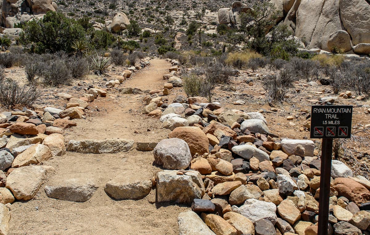
Although there aren’t many Joshua Trees on this hike, it does provide a good workout and great views. For a more casual hiking option with plenty of Joshua trees, the nearby Ryan Ranch Trail is a solid choice.
The Warren Peak Trail starts in the Black Rock Canyon section of the park and can be hiked in combination with the Panorama Loop if you want more of an adventure. This trail takes visitors to a high point in the western part of the park and features lots of Joshua trees and panoramic views.
There are a number of camping areas in the park for visitors to enjoy. There are also four visitors centers:
Here are some of the best accomodation options within Joshua Tree National Park.
The reservable campgrounds in the park can be reserved by using Recreation.gov or by calling (877) 444-6777. Reservable campgrounds include the following:
First come, first serve campsites allow for a maximum of 2 vehicles, 3 tents, and 6 people per site.
Visitors can go to the campgrounds and when they find a spot they can claim it and pay for their site in the self-payment deposit slot within 30 minutes of choosing their site. The permit stub can then be attached to the front of their campsite.
First come, first serve sites include:
There are also a number of campsites near the park, albeit outside of the park boundaries. These are a great option during the busier season when many spots in the park might be occupied.
To the north of the park there are a number of HipCamp sites as well as the Joshua Tree Lake RV and Campground, Twentynine Palms RV Resort, and Little Pioneertown RV. To the south of the park there is the Chiriaco Summit and Palm Springs/Joshua Tree KOA.
There is also a large amount of BLM land around the park that lends itself well to disperse camping, especially to the south of the park.
Here are some of the best places to stay before or after your visit to Joshua Tree National Park:
Twentynine Palms, California is located just to the north of Joshua Tree National Park. It is the best place to stay if you’re looking for a campground or hotel outside the park’s boundaries. The city has a population of over 25,000 people and is accessible by State Route 62, which connects the city and the park to I-10.
San Bernardino is just over an hour by car from Joshua Tree National Park. It is the largest city in the immediate vicinity of the park with a population of over 215,000 people. It is home to multiple colleges and universities and is easy to get to by road or train from other parts of California.
Los Angeles is a two and a half hour drive (without traffic) to the west of Joshua Tree. It is the largest city in California with a population of almost 4 million people and has everything you need to start your trip into the national park. The city offers excellent transportation links by road, air, or train all around the country and the state.

San Diego is located a three-hour drive to the south of Joshua Tree National Park near the US’ border with Mexico. It is home to over 1.3 million people and is a cultural and financial center of the region.
San Diego is well connected by road as it is located along I-5 and I-15. The city also has a major international airport and good train connections around the state.

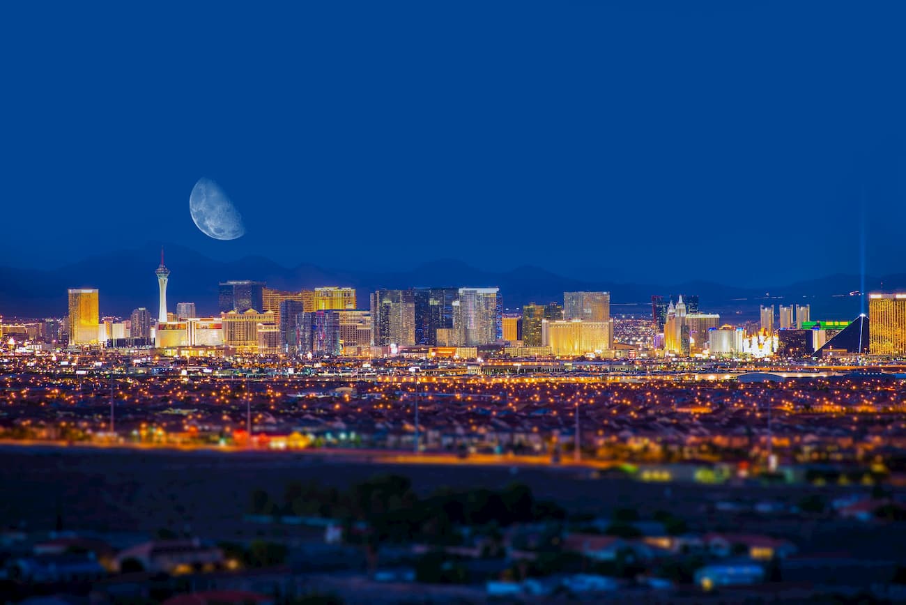
When most people plan their trip to California, they don’t think about Las Vegas. However, Vegas is just a three-hour drive north of Joshua Tree National Park and is a good place to start if you also want to visit Mojave National Preserve or Death Valley National Park.
Las Vegas has a population of over 640,000 people and is home to a major international airport with great flight connections around the world. It also has a plethora of restaurants and hotels to choose from for the beginning and end of your trip.