
Scan the QR code and open PeakVisor on your phone
The California Ranges include 2,221 named peaks. The highest is San Gorgonio Mountain at 3,502 m. Other notable peaks include Jepson Peak, Anderson Peak and San Jacinto Peak.
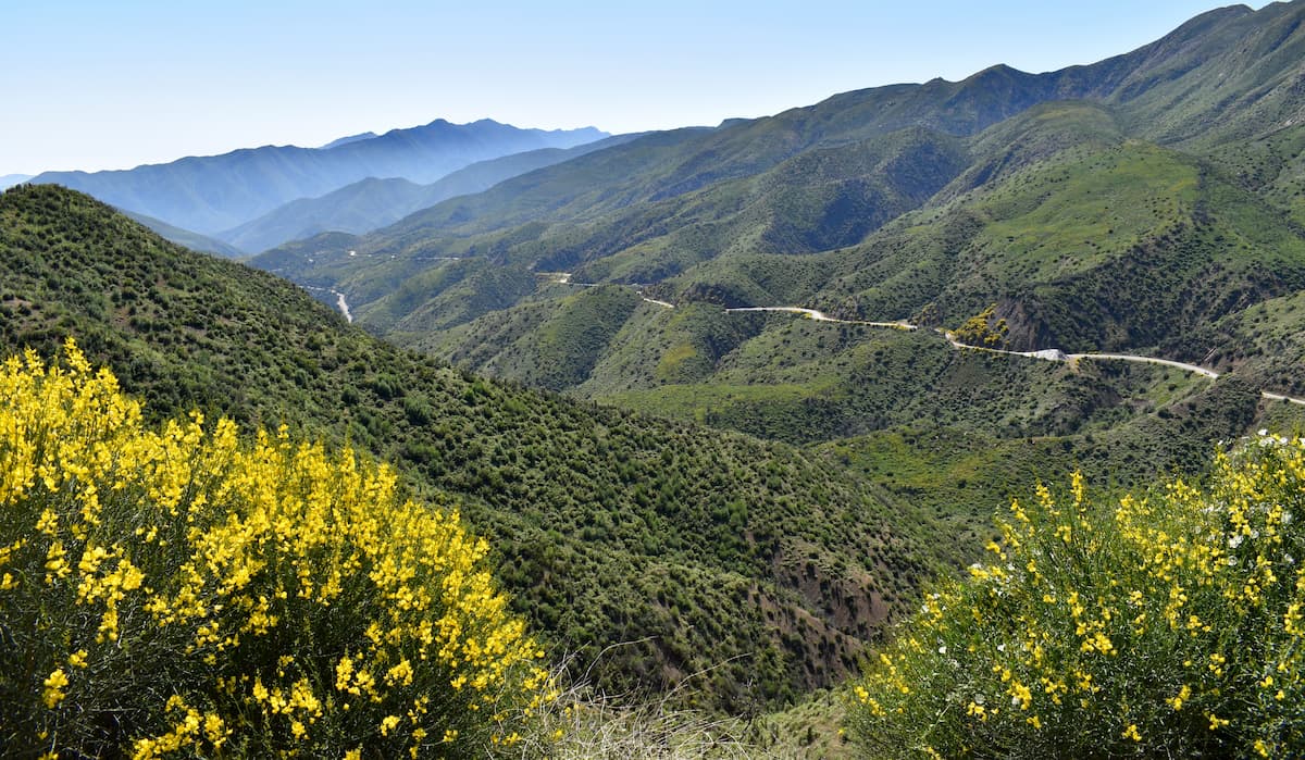
Spectacularly rugged, the aptly named California Ranges are a collection of mountain peaks and subranges that extend down the coast of the US state of California. The system includes 1,792 named peaks, the highest of which is San Gorgonio Mountain (11,490ft/3,502m), and the most prominent of which is San Jacinto Peak (10,787ft/3,288m).
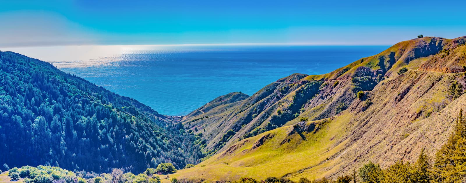
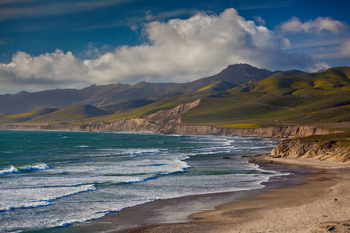
Known for their rugged terrain, arid landscape, and stunning ocean views, the California Ranges are a system of mountain ranges that run down the Pacific Coast of California from the San Francisco Bay Area to the state's borders with Arizona and Mexico.
The ranges are located to the south of the Northwest US Coast Ranges, which extends through the states of Oregon and Washington all the way to the US' border with Canada at British Columbia where they become the Canadian Coast Mountains. They are also situated just to the west of the California Central Valley, which separates them from the Sierra Nevada.
Meanwhile, the southernmost part of the California Ranges is bordered by the Great Basin Ranges and the Southwest Basins and Ranges to the east. Finally, the California Ranges are located to the north of the mountains on the peninsula of Baja California in Mexico.
Due to the vast area covered by the California Ranges, it's best to categorize the ranges' public lands and subranges by geographic regions of the state.
The California Ranges reach their northernmost extent along the southern part of the San Francisco Bay Area, which is technically part of Northern California. Here, they are part of the Diablo Range and the Santa Cruz Mountains subranges.
There are quite a few state and national protected areas in this part of Northern California, including:
Moreover, there are a number of popular regional parks and wildernesses in the area, such as:
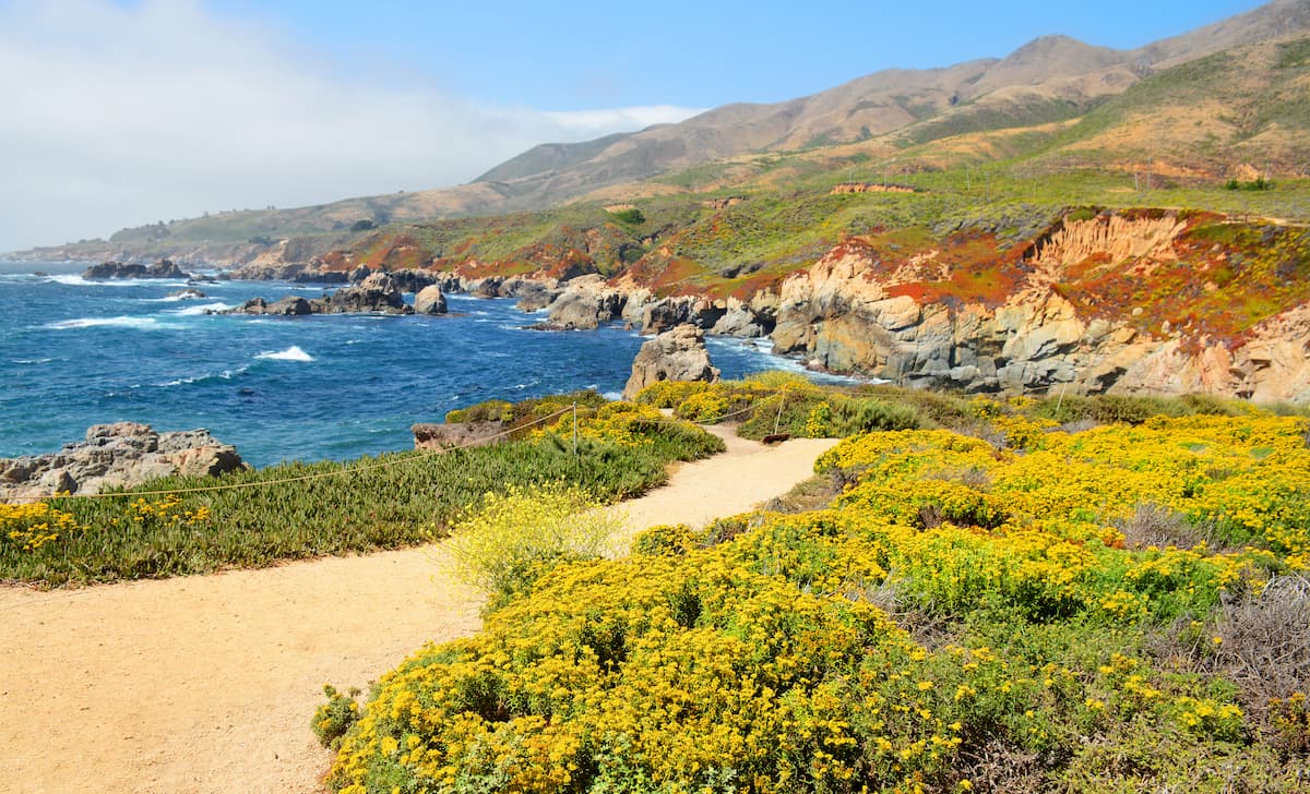
Within Central California, which occupies approximately the middle third of California between Monterey Bay and the northern part of San Luis Obispo County, there are 2 primary subranges: the Santa Lucia Range, which occupies the coastal portion of the region, and the Diablo Range to the east.
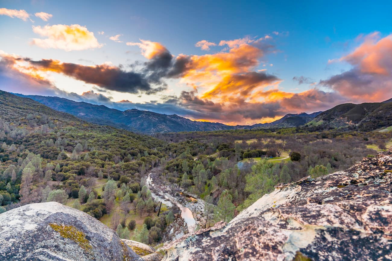
This includes the exceptionally popular Big Sur region, which is home to some of the most rugged sections of the Santa Lucia Range.
There are a number of major national protected areas in the region, such as:
San Luis National Wildlife Refuge
Bitter Creek National Wildlife Refuge
Meanwhile, popular state and regional recreation areas include:
Limekiln State Park
Hearst San Simeon State Park
Toro Regional Park
Garland Ranch Regional Park
San Antonio Reservoir Recreation Area
Southern California is by and large home to the biggest chunk of the California Ranges. Unlike the more northerly parts of the ranges, which are restricted mostly to the coastal areas to the west of I-5, in Southern California, the ranges extend as far east as the state's border with Arizona.
This region is a mix of chaparral in the north and the Sonoran Desert to the south. It includes a number of significant mountain ranges, such as:
Southern California also contains a fantastic mix of popular national parks, forests, and monuments, such as:
In addition to federally-managed recreation areas, Southern California has an array of state and regional parks, which are quite popular, including:
Finally, this section of the California Range is home to a truly spectacular array of wilderness areas, including some of the most popular wildernesses in California outside the Sierra Nevada.
Geologically, the California Ranges contain mountain ranges within 3 distinct sub-systems: the California Coast Ranges, the Transverse Ranges, and the Peninsular Ranges. Each of these mountain systems has a unique geological history which has resulted in the landforms that we see today.
The first of these mountain systems, the California Coast Ranges, technically extends from the north of California to Del Norte County to Santa Barbara County where they meet the Transverse Ranges. It includes ranges, such as the Santa Lucia Range, as well as others outside the California Ranges, such as the Northwest US Coast Ranges and the Klamath Mountains.

These ranges are made predominantly of Jurassic, Cretaceous, and Tertiary rock, which is mostly sedimentary in origin, though it shows evidence of widespread igneous intrusions. Parts of this range also include the Mesozoic-age Franciscan Formation, which is located throughout coastal central and southern California.
Just to the south of the San Francisco Bay Area, there were also sizable deposits of mercury, which was mined heavily, particularly around what is now Almaden Quicksilver County Park.
Folding and faulting also occurred throughout the region and some parts, such as the Santa Lucia Range, are actually part of the granitic Salinian Block, which is located between the Sur-Nacimiento and San Andreas Faults.
To the south of the California Coast Ranges is the Transverse Ranges, which is a system of ranges that stretch from northwest to southeast from Santa Barbara to Riverside County. They more or less go from Point Conception near Santa Barbara all the way to the Mojave Desert along the San Andreas Fault.
These ranges have a very complex geologic history. They formed as a result of significant tectonic activity in the region between the San Andreas Fault system, the Pacific Plate, and the North American Plate.
Within these ranges, which include the San Rafael Mountains and the Santa Monica Mountains, there are massive differences in geologic age and type, with respect to the regional bedrock. The San Gabriel and San Bernardino Mountains are home to the oldest rock in the Transverse Ranges, dating back to the Proterozoic, while the Santa Ynez Mountains are home to substantially younger miocene-aged limestones and dolomites.
The southernmost section of the California Ranges is home to the northernmost part of the Peninsular Ranges, which stretch all the way to the south of the Baja California Peninsula in Mexico. This includes the Santa Ana Mountains and the Temescal Mountains of Southern California.
For the most part, the mountains in this part of the California Ranges are Mesozoic-aged granites, some of which are part of the same batholith that produced the granites of the Sierra Nevada. Interestingly, the granites in this part of the state are a part of the Salinian Block, which is located to the west of the San Andreas Fault.
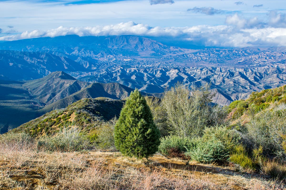
Despite covering a massive area, the California Ranges are home to only 3 distinct Level 3 ecoregions, each of which has its own unique flora and fauna. For the most part, the northern parts of the range are dominated by chaparral and oak woodlands while the southernmost sections are part of the Sonoran Desert.
Covering the vast majority of the range from the Bay Area to just north of Los Angeles, the aptly named Southern and Central California Chaparral and Oak Woodlands ecoregion is home to, well, chaparral and oak woodlands.
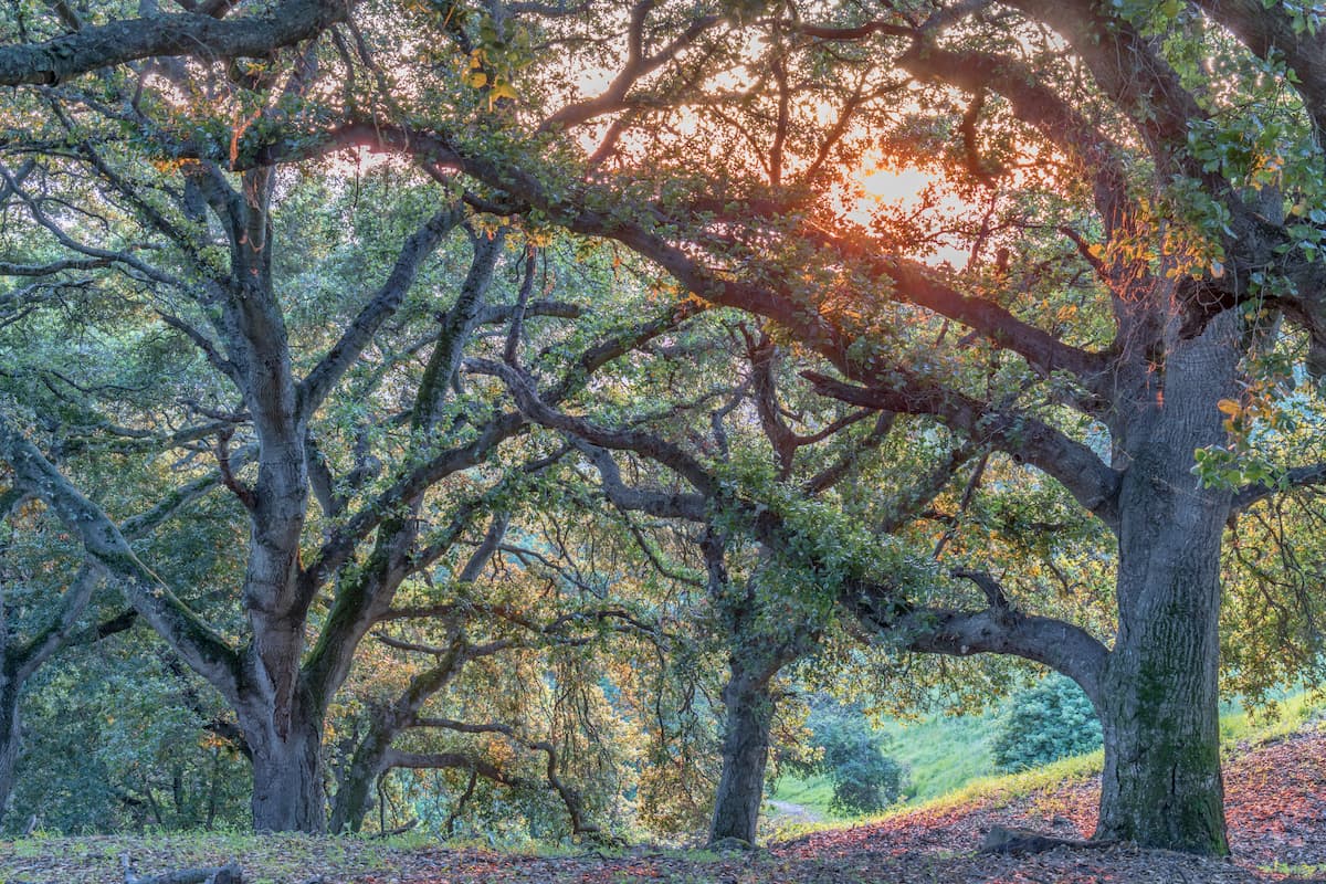
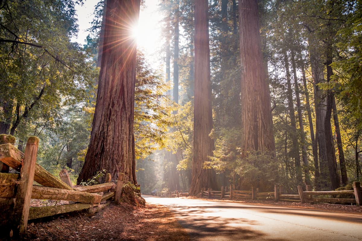
In addition to chaparral and oak woodlands, however, this part of the range also contains grasslands, coniferous forests, and even some coast redwoods, particularly around Big Sur. Scrub oak and grey pine are perhaps the most common tree species in the region, though Gowen cypress and Monterey cypress are sometimes spotted.
Wildlife in the region includes rosy boa, coast horned lizards, Santa Cruz kangaroo rats, and white-eared pocket mice.
Encompassing a very small sliver of the California Ranges around Los Angeles, the Southern California Mountains has a typical Mediterranean climate with hot summers and cool winters.
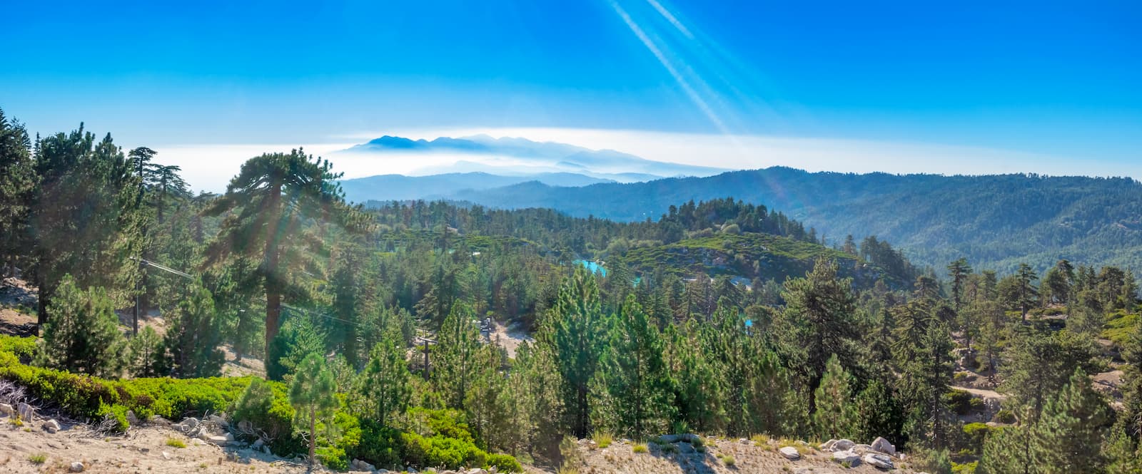
However, unlike the mostly chaparral and oak woodlands typically found in this type of climate, the Southern California Mountains are fairly high in elevation, which leads them to have some coniferous woodlands. This is particularly true on some southward facing slopes, which receive substantially more precipitations than their northern counterparts.
Common conifers in the region include Jeffrey pine, Coulter pine, ponderosa pine, sugar pine, Douglas-fir, white fir, limber pine, and even some lodgepole pine.
The easternmost part of the California Ranges is home to the Sonoran Desert and its associated ecosystems. This ecoregion extends far beyond the California Ranges into the states of Sonora and Baja California in Mexico within the Southwest Basins and Ranges.
It is technically classified as the hottest desert in Mexico, though the Mojave Desert to the north, which includes Death Valley, is the hottest in the United States.

Here, there is a surprisingly diverse array of flora and fauna, which have adapted well to this otherwise inhospitable environment. Although it grows in only a very small section of California, the saguaro cactus is endemic to the Sonoran Desert.
Other common succulents in the region include organ pipe, prickly pear, cholla, and hedgehog. In addition to cacti, creosote bush and indigo bush are common in the region.
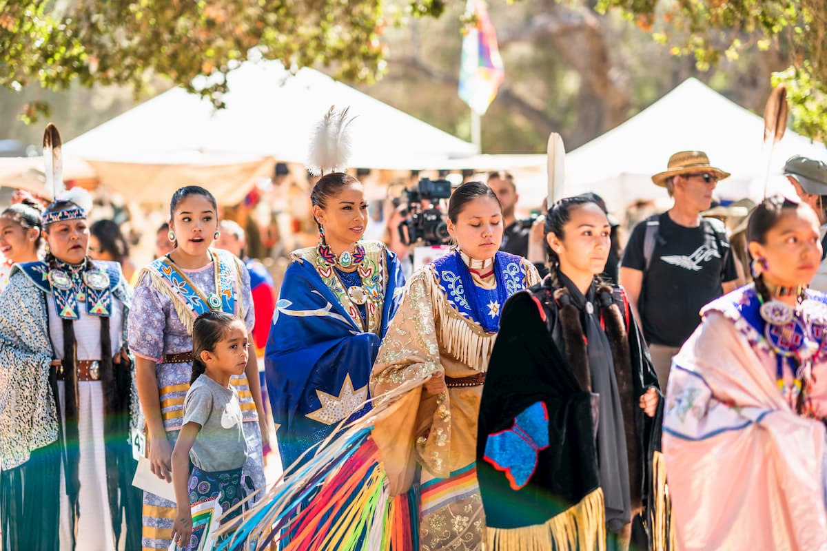
The region in and around the California Ranges has long been home to humans. Countless groups consider the region to be their ancestral homelands as humans have lived in coastal California and the Sonoran Desert for thousands of years.
Some of the many Indigenous peoples who have and continue to live in this region include the Ohlone, Ramaytush, Awaswas, Tamyen, Popeloutchom, Rumsen, Yokuts, Chalon, Salinan, Esselen, Chumash, Obispeño, Purisemeño, Ineseño, Ventureño, Barbareño, Serrano, Tongva, Fernandeño Tataviam, Newe, Cahuilla, Kumeyaay, Cocopah, Chemehuevi, Southern Paiute, and Payomkowishum, among countless others.
Among the earliest of the Europeans to visit the area was Juan Cabrillo of Spain, who sailed up the coast of California in the 1540s. However, the first European to extensively travel the region overland was likely Gaspar de Portola of Spain, who led an expedition throughout coastal California in the 1760s. Not long after, the then-governor of Alta California, Pedro Fages, led an army into the San Bernardino Mountains.
Soon enough, the Spanish started to establish missions throughout this part of California, which led to a long period of conflict, forced labor, and decimation of the Indigenous peoples of the region. After California became a part of the United States, the many ranchos that had been established throughout this period continued their agricultural and ranching tradition.
Various parts of the California Ranges experienced gold rushes over the centuries, including the San Bernardinos. Other parts of the range, including the Santa Lucia Range, experienced a substantial amount of logging as tanbark oaks were critical for the production of tanning agents for the leather tanning industry in the 1860s.
Over the last century or so, much of the California Ranges, however, have come under the purview of federal and state land managers. Much of the region is popular among outdoor recreationalists as a result of the establishment of the many national and state parks, forests, and monuments in the California Ranges.
Within the California Ranges, there are dozens of über-popular outdoor recreation areas. Here are some top places to check out!
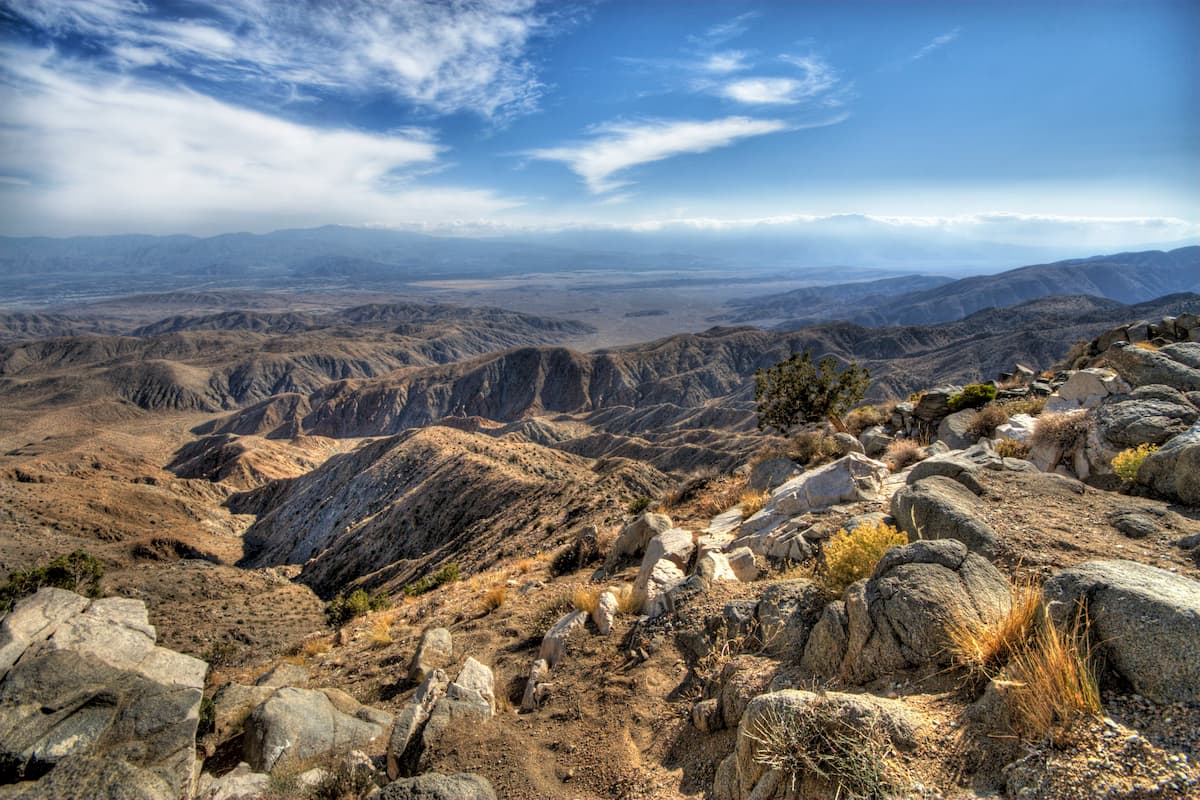
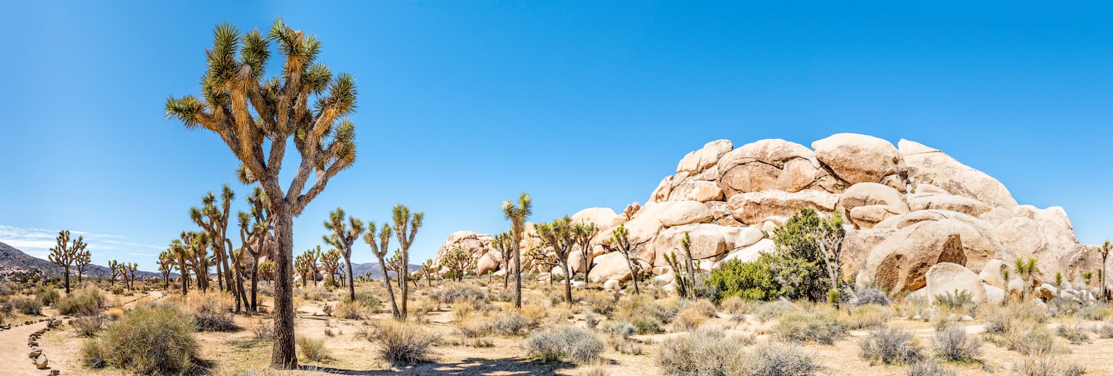
Located in the southeastern part of the California Ranges, Joshua Tree National Park is home to a desert landscape like no other. It contains 30 named mountains, the highest and most prominent of which is Quail Mountain.
Joshua Tree boasts some of the largest concentrations of Joshua trees in the world as well as some stunning rock formations. There are dozens of miles of hiking trails within the park, in addition to countless opportunities for off-trail adventuring.
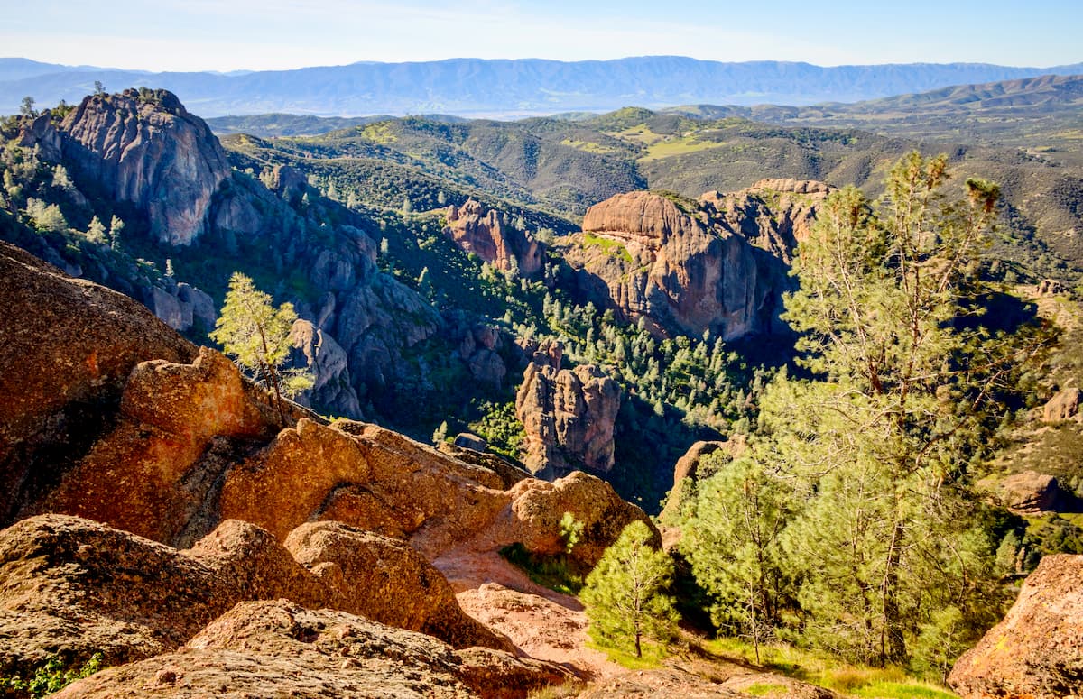
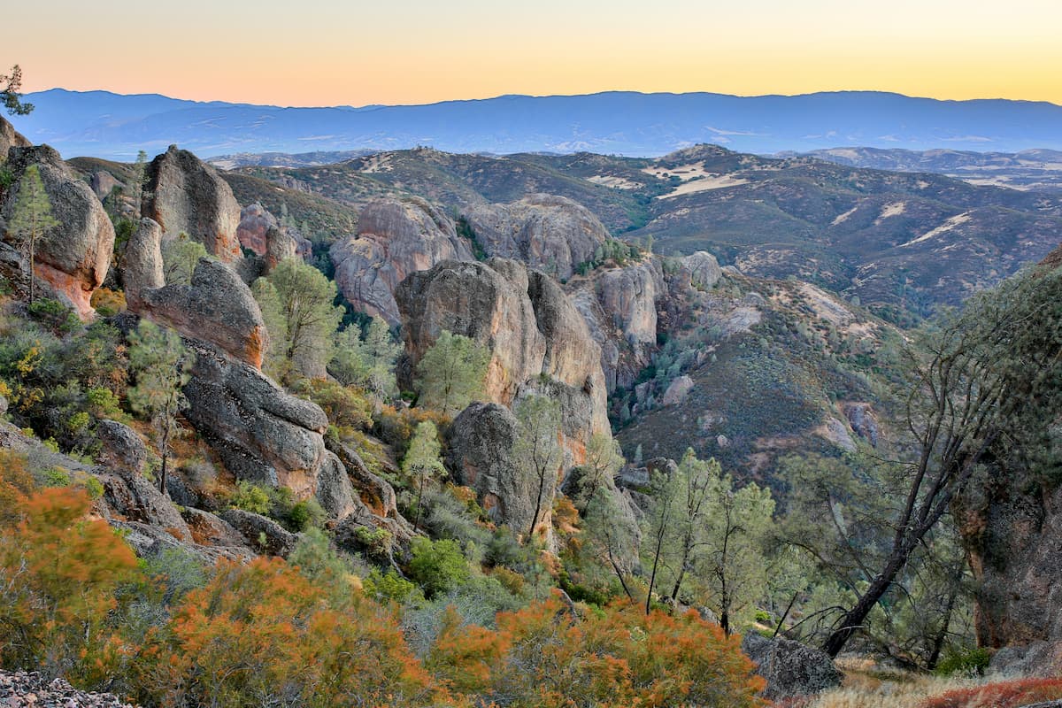
Pinnacles National Park is situated to the southeast of Monterey Bay near the town of Soledad in the northern-central part of the California Ranges. It contains 11 mountains, the highest and most prominent of which is North Chalone Peak.
Despite its small size, Pinnacles is home to some truly impressive rocky outcroppings, hence the name. There are plenty of great hiking opportunities within the park, including the popular High Peak Loop Trail. If you're lucky, you may even get to see the park's famous California Condors.
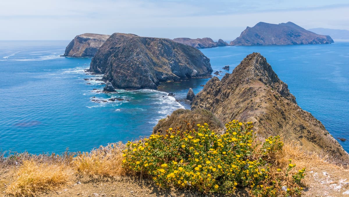
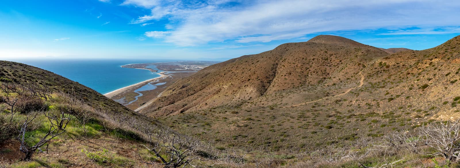
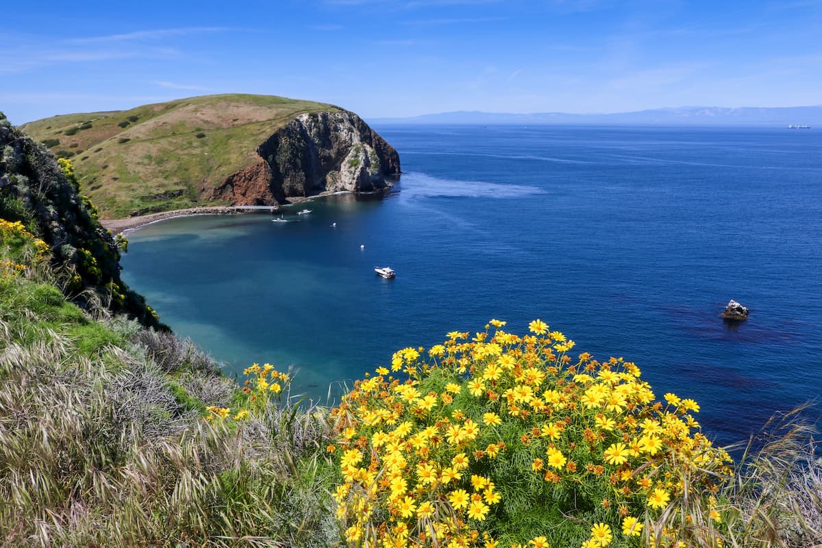
Channel Islands National Park is located off the coast of Santa Barbara. It contains 5 islands and 20 named mountains, the highest and most prominent of which is Devil's Peak.
While getting to the park can be a bit of a challenge, once you're at Channel Island, you can enjoy some fantastic hiking, camping, and kayaking opportunities. The islands are also home to a massive sea cave and some rugged coastline, which provide beautiful scenery for your adventures.
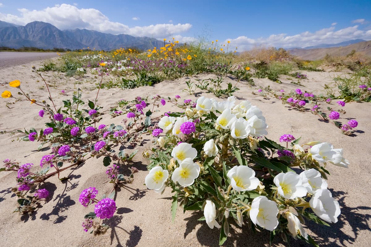
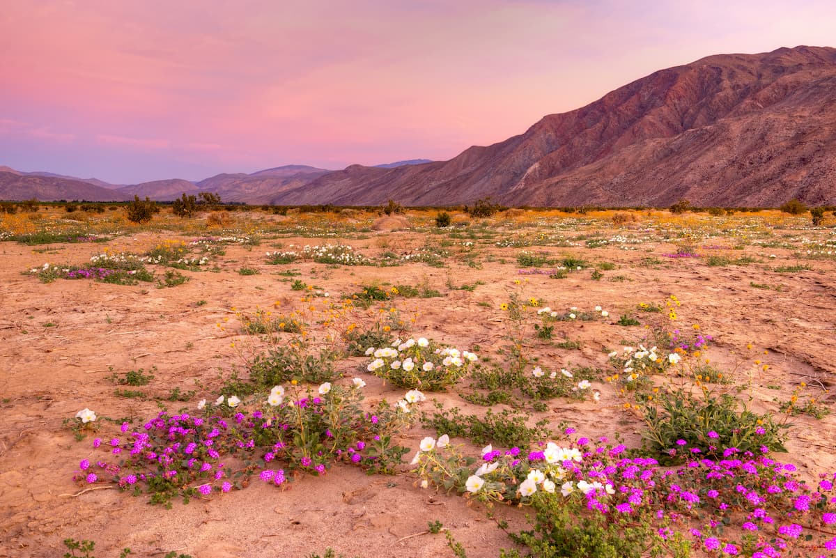
The largest state park in California, Anza-Borrego Desert State Park covers a massive swath of land in the southern part of the California Ranges. It contains 40 named mountains, the highest of which is Combs Peak, and the most prominent of which is Whale Peak.
The Pacific Crest Trail crosses through the Anza-Borrego Desert State Park, which makes it one of the first sections that thru-hikers complete when hiking from south to north. There are also dozens of other trails in the park, including the trails to Borrego Palm Canyon, Hellhole Canyon, and the Wind Caves.
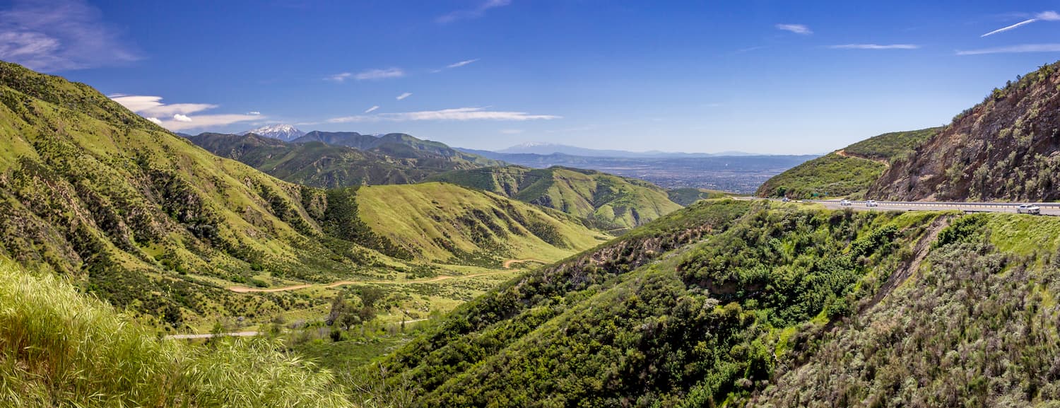
Los Padres National Forest is split into 2 sections, one of which contains much of the Santa Lucia Mountains in Big Sur, and the other of which contains the San Rafael Mountains, the San Emigdio Mountains, and the Santa Ynez Mountains. There are 120 named peaks in the forest, the highest and most prominent of which is Mount Pinos.
In particular, the northern part of the forest in Big Sur is one of the most popular hiking destinations in the state outside of the Sierra Nevada. Here, you can find the Ventana Wilderness, which offers excellent camping opportunities.
The California Ranges are located close to many of the state's major cities. Here are some of the best places to stay if you're visiting the region.
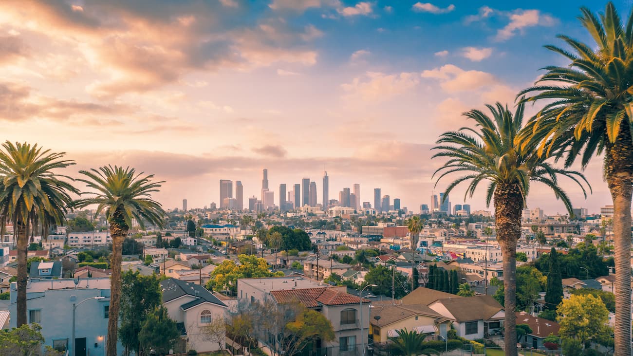
Los Angeles is home to over 4 million residents, which makes it the second most populous city in the US after New York City. It is situated in the southern part of the range near the San Gabriel Mountains.
LA has a major international airport as well as excellent road and train connections to the rest of California.
Nestled within the southernmost part of the California Ranges along the US' border with Mexico, San Diego is home to some 1.3 million people. It is a cultural center of the region as well as a transportation hub for Southern California. The city has a major international airport with good connections throughout the US and Mexico.

The 4th most densely populated city in the state of California, San Francisco is a bustling metropolis of some 900,000 people. It is located at the tip of the northernmost extent of the California Ranges near the northern edge of the Santa Cruz Mountains.
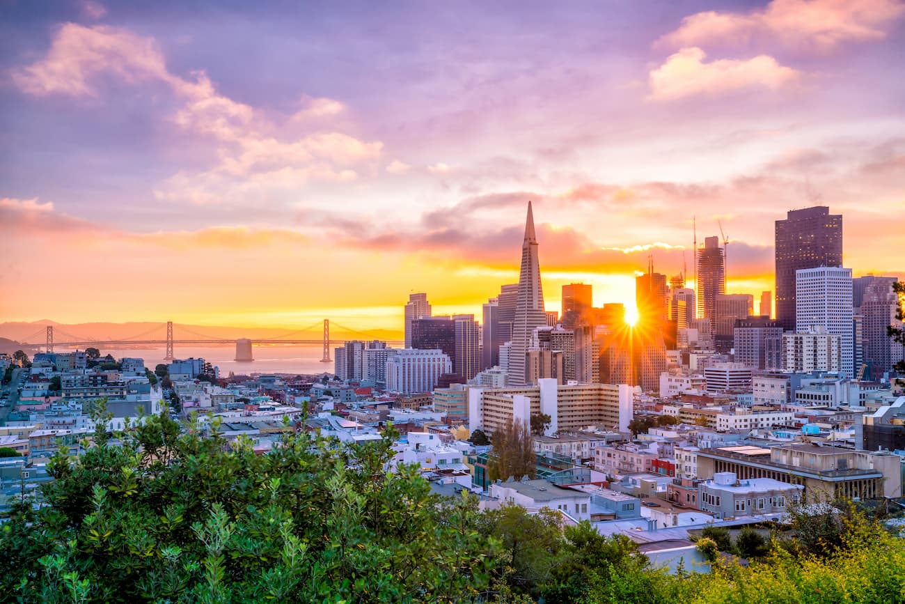
San Francisco is a cultural center for the region and it is a major transportation hub. The city can be accessed by road, train, and plane, thanks to its busy international airport.
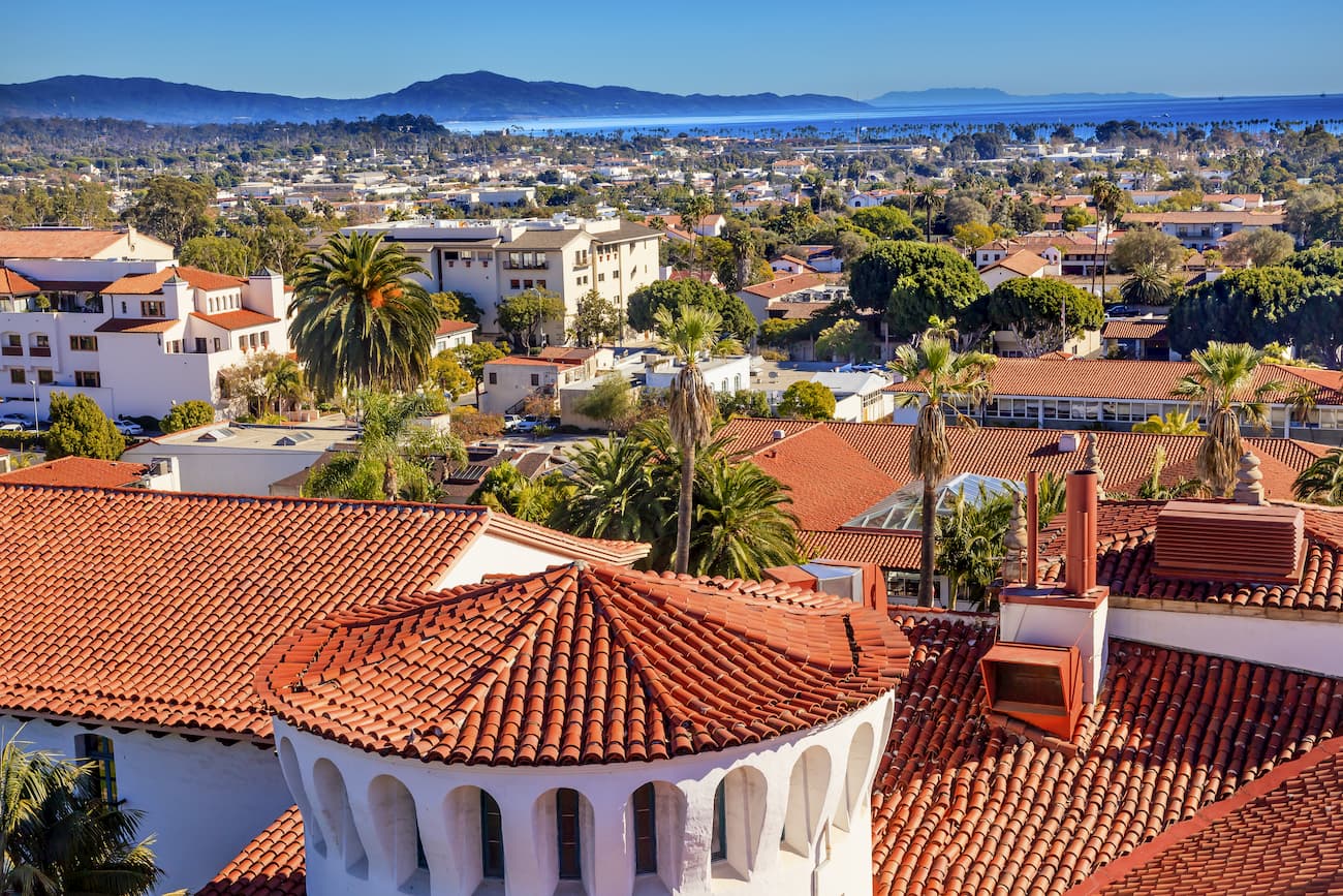
Located to the southeast of the San Rafael Mountains and to the north of Los Angeles, Santa Barbara is a city of some 90,000 people. The city is a popular tourist destination, thanks to its sandy beaches.
You can get to Santa Barbara by road, train, or even by plane as it has a small regional airport.
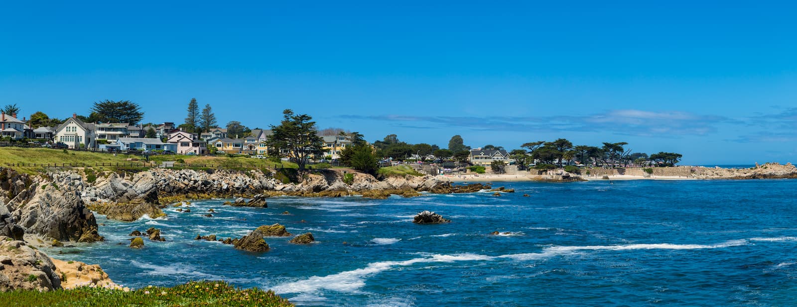
Situated just north of the Santa Lucia Range and the Big Sur coast, Monterey is a popular beach resort town that's home to nearly 30,000 people.
It is also home to the world-famous Monterey Bay Aquarium and it offers excellent access to the Los Padres National Forest. The city has a small regional airport as well as good connections to Highway 1.


ultra
san-bernradino-9-challenge
sierra-club-100
100-peaks-section-emblem
california-ultras
ultra
sierra-club-100
100-peaks-section-emblem
california-ultras
ultra
sierra-club-100
100-peaks-section-emblem
california-ultras
ultra
san-bernradino-9-challenge
sierra-club-100
100-peaks-section-emblem
california-ultras
ultra
sierra-club-100
100-peaks-section-emblem
california-ultras
The highest peak in the California Ranges is San Gorgonio Mountain, at 3,502 m.
The California Ranges have 2,221 named peaks.


