
Scan the QR code and open PeakVisor on your phone
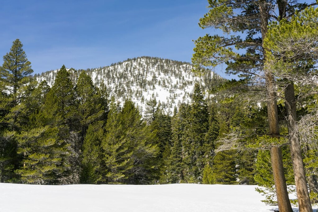
San Jacinto State Park serves as the pentacle of the San Jacinto Range. As the name suggests, the park encompassed the area surrounding Mount San Jacinto, southern California’s second highest peak next to San Gorgonio (11,490ft), which is visible from the summit. The San Jacinto Peak is a giant, often snow capped crag marked by great upthrusts of weathered granite and is the highest point in the California state park system. The park is surrounded by the San Bernardino National Forest and part of the Santa Rosa and San Jacinto Mountains National Monument. The San Bernardino, San Jacinto, and Santa Rosa ranges that surround and encompass the park as all part of the larger Southern California Peninsular Ranges system. This 14,000-acre park offers over 50 miles of trails in the mountains soaring above the Sonora desert. The park is only 2 hours away from both Los Angeles and San Diego and offers 2 drive up campsites, as well as a number of backcountry campsites for day hikers and Pacific Coast Trail through hikers alike.
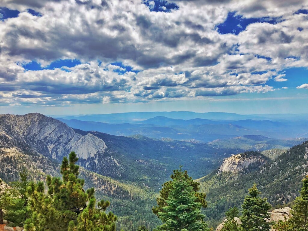
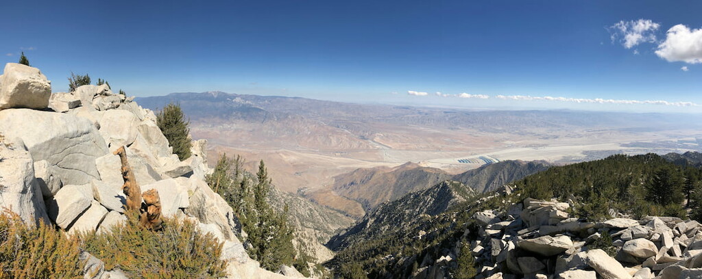
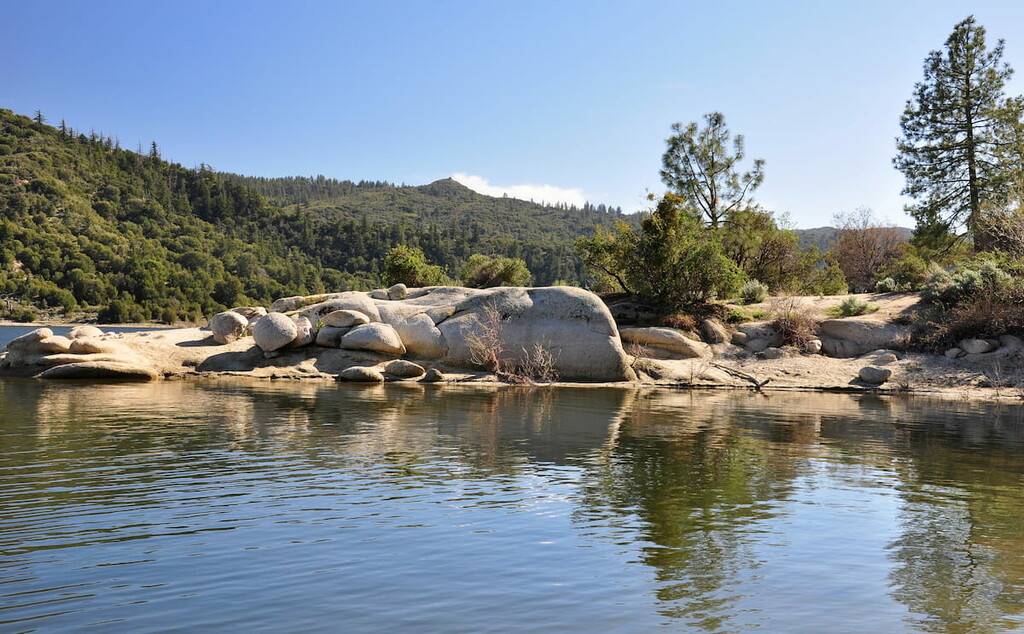
The park draws in hikers for a number of reasons including, its amazing flora and fauna, its distinct lack of noise or air pollution, and its amazing views of every part of southern California including; extensive desert landscapes, views of the Angeles and San Bernardino Mountain ranges (among others), the Salton Sea, and on a clear day you can see far out into the Pacific Ocean to the Channel Islands, and even catch a glimpse of the city of Los Angeles over 100 miles away.
You will also see a number of notable mountain peaks on your hikes through the Mount San Jacinto State Park including; San Jacinto Peak (11,490ft), Cucamonga Peak (8865 ft), Mount San Antonio (10,066 ft), Sugarloaf Mountain (9938 ft), Heart Bar Peak (8330 ft), Ralston Peak (4557 ft).
This 14,000-acre park can be reached via Highway 243 from Idyllwild or by tram from Palm Springs. Coming from Los Angeles you will follow either Interstate 10 or highway 60 until you reach Banning, where you will take exit 100 for 8th street. You will then get on highway 243 which will take you into the park. After climbing the mountains into the park you will take a left on Forest Route 4S02 and follow signs for the state park.

From San Diego you will take Interstate 15 to highway 79 at exit 58. You will eventually turn left of highway 371 before connecting to highway 74 (another left) and eventually connect to highway 243, which enters the park from the opposing south side compared to Los Angeles’ north entry. Again turn on Forest Route 4S02 and follow signs for the state park.
Once you enter the state park you can buy a day pass for your visit there.
Mount San Jacinto State Park has 2 developed campgrounds accessible from Highway 243.
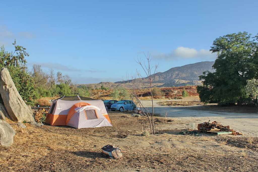
The Idyllwild Campground is located in the town of Idyllwild and within walking distance of many shops and restaurants. It offers amenities like full hook-up and electric campsites, flush toilets, and coin-operated showers. The Idyllwild Ranger Station (park headquarters) is conveniently located at the campground entrance.
The Stone Creek Campground is located about 5 miles north of Idyllwild on Highway 243. Although it offers electric campsites (no full hook-ups), it is a little more primitive as it only has vault toilets and no shower facilities.
Developed Camping Fees: Day Use: $10.00, Tent Site: $25.00/night, Site with Electric: $35.00/night, Site with Full Hook-Ups: $45.00/night, Additional Vehicle: $10.00, ReserveCalifornia.com Reservation Fee: $7.99.
The Idyllwild campground is open year-round with 28 sites total (tent, electric, full hook-up sites, and ADA-accessible sites available), Water spigots, flush toilets, coin-operated showers, picnic tables, fire rings and/or barbeques, day-use picnic area, amphitheater, nature trail.
RV’s and cars are welcome at this site with the following limitations; maximum trailer length: 24 feet, maximum vehicles: 2, maximum occupancy: 8. The Check-in time at this campground is 2:00 PM, and the check-out time is 12:00 PM. You can reserve a spot at; ReserveCalifornia.com
The Stone Creek Campground, closer to the trailheads of the state park are open seasonally in Spring/Summer/Fall depending on snowfall and access. There are 44 sites total (tent, electric, and ADA-accessible sites available; no full hook-up sites), Water spigots, vault toilets, picnic tables, fire rings and/or barbeques, day-use picnic area, amphitheater, nature trail. RV’s and cars are welcome at this site with the following limitations; maximum trailer length: 24 feet, maximum vehicles: 2, maximum occupancy: 8. The Check-in time at this campground is 2:00 PM, and the check-out time is 12:00 PM. You can reserve a spot at; ReserveCalifornia.com
You can also camp at the Marion Mountain Campground, which is located just outside of the San Jacinto State Park, but has access to the popular Marion Mountain Trail, which leads to other portions of the local trail network including the strenuous 5 mile hike to San Jacinto Peak at 10,834 feet elevation.
Marion Mountain Campground is open from late May through mid November and consists of 25 individual campsites (16 reserved and 9 first-come-first-serve sites). Located approximately 50 miles southeast of San Bernardino and 7 miles north of Idyllwild, the facility is in an alpine forest of pine, cedar, and oak trees at 6,400 feet elevation. Many of the campsites offer panoramic views of sunsets and the surrounding mountain ranges.
Additional recreation opportunities include lookout towers, scenic overlooks, OHV roads, rock climbing, horseback riding, mountain biking, fishing, picnic areas and a nature center. Each campsite has a picnic table and a campfire ring with a grill. Roads and campsite parking spurs are paved. Other amenities include water faucets, trash receptacles and restrooms with vault (pit) toilets. Firewood, restaurants, shops, gas stations and other facilities are available 7 miles south in the town of Idyllwild.
To reserve a spot you can call 1-877-444-6777 or visit www.recreation.gov. Reservations can be made as early as 6 months in advance or at least 3 days in advance of camp date.
The fees for these sites are $10 per night (includes 1 vehicle) and $5 each additional vehicle payable at the campground. The fee allows for a maximum of 8 people per campsite and entry for one motor vehicle and one legally towed vehicle. A Maximum of two cars may be parked in each parking spot. Parking off the pavement, in unoccupied parking spurs or on the campground road is prohibited. Additional free parking is available 1/4 -mile outside the campground at the Marion Mountain Trailhead parking area.
Additional considerations include: Potable water may not be available. Dogs are allowed but must be on a leash or otherwise secured at all times. There are no refunds for inclement weather. When allowed, all wood and charcoal fires must be contained in the campfire rings provided. Use of portable charcoal barbecues is not permitted. Fire restrictions may be imposed at any time due to hot, dry weather conditions, at which time all wood and charcoal fires will be prohibited. For current fire conditions or weather closures contact the Idyllwild Ranger Station at 909-382-2921.
There are four (4) primitive wilderness campgrounds in Mount San Jacinto State Wilderness. Because these campgrounds are remote and are only accessible by foot, the hearty backpacker will gain a true sense of peace and solitude.
The San Bernardino National Forest has a similar permit system in effect for its federal wilderness area known as the San Jacinto Wilderness. Both the State Park and National Forest honor each other's DAY USE PERMITS; however, each agency has its own camping permit system that you must apply for separately.
There is no dispersed camping in the State Wilderness. All campers must have a Wilderness Camping Permit issued by Mount San Jacinto State Park in their possession and camp in a designated wilderness campground. To both prevent overuse and to provide everyone an opportunity for solitude, carrying capacities have been established for these wilderness campgrounds.
Wilderness Camping Permits are $5.00 per person and are available at the Idyllwild Ranger Station or Long Valley Ranger Station. You may also apply for a Wilderness Camping Permit in advance by printing and mailing the following application: Wilderness Camping Permit. Wilderness Camping Permit applications will be accepted up to 56 days (8 weeks) in advance. It is important to mail your permit application in at least 14 days prior to your camping dates. No telephone, fax, or email requests will be accepted. Summer is the busiest time for the park, and these wilderness campgrounds can fill to capacity four (4) or more weeks in advance. Campers who do not have reservations may be turned away if these campgrounds are full.
Wilderness rules and regulations include; all hikers must possess State Wilderness camping permit, hikers must camp at designated campsite, no more than 15 people per campsite, no fires, no smoking, no dogs, no firearms, bows, or slingshots, no mechanical/motorized devices, hikers must pack out all trash and belongings.
Round Valley: Open year-round, 19 primitive sites total, water spigot (must be filtered/purified, may run dry), vault toilets, maximum occupancy per site: 15.
Tamarack Valley: Open year-round, 8 primitive sites total, vault toilets, maximum occupancy per site: 15.
Little Round Valley: Open year-round, 6 primitive sites total, vault toilets, maximum occupancy per site: 15.
Strawberry Junction: Open year-round, 3 primitive sites total, vault toilets, maximum occupancy per site: 15.
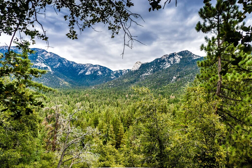
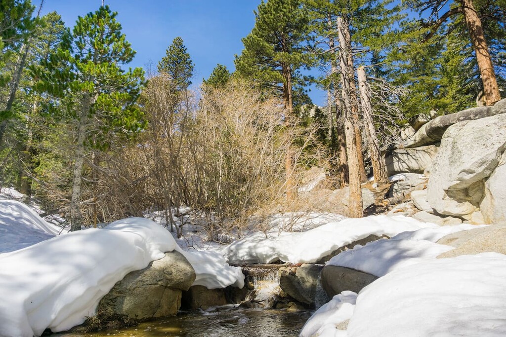
There are a number of trails leading up to the summit of San Jacinto, as well as around the surrounding wilderness. While many hikers prefer to tackle a San Jacinto summit hike, you can also follow a number of shorter hikes through the lower valleys. The Pacific Crest Trail also makes its way through the park and intersects with a number of other trails.
The Marion Mountain Trail is the shortest route up to San Jacinto’s summit. Starting at the Marion Mountain Campground the trail climbs almost 5000 feet over about 6 miles. The trail follows the western edge of Marion mountain and intersects the Pacific Crest trail around the halfway point. Via this trail you will come upon the Little Round Valley Backcountry site over the ridge. As you get closer to the peak you will also see a stone backcountry cabin available to hikers. You can extend this hike around the eastern portion of Marion mountain to lengthen the trip to about 17 miles, or do a simple in and out hike, which will run about 12 miles total.
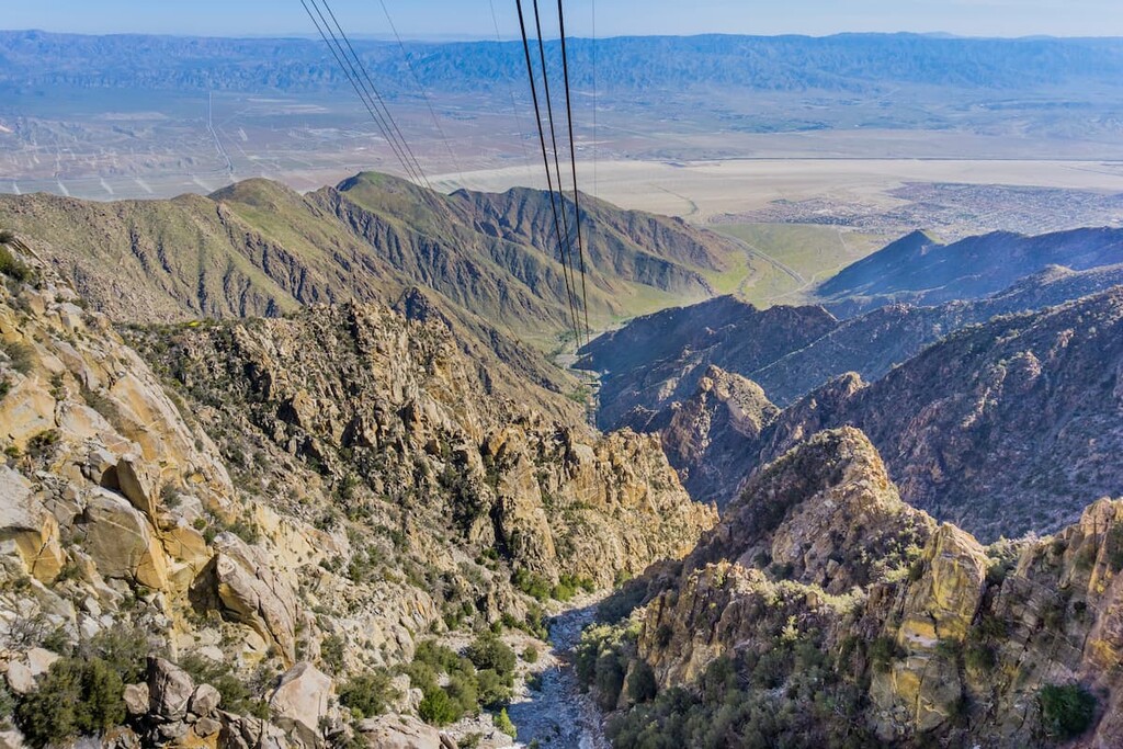
Taking the tram from Palm Springs up to the ridge and hiking further into the State Park is arguably the most popular way to reach the San Jacinto Peak. There are a number of campsites on this trip to the peak and a couple of routes up depending on how you are traveling. If you are snowshoeing, you can follow the backcountry snowshoeing route that goes through a number of backcountry campsites and is about 11 miles in and out. You can also take the longer hiking route that goes around the campsite area and closer to Jean Peak. An in and out for this route would be about 12 miles.


ultra
sierra-club-100
100-peaks-section-emblem
california-ultras
ultra
sierra-club-100
100-peaks-section-emblem
california-ultras


