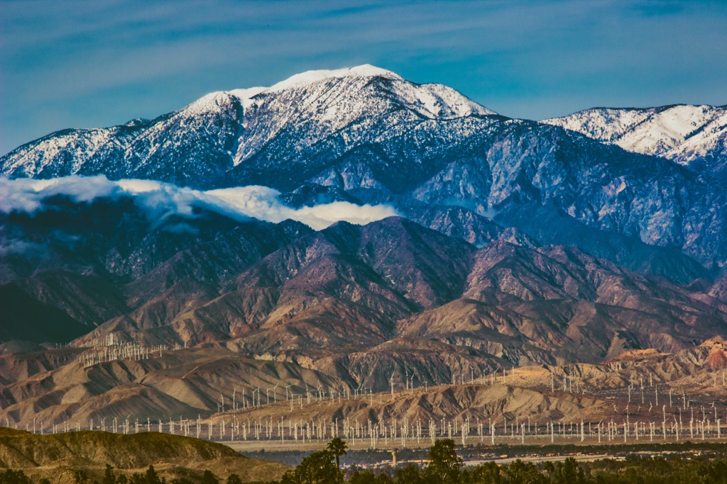
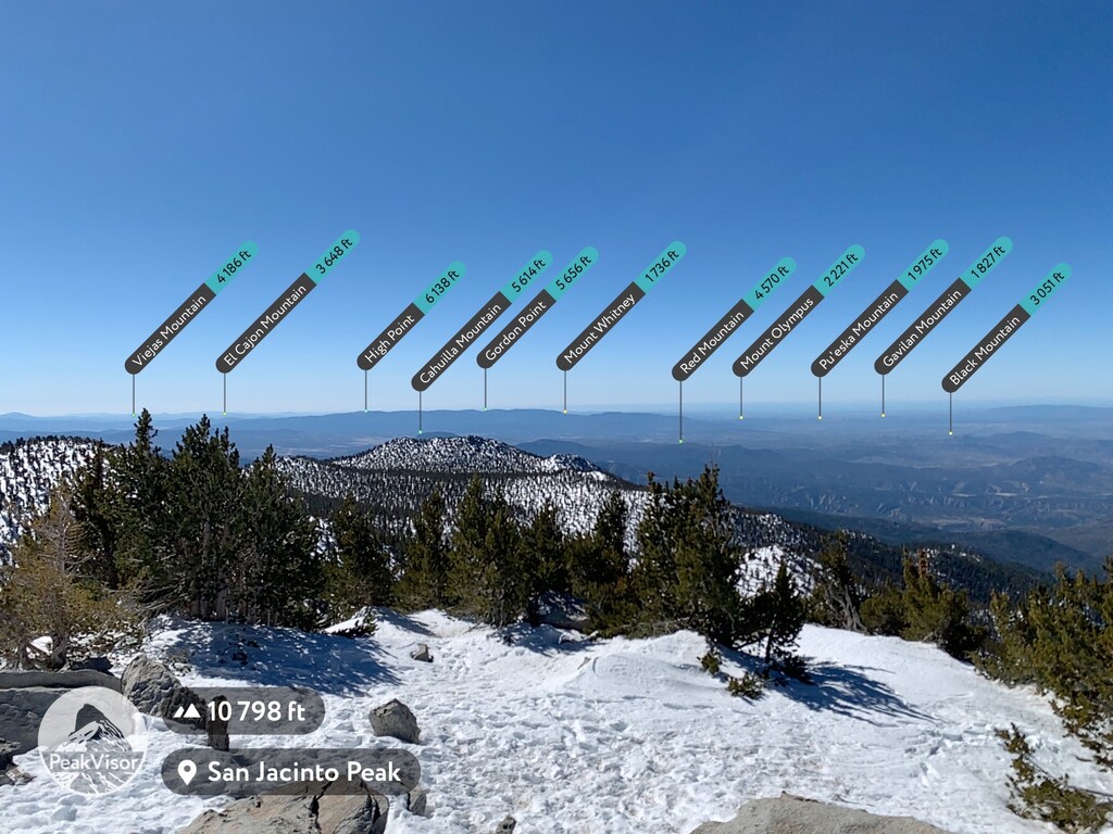
San Jacinto Peak, located in Riverside County, California, is the highest peak in the San Jacinto Mountains and the most topographically prominent peak in Southern California. This majestic peak stands 10,834 feet (3,302 m) tall and is a popular destination for hikers and mountaineers. The peak is part of the San Jacinto State Park.
The area around San Jacinto Peak has a rich history. According to local legend, the Cahuilla Native Americans believed the peak was home to the spirit of their ancestor, Dakush.
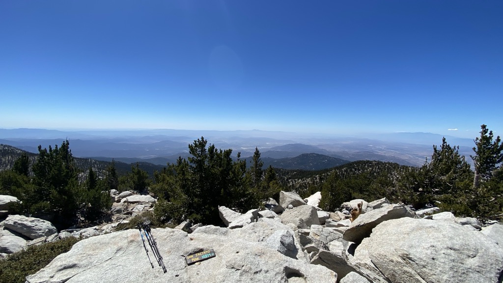
Hiking to San Jacinto Peak in California is one of the most rewarding and beautiful hikes in the state. The trailhead for the San Jacinto Peak hike starts from Valley Station on the Palm Springs Aerial Tramway. From there, one can easily climb the mountain face via trails. From the top, hikers will be treated to stunning views of the Coachella Valley and the Salton Sea.
No matter how you choose to experience San Jacinto Peak, you're sure to be in awe of its beauty and history. So, if you're in Southern California, make sure to add this majestic peak to your list of must-see sights.
There's a hiking trail (T1) called San Jacinto Peak Trail leading to the summit.
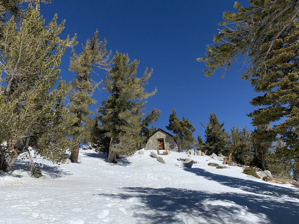
The nearest mountain hut is null located 160m/524ft SE of the summit.
By elevation San Jacinto Peak is
# 4 out of 2181 in the California Ranges # 1 out of 11 in Mount San Jacinto State Wilderness # 1 out of 203 in Riverside County # 1 out of 11 in Mount San Jacinto State Park # 1 out of 69 in the San Jacinto Mountains
By prominence San Jacinto Peak is
# 1 out of 2181 in the California Ranges # 21 out of 91437 in USA # 3 out of 7926 in California # 1 out of 11 in Mount San Jacinto State Wilderness # 1 out of 203 in Riverside County # 1 out of 11 in Mount San Jacinto State Park # 1 out of 69 in the San Jacinto Mountains
We use GPS information embedded into the photo when it is available.
3D mountains overlay
Adjust mountain panorama to perfectly match your photos because recorded by camera photo position might be imprecise.
Move tool
Rotate tool
Zoom
More customization
Choose which peak labels should make into the final photo and what photo title should be.
Next
Photo Location
Satellitte
Flat map
Relief map
Latitude
Longitude
Altitude
OR
Latitude
°'''
Longitude
°'''
Apply
Register Peak
Peak Name
Latitude
Longitude
Altitude
Register
Teleport
PeakVisor
This 3D model of Sagarmatha National Park in Nepal was made using the PeakVisor app topographic data. The mobile app features higher precision models worldwide, more topographic details, and works offline. Download PeakVisor maps today.
Download OBJ model
PeakVisor
The download should start shortly. If you find it useful please consider supporting the PeakVisor app.
PeakVisor for iOS and Android
Be a superhero of outdoor navigation with state-of-the-art 3D maps and mountain identification in the palm of your hand!