
Scan the QR code and open PeakVisor on your phone
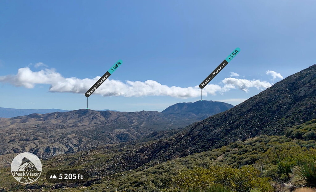
Santa Rosa Wilderness has 5 named peaks. The highest is Rabbit Peak at 2,028 m. Other notable peaks include Peak 6582, Martinez Mountain and Sheep Mountain.
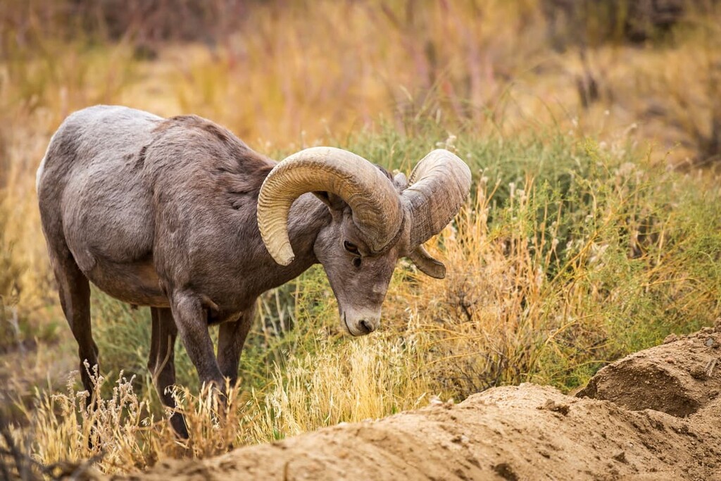
Home to one of the largest herds of Peninsular bighorn sheep in the world as well as some stunning mountain and desert landscapes, the Santa Rosa Wilderness is a federally-protected region located in the southern part of the US state of California. The wilderness contains 5 named mountains, the highest of which is Rabbit Peak (6,654ft/2,028m), and the most prominent of which is Martinez Mountain (6,555ft/1,998m)
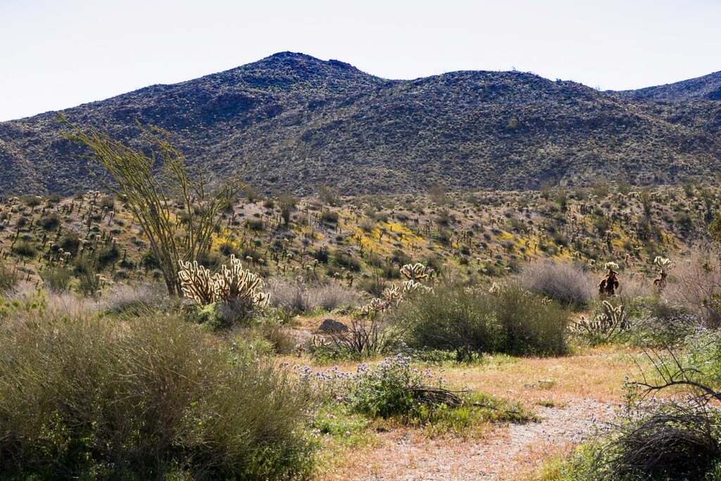
The 72,259-acre (29,242 ha) Santa Rosa Wilderness is a dynamic, beautiful blend of desert and mountain environments that form a unique riparian environment just south of Mount San Jacinto State Park in California’s Riverside County.
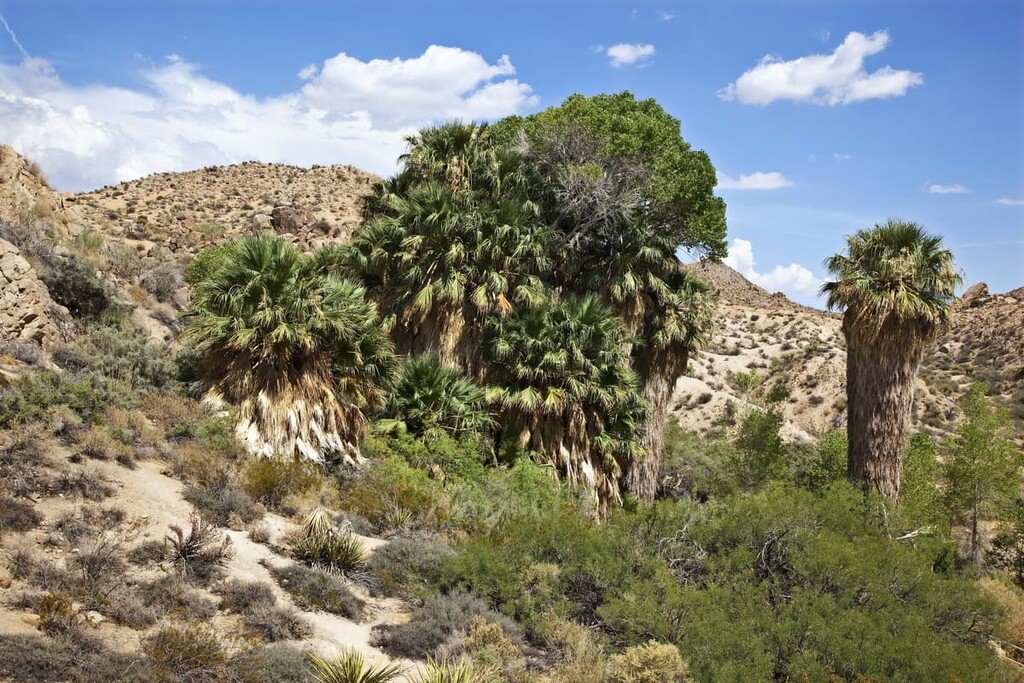
Strewn with boulders, the steep canyon walls of the Santa Rosa have been eroded by springs and streams and explode with color from the local flora mixed with the geological formations of the region. The wilderness is home to Bear Creek Oasis, Lost Canyon Oasis, Guadalupe Canyon, Devil Canyon and Rockhouse Canyon, and supports the largest herd of Peninsular bighorn sheep in the United States.
Although it is located within driving distance of two of California’s largest cities—Los Angeles and San Diego—the Santa Rosa Wilderness is situated near a slew of different outdoor recreation destinations and protected areas.
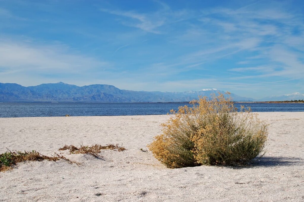
This includes Santa Rosa and San Jacinto Mountains National Monument, Joshua Tree National Park, Mecca Hills Wilderness, and Orocopia Mountains Wilderness to the north. Furthermore, the wilderness is located just north of the Anza-Borrego Desert State Park and the Santa Rosa Mountains State Wilderness, to the east of the Beauty Mountain Wilderness, and to the west of the Salton Sea.
The Santa Rosa Wilderness is currently jointly managed by the Bureau of Land Management (BLM) and the US Forest Service. Parts of the wilderness are included within the San Bernardino National Forest while other parts are situated within the Santa Rosa and San Jacinto Mountains National Monument.
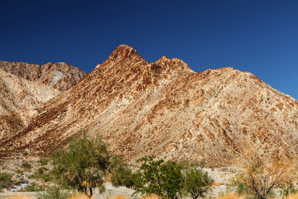
Santa Rosa’s rugged terrain is formed by uplifted blocks of igneous and metamorphic rocks that have been thrust up by the competing fault zones of the San Andreas and the San Jacinto, which trend northwest-southeast and are part of the Peninsular Ranges that extend from Southern California to Baja, Mexico. Perennial streams erode the steep-walled canyons and support large fan palm oases.
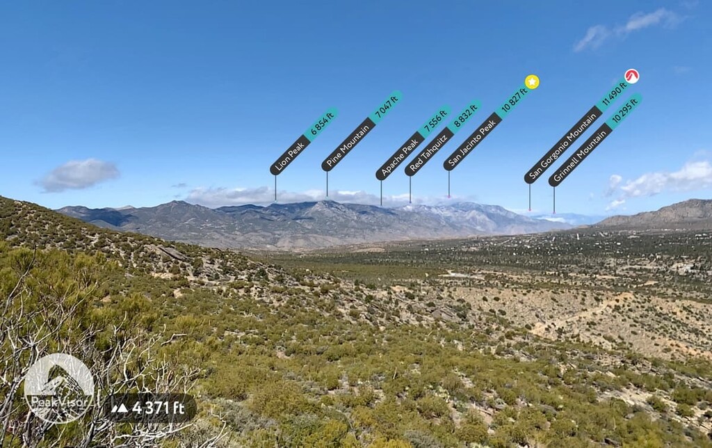
Major peaks within the wilderness include Rabbit Peak, Martinez Mountain, Sheep Mountain, and Buck Ridge.
The Santa Rosa Wilderness is an example of a stark Colorado Desert habitat. You will find agave, ocotillo, and creosote bush, in the lower regions and as the canyons rise up you will see chaparral landscapes, with juniper, and pine-covered ridges.
Native rare plants in the Santa Rosa Wilderness include shrubs such as Santa Rosa sage and Nuttall's scrub oak. Perennial herbs include Santa Rosa Mountains leptosiphon and triple ribbed milkvetch.
The Santa Rosa Wilderness supports the largest herd of Peninsular bighorn sheep in the country who utilize the entire range between 1,000 to 4,000 feet in elevation. The Bighorn Institute estimates approximately 60 adult sheep live in the Santa Rosa Mountains of the total population of 800 sheep in the Peninsular Ranges north of Mexico.
Peninsular Range bighorn sheep are under the California Endangered Species Protection Act and the Endangered Species Act. Bear Creek, Deep Canyon and Martinez Canyon are especially important as they are summer concentration areas for the species and as they provide the rugged escape terrain necessary for lambing.
The wilderness is also home for mule deer, which can be found throughout the mountainous coniferous forests at the higher elevations of the range, as well as great horned owls, prairie falcons and golden eagles, which nest and forage throughout the entire wilderness. Reptiles, including frogs, toads and the desert slender salamander also live in this desert setting.
As with all desert landscapes in the southern California region, rattlesnakes call this wilderness home so be sure to watch where you step. These misunderstood creatures are an important part of the ecosystem and don’t want to harm you, but it is your job to keep an eye out for them.
The Santa Rosa Mountains are the ancestral homeland of the Cahuilla Band of Indians and archeological evidence links the tribe to this area for at least 3,000 years. Both Santa Rosa Peak and nearby Tahquitz Peak are considered sacred sites for the Cahuilla and there is evidence of ancient Cahuilla villages throughout the wilderness.
Generally, these villages were located in or near the mouth of a canyon or in a valley, and in some instances there were both summer and winter villages with the former being at higher elevations and the latter closer to the valley floor. A network of trails connect village sites, campsites, and other areas of importance.

The Cahuilla lived in the Santa Rosa area until the late 19th century when they were forcibly moved to nearby reservations or the Coachella Valley. Many Cahuilla archeological sites are part of the National Register of Historic Sites. The Bureau of Land Management outlines the Cahuilla archaeological sites as the following:
Other major cultural and archaeological sites in the wilderness include:
The Cactus Spring area is one of the most sacred areas for the Cahuilla who lived in the desert, and one of the last ones untouched by urban development. It contains the site Wehghett, the "Place of Ponderosa Pines," an important village, and a lower village called Tevutt, "The Place of the Pinyon Trees."
The area is mapped as Little Pinyon Flat. Both sites contain many bedrock mortar grinding places, smooth rock floors where people used to dance, as well as pictographs and petroglyphs. Four important ancient trails go from here to the west, northeast, southeast, and southwest. Some of the trails are worn two feet deep in places.
Cahuilla elders and others recently mounted a campaign to have this area included in the Santa Rosa Mountains State Wilderness in Anza Borrego-Desert State Park protected and urged that letters be written to Congressmen and Senators in support of such action.
This canyon is important in the Cahuilla sacred literature as the home of Yellow Body, a group of people who gave a second fiesta for growing girls. This they did to teach them all the things that they should know about their own bodies.
They were given a course of treatment which was to keep them from certain kinds of sickness which could come at the present time and in later years and they were given different kinds of bitter herbs to drink.
Along what was the falling shoreline of ancient Lake Cahuilla is a series of fish traps made of rocks that were built by the Cahuilla about 400–500 hundred years ago. When the Colorado River changed its course, the huge freshwater lake began to dry up. This process took 50 to 60 years according to current estimates.
When the lake became too saline to support the growth of the fish they died by the thousands. The Cahuilla built the fish traps to catch the fish as the waters receded, which extended for some distance along the shoreline. These fish traps are listed on the National Register of Historic Places.
The wilderness was designated in 1984 and is overseen by the US Bureau of Land Management as part of the California Wilderness Act, which placed it under joint management of the BLM and the US Forest Service. The wilderness is part of both the San Bernardino National Forest, as well as in the Santa Rosa and San Jacinto Mountains National Monument, which was established in October 2000, through Congressional legislation. It was then expanded in 2009 under the Omnibus Public Land Management Act.
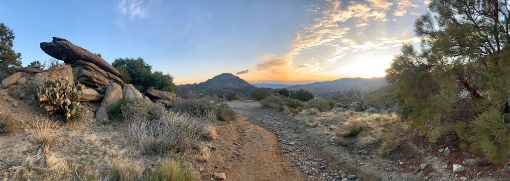
The trails of Santa Rosa are open to backpackers, day hikers and horseback riders, and dogs are welcome on the trails. The trails navigate up and down steep mountains, thread through the desert valley, and discover a variety of oases and waterfalls that the wilderness is famous for.
Here are some of the best hiking areas to check out in the wilderness during your next trip:
The Sawmill Trail is a perfect day hike for beginner hikers who want a challenge. The trail is an approximately 10 mile (16 km) long out-and-back trail along a truck trail road that climbs 2,427 feet (740 m) over the course of 5-miles before descending that same amount.
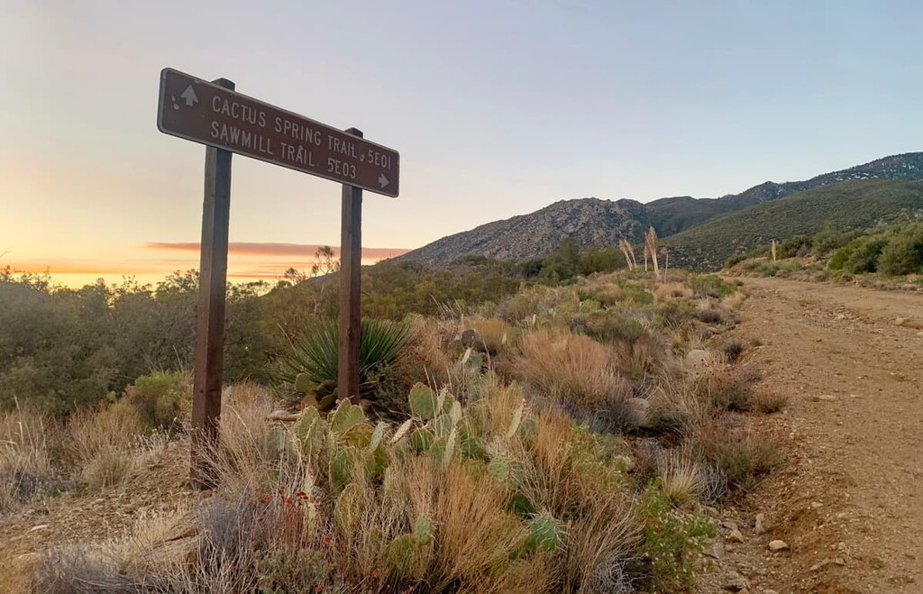
The entrance to the trail is easy to find and branches off from the Cactus Springs Trail near the entrance of the park and climbs up the canyon towards Santa Rosa peak without actually summiting it.
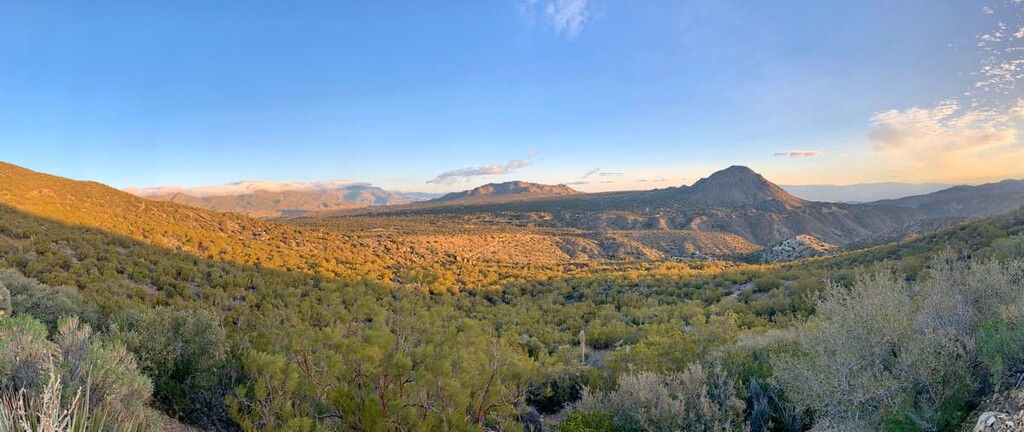
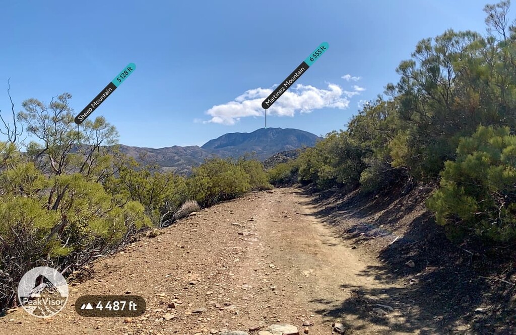
As you climb up, you will get spectacular views of the Santa Rosa and San Jacinto Mountains National Monument, as well as Mount San Jacinto State Park, the peak of San Gorgonio, and the San Bernardino National Forest on a clear day. You will also get great views of Sheep Mountain, Martinez Mountain, and the desert valley of Santa Rosa below.
The primary access into the interior of the wilderness is the 9.5 mile (15.3 km) long Cactus Spring Trail (5E01). From Highway 74, across from the Pinyon Flats Campground, take the road south to the designated parking area (also for Sawmill Trail), just before the Pinyon area Riverside County Transfer Station.
Take the access trail on the east end of the parking area and look for the trailhead sign. To enter the Santa Rosa Wilderness register at the sign-in box a short way beyond the trailhead sign, this is your wilderness permit. A high desert trail, it begins in Pinyon Flat at 4,000 feet (1,219 m) descending 2.5 miles (4 km) to Horsethief Creek then continuing 2 miles (3.2 km) to the spring that is difficult to find, the trail is fairly easy to follow to this point.
If you like you can extend your trip to incorporate the Martinez Canyon Trail, which eventually connects to Highway 86. This section of the trail is less popular and is located in the low desert and may be very difficult to follow. Much of the trail is within the Santa Rosa and San Jacinto Mountains National Monument, but if you want to continue along the Martinez Canyon Trail to make the trip around 30 miles (48 km) total (or more) in and out, it will be best to make it a backpacking trip.
Martinez Mountain is one of two notable peaks in the wilderness. For the especially hardy adventurer you could consider a summit of Martinez Mountain, via the in and out trail to the peak that is around 16 miles (25.7 km) long round trip.
Special care should be taken with this and the Sheep Mountain summit and only experienced hikers with solid navigational expertise should attempt it. As is the case with many wilderness areas, the clarity of the trail is dependent on how often foot traffic is had on it.
Since this is not a very popular summit, the trail is not clear and hikers will need to navigate their way up and down. Near the summit of the peak the trail gets very steep and considering the high altitude desert climate, hikers should check wind speeds before they set out as gusts can get incredibly high.
The Sheep Mountain Trail, while shorter and with less elevation gain than the Martinez Mountain Trail is still only recommended for experienced hikers. The trail all but disappears as you approach the peak of Sheep Mountain and you will have to navigate your way up and down.
The area in and surrounding the Santa Rosa Wilderness is a meca for both long and short term camping, for everything from primitive camping to more luxurious RV sites. Also, given it’s relative remoteness it is a bit easier to find a camping spot than it would be in other popular locations such as the Angeles or the San Bernardino National Forests.
There are a number of developed campgrounds in the area, but the Pinyon Flat Campground is the primary developed campground for the wilderness and is located at the entrance to the wilderness along Highway 74. There are 18 sites available, first come first serve.
There is also the Ribbonwood Equestrian Campground right across from the parking lot entrance of the wilderness on Pinyon Flats Transfer Station Road.
Backcountry camping is allowed in the wilderness with a permit, which can be acquired at the local ranger stations. Campfires are allowed under special permit and only during safe times of the year, but the BLM prefers hikers use portable gas stoves as part of their Leave No Trace policy. Campers are also required to pitch their campsites at least 200 feet (60 m) away from waterways.
Looking for a place to stay near the Santa Rosa Wilderness? Here are some of the best cities and towns to check out in the region:
Palm Springs is incredibly popular as a desert resort town. The city covers approximately 94 square miles (240 km2), making it the largest city in Riverside County by land area and it is a notable destination for winter snowbirds in the area. The city also often pulls in visitors who want to take in the Coachella Valley and the nearby San Bernardino Forest, but who want the comfort of a vacation along with seeing some of the most beautiful nature in the region.
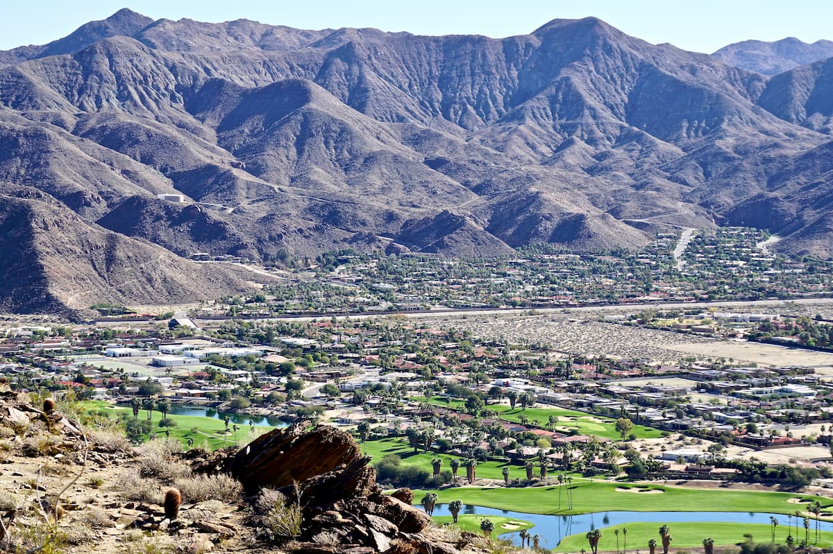
La Quinta is the closest town from the Santa Rosa Wilderness and is a convenient location if you want to stay at an RV park or hotel, but still have rapid access to wilderness regions like the Santa Rosa, or the surrounding national forests.
The Santa Rosa wilderness is placed right between San Diego and Los Angeles. From San Diego the drive is an hour and a half to two hours, making it a doable day trip up I-15, turning off at Temecula.

The Santa Rosa Wilderness is about two and a half to three hours away from Los Angeles and given its distance from LA it pulls in fewer Angelinos than the Angeles or the Los Padres National Forests. If you are looking to beat the crowds, this distance very much works in your favor and if you get to the wilderness early, you are likely to be the only one around for hours.


The highest peak in Santa Rosa Wilderness is Rabbit Peak, at 2,028 m.
Notable peaks in Santa Rosa Wilderness include Rabbit Peak, Peak 6582, Martinez Mountain, Sheep Mountain and Buck Ridge.


