
Scan the QR code and open PeakVisor on your phone
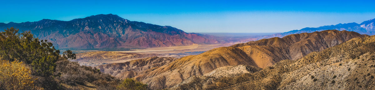
The San Bernardino Mountains are a towering, rugged mountain range situated in Southern California. An easterly extension of the larger San Gabriel Mountains, the San Bernardinos stretch for over 50 miles and rise to 11,490-feet at the top of San Gorgonio Mountain, the tallest peak in Southern California. Together, with the San Jacinto Mountains, the San Bernardino Mountains form a natural boundary between Los Angeles and the Inland Empire, and the Mojave Desert. The Morongo Valley divides the range from the Little San Bernardino Mountains.
The San Bernardino Mountains were formed approximately eleven million years ago by tectonic activity along the infamous San Andreas Fault. For over 10,000 years, these summits and the surrounding wilderness has been inhabited by indigenous people. Spanish explorers first encountered these peaks in the late 18th century and in the 1860s, the San Bernardino Mountains earned a reputation for being the epicenter of the largest gold rush to occur in Southern California. It wasn’t until the early 20th century that the San Bernardinos began to see more recreational development and mountain resorts, boosting their recreational visitation numbers.
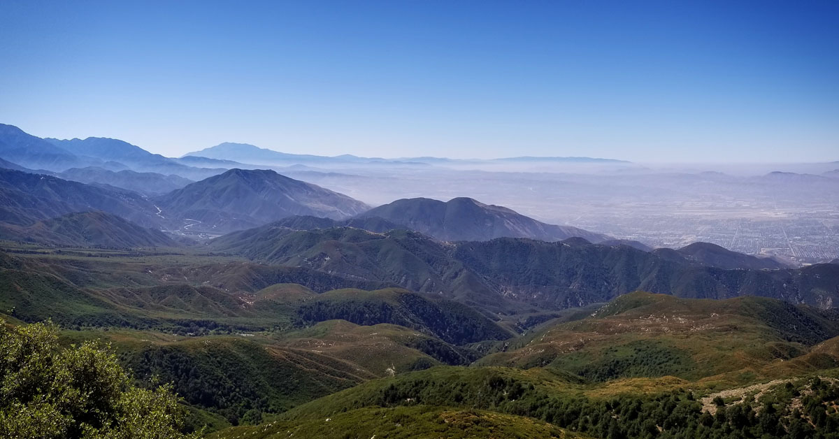
The range is generally divided into three major regions – the highly urbanized Inland Empire, the Coachella Valley, and the Mojave Desert. Although the San Bernardinos aren’t exceptionally awe-inspiring in comparison to the Cascades or Sierra Nevadas, their proximity to civilization makes them a popular destination for Southern California locals.
Popular activities in the San Bernardinos include climbing, hiking, camping, skiing, boating, and camping. Most of the range lies within the boundaries of the San Bernardino National Forest, an 823,816-acre wilderness area, but the eastern section of the range also stretches into the San Gorgonio Wilderness. The San Gorgonio Wilderness is often referred to as the crown jewel of the San Bernardinos, encompassing over 94,000 acres and 100 miles of designated trails. Ten peaks within the San Gorgonio Wilderness exceed 10,000 feet in elevation including Mount San Gorgonio, Jepson Peak, Galena Peak, and Charlton Peak.

Several more summits in the San Bernardinos also exceed 10,000 feet in elevation including Anderson Peak, Shields Peak, Little Charlton Peak, San Bernardino East Peak, Dobbs Peak, and Grinnell Mountain. The San Bernardinos are known to drop dramatically into the Coachella Valley and San Gorgonio Pass. The San Gorgonio Pass, in particular, is one of the deepest mountain passes in the United States, exceeding the Grand Canyon’s depth by over 2,000 feet.
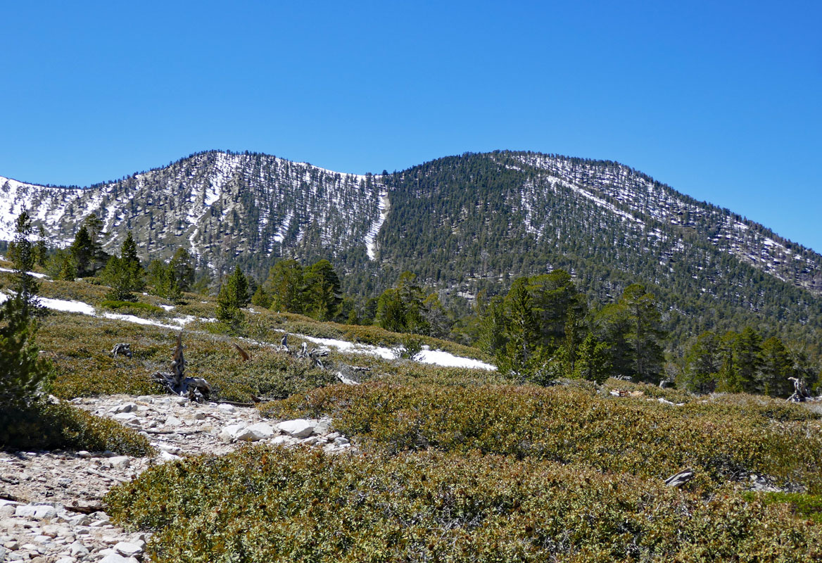
The San Bernardinos are known as a mostly humid range that lies within the mostly semi-arid Southern California coastal plain. Surprisingly, these peaks receive an average of 40 inches of rain, and, in the winter, several popular ski resorts take advantage of seasonal fresh powder at higher elevations.
The Rin of the World Scenic Byway is a 110-mile route that traverses the rim of the San Bernardino Mountains form Cajon Pass to San Gorgonio Pass. Though the road begins in the desert and coastal valley, it quickly climbs in elevation to some of the most stunning vistas in Southern California. The road remains open most of the year, but you’ll want tire chains during the winter. Just don’t forget to stop at the several scenic overlooks, like the Silverwood Lake Overlook, along the way.
Southern California’s tallest peak is accessible by foot and it’s a pretty incredible, albeit arduous, climb. The 8.9-mile route to the summit can be completed in a day or can be turned into a multi-day adventure. Hikers will generally start their ascent by crossing Mill Creek and climbing almost 1,000 feet in just over a mile. After catching their breath, the trail continues upward via a series of switchbacks to the first campground. From there, it’s another 3.6 miles to High Creek and a total of 6.5 miles to the southern ridge of San Gorgonio. The fun doesn’t end there. The trail quickly climbs above the tree line, following a faded footpath before reaching a junction with the San Bernardino Peak Divide Trail. Hikers must continue onward to reach the ‘true’ summit, but spectacular 360-degree views of surrounding summits make the trek worthwhile.
San Gorgonio receives most of the love from Southern California hikers, but nearby, San Bernardino Peak offers equally as incredibly vistas. Like Gorgonio, the hike to the top of San Bernardino Peak isn’t easy. The trail is long, steep, and challenging, topping out at well over 10,000 feet. In just 8 miles, hikers will need to climb 4,600 feet of elevation. The trail rises abruptly for the first couple of miles, but eventually levels out in an area referred to as Manzanita. This is also where hikers will appreciate their first panoramic views. The trail will begin to steepen again toward Washington Monument and the summit ridge, but after hitting the ridge, it’s only another half-mile to the summit. From the summit, hikers can rest their feet and enjoy a snack overlooking the surrounding San Bernardino Mountains and wilderness.
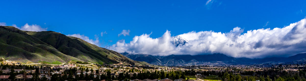
Several major cities lie at the base of the San Bernardino Mountains: San Bernardino, Redlands, and Yucaipa lie to the south, Yucca Valley to the east, and Hesperia to the northwest. However, while most visitors to the San Bernardinos might live in one of these major cities, visitors generally travel to mountain towns like Big Bear Lake, Crestline, Lake Arrowhead, and Running Springs.
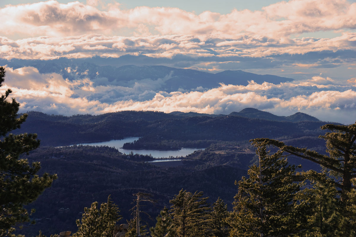
Big Bear, in particular, draws the most visitors in the San Bernardino Mountains. This unique mountain resort community sits directly within the San Bernardino Mountains and, despite seeing 300 days of sunshine, Big Bear receives enough snowfall (approximately 100 inches/year) each winter to lure winter recreation enthusiasts from across the country. The town is also a hub for outdoor recreation throughout the year, offering hundreds of miles of hiking trails, 22 miles of shoreline, and a gorgeous lake to enjoy. Big Bear offers a variety of accommodations, including cabins, hotels, resorts, and lodges.
There are two ski resorts in Big Bear, Bear Mountain and Snow Summit. Both resorts are open year-round and offer a variety of terrain. Combined, skiers and snowboarders can take advantage of more than 438 developed acres, 26 lifts, and 55 runs. During the summer, the resorts provide access to a lift-served bike park and over 60 miles of trails.
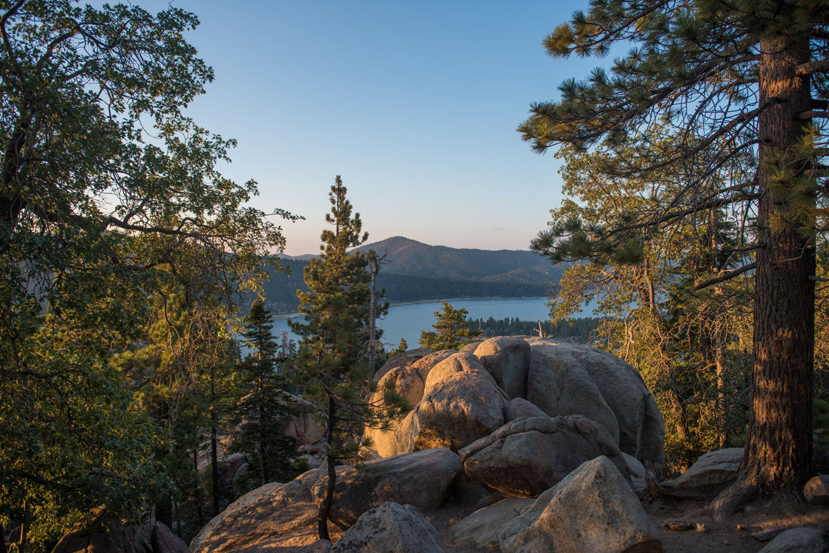
Widely known as ‘The Alps of Southern California,’ Lake Arrowhead is one of Southern California’s best-kept secrets. This small mountain town is cozy, quaint, and features countless outdoor recreation activities. Lake Arrowhead is just 23 miles from the bustling city of San Bernardino but feels a world apart. The charming resort town sits on a deep blue mountain lake and is known as a luxurious alpine getaway. Popular resorts include the Lake Arrowhead Resort and Spa, the Hilltop Tavern and Inn, and Bruin Woods. Just 20 minutes down the highway from Lake Arrowhead is Snow Valley, the oldest continually operating ski resort in Southern California.


ultra
sierra-club-100
100-peaks-section-emblem
california-ultras
ultra
sierra-club-100
100-peaks-section-emblem
california-ultras


