
Scan the QR code and open PeakVisor on your phone
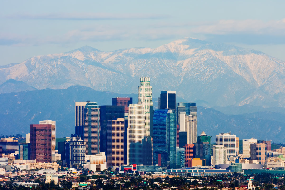
When you think of Los Angeles, your brain probably conjures up images of sandy beaches, movie stars, and high-end fashion. But did you know that the San Gabriel Mountains lie just north of the second most populous city in the United States?
The San Gabriel Mountains are a chain of peaks located in the northern edge of Los Angeles County and to the west of San Bernadino County. These mountains are actually part of a larger mountain chain known as the Transverse Ranges, which are a grouping of ranges in the southernmost part of California.
The San Gabriel Range forms part of the barrier between the Los Angeles Basin and the arid Mojave Desert. US Interstate Highway 5 runs parallel to the range on its western side while US Interstate Highway 15 runs parallel to the San Gabriel Mountains on its eastern flank.
Much of the range is considered part of the Angeles National Forest, which is managed by the US Forest Service. That being said, on October 10, 2014, President Barack Obama used the Antiquities Act to turn the range into a National Monument, thereby protecting 346,177 acres of public land from any form of commerce-driven development. However, breaking with tradition, the National Monument is managed by the US Forest Service, not the National Park Service, who are generally charged with caring for the nation’s National Monuments.
The range’s northernmost border is actually formed by the San Andreas Fault, the continental transform fault that extends nearly 750 miles (1,200 km) through California and is the source of many of the state’s most destructive earthquakes.
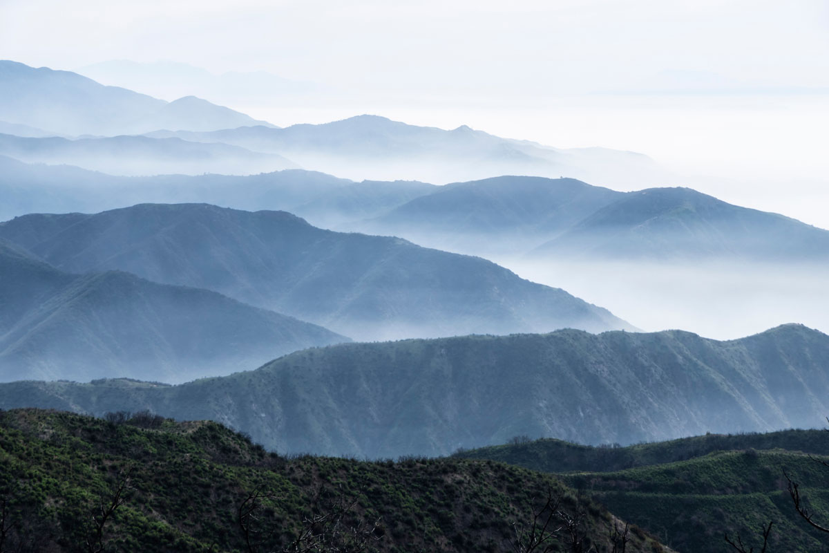
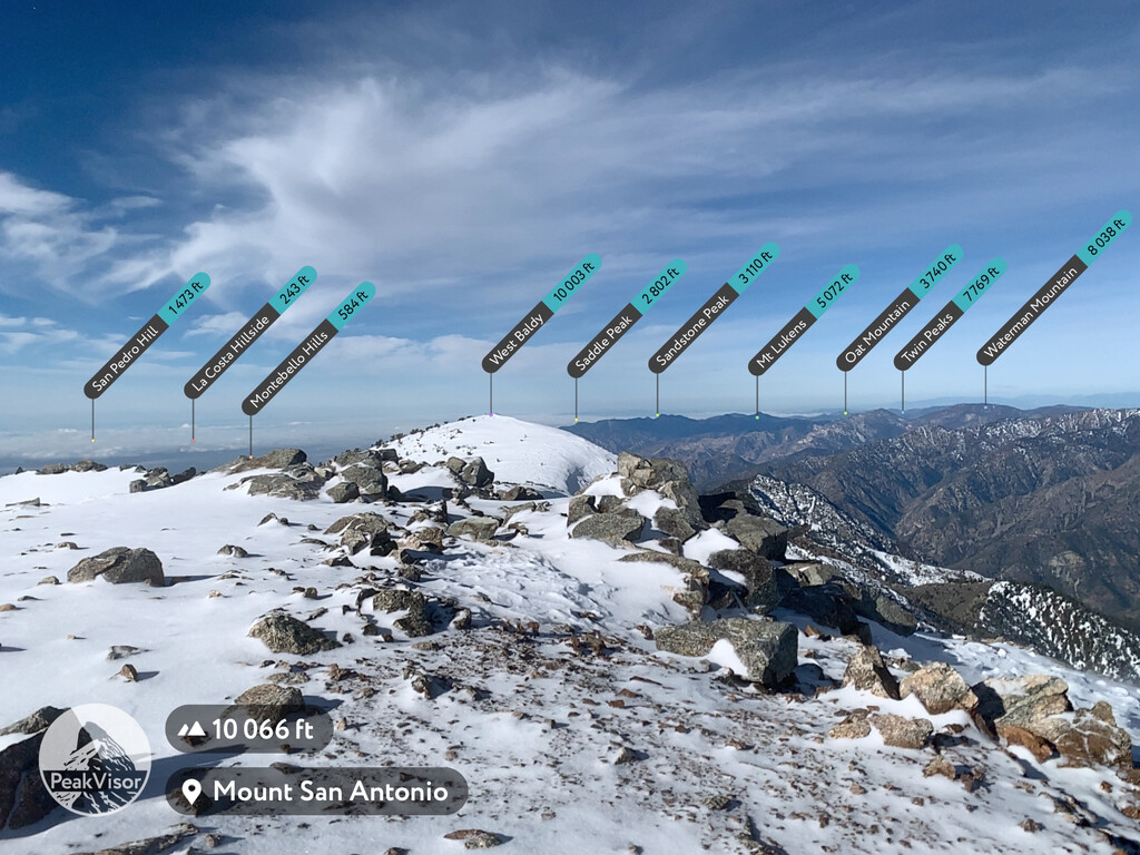
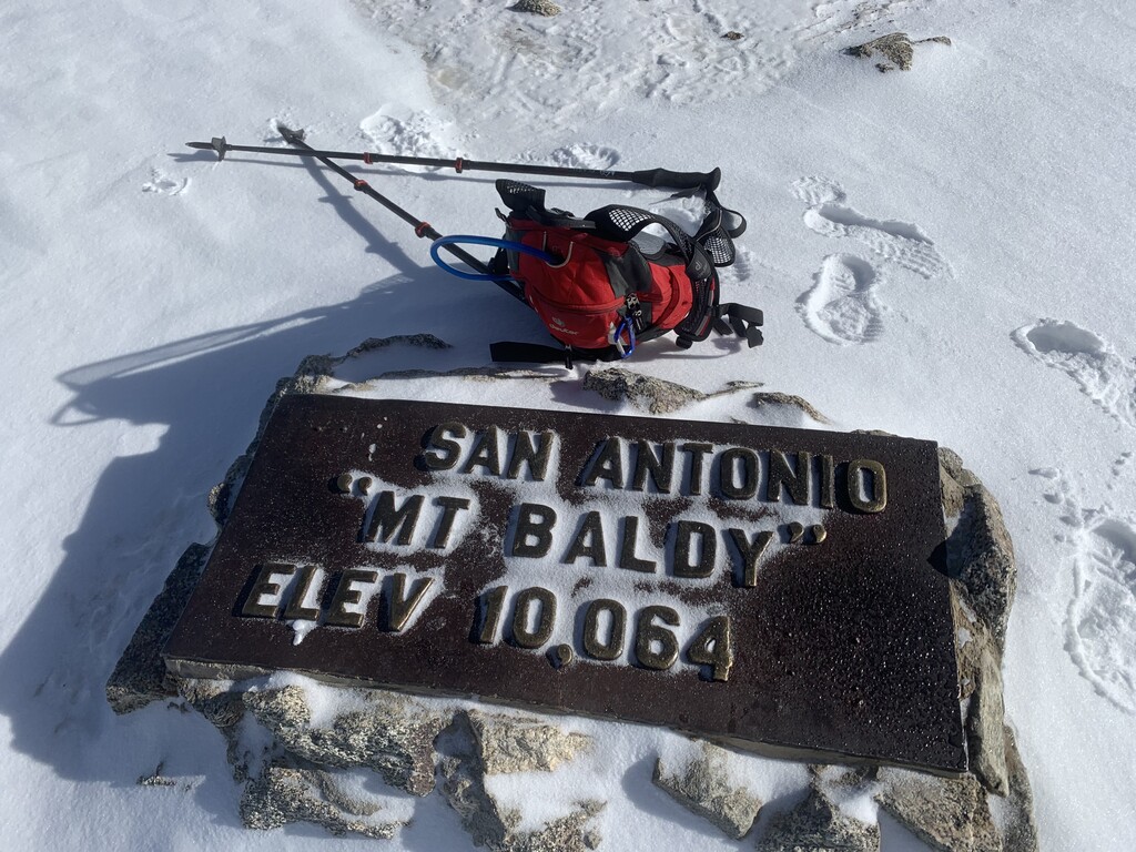
The San Gabriel Mountains are home to 124 named peaks, the highest and most prominent of which is Mount San Antonio (10,064ft/3,068m), which is more commonly known as Mt. Baldy. The range is dominated by rolling peaks and lacks sharp, jagged featured. However, this does not mean that the range is easy to hike in as a significant number of deep canyons make the mountains quite difficult to traverse.

The mountains themselves are actually the result of a large fault block that was uplifted in the Cenozoic Era and then eroded away by various rivers, forming the many canyons we see in the range today. The range’s largest river, the San Gabriel River, is fed mostly by melting snow and runoff from the area’s infrequent rainstorms.
Home to a wide array of different climates, the ecosystems in the San Gabriel Range change as you move up in elevation. Near the base of the mountains, the climate is more Mediterranean, featuring mostly dry summers and col, wet winters. As one moves up in elevation, the climate becomes more continental and snow sometimes falls above 4,000 ft (1,219m) in the winter months.
The area is known for being quite dry, with an average annual rainfall of only 40 inches (101 cm), but during El Niño years, rainfall can easily total over 70 inches (177cm). Fires are a frequent threat in the San Gabriel Mountains, especially during the summer and fall months. The extremely dry and hot Santa Ana wind events that blow in from the Los Angeles area increase the risk of devastating fires during this time.
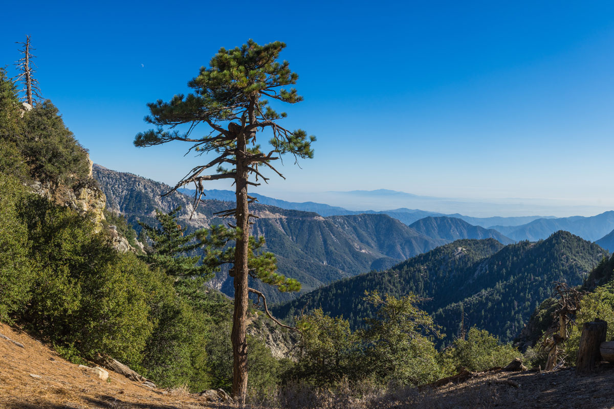
Due to the various relative climates of the area, the San Gabriel Mountains are home to a surprising amount of biodiversity. The mountains are forested by both conifer and broadleaf (deciduous) trees, including pines, firs, cedars, and oaks, which are common above 5,000 ft (1,524m), even where precipitation is relatively low.
In the wetter parts of the range and along rivers, laurel trees, ferns, willow, alder, and cottonwood are also present. That being said, the lower parts of the range are dominated by chaparral - an ecosystem comprised mainly of shrubs, brush, and small trees) - which is known for being well adapted to fire.
Large mammals in the range include mule deer, black bear, coyote, and the ever elusive mountain lion (also known as a cougar or puma). Other, smaller animals include the raccoon, opossum, skunk, bobcat, rattlesnakes, and hawks. Rarely, a lucky hiker might even get to see a golden or bald eagle in the San Gabriel Mountains. Thus, hikers in the San Gabriel Mountains should be prepared for anything!
The San Gabriel Mountains’ proximity to the densely populated greater Los Angeles area makes them an incredibly popular playground for outdoor enthusiasts. A large number of hiking and backpacking trails cross the range, making for excellent recreation opportunities in the mountains.
The most well-known trail in the San Gabriel Mountains is the 2,653 mile (4,270km) long Pacific Crest Trail, or the PCT, which crosses the mountain range along the ridge. The section of the PCT that crosses the San Gabriel Mountains - known as Section D - is 120 miles (193km) long and features large gains and losses in elevation as it traverses the ridge.
The PCT’s section through the San Gabriel Mountains begins at Cajon Pass (3,000ft/914m) and climbs quickly up to the 8000ft (2,438m) Lytle Ridge before it starts down the crest of the Blue Ridge toward Mount San Antonio and Mount Baden-Powell (9,399ft/2,864m). From here, the PCT descends some five miles down to Islip Saddle before bringing weary hikers to Cooper Canyon, where one starts to leave behind the mountains and enter the Mojave Desert.
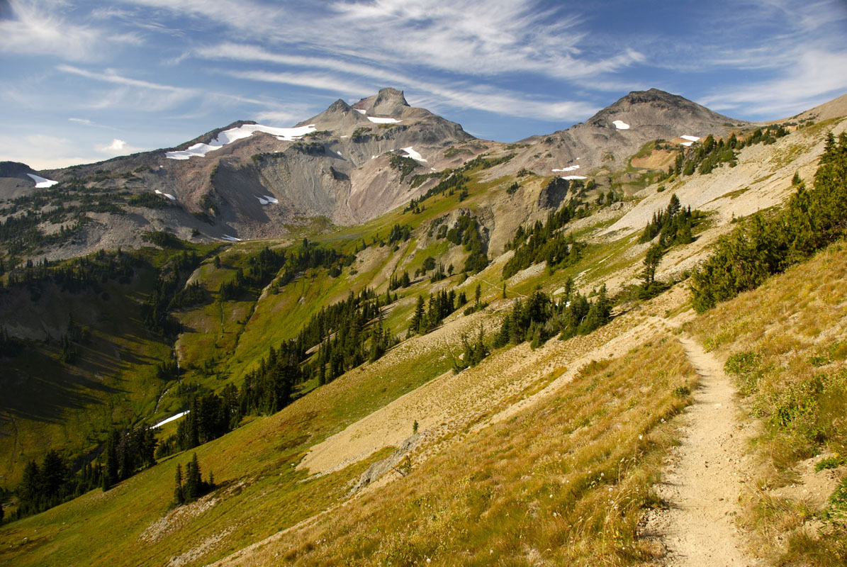
This incredibly popular 7.2 mile (11.6km) out-and-back trail starts at Icehouse Canyon Trailhead and follows a creek for 2 fairly flat miles before the switchbacks begin. From here, you’ll trek uphill toward the Icehouse Saddle, working hard to get some fantastic views of Mt. Baldy and the surrounding range.
Upon reaching the saddle, you can set off on a number of different trails to make some peak ascents, set up camp for the night, or just get some more amazing views. Even if you’re just out on a day trip, we recommend hiking north up the ridge for a short distance to get some fantastic views of the saddle itself.
For the descent, hikers have the option of returning on the same path to complete their out-and-back adventure. However, hikers can opt for a longer and more gradual descent via the Chapman Trail if they’d like a different set of views to end their trip.
Although the San Gabriel Mountains are known for being quite dry, they are home to a plethora of waterfalls, especially in the spring months. The Fish Canyon Falls trail is a popular hike that brings you to a stunning three-tiered waterfall tucked away in the hills behind the town of Azusa, California.
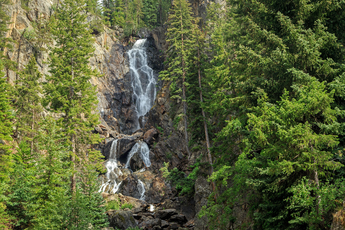
The Fish Canyon Falls trail begins at a parking lot just off of the Encanto Parkway. Here, a clearly marked trail takes you straight to the base of the falls on a 5-mile out-and-back hike. This popular trail is not for those of us who want some seclusion, but it makes for a refreshing getaway from the summer heat. Oh - and watch out for poison oak on the trail!
The San Gabriel Mountains are located just north of the greater Los Angeles area, so they’re some of the most accessible mountains in California. Here are some of the main cities in the area where you can start your adventure:
The city of Los Angeles is just one hour from the heart of the San Gabriel Mountains, so it’s the perfect launching pad for your trip into the mountains. With a large international airport, train stations, buses, and rental cars, and shops filled with all of the supplies you could possibly need, LA is a relatively easy place to start your hiking adventure in the San Gabriel Mountains.
If the hustle and bustle of the Los Angeles area just isn’t your thing, you can head to the city of Palmdale, which sits just north of the Angeles National Forest. A city of just 150,000 people, Palmdale is a veritable village when compared with its more southern neighbor of LA. But, Palmdale has everything you could need for a hiking trip into the mountains. Plus, it’s just an hour and a half from Mount San Antonio, so you don’t have to travel far to start your adventure.


ultra
sierra-club-100
100-peaks-section-emblem
california-ultras
ultra
sierra-club-100
100-peaks-section-emblem
california-ultras


