
Scan the QR code and open PeakVisor on your phone
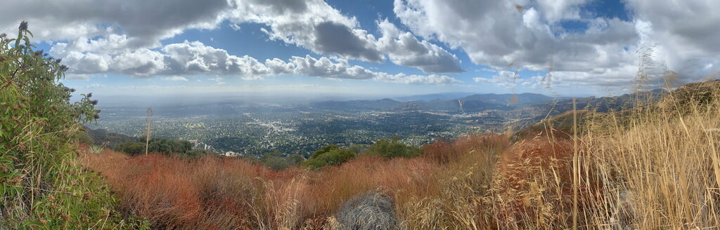
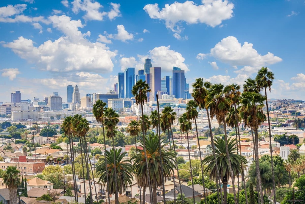
While Los Angeles County in the southern part of the US state of California is best known for its namesake city and its entertainment industry, it is equally popular for its outdoors community and many hiking opportunities. There are 264 named mountains in Los Angeles County. The highest and the most prominent mountain is Mount San Antonio (also known as Mount Baldy) at 10,069 ft (3,069 m) in elevation.
Los Angeles County (LA County) is an administrative region located in the southern part of the US state of California. The county is home to more than 600 parks, over 550 miles (885 km) of trails, and hundreds of mountain peaks in the San Gabriel Mountains, Sierra Pelona Mountains, Santa Monica Mountains, and Santa Susana Mountains.
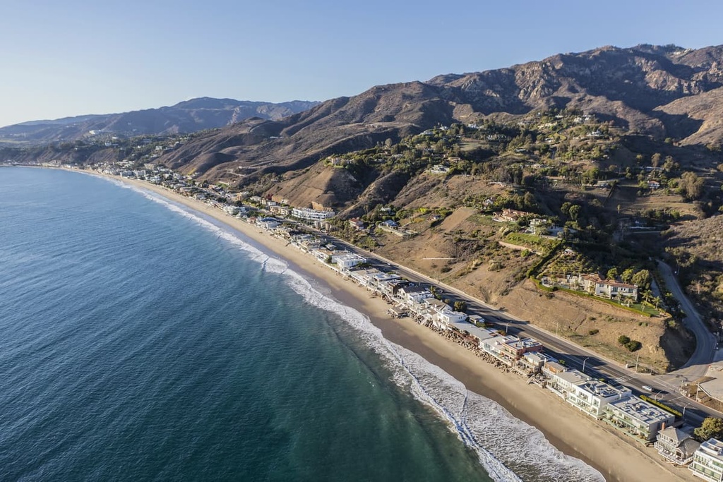
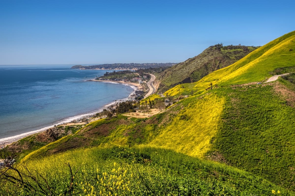
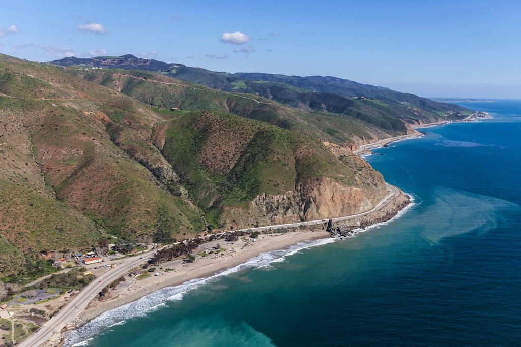
The county encompasses an area of 4,751 square miles (12,310 sq. km), including 4,058 square miles (10,510 sq. km) of land and 693 square miles (1,790 sq. km) of water. LA County has 70 miles (110 km) of Pacific Ocean coastline and is home to a vast array of mountain ranges, valleys, forests, islands, lakes, rivers, and desert.
LA County is located to the east of Ventura County, to the south of Kern County, to the west of San Bernardino County, and to the north of Orange County. Los Angeles County also includes San Clemente Island and Santa Catalina Island in the Channel Islands archipelago off the Pacific Coast.
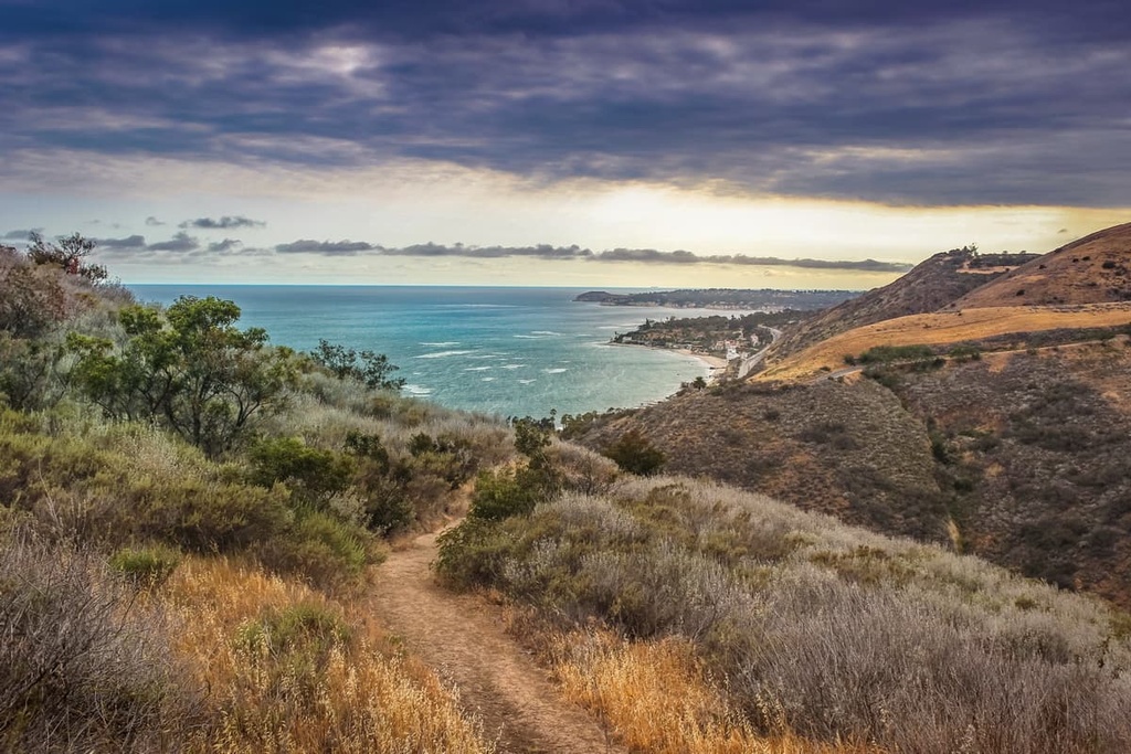
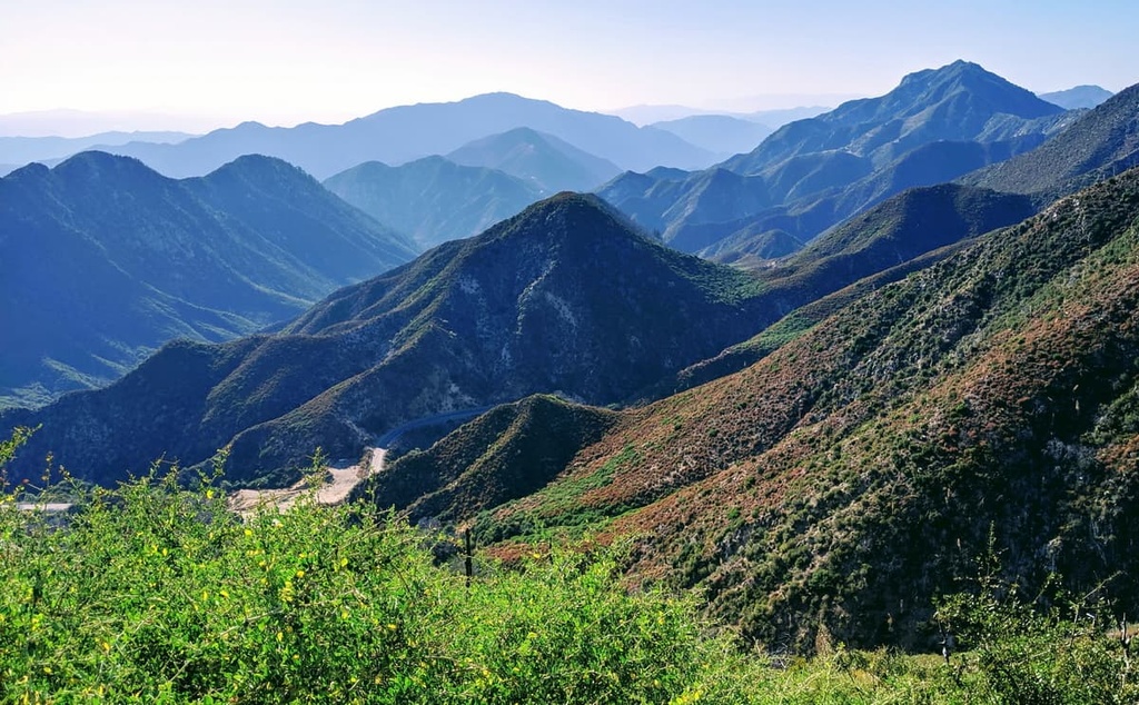
The county’s primary mountain ranges are the Santa Monica Mountains and the San Gabriel Mountains, which are home to hundreds of miles of trails and dozens of mountain summits.
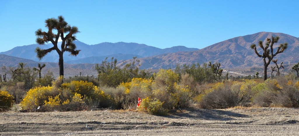
The western extent of the Mojave Desert begins in the Antelope Valley in the northeastern part of LA County. All in all, LA County is home to 3 major protected areas: Angeles National Forest, Los Padres National Forest (most of which is in Ventura County and Santa Barbara County), and the Santa Monica Mountains National Recreation Area.
While many of LA County’s 10 million residents reside in the city of Los Angeles in the Los Angeles Basin, many also reside in the San Fernando Valley and San Gabriel Valley. Other major population centers in the county include the Santa Clarita Valley, Pomona Valley, Crescenta Valley, and Antelope Valley.
Interestingly, Los Angeles County is the most populous county in the United States by a sizable amount. The second largest county in the country is Cook County, Illinois (home to the city of Chicago), which has 5.3 million residents. Meanwhile number three Harris County, Texas (home to Houston) and number four Maricopa County, Arizona (home to Phoenix) have just 4.7 and 4.4 million residents, respectively.
LA County’s varied geology has created diverse topographic, climate, and vegetation conditions in the region that plants and animals have evolved and adapted to over countless generations.
Most of LA County is dominated by alluvium in the lowlands areas of the LA and Mojave basins. Additionally, bedrock of sedimentary sandstone, igneous granodiorite, and metamorphic gneiss also cover significant areas of LA County.
This unique geological makeup of the region has required LA County’s plant species to evolve to depend on volcanic rock, as well as serpentine, limestone, or unique substrates such as vernal pools or washes.
Similarly, the development of LA County’s urban areas has been greatly influenced by its geological makeup. Alluvium tends to occur in relatively flat, low-lying areas and creates an ideal situation for development. Ultimately, the native vegetation and ecosystems that occurred in areas of the Los Angeles Basin are now very rare as a result of the area's geology and human development.
Much of LA County was historically part of an ancient deep ocean basin, but the region slowly filled with ocean debris from nearby mountain ranges over the course of millions of years. The coastal areas of LA county have been rising somewhere around 2 millimeters per year.
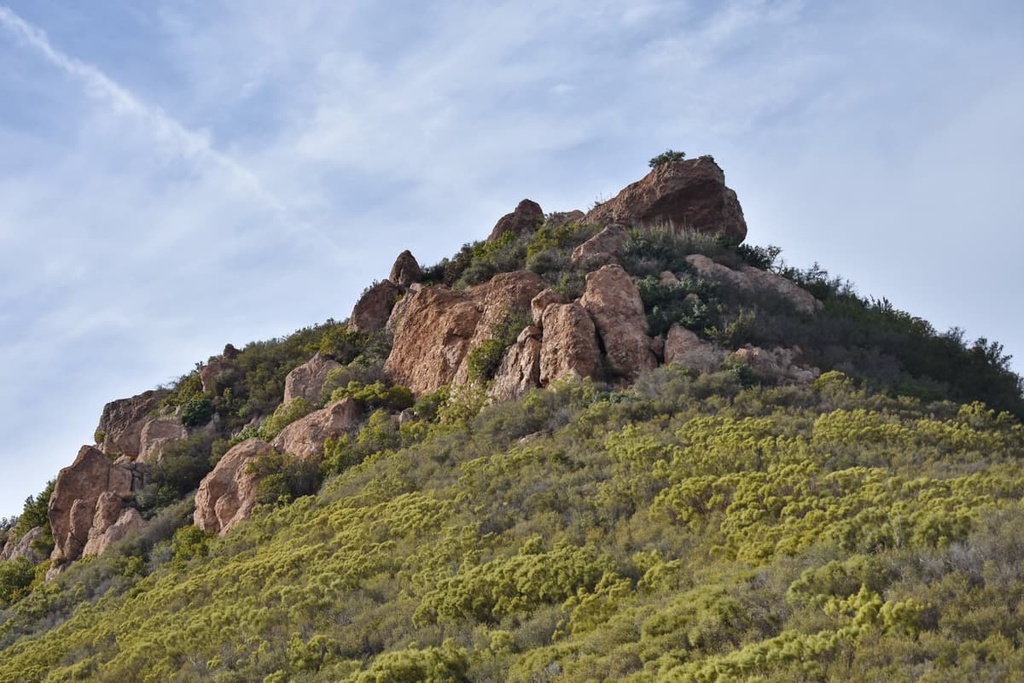
LA County is divided west-to-east by the San Gabriel Mountains, which are part of the Transverse Ranges of southern California. The San Gabriels are mostly contained within the Angeles National Forest, though the San Bernardino National Forest also encompasses a portion of them.
The San Gabriel Mountains are also home to most of the county's highest peaks, including Mount San Antonio, which is located at the Los Angeles-San Bernardino county lines.
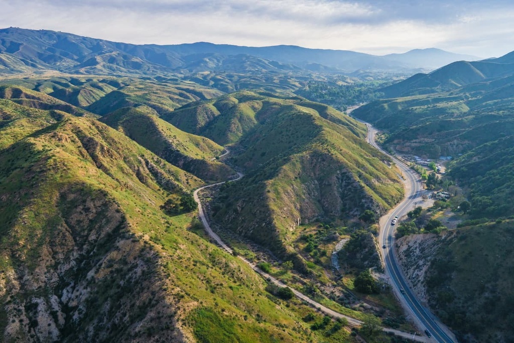
Additionally, several mountain ranges can be found in the northern, western, and southwestern parts of the county, including the San Emigdio Mountains, the southernmost part of Tehachapi Mountains, and the Sierra Pelona Mountains.
Los Angeles County is part of the Mediterranean climate zone, one of only five such regions in the world. This means that it is characterized by mild, wet winters and dry summers.
Rain in LA County peaks during the winter and is almost non-existent in the summer with about 15 inches (38 cm) of precipitation falling in the county annually. LA County is home to coastal bluffs, dunes, beaches, and terraces, interior coastal sage scrub, chaparral, riparian woodlands, grasslands, wetlands, and the especially rare Channel Islands ecology.
As a result of LA County’s unique geologic history and location, it has some of the highest rates of biodiversity in the continental US, as well as some of the highest biodiversity rates in California.
In Southern California, there are approximately 2,000 species of native vascular plants, which constitute nearly half of the flora of the state. Additionally, another 700 species of non-native plants grow in the region.
The variety of flora in LA County is extensive. It ranges from coastal flora to high alpine flora and everything in between. There is never a dull moment while hiking LA County.
Many of LA County’s coastal ecosystems (especially their wetlands) have been destroyed by human development. However, some ecosystems remain intact.
The Ballona Creek wetlands in the Culver City and La Playa neighborhoods of LA, for example, are still protected and preserved areas. They contain a number of native species, such as dune bush lupines, sand verbena, beach evening primrose, and more.
Another coastal ecosystem you will find in LA County is coastal sage scrub. This ecosystem is closely related to interior sage scrub and it features plant communities that are characterized by the dominance of drought-tolerant deciduous shrubs.
This means that these species lose their foliage in the summer with the onset of drought conditions and then grow new leaves with the onset of the rainier seasons. More specifically, LA County is located between the Venturan sage scrub and Diegan sage scrub ecosystems.
Further inland, you will find chaparral ecosystems, which make up the most prominent and widespread plant communities in LA County (and much of Southern California). The name chaparral comes from the Spanish word chaparro, which originally was used to describe the shubby cover of evergreen oaks in Spain.
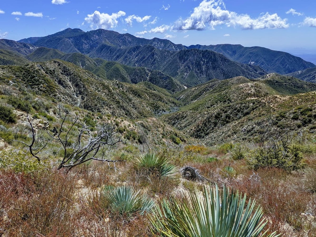
Chaparral communities are largely found in the south coast and in both the Transverse and Peninsular Ranges, particularly in the drier or shallower soils where woodlands cannot survive. Chaparral landscapes in LA County often create transitional ecosystems from lower and drier areas to higher and wetter areas.
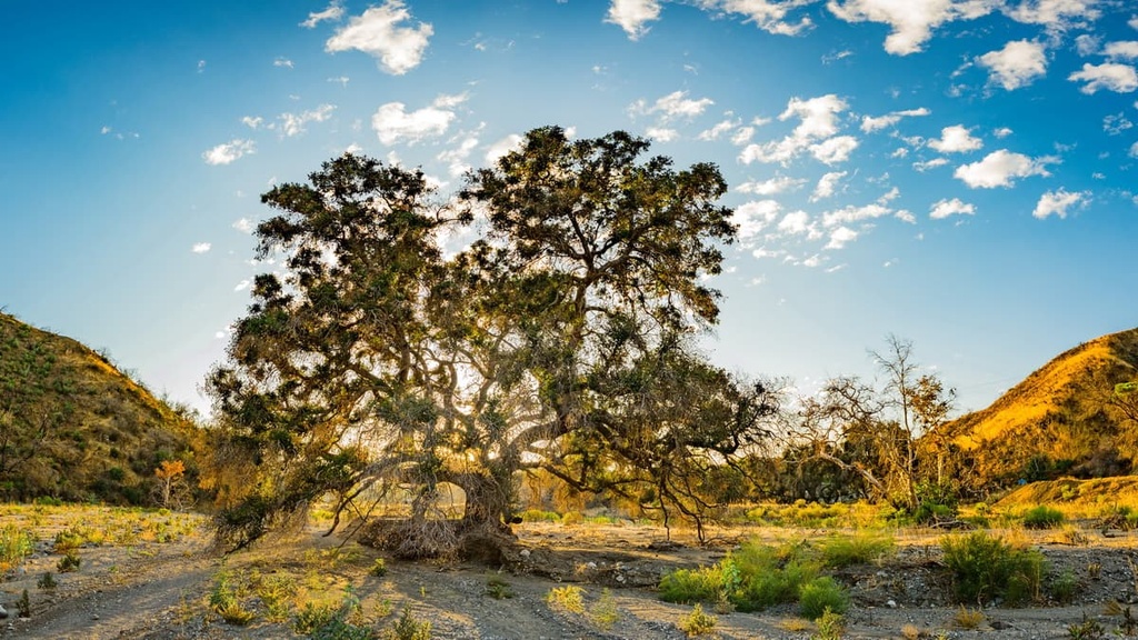
LA County’s woodland ecosystems are largely dominated by oaks. They include closed canopy woodlands of evergreen oaks, open savannahs of deciduous oaks that are located among the region’s receding grassland communities, walnut woodlands, and conifer woodlands.
Woodlands in the county often occur in an ecological mosaic with chaparral ecosystems. Thedy reflect the changing soil structure from one area to another with chaparral ecosystems living in shallow soils and woodlands living in deeper soils.
There are 5 types of woodlands hikers can find in the area: live oak woodlands, Engelmann oak woodlands, deciduous oak woodlands and savannas, walnut woodlands, and conifer woodlands.
For millennia, the southern California area housed its own unique grassland ecosystems. However, with European settlement, the advent of livestock grazing, and the unintended introduction of invasive grass species, many of southern California’s native grassland communities have been destroyed.
Mediterranean annual grasses, in particular, have been the primary invasive species including species such as wild oats, red brome, ripgut grass, soft cheat, barley, and Italian rye, among others.
However, there have been areas of LA County that have been able to resist invasive species due to their particularly harsh local climates. Some areas of the Santa Monica Mountains and Coast and Peninsular ranges retain native grasslands, albeit with some invasive grasses interspersed throughout.
While southern California is famous for its chaparral communities, it is also famous for its riparian woodlands, especially in its foothills.
Riparian woodlands in the county are home to trees such as tall sycamores and coast live oaks, which provide a welcome respite to the southern California sun. Additionally, these ecosystems have created an effective fire containment zone as fires tend to die out around wetter riparian ecosystems.
Wetlands, both coastal and inland, are incredibly important to southern California’s ecosystem. Unfortunately, development has threatened these systems and ecological restoration has needed to be done in many areas.
There are three types of wetlands found in southern California including estuaries and salt marshes, freshwater marshes, and vernal pools. Estuary habitats range from subtitle seagrass communities with eel-grass and surf grass to marshes on the shoreward side of mudflats.
Freshwater marshes are plant communities that occur in areas with standing or slow moving water that floods the area year round. These communities are the least common in southern California given the area's notoriously dry climate.
Finally, vernal pools are seasonal wetlands that form in the winter as rain falls in shallow, poorly drained depressions. Southern California is famous for its vernal pools and these ecosystems display an amazing variety of wildflowers while saturated, only to turn brown and barren during the dry season.
Additionally, LA County is home to two of the Channel Islands. The Channel Islands ecosystem is famously unique and heavily protected by Channel Islands National Park and the Nature Conservatory.
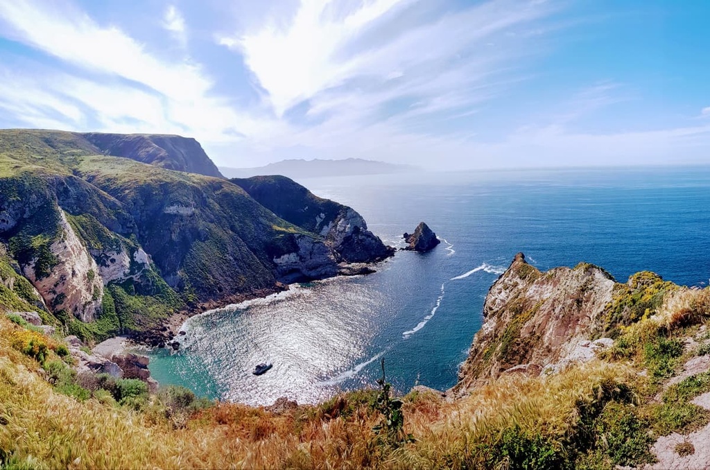
While the Channel Islands exhibit a number of ecological systems similar to mainland southern California, plants and animals on the islands have adapted unique traits that differentiate them from other parts of the region.
For example, gigantism in some plants, especially trees, can be seen in the archipelago. Additionally, the Channel Islands’ wetter climate has changed the characteristics of some native chaparral and riparian plants.
Depending on whether you are in the desert, forest, or on the coast, the fauna of LA County can vary dramatically. For example, in the Mojave desert regions of LA County you can find the Mohave rattlesnake, desert tortoise, glossy snake, common side-blotched lizard, California kingsnake, giant hairy scorpion, stripe tailed scorpion, and the desert iguana.
Mammals found in the deserts of the Lower Sonoran Desert areas of LA County include the jackrabbit, kangaroo rat, and opossum, as well as the Western screech-owl, roadrunner, cactus wren, and various species of hawk. Meanwhile, the sidewinder, desert tortoise, and horned toad represent the area's reptilian life.
The Upper Sonoran Desert zone is home to such mammals as the antelope, brown-footed woodrat, and ring-tailed cat. Birds that call this desert home include the California thrasher, the American bushtit, and California condor.
The Colorado River zone in southern California is also home to many animal species, including several species of snakes, scorpions, tarantula, yellow-headed blackbird, desert iguana, kit fox, bobcats, and coyotes.
Unfortunately, human development has put a number of animal species of the Colorado River area at risk, such as the bonytail chub, razorback sucker, Colorado pikeminnow, and humpback chub.
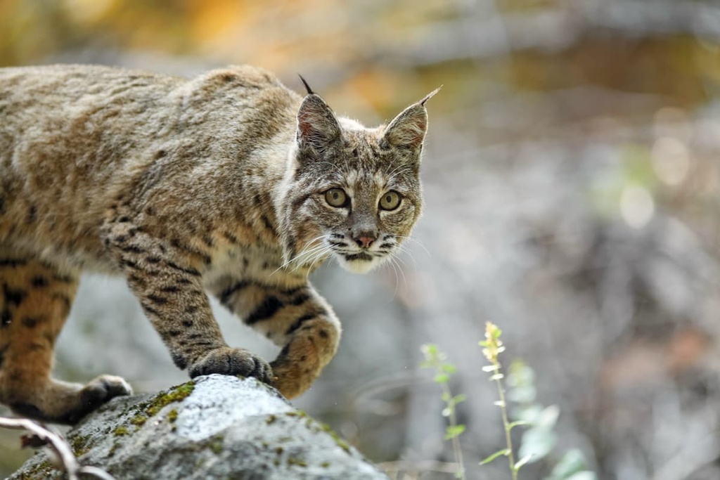
On the California Coast, many species of animals and plants can be found such as the raccoon, skunk, opossum, and rat, as well as large predators including; the red fox, bobcat, coyote, American black bear, and the cougar.
In the mountains of Los Angeles County, hikers will need to keep an eye out for a variety of large predators (though they are famously human-averse), such as black bears and cougars.
LA county was established in 1850 and is one of the original counties of California. At one point in time, LA county contained parts of what is now Kern, San Bernardino, Riverside, Inyo, Tulare, Ventura, and Orange counties.
Indeed, LA county used to be much larger than it is today. It originally stretched from the coast to the state line of Nevada, but as it grew in population, it was split up into multiple counties. Prior to LA County’s incorporation, it was a series of townships and ranchos.
There are around 55,000 Indigenous people who live in the city of Los Angeles and approximately 140,764 Indigenous people who live in Los Angeles County. However, these communities represent just a small fraction of the countless members of the many tribal nations who have called this region home since time immemorial.
In particular, three tribal nations—the Chumash, Barbareño/Ventureño Band of Mission Indians, the Gabrielino-Tongva Indian Tribe, and the Fernandeño Tataviam Band of Mission Indians—all consider the Los Angeles Basin and what is now called Los Angeles County to be part of their ancestral homelands.
Over the course of the recent history of Los Angeles County, many Indigeonus peoples were killed by disease or violence, forced into labor, or forcibly removed from their homelands.
The peoples of European descent to visit what is now LA County arrived in 1769 when Gaspar de Portolá and a group of missionaries camped on what is now the banks of the Los Angeles River. In September 1771, the San Gabriel Mission was established by Father Junípero Serra and a group of Spaniards in an area inhabited by the Gabrielino Tribe.
Approximately 10 years later, the Los AngelesPobladores, a group of 11 families, traveled from the San Gabriel Mission to a new pueblo named El Pueblo de la Reina de Los Ángeles (The Pueblo of the Queen of the Angels). Over time, the area grew from a few adobe houses to became known as La Ciudad de Los Ángeles, “The City of Angels.”
Trade in the area began to expand in the early 1800s, and the first English-speaking settlers came to the area in 1818. Whale hunting and grazing made the area appealing to English speaking settlers and eventually in 1846, the area came under US control after a period of hostility and the signing of the Treaty of Cahuenga in 1847.
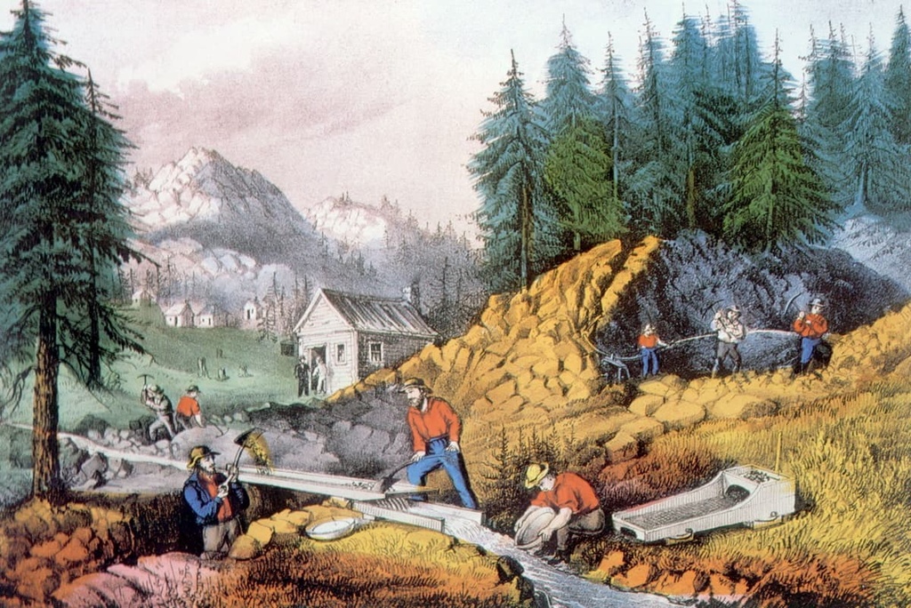
The California Gold Rush caused a massive increase in population in the region a couple years later in 1849. Additionally, the population grew more during the Civil War (1860-1865), as gold, silver, and copper were extracted from the Soledad Canyon region and Fremont’s Pass was expanded to speed up ore shipments back east.
Arguably, LA County is best known for its contribution to film and TV. The county’s good weather and picturesque locations make it a great place to film, which is why the region was chosen when making the first films with sound, which were also known as “talkies,” after the boom in popularity of silent films. In the 1950s, a number of TV stations opened up in the area and further expanded the industry’s hold on Los Angeles.
Since then, every type of entertainment industry has found a home in LA County from film, TV, radio, and online streaming. In 2016, the Los Angeles County Film and Digital Media Industry generated 640,500 jobs, $58.8 billion in labor and another $158.3 billion in annual economic impact for the region.
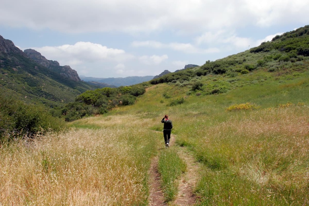
There is no shortage of hiking opportunities in Los Angeles County. You can hike in one of Los Angeles’ many parks or drive a little bit out of town to one of LA County’s national forests.
Whether you are an experienced or a new hiker, LA County has a good adventure option for you to check out.
The Angeles National Forest is one of the most popular hiking destinations for Angelinos. It is located within one of the driest, most fire-prone areas in the United States, so the local forest service is incredibly vigilant about fire prevention.
The forest is often under a no-burn ordinance while you camp in its campgrounds or in its backcountry. The dryness of the forest is also a good reminder for visitors to bring lots of water as they hike.
Here are some of the most popular hikes in the forest:
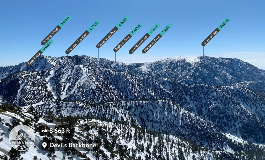
Mount Baldy
If you want to get the most bang for your hiking buck in LA County, then the Mount Baldy hike will deliver it in spades.
Mount Baldy is the highest point in the entire county. Hiking to the top will require you to climb 5,625 feet (1,714 m) from the parking lot at the end of Mount Baldy Road up to the summit of Mount San Antonio (a.k.a. Mount Baldy).
There are a number of routes up to the peak that you can choose from depending on the time of year, your physical fitness, and how much time you have to hike. You will need a California National Forests Adventure Pass to do this hike. You can either buy a day pass for $5 or an annual pass for $30 as of 2021.
One of the more popular ways to get up to and down from the peak is to take the 11.5 mile (18.5 km) loop option that connects the Backbone Trail to the Baldy Bowl Trail. When you leave the parking lot, you will take a private road that leads to the fire road going up to the Mt. Baldy Ski Lodge.
This fire road provides a relatively simple climb if you are a beginner hiker. However, climbing through the ski routes is very steep. The Backbone Trail section of the trail gets very steep and technical (especially in the winter when you may have to establish the trail through the snow.
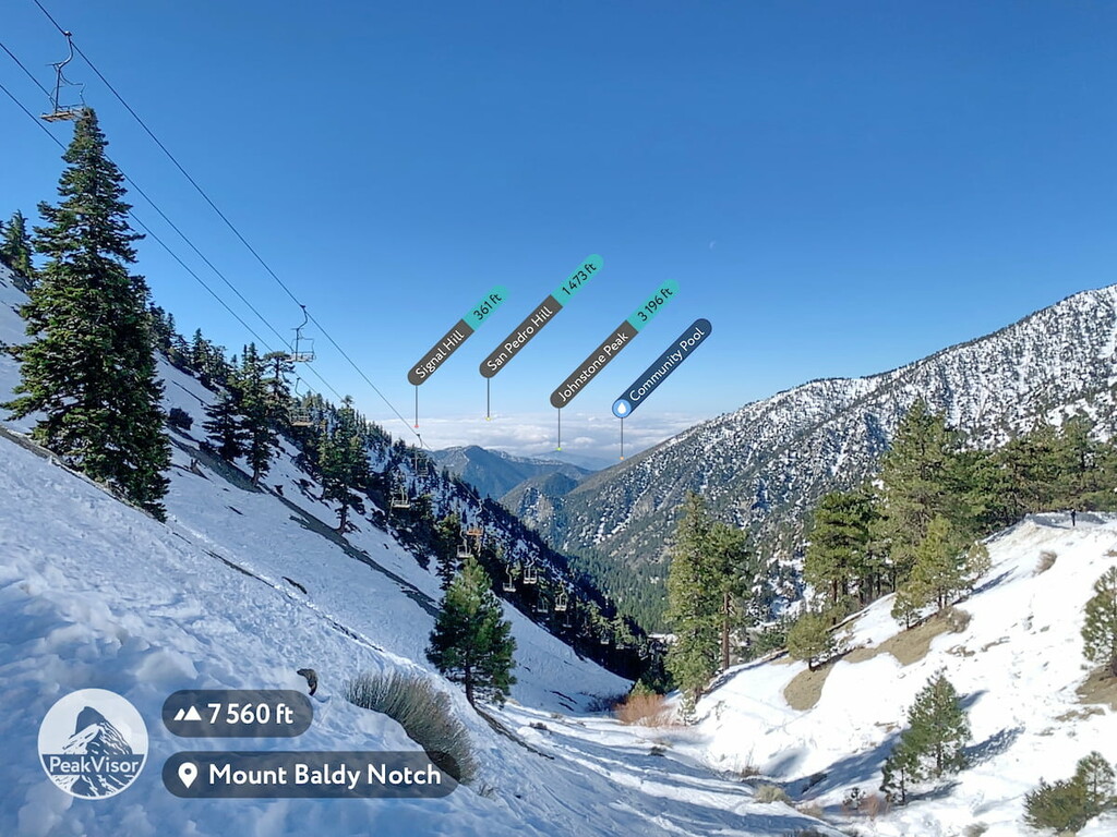
You can also take an easier first leg up by purchasing a lift pass for between $20 and $40 that will get you up to the ski routes, just short of the start of the Devil’s Backbone Trail.
The Backbone Trailhead splits after a few hundred yards leading up to either the summit of Mount Harwood (Baldy’s sister peak), or around the summit, and on up to the summit of Mount Baldy. The trail splits because the winds on top of Mount Harwood can be extremely (often dangerously) high as a result of desert winds coming up over the mountain range from the east.
Once you summit, you can either take the Devil’s Backbone Trail back down to the ski lodge (where you could get an early meal and a drink) and the fire road back to the trailhead. Or, you can take the Baldy Bowl Trail back down, which is faster, but steeper (though not unmanageably steep).
The Baldy Bowl Trail also takes you through some beautiful forested sections of Mount Baldy and by a backcountry ski lodge (which costs $1 to enter and $20 to rent for the night, but note that it is unheated with bunk beds). The lodge is a great place to take a break and have a snack or use the outhouse.
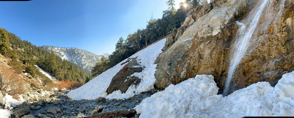
The route meets up with the fire road just before you hit the seasonal San Antonio Falls on your descent. The falls run with the winter snow melt and are active mostly in the spring. You will have seen these falls on your way up the fire road.
The Bridge to Nowhere
The Bridge to Nowhere hike is one of the most popular hikes in the Angeles National Forest due to its low grade and the option of bungee jumping at the bridge. This means that it’s a nice option for beginner hikers if they are willing to take on a longer day of adventure.

The hike starts at the end of Camp Bonita Road, which is located off of East Fork Road coming off of Highway 39, or Glendora Road. You will need an Adventure Pass for this hike.
This is a 9.5 mile (15.3 km) out-and-back hike with manageable elevation gain, though it does have many water crossings since it follows the East Fork of the San Gabriel River. You will want very breathable, easy-dry shoes rather than heavy duty boots. This hike should take you the better part of your day, so it’s a good idea to start early and pack a lunch.
Once you get to the bridge, you also have the option of bungee jumping off the bridge for about $150 (t-shirt included). The bungee jumping station closes at around 3 pm each day.
Iron Mountain via Heaton Flats
To say that the Iron Mountain via Heaton Flats hike is difficult would be an understatement. This
hike is considered to be one of the most difficult on-trail day hikes in the entire Angeles National Forest, and even Los Angeles County.
While Iron Mountain only clocks in at 7,999 ft (2438 m), 2067 ft (630 m) less than its neighbor, Mount Baldy, this hike has you climbing and descending about 7,876 ft (2,401 m) over the course of approximately 14 miles, with an average grade of around 30 degrees (though it often increases to 50 degrees in places). Suffice it to say that this hike is not for the faint of heart.
The hike starts at the same trailhead as The Bridge to Nowhere Trail, but heads up via Heaton Flats immediately for the first 3 miles (4.8 km) of the trail. The famous ‘suffer fest’ begins at around the halfway point. At the completion of Heaton Flats, you will descend into a small valley before you start climbing steeply. From here, you won’t stop climbing for longer than a few feet for the rest of the hike.
For this hike, bring more water than you anticipate needing, especially in the hotter months (about 3 to 4 litres).
Be sure to start early, too. A 6 am start time for this hike is considered late. Bring trekking poles, as the grade on the trail can be very steep.
Additionally, This hike is best done in the fall and spring. In the winter, the snow makes the hike much more difficult and in the summer the temperature coupled with the exertion of the hike can be very dangerous.
While Iron Mountain is one of the most challenging hikes you could attempt in Los Angeles, it is also one of the most rewarding. As a result it has become a beloved hike for the most ravenous of hiking enthusiasts in southern California.
Rattlesnake Peak Trail
The Rattlesnake Peak Trail is a slightly easier alternative to Iron Mountain. This approximately 9 mile (14.5 km) hike overlooks both Iron Mountain and the Bridge to Nowhere hike (you can even see the bridge if you take the loop option. While the initial climb from the Shoemaker Canyon Road entrance is quite steep, much of the climb for this hike is reasonable and well cut.
However, this hike (like many of the Angeles hikes), is very exposed. So be sure to bring extra water and sunscreen and start your hike early so you can make it to the summit of Rattlesnake Peak while avoiding the worst of the heat.
If you feel confident in your navigation and trail blazing skills, you can take the Rattlesnake Loop option that descends over the easternmost side of the ridgeline and connects with the dirt road. However, if you are not skilled in trailfinding or navigation, then this option is not recommended as the trail is not well blazed and is easy to lose.
There is also steep descent on sections of this trail and you will undoubtedly be negotiating washed out sections as you hike. Be sure to bring gators and trek poles. The upside of this option is that you can see the two tunnels on the dirt road as you head back to your car.
Echo Mountain
Overlooking downtown Los Angeles, Echo Mountain is a popular trail for hiking, cycling, and history buffs. Echo Mountain is part of the Mount Lowe Railway monument area and is listed on the National Register of Historic Places. Along the way, you’ll even get to see the remains of the "White City," a former resort.
The area was formerly home to the Great Incline Funicular, which climbed up the mountain to the resort and was the third in a series of scenic mountain railroads in the US. It was created as a tourist attraction on Echo Mountain and Mount Lowe (5614 ft). The railroad ran from 1893 until its official decommissioning in 1938.
Frequent forest fires in the area made the resort and funicular’s upkeep financially untenable and contributed to its abandonment. However, during its operation, the funicular was the only scenic mountain electric traction (overhead electric trolley) railroad ever built in the United States.
Echo Mountain is named for the number of small gramophone-like objects on the peak that are directed at the opposing mountain. Yelling through the gramophones will have your voice echoing through the canyon.
To start the hike, you venture to AltaDena near Pasadena and head to the trailhead located very close to a residential neighborhood. Park near the Sam Merrill Trailhead off of East Loma Alta Drive and Lake Avenue and head up along the Sam Merrill trail to the White City Ruins. You can also take the route that goes along the opposing mountainside and ridge line.
Another, longer option is to take the 5.5 mile (8.9 km) route through White City across the ridge and up to the peak of Echo Mountain. Then turn around and take the loop back down to the parking lot. You will climb about 1,700 ft (518 m) in less than 10 km (6 miles).
Pacific Crest Trail
The Pacific Crest Trail (PCT) is a famous 2,665 mile (4,488 km) interstate trail that winds from the Mexican to the Canadian border. The majority of the PCT is found in California and 106 miles (171 km) of the PCT are found in the Angeles National Forest.
The Angeles National Forest section of the trail starts from Highway 15 at Cajon Junction and ends just past the forest at Agua Dulce.
However, the Station Fire in 2009 impacted 37 miles (60 km) of the trail. This section of the trail had to be rerouted and there is now more road walking along Highway 2 in the high country of the forest.
Topanga State Park is a popular hippie hideaway that’s located just outside of Los Angeles and is very popular with Angelinos as a day hiking destination. The official entrance to the park is along Entrada Road, which leads up to Tippet Ranch and leads to the Eagle Rock, Parker Mesa, and Waterfall-San Ynez Trails, and a number of other trails.
There are a wide variety of hikes that intercut the canyons of this area via a number of entrances in both Los Angeles, Topanga, and more eastern areas along the road. A good option for exploring Topanga Canyon is to bring a map and simply go exploring.
The area is so popular, the trails are so well cut, and the access to the road is so readily available that it is hard to get lost in the park. Luckily, there are also a number of water points along the trails, so even though the area is incredibly dry, you will have options if you run out of water.
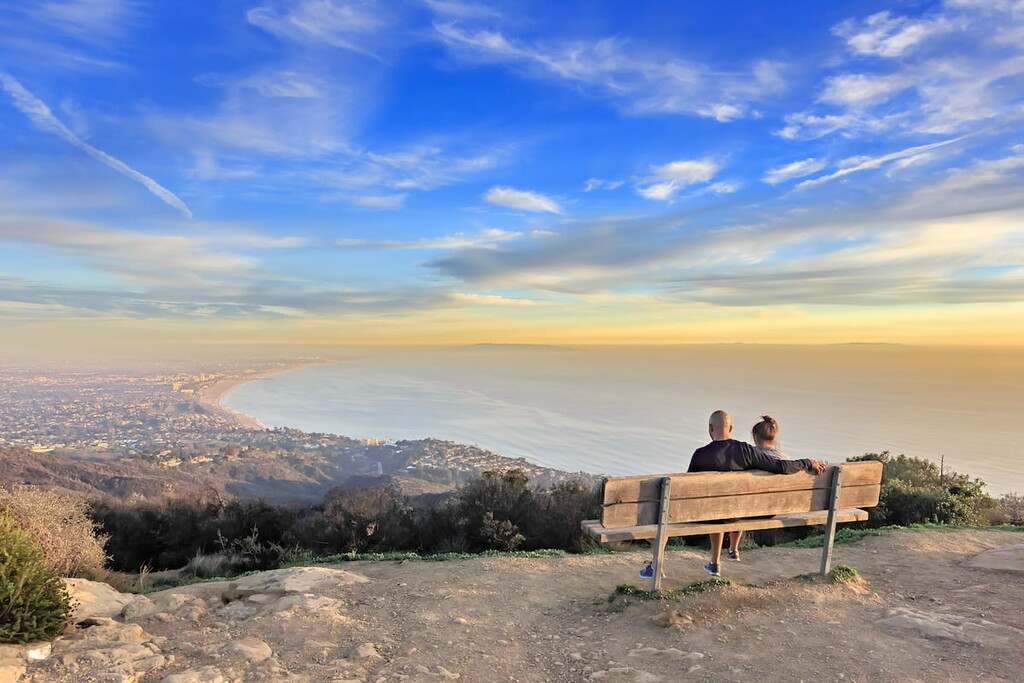
Will Rogers Park is one of the many parks connected to Topanga Canyon. It is located off of Sunset Boulevard and has some of the best views of the city of Los Angeles and the Pacific Ocean.
Temescal Canyon is located next to Will Rogers Park. It is situated just before the Los Liones Canyon entrance off of Sunset Boulevard. Here, you can check out the Temescal Canyon Ridge Trail as well as the trail to Temescal Canyon Falls.
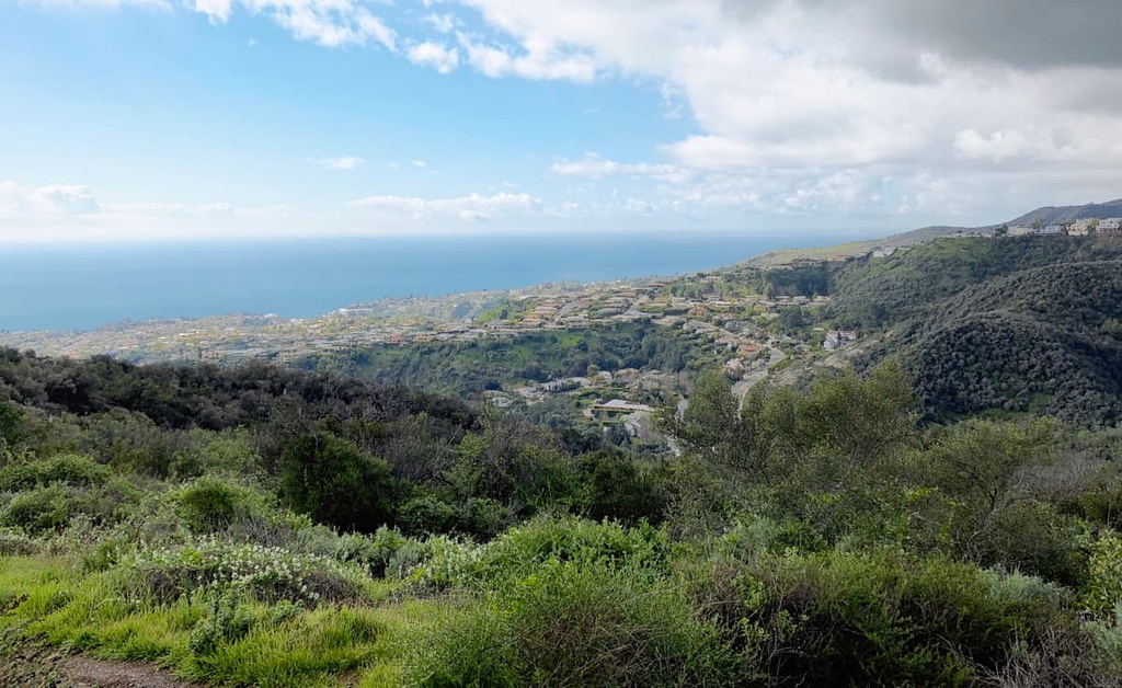
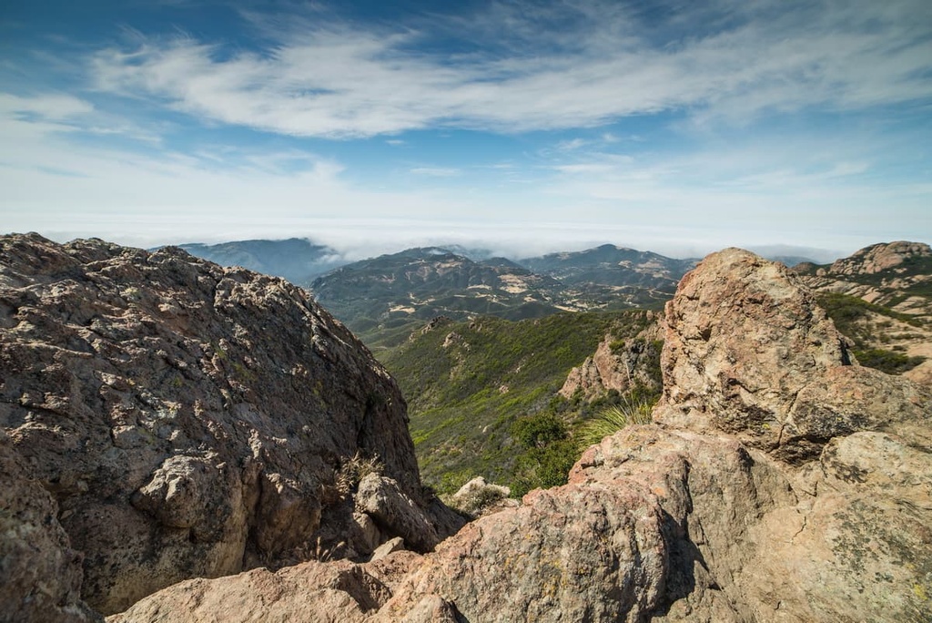
The Circle X-Ranch is a little-known gem in the Santa Monica Mountains that is a phenomenal option if you want to beat the crowds but not drive 2 to 3 hours out of the city.
Located only an hour from LA, this park offers spectacular views of the Pacific and Santa Monica Mountains. It also boasts peace, quiet, and amazing wildflowers in the spring (again, without the normal crowds that typically go to see springtime wildflowers).
Here are some of the best hiking trails in the park.
Grotto Trail
The Grotto Trail is a 2.5 mile (4 km) long out-and-back trail that descends into a verdant canyon with intermittent shade and follows a small creek down the mountain.
The trail comes to an abrupt stop just above the grotto at the West Fork of the Arroyo Sequit. While most of the hike is suitable for beginner hikers, getting to the grotto is a bit of a challenge.
Mishe Mokwa to Tri-Peaks and Sandstone Peak Loop
This approximately 7 mile (11 km) long round trip hike is arguably the best hike in the park.
This trail highlights the region's best array of wildflowers and gives you spectacular views of rock formations, as well as panoramas of the Santa Monica Mountains and the Pacific Ocean. You will also get views of Circle X’s neighbor, Point Mugu State Park from the Tri Peaks Summit.
The hike can be done in a by just following the trail or you can add a few climbs to your hike including summit ascents of Tri Peaks (3,009 ft/917 m), Exchange Peak (2,966 ft/904 m), Skull Rock (3,018 ft/920 m), and Sandstone Peak (3,110 ft/248 m).
You can start this hike from either the Sandstone Peak Trailhead parking lot or the Mishe Mokwa Trailhead parking lot, both of which are situated just up the road from the Ranger Station on Yerba Buena Road.
Rocky Peak Park is a popular destination for those living in the Simi Valley. It highlights the area's interesting rock formations and it is popular with mountain bikers and hikers alike.
Some of the best hikes in the park include:
The biggest thing to keep in mind when hiking in LA County is the region’s relative lack of water. While some parks have ready water points, many national forests or state parks require their visitors to be a bit more self-sufficient.
LA County encompasses a mostly mediterranean climate zone. But many of the hiking areas have a chaparral landscape and are extremely hot, dry, and exposed as a result.
If you are hiking within the city, then the normal safety measures associated with city hiking apply including locking your car doors, keeping your belongings on you at all times, and being aware of your surroundings.
However, if you plan to go further out of the city and into the mountains, then it is important to let someone know what your plans are and when to expect your return. The mountain ranges in LA County, even though heavily trafficked, still find a number of hikers lost, injured, or dead every year.
As far as flora and fauna goes, park officials ask hikers to watch out for bears, mountain lions, and snakes. However, there are a few other things to watch out for as well. Well traveled SoCal hikers know to watch out for poodle-dog bush (Eriodictyon parryi), a cutely names plant that is notable for secreting a severe skin irritant that can cause severe rashes if touched.
Planning a trip to Los Angeles County? Here are some of the best cities and towns to check out during your trip;
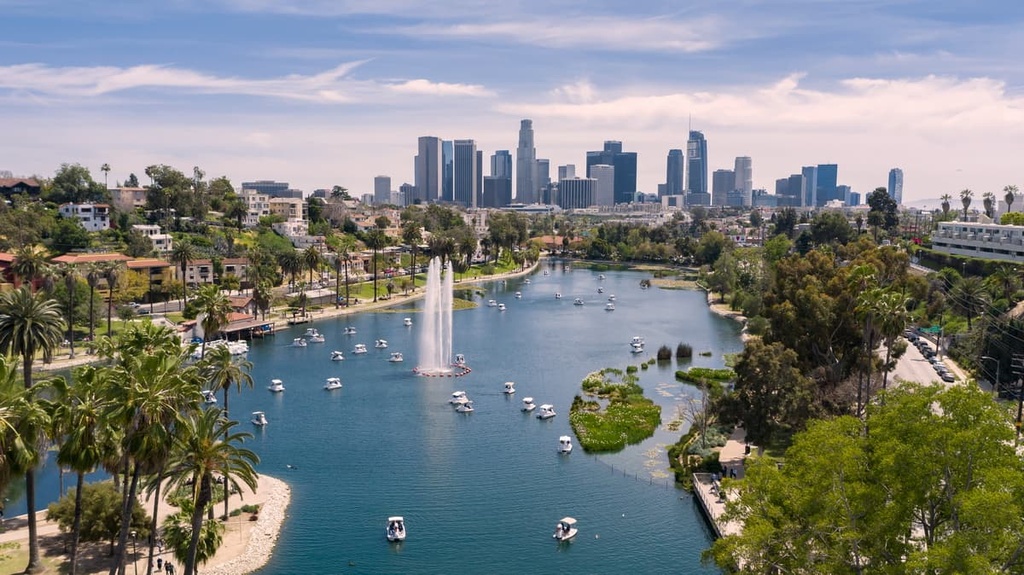
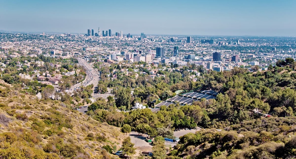
The county’s namesake city, Los Angeles is a sprawling metropolis with a population of nearly 4 million people. It is the largest city in the state of California and the second largest in the country after New York City.
Los Angeles is perhaps most famous for its filmmaking industry, though the city’s beautiful landscapes, sandy beaches, and fantastic weather are part of its charm. Of course, this amazing and heavily populated city also has some infamously bad traffic, but that’s part of the LA experience.
If you’re flying to Los Angeles County, you’ll likely arrive at Los Angeles International (LAX), though there are four other airports near the city including John Wayne, Ontario, Hollywood Burbank, and Long Beach. LA also has great road, rail, and bus connections to other nearby cities and towns.
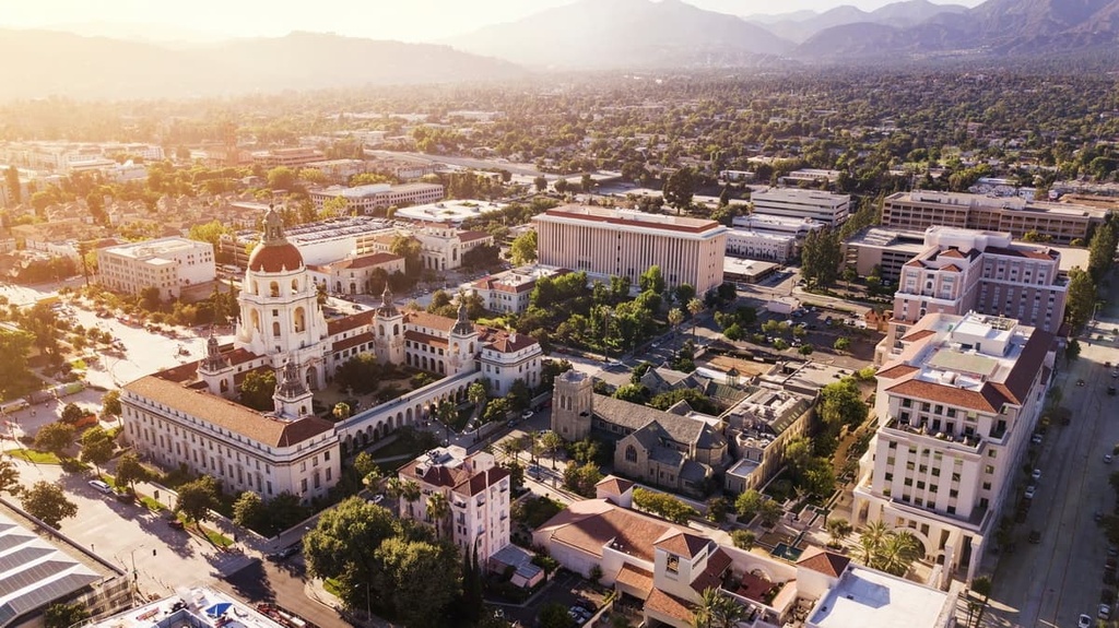
The city of Pasadena is home to approximately 140,000 people who live just to the north of downtown LA in the San Gabriel Valley. It is perhaps most famous for hosting the Rose Bowl football game each year.
Pasadena is also home to a number of major universities including Caltech as well as a handful of important museums. The Tournament of Roses Parade is also held in the city each year on January 1 or January 2, and it’s a truly amazing sight to behold.
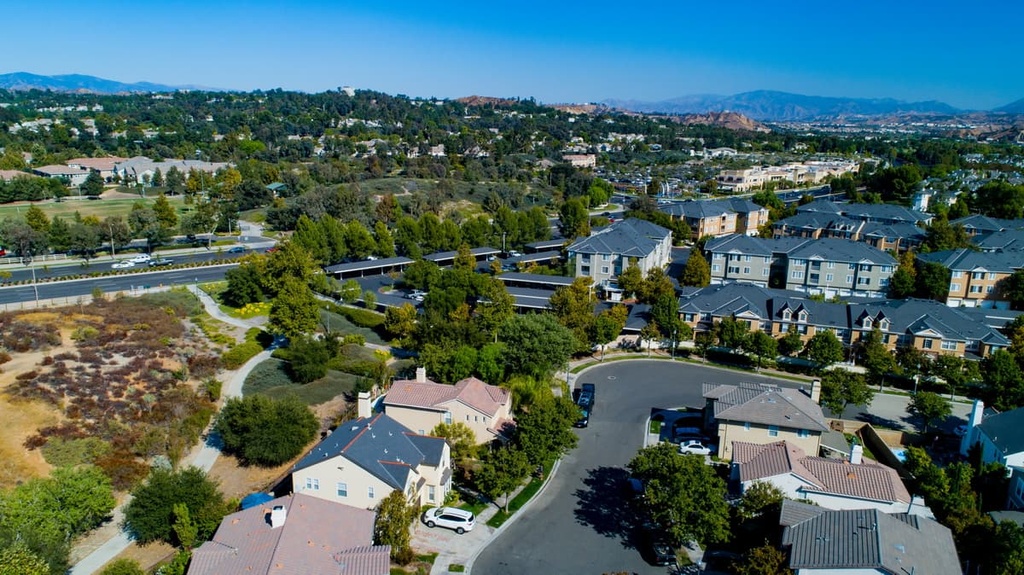
Home to approximately 230,000 people, Santa Clarita is the third-largest city in LA County. It is situated in the northwestern part of the county to the north of the San Gabriel Mountains in the Santa Clarita Valley.
Santa Clarita is currently one of California’s fastest-growing cities because it offers a cheaper cost of living than many of the other major cities in LA County. There are many parks and hiking trails to check out in and around the city. However, roller coaster enthusiasts can also visit the Six Flags Magic Mountain theme park, which is arguably Santa Clarita’s most popular attraction.
Palmdale is a community of approximately 150,000 people that’s located in the far northern part of LA County in the Antelope Valley. It is separated from the rest of the county by the San Gabriel Mountains and it is a major commercial and cultural hub of the region.
These days, Palmdale’s biggest economic drivers are the aerospace and manufacturing industries. It is home to a massive indoor shopping mall called the Antelope Valley Mall, as well as a number of fantastic hiking trails.


ultra
sierra-club-100
100-peaks-section-emblem
california-ultras
ultra
sierra-club-100
100-peaks-section-emblem
california-ultras


