Scan the QR code and open PeakVisor on your phone
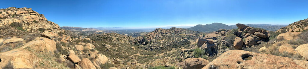
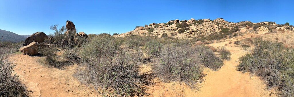
Just northwest of Los Angeles in the Simi Valley is Rocky Peak Park. Aptly named, Rocky Peak Park is a surprisingly large, 4800 acre desert recreation area that is home to seemingly endless fields of boulders that stack upon themselves to create the many hilly peaks of the park. As part of the Rim Valley Corridor, a community-based effort to expand the Santa Monica Mountains National Recreation Area for the purposes of preserving some of the last remaining wild spaces in the greater Los Angeles area, Rocky Peak Park stretches from the 118 Freeway five miles northward to Las Llajas Canyon in the Santa Susana Mountains between Chatsworth and Simi Valley. Rocky Peak Park is a popular destination for casual hikers and mountain cyclists and a great place for families to visit for the day.
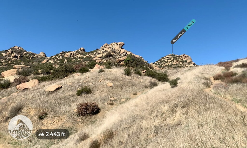
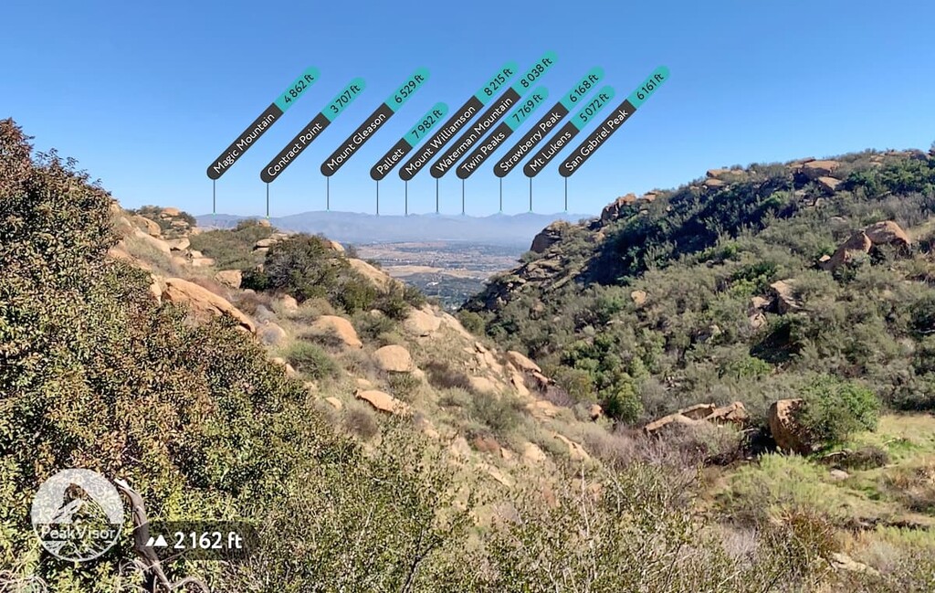
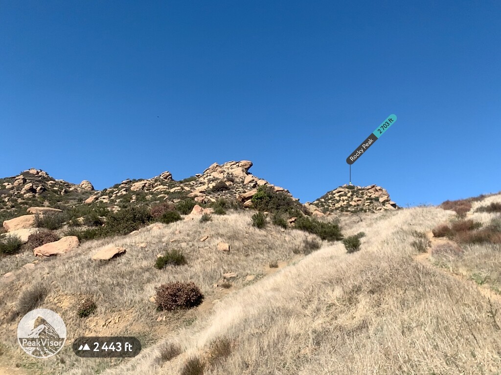
While visiting the park you will get great views of Los Angeles and Ventura Counties, as well as the Angeles National Forest. You will also get be able to see a number of notable peaks and landmarks in the region such as; Magic Mountain (4862 ft), Contract Point (3707 ft), Mount Gleason (6529 ft), Pallett (7982 ft), Mount Williamson (8215 ft), Waterman Mountain (8038 ft), Twin Peaks (7769 ft), Strawberry Peak (6168 ft), Mount Lukens (5072 ft), San Gabriel Peak (6161 ft), and Verdugo Peak (3133 ft), in the Angeles National Forest; Flint Peak (1893 ft), Duck Pond, San Juan Hill (1785 ft), Cahuenga Peak (1818 ft), Santiago Peak (5696 ft), the neighborhoods Van Nuys and Sherman Oak, Lake Balboa, Reseda Lake, Encino Reservoir, and San Vincente Mountain (1962 ft), Temescal Peak (2126 ft), Mount Orizaba (2103 ft), Chatsworth Peak (2310 ft), Camarillo Hills (873 ft), Seasons Fountain, Red Mountain (2149 ft), South Mountain (2326 ft), La Cumbre Peak (3986 ft), Divide Peak (4705 ft), Monte Arido (6017 ft), Mordhoff Peak (4505 ft), Santa Paula Peak (4951 ft), Hines Peak (6699 ft), Topatopa Peak (6211 ft), and Hopper Mountain (4531 ft), in Los Angeles and Ventura Counties; and Oat Mountain (3740 ft) near Chatsworth, just outside of the park; as well as Rocky Peak (2703 ft), the only named peak in the park, among many others.
Rocky Peak Park resides right on the county line between Ventura and Los Angeles Counties and marks the point where the county line shifts from direct north to northwest. The region was originally home to the Tataviam, Tongva, and Chumash people for eight thousand years. Just west of Rocky Peak Park is the The Chumash Burro Flats Painted Cave in the Simi Hills on the Santa Susana Field Laboratory property. Rocky Peak Park’s rugged western desert look and proximity to Los Angeles has made it a popular shooting location for a number of westerns, especially old hollywood films.
Getting to Rocky Peak Park from Los Angeles is incredibly easy as it sits right on the 118 Freeway. Coming from Los Angeles, Rocky Peak Park is directly off Exit 32 on the 118 Freeway. There are a number of other, smaller entrances to the park in the residential Simi Valley and via the neighboring Joughin Ranch Regional Park, but the 118 Freeway entrance is the most straightforward and popular. There is limited parking directly at the park entrance, but a large parking area off the road across the Rock Peak Park Overpass.

There is one main path through the park along the Rocky Peak Trail, which doubles as the fire road. There are also a number of secondary paths leading into and out of and looping around through the neighboring Joughin Ranch Regional Park, making it easy to spend an entire day exploring the area.
The moderately strenuous hike to Rocky Peak is a straightforward in and out hike that is about 5 miles long. Starting at the entrance of the park directly off exit 32 on the 118 Freeway the trail follows the main fireroad through the park until it breaks off onto a smaller trail that leads up to the peak. This is a dual use trail and you will see a fair amount of mountain cyclists as you hike. On your way towards the peak there are a number of small lookout points and rock formations for you to rest at and explore. There are no signs that indicate where the peak is so using the PeakVisor App throughout your hike will be incredibly helpful in assisting you in finding the peak and the subsequent smaller trail that leads to it. This hike has a lot of uphill climbing as you head further into the park. Once you get up to Rocky Peak you will have a great view of the entire Simi Valley and Los Angeles and Ventura Counties.
The Chumash Trail begins at an alternative entrance to the park on Flanagan Drive in a residential subdivision of Simi Valley. The smaller trail leads up into the park and connects with the Rocky Peak Trail and has especially nice views of wildflowers during the spring. This trail is about 3 miles long.
The Hummingbird Trail also starts at an alternative entrance to the park with the trailhead a few hundred yards outside of the park boundaries. The entrance is just off Kuehner Drive in a residential subdivision of Simi Valley and leads up into the park before connecting with the Rocky Peak Trail. The Chumash Trail bisects the Rocky Peak Park trail at about its halfway point while the Hummingbird Trail bisects the trail closer to the entrance. This trail is also about 3 miles long.