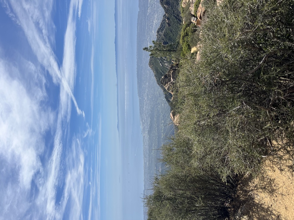
La Cumbre Peak is a 3,997-foot (1,218 m) peak in the Santa Ynez Mountains north of Santa Barbara, California and located within the Los Padres National Forest. Composed of boulders and slabs of the Matilija Sandstone amid groves of pine trees, it is the highest summit in proximity to the city. Adjacent to La Cumbre is Arlington Peak (3,258 ft (993 m)) and Cathedral Peak (3,336 ft (1,017 m)). Other peaks within the Santa Ynez Range include Santa Ynez Peak, 15 miles (24 km) to the west, and Divide Peak, 15 miles (24 km) to the east.
East Camino Cielo (originally known as Ridge Route) was constructed between October 1930 and June 1931 as a single lane road that extended 18 miles (29 kilometres) from San Marcos Pass to the summit of La Cumbre Peak. The intermittently curvaceous road was opened to the public, built with frequent turnouts and a set maximum speed limit of 15 mi (24 km) per hour. Today the road is frequently used by runners and cyclists for training, as the elevation gain is substantial and sustained, while there is relatively little car traffic.
Construction of a fire lookout station upon the summit featuring a seasonal glass house was completed in the summer of 1923 by the US Forest Service, but may have been impacted by a fire that approached it from three sides in September of that year. In 1946, "La Cumbre Peak Lookout" was built to replace a California Region 5 Plan 4AR cabin that was mounted on a 10 ft (3.0 m) open timber tower. Utilizing an "innovative experimental design" that employed relatively high walls and sloped glass, the newer structure was considered to be expensive for its time (at a cost of $6,500) and was therefore the only model of its type to be constructed. The lookout was listed in the National Historic Lookout Register on June 19, 2010.
There's a trail leading to the summit.
By elevation La Cumbre Peak is
# 67 out of 133 in Los Padres National Forest # 29 out of 109 in Santa Barbara County # 6 out of 42 in the Santa Ynez Mountains
By prominence La Cumbre Peak is
# 22 out of 133 in Los Padres National Forest # 16 out of 109 in Santa Barbara County # 5 out of 42 in the Santa Ynez Mountains
We use GPS information embedded into the photo when it is available.
3D mountains overlay
Adjust mountain panorama to perfectly match your photos because recorded by camera photo position might be imprecise.
Move tool
Rotate tool
Zoom
More customization
Choose which peak labels should make into the final photo and what photo title should be.
Next
Photo Location
Satellitte
Flat map
Relief map
Latitude
Longitude
Altitude
OR
Latitude
°'''
Longitude
°'''
Apply
Register Peak
Peak Name
Latitude
Longitude
Altitude
Register
Teleport
PeakVisor
This 3D model of Sagarmatha National Park in Nepal was made using the PeakVisor app topographic data. The mobile app features higher precision models worldwide, more topographic details, and works offline. Download PeakVisor maps today.
Download OBJ model
PeakVisor
The download should start shortly. If you find it useful please consider supporting the PeakVisor app.
PeakVisor for iOS and Android
Be a superhero of outdoor navigation with state-of-the-art 3D maps and mountain identification in the palm of your hand!


.jpg)
.jpg)
.jpg)


