Scan the QR code and open PeakVisor on your phone
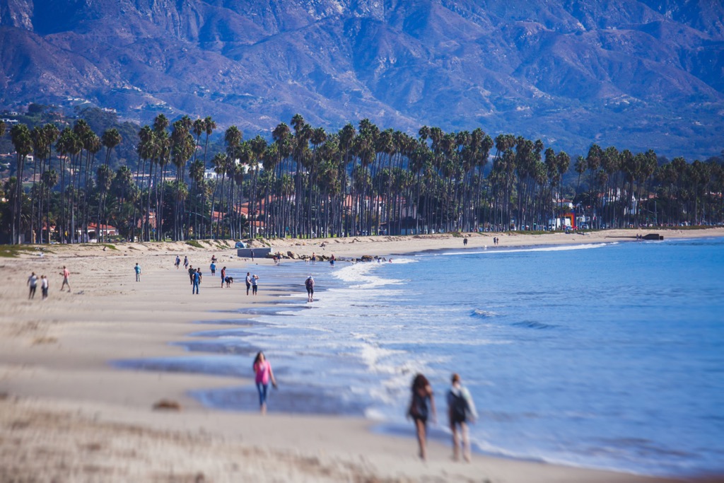
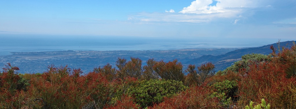
Running east to west north of Santa Barbara, California in the United States, the Santa Ynez Mountains stretch across Santa Barbara County into Ventura County. Only a short distance from the Pacific Ocean, these mountains offer stunning coastal views from their summits. The Los Padres National Forest encompasses a large portion of the range. There are 44 named mountains. Divide Peak is the tallest at 4,705 ft (1,434 m) and Santa Ynez Peak (4,291 ft/1,308 m) is the most prominent (2,073 ft/632 m).
The Santa Ynez Mountains are the westernmost of the Transverse Ranges along California’s southern and central coast. Running east-west, the range goes between Point Arguello almost to Ojai, at times only a couple miles (3 km) from the Pacific Ocean. The range is neighbored by the two other ranges of the Transverse Ranges – the San Rafael and Sierra Madre Mountains.
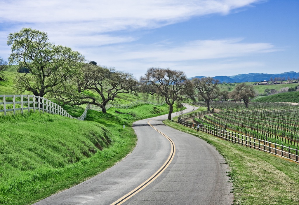
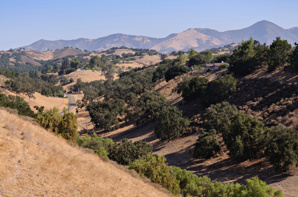
To the north, the Santa Ynez River runs parallel along most of the range. There are two main mountain passes for vehicles. Gaviota Pass lies on the range’s western side. It offers a gentler climb, more lanes, and less fog, making it the preferred route for many. The San Marcos Pass is steep, has winding roads, and sometimes experiences heavy fog and rock slides. It is very scenic but a more challenging road.
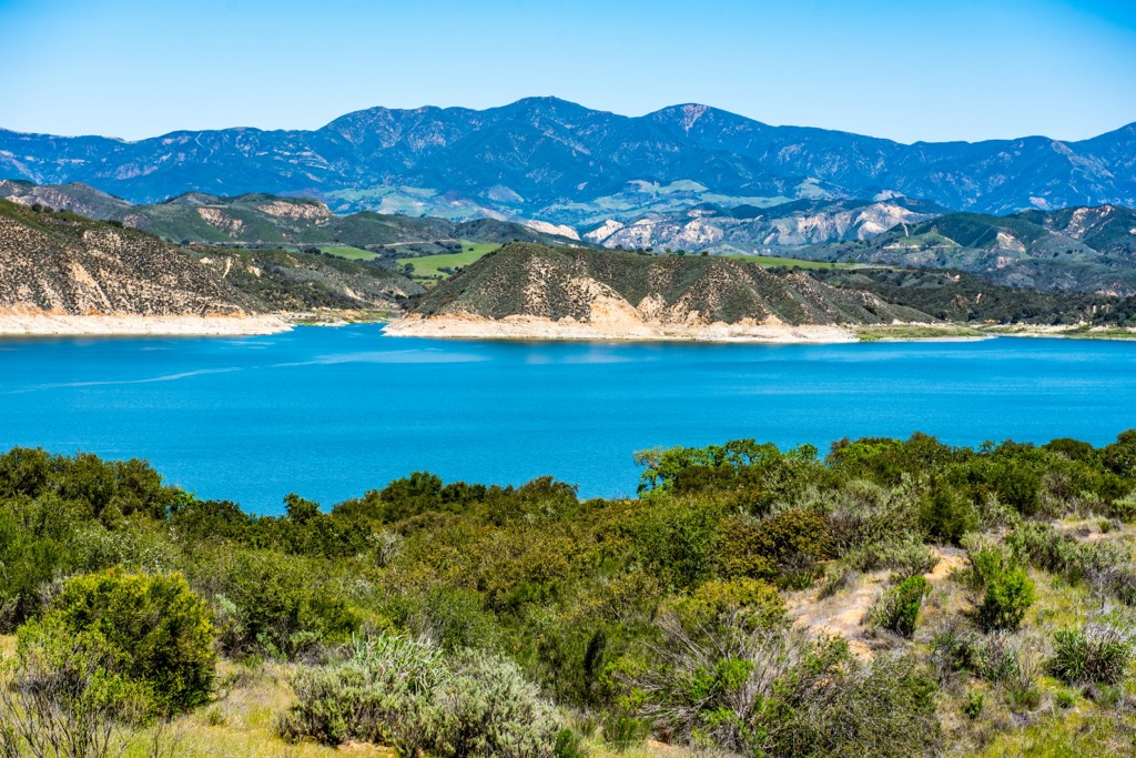
Besides the hiking and rock climbing opportunities in the mountains, two notable attractions include the Chumash rock art paintings at Painted Cave State Historic Park and Cachuma Lake, bordered by the Santa Ynez and the San Rafael Mountains. A large portion of the Santa Ynez Mountains lie within Los Padres National Forest and a small portion is part of Gaviota State Park.
The Santa Ynez Mountains represent some of the region’s youngest mountains – only about five million years old. Like the other mountains of the Transverse Ranges, these mountains were created by the Pacific and North American Plates colliding near the big bend of the San Andreas Fault. It remains an active seismic region.
Composed primarily of sedimentary rock, the geological region contains distinct formations. The Juncal Formation is the oldest and contains sandstone and shale that formed around 50 million years ago. This layer measures around 4,500 ft (1,370 m) thick and is best seen in the Red Rock region and upper parts of the Santa Ynez Valley.

The Cozy Dell Shale is made of sea mud that was deposited around 37 million years ago. It is exposed in the saddle between Cathedral and La Cumbre Peaks, and on the connector trail between Rattlesnake and Tunnel Trails. The Matilija Sandstone was formed by granite particles that accumulated on the ocean floor. It is hard and less susceptible to erosion. The best place to spot this formation is on the upper sections of the San Ysidro Trail and around La Cumbre Peak.
The Coldwater Sandstone has mollusk fossils and is present along the upper Jesusita Trail and the Cold Springs Trail. The Sespe Formation contains a mix of shales, sandstones, and conglomerates. It is red due to iron oxides and can be spotted on the Jesusita Trail and in the Montecito Foothills.
Located just off the Pacific Coast, the Santa Ynez Mountains receive around 34 inches (86 cm) of precipitation annually. Chaparral communities are one of the region’s primary vegetation types. Here you will find manzanita, chemise, silk-tassel bush, scrub oak, wild lilac, mountain mahogany, islay, monkeyflower, toyon, laurel sumac, current, buckwheat, and sages.
Sudden Oak Death is a pathogen (Phytophthora ramorum) that kills tanoak and coast live oak, as well as affecting other tree species, in the region. It spreads through moist soil and mud. Recreators are asked to be conscious of signs of the pathogen on trees and to do their best to stay away or to thoroughly clean their shoes if they’ve been in an infested area.
Native grasslands are another vegetation type in the area that have been altered in recent history, in this case by conversion to farmland or non-native species. While greatly reduced in extent, some native species still present include wild oats, barley, and ripgut brome.
The mountains and surrounding valleys are home to mountain lions, bobcats, coyotes, mule deer, rabbits, and squirrels. A number of lizards and snakes also thrive here, as do a range of birds including quail, doves, turkeys, chukar, pigeons, and birds of prey.
The Santa Ynez Mountains are part of the traditional territory of the Chumash Native Americans. Living along coastal California, their territory once spanned 7,000 sq mi (18,130 sq km) from Malibu to Paso Robles, and inland up to the San Joaquin Valley.
They were hunters, gatherers, and fishermen who developed a high level of craftsmanship in boat-making, basketry, and stone cookware. Communities had multiple professions and divisions of labor, and women were equally allowed to be chiefs and priests. The early Chumash left behind cave drawings, initially with charcoal and later with red, orange, and yellow pigment, that can be seen at the Painted Cave State Historic Park.
In 1769, a Spanish expedition led by Gaspar de Portola arrived in the region. Within a short time, they established five missions in Chumash territory. Foreigners introduced diseases that decimated the Chumash population, reducing their numbers from 22,000 pre-contact to less than 3,000 people by 1831.
The early cities of Santa Barbara, Montecito, Summerland, and Carpinteria sit on Chumash territory. With mission secularization in 1834, the land did not get redistributed to surviving Chumash as Mexican authorities had promised. The continued separation from their land, resources, and way of life contributed to a further decline in tribe numbers.
By 1870, the region’s Anglo culture was booming. The California coast quickly developed a reputation for wealthy tourists and those seeking health retreats. As this happened, many of the remaining Chumash were relegated to menial work on farms and ranches.
In recent years, the tribe has risen to economic self-sufficiency with revenue from their gaming property and continues to push to reclaim and embrace their rich culture and traditions.
The Los Padres National Forest that encompasses a portion of the Santa Ynez Mountains was created in December 1936.
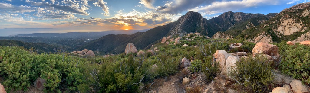
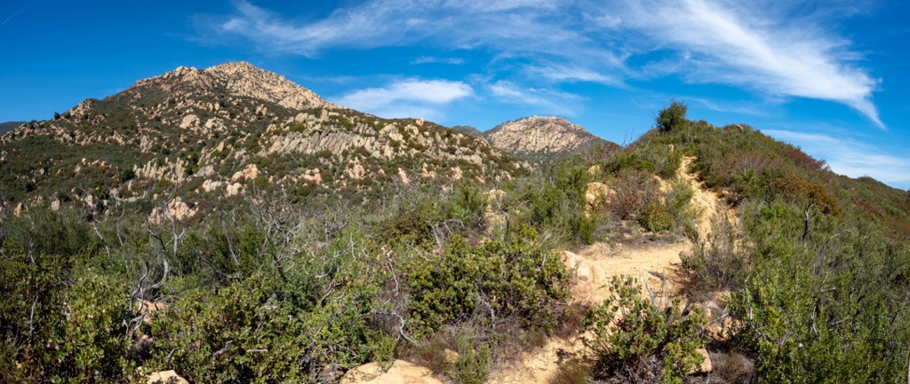
Located as close as they are to Santa Barbara, the Santa Ynez Mountains offer a number of trails that attract locals and visitors alike. A list of top hikes can be found here.
Located in Gaviota State Park, Gaviota Peak (2,451 ft/747 m) is only two miles (3.2 km) from the ocean. The trail measures 6.5 mi (10.5 km) out and back with about 2,000 ft (610 m) elevation gain. Shortly beyond the trailhead, hikers can choose to take the single-track Trespass Trail to the top. There is the option to take the fire road down to make it a loop. This is a popular hike for its moderate workout and the stunning ocean views from the top.
Another popular hike ascends La Cumbre Peak (3,986 ft/1,215 m). Considered moderate, the trail is 10 mi (16.1 km) out and back. Like many of the peaks here, this is a popular route for the sweeping vista across Santa Barbara and the Pacific Ocean from the top. The sun can be intense on this trail and it is best to be prepared with sunscreen and sufficient water.
Cathedral Peak (3,333 ft/1,016 m) is a great choice if you’re looking for a challenge. The great views from the top are earned by passing huge boulders along a route rated as Class 3 rock climbing. With this in mind, this is not a good trail for dogs.
The trail begins on Tunnel Road. From there it follows Jesusita Trail to Mission Creek. After turning right at the creek, look for a steep trail on the left to take to the summit. It is 4 mi (6.4 km) roundtrip with 3,000 ft (915 m) elevation gain.
Those looking for a quick but rewarding hike will enjoy the climb to Lizard’s Mouth (3,077 ft/938 m). Named after a unique rock formation at the top, this is a popular short trail near the city that rewards visitors with great views across the coast.
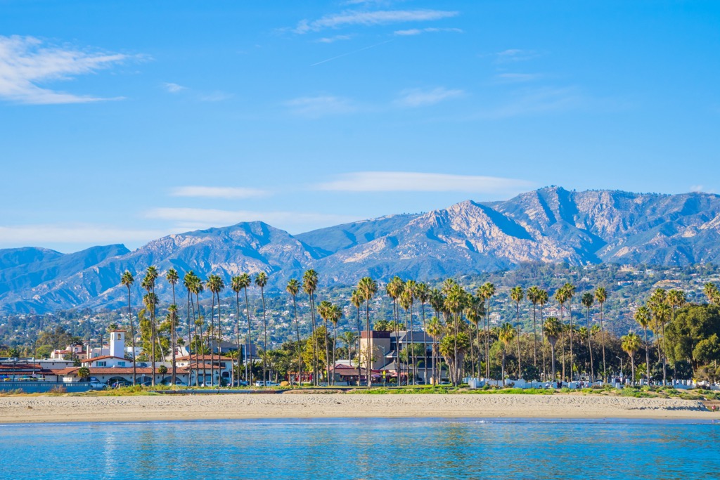
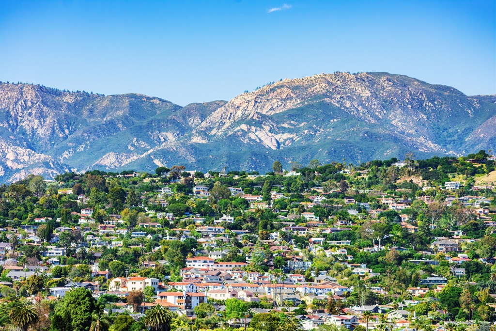
Santa Barbara sits at the base of the mountains and Los Angeles is only an hour and a half away by car. This is a popular area with plenty to do both culturally and in the outdoors.
Santa Barbara has a population of 88,000. Boasting beaches, art galleries, craft markets, museums, botanic gardens, whale watching, bike paths, hiking trails, kayaking, and surfing, there is little this city doesn’t offer.
There are more than 450 restaurants that provide options for a diverse range of international cuisines, local wines, fresh seafood, fine dining, and farm-to-table meals. Accommodation is plenty and varied, ranging from camping and RV parks to hotels to resorts and spas.
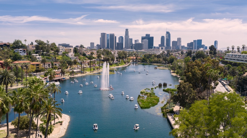
Los Angeles is a metropolis with a population of 3.85 million people. This cultural hub is packed with art, film, music, museums, film studios, adventure parks, and resorts and spas. Outside the city are hiking trails in Angeles National Forest and, slightly further east, in Joshua Tree National Park.
Home to many multicultural neighborhoods, the city houses incredible cultural diversity with dining options to match. WIth cuisines from around the world, innovative chefs, and Michelin star restaurants, some choose to explore the city by food alone. Hotels around the city range from top-of-the-line luxury to budget friendly accommodation.