
Scan the QR code and open PeakVisor on your phone
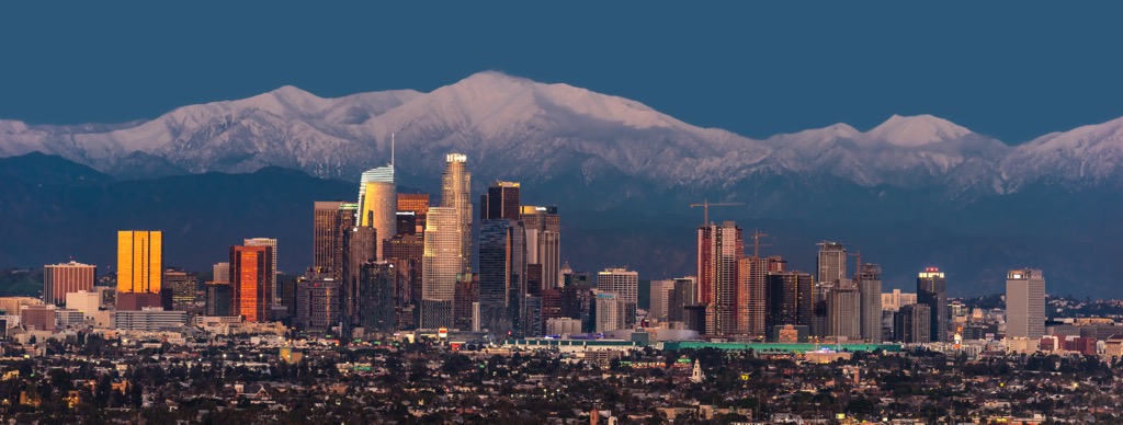
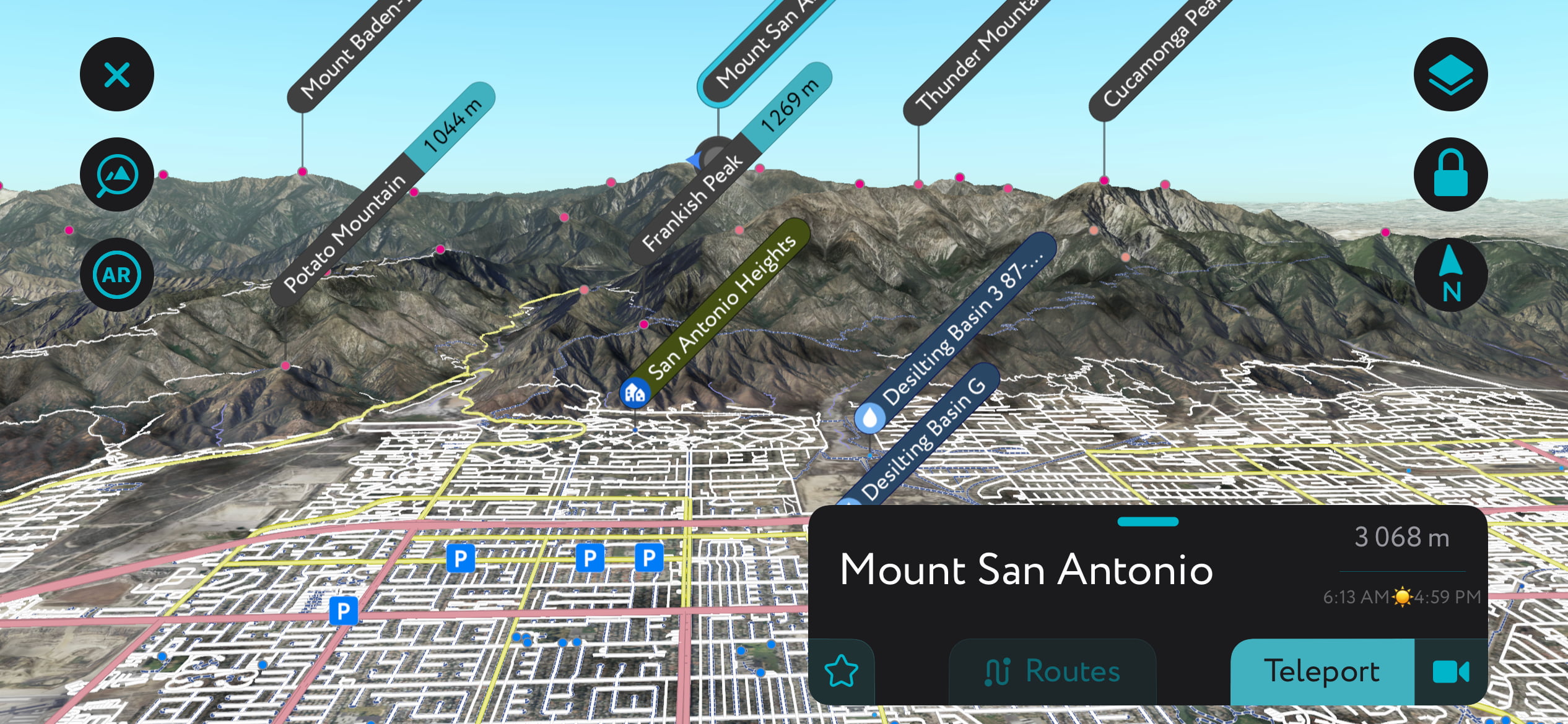
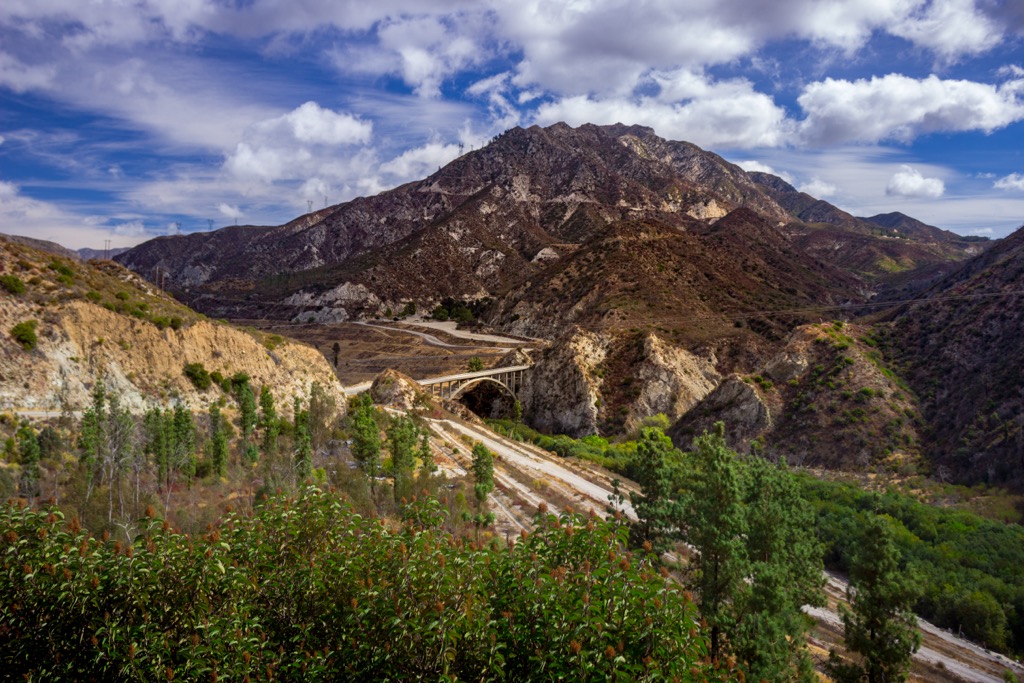
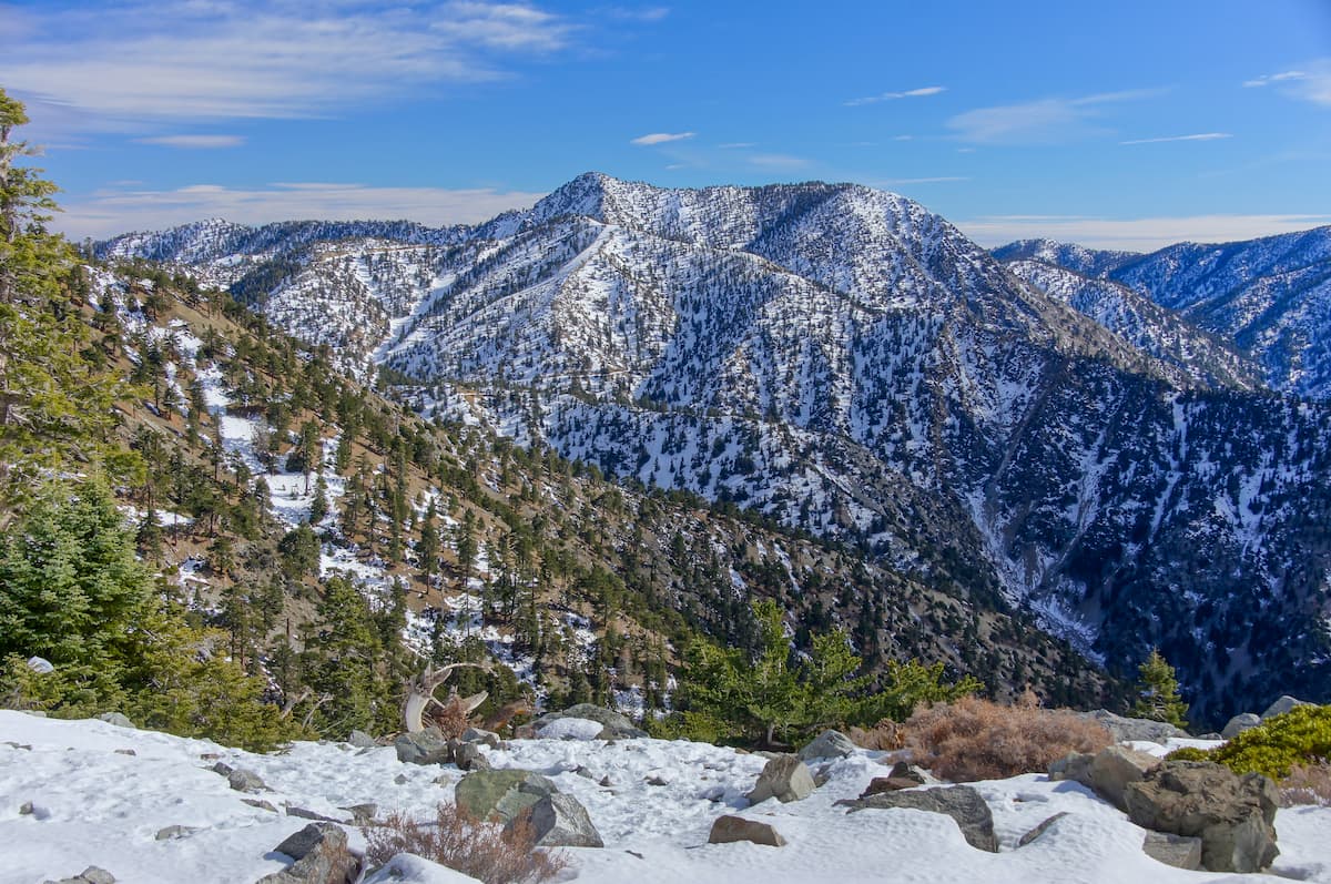
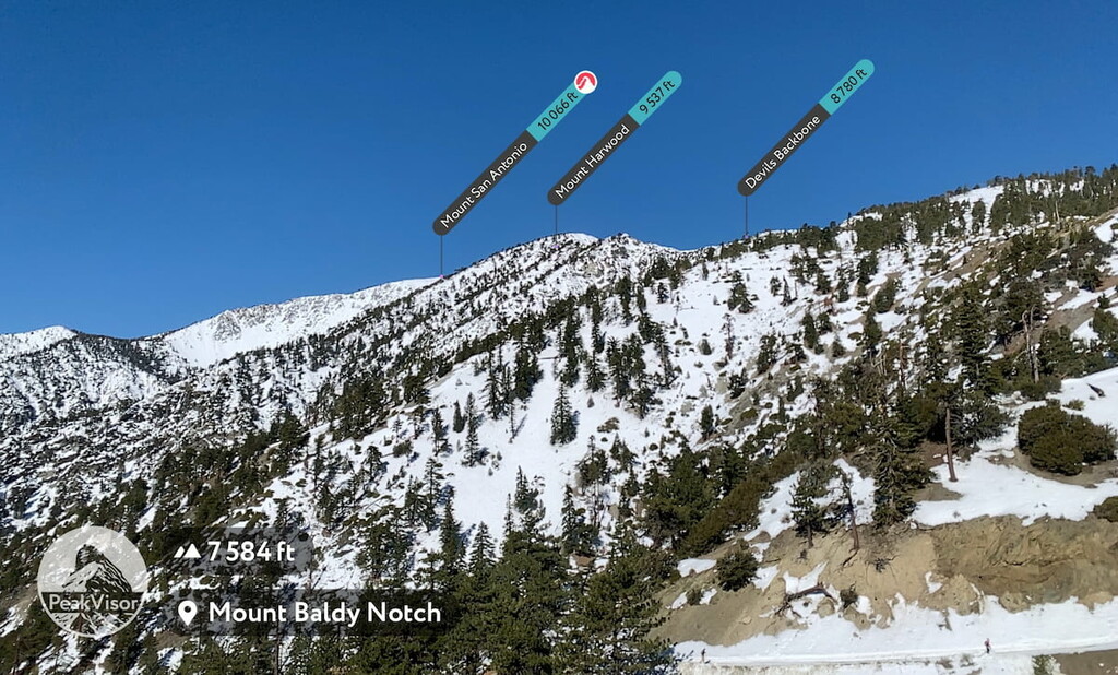
The Angeles National Forest is a favorite getaway for any Angeleno and offers many outdoor activities, including hiking, horse riding, cycling, skiing, and snowboarding. Angeles National Forest covers 700,176 acres (283,351 ha) and lies primarily within Los Angeles County in southern California, USA. The national forest overlaps part of the San Gabriel range and covers most of the San Gabriel Mountains National Monument. There are 144 named mountains; the tallest and most prominent is Mount San Antonio at 10,066 ft (3,068 m) elevation with a prominence of 6,227 ft (1,898 m).

Angeles National Forest manages five wilderness areas – the San Gabriel, Sheep Mountain, Cucamonga, Pleasant View Ridge, and Magic Mountain wildernesses. The national forest encompasses watersheds that provide one-third of the drinking water for Los Angeles and 18 debris basins and dams that work as a flood control system. Many streams and headwaters flow down from the mountains; the San Gabriel River is the largest river draining the Angeles National Forest.
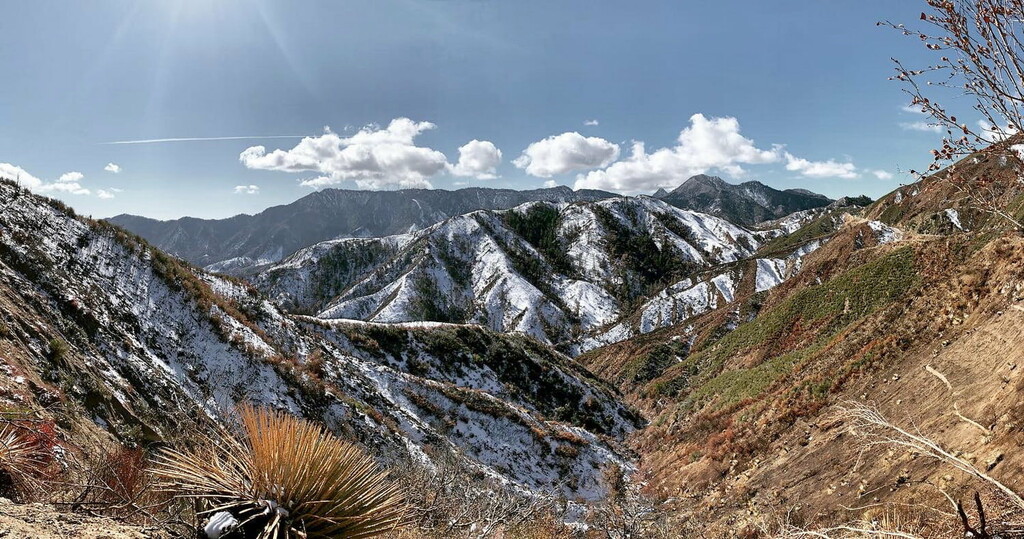
Though its peaks only reach about 10,000 ft (3,000 m), the prominence is massive; elevations within the forest range from 1,200 to 10,066 ft (365 to 3,068 m). The tallest peak in the Angeles National Forest is Mount San Antonio (10,066 ft / 3,068 m), better known as Mount Baldy.
As a result, the climate varies significantly throughout the forest. Lower elevations feature a Mediterranean and, in some inland canyons, almost desert climate. Meanwhile, upper elevations are characterized by alpine tundra, with a deep snowpack throughout the winter.
Precipitation and upper mountain snowpack also vary significantly from year to year, with wet years receiving 5-10 times more precipitation than dry years. The end of February 2023 saw 110 inches (2.75 m) of snow at the base of Mount Baldy Ski Resort.
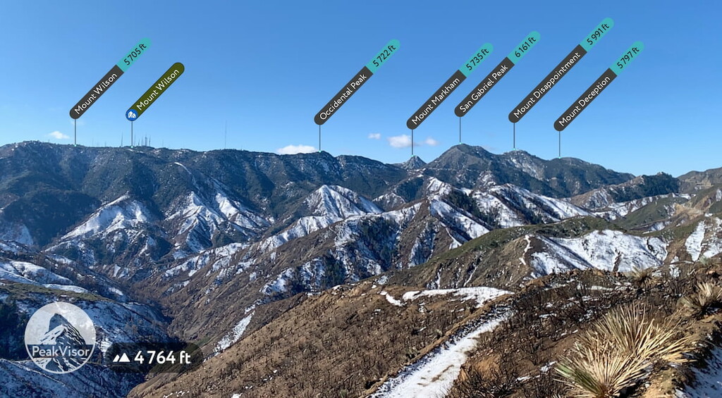
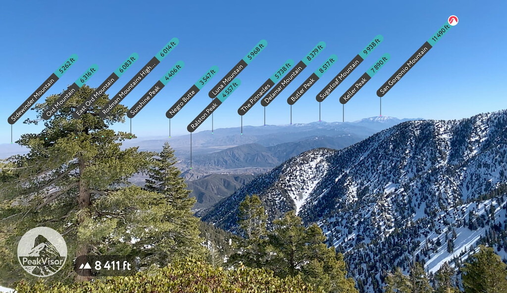
Notable peaks include Mount San Antonio, West Baldy, Pine Mountain, Dawson Peak, Mount Harwood, Mount Baden-Powell, Throop Peak, Mount Burnham, Telegraph Peak, Mount Hawkins, Burnt Peak, Mount Lukens, Mount Gleason, Strawberry Peak, Pacifico Mountain, Mount Williamson, San Gabriel Peak, and Monrovia Peak.
The San Gabriel mountains are composed primarily of granite rocks dating from the Mesozoic era 65 to 245 million years ago. Like most of the Sierra Nevada, much of the range is defined by sandy soils comprising decomposing granite. Igneous and metamorphic rock from the Precambrian era 544 to 4,600 million years ago and Pleistocene sedimentary deposits are also present.
The San Gabriel Mountains are part of the greater Transverse mountain system. This mountain system began uplifting around 6 million years ago as two tectonic plates collided. Geologic forces like the San Andreas Fault have continued to shape the mountains.
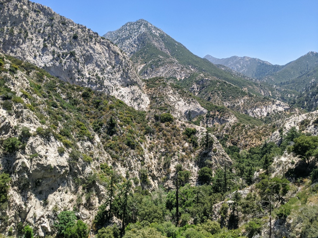
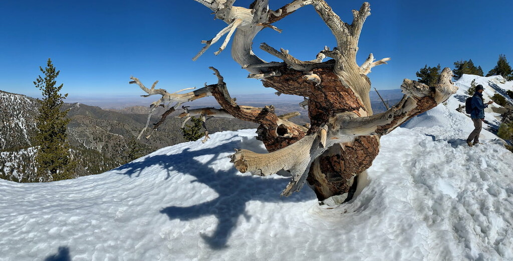
Angeles National Forest has a typical southern California landscape with lower-elevation forests dominated by dense chaparral that shifts to pine and fir at higher elevations. Some of the limber pines are over 1,000 years old.
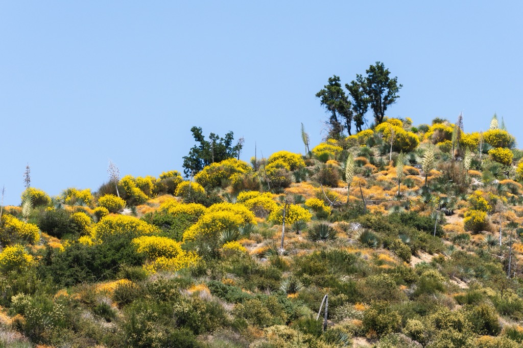
Wildflowers abound in spring, including golden yarrow, baby blue eyes, tree poppy, popcorn flower, sweet alyssum, Silverleaf lotus, holly leaf redberry, blue-eyed grass, white-flowered phacelia, white nightshade, mountain violet, silvermat lotus, purple nightshade, dusty maiden buds, and tower mustard.
The area’s canyons and perennial streams are home to much wildlife, some threatened and endangered species. Some of the more delicate species in the park are the Santa Ana sucker, California unarmored 3-spined stickleback, California red-legged frog, mountain yellow-legged frog, desert tortoise, and Nevin’s barberry. Other species include the spotted owl, bighorn sheep, bobcats, mountain lions, and bears.
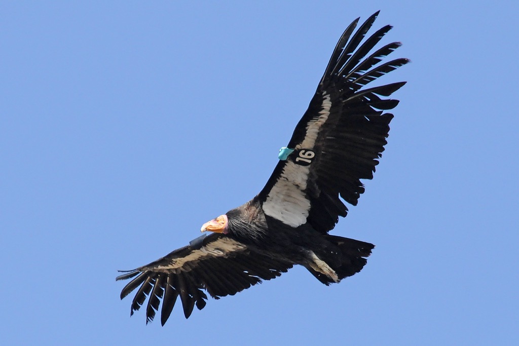
The California condor is a particularly fascinating bird endemic to the region. The condor boasts a wingspan of 10 ft (3 m) and can weigh up to 26 lbs (12 kg). Once declared extinct in the wild, the condor was bred in captivity and eventually repopulated throughout its former range, albeit in much smaller numbers.
About 550 birds now soar throughout the California coastal mountains, the high desert ranges of Northern Arizona and Southern Utah, and parts of Baja California, Mexico. Still, such a fragile population makes the condor one of the rarest species in the world. With the elimination of DDT, the pesticide responsible for the downfall of the condor and other large birds of prey, there is hope for this magnificent creature.
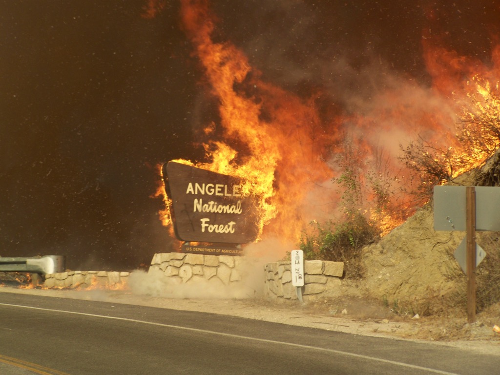
As is often the case in Southern California, there have been several notable fires in the Angeles National Forest.
Angeles National Forest contains hundreds of archaeological sites, including two sites of Native American rock art within the San Gabriel Mountains National Monument. The oldest artifacts indicated human presence as far back as 7,500 years. These artifacts include tools for grinding seeds and hunting. More permanent or regular sites appeared about 5,000 years ago, with archeological evidence suggesting villages, ovens, and food processing sites.
Over time, five native tribes developed – the Tongva, Tataviam, Chumash, Kitanemuk, and Serrano – and called the San Gabriel Mountains home for millennia.
The Gaspar de Portola expedition arrived in 1769, opening the region to Spanish influence. European presence quickly wrought destruction upon indigenous culture. By 1800, much of the local Native American culture was altered and disappearing due to disease, religious conversion, and loss of territory.
Mexico gained independence in 1821. As the forest fell under Mexican rule, ranching increased. Shortly thereafter came the first discoveries of gold in California, prompting the first of several gold rushes. Some parts of the San Gabriel Mountains had quartz veins and exploratory sites to look for gold, but mining in the region never took off; most sites were abandoned by 1896.
Before Angeles received its National Forest designation, the San Gabriel Forest Reserve and the San Bernardino Forest Reserve were established in 1892 and 1893, respectively. In 1908, these two forest reserves were joined to make the Angeles National Forest. In 1925, a portion of the Angeles National Forest and the Cleveland National Forest were detached to re-establish the San Bernardino National Forest.
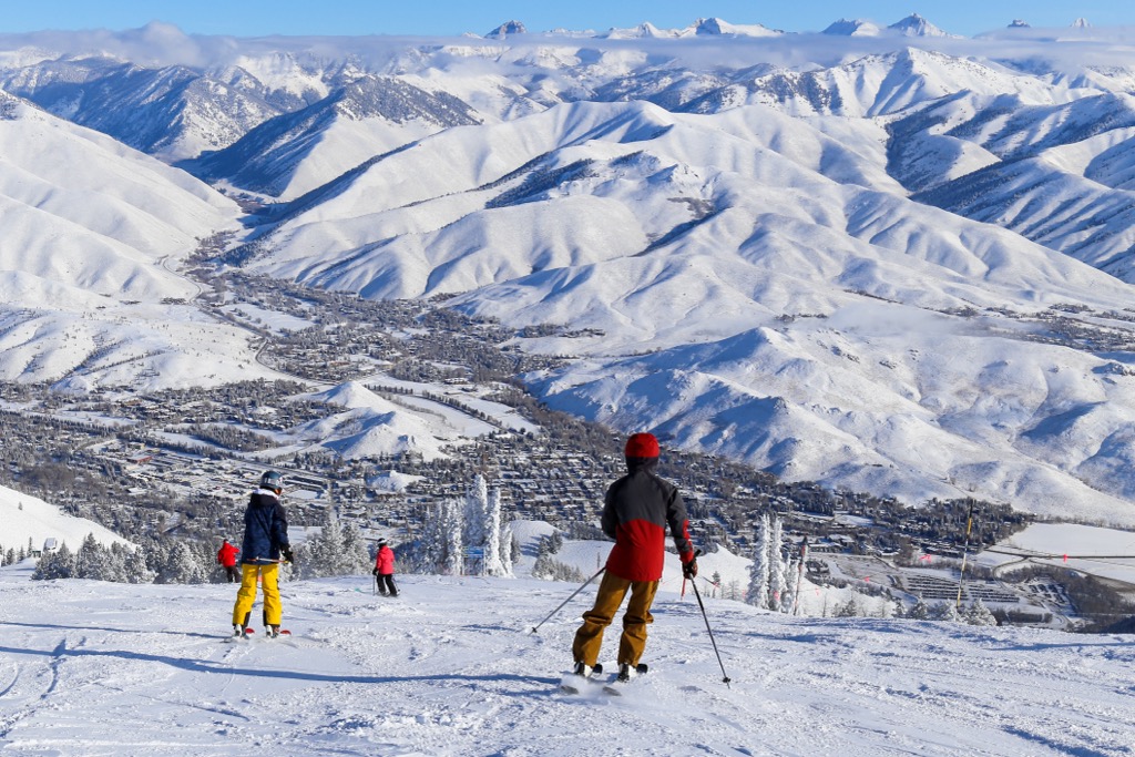
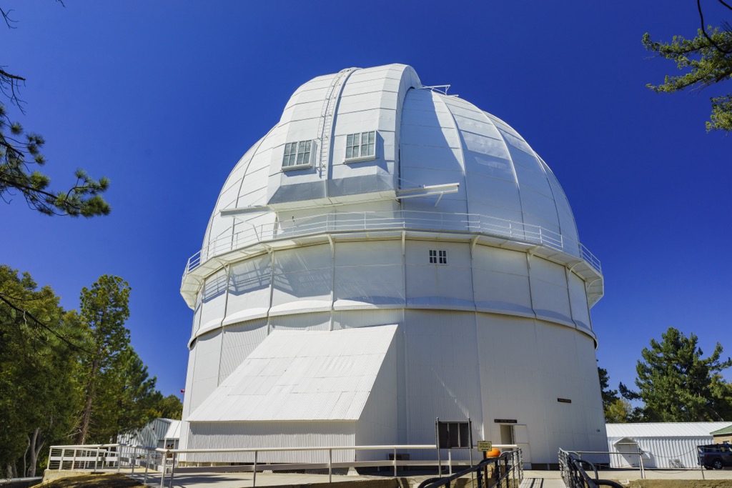
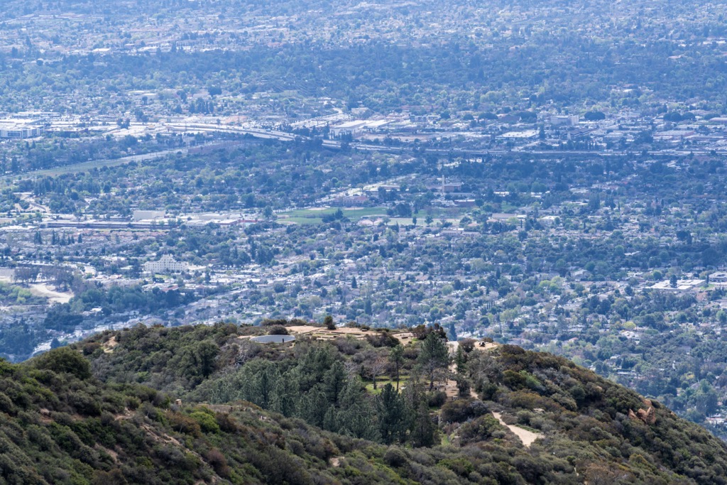
Today, the forest is a hub for recreationists throughout Los Angeles, the US’s 2nd largest city. The Mount Baldy ski area opened in 1944 and continues to operate with four lifts, most recycled from the larger Mammoth Mountain in the central Sierra. Another notable feature is the Mount Wilson Observatory. The observatory houses two of the world’s largest telescopes and is open to visitors.
The Angeles National Forest has 557 mi (895 km) of hiking and horseback riding trails, including a portion of the Pacific Crest Trail. There are also ample opportunities for camping and mountain biking. Many hikes require an Adventure Pass, which can be purchased as a day or season pass. Those wanting to access one of the wilderness areas must also obtain a free permit simply by registering in advance.
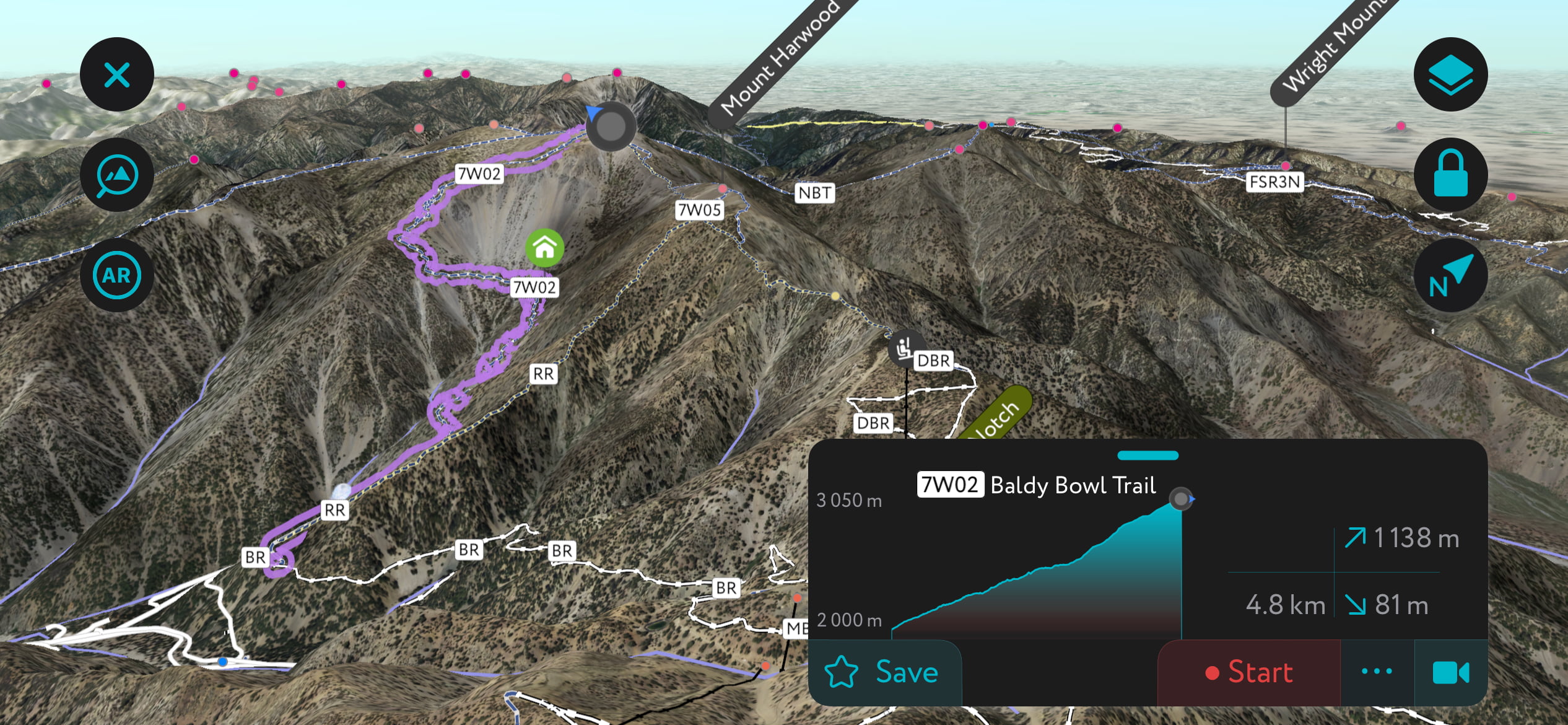
Summiting the tallest peak in the park, called Mount San Antonio or Mount Baldy, entails climbing over 4,000 ft (1,220 m). There are several routes. Two more popular ones are an 11.5 mi (18.5 km) loop and a 14 mi (22.5 km) out-and-back option. Those wishing for a shorter hike can skip the first part of the trail and instead take the lift to the Devil’s Backbone trail that summits Mount Baldy and the neighboring Mount Hardwood.
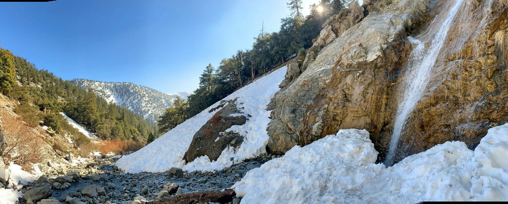
Prior to the Devil’s Backbone trail, the route follows a fire road and short sections of ski slopes. However, once on the Devil’s Backbone trail, the path narrows as it follows the ridgeline. There are multiple options for descending, one of which is to take the San Antonio trail that passes by the seasonally flowing San Antonio Falls.
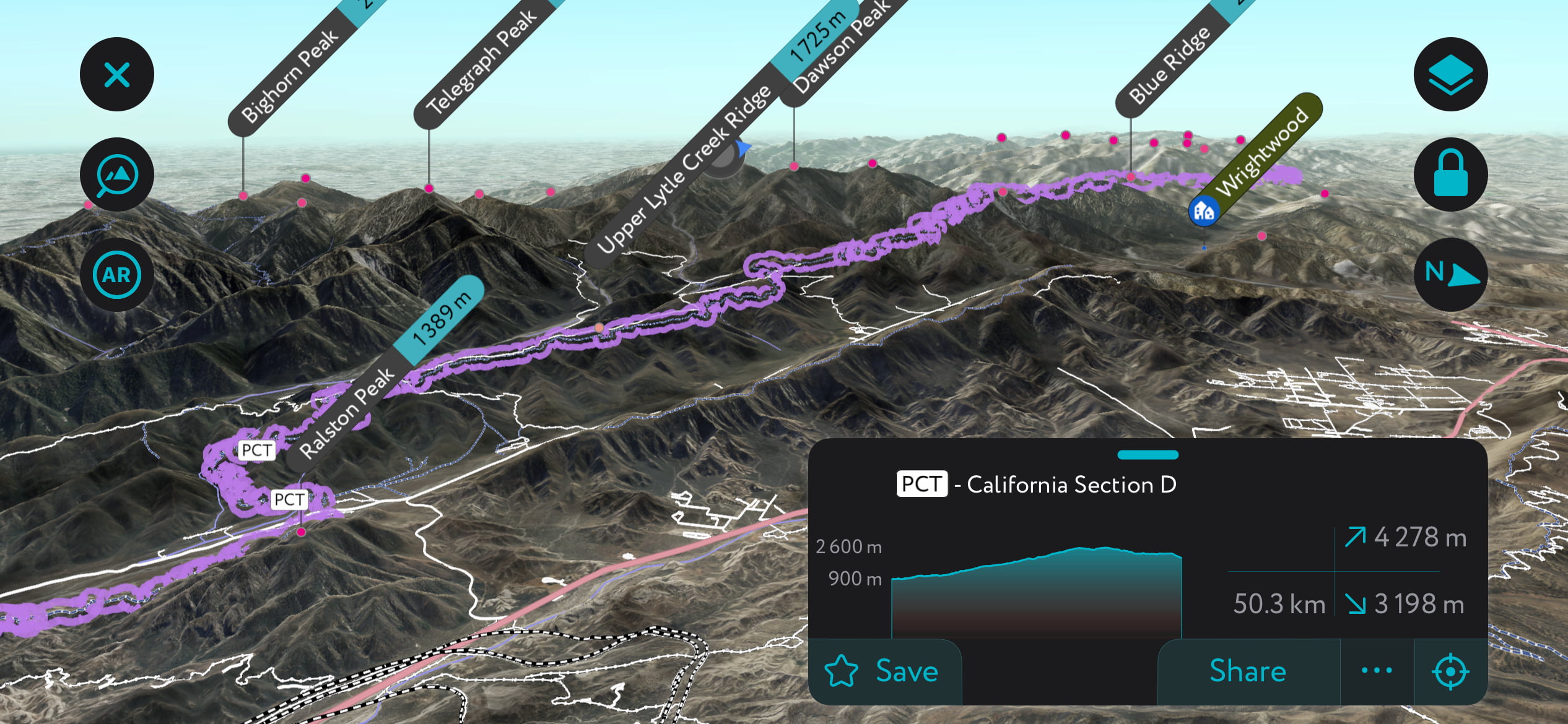
The Pacific Crest Trail is a famous 2,665 mi (4,288 km) trail that runs through the United States from Mexico to Canada. A section known as California Section D, consisting of 105 miles (169 km) of trail with approximately 21,725 ft (6,622 m) elevation gain, runs through Angeles National Forest. It begins at the Cajon Junction along Highway 15 and ends just beyond the forest at Agua Dulce.
Unfortunately, the Station Fire impacted 37 miles (60 km) of the trail, which had to be rerouted. The PCT in the national forest passes over Mount Baden-Powell (9,400 ft / 2,865 m), Throop Peak (9,137 ft / 2,785 m), Mount Williamson (8,215 ft / 2,504 m), and Pacifico Mountain (7,129 ft / 2,173 m), to name a few.
The Bridge to Nowhere hike is a popular trail with the option for bungee jumping from the bridge at the end. The 9.5-mile (15 km) out-and-back trail has moderate elevation gain and includes a handful of water crossings as it follows the East Fork of the San Gabriel River. Breathable shoes are recommended rather than waterproof boots. Those wanting to bungee jump can expect to pay around $150 when they reach the bridge.
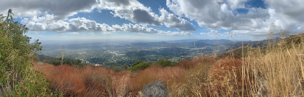
Echo Mountain is a popular spot with several hiking options. Overlooking downtown Los Angeles, Echo Mountain has hiking and cycling trails and historical markers. The area is part of the Mount Lowe Railway monument area on the National Register of Historic Places. The Mount Lowe Railway was the third in a series of scenic mountain railroads in America created as a tourist attraction. The railroad ran from 1893 until 1938.
The ruins of "White City," a resort along the scenic Mount Lowe Railway, can be found at the top of one of the hikes. When you arrive at “White City,” you will see some small gramophone-like objects directed at the opposing mountain. You can yell into these and hear the famous echo of Echo Mountain.
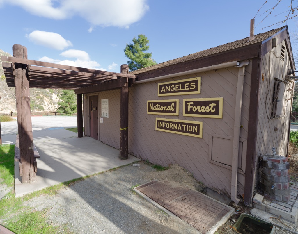
Like many things in California, Angeles National Forest is shrouded in a bit of bureaucracy. Such is life when you recreate in a state home to about 1/7 of the US population. You have to obtain permits and pay fees. However, despite the inconvenience, it’s not difficult, and the fees are manageable.
You will need a permit or an adventure pass for most hikes and camping. The National Forest Adventure Pass is an interagency pass that can be used for several forests in California. The pass costs $5 a day or $30 for an annual pass. These passes can be purchased online and delivered to you, or you can buy one at local retailers (such as gas stations) near the park. You can also enter the park on a US National Parks annual pass.
If you want to enter parts of the forest that are designated wilderness zones, such as the Sheep Mountain Wilderness, you will need to acquire a wilderness pass, which is free.
To cut fallen wood from the Angeles National Forest, you must purchase a Forest Product/Woodcutting permit, which costs $25.00 per cord for pine and $35.00 for hardwoods. Cutting of live trees in the forest is not permitted.
Event or Commercial permits must be applied for and approved by the forest service and can be filled out online.
Campfire permits are required to use campfires, charcoal fires, or portable gas stoves outside designated recreation sites. These are free and are available at all Forest Service, BLM, or CAL FIRE offices.
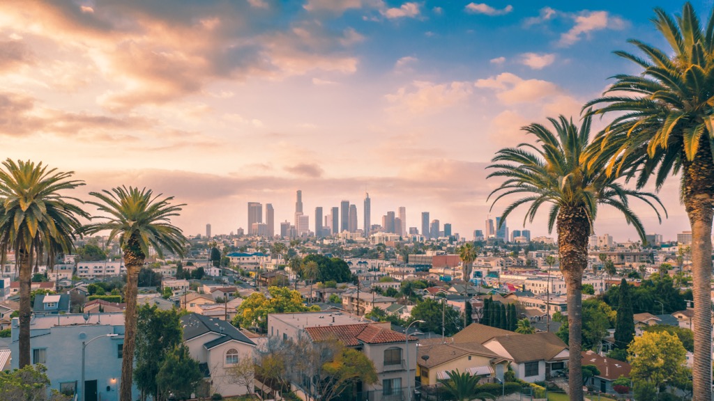
Los Angeles is the world’s entertainment capital and is home to 3.849 million people, making it the second-largest city in the US. The bustling urban center is known as the world's entertainment capital and has a culinary scene reflecting the city’s diverse and vibrant population.
Los Angeles spills into smaller cities that offer the opportunity to explore diverse cultural scenes via food, shops, and art or to enjoy the Pacific coast. Top attractions in LA include visiting Hollywood, strolling along the Venice Beach boardwalk, or taking a short ferry ride to Catalina Island. The city has several fantastic museums, including the Getty Center, the Los Angeles County Museum of Art, the Academy Museum of Motion Pictures, and the Natural History Museum.
Although there is public transportation throughout the city, most people prefer to explore the spread-out parts of the city by car.
Campsites are first come, first served, with a maximum 14-day stay at a site and a total of 30 days per year in the forest. A maximum of eight people and two vehicles may use each campsite. Where fees are required, checkout time is 11 a.m. unless otherwise specified.
A National Forest Adventure Pass is required for vehicles parked in non-fee campgrounds on the Angeles, Cleveland, Los Padres, and San Bernardino National Forests.
The Angeles National Forest offers group campgrounds in all three of the ranger districts, some accommodating up to 300 campers. These campgrounds are available on a reservation-only basis. Many are at elevations that receive snow during winter and are subject to closures. Group sites may also be closed at times due to refurbishing.
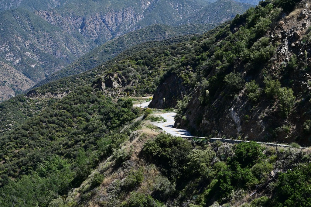
One big thing to note about driving in the Angeles National Forest is that the roads are tight, twisty, and heavily trafficked, especially by sports car and motorcycle enthusiasts who like to drive fast. As such, many wrecks on the road going through the forest can shut down sections, especially along Highway 2. Be sure to drive carefully and check the traffic report before making the trip. You also need to be aware of Pacific Crest Trail thru-hikers walking along parts of Highway 2.
The most prominent entry into the park is Highway 2, which cuts the park in half and connects to Highway 39. Highway 2 connects Interstate 210 on the Los Angeles side and Highway 138 from Interstate 15 to the east.
More minor roads going through the park on the eastern section include Glendora Ridge Road (connecting Glendora and the larger Azusa and Pomona neighborhoods to the park), which connects to Mount Baldy Road (connecting the San Antonio Heights and Upland neighborhoods to the park) going up to the Ice Canyon and Mount Baldy trailheads.


ultra
sierra-club-100
100-peaks-section-emblem
california-ultras
ultra
sierra-club-100
100-peaks-section-emblem
california-ultras


