Scan the QR code and open PeakVisor on your phone
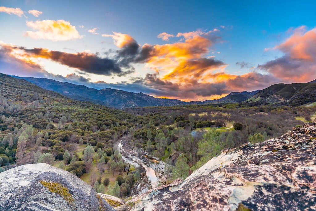
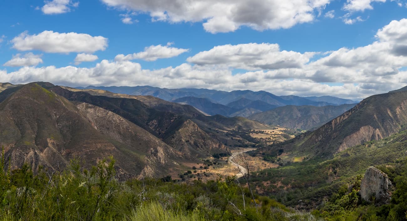
Spanning a wide swath of land with rugged, varied terrain, the Los Padres National Forest is a federally protected area in the southern and central parts of the US state of California. The forest contains 2,970 square miles (7,700 sq. km) of land and is home to 120 named mountains, the highest and most prominent of which is Mount Pinos (8,845ft/2,696m).

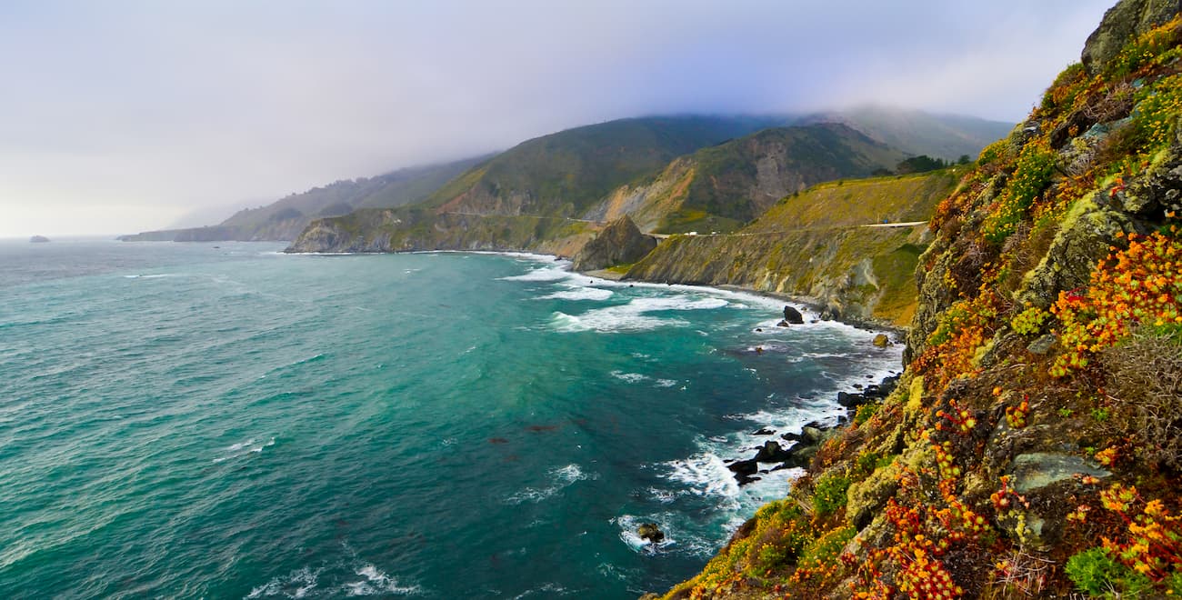
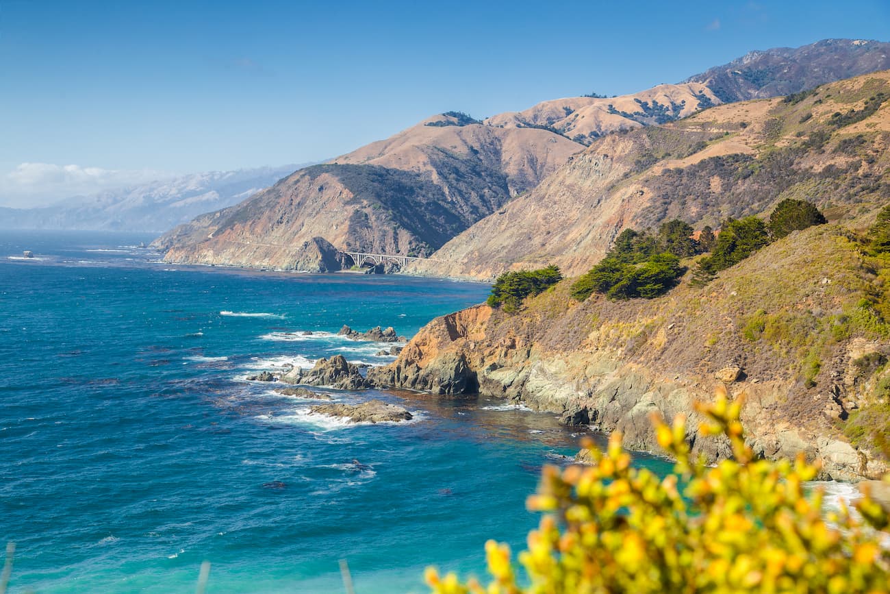
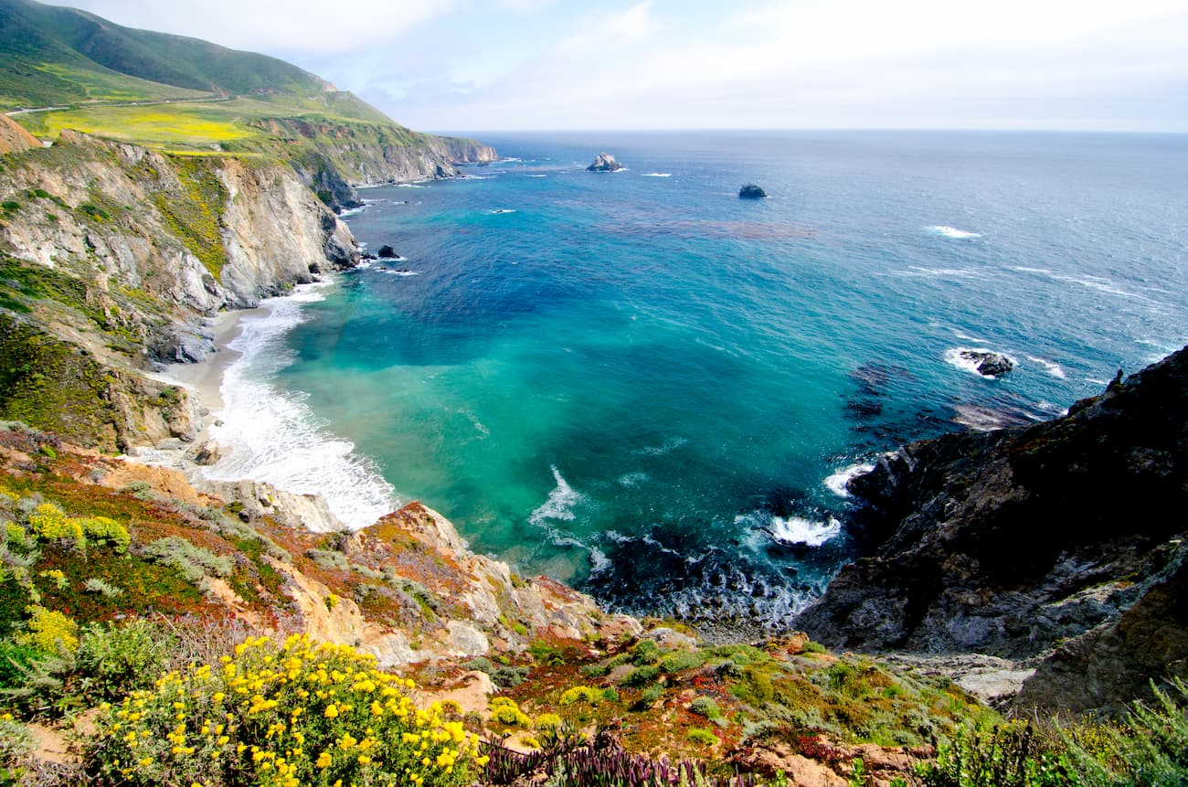
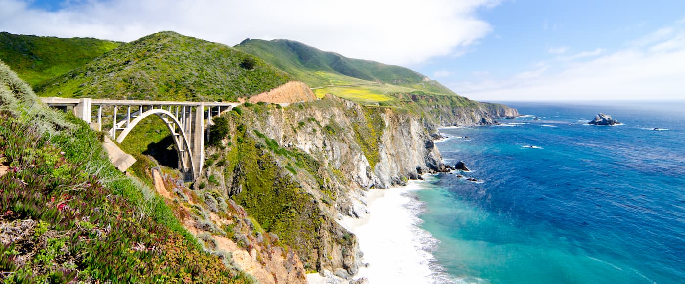
Los Padres National Forest is broken up into two distinct sections. The northernmost section is in Monterey County near the city of Monterey and is located along the coast of Big Sur, one of the most heavily visited natural areas along the California Coast.
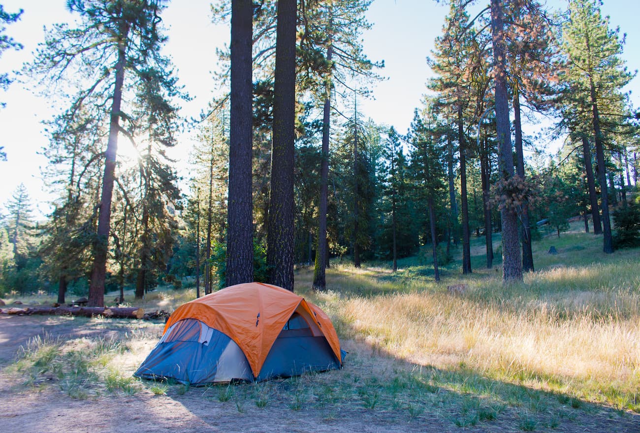
This section of the forest also has over 300 miles (500km) of hiking trails, 11 campgrounds, and one wilderness area - the Ventana Wilderness. It’s also known as a great habitat for the endangered California condor.
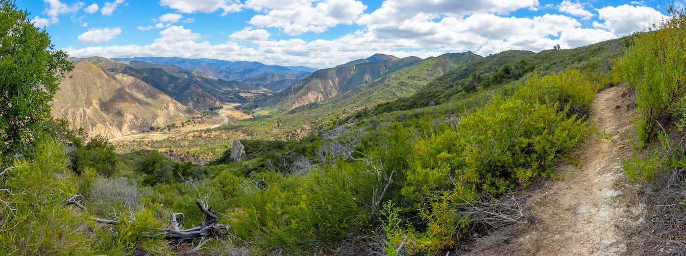
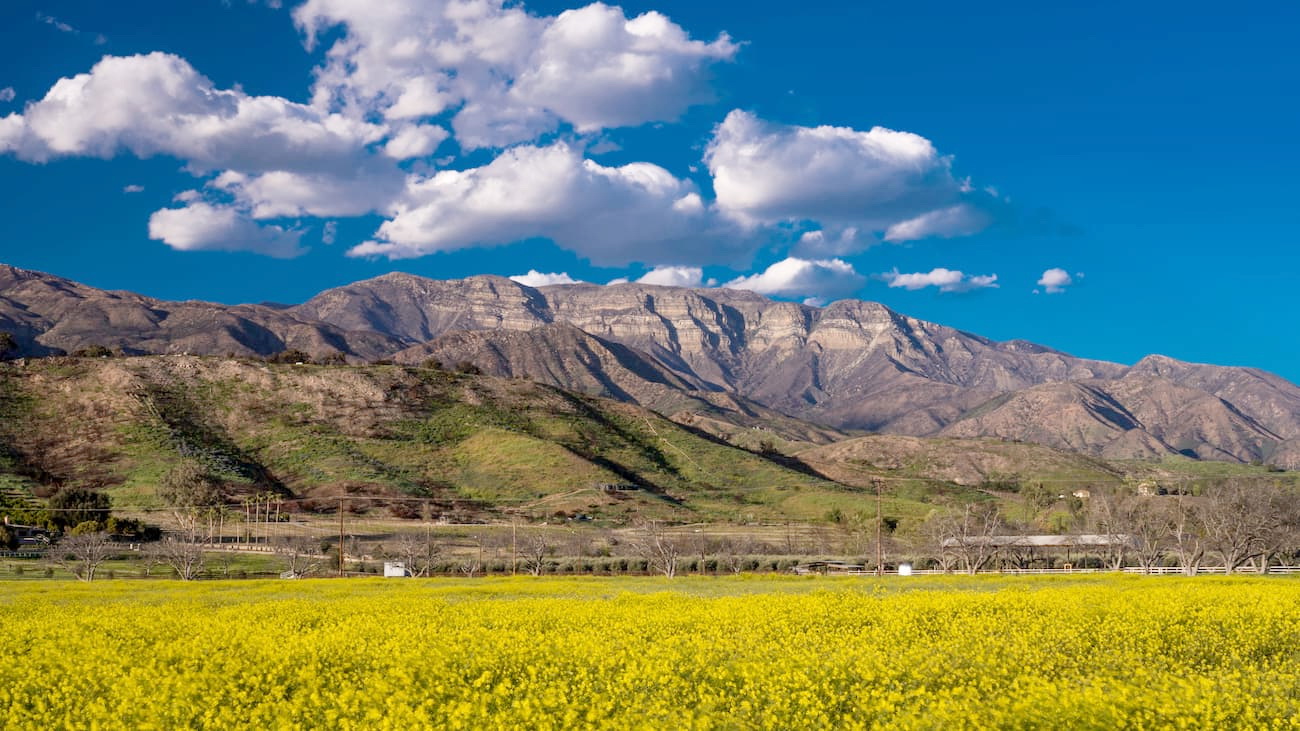
The majority of the Los Padres National Forest is located in the “southern section” which spans parts of Kern, Santa Barbara, Ventura, and San Luis Obispo Counties. This section of the forest is managed by ranger districts in Santa Barbara, Ojai, Santa Maria, King City, and Frazier Park but the forest headquarters are in Goleta.
The southern part of the forest contains a number of mountain ranges including the San Rafael Mountains, the Santa Lucia Mountains, the Santa Ynez Mountains, and the San Emigido Mountains.
Additionally, this southern section of the Los Padres National Forest includes quite a few wilderness areas, which make up over 48% of the forest’s total land area. These include:
The Los Padres National Forest also contains the headwaters of some of the most important rivers in Southern and Central California, including the Cuyama, Sisquoic, Sespe, Carmel, Ventura, Salinas, and Piru. In total, 88% of the land within the Los Padres National Forest is publicly owned, while the other 12% are part of private inholdings.
Geologically, the mountains within the Los Padres National Forest are part of the California Ranges, which cover most of the coastal region of the southern and central parts of the state. These mountains were created as the result of widespread tectonic activity along the many fault lines in the region, particularly along the San Andreas Fault system.
However, the rocks within the range vary greatly in terms of age and composition. Most of the rocks in the Los Padres region are sedimentary in origin, though the nearby Santa Monica Mountains are igneous while the San Gabriel and San Bernadino Mountains to the south are primarily metamorphic.

Within the Santa Ynez Mountains, in particular, there are many limestones and dolomites that originate from the Miocene-era Monterey Formation, which is home to most of California’s known oil resources. Meanwhile, the San Rafael Mountains are home to the Franciscan Complex, which is region rich in mercury and limestone that’s pure enough to make cement.
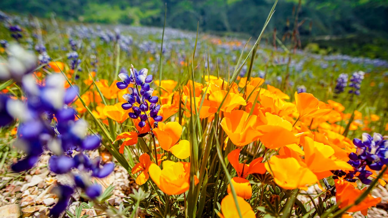
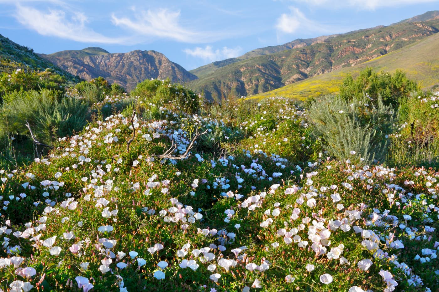
The Los Padres National Forest is has a wide diversity of ecosystems within its boundaries, most of which are quite typical of the Mediterranean climate in southern and central California.
Perhaps the most notable ecosystem in the area is the montane chaparral and woodlands ecoregion, which covers some 7,900 square miles (20,000 sq. km) along the coast of California. This ecosystem is known for its chamise, manzanita, and scrub oak shrublands as well as its abundance of coast live oak, interior live oak, canyon live oak, tan oak, and Englemann oak.
At mid-elevations until 9,500ft (2,900m) there are mixed evergreen forests of sugar pine, Jeffrey pine, western juniper, ponderosa pine, and white fir. Until 11,500ft (3,500m), there are subalpine forests, which are dominated by Jeffrey pine, lodgepole pine, and limber pine.
Some researchers estimate that there are about 29 square miles (76 sq. km) of old-growth forest left within Los Padres National Forest. This old-growth is mostly Jeffrey pine, coast Douglas-fir, white fir, and coast redwood. Most of the coast redwood can be seen in the mountains of Big Sur.
As far as wildlife goes, the region is home to a nice array of different animal species. Some of the most charismatic animals in the Los Padres National Forest include California mule deer, bighorn sheep, bobcats, black bears, and mountain lion. Birdlife includes bald eagles, red-tailed hawks, barn owls, great horned owls, California quail, and peregrine falcon.
The most famous animal that calls the Los Padres National Forest home, though, is the California condor (Gymnogyps californianus). Due to poaching, poisoning, and habitat destruction, the condor became extinct in the wild by 1987.
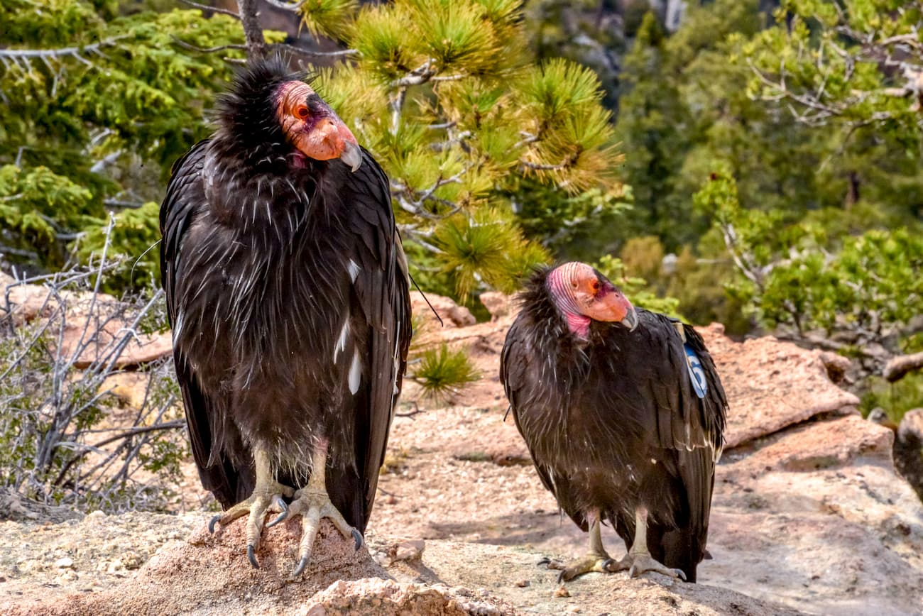
However, due to extensive conservation efforts, including the creation of the Sespe Condor Sanctuary within the Los Padres National Forest, the condor was re-introduced to the wild and the population numbers are growing every year. Other good places to see the California condor int the wild include Pinnacles National Park and Big Sur.
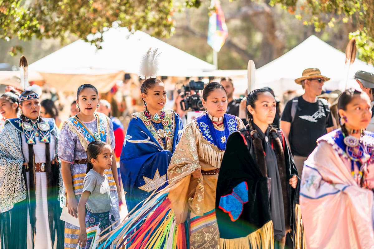
The area that is now the Los Padres National Forest has been continuously inhabited by humans for over 10,000 years. The Chumash people, which now includes the Coastal Band of the Chumash and the Santa Ynez Band of Chumash Indians were the original inhabitants of central and southern coastal California, including parts of the Channel Islands. Meanwhile, the Esselen, Salinan, and Ohlone people, among countless others, lived in the Big Sur region, just north of the Chumash territory at least as far back as 3,500 BC.
Spanish sailor Juan Cabrillo was the first European to arrive in the region when he sailed up the coast of California in 1542. However, the Spanish didn’t attempt to settle in the area until the 1770s, when they set up a number of missions throughout California.
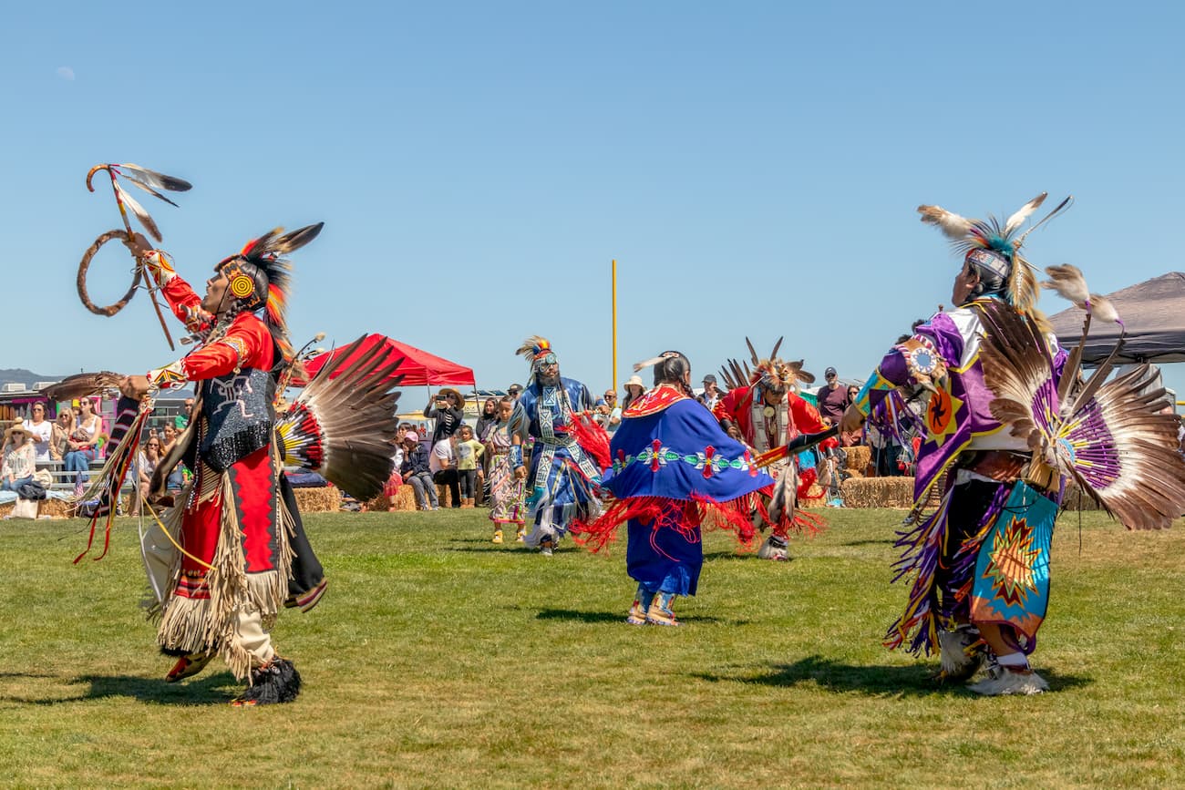
Through these missions, they forcibly baptized many of the native people of the region and forced them into labor. As a result of massacres, conflicts, forced labor, and the importation of European diseases, the Chumash and other first peoples in the region were either removed from their land or killed.
Today, the Chumash Nation has a small reservation (known as the Santa Ynez Reservation) of just 127 acres (51.4 hectares) located to the south of the Los Padres National Forest near the town of Santa Ynez.
The forest was formally designated in 1936 and was originally called “Santa Barbara National Forest.” It was actually created through the consolidation of a number of smaller forest areas that date back to the late 1800s. After the creation of this larger forest, though, local residents demanded that the name be changed to better reflect its vast area.
The region is highly susceptible to fires, which are a natural part of its ecology. Indeed, some of the largest fires in California history, including the 1977 Marble Cone Fire, the 2008 Basin Complex Fire, and the 2017 Thomas Fire, have burned hundreds of thousands of acres within the Los Padres National Forest, alone. To mitigate the risk to human life, parts of the forest are closed during peak fire season between June and mid-November.
The Los Padres National Forest covers a huge expanse of land and is home to hundreds of miles of hiking trails. Here are some of the most popular areas to hike:
The San Rafael Wilderness is located within the San Rafael Mountains section of the Los Padres National Forest between Santa Maria and Santa Barbara. It is home to 5 named mountains, the highest and most prominent of which is San Rafael Mountain (6,578ft/2,005m)
The region is fairly easy to access from either the Santa Ynez or Cuyama Valley. There are a few good, yet overgrown, hiking trails in the area, including one that walks along Hurricane Deck and one to Sweetwater Canyon.
The Garcia Wilderness is a small protected area of some 22 square miles (57 sq. km) to the east of San Luis Obispo. It contains just one named mountain, Caldwell Mesa (2,479ft/761m), which can be hiked via the 11 mile (18km) Caldwell Mesa Trail. The Garcia Wilderness was formally designated in 1992 in an attempt to protect the Salinas and Santa Maria Rivers, in addition to the California condor.
The Santa Lucia Wilderness is a small area of very rugged chaparral landscape located to the east of San Luis Obispo. It is known for its lush vegetation, particularly around streambeds, as well as an abundance of waterfalls. The wilderness is home to 4 named mountains, the highest and most prominent of which is Lopez Mountain (2,858ft/871m). There are a number of trails and campgrounds within the wilderness, which are popular with locals from San Luis Obispo.
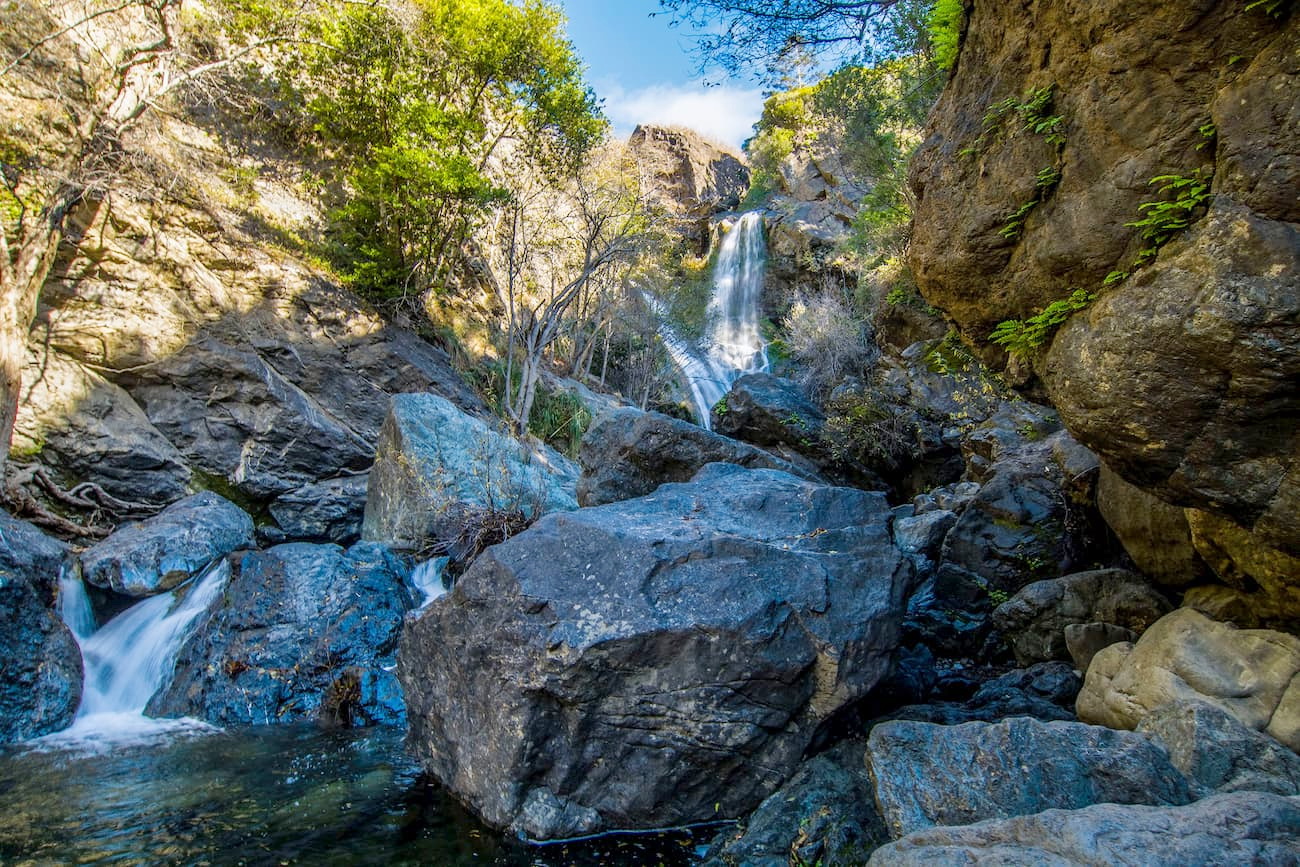
The Silver Peak Wilderness is situated in the southern part of Monterey County and includes a section of the Santa Lucia Mountains. It is known for its very steep terrain, which rises up from the Pacific Ocean.
The wilderness is home to 9 named mountains, the highest of which is Silver Peak (3,573ft/1,089m), and the most prominent of which is Mount Mars (2,674ft/815m). In the springtime, the wilderness is quite popular among visitors who come to see some of the beautiful waterfalls in the region, particularly Salmon Creek Falls.
The Machesna Mountain Wilderness is a scenic area of the Los Padres National Forest that’s just north of the Garcia Wilderness. It is home to 2 named mountains, the highest and most prominent of which is Machesna Mountain (4,055ft/1,236m).
This region is best known for its rugged terrain and the massive American Canyon. Much of the wilderness is chaparral brushland, but a large section of it is protected as a study area for a unique subspecies of Coulter pine. There are two trails in the region, the Machesna Mountain and American Canyon trails, but they are infrequently used.
The Dick Smith Wilderness is located within the San Rafael Mountains of Los Padres National Forest near Santa Barbara and Ojai. It is squished between the San Rafael Wilderness and the Matilija Wilderness and contains 3 named mountains, the highest and most prominent of which is Big Pine Mountain (6,820ft/2,078m).

This region was named after Dick Smith, a photographer and historian from the Santa Barbara area. It was formally designated as part of the 1984 California Wilderness Act. There are a few trails in the area, including the Madulce Peak Trail, the Santa Barbara Canyon Trail, and the Poplar Trail.
The Chumash Wilderness is located in the southern part of the Los Padres National Forest, just north of both the Sespe and Dick Smith Wildernesses. It was created as part of the 1992 Los Padres Condor Range and River Protection Act and it includes some of the highest terrain in all of Ventura County.
The wilderness is home to 2 named mountains, the highest and most prominent of which is Sawmill Mountain (8,812ft/2,686m). The two biggest trailheads leading into the region are at Cerro Noroeste/Mount Able and Mount Pinos.
The Matilija Wilderness is a small wilderness area located just north of Santa Barbara and to the west of the Sespe Wilderness. It is home to one named peak, Old Man Mountain (5,535ft/1,687m), and was created to protect prime condor habitat. The region is very rugged but has been a popular recreation area for decades, thanks to the nearby Matilija Falls and Matilija Hot Springs.
The Sespe Wilderness is one of the largest sections of the Los Padres National Forest and is located near its southern border. It was created in 1992 to protect good condor habitat and is home to 18 named mountains, the highest of which is Reyes Peak (7,493ft/2,284m) and the most prominent of which is Hines Peak (6,716ft/2,042m).
The Sespe Condor Sanctuary is also located within the wilderness but is closed to the public to protect the endangered birds. Most of the wilderness is chaparral and there are plenty of hiking trails, bringing visitors to waterfalls, hot springs, campsites, and notable rock formations in the region.
The Ventana Wilderness is located in the rugged Big Sur region of the Los Padres National Forest. There are 23 named mountains in the wilderness, the highest and most prominent of which is Junipero Serra Peak (5,869ft/1,789m).
It is incredibly popular among tourists and locals who enjoy the area’s steep peaks, coastal redwoods, hot springs, and rocky beaches. The scenic Highway 1 skirts to the west of the wilderness, providing fantastic views of the mountains and the ocean, all at the same time.
The Los Padres National Forest covers a massive area in southern and central California, so you have many options when looking for a place to stay in the region. Here are some of your best choices:
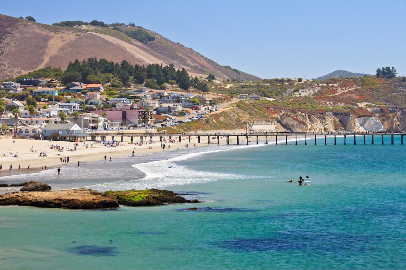
Monterey is located along the California Central Coast and was once the capital of Alta California when it was under the rule of both Spain and Mexico. The city is home to nearly 30,000 people and is known for its beaches and its world-famous aquarium.
Monterey provides excellent access to the Big Sur and Ventana Wilderness regions of the Los Padres National Forest. The city has a small airport, but it is also easy to get to by road from the San Francisco Bay Area.
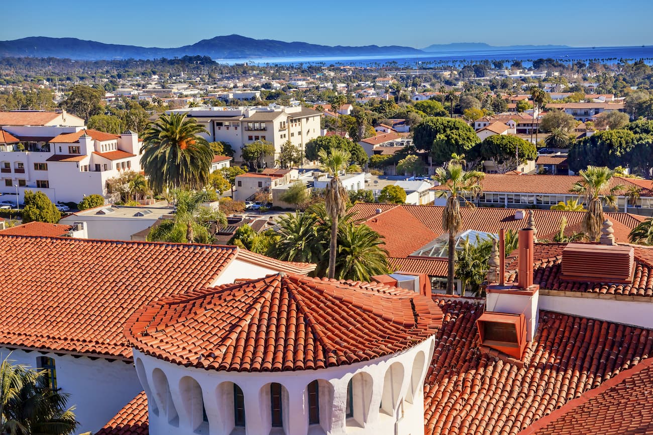
Santa Barbara is located to the south of the San Rafael Mountains section of the Los Padres National Forest and is home to over 90,000 people. It offers good access to the Dick Smith Wilderness, Sespe Wilderness, and Matilija Wilderness areas. The city has a small airport and good train connections to the rest of coastal California.
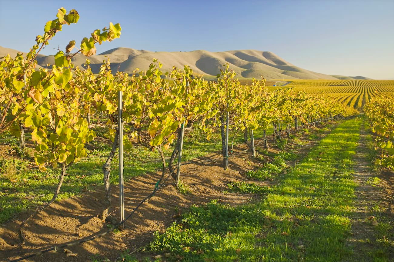
Santa Maria is located just north of the San Rafael Mountains section of the Los Padres National Forest and to the south of San Luis Obispo. It has a population of over 100,000 people and a small airport with service around California and some of the major cities in the American West. Santa Maria is a good place to stay if you’re looking to visit both the northern and southern sections of the national forest during your visit.
Ojai is located just north of the city of Ventura and is home to nearly 8,000 people. It is easy to get to by road from the Los Angeles area and it offers good access to the northern and southern sections of the Los Padres National Forest. The city is known for its boutique hotels, farmers’ markets, and other small businesses as chain stores are prohibited by city rules.
San Luis Obispo (aka SLO) is one of California’s oldest European-created cities and it has a population of over 270,000 people. The city is known for its beaches and outdoor recreation areas. It is close to both the Garcia Wilderness and the Santa Lucia Wilderness areas.
San Luis Obispo has a small regional airport with service around the American West. It is also well connected by train and road to other major cities in California.