
Scan the QR code and open PeakVisor on your phone
The Santa Lucia Range include 266 named peaks. The highest is Junipero Serra Peak at 1,789 m. Other notable peaks include Pinyon Peak, Cone Peak and South Ventana Cone.
Stretching for some 140 miles along the coast of the US state of California, the Santa Lucia Range is a collection of peaks known for its rugged terrain. The range is home to 203 named mountains, the highest and most prominent of which is Junipero Serra Peak (5,869ft/1,789m).
The Santa Lucia Range starts in the city of Carmel-by-the-Sea and terminates near the Cuyama River. It is located within Monterey and San Luis Obispo counties and it is never more than 11 miles (19km) from the coast.
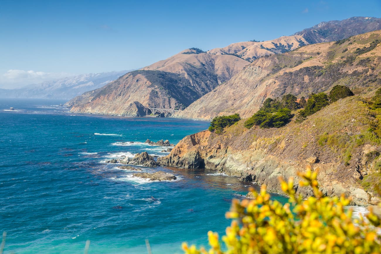
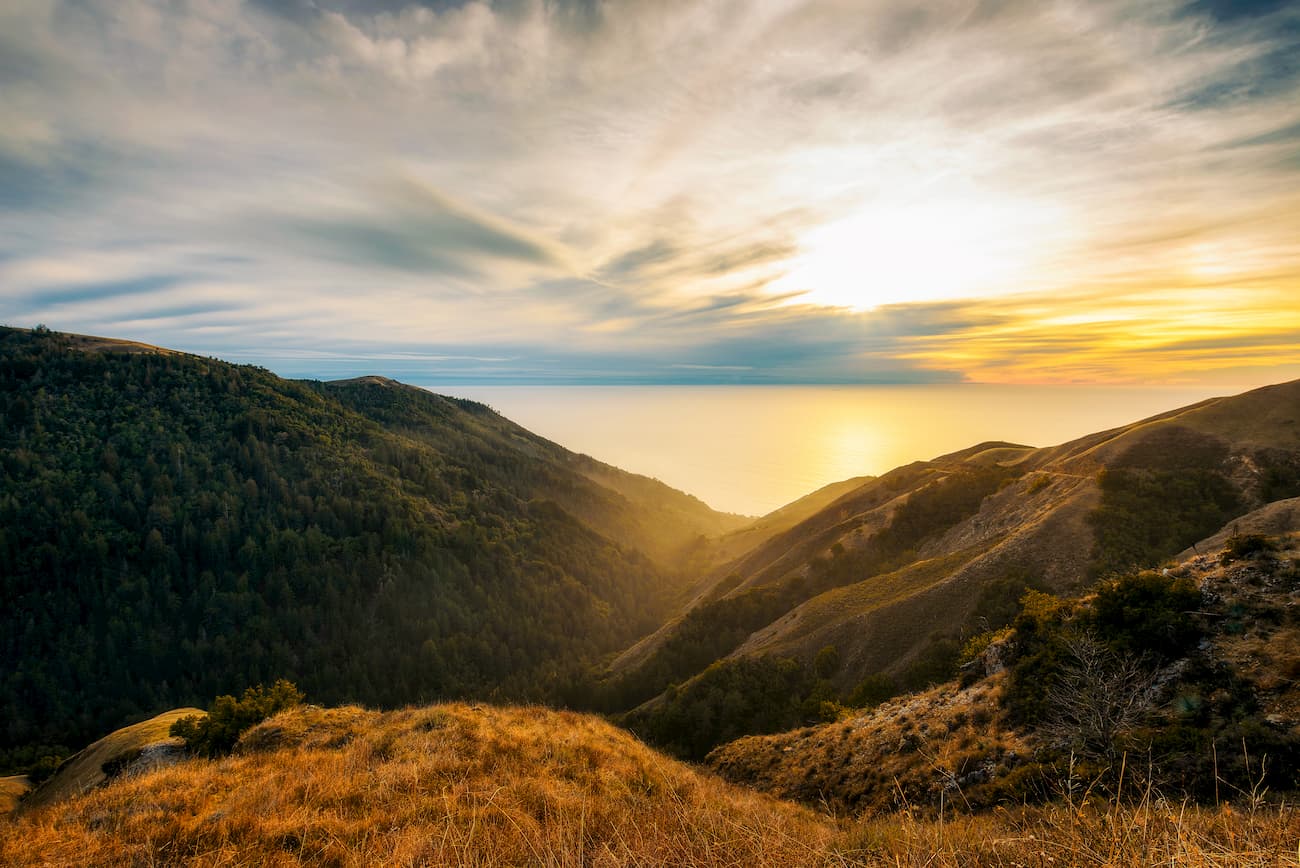
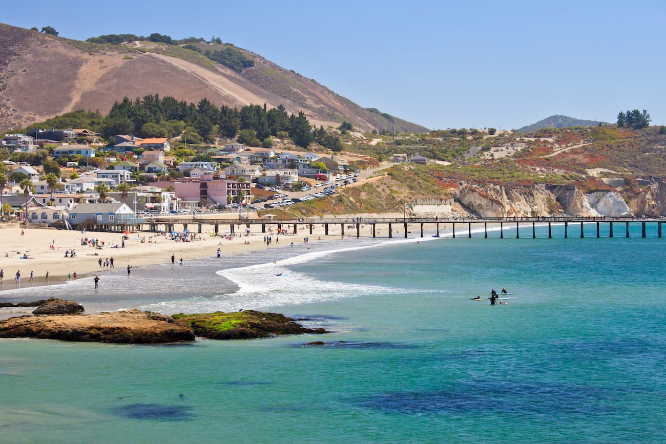
Much of the range is located in the region of California known as “Big Sur,” which is a highly popular tourist destination known for its long, scenic stretch of undeveloped coastline. Within Big Sur, the Santa Lucia Mountains rise right up from the ocean, creating ridges that are some 4,000 to 5,000ft (1,200-1500m) above the water. In fact, the range’s Cone Peak is one of the steepest coastal mountains in the contiguous United States.
The Santa Lucia Range runs parallel to the Diablo Range and it forms the western boundary of the agricultural Salinas Valley.
The Santa Lucia Range is contained mostly within the Los Padres National Forest. Mountains within the range are included within various wilderness areas, such as the Garcia Wilderness, Santa Lucia Wilderness, and the Ventana Wilderness.
It also includes various smaller parks and conservation areas, such as Julia Pfeiffer Burns State Park, Bear Mountain Wilderness Study Area, Andrew Molera State Park, Garland Ranch Regional Park, and Fort Ord National Monument.
Geologically, the Santa Lucia Range is part of the greater California Ranges system. The mountains within the California Ranges were created through the movement of tectonic plates along the many transverse faults in the region.
In particular, the bedrock of the Santa Lucia Range is predominantly granitic from the Salinian Block, which is sandwiched between the San Andreas Fault and the Sur-Nacimiento Fault.
Interestingly, the Salinian Block was originally part of the same plutons that created the Sierra Nevada Batholith and formed the Sierra Nevada Range. However, the bedrock in the Santa Lucia Range was then separated and transported northward by the San Andreas Fault to its current location.
In addition to the granites of the Salinian Block, the range has a significant amount of Mesozoic-era Franciscan formation rock, which includes greenstones, greywacke sandstone, and some ultramafic rocks. Moreover, the Salinian Block features some highly fractured meta-sediments, which includes gneiss, and biotite schist, as well as quartz diorite and granodiorite intrusions.
The climate of the Santa Lucia Range is Mediterranean with a modest amount of rainfall, the vast majority of which occurs in the winter. Due to the soil composition of the area, most runoff from rainfall is quite rapid and many streams will dry up completely in the summer.
However, the range’s location along the coast means that it gets more rainfall than other mountains further inland. In fact, the Santa Lucia Range forms a rainshadow over the Salinas Valley, which is just east of the mountains.
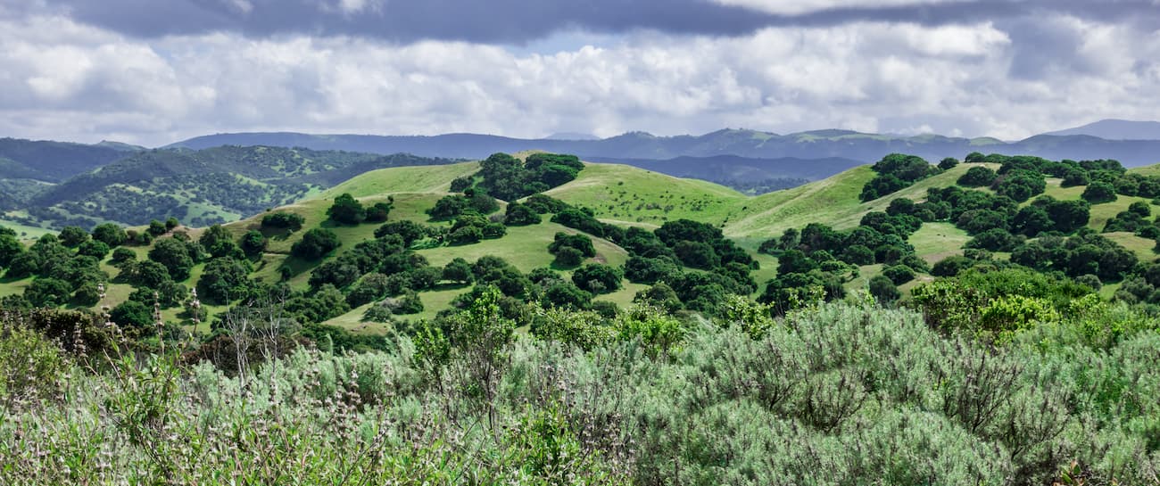
Within the range, the landscape is covered by a mix of fire-resistant chaparral brush and coniferous forests. In valleys, the Santa Lucia Range has a nice mix of ponderosa pine, Pacific madrone, Santa Lucia fir, Gowen cypress, Coulter pine, and Douglas fir.
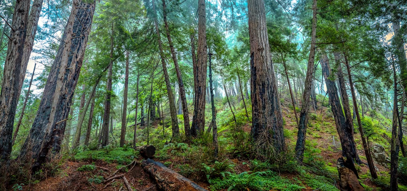
It is also home to the only Vortriede’s spineflowers (Systenotheca vortridei) in the world as well as the southernmost limit of the coast redwood (Seqouia sempervirens) range. Additionally, the Big Sur region of the Santa Lucia Range contains some of the healthiest stands of blue oak and live valley oak in California.
Wildlife in the region includes bald eagles, mountain lions, wild boar (non-native), foxes, coyotes, and black bears. The Santa Lucia Range is home to a number of large rivers, including the Little Sur River and the Wild and Scenic Big Sur River. Both of these waterways contain significant stocks of steelhead (rainbow) trout and the California giant salamander (Dicamptodon enstatus).
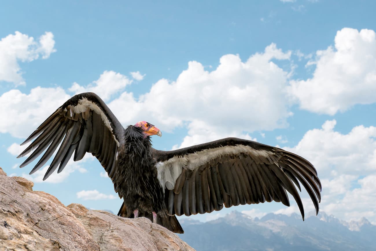
Perhaps the most exciting animal one can spot in the Santa Lucia Range is the California condor, which was reintroduced into the region in the 1990s after becoming extinct in the wild in 1987. The Sespe Condor Sanctuary to the south and Pinnacles National Park to the east are both home to decent-sized populations of nesting condors which then travel into the Santa Lucia Range.
Humans have lived in the Santa Lucia Range and the surrounding area for thousands of years. The Ohlone, Salinan, and Esselen people all inhabited the area, living in the mountains during the summer months and closer toward the coast during the winter.
Juan Cabrillo, a Spanish sailor, was the first European to visit the area, having sailed up the coast of California in 1542, but he never made landfall in the Santa Lucia Range. In the 1770s, the Spanish created multiple missions throughout the region, pushing the native inhabitants of the land off of their territory and forcing them into labor. Many of the original people of the Santa Lucia Range were killed through violence or from introduced diseases as more Europeans started to settle in the area.
When Alta California became part of Mexico after the Mexican Wars of Independence, much of the region was parceled out into huge ranchos between 1820-1840, save for the Big Sur area, which was mostly too rugged to be developed.
During the 1860s, loggers cut down many of the most accessible coast redwoods and tanbark oaks, the latter of which was critical for the tanning process in the burgeoning leather industry. Near the city of Gorda, there was even a small gold rush in the 1880s when miners found about $4.61 million (2019 dollars) worth of gold in a few years.
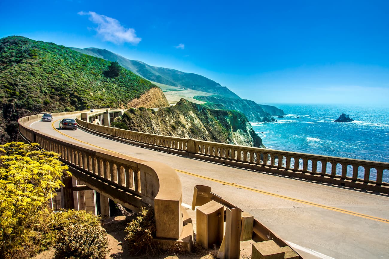
The range, particularly around Big Sur, became much more accessible, thanks to the completion of the 71 mile (114km) segment of Highway 1 along the Pacific coast in 1939. Before that time, the region between San Simeon and Carmael was one of the most remote in the state and could take upward of 4 days to traverse by wagon. Interestingly, the highway has been closed over 55 times by landslides, one of which was a massive 5,000,000-cubic foot (140,000 sq. meter) rockfall south of Gorda in 2017.
By the mid-1900s, though, people became more concerned with conserving and protecting the Santa Lucia Range and the surrounding area. Within 5 years of the passing of the 1964 Wilderness Act, the Ventana Wilderness was created to formally protect the Big Sur region of the Santa Lucia Range.
Other parts of the range, including the Garcia Wilderness, were created by the 1992 Los Padres Condor Range and River Protection Act of 1992. Meanwhile, the Santa Lucia Wilderness was created by the 1978 Endangered American Wilderness Act.
The Santa Lucia Range is a huge collection of mountains with hundreds of miles of hiking trails dispersed between different distinct regions. Here are some of the most popular hiking areas within the range:
A significant portion of the range is contained within the Ventana Wilderness, which is located in the Big Sur region of the California Central Coast. The Ventana Wilderness has 23 named peaks, the highest and most prominent of which is Junipero Serra Peak (5,869ft/1,789m).
This region is incredibly popular and sees about as many visitors as Yosemite National Park. It has plenty of great hiking trails including the Pine Ridge Trail, Carrizo Trail, Stone Ridge Trail, and the Ventana Double Cone Trail.
The Santa Lucia Wilderness is located just outside the city of San Luis Obispo. It contains 4 named mountains, the highest and most prominent of which is Lopez Mountain (2,858ft/871m).
The wilderness is very popular among locals, thanks to its collection of scenic waterfalls and developed campgrounds. Good hiking options include the Big Falls Trail, Little Falls Trail, Hi Mountain Trail, and the Florence Hart Trail.
The Garcia Wilderness is a small area to the east of San Luis Obispo with one named mountain, Caldwell Mesa (2,479ft/761m). Despite its small size, the Garcia Wilderness does have some hiking trails, most notably, the 11 mile (18km) Caldwell Mesa Trail. It is also a good place to visit if you’re interested in seeing some California condors without traveling far from the city.
Here are the best places to stay near the Santa Lucia Range:
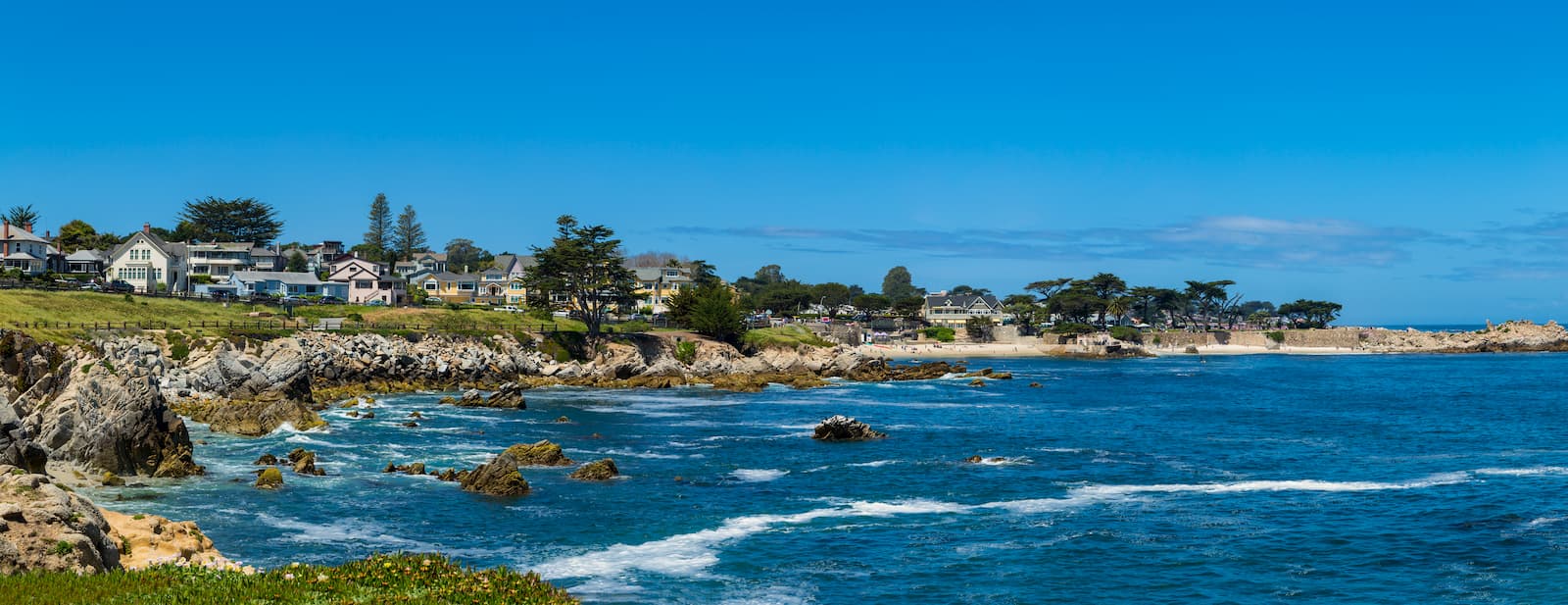
The city of Monterey is located just north of the Santa Lucia Range along the coast of Monterey Bay. It is home to nearly 30,000 people and is one of the oldest European-founded communities in California.
Monterey is well connected by road to the Santa Lucia Range, thanks to California State Route 1, which runs through the city. Additionally, Monterey has a regional airport with decent connections to major cities around California, Arizona, Nevada, and Colorado. The city is also easy to get to by road from the San Francisco Bay Area.
San Luis Obispo is one of the largest cities in the California Central Coast region, with a population of over 270,000 people. SLO, as it’s commonly called, is just south of the Santa Lucia Range and is located along US Route 101, which provides good access to the mountains and the Big Sur region. The city also has a small regional airport and a busy Amtrak train station, both of which offer good connections to other major population centers.


The highest peak in the Santa Lucia Range is Junipero Serra Peak, at 1,789 m.
The Santa Lucia Range have 266 named peaks.


