Scan the QR code and open PeakVisor on your phone
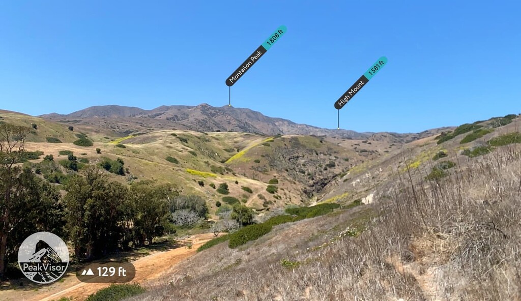
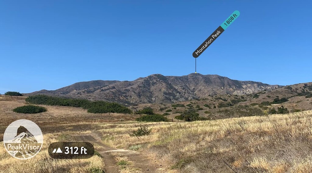
Yosemite National Park generally steals the limelight as California’s most beloved national park. However, just a few miles off the coast of southern California lies an outdoor recreation area of five remote islands that are perfect for any adventure—Channel Islands National Park. The park contains 23 named mountains, the highest of which is Montañon Peak (1,808 ft/551 m) and the most prominent of which is Soledad Peak (1,572 ft/479 m).
Channel Islands National Park is a federally protected area that consists of five of the eight beautiful Channel Islands that are located just off the southern coast of the US state of California.
Although all eight of the Channel Islands were designated as a biosphere reserve by UNESCO in 1976, only five of the eight-island archipelago along the Santa Barbara Channel form the 249,561-acre (100,993-ha) Channel Islands National Park.
Anacapa, Santa Cruz, Santa Rosa, San Miguel, and Santa Barbara islands were all designated as a national park in 1980. Four of the islands—San Miguel, Santa Cruz, Santa Rosa, and Santa Barbara—are located in Santa Barbara County, while Anacapa is located in Ventura County and both San Clemente and Santa Catalina islands are located in Los Angeles County.
In addition to Channel Islands National Park, the Channel Islands National Marine Sanctuary extends for 6 nautical miles (6.9 mi/11.1 km) offshore of each of the five islands.
The marine sanctuary protects more than 150 historic shipwrecks and is credited for preserving the natural and cultural resources of the islands. It’s a popular destination for scuba diving, snorkeling, kayaking, boating, whale watching, and guided trips.
Each island in Channel Islands National Park offers its own distinct geography, wildlife, and hosts a variety of unique outdoor activities. Generally, the islands are divided into two groups: the Northern Channel Islands and the Southern Channel Islands.
Much of the park is located in the northern part of the archipelago as the Southern Channel Islands contain only one of the islands designated as a national park—Santa Barbara.
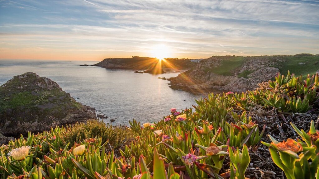
Despite their close proximity to shore, visiting the Channel Islands requires a great deal of preparation and self-reliance. Nicknamed the “Galapagos of North America,” the Channel Islands are a remote and wild coastal landscape.
As such, the islands do not contain any resorts, restaurants, or stores. Therefore, if you’re looking to visit one of the most beautiful and untouched national parks in the US with the least amount of visitors, the Channel Islands are the perfect place for you.
To reach the islands, visitors must also take a boat or a small airplane. There is also no on-island transportation, so expect to walk or kayak wherever you want to go in the park. Unsurprisingly, the Channel Islands are one of the least-visited national parks in the United States, receiving an average of just 30,000 visitors to the islands each year.
Here’s what you can expect when visiting each of the five islands in the park:
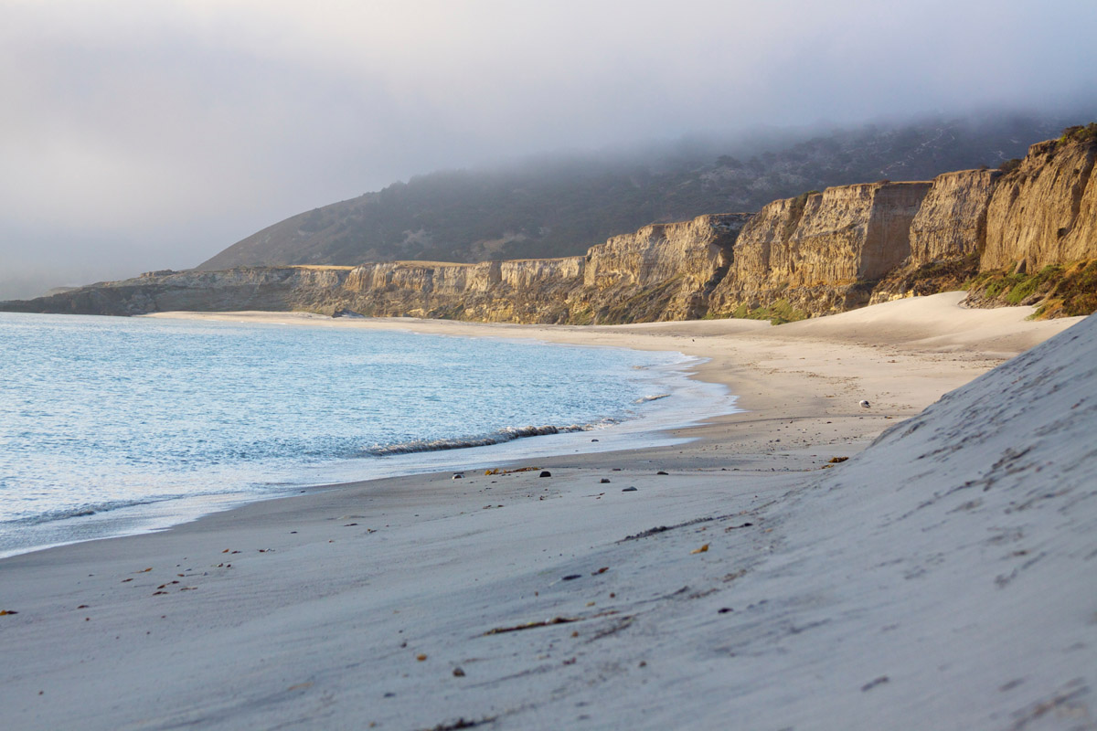
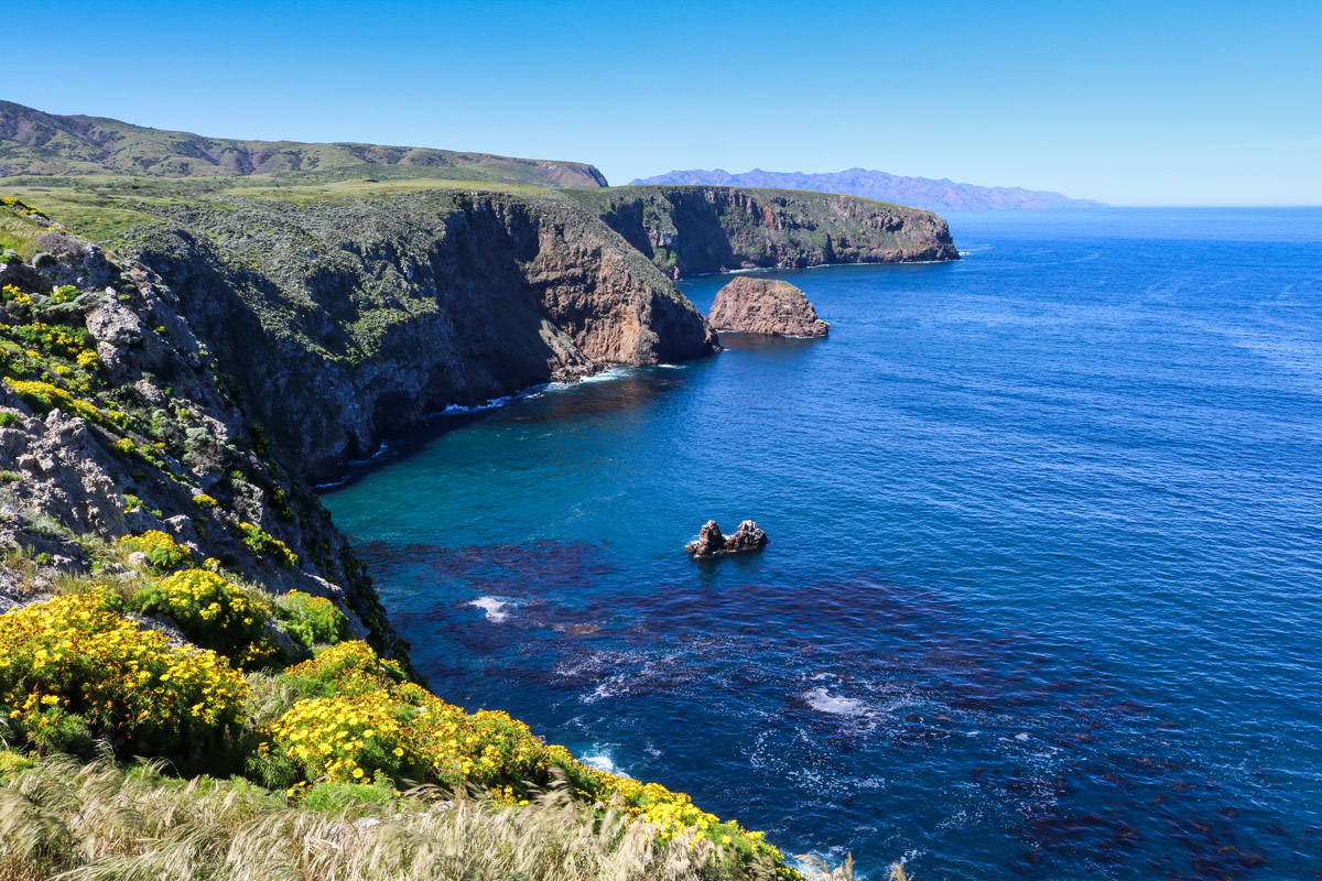
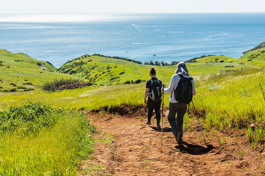
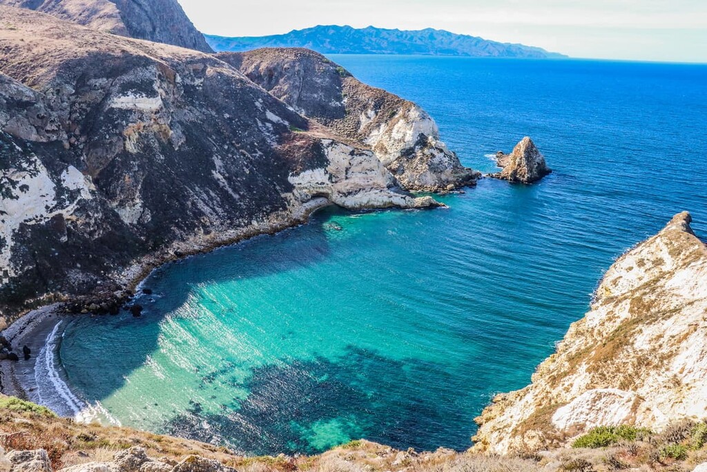
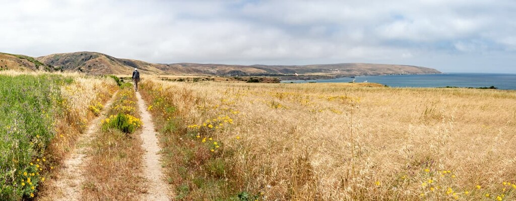
Santa Cruz is the park’s most visited island. It also houses one of the largest known sea caves in the world: the Painted Cave. Santa Cruz is the largest island in California and it is home to the tallest peak amongst the Channel Islands. Unsurprisingly, the island’s rugged coastline, sea caves, and coves make it the ideal destination for hiking.
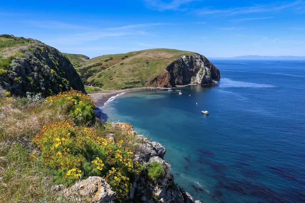
The care of Santa Cruz island is split between the National Park Service, which oversees the easternmost half of the island, and the Nature Conservancy, which oversees the westernmost half of the island. The boundary between the two halves is marked by a fence. While it is possible to hike in the Nature Conservancy, you will need a permit before entering and you can not leave the designated trails.
Santa Barbara is the ideal island for visitors that are looking for a secluded vacation destination. With an area of just 640 acres (259 ha), Santa Barbara is the smallest of the Channel Islands.
Nevertheless, the island’s tallest peak, Signal Peak, is known for its stunning panoramic views. Furthermore, the island is an excellent destination for diving, snorkeling, kayaking, and swimming.
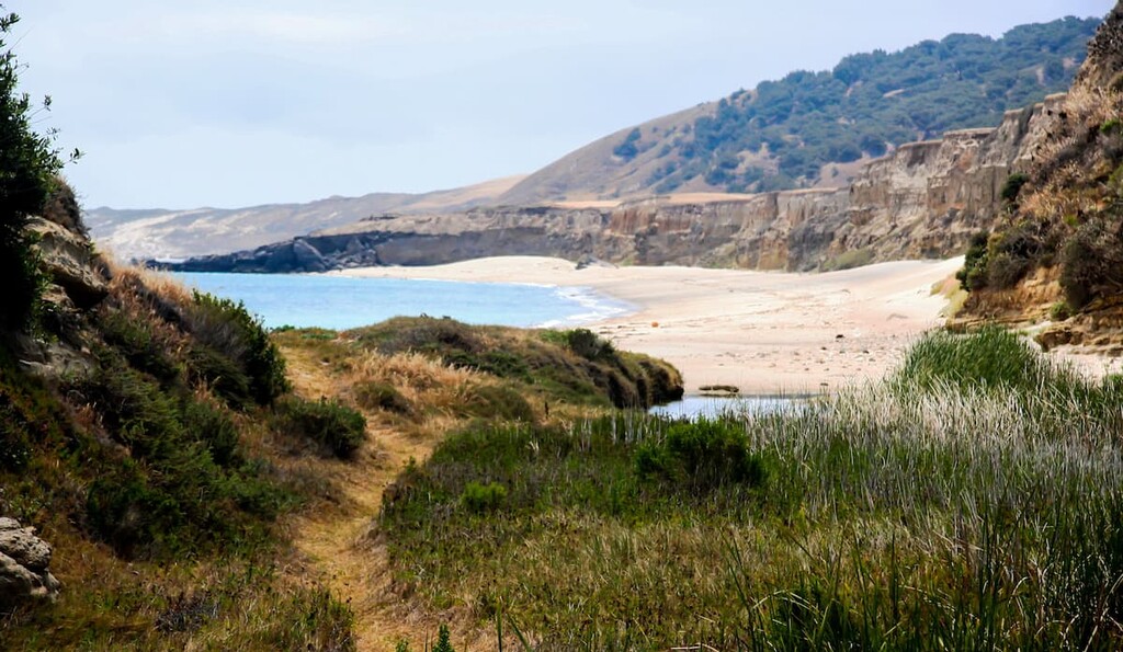
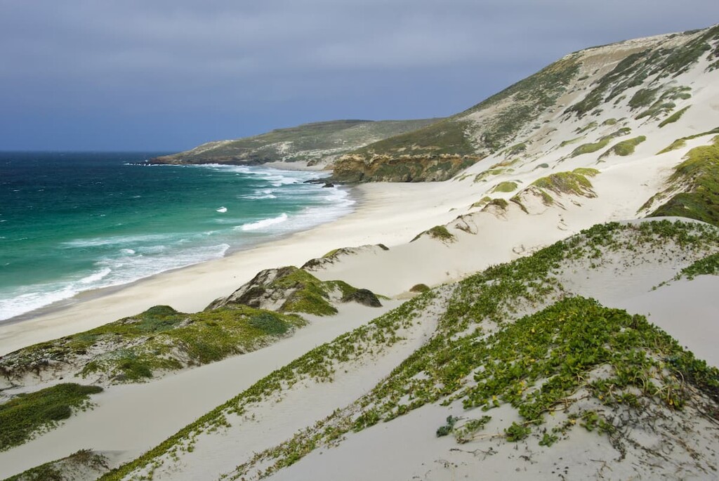
Due to adverse weather in the region, visiting Santa Rosa is more challenging than other islands in the park. Most visitors will camp at the island’s primitive campground—Water Canyon Campground—and hike through the island’s unique stand of Torrey pines.
Santa Rosa, which consists mostly of rolling hills, coastal lagoons, and deep canyons, is the second largest island in the Channel Islands. Additionally, the highest point on the island is Soledad Peak.
If you have an anthropology buff in your family, they’ll probably also appreciate that some of the oldest human remains (that of the Arlington Springs Man) in the Americas were discovered on Santa Rosa Island.
Unlike other islands, a visit to San Miguel requires a permit. Almost the entire island has been designated as an archaeological district on the National Register of Historic Places as a number of important archaeological sites, including that of the Tuqan Man, have been found on San Miguel.
So, not only are visitors required to stay on designated island trails while on San Miguel, but they must also be accompanied by park staff when traveling beyond the ranger station.
In addition to its archeological significance, San Miguel Island is also an important hub for biodiversity. The island is home to a colony of California common murre as well as a colony of northern fur seals and a small population of island foxes. Therefore, if you’re hoping to see some fantastic wildlife, San Miguel is the island for you.
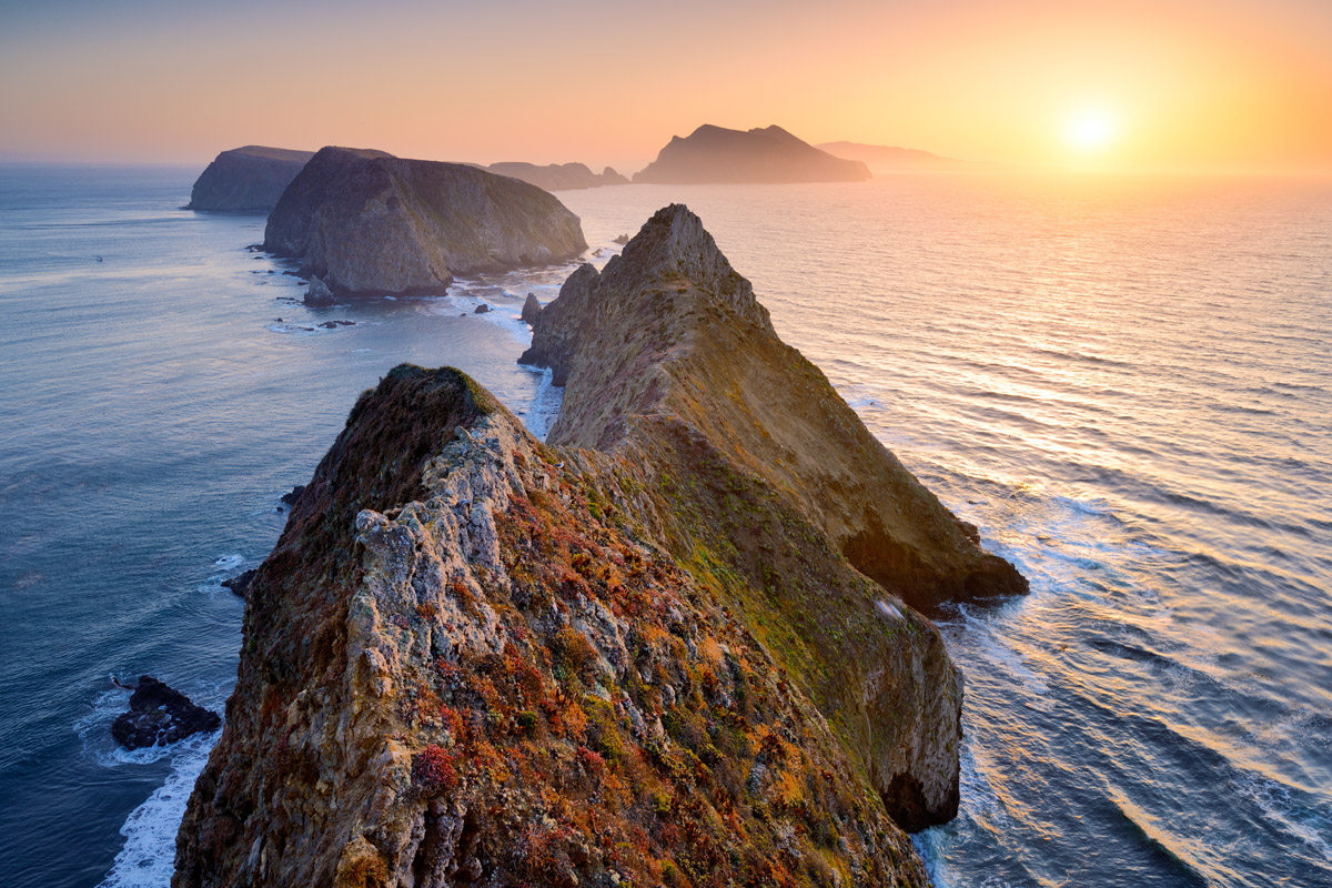
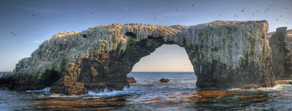
Anacapa Island, which is the closest Channel Island to the mainland, is a small volcanic Island that formed by volcanic eruptions over 15 million years ago.
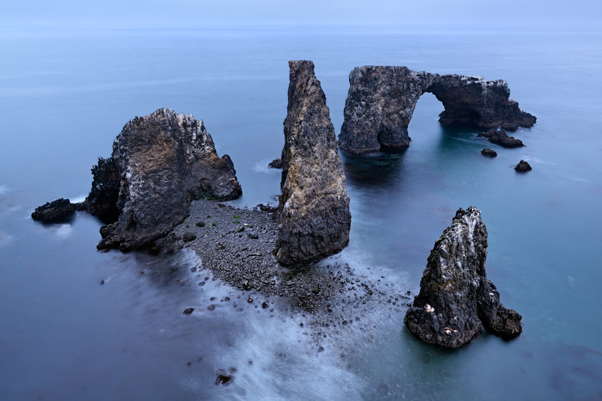
The island is composed of a series of narrow islets, the most notable being East, West, and Middle Anacapa. All of the islets feature a magnificent array of sea arches, caves, and stacks.
West Anacapa, the tallest and largest islet, is best-known for its sheer cliff sides and reaches 935 feet (285 m) at the top of Summit Peak, while East Anacapa is most notable for its 40-foot natural bridge—Arch Rock.
The peaks within Channel Islands National Park form the westernmost edge of the Transverse Ranges (California Ranges), one of the most complex and diverse mountain ranges in the United States.
However, the islands themselves are the result of a long and storied geologic past. In particular, until about 30 million years ago, the Farallon plate was in the process of colliding with the North American plate near the current site of the Channel Islands. As this happened, the Farallon plate subducted under the North American plate, creating a large marine trench.
Then, approximately 30 years ago, the Farallon plate had finally completely subducted under the North American Plate. Afterward, the Pacific plate started to slide past the North American plate, rather than colliding with it, creating the San Andreas plate boundary that exists until this day.
Some 10 million years later, lava flows from tectonic activity in the region led to the formation of thick layers of volcanic rock that is now known as the Conejo Volcanics. This formation underlies much of the region of the Channel Islands, though newer lava flows in the archipelago have slightly different compositions. Meanwhile, much of the Channel Islands, particularly in the north, consists of sedimentary rocks.
That being said, the islands in the northern part of the archipelago are among the youngest in the region as they are believed to have formed within the last five million years. During this time compressional forces resulting from the northwestern movement of Baja California caused the folding and faulting of the rocks that now form the northern Channel Islands.
Even more recently, the northern Channel Islands were once part of a collective landmass known as Santa Rosae. This landmass formed during the last glacial maximum about 10,000 years ago, at which point the sea level was considerably lower than it is today. As a result, the island was only about 5 miles (8 km) from the mainland and it’s believed that mammoths and other animals swam to the islands during this time.
The Channel Islands National Park remains a highly geologically active place. In addition to being located in a tectonically active region that’s prone to earthquakes, the islands are known to have a high rate of erosion due to the harshness of the surrounding sea. Nevertheless, continuing compressional forces in the region mean that the islands will continue to rise in the coming millennia until the compression stops and the islands erode into the sea.
Major peaks on the islands include Devil's Peak (the highest mountain on an ocean island in the contiguous United States), Montañon Peak, High Mount, and Soledad Peak.
Channel Islands National Park is a veritable treasure trove of biodiversity with an abundance of rare and endemic species within its boundaries.
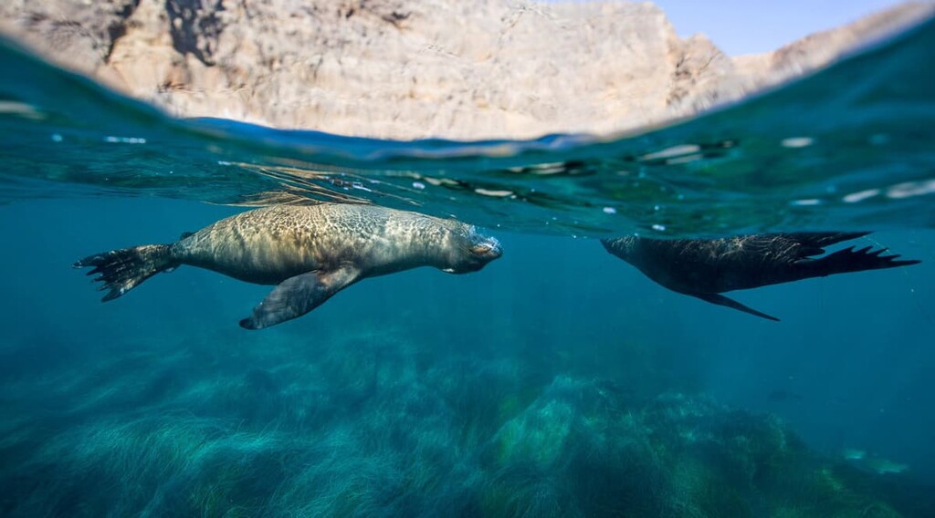
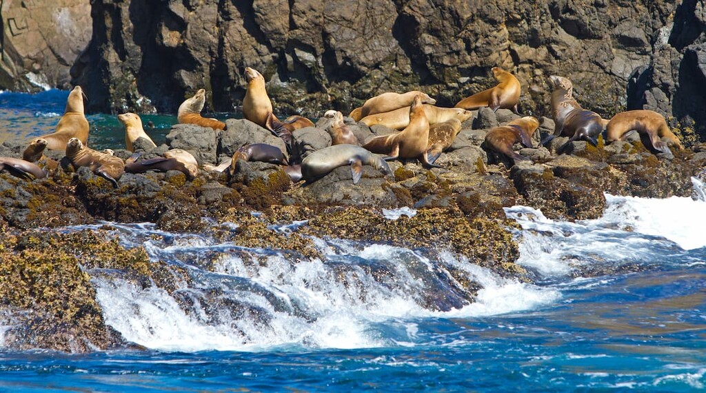
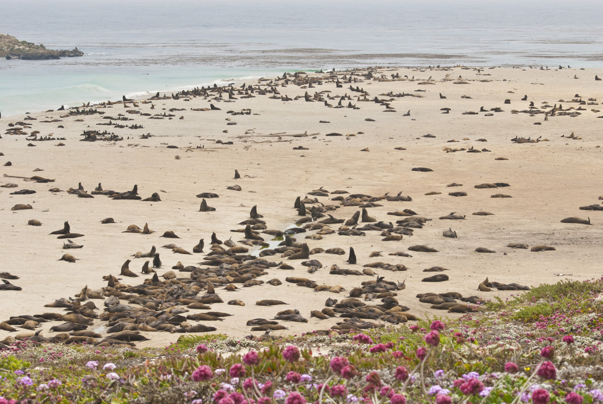
For example, Santa Cruz Island supports more than 600 plant species as well as 220 bird species, 13 mammal species, 3 amphibian species, 5 reptile species, and a large colony of breeding seals, sea lions and other marine wildlife.
The island is also home to a number of endemic plant and animal species that are found nowhere else in the world, including the island scrub-jay and eight different species of unique plants.
Peregrine falcons have an interesting history in the Channel Islands, too. These birds had largely disappeared from the Channel Islands in the 1950s as a result of the use of DDT (dichloro-diphenyl-trichloroethane), a synthetic insecticide, on mainland farms. DDT is known to affect the reproduction and development of animals, especially top predators like the peregrine falcon.
However, beginning in 1983, the National Park Service and other organizations funded the Santa Cruz Predatory Bird Research Group, which released four peregrine falcons on the island. By 2007 there were eight nesting pairs in the park and there are now more than 45 pairs on the islands, indicating that the species is starting to repopulate the area.
Bald eagles, like peregrine falcons, also struggled throughout the mid-1900s in the Channel Islands. In the early 1900s, at least seven pairs of bald eagles nested on Santa Cruz Island, with more than 30 pairs nesting across the entire Channel Islands chain.
However, by the 1960s every pair of nesting bald eagles on the islands had disappeared due to DDT poisoning. In the early 2000s, the park service set up a bald eagle conservation program and by 2006, bald eagles were found on the islands again.
In addition to these wonderful birds, Channel Islands are particularly famous for their island foxes. Island foxes (Urocyon littoralis), are a species of small foxes that’s endemic to six of the eight Channel Islands.
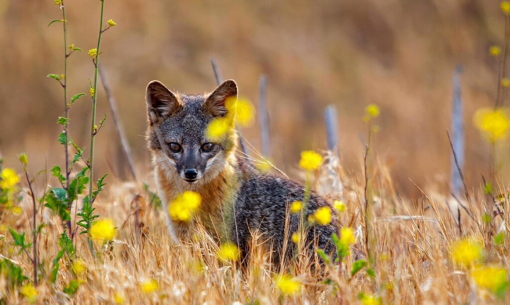
That being saids, not too long ago these little foxes were almost wiped out by golden eagles and by human activity, both of which collectively reduced the species’ population numbers by about 95 percent. In response, the park service set up a captive breeding station in 2002 to help the fox population recover.
The Channel Islands are the ancestral homelands of the Chumash people, many of whom lived on Santa Cruz island before the time of European contact. They called Santa Cruz “Limuw” meaning “in the sea.” Additionally, the Tongva lived primarily in the southern Channel Islands.
Prior to the European colonization, the islands were filled with a diverse array of shrubs, trees, and native grasses. This all changes however, with European settlement and the introduction of invasive species.
The Chumash were historically a highly maritime people and would travel to and between the islands on “tomol” or their traditional plank canoes, however, they have since been forced off of their ancestral homelands and to mainland California.
In 1542, some two thousand Chumash people lived on Santa Cruz Island in a number of different villages. The eastern end of the island had two villages: “Swaxil” in what is now called Scorpion Valley, and “Nanawani” in what is now called Smuggler’s Cove. The Chumash lived in large domed houses thatched with seagrass on the island.
During the 1540s, Juan Rodríguez Cabrillo, who was sailing for Spain, led an expedition that sailed along the coast of what is now California, stopping to make landfall on Santa Catalina Island, which he called San Salvador.
The next Europeans to arrive in the region were sailors with Sebastián Vizcaíno’s 1602 expedition, which gave the island the name Santa Catalina. Over the next couple of centuries, all of the Indigenous peoples of Santa Catalina Island and many of the other Channel Islands were forcibly removed from their homelands and sent to the California mainland, where many were enslaved.
During the late eighteenth century, George Vancouver of Great Britain also sailed to the Channel Islands, particularly around Anacapa Island and San Miguel Island. Both islands were actually home to sheep herding operations that lasted from about the 1850s to the 1940s. Santa Cruz island was especially attractive to ranchers as a result of its size, seclusion, and the lack of need to put up fences for livestock.
Some of the islands were later occupied by the US Navy during World War II. The Navy used the islands as lookouts and as missile training areas. However, around the same time, the US Government also declared both Anacapa Island and Santa Barbara Island to be a national monument.
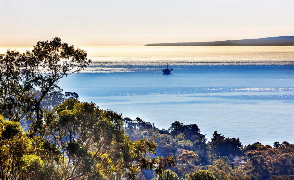
The Channel Islands saw one of their largest catastrophic events in recent memory in 1969 when an oil rig experienced a major oil spill near the archipelago. This spill caused oil to spill onto the beaches of much of the Channel Islands, killing countless birds, dolphins, seals, and other animals. It is the third-largest spill on record as of 2021, having affected an area of about 800 square miles (2,100 sq. km)
In 1980, Santa Miguel, Santa Cruz, and Santa Rosa islands were combined with the existing national monument that included Anacapa and Santa Barbara islands and designated a national park. This allowed the restoration of the islands and their native landscape began in earnest.
More recently, there was a notable flood in Scorpion Cove in 1997. While the low-lying Scorpion Cove has always been subject to flooding, the years of overgrazing and development damaged the integrity of the landscape’s natural ability to manage the rising waters.
One night in December of 1997, over a foot of rain fell on the east end of the island sending a torrent of mud through the scorpion valley and cove. The next morning the valley was still flooded and even destroyed the campgrounds, as well as the historic blacksmith shop and its artifacts.
Nowadays, Channel Islands National Park is one of the best places to visit if you’re looking to see a unique, rugged landscape just off the coast of one of the most populous areas in the United States.
Looking for a great hike or adventure during your next trip to Channel Islands National Park? Here are some of the best places to check out:
The Smuggler’s Cove footpath features remarkable views of the Pacific Ocean from the southeastern most point of the island, making the winds and the terrain considerably more manageable.
While the northern and western sides of the islands are considerably more rugged, this hike highlights the gentler side of Santa Cruz Island and offers a great day at a secluded cove to boot! Stunning sandy beaches, mountains, grassland, and even the occasional island fox can be expected on this hike.
This hike is considered to be strenuous and will take at least 4 to 5 hours to complete. It begins with a steep climb up a dirt path. At the first plateau, hikers can take a break and soak in stunning panoramic views at Scorpion Rock before continuing on toward a cypress tree grove.
Once the trail levels out, hikers will be greeted with beautiful views of Anacapa and the Pacific Ocean before descending to Smuggler’s Cove. You can expect to climb and descend 758 feet (231 meters) each way.
Hikers should also take care to bring a lot of water and sunscreen. The ridgeline hiking is very exposed and especially hot during summer days and there are no water points on the hike.
At just 1.4 miles (2.3 km) long, the Cavern Point loop is an excellent alternative to more strenuous hiking trails,though you can expect an approximately 300-foot (92-meter) climb and descent.
The trail is accessible from the Scorpion Cove boat ramp, as well as the lower loop campground. So if you want to catch a great sunset before curling up in your tent, this hike offers the perfect view and accessibility.
Cavern Point takes hikers to the top of one of the largest sea caves on the island and features sweeping views of the California coastline. Cavern Point is also close to the island’s only established campground and it’s a popular destination for watching the sun set.
The Cavern Point trail lies on the northeastern most point of the island, so even though it is a mere stones throw from the Smuggler’s Cove trail, the landscape feels very different, and much more rugged. Coastal cliff lines drop off so rapidly that it can give even the most seasoned hikers vertigo.
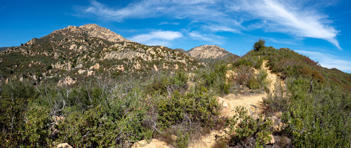
Although El Montañon Peak isn’t the highest point on Santa Cruz, it’s the highest summit accessible to the general public. The trek to the top of El Montañon spans several historical areas including the abandoned oil derrick and remnants of a World War II-era plane wreck. This footpath also offers commanding views of the island.
Other trails accessible on Santa Cruz Island include:
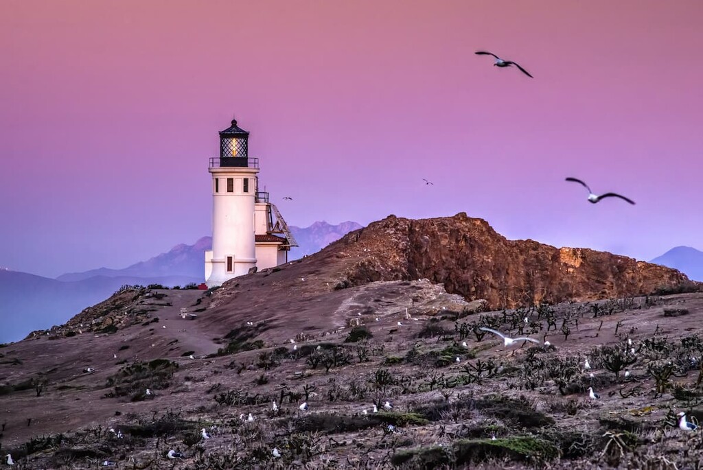
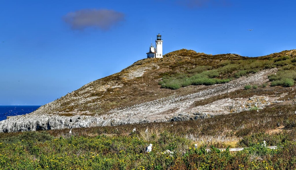
Arguably the most iconic attraction on Anacapa, the historic Anacapa lighthouse was constructed in 1932. Since then, it has helped guide sailors through the precarious waters around the Channel Islands ever since.
The lighthouse, a 39-foot (11.9 km) concrete cylindrical tower, sits at the highest point of East Anacapa and is one of the most advanced lighthouse beacons in the world. Before it was automated in the 1960s, the lighthouse housed a crew of 15 to 25 people that maintained the lens, fog signal, hourly weather, and radar monitoring. The grounds are open and escorted tours are offered.
To find the most iconic view of the Channel Islands, visit Inspiration Point. Located on the western point of Anacapa’s eastern islet, Inspiration Point features sweeping vistas of nearby islets, craggy volcanic rocks jutting out of the Pacific, as well as Santa Cruz. Inspiration Point is an easy 0.5-mile (0.8 km) walk, making it a popular destination for visitors with a limited amount of time.
Visitors to Santa Rosa will make the trek to the top of Black Mountain for stunning views of Becher Bay, Carrington Point, Cherry Canyon, and Water Canyon. The typical route to the top of Black Mountain starts at the Water Canyon Campground and follows the Cherry Canyon Trail.
Hikers will eventually cross over Telephone Road to reach the summit. The most direct route to the top is 8 miles (12.9 km) out and back, though there are several other footpaths to choose from.
San Miguel is unique—many parts of the island are inaccessible to visitors in order to protect fragile ecosystems and geological features. Not to mention, the island was a former bombing range and there may be unexploded ordnance throughout the landscape.
Visitors are able to explore the Cuyler Harbor beach, Cabrillo monument, and Lester ranch site unsupervised via the Nidever Canyon Trail. If you’re looking to explore more of the island, like Point Bennett or the Caliche Forest, you’ll need to make arrangements with a ranger.
The trek to Signal Peak begins at Landing Cove on the island’s northeastern shore before leading inland. The trail, which reaches the highest point of the island, offers hikers panoramic views of the Pacific Ocean and Sutil Island, a small island that sits offshore to the southwest of Santa Barbara Island.
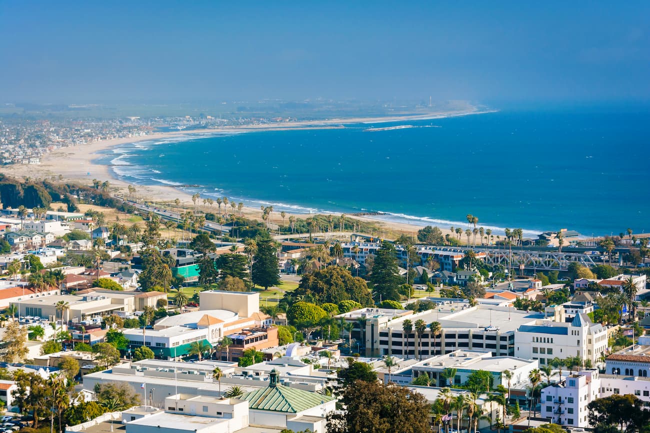
There are no services or lodging on any of the islands, so it’s important that visitors bring their own food and potable water. Most visitors to the islands will opt to make a daytrip from nearby Ventura, Oxnard, or Santa Barbara. All three beach cities offer plenty of accommodation options and amenities.
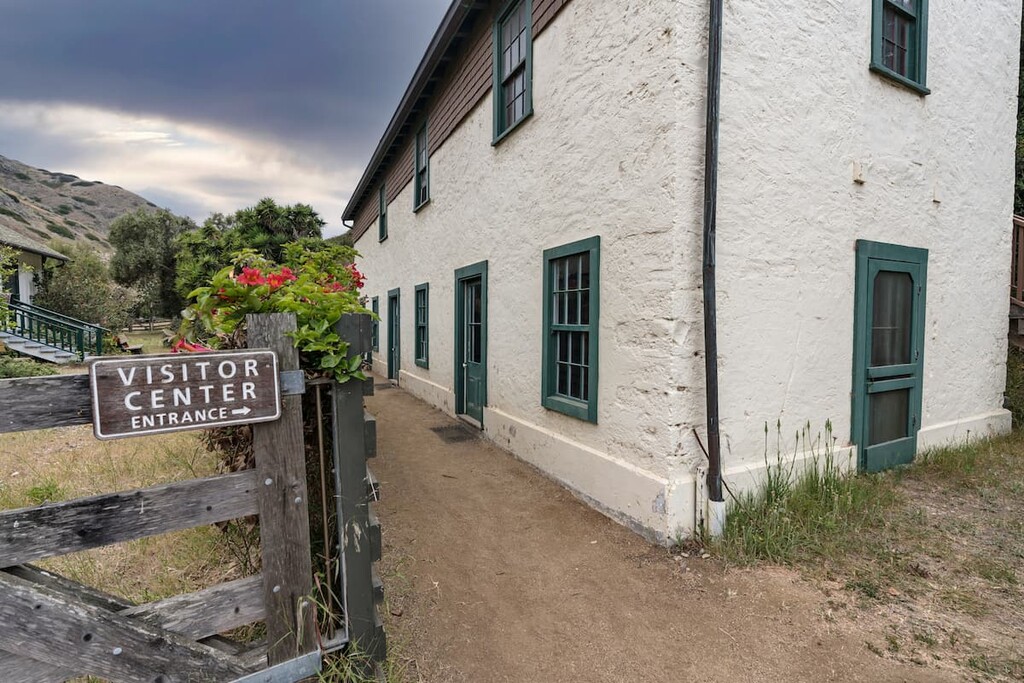
Mainland visitor centers can be found in Ventura and Santa Barbara, but the islands are only accessible via park concessionaire boats and planes or via private boat. Frequency of transportation to the islands depends on the island in question and the season.
Do note that tickets tend to sell out quickly for ferries and planes to the national park during the summer months. So plan ahead, especially if you’re looking to camp on the island as you’ll have to coordinate campground reservations and transportation reservations for your trip.
While camping is possible on each island in the national park, the restrictions and requirements vary from one to the other. For example, you need a special permit to visit San Miguel, while reserving a spot at Santa Cruz is as straightforward as reserving a spot at any other national park.
There is primitive camping available year-round on all five islands at each of these camping areas:
However, it should be noted that there are no campfires allowed at the campsites. Campers also have to pack out what they pack in, and depending on the campsite, campers will need to plan to bring water if the island is more remote and less developed.
Additionally, campers also need to be especially aware of deer mice, which have spread hantavirus in the past. Ravens, as well as, island foxes, are also always looking for an easy meal. There are often fox boxes at campsites where campers can store their food. All other items should be hung from a tree as food should never be stored in your tent at Channel Islands National Park.