Scan the QR code and open PeakVisor on your phone
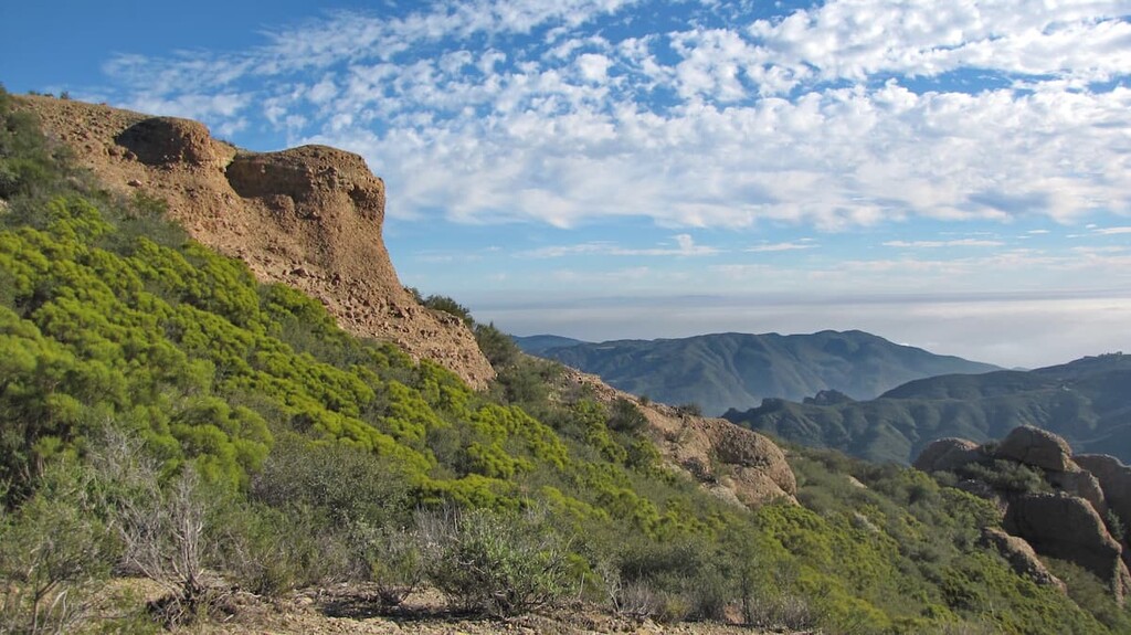
Located just to the north of Los Angeles, along the Ventura County line in the US state of California, Circle X Ranch is a small and historic national park unit in Malibu Canyon. The park contains 5 named mountains, the highest and most prominent of which is Sandstone Peak (3,110 ft/948 m).
Circle X Ranch is a former Boy Scout camp that offers many options for exploration and leisure, including spectacular nature watching opportunities in the park’s rare coastal Mediterranean ecosystem.
The camp is located in the heart of the canyons above the city of Malibu along the line separating Ventura and Los Angeles counties in the US state of California. It contains some 1,655 acres (670 ha) of land within the greater Santa Monica Mountains National Recreation Area.
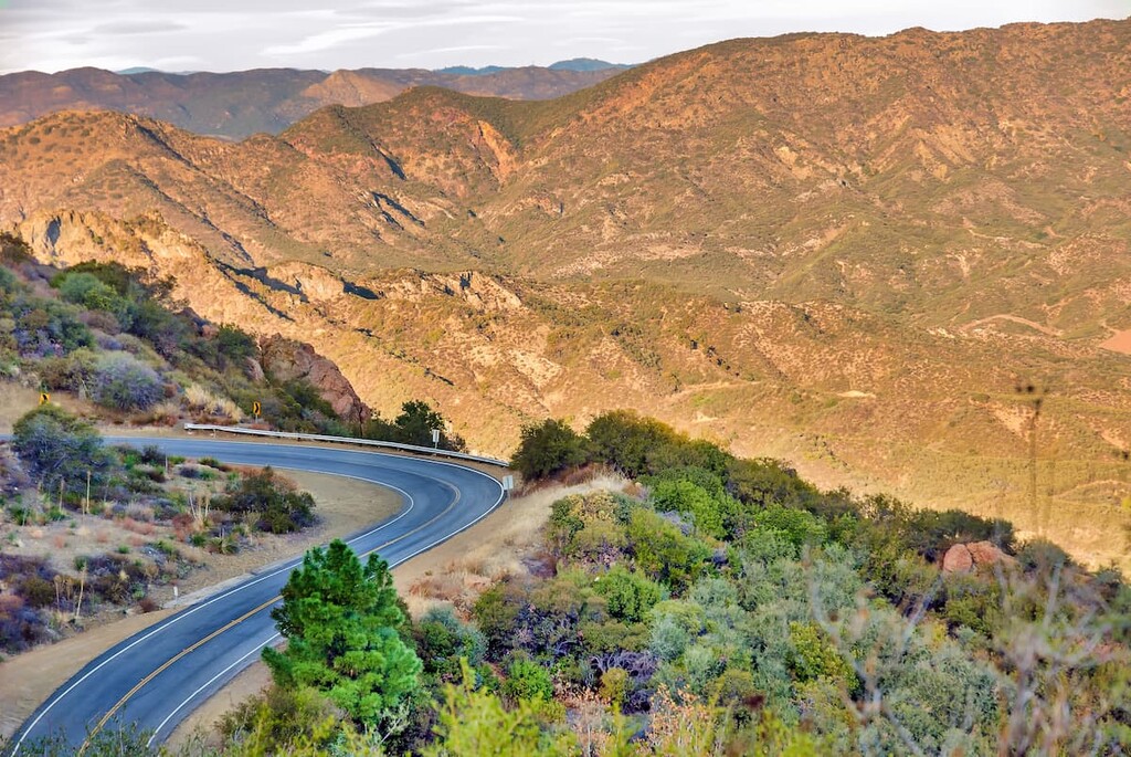
Due to the park’s strategic location within the heart of Malibu Canyon, it offers fantastic views of some of southern California’s best natural wonders, including the Channel Islands, the Topatopa Mountains, and Mount Baldy.
Furthermore, the park is surrounded by other protected areas, making it a superb place to start an adventure in southern California. Some of the region’s many nearby parks include Point Mugu State Park, Boney Mountain State Wilderness, and Malibu Creek State Park.
However, despite the park’s proximity to the city of Los Angeles, and despite the fact that it is open to hikers, cyclists, equestrians, and rock climbers, you will not have to worry about encountering the same high levels of traffic that you might find in the Topanga State Park or the Angeles National Forest.
Instead, you can head north into the park and escape the crowds, all while experiencing the magic of the region’s chaparral landscape.

Circle X Ranch is nestled in the Santa Monica Mountain range, which extends approximately 40 miles (64 km) east-west from the Hollywood Hills in Los Angeles to Point Mugu in Ventura County. While the Santa Monica range is relatively small, it is part of the larger Transverse Ranges, which begin at the southern end of the California Coast Ranges and lie within Santa Barbara, Ventura, Los Angeles, San Bernardino, Riverside and Kern counties. Given the Santa Monica ranges proximity to Los Angeles it is one of the most visited natural areas in California.
The Santa Monica Mountains, along with the Channel Islands began appearing only about 16 million years ago as result of uplifting and submergence by the Raymond Fault, which created complex layers of sedimentary rock. They at one point had peaks of over 10,000 feet before they were worn down again to the mere 3,000 foot peaks of today.
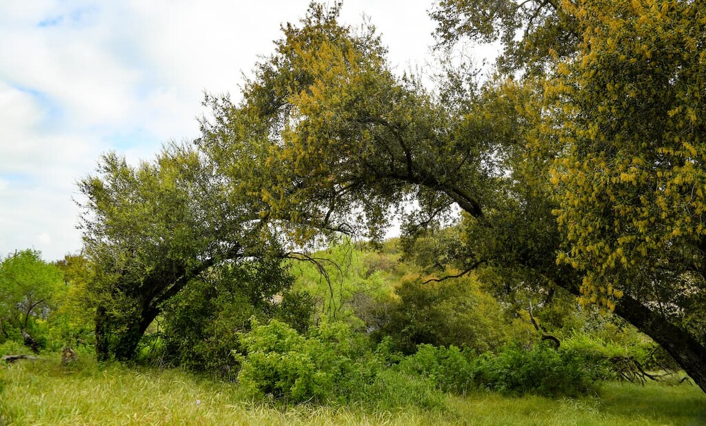
Circle X Ranch is part of both the California coastal sage and chaparral and the California montane chaparral and woodlands ecoregions.
The California coastal sage and chaparral is a Mediterranean forest, woodland, and scrub ecoregion located in southwestern California and northwestern Baja California in Mexico. It is part of the larger California chaparral and woodlands ecoregion.
The California montane chaparral and woodlands is an ecoregion defined by the World Wildlife Fund, spanning 7,900 square miles (20,000 sq. km) of mountains in the Transverse Ranges, Peninsular Ranges, and Coast Ranges of southern and central California (sometimes collectively referred to as the California Ranges).
The ecoregion is also part of the larger California chaparral and woodlands ecoregion, and belongs to the Mediterranean forests, woodlands, and scrub biome.
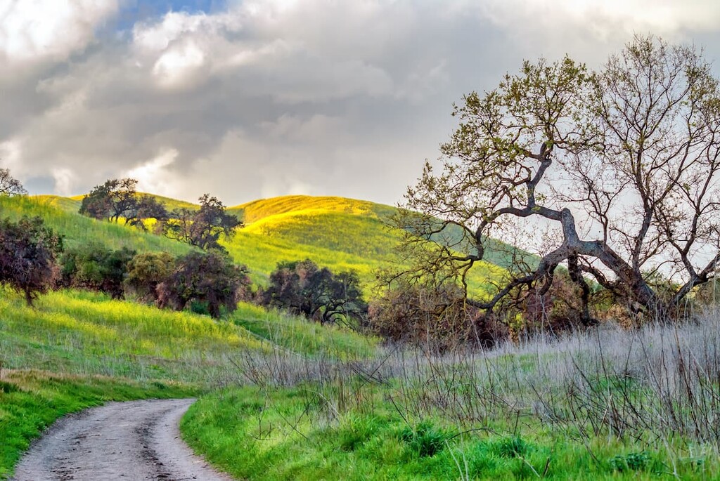
The best time to hike in the park is the spring. The wildflowers during even dry springs make any hike worth your time and effort. While at Circle X Ranch you get a chance to see some of the best native flowers southern California has to offer including California poppies, Catalina mariposa lilies, Wollyleaf ceanothus, Monkeyflowers, and Larkspurs, among others.
However, if you decide to come in July or August you may catch a glimpse of the region's red shank chamise in bloom.
There is also a variety of wildlife you can see in the park, such as mountain lions, which are present, but very rare. The mountain lion population is challenged because the Santa Monica Mountains are isolated and not big enough for weaned cubs to find their own territory. That coupled with the many cities and towns around the mountains make the population even more scarce. You may also see a bobcat while you hike, though their populations are also declining as a result of being hit by cars and often ingesting agricultural poisons intended to reduce the rat population in the mountains.
Snakes are common but only occasionally seen. The Southern Pacific rattlesnake is the only venomous species of snake in the mountains and is incredibly shy. There is also the mountain kingsnake, California kingsnake, gopher snake, and garter snake. The mountains are also home to the western fence lizard and the coastal whiptail, of which you are sure to see many. There is also an endangered Southern California Distinct Population Segment of steelhead found in the park.
Circle X Ranch is famous for, and gets its name from its history as a boy scout camp. It became a state park in 1987 in part to ensure the area be protected from development. However, prior to this history the area was inhabited by Chumash tribes for thousands of years prior to settlers coming in. The Circle X Ranch area is only a few miles from a former Chumash capital, which is located in Point Mugu State Park and can be seen from the Trip Peak summit.
Point Mugu’s name is derived from the word Muwu, a Chumash word meaning ‘beach’. In pre-colonial times, Muwu was the capital of Lulapin, a major political unit of Chumash territory, which stretched from modern day Los Angeles County to Santa Barbara in the north (which included at least 60 miles of coastland, as well as 60 miles inland). Muwu had the highest population of any Chumash territory and was a ceremonial center, as well as the ancient capital.
While none of the popular trails at Circle X Ranch are particularly long, given its slightly higher altitude location, general exposure at the higher reaches, and southern California location, it is important to bring water on your hike, especially in the summer months.
There are many washes throughout the park, but they should not be relied upon as emergency water sources as they are often dry during the summer and often contaminated with giardia. There are also no water points along the trails in the park.
Furthermore, dogs are welcome to hike with visitors, but must be kept on a leash while in the park.
With that in mind, here are some of the best hikes to check out in the park:
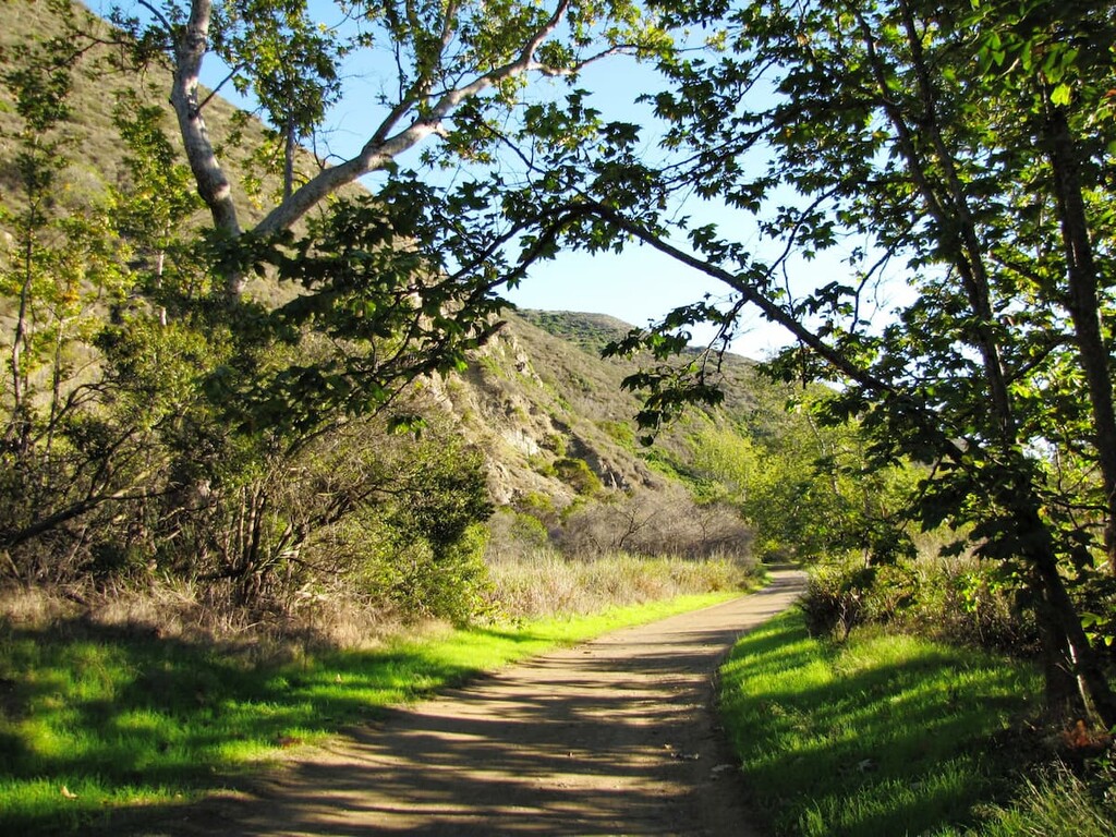
The Grotto Trail is a short, heavily trafficked, out-and-back trail that often serves as the entry point for visitors looking to explore the park.
Only around 2.5 miles (4 kilometers), this trail descends into a verdant canyon and passes in and out of shade as it follows a small creek down the mountain. Eventually, it comes to an abrupt stop just above the grotto at the West Fork of the Arroyo Sequit.
The elevation gain and loss on this trail are both 641 feet (195 meters), so you’ll need to put in a bit of effort on your return up the canyon. While the vast majority of the hike is suitable for new hikers, if you want to get down to the grotto you will have to do a bit of scrambling up steep rock faces and between overgrown vegetation. It is doable for most hikers, but it is not advisable for those with less experience.
To get to the trailhead, you will park at the Circle X Ranch ranger station and descend along the dirt road past the campsites just a few feet below. Parking is plentiful throughout the park and doubly so at this location. You can park at the top with the ranger station, or drive a little further down and park at one of the two lots nearer the camping area.
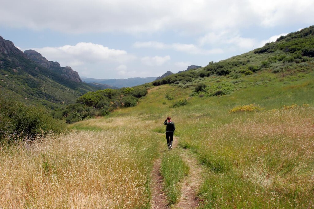
This is a trail that is not to be missed! Absolutely stunning in the spring, this trail highlights not only the region's best array of wildflowers, but also spectacular views of rock formations, as well as panoramas of the Santa Monica Mountains and the Pacific Ocean, and even a full view of Point Mugu State Park from the Tri Peaks Summit.
Given its approximately 7 miles (11 kilometers) round trip distance, this hike will give you the most bang for your Circle X Ranch buck.
Additionally, you can bag a few choice peaks on this hike including, Tri Peaks (3,009 ft/917m), Exchange Peak (2,966 ft/904 m), Skull Rock (3,018 ft/920 m), and Sandstone Peak (3,110 ft/248 m), as well as climb Inspiration Point. If you include the 4 available summits the ascent is 1,891 ft (576 m), and the descent is 1,963 ft (576 m) going counter clockwise from the Sandstone Peak Parking lot.
In fact, if you want an overall easier hike, it is advisable to go counter clockwise so you do not have to climb the steeper ridge up to Sandstone Peak and can instead enjoy a steady climb through the wilderness behind the ridgeline.
You can start the hike from either the Sandstone Peak Trailhead parking lot or the Mishe Mokwa Trailhead parking lot just up the road from the Ranger Station on Yerba Buena Road. The trail intercuts with the Backbone trail, an approximately 68 mile (109 km) backcountry trail going across the length of the Santa Monica Mountains from Point Mugu State Park to Topanga State Park.
As you progress through the hike follow signs for Tri Peaks and Sandstone Peak, before you will eventually come across a number of signs indicating the direction of the parking lot down hill from the Sandstone Peak.
The park is only 45 minutes to an hour from Los Angeles depending on traffic. A straight shot up the Pacific Crest highway from Santa Monica in LA, or via the northern route up highway 101, Circle X ranch is one of the most accessible parks in the area!

Circle X Ranch resides in Oxnard’s backyard at only about 30 minutes away. SImilar to Los Angeles, the park can be reached via the Pacific Coast Highway or via highway 101. Circle X Ranch, along with its neighbor, Point Mugu State Park, are some of the best and closest hiking destinations to Oxnard.
While backcountry camping is not permitted in the Santa Monica Mountains Recreational area, there is a developed camping site located just below the Circle X Ranger Station. Group campground reservations are required and can be made at Recreation.gov.
As of 2021 the campground fees are;
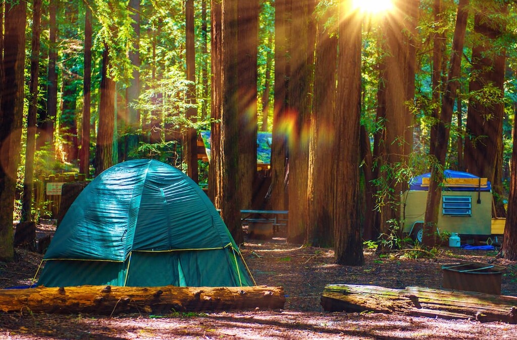
Campers can stay for up to 14 consecutive days, but for no more than 30 days per calendar year. There is a daily camper limit of 75 people at the campgrounds.
At the campground, charcoal fires are permitted in fire grates or personal barbecue grills and gas stoves are also permitted. However, campfires with wood or compressed log fires are prohibited due to fire hazards.
Indeed, as with many coastal chaparral landscapes, the park is often at risk of seasonal wildfires. You will likely see evidence of previous burns during your stay to attest to this. So keep an eye on the park’s webpage to stay up to date on seasonal fire bans.
Circle X Ranch is bisected by Yerba Buena Road. From Los Angeles you can take either the Pacific Coast Highway or the more northern route along Highway 101 towards Thousand Oaks.
If you take Highway 101 you will take the exit for Highway 23 just before you enter Thousand Oaks. Then turn right on Mulholland Highway before turning right again shortly after for Yerba Buena.
Coming from the north (from Oxnard, Ventura, Thousand Oaks, etc.), these same directions apply.
If you are coming from the west along the Pacific Coast Highway you will reach the Ranger Station on the right, followed by the Sandstone Peak Trailhead parking lot and then the Mishe Mokwa Trailhead parking lot a few miles up on the left.