Scan the QR code and open PeakVisor on your phone
An hour north of Los Angeles in Ventura, California, Point Mugu State Park is a sterling example of coastal desert landscapes that makes for a great day trip, or overnight getaway. The park has 5 miles of shoreline and more than 70 miles of hiking trails inland and along the high ridge overlooking the coast. The Park is just south of the city of Port Hueneme and the city of Oxnard, California and borders the Naval Base of Ventura County.
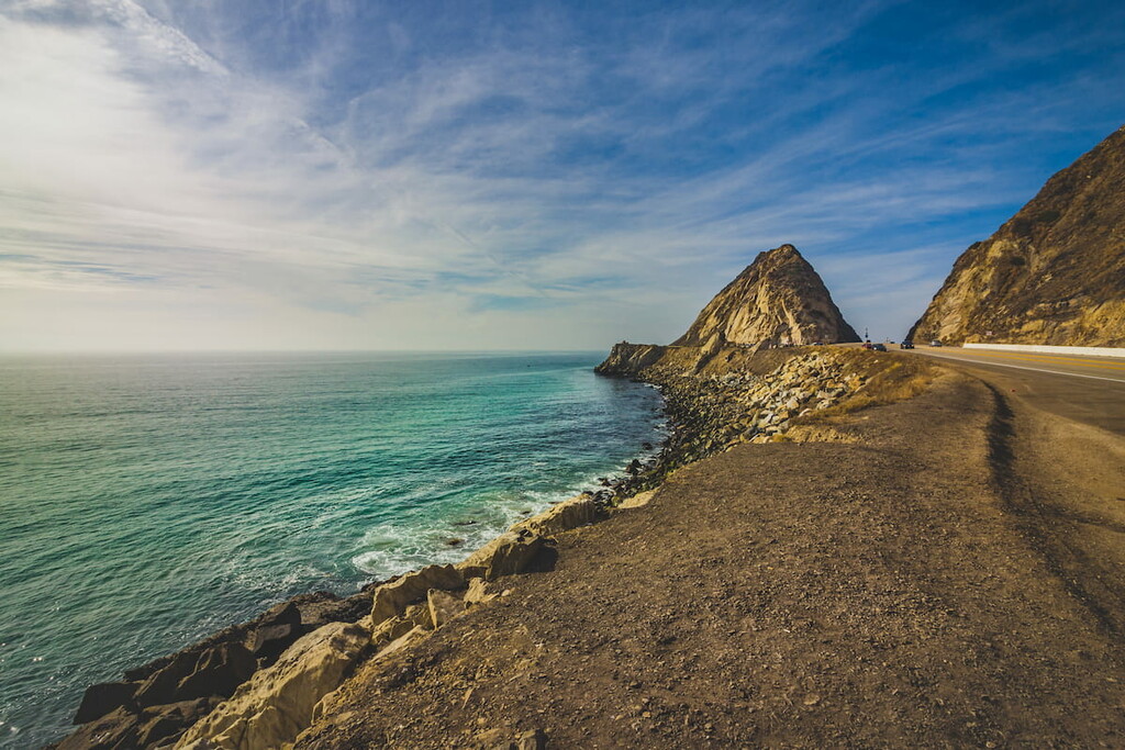
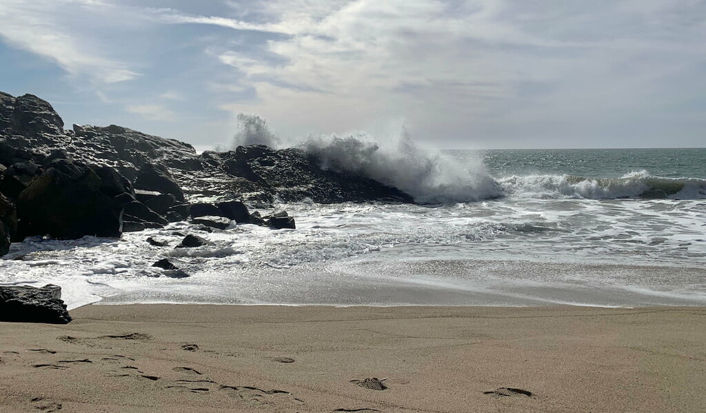
Mugu Rock is a notable coastal headland promontory that marks the western end of the Santa Monica Mountains, and the Rancho Guadalasca boundary. The rock was formed when the Pacific Coast Highway was cut through the near-vertical ridge of resistant volcanic rock in 1937.
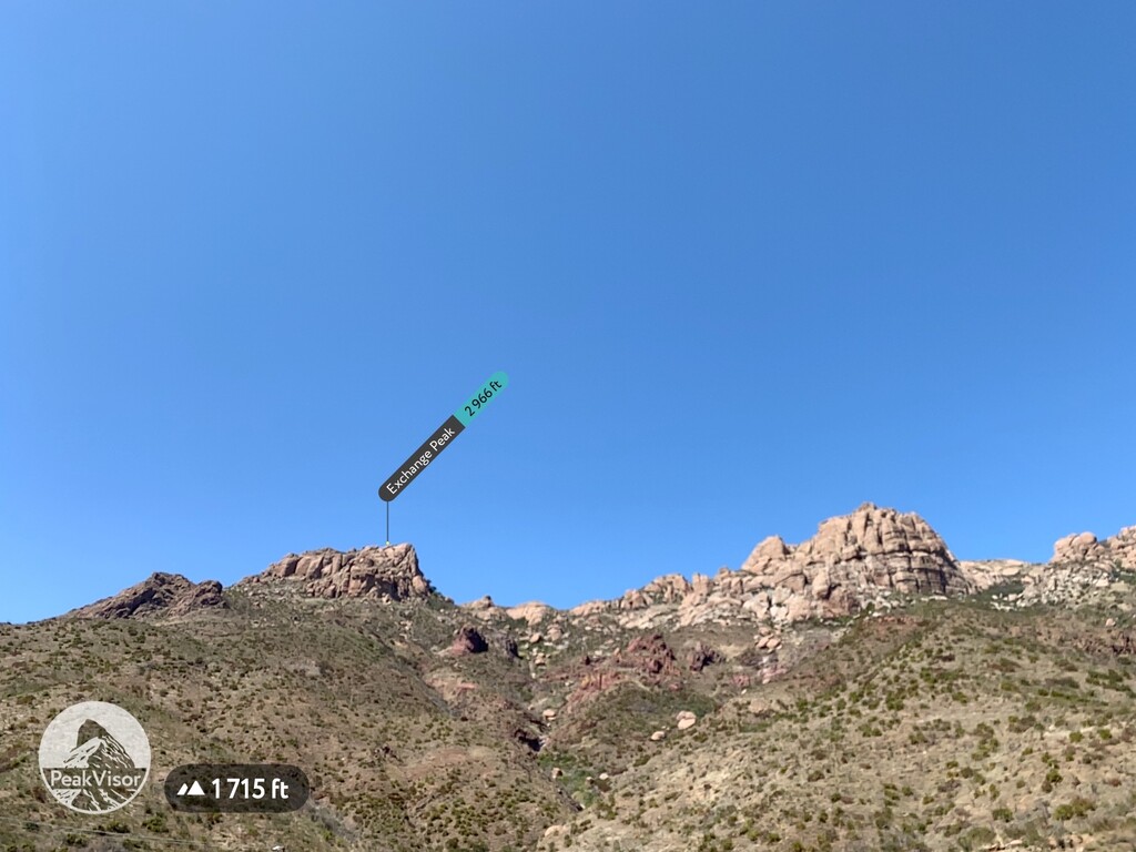
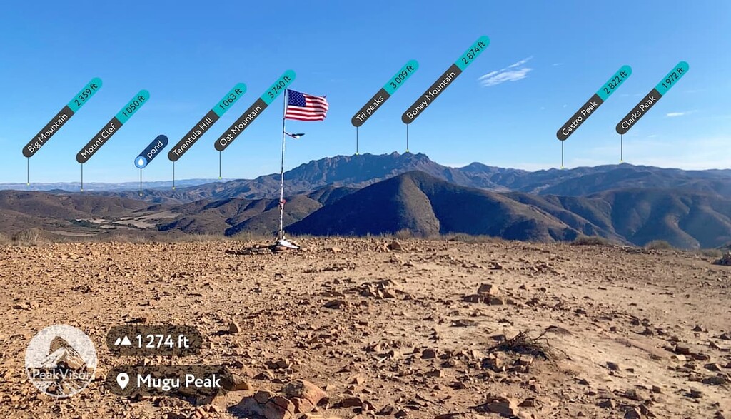
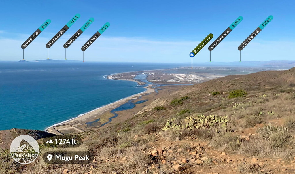
From Point Mugu (1274 ft) you can easily see Channel Islands National Park, home to Summit Peak (935 ft), Montanon Peak (1808 ft), Devil’s Peak (2428 ft), and Profile Point (312 ft), as well as Port Hueneme to the North. On a clear day you can also see Mount Orizaba (2103 ft), Silver Peak (1821 ft) and San Nicolas Island out to sea. From the point you can also see (from north to south); Santa Ynez Peak (4291 ft), La Cumbre Peak (3986 ft), Divide Peak (4705 ft), Monte Arido (6017 ft), Laguna Peak (1453 ft) which is home to the Point Mugu Air Station, Sulphur Mountain (2730 ft), Reyes Peak (7493 ft), Chief Peak (5587 ft), Hines Peak (6699 ft), Alamo Mountain (7388 ft), La Jolla Peak (1568 ft), Big Mountain (2359 ft), Mount Clef (1050 ft), Tarantula Hill (1063 ft), Oat Mountain (3740 ft), Tri Peaks (3009 ft), Boney Mountain (2874 ft), Castro Peak (2822 ft), Clarks Peak (1972 ft), Point Dume (203 ft), and San Pedro Hill (1473 ft), as well as Sycamore Cove.
Point Mugu’s name is derived from the word Muwu, a Chumash word meaning ‘beach’. In pre-colonial times, Muwu was the capital of Lulapin, a major political unit of Chumash territory, which stretched from modern day Los Angeles County to Santa Barbara in the north (which included at least 60 miles of coastland, as well as 60 miles inland). Muwu had the highest population of any Chumash territory and was a ceremonial center, as well as the ancient capital.
Getting to Point Mugu is incredibly easy, especially if you want to access the park from its coastal edge. From Los Angeles you simply drive up the Pacific Coast Highway until you either reach the park at the (from south to north); Sycamore Canyon Campground access, which is also home to the Range Station for Malibu Operations, the La Jolla Canyon Trailhead, where there is also a camping location, or the Chumash Trailhead at Mugu beach just below Point Mugu. Parking at both Sycamore Campground and La Jolla Canyon will require that visitors pay. The California State Park parking rates are; All day – $12.00 per car, per day 3 hrs – $9.00 per car 2 hrs – $6.00 per car 1 hr – $3.00 per car, however those rates may vary based on location. Parking at the Mugu Beach access point is free but limited.
If you are coming to Point Mugu from Inland you can take California Highway 101 to Newbury Park or Camarillo where you can take a number of inland entry points. Point Mugu is part of a larger state park protection area so you can even hike into the park from Malibu.
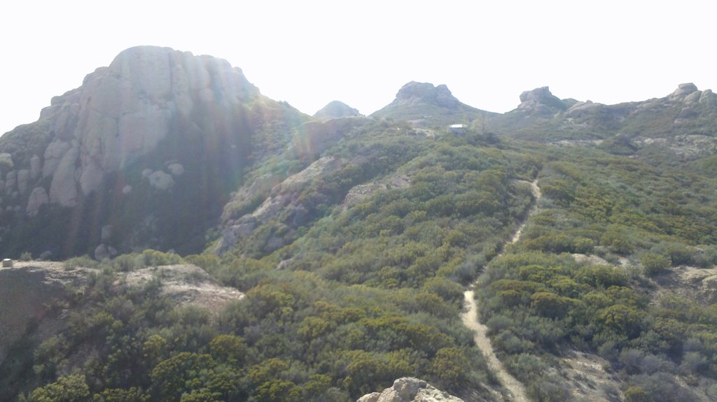
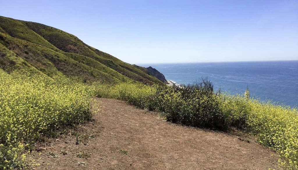
From the Chumash trailhead at the Mugu beach you will climb steeply up 1.2 miles gaining about 1247 feet. This is a tough climb, but worth it for the phenomenal views. You can limit your hike to the peak and have a rigorous 2.4 mile hike or you can extend it to La Jolla Valley (entering into the La Jolla Valley Nature Preserve), which will give you access to the gorgeous high desert valley with wonderful views of Tri Peaks (3009 ft) and Boney Mountain (2874 ft) in the Santa Monica Mountain Range.
If you decide to extend your hike you have three easy options for an extension. Head down the south edge of Point Mugu and take the trail heading around the mountain towards the inland La Jolla Valley. As you continue your hike you will come to a fork in the road. You can either head right for your longest option and go around the La Jolla Valley along the La Jolla Loop road headed north before turning west towards the Point Mugu Chumash trail that you climbed earlier. If you want a shorter option you can turn left at the fork and either take the first right for a medium distance hike through the valley or stay left and take a shorter hike around Mugu Peak and back down to the parking lot. Each hike will be about 7 miles, 5 miles, or 4 miles (give or take) respectively.
The Ray Miller trail is a straightforward 5.5 mile in and out hike that takes a section of the much much longer 68.8 mile Backbone Trail (that terminates in Santa Monica) and instead follows it up to where it meets the Sycamore Canyon Loop trail. The draw of this trail is the variety of plant life in the valley. There is a paid parking lot and a campsite at this spot.
The Sycamore Cove Loop is a 9.2 mile day hike that connects to the Backbone trail and explores the inland areas of Point Mugu State Park. You can either follow the Sycamore Canyon Trail for 3 miles until it hits the Backbone Trail, where you will turn left and loop back in to connect back to the Sycamore Canyon Loop trail (another left) and back to the parking lot for the full hike or if you want a shorter option you can turn left at the Overlook trail for a shorter approximately 2 mile hike with lovely views of the coast, or turn left at the Fireline Trail for an approximately 4 mile hike. Both options will connect you back with the Sycamore Canyon Loop Trail.