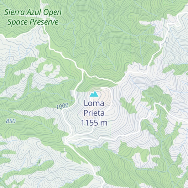
Loma Prieta (from Spanish loma -hill, prieta -dark) is 3,790 feet (1,160 m) high and is the highest peak in the Santa Cruz Mountains in Northern California.
Although the 1989 Loma Prieta earthquake was named for this mountain, the actual epicenter was five miles southwest of the peak, across the San Andreas fault, in The Forest of Nisene Marks State Park.
In the 19th century, the peak was called Mount Bache, a name given in honor of Alexander Dallas Bache; the name is no longer in use.
From 1955 to 2005, the mountain was the longtime site for the transmitter tower of San Jose television station KNTV. In September 2005, it moved its transmitter 83 kilometres (52 mi) northwest to San Bruno Mountain after it became the Bay Area's NBC affiliate.
There's a trail leading to the summit.
By elevation Loma Prieta is
# 15 out of 155 in Santa Clara County # 1 out of 4 in Sierra Azul Open Space Preserve (closed areas) # 1 out of 176 in the Santa Cruz Mountains
By prominence Loma Prieta is
# 10 out of 2181 in the California Ranges # 30 out of 7926 in California # 1 out of 155 in Santa Clara County # 1 out of 4 in Sierra Azul Open Space Preserve (closed areas) # 1 out of 176 in the Santa Cruz Mountains
We use GPS information embedded into the photo when it is available.
3D mountains overlay
Adjust mountain panorama to perfectly match your photos because recorded by camera photo position might be imprecise.
Move tool
Rotate tool
Zoom
More customization
Choose which peak labels should make into the final photo and what photo title should be.
Next
Photo Location
Satellitte
Flat map
Relief map
Latitude
Longitude
Altitude
OR
Latitude
°'''
Longitude
°'''
Apply
Register Peak
Peak Name
Latitude
Longitude
Altitude
Register
Teleport
PeakVisor
This 3D model of Sagarmatha National Park in Nepal was made using the PeakVisor app topographic data. The mobile app features higher precision models worldwide, more topographic details, and works offline. Download PeakVisor maps today.
Download OBJ model
PeakVisor
The download should start shortly. If you find it useful please consider supporting the PeakVisor app.
PeakVisor for iOS and Android
Be a superhero of outdoor navigation with state-of-the-art 3D maps and mountain identification in the palm of your hand!


.jpg)