
Scan the QR code and open PeakVisor on your phone
The Sand to Snow National Monument is a protected area in the US that’s jointly administered by the US Forest Service and Bureau of Land Management (BLM). It protects about 154,000 acres (62,322 ha) of wilderness in southern California's San Bernardino County. There are 11 named mountains in Sand to Snow National Monument, the highest and the most prominent of which is San Gorgonio Mountain (11,490 ft/3,502 m).
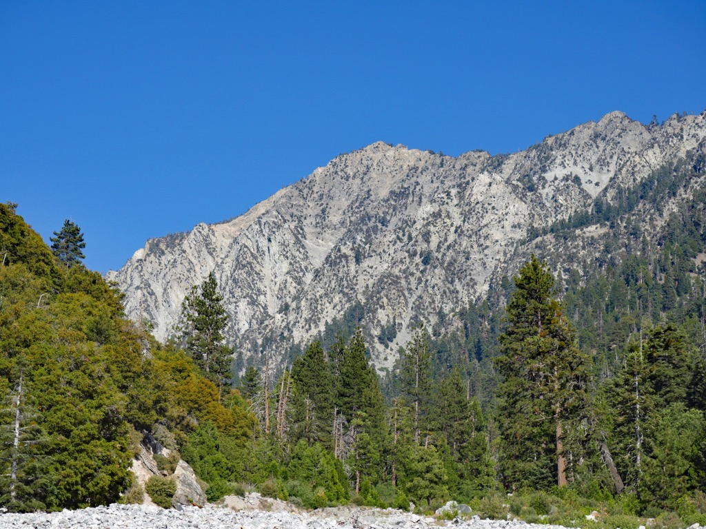
Just as its name implies, the Sand to Snow National Monument extends from the floor of the sandy Sonoran Desert to an elevation of over 11,000 feet (3,353 m) at the summit of San Gorgonio Mountain in the San Gorgonio Wilderness. It encompasses roughly 154,000 acres (62,322 ha) of terrain, including over 100,000 acres (40,469 ha) of the congressionally designated San Gorgonio Wilderness.
The US Forest Service manages about 71,000 acres (28,733 ha) of the national monument as part of the San Bernardino National Forest while the Bureau of Land Management (BLM) manages about 83,000 acres (33,589 ha) of the monument as part of its California Desert District.
Within the Sand to Snow National Monument, the focal point is easily the 11,500-foot (3,505 m) San Gorgonio Mountain, which is one of the tallest peaks in southern California. San Gorgonio is one of just eleven peaks that reach over 10,000 feet (3,048 m) in the southeast part of the San Bernardino Mountains.
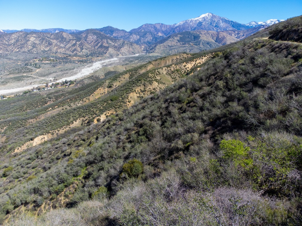
The Sand to Snow National Monument is surrounded by many acres of public land. The monument’s eastern border abuts Joshua Tree National Park and its vast wilderness. The Bighorn Mountain Wilderness also lies to the north of the monument while the San Jacinto Wilderness is located to the south.
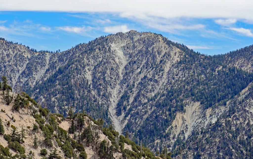
The Sand to Snow National Monument encompasses part of the San Bernardino Mountains, which are part of the larger Traverse Ranges of southern California. The San Bernardino Mountains formed roughly 11 million years ago as the result of tectonic activity along the San Andreas Fault.
The rocks that make up the San Bernardino Mountains are between 18 million years to 1.7 billion years old, making them far more ancient than the mountains themselves.
An earlier version of the San Bernardino Mountains rose during the Miocene, about 11 to 15 million years ago, but was mostly eroded away.
The San Bernardinos in their present form were shaped by a series of fault blocks, or massive sections of crustal rock created by tectonic forces, during the Pleistocene epoch. The San Gorgonio block, which is located partially in the Sand to Snow National Monument, is the largest of the southern fault-bounded tectonic blocks in the state.
Due to their dramatic, steep rise above the surrounding terrain, the San Bernardino Mountains have been subject to significant erosion over the course of millions of years. Rocks and sediment from the mountains are regularly deposited on the surrounding valley floors as massive alluvial fans. These alluvial deposits can reach depths of more than 1,000 feet (305 m).
Though mountain building began in the San Bernardinos roughly eleven million years ago, they are still actively rising to this day, as is the case with some other famous mountain ranges around the world, like the Himalaya.
As one of the most biodiverse areas in southern California, the Sand to Snow National Monument hosts a variety of unique ecosystems, including lowland Mojave and Colorado deserts, riparian forests, creosote bush scrub and woodlands, freshwater marshes, Mediterranean chaparral, and alpine conifer forests.
The monument is located within the San Bernardino Mountains, which is one of the most botanically diverse mountain ranges in the southwestern US. Plant and animal species in the San Bernardino Mountains are heavily influenced by the convergence of three distinct ecosystems—California chaparral and woodlands, Mojave Desert, and Sonoran Desert.
The San Bernardino Mountains are what is known as a “sky island,” or mountainous region where flora and fauna vary dramatically from adjoining lowland, semi-arid environments. More than 440 species of animals and 1,600 native plant species thrive in the San Bernardino Mountains, including many rare and endangered species.
The undisturbed and roadless San Gorgonio Wilderness, which is partially located within the Sand to Snow National Monument, acts as an important wildlife corridor between the San Bernardino Mountains and the San Jacinto Mountains.

More than 250 federally listed threatened and endangered animal species (including 240 species of birds) are protected by the monument. The area also sustains one of the southernmost stands of quaking aspen trees in the country, and it serves as a habitat for California spotted owls, peregrine falcons, bighorn sheep, mountain yellow-legged frogs, San Bernardino flying squirrels, and black bears, among other animals.
The land now occupied by the Sand to Snow National Monument has been inhabited by humans for thousands of years.
A group of Takic-speaking people arrived in the region around 2,500 years ago. They subsisted on a variety of native plants in the area, including honey, mesquite, oak, pinon, cactus fruits, and yucca roots. They also made tools, manufactured woven goods, and coiled basketry and ceramic pots for storage and transport.
San Gorgonio Mountain is one of many sacred peaks in southern California that have long been of interest to humans. The origin of its English language name dates to the seventeenth or eighteenth century when Spanish missionaries named it for Saint Gorgonius. However, it is called Pewipwi in Luiseño and Pewipwi in Cahuilla/Ivilyuat (ʔívil̃uʔat).
The Luiseño consider San Gorgonio Mountain to be the sacred older brother of Mount San Jacinto. In fact, both peaks are considered to be among the first born of Earth Mother in the Luiseño creation story.
When Spanish missionaries first arrived in the area in the mid-eighteenth century, they encountered the Yuhaaviatam people who lived in small, autonomous villages throughout the San Bernardino Mountains and the Mojave Desert. They called the Yuhaaviatam people the Serrano, or “person from the mountains.” This name is still regularly used today to identify the tribe, which is also known officially as the Yuhaaviatam of San Manuel Nation or the San Manuel Band of Mission Indians.
Not long after their first contact, Spanish colonizers began invading Yuhaaviatam villages, forcing them from their sacred homelands. Those fortunate enough to survive the violence and disease brought by early colonizers were forced to live in missions, where they had to give up their traditions in favor of western ways of life.
The California Gold Rush in 1849 brought another influx of settlers to the area. Their mining, farming, and logging activities would alter the landscape forever and subsequently displace many more Indigenous people from the region.
Just two decades later, in 1867, the Yuhaaviatam were again the victims of a massacre, this time by US settlers of the San Bernardino Valley. Over the course of 32 days, Chimney Rock, a sacred place once used for rituals, ceremonies, and prayer, became the site of extreme violence and contention between Euro-American colonizers and the Yuhaaviatam people.
An estimated 200 and 300 Yuhaaviatam were killed before tribal leader Santos Manuel led survivors from the mountains to the San Bernardino Valley, where they established permanent residence. In 1891, the US government established the San Manuel Reservation.
By the mid-1920s, thousands of people had begun traveling to the San Bernardino Mountains for recreation purposes. In February 2016, after decades of land acquisition and advocacy, the Sand to Snow National Monument was formally designated by President Barack Obama, along with Castle Mountains National Monument and Mojave Trails National Monument.
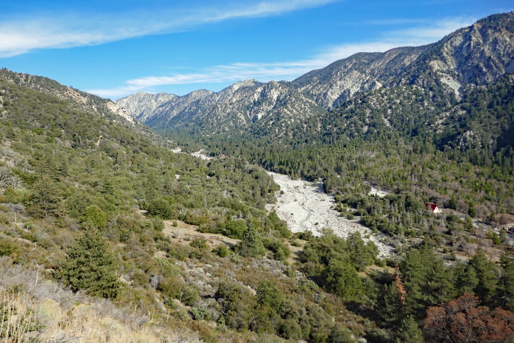
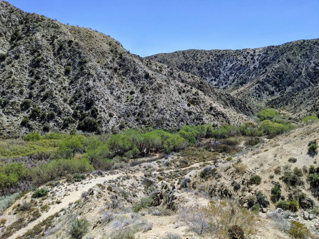
The Sand to Snow National Monument area is a popular destination for a variety of outdoor recreation activities, including primitive camping, hiking, hunting, horseback riding, photography, wildlife viewing, and even skiing. Here’s a look at some of the best trails in the area.
The 4,760-acre (1,926 ha) Mission Creek Preserve is an often-overlooked desert gem located just outside of Joshua Tree National Park in the Sand to Snow National Monument.
The preserve has many hiking trails, a picnic area, and a walk-in campground. One of the most popular attractions in the area is the Mission Creek Stonehouse, which is a historic structure that’s tucked in the wetlands of the preserve.
As one of the largest cottonwood and willow riparian habitats in California, the Big Morongo Canyon Preserve is a popular destination that’s located among the Little San Bernardino Mountains in the Sand to Snow National Monument.
The 31,000-acre (12,545 ha) preserve is a desert oasis that contains a variety of hiking and walking trails. All trails in the preserve begin at a kiosk in a well-marked parking area. Elevations in the preserve range from 600 feet (183 m) at the canyon floor to highs of over 3,000 feet (914 m), and visitors can choose from trails ranging anywhere from less than a mile to over 10 miles (16 km) in length.
Popular trails in the preserve include the West Canyon Trail, Marsh Trail, Desert Willow Trail, and Mesquite Trail.
Visitors looking for a trekking challenge can hike roughly 30 miles (48 km) of the 2,600-mile Pacific Crest Trail in the Sand to Snow National Monument.
This section, which is known locally as the ‘nine peaks challenge,’ features more than 8,300 feet (2,530 m) of elevation change across nine summits:
This traverse is an all-day adventure and will test even the most experienced hikers’ endurance and mental fortitude. Note that it can get very, very hot in the monument during the summer months, so start hiking early in the day, wear sun-protective clothing, bring lots of water, and be willing to turn back if the weather is too extreme during your adventures.
About 24 million people live within a two-hour drive of the Sand to Snow National Monument. Here are some of the best nearby cities to visit on your next trip to the area.
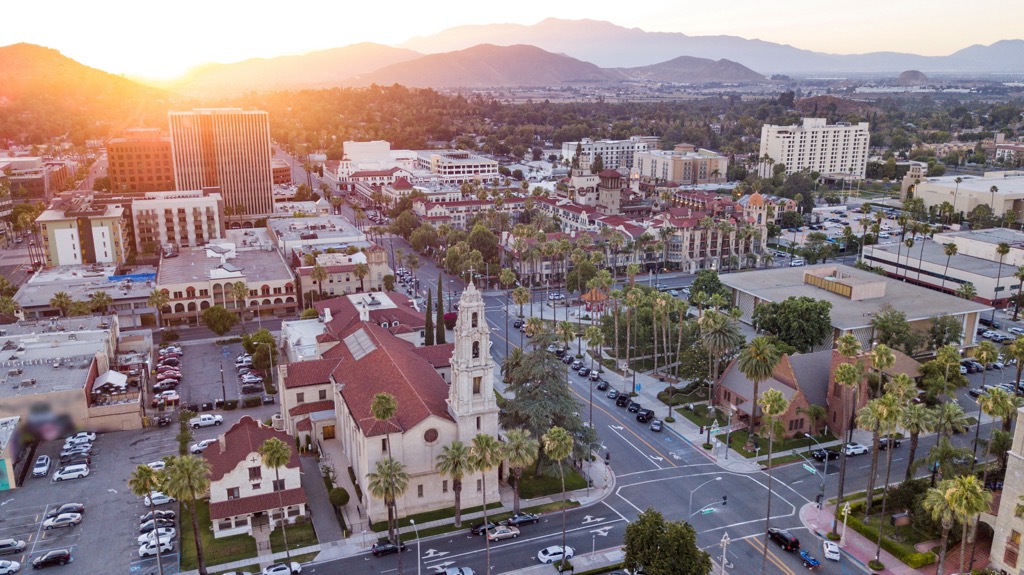
Located just west of the San Bernardino Mountains, San Bernardino is home to over 220,000 people, making it one of the largest cities in the Inland Empire region of southern California. San Bernardino is also the economic, cultural, and political hub of the San Bernardino Valley.
The city is situated at the junction of several major highways and it has an international airport. It is also served by Metrolink and Amtrak’s Southwest Chief, which operates between Los Angeles and Chicago.
Visitors to San Bernardino can easily access and enjoy a variety of outdoor activities in the nearby San Bernardino National Forest and Angeles National Forest.
Situated some 60 miles (97 km) to the east of Los Angeles, Riverside is the most populous city in southern California’s Inland Empire.
As the birthplace of the state’s citrus industry, Riverside is home to two dozen nationally registered historic sites, including the historic Mission Inn, the Beaux-Arts style Riverside County Historic Courthouse, and the Riverside Fox Theater. It’s also situated adjacent to many acres of wilderness in the San Bernardino National Forest.
Nestled to the east of the San Jacinto Mountains in the Coachella Valley, Palm Springs is a desert resort city that’s best known for its lavish amenities and accommodations. One of the city’s most unique attractions is the Palm Springs Aerial Tramway, which is a rotating tram car that ascends 5,800 feet (1,768 m) of elevation in just 10 minutes.
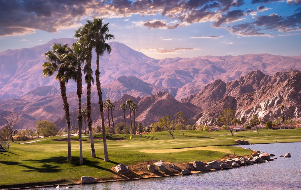
Once at the Mountain Station, visitors can enjoy two restaurants, an observation deck, a natural history museum, two theaters, and a gift shop. There are also more than 50 miles (80 km) of hiking trails that are accessible from the top of the tramway.


