Scan the QR code and open PeakVisor on your phone
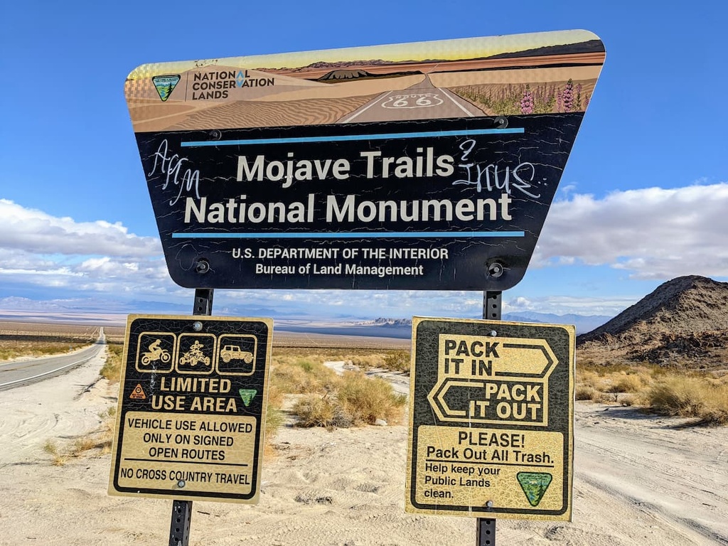
The Mojave Trails National Monument is a large federally protected area of vast desert located in the southeastern part of the US state of California. It is the largest national monument in the contiguous US, and it is managed by the Bureau of Land Management. There are 19 named mountains in Mojave Trails National Monument. The highest and the most prominent mountain in the monument is Cady Peak (4,616 ft/1,407 m).
Mojave Trail National Monument is a 1.6 million acre (647,498 hectare) large federally designated monument that connects the Mojave National Preserve with Joshua Tree National Park.
The national monument also includes more than 350,000 acres (141,640 hectare) of Congressionally-designated wilderness in the southeastern part of the US state of California. It is wholly contained within San Bernardino County.
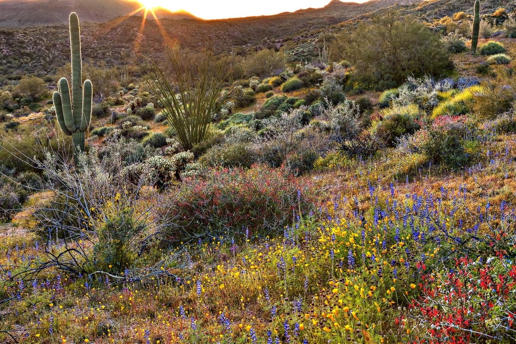
The Mojave Trails National Monument shares, as its name would suggest, a number of similar characteristics with the Mojave National Preserve. This includes stark mountain ranges, volcanic features, and sand dunes. Notably, the monument contains the longest undeveloped stretch of the famous Route 66.
Mojave Trails National Monument is the largest national monument in the contiguous United States and is, to date, almost entirely undeveloped. There are four wilderness areas within the monument: Trilobite, Clipper Mountain, Piute Mountains and Bigelow Cholla Garden.
One of the major draws of the Mojave Trails National Monument is Afton Canyon, which is one of only two places where the 140 mile (225 km) long Mojave River continuously flows above the ground year round (rather than seasonal with the late summer monsoons). Afton Canyon is nicknamed the “Grand Canyon of the Mojave” as a result of its steep rock faces.
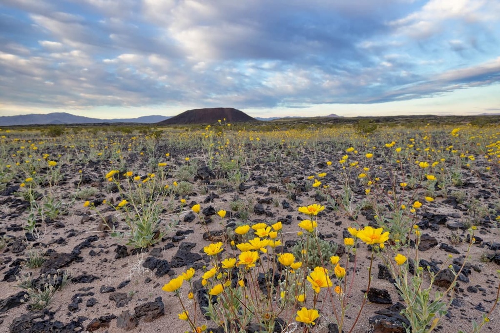
The Mojave Trails National Monument is also home to one of the most remote areas in California: the Cadiz Dunes. These dunes are orange-pink in color, and they are almost entirely unvegetated. They formed from the sand of dry lake beds.
The monument is also home to Bonanza Spring and the Bonanza Springs Wildlife Area, an important water resource for local wildlife.
One notable aspect of the Mojave Trails National Monument is that it effectively creates a land bridge of safety for migrating wildlife. This includes species such as the desert bighorn sheep that migrate from the north of the Mojave to to south toward Joshua Tree.
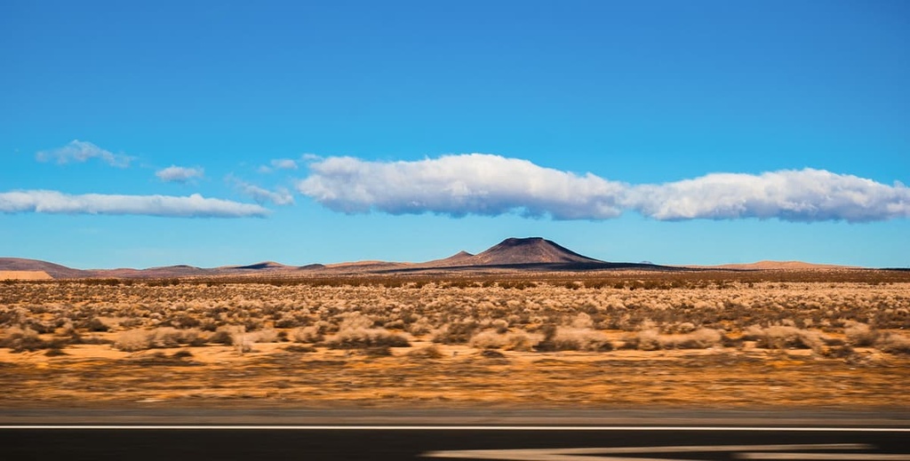
Mojave Trails National Monument boasts a number of geological wonders that hint at the region’s long volcanic and prehistoric past. Here are some of the many features you can see when traveling around the monument.
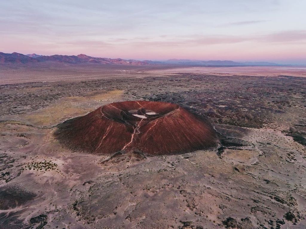
The Pisgah Crater is the most accessible of the Lavic Lake volcanic field's four cinder cone volcanoes.
The crater was the site of the Mount Pisgah Volcanic Cinders Mine, which was mined for pumice. As a result, the top is not as regularly shaped as Amboy Crater, which is also located within the monument.
The Marble Mountains and Ship Mountains are also located in Mojave Trails National Monument. The Marble Mountains are known for their fossil bed collecting areas, which are famous for housing trilobites.
There is also a rockhounding location in the monument where visitors can find some of the following rocks and minerals:
Meanwhile, the Ship Mountains got their name because they look like a ship sailing across the flat desert surrounds. The mountains are also known for their pastel-colored opalite.
The Cadiz Wilderness is located near the Marble Mountains. This wilderness is home to the Cadiz Dunes, which are low-lying dunes that have formed as a result of wind-deposited sand from Cadiz Dry Lake.
Mojave Trails National Monument, like it’s neighboring protected areas, is home to a vast array of plants and wildlife. The National Monument is particularly important because it acts as a land bridge between Death Valley and the Joshua Tree.
Notable flora of Mojave Trails National Monument includes:
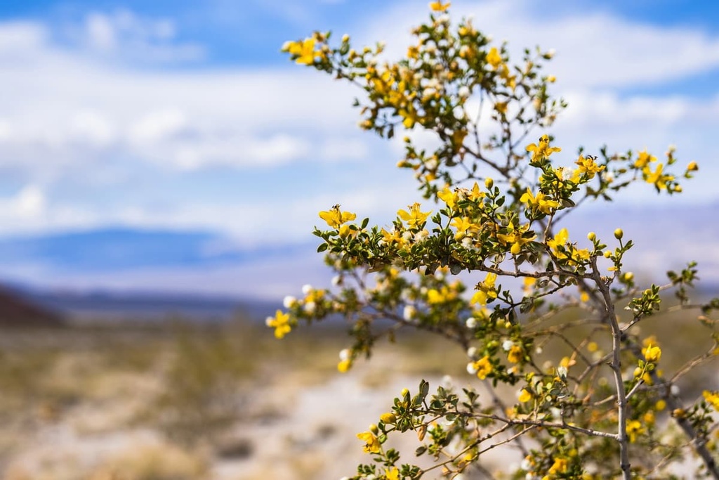
Additionally, the monument supports a number of cactus species including:
There are also a few blended ecoregions in the Mojave where it joins with the Sonoran Desert and the Great Basin Desert.
Species can be found in the Mojave and Sonoran desert blended regions include:
Notable fauna found in the Mojave Trails National Monument include small mammals like black tailed jackrabbits, desert cottontails, Crawford’s gray shrews, desert woodrats, as well as desert, Merriam’s, and Panamint kangaroo rats. There are also many squirrel species in the monument, including antelope, white tailed, and round-tailed ground squirrels. The desert bighorn sheep also lives in the monument.
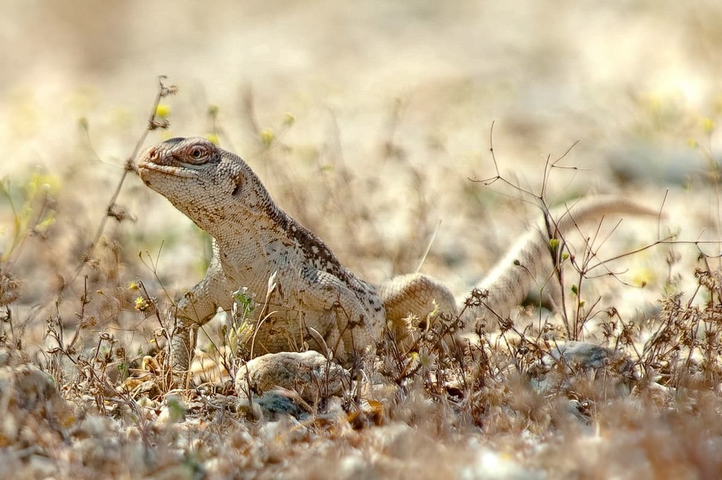
Reptiles of the Mojave include chuckwallas, Mojave green snakes, sidewinders, desert iguanas, fringe-toed lizards, dipsosaurus, desert horned lizards, red-spotted toads, western banded geckos, great basin collared lizards, desert night lizards, and desert spiny lizards.
Other notable animals of the Mojave include gopher tortoises, pupfish, greater roadrunners, giant hairy scorpions, tui chubs, and California leaf-nosed bats.
The Mojave Trails National Monument was designated by President Obama on February 12, 2016. It was designated alongside Castle Mountains National Monument and the Sand to Snow National Monument. The monument is managed by the Bureau of Land Management.
However, prior to its designation, the area that is now part of the National Monument area has had a long history of human inhabitation that dates back to time immemorial.
The land that is now part of the monument is part of the ancestral homelands of many Indigneous tribal nations, including the Chemehuevi Indian Tribe and the Fort Mojave Indian Tribe.
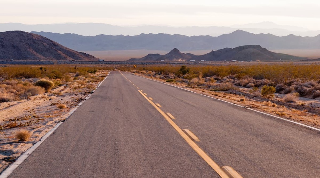
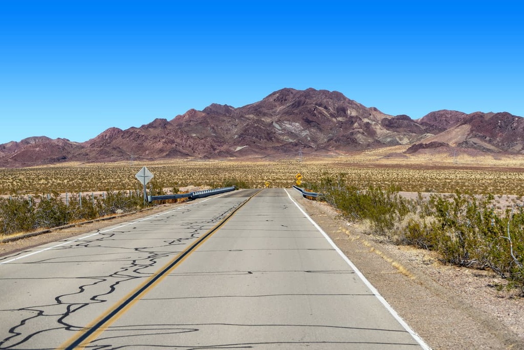
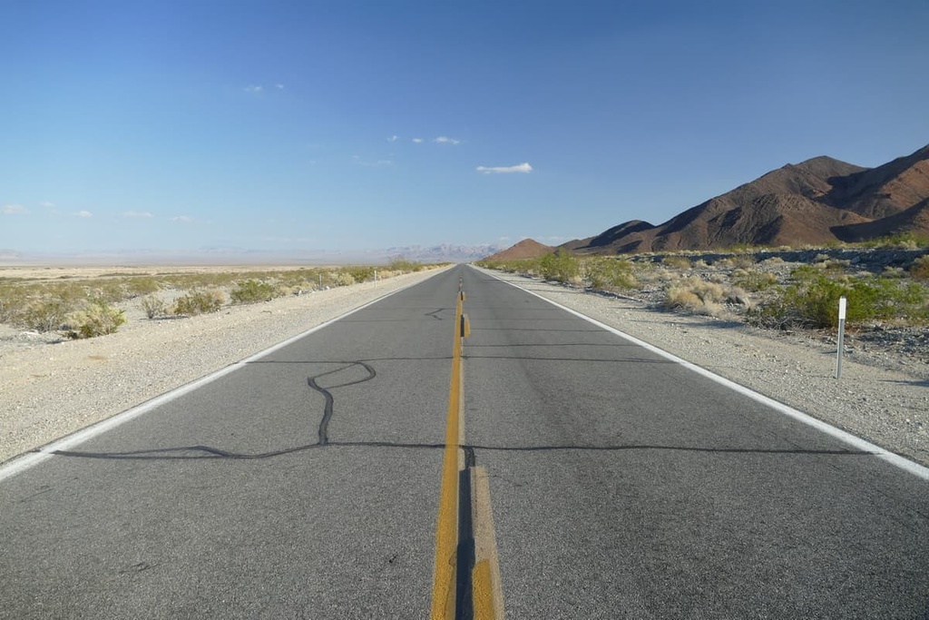
Historic U.S. Route 66 also runs through the Mojave Trails National Monument from Needles to Ludlow. It is the longest remaining undeveloped stretch of Route 66. The region also holds some of the best preserved sites from the World War II-era Desert Training Center.
Most of the Mojave Trails National Monument is remote and challenging to get to. As such, visitors need to be self-sufficient and not rely on signposts, or cell or GPS service to get them out quickly in case of an emergency. A radio, personal locator beacon, satellite phone, or signaling mirror is advisable since cell phones are often unreliable in the backcountry.
Much of the National Monument is reachable via an off road 4x4 vehicle. Established hiking routes are nearly non-existent. So if you venture into the National Monument, you will need to have the proper off road vehicle and navigation skills.
That said, don’t rely on electronic navigation when traveling to the monument. Some map services may direct you on routes that require high-clearance 4x4s or routes that are impassable, so it is important to plan your trip ahead of time and know where you are going and how to get there.
Be sure to leave an itinerary with friends and/or family before your trip—especially if you are exploring the National Monument alone.
Carry and drink as much water as you can while hiking in the preserve. It’s best to have at least one gallon per person per day. When hiking, if you find that half of your water is gone, turn around and head back.
Sun fatigue is another risk in the Mojave Desert. As a result, dress in layers and wear a wide brimmed hat, sunglasses, protective clothing, and sturdy footwear. Also, don’t forget to use sunscreen. It’s important to bring warmer layers, too, since weather in the desert changes quickly and temperature at night can fall rapidly.
When backcountry hiking, know your route well before you leave home. Carry a map and pay attention to the terrain so you can find your way back.
Familiarize yourself with dangerous flora and fauna such as cacti, ocotillo, rattlesnakes, and bees (to name a few). And always remember to keep your children close to you when you are on the trail.
The Mojave Trails National Monument is largely undeveloped, even with regard to hiking trails. However, there are a few hiking areas in the monument that visitors can consider.
Hikers should keep an eye out for off road vehicles while hiking as the monument is more popular with ATVers than hikers.
The Amboy Crater hike is a moderately difficult, 4 mile (6.4 km) out and back hike located in Amboy, California.
The hike makes its way to an ancient volcano crater through a series of low lying lava fields. While the elevation gain on this hike is minimal, visitors should start their hike early and bring plenty of water due to the high temperatures in the regino.
The trail to Spooky Canyon is a 8-mile (13 kilometer) out and back hike located near Baker, California. It is appropriate for hikers of any skill level.
The hike follows Mojave Road and has a few water crossings over the Mojave River.
Mojave Trails National Monument is located between the Mojave National Preserve to the north and both Joshua Tree National Park and the Sheephole Valley Wilderness to the south.
The most straightforward entrance into the park is found by taking Interstate 40 East from Los Angeles or Highway 95 South to Interstate 40 West from Los Vegas. From these highways, you need to get onto Highway 66, which is also known as the National Trails Highway, to get to the national monument.
Camping is the most popular accommodation option in the Mojave Trail National Monument due to its remoteness.
The Afton Canyon Campground has 22 developed campsites and a group campsite. These campsites offer picnic tables, shade structures, restrooms and trash receptacles. You can reach the campground via Afton Road off of the Barstow Freeway.
Dispersed camping is free and permitted on all BLM lands within the National Monument, except in the Afton Canyon Area of Critical Environmental Concern and the main Amboy Crater parking lot. Visitors are allowed to camp at a single site for a maximum of 14 days, after which time, they can move to a new location at least 25 miles (40 kilometers) away.
Note that dispersed campsites must be at least 1/4 mile (400 meters) from wildlife water sources—both natural and manmade. Camping in previously disturbed sites is encouraged.
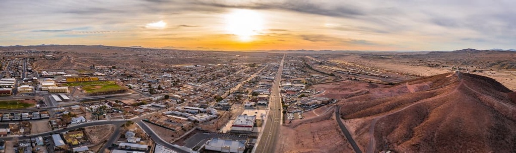
Mojave Trails National Monument is even more remotely located than its sister park, the Mojave National Preserve. However, there are nearby cities that visitors can travel through on their way to the desert.
Las Vegas is located about an hour away from the Mojave Trails National Monument. It acts as a hub for visitors flying into the region.
Interstates 15 runs through Las Vegas, connecting the city and Los Angeles. There are a variety of places to stay in the city , as well as many options for car rentals and regional guides.

Barstow may be a notably easier option when it comes to accommodations if you are interested in visiting the western most reaches of the preserve or if you also want to travel to Joshua Tree National Park.
While it is not the most tourist oriented town, Barstow offers a number of affordable hotels and restaurants that will satiate any weary desert traveler.