
Scan the QR code and open PeakVisor on your phone
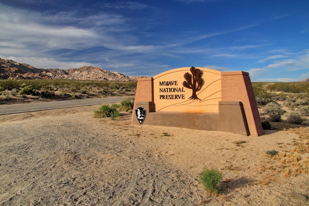
The Mojave National Preserve is a protected area that covers 1.6 million acre (648,000 ha) of rugged desert in the southeastern part of the US state of California. There are 50 named mountains in Mojave National Preserve. The highest and the most prominent peak in the preserve is Clark Mountain (7,927 ft/2,416 m).
The Mojave National Preserve is a huge area of protected desert area, about1.6 million acre (648,000 ha), that’s located in the southeastern part of the US state of California. It is located in San Bernardino County along California’s border with the state of Nevada.
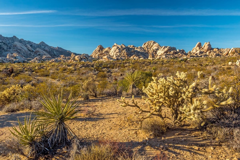
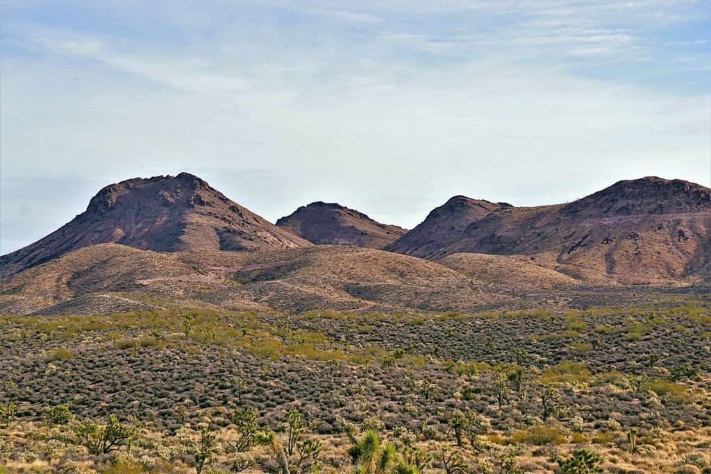
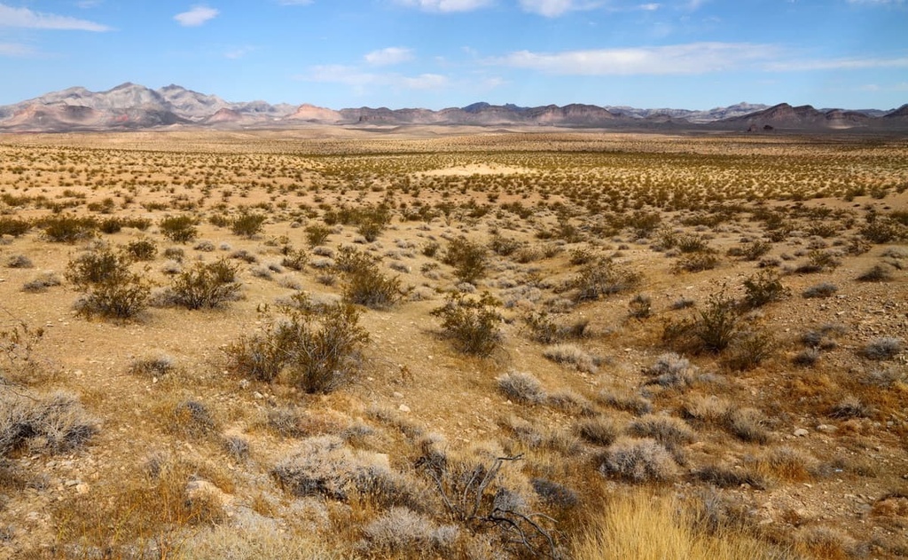
Within the preserve, there is a wide variety of plant and animal life, as well as a rich geologic and cultural history. In the Mojave, you can find everything from high mountain ranges to dry river beds, great mesas to towering sand dunes, and even striking cinder cones, domes and lava flows.
The weather in the Mojave is intense, but it varies greatly from season to season and even based on the time of day or night. Summer temperatures average from 90 to 105 degrees Fahrenheit (32 to 38 degrees Celsius), while lows in the winter can plummet to the 20s (-7 degrees Celsius). Winter snow is not uncommon in the Mojave, either.
Precipitation in the Mojave National Preserve is largely concentrated in the mountains, which recieve around 9 inches (23 cm) annually. Lower lying areas near Baker average only 3.4 inches (8.6 cm) in yearly rainfall. At least 25 percent of precipitation falls during the summer monsoon thunderstorms.
Mojave National Preserve contains the sprawling Mojave Wilderness. It is also located near a number of other major areas of protected land. This includes Mojave Trails National Monument, Joshua Tree National Park, and the Sand to Snow National Monument.
Mojave National Preserve contains an incredibly old and extremely dynamic geological history. Rocks have been found in the Mojave near the Clark Mountains that date back 2.5 billion years.
The Mojave Desert is a subsection of the Basin and Range Physiographic Province. This area is characterized by long, north to south mountain ranges separated by broad valleys. Additionally, igneous, metamorphic, and sedimentary rocks of the Mojave Desert hint at the region’s prehistoric past.
The Mojave Desert was covered by shallow seas during the Paleozoic era. The evidence of this is found in the fossilized marine creatures that are trapped in limestones and dolomites along the banded mountains throughout the region.
Limestone speckled the Mojave and has played an important role in the history of the desert as a host rock for metallic mineral veins. These veins were produced when magma erupted. They also house fossilized marine creatures.
The Mojave was uplifted during the Mesozoic era. Salt water lakes evaporated and left behind a variety of minerals, such as halite and gypsum. Rivers and ephemeral streams washed large amounts of eroded materials into the lowlands over the course of millennia.
The Cenozoic era saw further tectonic activity in the region. Movement along faults shifted the Mojave's layers of sediment to expose underlying metamorphic rock. The Red Rock Canyon National Conservation Area shows how shifts along thrust faults forced older layers on top of younger ones.
During the gold rush, a number of different mines were opened in the Mojave region including gold, silver, lead, zinc, copper, tungsten, vanadium, iron, clay, and cinders. Mining was made easy in the region for a number of reasons including the region’s high geological activity and the relative ease with which mines could be opened up.
However, mines in the were rarely profitable for the long term. The region hosts a number of small, rich ore deposits that led to occasional bonanza strikes but little long-term profitability. Regardless, mining stayed a consistent practice, especially in East Mojave, for much of it’s later history.
Today, the Mojave is known as a geological "accommodation zone" between the surrounding Pacific and North American plates. This feature causes the region to experience relatively strong earthquake activity along numerous faults from year to year.
Despite its harsh climate, the Mojave National Preserve is home to a vast array of flora and fauna that thrives in a hot desert environment.
There are a number of different kinds of plant species in the Mojave National Preserve, including banana yucca, threadless groundsel, mormon tea, Mojave mound cactus, desert chicory, hairy sand verbena, and honey mesquite.
Within the preserve, there are also a number of distinct ecological zones. Here’s an overview of the major ecozones in the region:
Pinyon-Juniper Woodlands
Pinyon-Juniper Woodlands can be found at the higher elevations of the Mojave, particularly on north-facing slopes. You can find well established pinyon-juniper woodlands in the Clark, Granite, New York, and Providence mountains in the Mojave. The Mid-Hills Campground is especially close to these woodland areas.
Pinyon and juniper trees thrive by clinging to rocky, shallow soil areas where few other plants can grow. Additionally, pinyon nuts and juniper berries have been a consistent food source for humans and wild animals in the region for millenia. The pinyon-juniper woodlands are also home to sagebrush, as well as wildflowers like Indian paintbrush, goldenbush, and the Mojave prickypear.
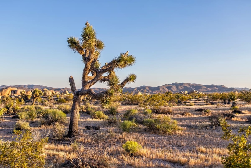
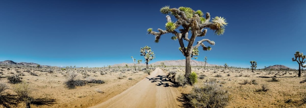
Joshua Tree Woodlands
Visitors can also find Joshua tree woodlands in the Mojave. These species of yucca are not actually a tree at all, though they can grow up to 40 ft (12 m).
However, Mojave yucca tend to grow to about 20 ft (6 m) in height. These yucca prefer flat areas with a gradual incline. The world’s largest concentration of Joshua trees grows on the slope of Cima Dome near Teutonia Peak.
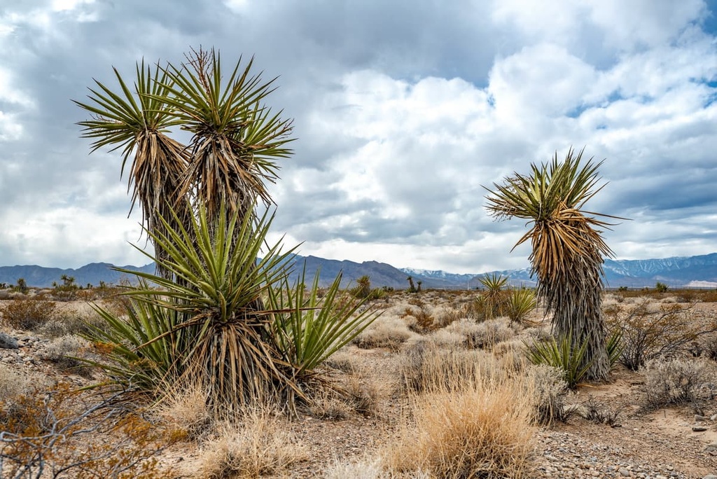
Cactus-Yucca Scrub
Cactus-yucca scrub covers a great deal of the preserve. This ecozone is home to barrel cacti, which grow on south facing slopes.
These cacti only germinate during years of favorable rainfall, so if you see barrel cacti that are growing in close proximity to each other, they are likely the same age. In the spring you can enjoy the yellow blooms of these cacti.
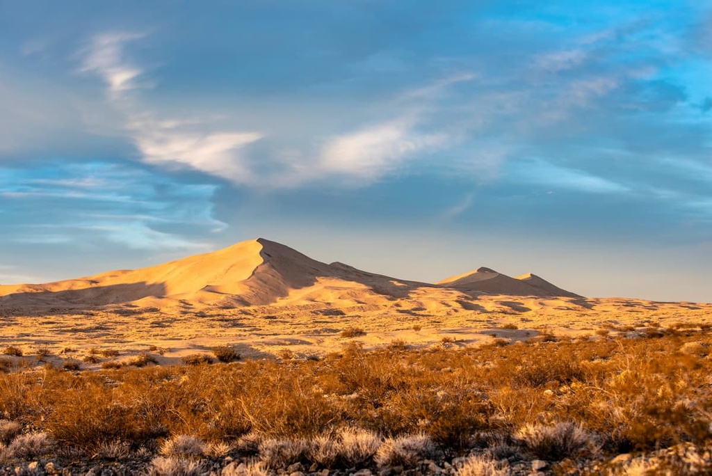
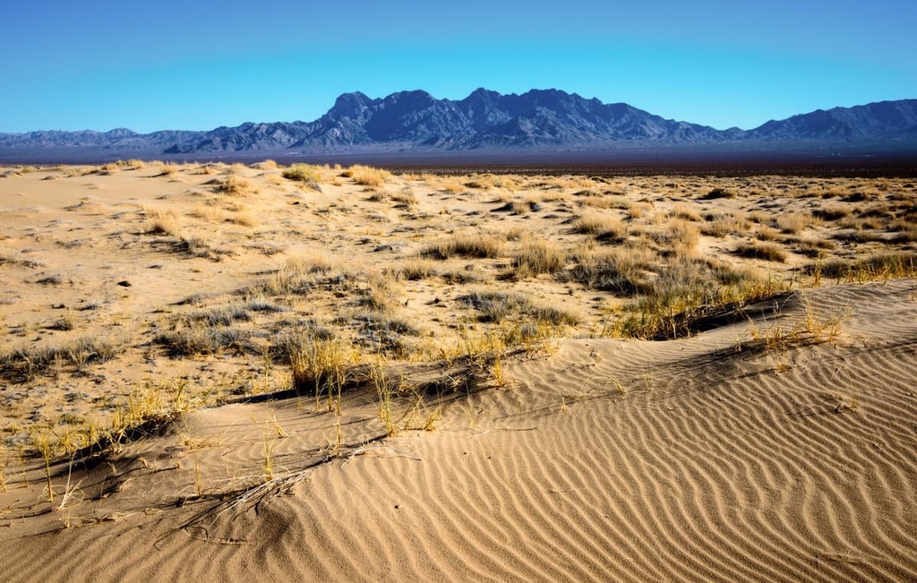
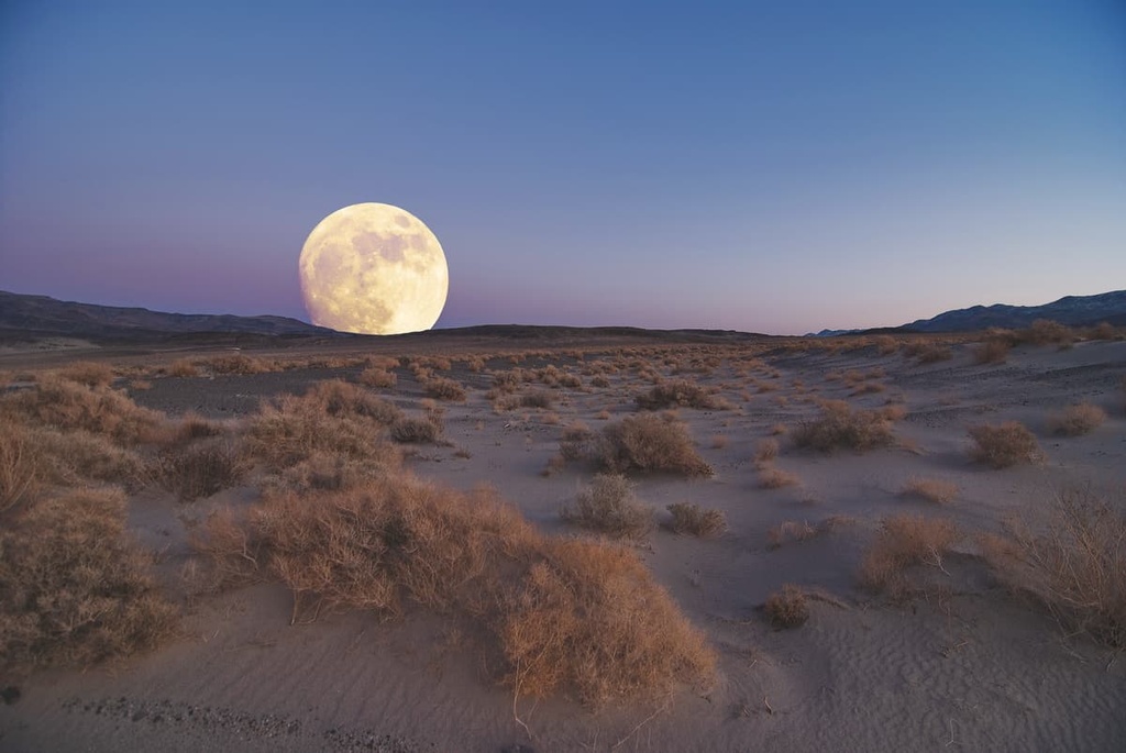
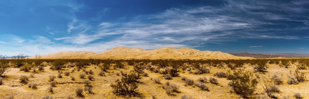
Desert Dunes
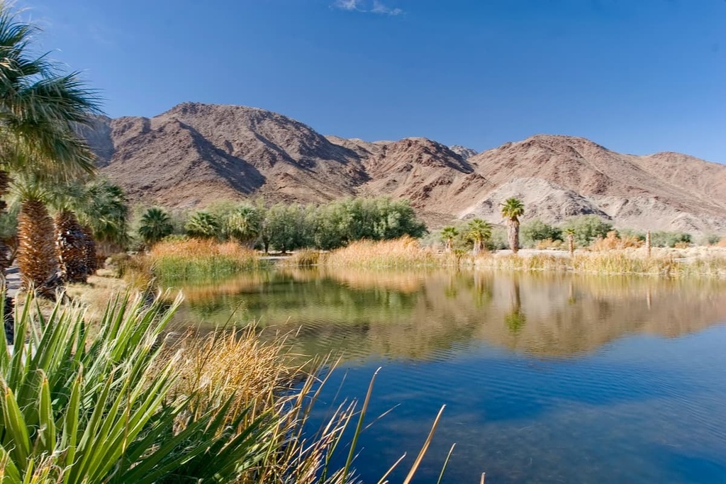
The desert dune landscape can be found largely at the base of the Granite Mountains. This ecozone formed as a result of winds taking silt and sand from Soda Dry Lake, the Mojave River Sink, and the Devil’s Playground area and depositing them at the base of the mountains.
These dunes can grow up to 700 feet (213 m) high and are called the Kelso Dunes. While these areas may seem barren you will find evening primrose, blazing start, and a few other desert plants speckling their surface. In favorable conditions, you may even find Indian ricegrass.
Creosote Bush Scrub
The aptly named strong smelling, creosote bush and bursage dominate much of the Mojave. This bush is said to be one of the world’s oldest living things as some colonies date back as far as 11,500 years.
Other plants in this landscape include desert mallow, brittlebush, and hedgehog cactus, as well as several types of cholla (including the diamond, or pencil, cholla).
Desert Wash
Desert wash landscapes typically form after heavy rainfalls that spark flash floods and surprise blooms. Plants like sacred datura, also known as jimson weed or thorn apple, often pop up in desert washes.
Plantlife in these washes is uniquely lush and deep rooted. This ecozone can include plants like catclaw acacia, cheesebush, four-wing saltbush, bush senecio, as well as desert willows and cottonwood trees. You can also sometimes find desert mistletoe growing on the branches of trees.
Desert animals are experts in surviving in the Mojave and they can be found all across the preserve.
For example, scrub jays and antelope ground squirrels can be found in the pinyon-Juniper woodlands; desert night lizards can be found in the Joshua tree woodlands; Mojave rattlesnakes can be found in the cactus-yucca scrub landscapes; and roadrunners and desert tortoises call the creosote bush scrub landscape home.
Bighorn sheep are the Mojave’s largest inhabitants, they can be found at the higher elevations of the desert. These wild sheep feed on grasses and other plants and their herds are good indicators or nearby water sources. Their hooves have also adapted to the steep rocky terrain and give them an edge in evading predators such as mountain lions.
The American kestrel and Scott’s oriole can also be found in the Joshua tree woodlands alongside the desert night lizard. Another famous fowl is the Gambel’s quail, which can be found feeding on cactus seeds and berries. These birds like nesting in the abandoned nests of roadrunners, thrashers, and cactus wrens.
The kit fox is another very cute inhabitant of the Mojave that can be spotted around dusk in the open desert. Their fur-covered toes give them traction in the sand. Alongside the kit fox, you can find the Mojave fringe-toed lizard, kangaroo rats (the main food source for kit foxes), and sidewinder snakes in the desert dunes regions.
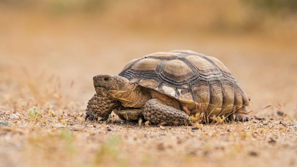
Another notable inhabitant of the Mojave is the desert tortoise. Visitors are asked to check under parked cars before they pull out as desert tortoises have been known to take shelter under them. Visitors are also asked to, in general, give these animals a wide berth as they are highly susceptible to disease and human disturbance.
Finally, we have the coyote. Camping in the park will show you just how prevalent these animals are as they sing across the desert at night. You can recognize them (if you can spot them), by their black-tipped ears and black-tipped tail.
The land that is now the Mojave National Preserve has a long and vibrant history of human habitation. The region is part of the traditional territory of the Chemehuevi Indian Tribe, who historically lived on prickly pear, mesquite and roasted agave blooms and hunted deer and bighorn sheep.
The Mojave Trail was one of the main trading routes of the Chemehuevi and other Tribal Nations in the region.
Peoples of European descent first ventured into the region around 1776 when Father Francis Garces traveled across the Mojave Desert. He was swiftly followed by other missionaries and settlers, most of whom came from Spain.
The Gold Rush then struck California in the late 1800s and the General Mining Law of 1872 was established, permitting individuals to stake a claim on an area of land where a mineral deposit was discovered. In the Mojave, Copper, iron, gold and silver mines were rapidly established. Silver mining was especially prevalent. Ranchers also laid claim to land in the Mojave.
The Mojave National Preserve was established October 31, 1994 with the passage of the California Desert Protection Act. Previously, it was called the East Mojave National Scenic Area and was under the jurisdiction of the Bureau of Land Management.
With 1,542,776 acres (624,339 ha) of land, the park is the third largest unit of the National Park System in the contiguous United States.
Mojave National Preserve is home to a beautiful variety of hiking trails that let you see everything from the high desert to the dunes and various scrub landscapes. Here are some of the best hikes in the preserve to check out.
The Barber Peak Loop is a beautiful 6 mile (9.7 km) long hike from the Hole-in-the-Wall Campground. The loop travels through pinyon-juniper landscapes around Barber Peak, highlighting desert wash landscapes, as well as massive volcanic ash deposit rock formations.
The trail eventually arrives in the Banshee Canyons. It should be noted here that the National Park Service has put up a number of rings to help hikers climb through the canyons, but hikers need to be more physically fit to exit via the canyons, otherwise they should exit through the Rings Loop Trail.
If you are not interested in a 6 mi (9.7 km) hike, but still want to see some great landscapes in the Mojave, then the 1 mi (1.6 km) long Rings Loop Trail might be more your speed.
This trail starts at the National Park Service’s Nature Center and ends at Banshee Canyon. Again, climbing through the canyon can be tough, so hikers need to honestly evaluate their fitness for the traverse.
The Mid-Hills to Hole-in-the-Wall Trail connects the Mid-Hills and Hole-in-the-Wall campgrounds.
It is a 16 mi (26 km) round-trip trail that goes through the pinyon-juniper landscapes near Hole-in-the-Wall and ends at the Joshua tree landscape nearer to Mid-Hills.
The Mojave National Preserve is home to a number of special areas that are worth checking out during your next visit. Here are some of the best sights to see in the preserve:
Formerly known as the Soda Spring Oasis, Zzyzx is the former site of the Zzyzx Mineral Springs and Health Spa, which is now the site of the Desert Studies Center. The oasis has seen human activity for millennia and cultural artifacts are commonly found there.
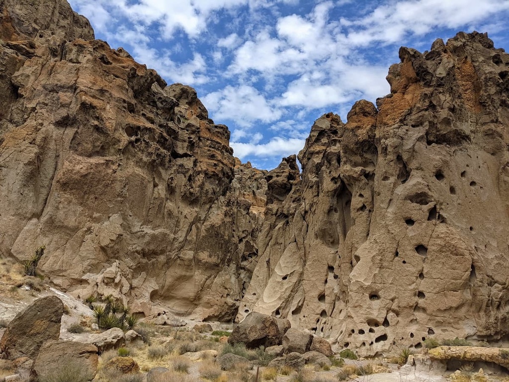
The Granite Mountain Natural Reserve encompasses 9,000 acres (3,642 ha) of land on the southwest corner of the Mojave National Preserve. The granitic rocks found in the reserve are notable as they have eroded into unusual rounded shapes that include spires, perched boulders, and curved cliff faces.
These rock formations were created as a result of ancient continental-margin volcanic systems. Like most rock formations found in the Mojave, these rocks date back to the late Mesozoic (80 to 180 million years ago).
The Providence Mountain State Recreational Area is located in the central south portion of the Mojave National Preserve.
The recreation area features layers of tilted grey limestone rock that formed during the Paleozoic period. Here, the elevation of the preserve ranges between 4,300 to 7,000 feet (1,311 to 2,134 meters).
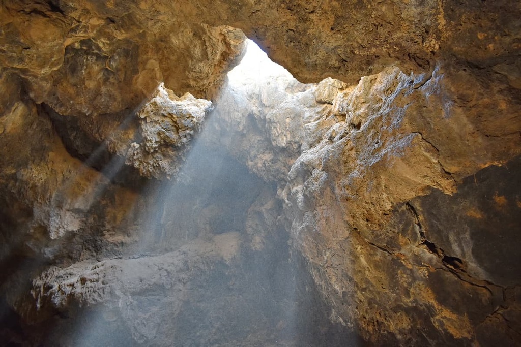
Mitchell Caverns Nature Preserve is located in the middle of the Providence Mountain State Recreational Area. It is home to three limestone caves (two of which are open to the public). The caves were cut from a thick sequence of marine Permian limestone formed before the Pleistocene epoch.
They formed when highly carbonic acidic groundwater ate into the surrounding sedimentary limestone. Stalactites, stalagmites, and other cave formations came from calcium carbonate left by dripping mineral water.
While not technically part of the Mojave National Preserve, the Castle Mountains National Monument is surrounded on its south, west, and northern borders by the preserve.
The almost 21,000 acres (8,500 ha) of the Castle Mountains National Monument boasts Joshua tree forests, rare desert grasslands, and a rich archeological history.
As with any desert excursion, heat exhaustion and dehydration are the two biggest safety concerns when hiking in the Mojave National Preserve.
Some safety precautions to follow when hiking in the region include bringing more water than you anticipate, starting your hikes or summits very early in the day when it is still cool, and heading back to the parking lot when you have only half of your water supply left.
Additionally, the National Parks Service recommends visitors carry a minimum of 1 gallon (4.5 L) of water per person, per day; hikers and cyclists should carry 2 gallons (9 L) per person, per day. Hikers should also wear large sun hats and be sure to cover their arms and legs with long sleeves and light pants.
Hikers also need to make sure they let others know what their plans for hiking and traveling are and be sure to bring a map and compass when exploring. Anyone traveling to the preserve should also get a general understanding of the area and their hike before they head out.
Furthermore, keep in mind that snakes also call the Mojave home. The Mojave rattlesnake and the Colorado Desert sidewinder can both be found in the preserve. These snakes are typically very human-averse, but hikers should watch their step so as not to disturb these venomous desert dwellers.
In 2020, there was an outbreak of Rabbit Hemorrhagic Disease virus type 2 (RHDV2) in the area. Visitors are encouraged to stay away from wildlife and report any sightings of dead or sick jackrabbits in the preserve.
It is also important for hikers to be aware of the hunting season in the Mojave. These take place at different times of the year depending on the type of game in question. However, the season is typically between the months of July and December, though some game is open to hunting year round.
The types of game hunted in the park include cottontail rabbits, mourning and white winged doves, mule deer, bobcats, gambel quail, red legged partridge, bighorn sheep, jackrabbits, and coyotes.
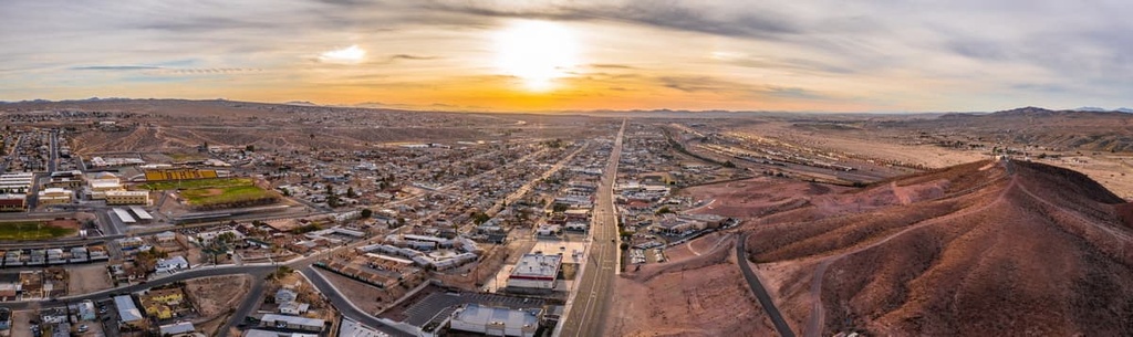
The Mojave National Preserve is quite literally in the middle of nowhere. Located some four hours from Los Angeles and two hours from Los Vegas, the preserve’s nearest neighbors are the neighboring towns of Needles and Mojave Valley in Nevada, both which are about an hour away from the heart of the preserve.
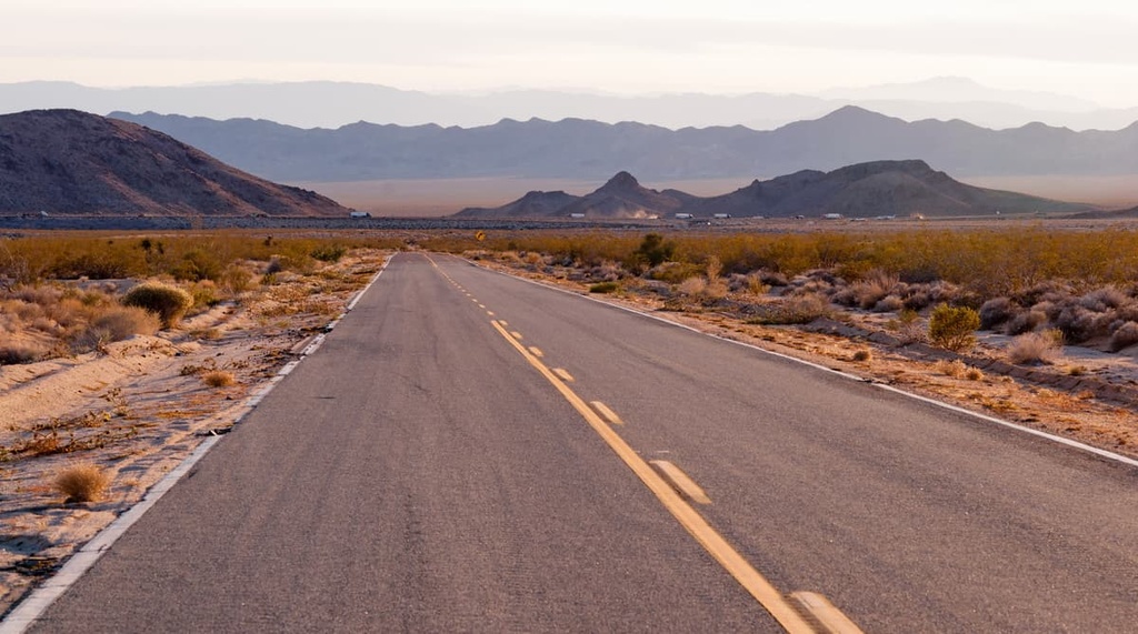
The preserve is encircled by Interstate 40 to the south, Highway 15 to the east, and Interstate 15 to the north and west. A series of county roads lead off the interstates into the park and eventually transition into dirt roads.
Most visitors to the Mojave National Preserve choose to stay in the National Park Service campgrounds. This is primarily because the nearest towns are at least an hour away.
Developed camping in the preserve is first come first served. There are two campgrounds available: the Hole-in-the-Wall Campground, and the Mid-Hills Campground. Camping fees can be paid at the self-service fee station located at the campground entrance.
If, during the busy months, developed camping is not an option, then visitors can consider dispersed camping options. These options are also free. There are 5 undeveloped camping areas in the Mojave, including:
Though less remote than its neighboring wilderness, the Mojave Trails National Preserve, the Mojave National Preserve is still well out of the way of most major cities. As such, visitors should be sure to bring plenty of provisions and extra gas with them as they head out to the middle of nowhere.
That said, here are some of the biggest cities and towns within driving distance of Mojave National Preserve:
Though better known as the gambling capital of the US, Las Vegas also serves as a hub for a number of wilderness regions in the California desert.
Vegas is a common city for visitors to fly into when traveling to the deserts of southeastern california. The city offers a large number of amenities from accomodations to entertainment, car rentals, local guides, and more.

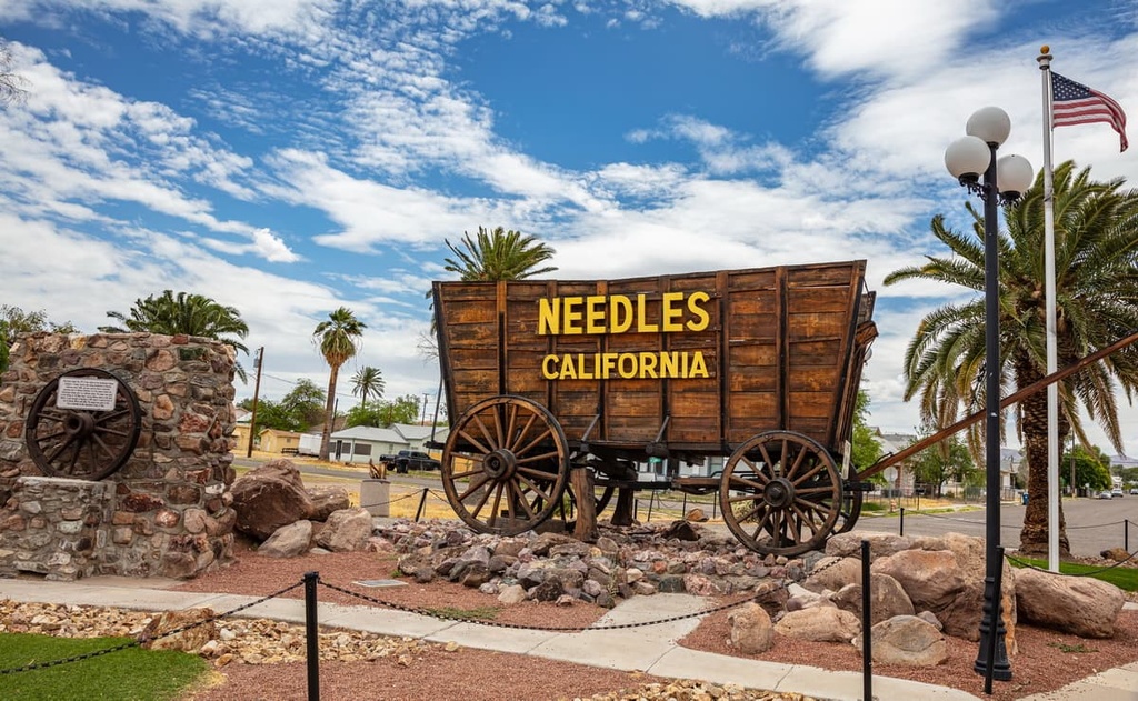
Needles is a small town that’s situated just outside the Mojave National Preserve. It is located about an hour from the heart of the wilderness.
Visitors can rely on Needles for the basic provisions and it is a nice place to stop if you run into any issues during your trip.
Barstow is a great place to stop if you’re venturing to Mojave National Preserve from Los Angeles or if you’re heading south to Joshua Tree National Park.
While Barstow is not a highly tourist oriented town, it will still offer you any basic amenities you might need, including accommodations and places to eat.


western-state-climbers
western-state-climbers-emblem
desert-summits-book
sierra-club-desert
western-state-climbers
western-state-climbers-emblem
desert-summits-book
sierra-club-desert


