
Scan the QR code and open PeakVisor on your phone
Almaden Quicksilver County Park has 3 named peaks. The highest is Mine Hill at 527 m. Other notable peaks include Jacques Ridge and Church Hill.
Almaden Quicksilver County Park is a small publicly-owned park known for its historical significance in the central part of the US state of California. The park contains 2 named high points, Mine Hill (1,732ft/528m) and Church Hill (1,473ft/449m).

Almaden Quicksilver County Park is located in Santa Clara County to the south of the city of San Jose and the San Francisco Bay Area. Although it is located near some of the most densely populated cities in California, Almaden Quicksilver is surrounded by a number of other parks and public lands.
To the west of Almaden Quicksilver is Calero County Park and Rancho Canada del Oro Open Space Preserve. The park is bordered to the south and the west by the Sierra Azul Open Space Preserve. Additionally, it is located just north of The Forest of Nisene Marks State Park, to the west of Big Basin Redwoods State Park, and east of Henry W. Coe State Park.
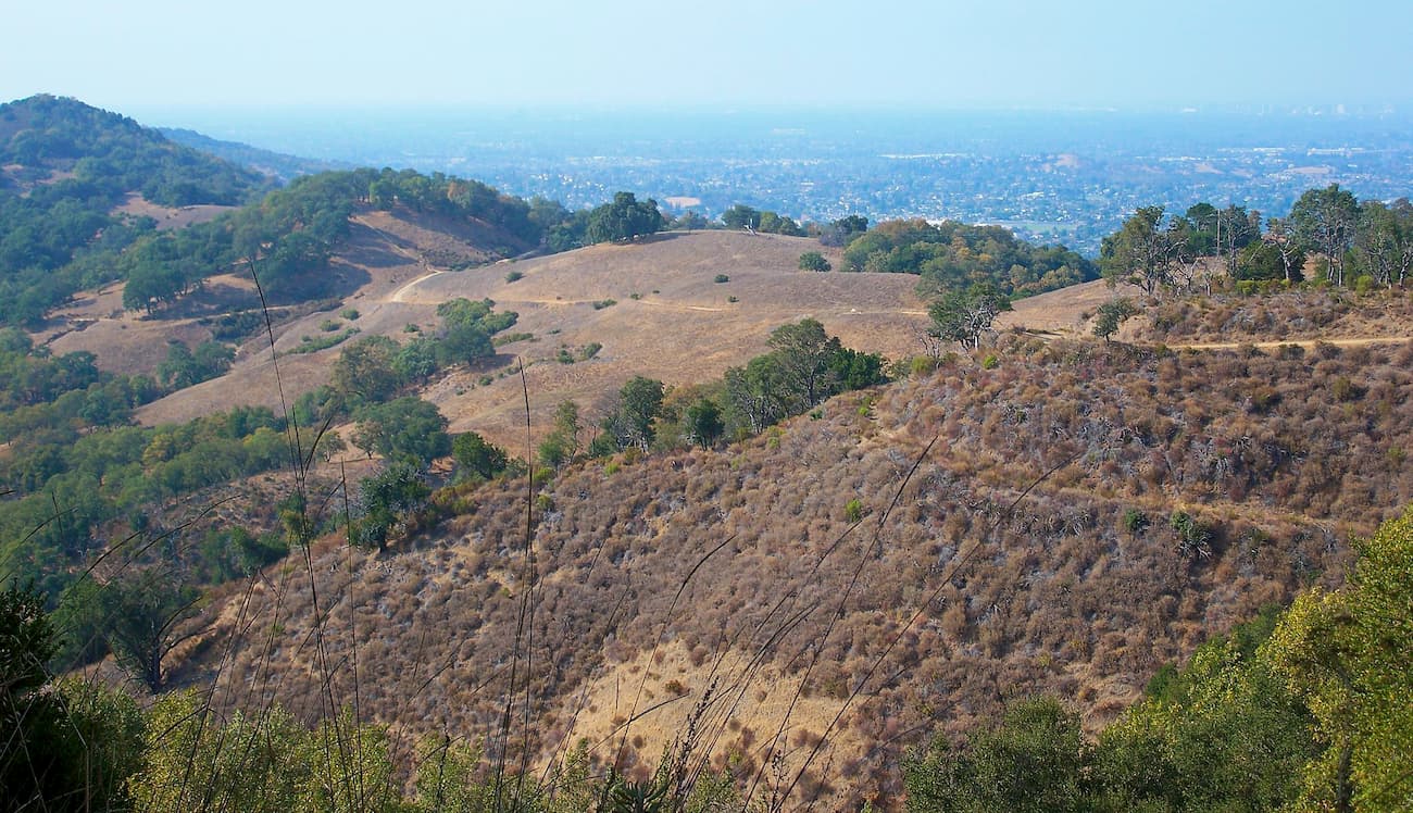
The two hills in Almaden Quicksilver County Park are part of the foothills of the Santa Cruz Mountains, which stretch from the Bay Area down the Central Coast to the Salinas Valley, which separates them from the coastline of Big Sur, the Ventana Wilderness, and Los Padres National Forest. Moreover, the Santa Cruz Mountains are a subrange of the California Ranges, which covers most of the southwestern and southern parts of California.

Geologically, the Santa Cruz Mountains and Almaden Quicksilver County Park were formed through the uplift of a section of the San Andreas Fault. Much of the bedrock in the area is part of the Salinan Block, a granitic block that is found between the Big Pine Fault and the Nacimiento fault.
What makes the area around Almaden Quicksilver County Park unique, however, is the region’s high concentration of mercury deposits. Mercury, a.k.a. “Quicksilver” was mined extensively in the park during the California Gold Rush as mercury is essential for processing gold ore.
Despite its 135 year history as an active mercury mine, Almaden Quicksilver County Park is a highly biodiverse area teeming with wildlife. The park is home to an assortment of mammals, including beavers, gophers, mule deer, wild boar, bobcats, mountain lions, coyotes, skunks, foxes, and shrews. It’s also known habitat for a surprising array of amphibians, including the American bullfrog, California giant salamander, and the California Newt.
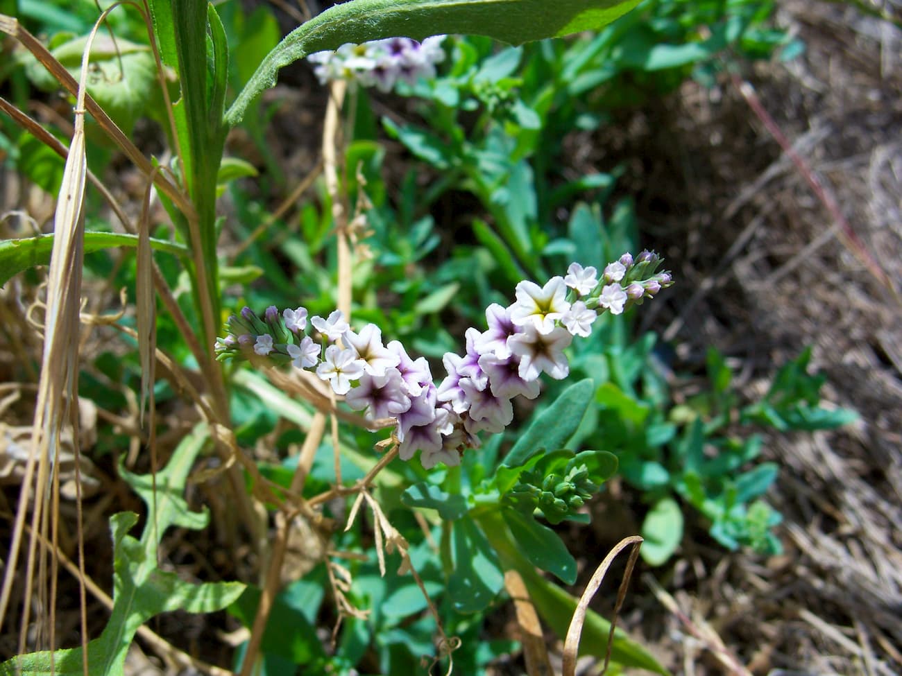
Almaden Quicksilver County Park has a chaparral and oak woodlands ecosystem. During the spring and summer, it is also a good place to visit if you want to see beautiful wildflowers in bloom.

The region in and around the Almaden Quicksilver County Park is the ancestral home of the Ohlone people, among others. They frequently used the region’s cinnabar - bright red mercury ore - deposits for paint.
During the 1840s, an English textile firm based in Mexico gained the rights to mine the region, naming it Nueva Almaden (New Almaden) after the mercury mine in Almadén, Spain, which dates back centuries. As soon as the mine opened, there were disputes over who had the rights to mine on the land, a conflict that eventually made its way up to the Supreme Court.
Over the course of its 135 years of operation, the New Almaden mine became both the oldest and most productive mercury mine in the United States. By the time the mine closed, it had produced over 41,980 tons (38,090 metric tons) of mercury, which was worth more than $70 million.
The mine’s activity caused the mercury pollution of the Guadalupe River and the southern part of the San Francisco bay, which led to numerous lawsuits and then a settlement of over $6 million for habitat restoration projects.
New Almaden eventually closed in the 1970s after it was purchased by Santa Clara County and all entrances to the mine are now boarded up. The region was designated as a Superfund site and, which helped to aid the containment and clean-up process to restore wildlife habitat in the area.
It was officially designated as a National Historic Site in 1961. After Santa Clara County purchased the land in the 1970s, it was converted into a park for outdoor recreation. The nearby New Almaden Quicksilver Mining Museum also provides visitors with historical information about the park.
Despite its small size, Almaden Quicksilver County Park is home to over 37 miles (59km) of hiking trails. Here are some of the best options:
The 8 mile (12.9km) Quicksilver History Loop takes hikers on a tour of the Almaden Quicksilver County Park, stopping by some of the remaining mining sites along the way. It traverses through the woods and climbs up a number of small hills before returning back to your starting point.
The Mine Hill Trail covers 7.1 miles (11.4km) of terrain as it traverses from the park’s McAbee entrance to the Hacienda Entrance. This trail is a good way to access some of the historic sites on the eastern edge of the park, though you’ll have to arrange a car shuttle or plan to walk 14.2 miles (22.8km) to complete this trail round trip.
The Randol Trail is a 4.6 mile (7.4km) moderate hiking path that follows a wide walkway through a grassy area to a nice viewpoint of the San Francisco Bay Area. It also offers good connections to the Mine Hill Trail and the Buena Vista Trail if you’re looking for a slightly longer adventure.
Here are some of the best places to stay during your trip to Almaden Quicksilver County Park
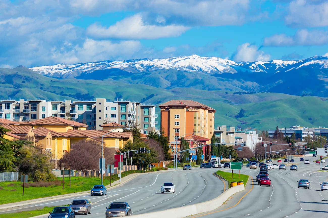
San Jose is the largest city in the San Francisco Bay Area with a population of 1.02 million people, making it the third-most populous metropolis in California. It is just north of the Almaden Quicksilver County Park and offers excellent transport connections, as well as great tourist sites for visitors to the area.
Los Gatos is located directly north of Almaden Quicksilver County Park in Silicon Valley and is home to over 30,000 people. The city is the headquarters for a number of tech start-ups and companies, including Netflix. Los Gatos is connected to San Jose by the Valley Transport Authority (VTA) and is within driving distance of the airports in San Jose, San Francisco, and Oakland.
Santa Cruz is a popular beach resort city of over 64,000 people located on the southern edge of Monterey Bay to the south of Almaden Quicksilver County Park. It is easily accessed by Highway 1 and offers good road connections to the park via Highway 17.


The highest peak in Almaden Quicksilver County Park is Mine Hill, at 527 m.
Notable peaks in Almaden Quicksilver County Park include Mine Hill, Jacques Ridge and Church Hill.


